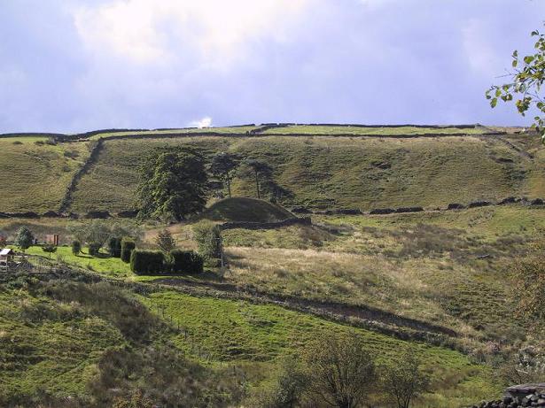
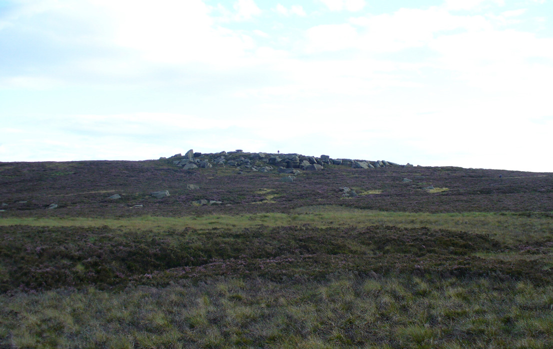
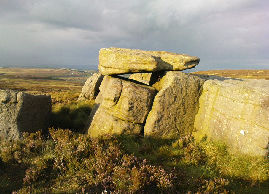
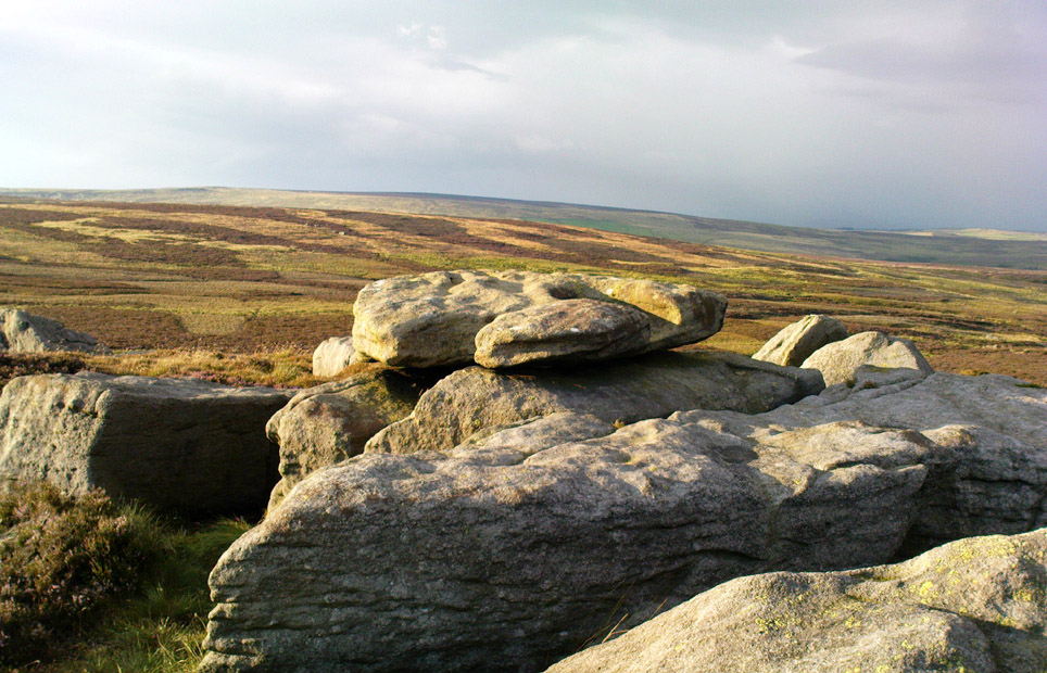
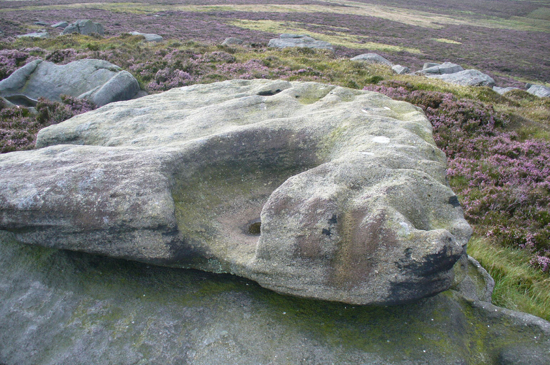
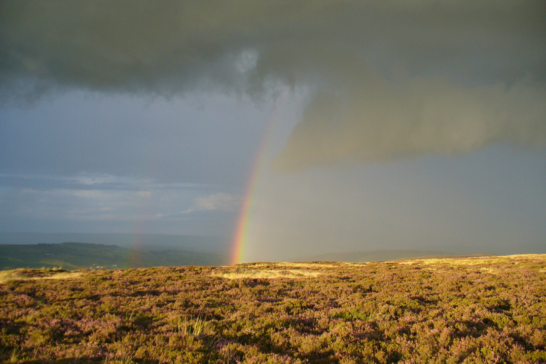
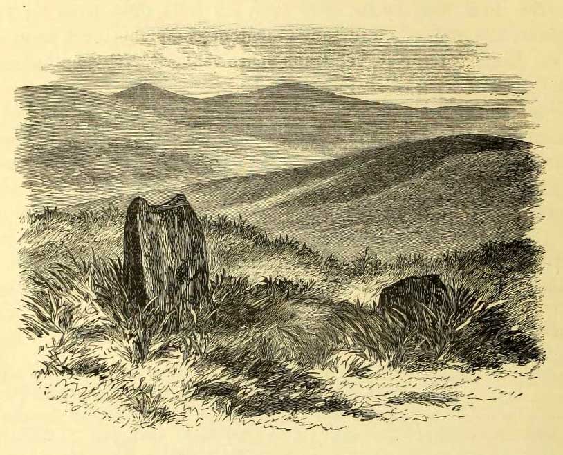
Go through the village of Stanbury, past the last of the two reservoirs until you’re on the western edge of Ponden. Stop and look up the slopes to your south. This spot was recently found and photographed by Richard Stroud: a curious-looking mound with all the hallmarks of being a forgotten tumulus. We’ve gotta check it out properly though!
Folklore
Although not in the archaeological records (not too unusual in Yorkshire it seems), the site does have some literary references and some all-too-common folklore motifs. Perusing my library for info about another nearby site (the Cuckoo Stones), I found the following said of this place in a rare book by James Whalley called The Wild Moor (1869, pp.103):
“It appears that some hills, as well as dales…have silvery names. There is a hill which is on the right hand on the way from Ponden House to Crow Hill Moor, which is distinguished by the beautiful designation of ‘Silver Hill.’ The hill is surrounded by a wall (I suppose to guard the treasure) and its surface is adorned with trees. Grey-headed men living on the borders of Crow Hill and Lancashire Moors affirm that during the Scotch rebellion here was deposited a large chest of silver, which was hid in the hill. It would appear as if the chest of silver is still there!”
This tradition was echoed a decade later by J. Horsfall Turner, and then again by Halliwell Sutcliffe in 1899, who reckoned the “vast treasure was said to have been buried during the ’45 rebellion,” adding how “the fields which climb this hill were well tilled aforetime through being constantly turned over in search of the treasure” – but nowt was ever found.
An additional bit of folklore tells of two spirits nearby: one of a man; another of a fiery barrel — either a remnant of earlier solar folk traditions hereby, or perhaps just an earthlight. One of these (the fiery barrel) rolled down the hill nearby; whereby the ghost of the man walked by the hillock along the track from Ponden House a little further east.
References:
Horsfall-Turner, J., Haworth Past and Present, J.S. Jowett: Brighouse 1879.
Sutcliffe, Halliwell, By Moor and Fell in West Yorkshire, T. Fisher Unwin: London 1899.
Cup-and-Ring Stone: OS Grid Reference – NM 027 487
Also Known as:
Kettle Stone
Ringing Stone
Singing Stone
Archaeology & History
This is a fascinating large coastal boulder with around 53 cup-markings on it — but whether these are all man-made is a matter of debate. Some of them may be natural. However some of the cups have lines and faint rings around them, showing that at least they’re man-made; and also in one of the large cups are placed small pebbles, similar in form to the well-known Butter Rolls, or bullaun stone at Feaghna, Ireland.
Folklore
This large boulder (suggested to have been dragged and dropped here from the Isle of Rhum in an earlier Ice Age) is known in the modern tongue as the ‘Ringing Stone’ because, allegedly, if you knock the surface hard with another stone it supposedly chimes with a metallic noise. As one of the links below shows, however, it doesn’t necessarily do the trick! Local folklore tells that if the stone is ever destroyed, or falls off its present platform of smaller stones, Tiree itself will sink beneath the waves. Other lore tells that this great rock is hollow; and another that it contains a great treasure. According to Otta Swire (1964),
“Some believe this to be a treasure of gold, others claim it to be the resting place of the Feinn who there await the call to rescue Scotland.”
References:
Royal Commission on the Ancient & Historical Monuments of Scotland, Argyll – volume 3: Mull, Tiree, Coll and Northern Argyll, HMSO: Edinburgh 1980.
Swire, Otta F., Inner Hebrides and their Legends, Collins: London 1964.
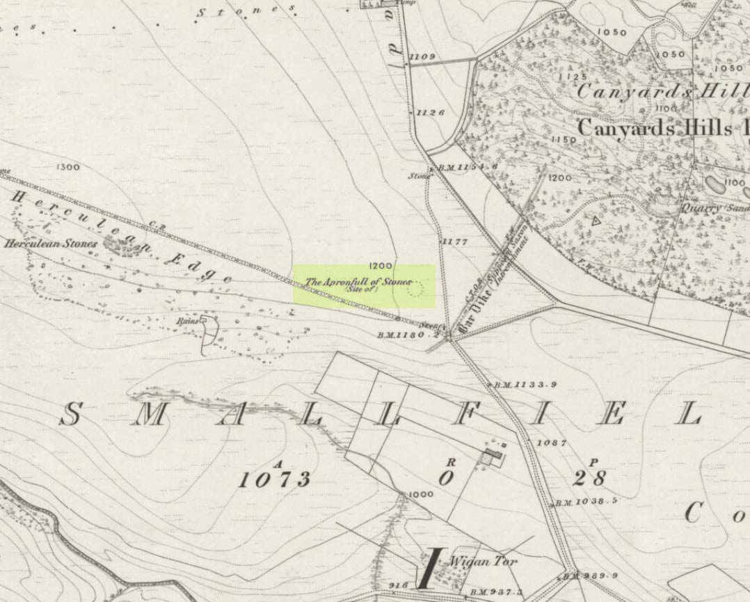
This was another example of the many giant cairns that scatter the upland moors on the Pennines, but much of it has been destroyed, with some halfwits in recent years cutting a track right through whatever remains there might have been! It was first described in John Watson’s (1776) essay on the local antiquities of Bradfield and district where, in relative conjunction with the curious Bar Dike, he told that “this is not the only curiosity on this common.” He continued: “there is on one part of it a large carnedde, called by the country people the Apron-full of Stones”, where he conjectured there laid a British tribal chief after he’d been slaughtered by the Romans. This might have been the folklore of the place, but we know such places were thousands of years earlier than the Romans.
It was later described in Joseph Hunter’s Hallamshire (1819) as a giant barrow, or ‘vast carnedde’, even then in the past tense; but some recent investigation here found “a few small stones and some lumpy turf which looked to be covering a few clumped stones.” The site requires further investigation by local people to assess the state of damage inflicted on this once great tomb.
Folklore
Said to have been the site of a local battle in ancient times; this is also another site which, as A.H. Smith (1961) tells, “is explained in folklore by tales of the devil undertaking some major building project and tripping up, only to deposit his apronful of stones” here. Does anyone out there have any more info on this place?
References:
Hunter, Joseph, Hallamshire: The History and Topography of the Parish of Sheffield in the County of York, Lackington: London 1819.
Smith, A.H., The Place-Names of the West Riding of Yorkshire, Cambridge University Press 1961-63.
Watson, John, “An Account of some Hitherto Undescribed Remains of Antiquity”, in Archaeologia, volume 5, 1776.
This is an awesome beast! You can either approach it from Nettlehole Ridge ‘stone circle’ as I did, or take the more sensible approach and begin from Embsay village, walking up the path towards Embsay reservoir and onto the moorland heights of Crookrise Crag, 1350 feet above sea level. Worra view! But keep walking a little more, downhill, and it’ll hit you right in the face!
Archaeology & History
Fairy’s Chest, Embsay Moor
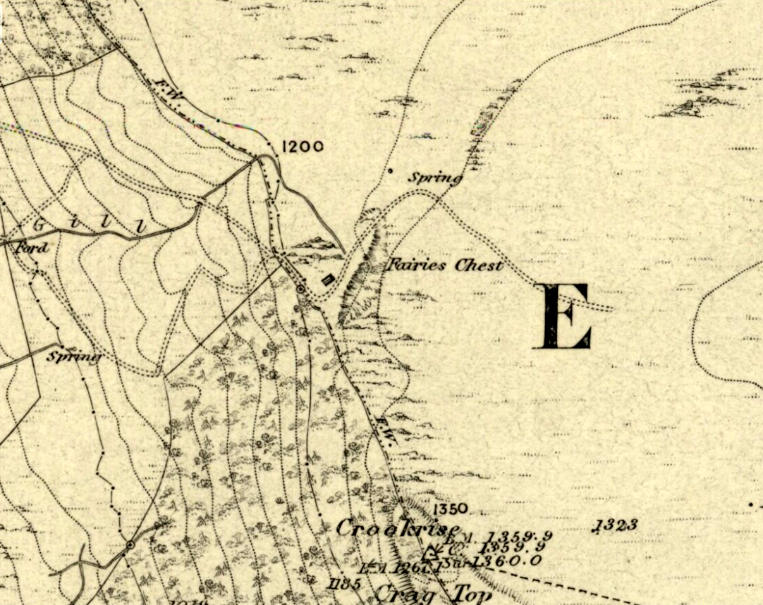
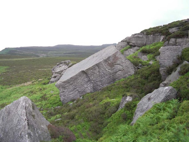
Known as an abode of the little people in the 19th century and shown on the earliest Ordnance Survey map of the region, I know of no previous accounts of this giant elongated boulder, forty feet long and nearly the same size as our legendary Hitching Stone that’s nestled below the small cliffs. The boulder is surrounded by what seems like cairn-material on all sides (though it doesn’t look prehistoric). You’re looking straight west from here, right at the three small paps of Sharp Haw, Rough Haw and Flasby Fell. If you like huge rocky outcrops, this (and others nearby) will make your day!
Folklore
Said to have been the abode of the little people in ages gone by; though even an old chap we met on our wander here told us how the legends it once held “have died with the old folk it seems.”
Takes a bitta getting to this spot, but it’s worth the effort! Make a day of it and walk up here via the little-known Cuckoo Stones monoliths. From here the walk gets steeper! Follow the footpath from the standing stones, uphill, to the legendary Wuthering Heights building of Bronte-fame a half-mile ahead of you. Then walk immediately up the slope at the side of the derelict house higher onto the moor (there’s no real footpath to follow) until the moorland levels out. From here, look west and walk that way for a few hundred yards where you’ll be seeing a large rock outcrop ahead of you. That’s where you’re heading! (if you reach the triangulation pillar, take the small path from there along the top of the moor towards this large rock outcrop)
Archaeology & History
Alcomden’s Altar Stone
To those of you who like a bitta wilderness, or healthy normal people I suppose, this is a stunning place! Even though there’s little by way of archaeology here — save the usual expectations of a few flints and arrowheads — its geomancy, its position in the landscape, makes it excel as a once important ritual site for our ancestors in not-so-distant centuries. Although local tradition gave these great rocks a prehistoric pedigree, the archaeological record doesn’t say as much — but that doesn’t really mean much up here. We’ve found a singular Bronze Age cairn on the level at Middle Moor Flat 400 yards northwest (not in the record books), some prehistoric walling on the flat east of here (not in the record books), so a lot more attention is needed hereby to see what more may be hiding in this rocky heathland area.
The main feature amidst this extensive scattering of rocks is the large rocking stone, said to weigh six- or seven-tons, resting upon other glacial deposits. The rock itself can be made to rock very slightly. It was described in Lewis’ Topographical Dictionary as a
“cromlech, an evident druidical remain, (which) consists of one flat stone, weight about six tons, placed horizontally upon two huge upright blocks.”
But the placement here was done by Nature and not humans — making it much more important to our ancestors. This was a site for solace, for ritual and to commune with the gods themselves. A few visits to this place show this quite clearly — unless you’re unable to relax that is! It’s a place I wanna spend more time working with, as the mythic history around these stones feels strong, despite their absence from written records.
The ‘altar’ resting on rocksAlcomden’s “altar”
The druidic sentiments espoused by Lewis were all but echoed by our otherwise sober historian, J. Horsfall Turner, in his history of Haworth (1879), where he describes the Alcomden Stones as “the remains of a Druid’s Altar.” On top of the main ‘altar stone’ are what could be ascribed as worn cup-markings, but it seems they’re Nature’s handiwork once again; though this wouldn’t deny them as having some significance to our ancestors. A number of other boulders amidst this mass of rocks also have what seem like cup-markings, but none of them can be said with any certainty to have been carved by people. Indeed, the entirety of this legendary rock outcrop seems to have been created solely by the spirits of Nature.
View of Earth, from Alcomden
It was first described as ‘Alconley’ in 1371, then in the 1379 Poll Tax returns as ‘Halcom’, the etymology of which is difficult. Al- is a cliff or rock, many of which occur here; den is certainly a valley, over which we look to the northeast (to Ponden Kirk, 500 yards away); but the central element of ‘com‘ is the greatest puzzle. Blakeborough (1911) tells of the old Yorkshire word ‘con’ — found in the 1371 spelling — meaning “to scan, or observe critically,” which one can certainly apply here in a topographical sense, i.e., “observation stones above a valley.” It’s simple, succinct, and makes sense!
Folklore
As Elizabeth Southwart (1923) rightly said,
“Our forefathers, instinct and imagination more highly developed than knowledge, peopled their woods with fairies and their valleys with ghosts. On the high, wind-swept spaces they built their altars to Unknown Gods.”
Turner’s 1913 drawing
And such she thought was done at this “heap of rocks called Oakenden Stones.” It seems likely, as this place is superb for ritual magick and meditative systems. But all we have are the repeats of numerous old historians, from Whiteley Turner (1913) and his namesake J. Horsfall, to James Whalley, J.W. Parker and more, who recorded what the old locals said: that is was a place of the druids. There may be a grain of truth in it somewhere…
References:
Bennett, Paul, The Old Stones of Elmet, Capall Bann: Milverton 2001.
Blakeborough, Richard, Wit, Character, Folklore and Customs of the North Riding of Yorkshire, W. Rapp: Saltburn 1911.
Parker, J.W., Guide to the Bronte Country, J.W. Parker: Haworth n.d. (c.1971)
Southwart, Elizabeth, Bronte Moors and Villages: From Thornton to Haworth, John Lane Bodley Head: London 1923.
Turner, J. Horsfall, Haworth, Past and Present, Hendon Mill: Nelson 1879.
Turner, Whiteley, A Spring-Time Saunter round and about Bronte Lane, Halifax Courier 1913.
It seems there’s not been a lot of archaeohistory written about this ruined site — nor its companion that was once visible 50 yards to the west. In Richard Feachem’s (1977) gazetteer he described it simply as:
“a turf-covered stony mound some 10ft in height, standing in the middle of an enclosure formed by a ditch with a wall on its inner lip, which is best preserved on the west.”
Folklore
A common aspect of faerie-lore are incidences of apparent time-lapses — beloved in modern times in certain UFO encounters (Vallee 1969; Keel 1970). Such was the case here, in the story described at this ruinous old site by George Sutherland (1937). He wrote:
“Two men carrying a small keg of whiskey for the New Year festivities were passing the church of Bruan. They heard stirring bagpipe music and a few hundred yards further on they came to the Bruan Broch and found it open, and saw a number of the little folk in green dancing merrily to the music. One of the men was eager to join them in the dance and went in. The other man was more cautious and remained outside, and waited patiently until his friend would have his dance. A long weary time passed and his friend was not appearing. He went to the open door of the broch and called to his friend to come out. His friend said, “I have not got a dance yet!” After another long wait he shouldered the keg of whiskey and set out for home, never doubting but that his friend would return home before morning. Next day he called at his friend’s house to see if he had come home, and to his consternation found that he had not. Then he went to the broch in the hope of finding him there, but the broch showed no trace of a door, and no trace or soil or stones having been disturbed since the days of King Brude MacBile, and there was no appearance of man or fairy. It was an old belief that in such a case the same scene would be enacted in the same place in a year after, and accordingly on the anniversary of that day he went to the Bruan Broch. It was open, the music and dancing were going on as before, and his friend was there. He put some iron article in the door to prevent the fairies from closing it… He went to the open door and said to his friend, “Are you not coming home now?” His friend replied, “I have not got a dance yet.” He told his friend that he had been a year in the broch, and that it was surely time for him to come home now, but his friend did not believe that he was more than an hour or so there. The man then made a rush at his friend, seized him, and dragged him out by sheer force, and they set out for home together. It was difficult for him to realise that his sojourn with the fairies was such a prolonged one, but the fact that his own child did not recognise him, together with other changes that had taken place, convinced him.”
References:
Feachem, Richard, Guide to Prehistoric Scotland, Batsford: London 1977.
Keel, John A., UFOs: Operation Trojan Horse, Souvenir Press: London 1970.
Sutherland, George, Folklore Gleanings and Character Sketches from the Far North, John-o-Groats Journal: Wick 1937.
Vallee, Jacques, Passport to Magonia: From Folklore to Flying Saucers, H.Regnery: Chicago 1969.
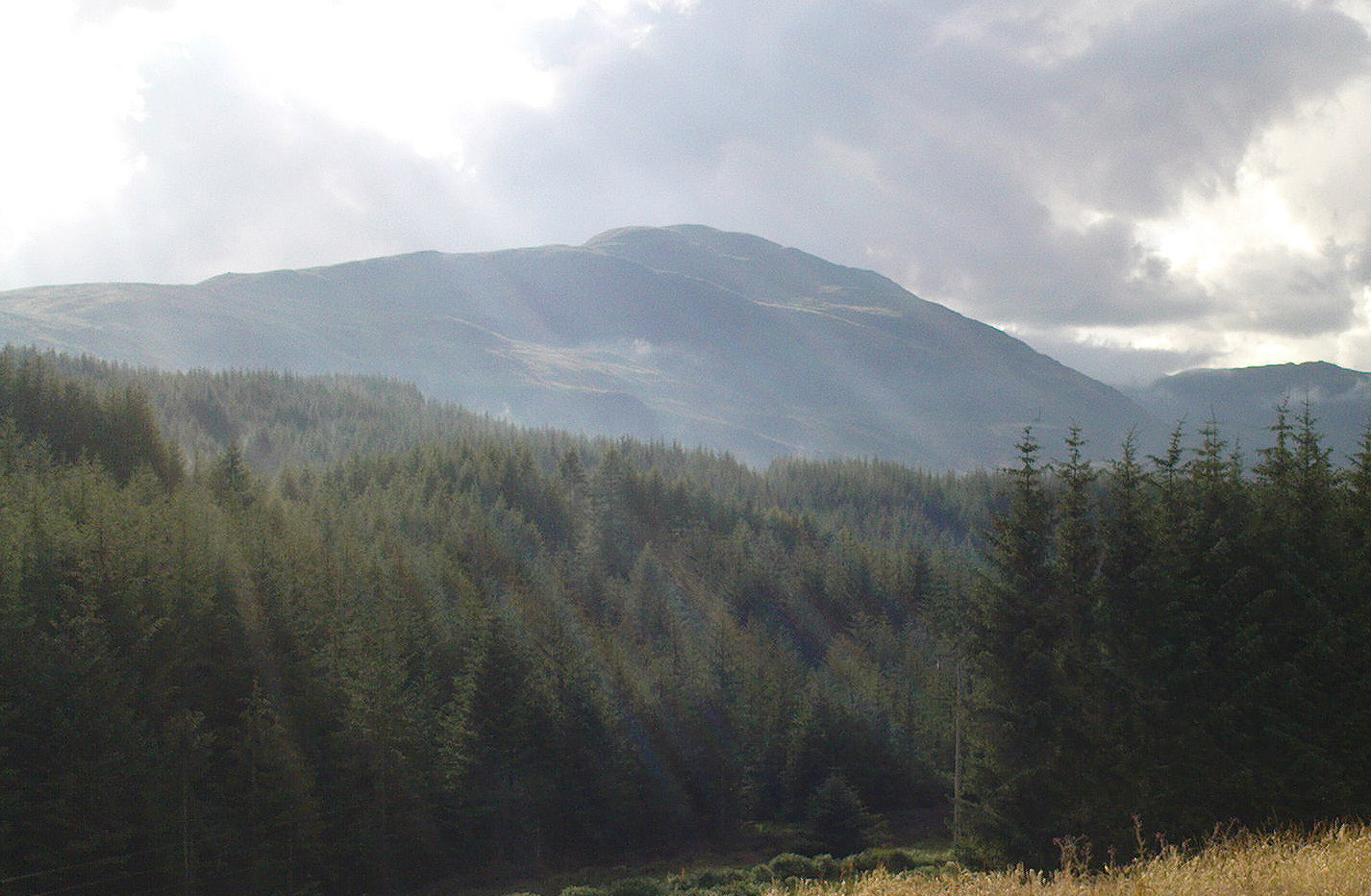
From the tourist-infested (but lovely) town of Callander, look west to the largest of the nearby mountains — that’s where you’re heading! You can keep along the A84 road out of the town for 4-5 miles (past the Falls and Pass of Leny) till you reach the parking spot on your left. Cross the river and go up into the signposted woodland. Keep walking up thru the trees until the rocky mass emerges above you. You can either keep to the path and follow the long walk round the mountain, or go straight up the crags above you. The top’s in sight!
Folklore
Getting up here is no easy task if you’re unfit — but it’s well worth the effort for the journey alone! And in bygone centuries it seems, local people made it a particular pilgrimage at specific times during the year. Even the name of this great hill has some supposed affinity with holy issues; though some modern english etymologists put a dampener on such things. In Charles Rogers’ (1853) excellent Victorian exposition, he told that,
“Benledi is an abbreviation of the Celtic Ben-le-dia, signifying the hill of God.”
But whether the old heathens who named most of these ancient mountains would echo his oft-repeated derivation is another thing altogether! However, there are other decidedly pre-christian events that used to be enacted here, for the summit of Ben Ledi was, tradition tells, where the sun god was worshipped. It would seem, however, that this tradition is a somewhat watered-down version of it as a site of cosmological and social renewal. (see Eliade 1974) For akin to the annual pilgrimage that happens upon Croagh Patrick in County Mayo, Ireland, here upon Ben Ledi,
“For three days and three nights…the inhabitants of the district in those primitive times convened, at the period of summer solstice, on the summit of the mountain, to join in the rites of heathen worship.”
More recent lore tells the date of such sacred gatherings was Beltane. Also a short distance to the north of the summit of Ben Ledi is a small loch known as Lochan-nan-corp. Mr Rogers again tells us that,
“Here two hundred persons, who were accompanying a funeral from Glenfinglas to the churchyard of St. Bride, suddenly perished; the ground had been covered with snow and the company were crossing the lake on the ice, when it at once gave way.”
It seems a most unusual event. But the tale itself implies that a corpse route passed by the way of this high summit, down to the heathen chapel of St. Bride at the bottom of its eastern face: a huge undertaking in itself with probably archaic origins. Does anyone know owt more about this?
References:
Eliade, Mircea, The Myth of the Eternal Return, Princeton University Press 1974.
Eliade, Mircea, Patterns in Comparative Religion, Sheed & Ward: London 1958.
Roger, Charles, A Week at Bridge of Allan, Adam & Charles Black: Edinburgh 1853.
An intriguing site this, as it doesn’t appear to be in the Canmore archaeological register – unless it’s the Canmore site 34750. Yet Alexander MacGregor (1937) mentions the place in his folklore study as being a site where the little people lived. Shown on the first OS-map of the region as ‘Fairyfold Hillock’, Mr MacGregor (1937) said of it:
“Near the summit of Carmylie Hill is a large barrow or tumulus, which was believed at one time by the natives to be a favourite haunt of the fairies, where, with much splendour, they held their nightly revels. It still bears the name of ‘Fairy-Folk Hillock.'”
However it seems that quarrying operations may have destroyed the site. The tomb here was probably the same one described by Mr Andrew Jervise in the Journal of the Kilkenny and South East of Ireland Archaeological Society (1864-66), where he wrote:
“Many years ago I took note of another example of these ‘footmarks,’ which was found in the parish of Carmyllie… This was discovered in the course of making agricultural improvements some thirty-five years ago, on which occasion stone coffins or cists were got, and in one of these was a bronze (?) ring, of about three inches in diameter, now said to be lost. Apart from the cists there was a rude boulder of about two tons weight; and upon the lower side of it, as my informant told me, was scooped the representation of a human foot. This too was associated with the elves; for the hillock upon which these discoveries were made was called the ‘fairies’ knowe;’ and tradition says that, but for a spirit that warned the workmen to suspend operations when they began to prepare for the foundations of the parish church, the church would have been built upon that spot!”
When Pete Glastonbury brought us here, we walked east out of the Avebury stone circle and up the Wessex Ridgeway track. When you hit the “crossroads” at the top of the rise a mile along, go across the stile into the grasslands for a few hundred yards till you hit the obviously-named “Gallops” racecourse-looking stretch. Walk down for a few hundred yards till you hit a footpath on your left that takes you across and down grasslands that takes you slowly into the valley bottom. You’re damn close!
Otherwise (and I aint done this route!), walk up the footpath straight north from Clatford village, up the small valley for about 1km. You’ll eventually see this great stone heap in the field on your left!
Archaeology & History
I was brought here one fine day last year in the company of PeteG (our guide for the day), Geoff, June and Mikki Potts. Twas a fine foray exploring the various prehistoric sites on the lands east of Avebury — but it was my very first venture to this site, the Devil’s Den — and a grand one it was indeed! Standing close to the small valley bottom a couple of miles east of the great stone circle, this megalithic monument is thought to be neolithic in origin.
When H.J. Massingham (1926) came here, the day and spirit of the place must have felt fine, as he described,
“its three uprights and capstone stand forlornly in the midst of an alien sea of ploughland swinging its umber ripples to the foot of a stone isle, drifted nearly four thousand years from the happy potencies of its past.”
And, on many good times here no doubt, for many people, such feelings still hold…
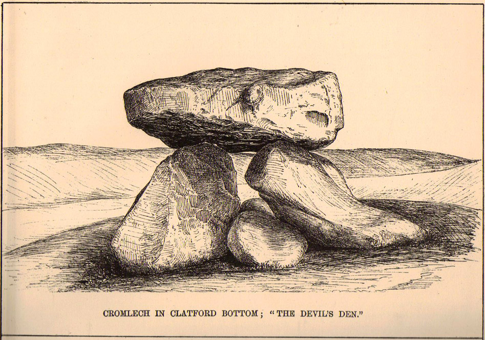
A.C. Smith’s Devil’s DenColt Hoare’s Devil’s Den
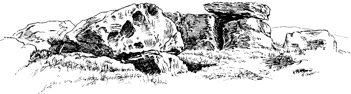
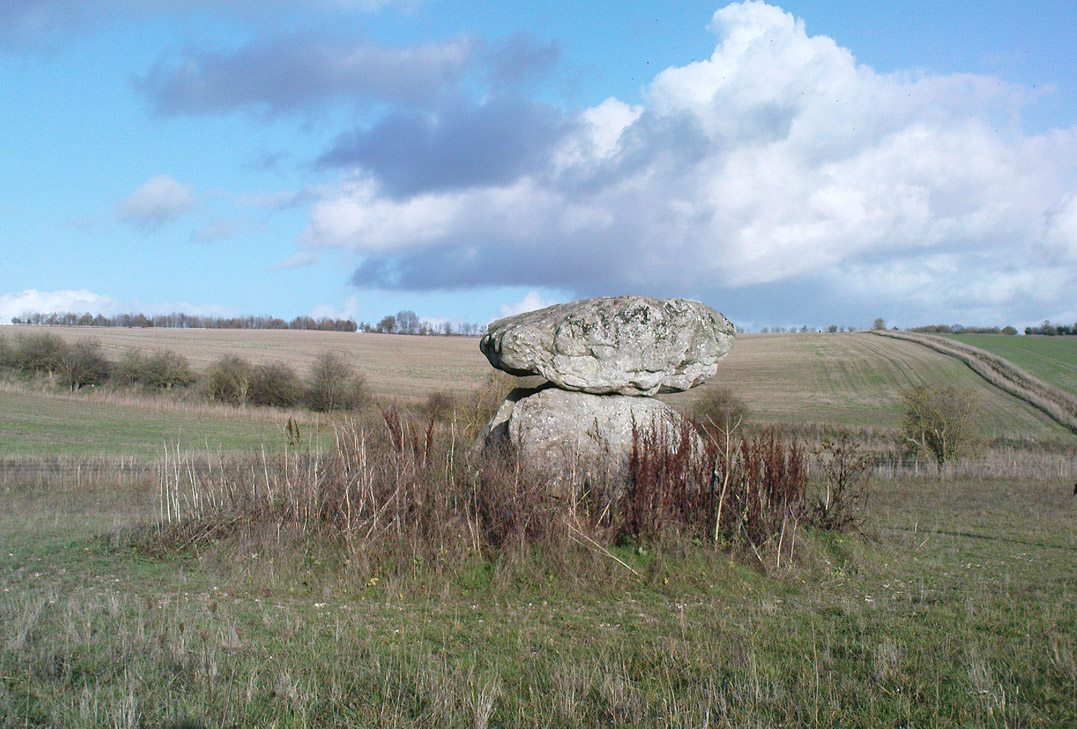
It was described by the President for the Council of British Archaeology, Paul Thomas (1976), “as a setting of four sarsen uprights with a capstone”, whereby four uprights have not been noticed here since very early times. Not sure how old he was though! Today the very large capstone weighing upwards of 20 tons rests gently upon just two very bulky upright monoliths. A third is laid amidst the great tomb , overgrown and sleepy, touching one of the two uprights….
The cromlech itself seems to have once been part of a lengthy mound that was covered in earth, “about 230ft long and 120ft broad, now virtually removed by ploughing.” On top of the great capstone are at least two cup-markings: one of them with a possible oval-shaped line carved out onto the edge of the rock (similar to the C-shaped carving on the nearby Fyfield Down cup-marked stone), but this needs looking at in various lights so we can ascertain whether it has a geological or artificial origin.
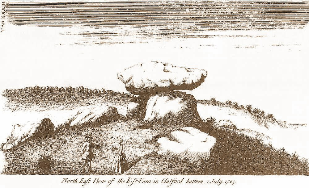
Stukeley’s Devil’s Den
Suggested by Edwin Kempson (1953) and also by Aubrey Burl (2002) and other dialect and place-name students to have originally been called Dillion Dene — “the boundary marker in the valley” — this collapsed chambered tomb has had many literary visitors, from William Stukeley onwards. When the reverend Smith wrote his great tome in 1885, he gave an assessment of those who came before him, saying:
“This is a noble specimen of the Kistvaen: it stands erect in its original position, only denuded of the mound of earth which, I venture to say (on the authority of the Rev. W.C. Lukis and others best acquainted with these remains) at one time invariably covered them: and this massive erection of ponderous stones is known as the ‘Devil’s Den’, and offers an exceedingly fine specimen of the kistvaen to those who have not made the acquaintance of these ancient sepulchres in other counties. It is not only perfect in condition, but of very grand dimensions; moreover, it is well known to everybody who takes the slightest interest in Wiltshire antiquities… Stukeley says very little of this kistvaen, though he gives several plates of it (in Abury Described), his only remark being: “An eminent work of this sort in Clatford Bottom, between Abury and Marlborough.” Sir R. Hoare (in Ancient Wiltshire, North) is more enthusiastic, he says: “From Marlborough I proceed along the turnpike road as far as the Swan public house in the parish of Clatford, and then diverge into the fields on the right, where, in a retired valley amongst the hills, is a most beautiful and well-preserved kistvaen, vulgarly call’d the ‘Devil’s Den.’ It has been erroneously described as a cromlech. From the elevated ground on which this stone monument is placed, it is evident that it was intended as a aprt annexed to the sepulchral mound, and erected probably at the east end of it, according to the usual custom of primitive times.””
In more recent years, Terence Meaden (1999) has suggested that the Devil’s Den may actually have been a simple cromlech and never had any covering mound of earth. In his Secrets of the Avebury Stones he described how,
“The vertical megaliths must have been set up firmly first and then, quite possibly, a mound was raised outside and between them. A very long ramp could have been built next, along which the capstone was dragged until it lay on top of the vertical monoliths, after which both mound and ramp would be removed as far as possible. Such an operation, if correct, would explain why the stones of Devil’s Den now stand on an obviously artificial eminence; and why the much-spread remains of a long mound oriented NW-SE, about 70 metres (230 feet) long and 40 metres (130 feet) broad, were seen and described by Passmore in 1922. One should not necessarily assume that the stones are the remains of a chambered long barrow, although they might be.”
And you’ve gotta say that unless we have hardcore evidence to the contrary, his summary is quite possible. However, it seems here that Meaden has simply utilised this logic to enable him to posit another reason — a “good one” he calls it — for this suggestion, i.e.,
“its capstone seems to have profiles of heads carved upon two, perhaps three of its sides; suggesting that, if the art was meant to be seen, the capstone was never covered with earth.”
Devils Den on 1889 map
Unfortunately however, these possible “carved heads” on the sides of the capstone more typify Rorscharch responses to natural geological shapes scattering rocks all over the planet. Up North, if we were to attempt this sorta suggestion, we’d have millions of such carved heads popping up all over the place. It’s a nice idea, but somewhat unlikely.
Folklore
The old dowser Guy Underwood (1977) was renowned for locating water lines* in and around many of England’s prehistoric sites, and the same pattern was recorded here. He told that the Devil’s Den marked the site of a blind spring “of exceptional importance.” He continued:
“The Devil’s Den dolmen marks the source of a multiple water line which forms a maze, marked by stones, about 200 yards to the northwest. It terminates at a well, where two tracks cross about a mile further west. This site is likely to have had special sanctity and would be interesting to excavate.”
Whilst the importance of water was understandable in ancient days, some other folklore attributes derive from quite different ingredients. The common theme of “immovability” is found here, as described by reverend Smith (1885) again who, amidst other peculiarities, told the following:
“There are various traditions connected with it. I was told some years since, by an old man hoeing turnips near, that if anybody mounted to the top of it, he might shake it in one particular part. I do not know whether this is the case or not, though it is not unusual where the capstone is upheld by only three supporters. But another labourer whom I once interrogated informed me that nobody could ever pull off the capstone; that many had tried to do so without success; and that on one occasion twelve white oxen were provided with new harness, and set to pull it off, but the harness all fell to pieces immediately! As my informant evidently thought very seriously of this, and considered it the work of enchantment, I found it was not a matter for trifling to his honest but superstitious mind; and he remained perfectly unconvinced by all the arguments with which I tried to shake his credulity.”
References:
Burl, Aubrey, Prehistoric Avebury, Yale University Press 2002.
Goddard, E., “The Devil’s Den, Manton, Wiltshire,” in The Antiquaries Journal, volume 2, no.1, January 1922.
Gomme, Alice B., ‘Folklore Scraps from Several Localities’, in Folklore, 20:1, 1909.
Grinsell, Leslie V., Folklore of Prehistoric Sites in Britain, David & Charles: London 1976.
Kempson, E.G.H., “The Devil’s Den,” in Wiltshire Archaeology & Natural History Magazine, 55, 1953.
Massingham, H.J., Downland Man, Jonathan Cape: London 1926.
Meaden, Terence, The Secrets of the Avebury Stones, Souvenir Press: London 1999.
Smith, A.C., A Guide to the British and Roman Antiquities of the North Wiltshire Downs, Wiltshire Archaeological & Natural History Society 1885.
Thomas, Nicholas, Guide to Prehistoric England, Batsford: London 1976.
Underwood, Guy, The Pattern of the Past, Abacus: London 1977.
Wright, Joseph, English Dialect Dictionary – volume 2, Henry Frowde: London 1898.
* Those people who allege they can dowse will always find water in their first few months, if not years, of sensitivity. There is a pattern nowadays of people using dowsing tools and, when the rods cross (or whichever accessory they get their reactions from), they allege they are connecting with unknown energies, ley lines and other such items; but this is simply incorrect. The primary dowsing response is water (life-blood) and it takes much practice over long periods of time to even begin isolating leys or other occult phenomena.
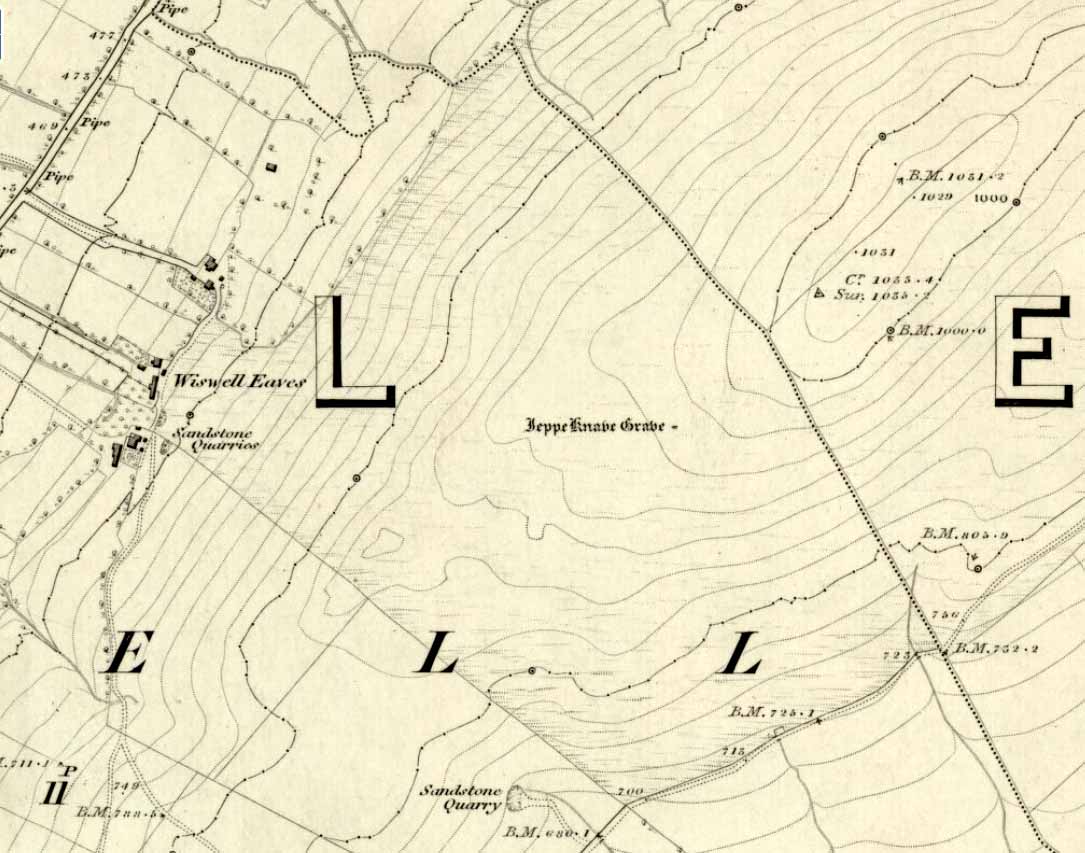
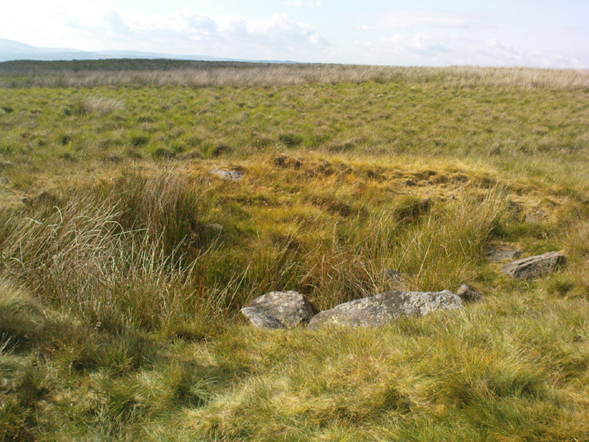
From Sabden, head up the steep Clitheroe Road towards the Nick o’ Pendle, turning left 100 yards before the hilltop and along the dirt-track for a few yards, before veering up the winding footpath to the hilltop. When you’re at the peak of this little bit o’ moorland, go to your left (west), following the small path into the grasses and heather all the way on for a few hundred yards till you hit the triangulation pillar. Go past this, over one stile (north) and then immediately at right-angles (west) over another stile and downhill for about 100 yards until you’re on the rough grassland level. Keep your eyes peeled as you’re walking until you see what looks like a denuded stone-lined pit, much overgrown — with the main feature (showing that you’ve hit the target) being the engraving on one of the larger rocks: “Jeppe Knave Grave”.
Archaeology & History
The Jeppe Knave Grave
First described in early perambulation records of 1326 CE, this is a small but intriguing site found on the far southwestern slopes of Pendle Hill, on the ridge beneath the triangulation pillar of Wiswell Moor. It’s a small and overgrown cairn with a general archaeological association of prehistory attached—though no detailed excavation has ever been done here, despite local archaeologists having access to a large grant to explore this region a short while ago.¹ But up North, as many of us know, archaeology is given little priority and those who do decent exploratory work under the umbrella of such academic quarters tend to be few and far between. Thankfully we had the northern antiquarian and local writer John Dixon (1993) nearby who gave us the best overview of the site. He wrote:
“This landscape feature, known as Jeppe Knave Grave, stands at a place called The Lows high on Wiswell Moor and takes the form of a low grass-covered mound 16M in diameter with a stone filled depression in the centre 5 x 3 M. This feature appears to be a mutilated cairn and has been tentatively ascribed to the Bronze Age. The outer ring of stones can be discerned in the rough pasture at the perimeter – yellow in dry conditions, showing the circular shape. Given the large size of the stones here, the cairn may have been of a chambered type/passage tomb of the Neolithic period, and if this was the case the burial (or burials?) was one of great importance.
“Upon the largest stone are inscribed the words ‘JEPPE KNAVE GRAVE and a cross (inscribed by the Scouting Association in the 1960’s). The stone marks the final resting place of Jeppe Curteys (Geoffrey Curtis), a local robber who was decapitated for his crimes in the first year of Edward III, 1327. The name first occurs in a record of the boundaries between Wiswall and Pendleton dated 1342.
“…In those times the punishment of decapitation was unusual, being reserved for those of noble birth. So who was this Jeppe Curteys, punished by decapitation and later buried on the high ridge of Wiswell Moor in a pre-Christian burial mound on the then boundary of parishes? That intriguing story we may never know. But to be buried in such a manner and place was indeed a great indignity – interment in what might be considered in those times to be a ‘pagan’ or ‘devilish’ spot. It may be that to bury a man in such a place was to literally ‘send him to the devil’. Alternatively one could ask: ‘Was the site thought then to be the burial spot of some noble ancestor, and Jeppe being of possible noble birth interred with great dignity? Again we may never know, yet it is significant that this lonely spot is still identified with a man who was executed 700 years ago.
In 1608 it was stated that one Robert Lowe had taken a stone from the grave and used it as a cover of his lime kiln.”
Old codgers from the local Senile Society, inspecting York Minster!Agatha Lyons’ 1871 sketch
The design of the cairn here is unlike the ones you usually come across on the Lancashire and Yorkshire moorlands. The edges of the Jeppe Knave Grave are walled and much more well-defined than the large rock piles that we find scattering our uplands. A similar though larger cairn with features similar to these can be seen in the large Low Hill tumulus on Elslack Moor near Earby, about ten miles northeast of here…
Other prehistoric remains scatter the many rolling hills that you can see from here: mainly prehistoric tombs sat upon hilltops as far as the eye can see. John pointed out what may be the remains of another tumulus that can be seen on the nearby horizon a few hundred yards NNW from here, overlooking the gorgeous village of Pendleton and the landscape beyond…
References:
Dixon, John, Journeys through Brigantia – volume 9: The Ribble Valley, Aussteiger Publications: Barnoldswick 1993.
Whitaker, Thomas Dunham, An History of the Original Parish of Whalley – volume 2, George Routledge: London 1876.
¹ John Dixon informed us how the people in question spent the grant — somewhere in the region of £50,000 — on exploring some modern architectural features, instead of exploring some of the little-known sites and seeking out others on these hills.
* John is the author of many fine historical travel guides, including the Journeys through Brigantia series. See the titles in the Lancashire Bibliography and Yorkshire Bibliography for a more complete listing of all his books to date. If you wanna buy any of his works, or make enquiries regarding them, email John at: lancashirebooks@fsmail.net – or write to him direct, at: John Dixon, Aussteiger Publications, 21 Lowergate, Clitheroe, Lancashire BB7 1AD.