Cup-Marked Stone (removed): OS Grid Reference – SE 1579 3995
Archaeology & History
Jenny Lane carving
A small, seemingly broken cup-marked stone that may have once been part of a prehistoric tomb, found itself being included in an old wall at some time in the not-too-distant past: in the south-facing wall of the cricket ground at the top end of town. No one seemed to know it was there until it was noticed in the 1950s by a local man who brought it to the attention of Sidney Jackson (1958), editor of the local Bradford archaeology mag at the time. Jackson visited the site and thankfully did a sketch of what it looked like, before it was removed at a later date. He wrote:
“The small rectangular stone bearing four cup-shaped hollows…is another of Mr George Pritchard’s finds. It forms part of the high wall which bounds the Baildon Cricket Club’s ground in Jenny Lane… Its appearance suggests that it is part of a Bronze age cup-marked rock which was split to make building stones.”
Following its removal more than twenty years ago, it ended up in the hands of a dude from Cononley called Gerald Wright. I’m not sure whether it still lives over there or has subsequently found a new abode. Does anyone know what’s become of it…?
Folklore
Although there’s nothing specific to this carving, the place where it was found, on Jenny Lane, was where a phantom black dog used to be seen in bygone years. It was renowned as the harbinger od death.
References:
Jackson, Sidney, “Cup-Marked Stone in Jenny Lane, Baildon,” in Cartwright Hall Archaeology Group Bulletin, volume 3, part 10, 1958.
Cup-Marked Stone (destroyed): OS Grid Reference – SE 152 393
Also Known as:
Carving no.195
Archaeology & History
A basic cup-marked stone could once be seen up near the top of the slope behind the Bay Horse pub as you’re heading up to Baildon village. The site would seem to have been destroyed following the demolition of buildings thereby. A photograph of the carving was taken and it was described, albeit briefly, by Sidney Jackson (1961), who told:
“A small boulder with two cups in it was found at the junction of a narrow bye road leading to 30 Lane Ends, Baildon, with the road which runs behind the Bay Horse Inn, on 12 April (1961), by Mr Alan E. Rowe, 10 Beaufort Grove, Bolton, Bradford and a photograph of it was taken for the Museum Reference Collection.”
Years back I contacted the Bradford Museum about this photo and they were about as helpful as a zionist in Palestine! – i.e., I never got to see it. It would be good if someone could locate the image.
References:
Boughey, Keith & Vickerman, E.A., Prehistoric Rock Art of the West Riding, WYAS: Wakefield 2003.
Jackson, Sidney, “Cup-marked Boulders, Baildon Finds,” in Cartwright Hall Archaeology Group Bulletin, volume 6, no. 6, 1961.
For those who like a walk: take the route to reach the Swastika Stone and keep walking west along the Millenium Way footpath, past the Piper’s Stone carving and over the next two walls. Then, stagger down the steep hill and head for the large upright near-cuboid block of stone and, once here, walk 30 yards to your east! Alternatively, from the Silsden-side, go along Brown Bank Lane up and past Brown Bank caravan park, and at the second crossroads turn right and travel for exactly 1¼ miles (2km) along Straight Lane (from hereon there’s nowhere to park!) which runs naturally into Moorside Lane, and notice the raised gate entrance into the field on your right. Walk to the top of this field, go through the next gate and, less than 100 yards uphill (south) you’ll find the stone in question.
Archaeology & History
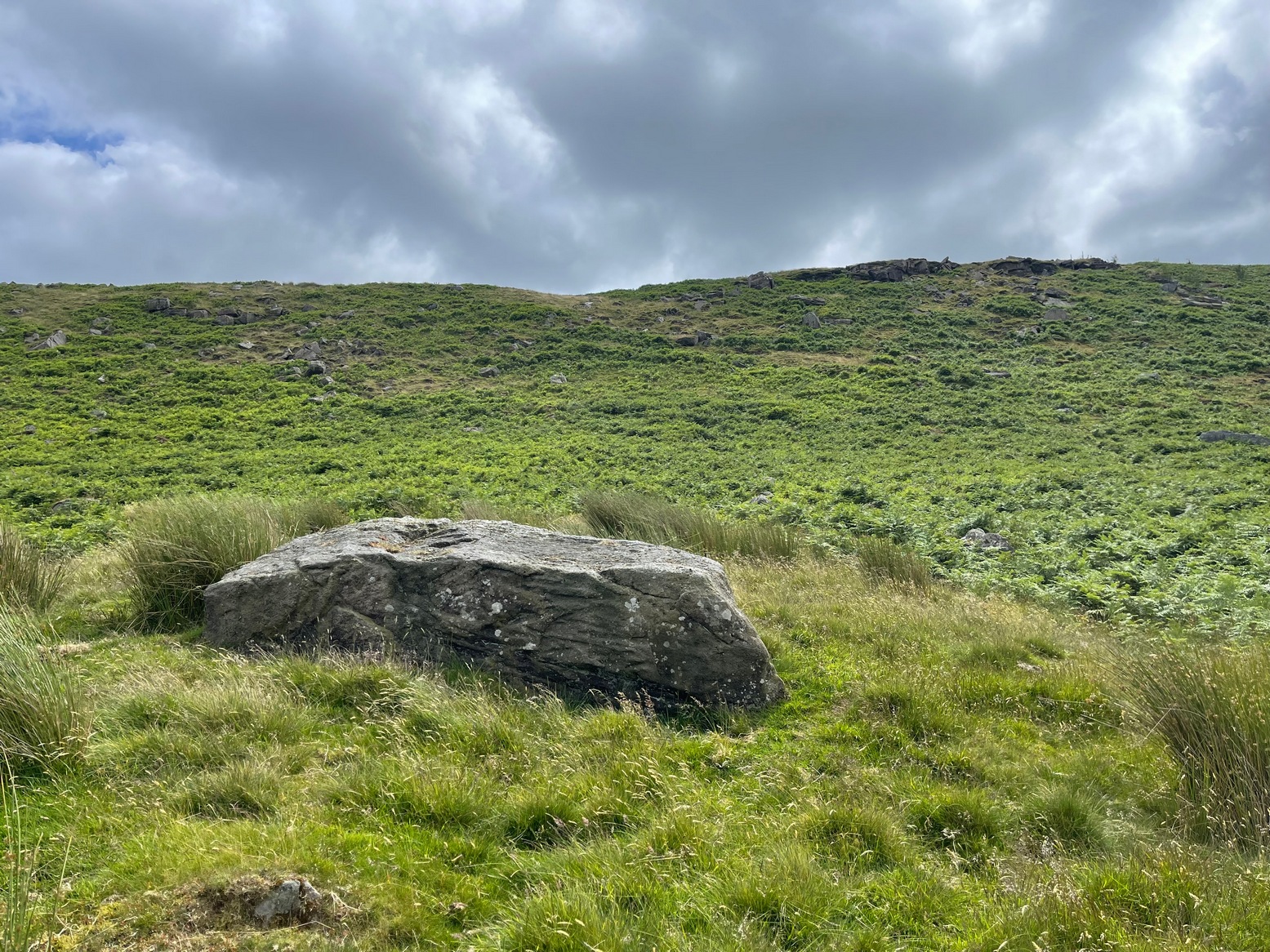
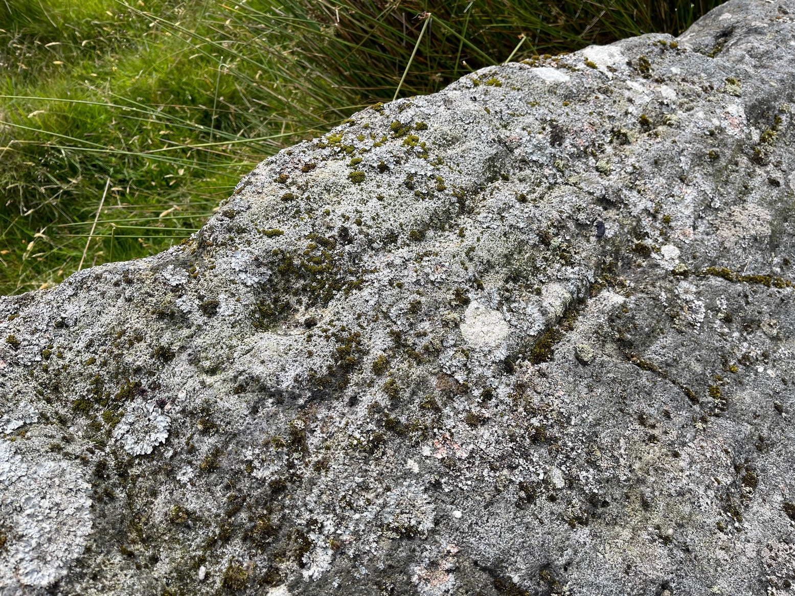
Cup, incomplete ring & line
Rediscovered by Paul Bowers in 2011, this is another one of those petroglyphs that’s difficult to make out unless the light is falling just right across the surface of the stone. Two distinct cup-marks can be seen near the more southern-edge of the stone, one of which has a near-complete, albeit unfinished ring around it, and from this a seemingly carved line runs roughly parallel with the edge of the stone, down towards another equally distinct cup close to the southwestern edge of the rock. Most of the stone is nicely covered in a decent lichen cover, so the design’s a bit difficult to see when the light’s not right. But, if you’ve made it this far, the petroglyph 30 yards to the west will make up for any disappointment you may have!
References:
Boughey, Keith & Vickerman, E.A., Prehistoric Rock Art of the West Riding Supplement, 2018.
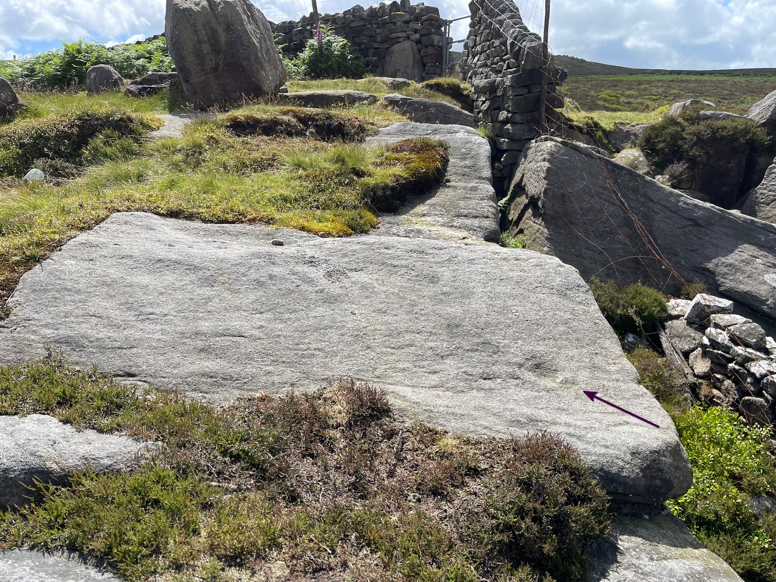
Get up to the Swastika Stone, then head west along the footpath towards the Piper Stone. Shortly before there, you’ll see the small cup-marked Piper’s Crag (3) carving, just by the walling. From this carving, just step a few yards down the slope and on the smooth sloping rock face is this faded carving. You’ll see it.
Archaeology & History
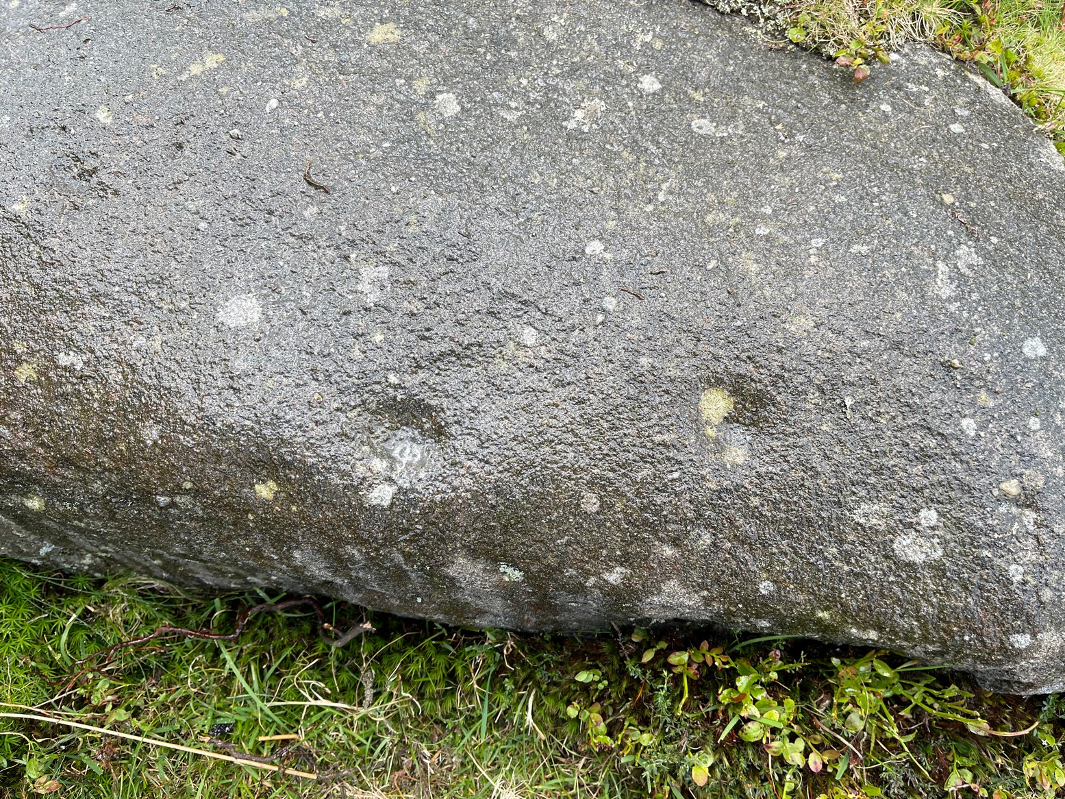
A larger than normal single cup-mark near the bottom slope of this rock has an incomplete ring around its east and southern edges, possibly with another broken element of it on its northern edge. It’s difficult to work out whether or not this is one of Nature’s curious markings and so needs looking at in different lights to work it out, one way or the other. It’s included in Boughey & Vickerman’s (2018) updated rock art survey, but there are a number quite natural cup-marks in that tome, so we need to exercise a little bit of caution here. However, it does seem to have a greater degree of authenticity than some of the other dubious single cup-marked stones in their book. Check it out on your way to the Piper’s Stone.
References:
Boughey, Keith & Vickerman, E.A., Prehistoric Rock Art of the West Riding Supplement, 2018.
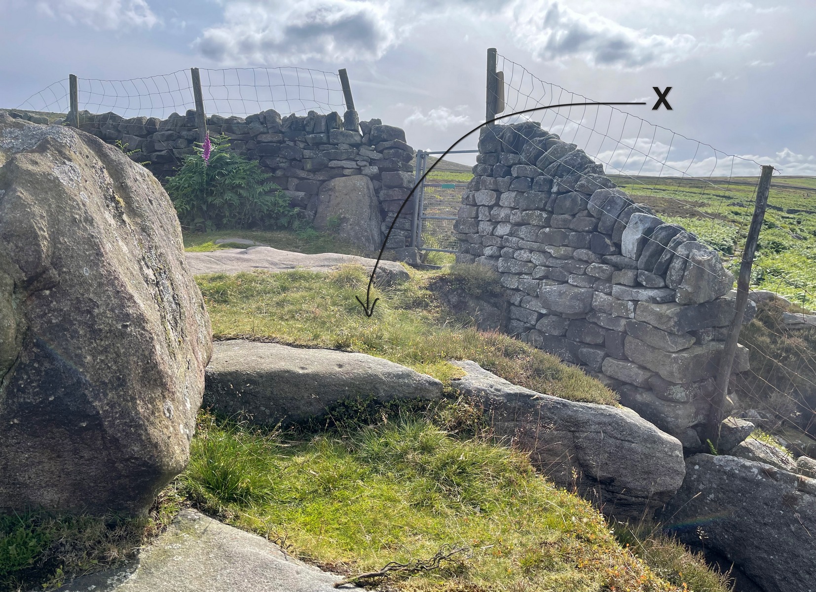
Heading up from Ilkley, follow the directions to reach the Swastika Stone, then keep walking (west) along the footpath to the small clump of trees, and keep walking past them too and keep going along the same path as if you’re heading toward the Piper’s Stone. About 200 yards before reaching it, just where the gate and boundary stone is in the old walling, there’s a small line of crags to the right of your feet and there, at the edge of the path, is the stone in question. You’ll see it (unless it’s a cloudy gray day, in which case you might struggle).
Archaeology & History
The two cup-marks
This is one of a number of cup-marked stones that you’ll find scattering this part of the moor, almost all of which are Nature’s handiwork (a few of these natural carvings have somehow found their way into Keith Boughey’s [2018] updated West Riding rock art book). I’m not 110% certain that this doesn’t have Nature’s name on it either, but it’s got a greater degree of probability to it than some of the others. It’s a simple little thing, as y’ can see, consisting of just the two cup-marks, smaller than usual, living next to each other. If it’s the real deal, we can surmise that it may have been carved by a young person back-in-the-days. In the walling just above this stone you can see the medieval boundary stone, which might—just might—have a prehistoric pedigree to it….
References:
Boughey, Keith & Vickerman, E.A., Prehistoric Rock Art of the West Riding Supplement, 2018.
Cup-and-Ring Stone (lost): OS Grid Reference – SE 0965 4797
Archaeology & History
In Ronald Morris’ (1989) gazetteer of British petroglyphs, he included this curious entry but gave no real details regarding its appearance or history. Listed by the Royal Commission lads, it would seem to have been located immediately south of the dismantled railway where it used to cross the Addingham-Ilkley road, but no one seems to have seen it either before or since Morris’ description. Any help regarding its whereabouts would be appreciated.
References:
Boughey, Keith & Vickerman, E.A., Prehistoric Rock Art of the West Riding, WYAS: Wakefield 2003.
Morris, Ronald W.B., “The Prehistoric Rock Art of Great Britain: A Survey of All Sites Bearing Motifs more Complex than Simple Cup-marks,” in Proceedings of the Prehistoric Society, volume 55, 1989.
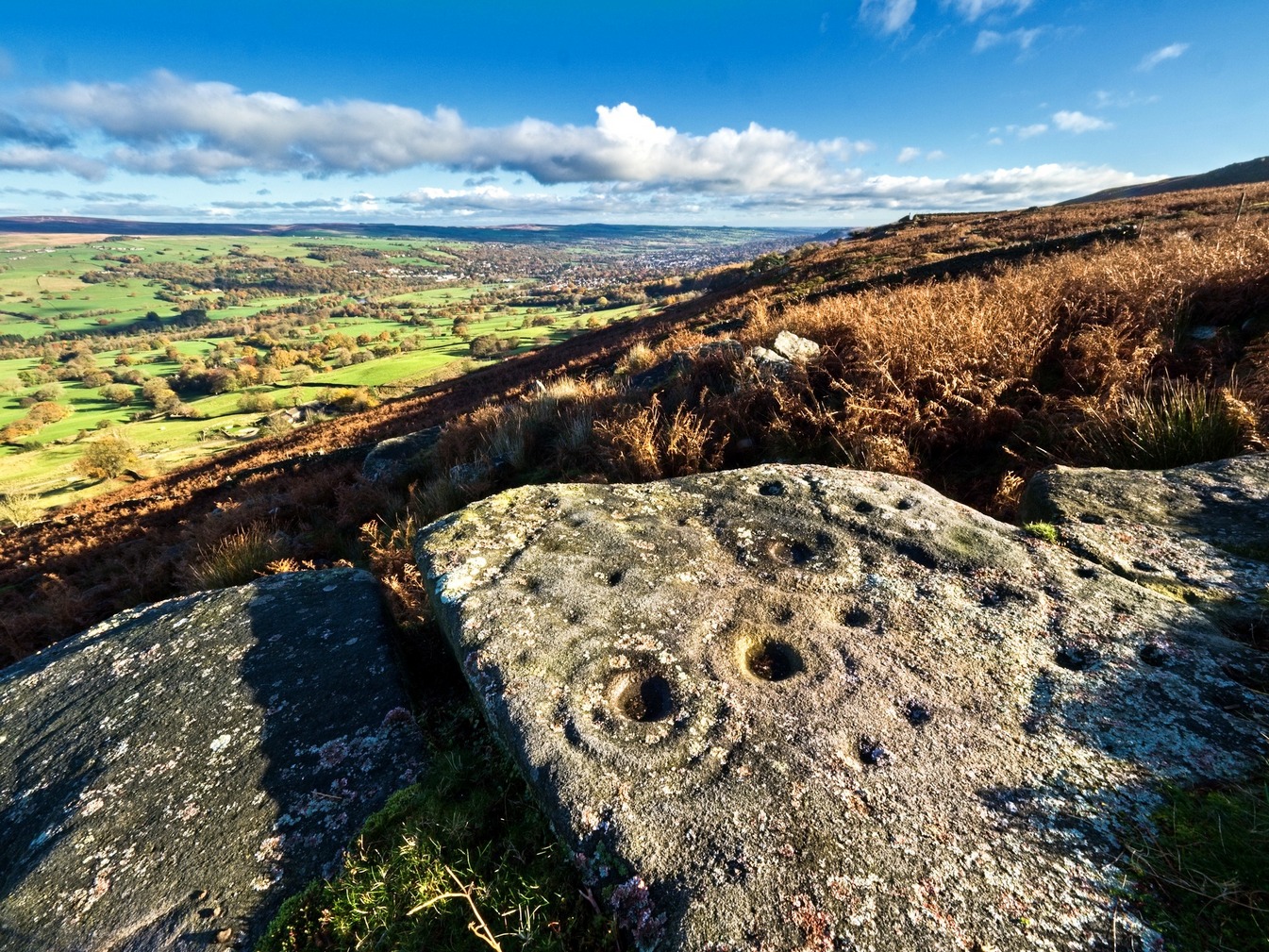
Follow the directions to reach our superb Swastika Stone from Ilkley, visible due to the iron railing that surround and protect the carving on the cliff edge. From here, keep walking west along the Millenium Way footpath, over the stile of the first wall, then the second wall—six in all—for ⅔-mile (1km), where you’ll see another small crag of rocks on your right, just yards from the footpath. You’re damn close!
Archaeology & History
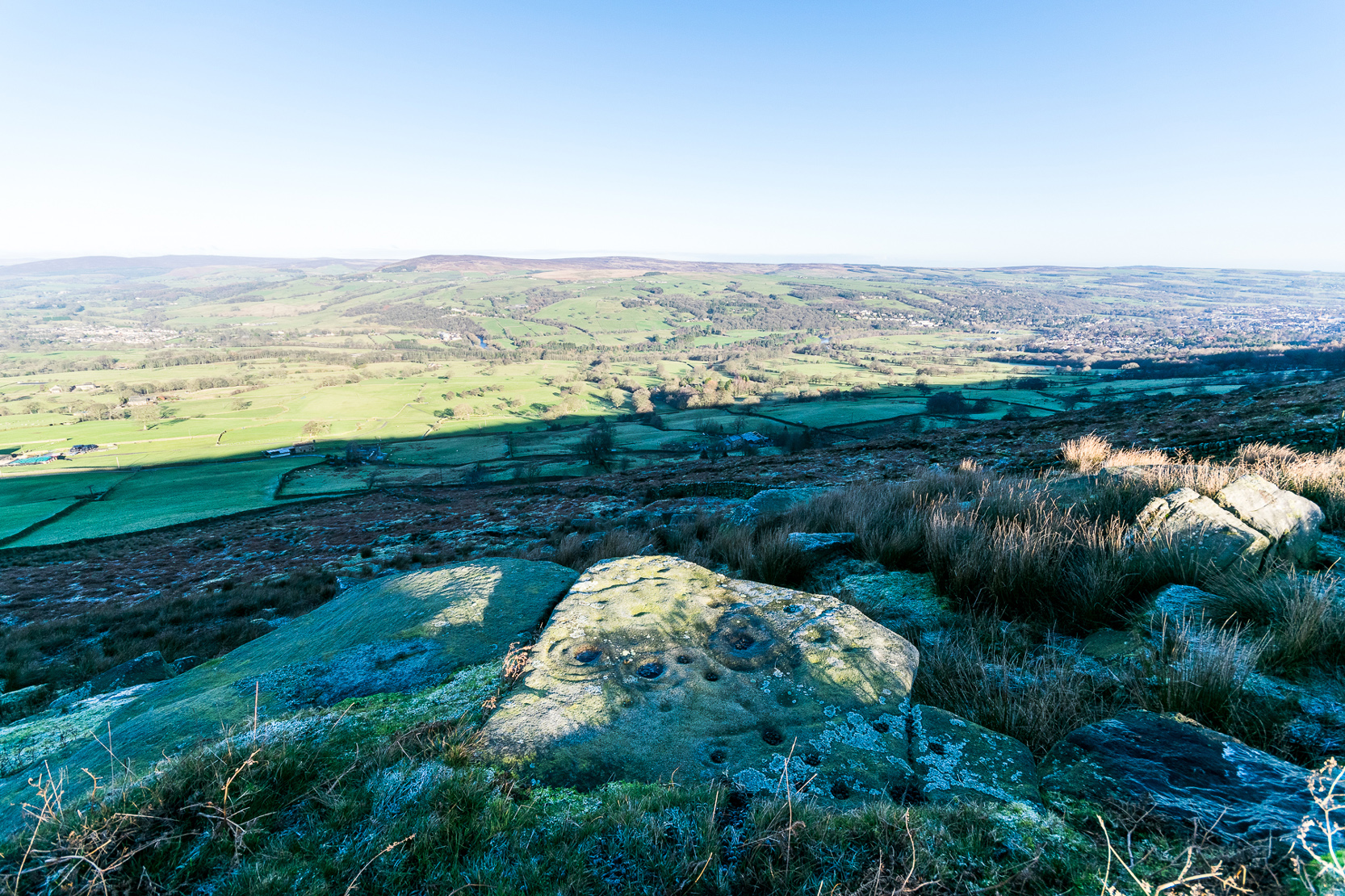
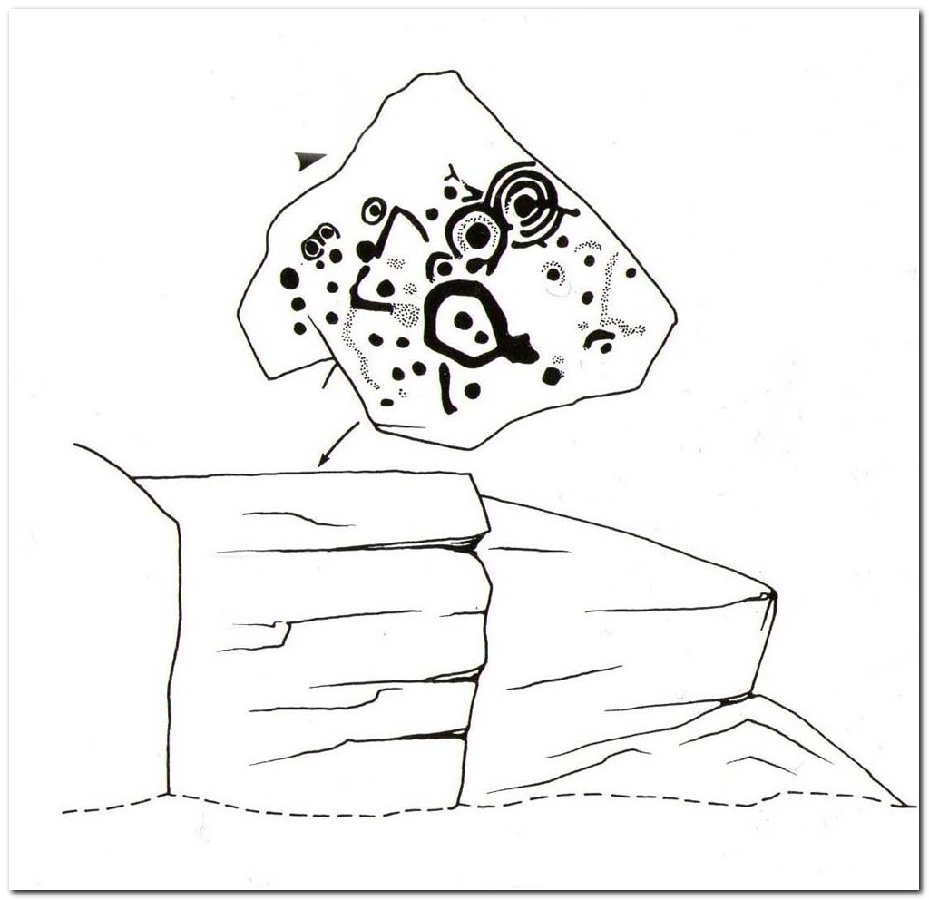
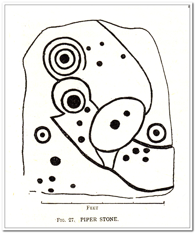
When the great J. Romilly Allen (1882) visited the Ilkley petroglyphs in 1878, the Piper Stone was one that he wandered over to see—and he had this to say of it:
“At the edge of Piper’s Crag is a horizontal rock-surface, and on a portion of it, measuring 5ft by 7ft, are carved a series of fifteen cups varying in diameter from 2 to 3 ins. Of these, one is surrounded by a single ring, four by a double ring, and one by a triple ring.”
Hedges 1986 sketchCowling’s 1940 sketch
This type of description, whilst accurate on the whole, rarely does justice to the carving. It was echoed more than 100 years later in John Hedges’ (1986) survey, when he described the large rock jutting out to possess merely, “a complicated design of cups, rings and grooves.” When Boughey & Vickerman (2003) did their follow-up survey, they added nothing more.
In an attempt to give some sort of meaning to the carving (and many others), the late great Eric Cowling (1940; 1946) placed it within Henri Breuil’s (1934) classification system, which assigns all carvings different degrees of complexity and form, from Classes 1-4. The Piper Stone entered Breuil’s Class 3A, being one “with deeply cut and smoothed down grooves.” Whilst this may sound good on the surface, in truth such classifications are utterly meaningless outside of the tables and graphs of statisticians and the boring. They give the appearance of quantitative research, but they have as much bearing on the nature of the carvings as an energy dowser healing the place with crystals.
In the flesh, in the real world—so to speak—from the Piper Stone we are looking, not just at the carving, but its place in the landscape: an ingredient that more and more emerging archaeologists are recognizing has a synergistic relationship with some petroglyphs. And here we have an impressive landscape that reaches out ahead of us for many miles. We look primarily to the north: the Land of the Dead in many traditional northern cultures. But our panorama here is 180º, with east and west horizons having the potential for measuring equinoctial periods in the cycle of the year. But in truth this is sheer speculation.
It’s a worthwhile carving to see, both for its views and its excess of non-linearity. In its form, Rorscharch impressions of early humans emerge; the usual solar and lunar symbols can be seen; star systems seem apparent; maps or settlement ground-plans could be there. We know that somewhere within it is the animistic ‘spirit’ of the rock itself, but the forms it exalts are, once again, all but lost on us modern folk…
References:
Allen, J. Romilly, “Notice of Sculptured Rocks near Ilkley,” in Journal of the British Archaeological Association, volume 38, 1882.
Allen, J. Romilly, “Cup and Ring Sculptures on Ilkley Moor,” in The Reliquary and Illustrated Archaeologist, volume 2, 1896.
Anonymous, Walks around Cup and Ring Stones, TIC: Ilkley n.d. (c.1990).
Baildon, W. Paley, “Cup and Ring Carvings: Some Remarks on their Classification and a New Suggestion as to their Origin and Meaning,” in Archaeologia, volume 61, 1909.
Bennett, Paul, “Cup-and-Ring Art”, in Towards 2012, volume 4, 1998.
Bennett, Paul, The Old Stones of Elmet, Capall Bann: Milverton 2001.
Boughey, Keith & Vickerman, E.A., Prehistoric Rock Art of the West Riding, WYAS: Wakefield 2003.
Breuil, Henri, “Presidential Address for 1934,” in Proceedings Prehistoric Society East Anglia, 7:3, 1934.
Collyer, Robert & Turner, J.H., Ilkley: Ancient and Modern, William Walker: Otley 1885.
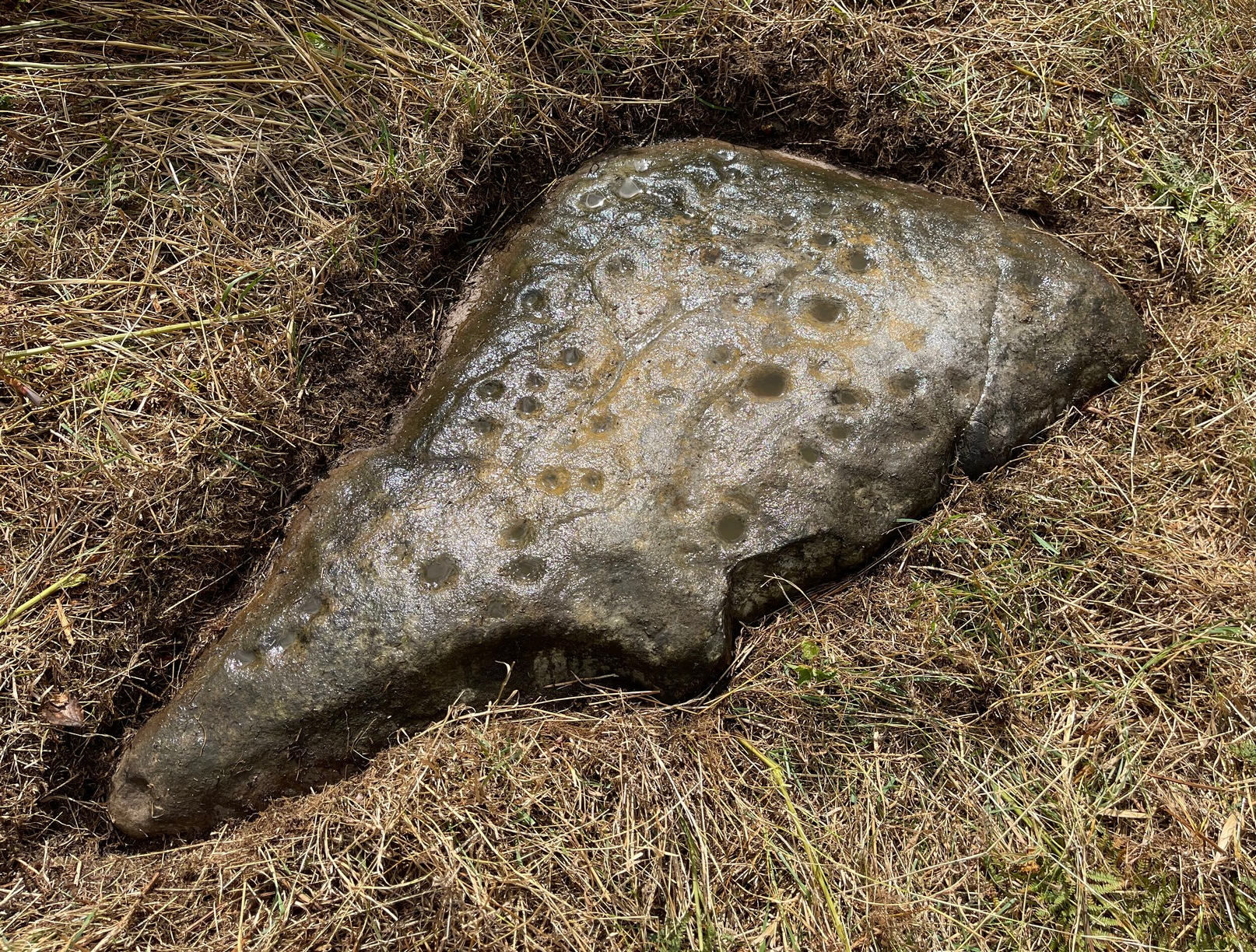
From Baildon go up onto the moor, turning left to go round Baildon Hill and onto Eldwick, stopping at the car park at the top of the brow where the Acrehowe circle once stood. Cross the road and walk along past carving 184, making sure you keep right sticking to the footpath that runs along the edge of the slope (not onto the flats & up to Baildon Hill itself). There are several carvings along here, but this one’s on the right-side of the widening path, another 300 yards past carving 184. Keep your eyes peeled – y’ can’t really miss it!
Archaeology & History
Carving 173, looking S
In my 1982 notebook I described this as “a very well-preserved cup-and-ring stone, with two cup-and-rings and seven other cup-marks. There seems to be faint remains of other lines carved by some of the cups.” And the description is as apt today as it was back then – though neither of the surrounding ‘rings’ are complete. However, as the photos here indicate, adjacent to the main cup-and-ring near the centre of the stone another incomplete cup-and-ring is evident, emerging from the natural crack that runs across it. In the subsequent surveys of Hedges (1986) and Boughey & Vickerman (2003) they somehow only saw one cup-and-ring on this rock. Easily done I suppose! In certain light there’s what may have been an attempted second surrounding ring starting on one of the cups…but I’ll leave that for a later date…
CR-173 (after Hedges)Slippery when wet!
There may also have been intent to carve another ring around one of the other cups on the northern half of the stone. This possible fourth ring and its position on the stone potentiates solar symbolism (not summat I’m keen on, tbh), which fits into the position and nature of several other cup-and-rings in this region and which I’ll expand on and highlight a little later on. It is important to remember that this petroglyph and its nearby relatives were once accompanied by a series of tumuli, or prehistoric burial mounds: a feature that is not uncommon in this part of the world. Well worth having a look at!
References:
Bennett, Paul, Megalithic Ramblings between Ilkley and Baildon, unpublished: Shipley 1982.
Boughey, Keith & Vickerman, E.A., Prehistoric Rock Art of the West Riding, WYAS: Wakefield 2003.
Hedges, John (ed.), The Carved Rocks on Rombalds Moor, WYMCC: Wakefield 1986.
Morris, Ronald W.B., “The Prehistoric Rock Art of Great Britain: A Survey of All Sites Bearing Motifs more Complex than Simple Cup-marks,” in Proceedings of the Prehistoric Society, volume 55, 1989.
From Baildon, take the road up onto the moors, turning left to go round Baildon Hill, then park-up at the small car-park on the brow of the hill at the edge of the golf course. Cross the road and take the well-trod footpath diagonally right, heading onto Baildon Moor. Walk along here for 300 yards and notice the large stone just to your right. You can’t really miss it!
Archaeology & History
Listed without real comment in several surveys, this large sloping rock that looks over the north and western landscapes of Rombald’s Moor and beyond, has several simple cup-markings on its surface, one with a faded ring around it. In more recent centuries, someone began to add their own etching onto the stone but, thankfully, stopped before defacing the ancient markings. I noted this carving in one of my early notebooks, saying only that it “lacked the central design found in others from this region,” being little more than a (seemingly) disorganized array of several marks.
Hedges 1986 drawingCups & faded ring
A greater number of other carved stones scatter the grassy flatlands west and south of here, some of which are found in association with prehistoric cairns and lines of walling; but no such immediate relationship is apparent with this particular stone.
References:
Bennett, Paul, Of Cups and Rings and Things, unpublished: Shipley 1981.
Bennett, Paul, Megalithic Ramblings between Ilkley and Baildon, unpublished: Shipley 1982.
Boughey, Keith & Vickerman, E.A., Prehistoric Rock Art of the West Riding, WYAS: Wakefield 2003.
Hedges, John (ed.), The Carved Rocks on Rombalds Moor, WYMCC: Wakefield 1986.
Morris, Ronald W.B., “The Prehistoric Rock Art of Great Britain: A Survey of All Sites Bearing Motifs more Complex than Simple Cup-marks,” in Proceedings of the Prehistoric Society, volume 55, 1989.
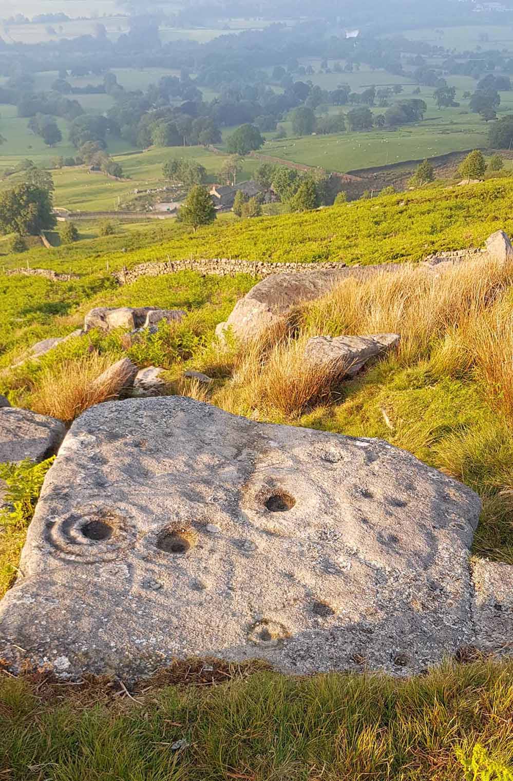
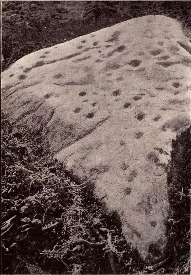
Take the road up alongside and past Shipley Glen, taking the turn to go to Crook Farm caravan site. Go right to the very end of the car-park, then walk up the footpath through the trees on your left. Keep going uphill about 100 yards by the field-wall until the land begins to level out – and shortly before the first gate into the field (on your right) keep your eyes peeled for the triangular stone in the ground, barely 10 yards away from the walling. Alternatively, from the entrance into the Dobrudden caravan park walk to the far-end of the level area in front of the little cafe and walk along the footpath that crosses the grassland to the walling nearly 300 yards away (south). Follow the wall down below the gate and zigzag about. You’re damn close!
Archaeology & History
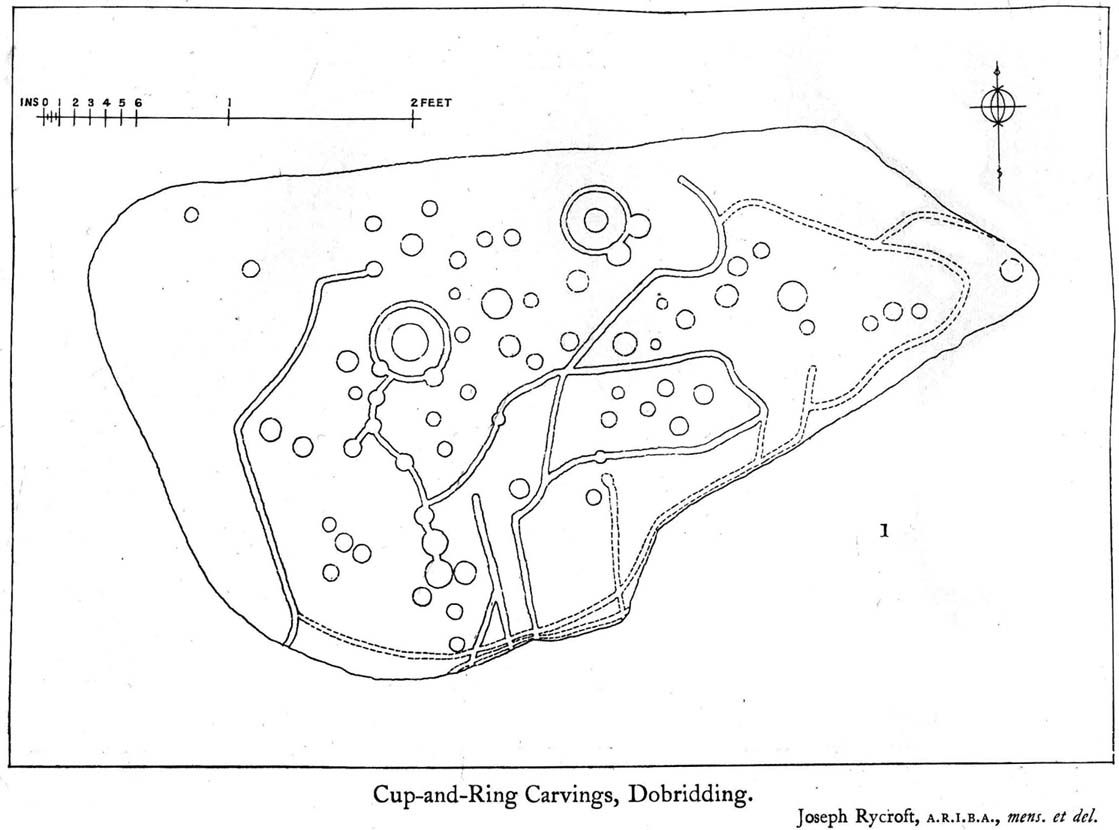
Crook Farm north carving
For some reason this has always been one of my favourite cup-and-ring stones on Baildon Moor and it’s well worth checking out if you visit the area! It was rediscovered by the Bradford historian W.E. Preston, who photographed the carving around 1912. Shortly afterwards he took fellow historians Joseph Rycroft and W. Paley Baildon to see this (and others he’d located) and subsequently both a drawing and Mr Preston’s photo of the site was included in Mr Baildon’s (1913) magnum opus the following year.
As you can see from the relative photos—with literally 100 years between them—erosion hasn’t taken too much toll and this neolithic or Bronze Age carving remains in very good condition.
Rycroft’s early drawingPreston’s 1912 photo
Covered with upwards of fifty cup-markings, there are also two cup-and-rings and numerous carved lines meandering around and enclosing some of the many cups. One cup-mark was cut into the narrow end or ‘nose’ of the stone.
It’s a fascinating design, with another ‘Cassiopeia’ cluster of cups in one section, beloved of archaeoastronomers who explore these stones. Mr Rycroft’s drawing of the design (left) is perhaps the best one, to date.
Along this same ridge there are remains of other prehistoric sites, more cup-and-rings, remains of prehistoric walling and what may be a small cairn circle (to be described later).
References:
Baildon, W. Paley, Baildon and the Baildons – parts 1-15, Adelphi: London 1913-1926.
Bennett, Paul, Of Cups and Rings and Things, unpublished: Shipley 1981.
Bennett, Paul, Megalithic Ramblings between Ilkley and Baildon, unpublished: Shipley 1982.