Found to the southwest edge of Hildenley Wood, on the west side of the track between Malton and Coneythorpe Road, the waters from the initial source of the well runs into a small well-house, and from here Nature’s blood runs into a small pool. The first reference I’ve found of the place is in T. Whellan’s (1859) huge survey, where he said,
“There is on the verge of Easthorpe Wood a copious and pure spring of water known by the name of Holy Well, which tradition affirms to have been much resorted to by the monks of Kirkham Abbey…and even to this day healing virtues are attributed to it.”
In Whelan & Taylor’s (1989) survey of the site, they noted the existence of another well a short distance away, but did “not know of any sacred associations connected with this site, but its proximity to the Holy Well may suggest the recognition of this area as a sacred spot.”
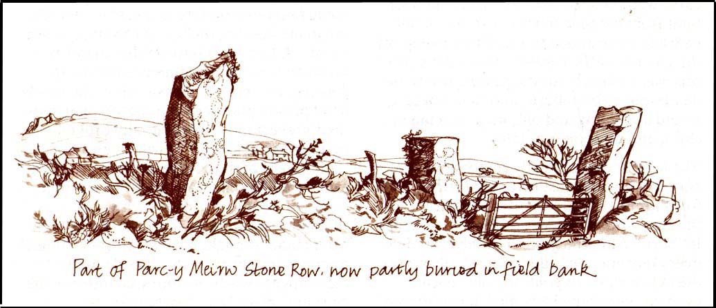
This is an impressive and well-known megalithic stone row, found just 4-5 miles inland from the coastal town of Fishguard. The drawing here is used courtesy of Elizabeth Haines, landscape artist, and gives a fine representation of the site as I’m sure you’d agree! Consisting of at least eight standing stones — four still upright and four laid down — aligning northwest to southeast, the tallest stone stands at the southerly end measuring 11 feet tall. The stone row is found in a region rich in prehistoric remains. Aubrey Burl (1993) said of the place:
“Four of the eight stones in this unusual row still stand, trapped in a field-wall, tow of them now gateposts. Thom suggested that the line, 131ft (40m) long, was laid out downhill towards the WNW and the minor northern moonset just north of Mount Leinster ninety-one miles away across the Irish Sea.”
Quite a distance! And perhaps because of this, Burl thought that the nature of this line of stones was more archaeological than astronomical, with its focal point being more likely up the slope to the ESE instead.
Folklore
There was once an adjacent chambered tomb here which, when it was “destroyed for a house in 1844 brought the owner no luck” (Thom, Thom & Burl 1990) – which is damn good to hear! There was a piece of folklore mentioned by E.L. Barnwell (1868) and other writers that the fields here marked the fall of three Welsh princes in the Battle of Mynydd Carn in 1084. In Roger Worsley’s (1988) fine tour of Pembrokeshire’s historical sites, he tells how these megaliths in the “field of the dead” are also haunted, saying:
“A local tale tells of Ladi Wen, a ghostly White Lady wandering about the fields at night, and who will kill anyone who ventures near; it was enough to keep villagers away from the site well into this century, though the stone row is over five thousand years old.”
References:
Barber, Chris & Williams, John Godfrey, The Ancient Stones of Wales, Blorenge: Abergavenny 1989.
Barnwell, E.L., “Alignments in Wales,” in Archaeologia Cambrensis, volume 14, 1868.
Burl, Aubrey, From Carnac to Callanish, Yale University Press 1993.
Thom, Alexander, Thom, A.S. & Burl, Aubrey, Stone Rows and Standing Stones, BAR 560: Oxford 1990.
Worsley, Roger, The Pembrokeshire Explorer, CCP: Abercastle 1988.
This old holy well, hidden behind a surround of shrubs a mile or so north of Winwick, is in someone’s field just off the roadside. The chap who lives there, Frank, is a very amiable chap, so please knock his door and ask to see it before plodding behind his buildings. He may know a thing or two about it that’s not written in the guide-books!
Folklore
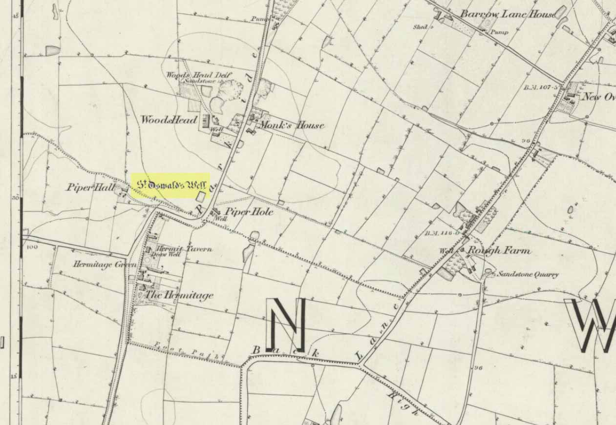
St Oswalds Well on 1849 map
In the old Hundred of West Derby in what was once Lancashire (them there political types shifting boundaries for their own greasy deeds) still remains to this day the trickling remains of old Oswald’s sacred spring, close to the Hermitage Green, which is thought to have gained its named after just such a hermit living hereby and who, no doubt, frequented or looked after this holy well for both refreshment and spiritual sustenance.
Named after the once-pagan King of Northumbria — who was later patronized and regressed to the cultus of a saint — the well was said to be close to an ancient palace, which was later moved when the King regressed into christendom. The well itself was said to have been created through the tradition that the very Earth here possessed healing powers so renowned that people came from many miles to collect and take it for its sacred and medicinal qualities. In Henry Taylor’s (1906) magnum opus he told:
“A writer in The Antiquary twenty years ago (vol.3, p.261) described it as having a very modest appearance for so famous a spot, looking merely like a hole into the hillside. The writer goes on to say, “Passing through a small cottage garden, a well-trodden path leads to the well, which is merely a fosse, as described by Bede, and, situated as it is at the bottom of a tolerable declivity, derives its supply from the drainage of the upper ground rather than from any spring. The water is not very bright, but the well is substantially walled inside, and two or three deeply worn steps lead to the water.”
“The Venerable Bede gives an account of numerous miracles which took place at St. Oswald’s Well. He says: “After which period Oswald was killed in a great battle by the same Pagan nation and Pagan King of the Mercians who had slain his predecessor Edwin at a place called in the English tongue Maserfield in the 38th year of his age on the 5th day of the month of August. How great his faith was towards God, and how remarkable his devotion, has been made evident by miracles since his death; for in the place where he was killed by the pagans…infirm men and cattle are healed to this day. Whereupon many took up the very dust of the place where his body fell, and putting it into water did much good with it to their friends who were sick. This custom came so much into use, that the earth being carried away by degrees, there remained a hole as deep as the height of a man… Many miracles are said to have been wrought in that place, or with the earth carried from thence; but we have thought it sufficient to mention two, which we heard from our ancestors.””
References:
Taylor, Henry, The Ancient Crosses and Holy Wells of Lancashire, Sherratt & Hughes: Manchester 1906.
Recently a good turn of fortune has brought about the discovery of a number of previously unpublished manuscripts detailing a number of prehistoric remains, holy wells and old stone crosses that existed in and around east Lancashire, Burnley, Cliviger and Todmorden. Many of these papers are the all-but-lost writings of historian and antiquarian Clifford Byrne of Nelson. Having never previously been published, I think his works deserve greater attention and so I’ll be slowly, gradually, sticking them on the internet and give them the wider audience they deserve. Not all of his notions are necessarily accurate, but the extent of this mans local history knowledge on the sites he describes in his essays is considerable. The following is his short essay—with minimal editing—on this all-but-forgotten site:
“Shorey Well, or rather its stone housing, was originally situated in the bank of the River Brun slightly upstream of the parish church at Burnley, at a spot now within the grounds of the Burnley Technical College. From within the stone housing issued the spring proper, which then ran down the brookside into the river.
“From time immemorial until the late 19th century, Shorey Well supplied part of the town of Burnley with its drinking water, then the water was impounded into a pipe and the stone housing removed to a place of safety. This housing was thought by our Victorian forebears to have sufficient merit to save it for posterity, and this act I feel implies more than a certain interest in the old stones which I suggest the movers of the Well probably did not themselves fully understand, and it is with this concept that I hope now to deal.
“The present location of the stones of Shorey Well is in the little triangle of greenery outside Prestige Ltd at Burnley. This spot is bounded on Colne Road and Bank Parade. Behind it squats the base of Burnley Market Cross and the remains of the stocks with — a little to one side — the shaft of the Godley Lane Cross standing out of a huge square pedestal.
“An old map in Burnley Library shows Shorey Well in situ with a well-defined row of stepping stones crossing the river directly in front. This line of stones went to the site of a still existing property called Shorey Fold — a spot that was probably once called St. Audry’s Fold, as we shall see.
“Godly Lane Cross is an Anglo-Saxon monolith with a somewhat damaged head. This damage was probably done around the time of the Reformation in the 16th century, when the anti-Catholic movement was at its height. The name Godly implies a god-like, or god-inspired or religious tone to the area, and Godly Lane — now Ormerod Road — certainly lived up to its name for there stood the parish church, the Cross itself, the Market Cross, another cross dedicated to a priest in the 16th century and now standing in the rear of Townley Hall, “Foldy’s Cross”, with nearby Shorey Well.
“There is a strong possibility that the Godly Lane Cross — sometimes called the Paulinus Cross — was a preaching cross and that it also marked the way to Shorey Well which issued close by.
“No one to the knowledge of the writer has attempted to explain the name Shorey Well. I therefore suggest that the Well was used for baptism and that it was dedicated to St. Audry. The parish church was erected prior to the Reformation and thus certainly had its Holy Well close by, from which the priests obtained water for baptism and blessings, etc. Because of its propitious nature and close proximity to the church, such a Well would almost certainly have been the Shorey Spring.
“A study of the name may be fruitful. Holy wells are almost always dedicated to some christian saint. However, many of them have undergone a slight change in name over the centuries, so that it is not always easy to recognise the dedication. For instance, the Ransible Well near Colne was dedicated to Our Lady of Ransome, or the Virgin Mary; Stellern Well was dedicated to St. Helen; Maudlin Well near Lathom House was dedicated to St. Mary Magdalen; Pewter Well at Sabden would be St. Peter’s Well; Mattus Well at Sawley Abbey is St. Matthew’s Well; whilst Cooks Well at Colne was surely dedicated to St. Luke the physician. Thus Shorey Well in the same context is almost certainly dedicated to St. Audry, and this saint we find was one of the most revered saints in Anglo-Saxon times, from which date the Godly Lane Cross stems.
“The close proximity of church, well and cross surely imply that one showed the way to the other, and that all three were at one period of time one unit: the Cross being a preaching place prior to the Church, and the holy well being a place of baptism and healing.”
Mr Byrne’s etymological reasoning may or may not be right here (Mr Ekwall says nothing in his place-name survey and I’m unaware of local dialect analysis that may account for the word), but the description of this and numerous other lost and forgotten sites in his various papers is hugely worthwhile and is a source of considerable study for us over the coming months.
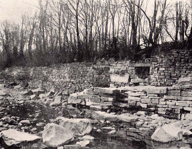
Ormerod (1906) described the site in his tome, but even in his day this once great well with its “abundance of sparkling water” was “disused and neglected.” (the image above is taken from his work) However, as if to dispel any notions of an earlier saintly dedication, we find that in Walter Bennett’s (1948) magnum opus, the site had a more prosaic title in bygone years:
“Whittaker’s Well, or Shorey Well as it was later known, was situated on the riverbank opposite Dawson Square, and was apparently the only public source of drinking water for the inhabitants of tge Top o’ th’ Town.”
References:
Bennett, Walter, The History of Burnley – volume 3, Burnley Corporation 1948.
Byrne, Clifford H., “A Short Study of Shorey Well, Burnley,” unpublished manuscript 1976.
The Nanny Howe burial mound was one of a group of at least three tumuli that could be found on what is now the wooded hilltop of Coate Moor, a mile east of Great Ayton. Large and conspicuous in previous centuries, the site was described briefly in Elgee’s (1933) archaeological survey as being in association with a prehistoric settlement, which itself appears to have long since succumbed to forestation. An essay on the state of this apparent Bronze Age burial mound was written by Mr Hayes (1966), who told us:
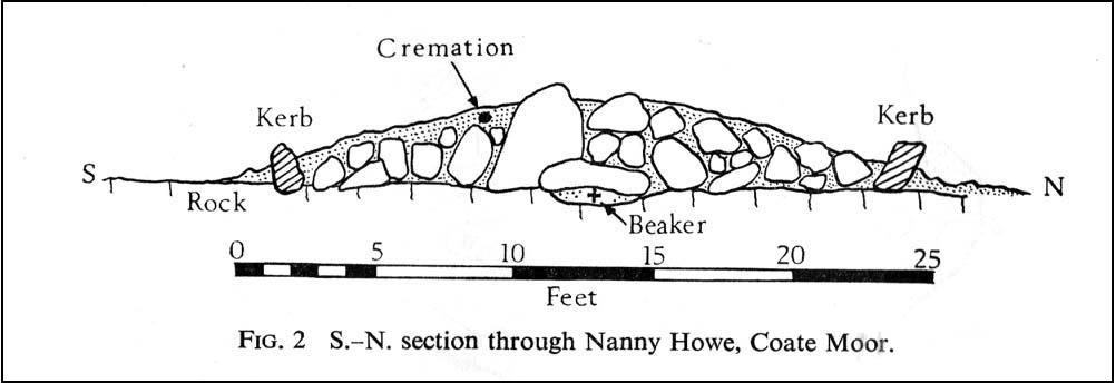
“The kerb of the barrow was exposed and noticed by J.N Grayson whilst excavations were in progress on Great Ayton Moor. S.V. Morris, A.N. Pacitto and the writer examined the site. It was a cairn of about 30ft diameter and 3ft high in the centre, with a strong kerb of stones set on edge of 25ft diameter. Its construction, of massive stones was similar to the chambered cairn on Great Ayton Moor, one mile to the north, and very like the food vessel-urn tumulus on Danby Rigg which also had a kerb of the same diameter…
“When the heather and turf were removed on the south-east side of Nanny Howe, a mass of cremated bones with part of the rim and side of a typical Iron Age ‘B’ jar were found only 6-9in under the turf. This was clearly a secondary burial long after the cairn was built. The sherd may have been a token offering, but more probably the remainder of the pot so near the surface of the mound had been eroded. No other secondary burial was found, although almost all the cairn was removed.
“Under large boulders in the central area was a shallow pit or depression… Only minute specks of charcoal and some small burnt stones distinguished its filling from natural sand. It was about 3ft in diameter and not more than 9in deep… In it were the broken sherds, more than 80 in number, of a beaker… There were no signs of bones or cremation, although presumably a contracted skeleton had accompanied the beaker. In the acid sand all bones would perish quickly… No other relics were found in the cairn.”
To which Mr Hayes and his team concluded the Nanny Howe tomb was an example of a typical “beaker burial” as they used to like calling them, set within a ring of stones over which the cairn was piled; and long after this, seemingly the Iron Age, a secondary cremation was inserted.
Folklore
Folklore ascribed the entire settlement here to have heathen origins, with Nanny Howe also standing out with folklore of its own. As Mr & Mrs Elgee (1933) wrote:
“Half a mile east of Captain Cook’s monument…on Easby Moor is the Devil’s Court, where, according to tradition, witches congregated under the presidency of their lord and master. We therefore examined the Court and found what we expected, a typical moorland Bronze Age settlement site, with stone-walled enclosures, shallow pits, flint implements and many barrows, one of which is named Nanny Howe, after a famous witch, it is said, who also frequented Nanny Nook, a right-angled bend in a stone wall near Wayworth Farm, Commondale, marking another settlement site.”
Another tale of this legendary witch was narrated by folklorist and historian Richard Blakeborough in one of his many tomes, where he told:
“Again, old people of Great Ayton still aver that on a certain night a once noted witch, Nanny Howe, may be seen riding astride on a broomstick over Howe Wood just at midnight. This witch, so mounted, is said once to have chased the devil for miles — on this occasion the two must have fallen out ; perhaps at that time honest folk got their due. Howe Wood is near Kildale.”
Whatever the source of such stories, the respective archaeologists of Elgee and Hayes wondered if they derived from some pre-christian rites and events. Hayes asked:
“Was the person interred in Nanny Howe a famous witch? Or were the witch and the devil legends connected with the site faint echoes of ceremonials and rites held here?”
It would seem likely that the local peasant communities hereby were, thankfully, not inflicted with the empty spirituality of the christian cult when it tried taming the souls of the villagers living in and around here. The folklore would seem to reflect simple peasant gatherings and celebrations, frowned upon by those weird clergy-folk, no doubt striving to get the local children into their more demonic pastimes…
References:
Blakeborough, Richard, Wit, Character, Folklore and Customs of the North Riding of Yorkshire, W. Rapp: Saltburn 1911.
Elgee, Frank & Harriet, The Archaeology of Yorkshire, 1933.
Gutch, Mrs E., Examples of Printed Folklore Concerning the North Riding of Yorkshire, David Nutt: London 1899.
Hayes, R.H., “Nanny Howe, Coate Moor, Cleveland,” in Yorkshire Archaeological Journal, part 164, 1966.
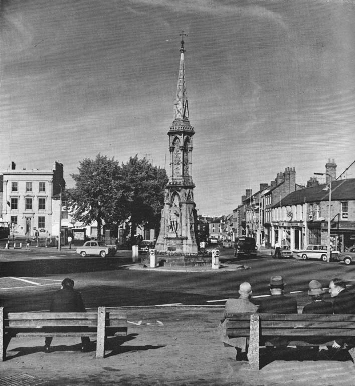
The original stone monolith that stood here has long since been destroyed (by christians arguing amongst themselves) and the ornate edifice that we see today was erected in 1859 to commemorate the marriage of Queen Victoria’s eldest daughter, Victoria Adelaide Mary Louisa, to Friedrich Wilhelm of Prussia. Standing more than 52 feet tall, it is of a neo-Gothic design and is one of the tallest crosses in the country. Originally there were going to be six carved statues cut into the niches of the cross, but this was later reduced to three.
First mentioned in place-name records from 1478, the original stone cross was itself very prominent, rising some 20 feet tall and sitting upon a square base of eight steps. It was described by John Leland in his Itinerary when he visited the town sometime between 1535 and 1545, who said:
“At the west part of the street…is a large area, having a goodly cross with many degrees (steps) about it. In this area is kept every Thursday a very celebrated market.”
The old cross was also a site where public notices and proclamations were dispensed to local people and seems to have been an old meeting place. Whether it had a prehistoric predecessor isn’t known.
Folklore
The nursery rhyme we’ve all recited when we were kids and growing-up, has much of its origins around this ornate edifice and in the 20th century was thought to have its origins in pre-christian practices hereby, but this is questionable. The rhyme, to those who don’t know it, goes:
Ride a cock-horse to Banbury Cross,
To see a fine lady upon a white horse,
With rings on her fingers and bells on her toes,
She shall have music wherever she goes.
As Kirsten Ayles (1973) told:
“This rhyme was first recorded in 1784, but it probably originated much earlier. The Banbury Cross mentioned was destroyed at the turn of the 16th century by the Puritan inhabitants of Banbury. It has been suggested that “bells on her toes” points to the fifteenth century, when a bell was worn on the long tapering shoe of each shoe. It has (also) been thought that the “fine lady” was Queen Elizabeth I, or Lady Godiva.”
Another option identifying the “fine lady” in the rhyme is perhaps a member of the Fiennes family, ancestors of Lord Saye and Sele who owns nearby Broughton Castle.
References:
Ayles, Kirsten, “A Short History of Nursery Rhymes,” in This England, 6:3, Autumn 1973.
Gelling, Margaret, The Place-Names of Oxfordshire (2 volumes), Cambridge University Press 1954.
Vallance, Aymer, Old Crosses and Lychgates, Batsford: London 1920.
Acknowledgements:
To Ronald Goodearl, for use of his 1973 photograph of the Banbury Cross.
The isle of Boreray is four miles northeast of Hirta and here once lived, according to legend, a christian hermit. However in the reverend Kenneth Macaulay History of St. Kilda (1764), he told us that the character was actually a druid. Take your pick! The druid lived at Stallir House, adjacent to which, said Macaulay, was
“a large circle of huge stones fixed perpendicularly in the ground, at equal distances from one and other, with one more remarkable regular in the centre which is flat in the top and one would think sacred in a more eminent degree.”
In a later article by F.L.W. Thomas (1867) he also mentioned this ‘stone circle’, though indicated its decline. Additional information on this little known stone is sparse due to its somewhat remote position on one of the uninhabited isles of St. Kilda. I wouldn’t mind spending a month or two there, roughing it, to see what’s what!
References:
Macaulay, Kenneth, The History of St. Kilda. Containing a Description of This Remarkable Island; the Manners and Customs of the Inhabitants; the Religious and Pagan Antiquities There Found, T. Becket: London 1764.
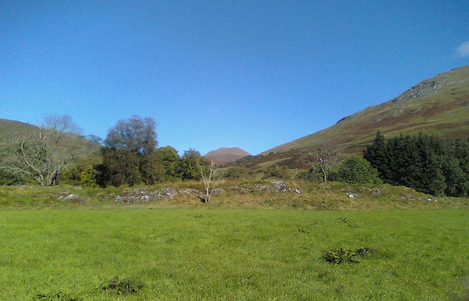
From the north side of Killin, take the minor road next to the Bridge of Lochay Hotel at Killin, past the hydroelectric station, through the wooded section until the fields open out again. The first gorgeous old house you come to is on the right-hand side of the road. Stop here! (I could really do with living here misself – tis a truly superb place!) You can ask the lady at the house where the carvings are and she’s very happy to point them out – they’re on the rocky crag near the bottom-end of the field on the other side of the road.
Archaeology & History
R.W.B. Morris sketch of the main carvings
What a brilliant setting and clump of carvings we have here! As you get to the rocky hillock in the field, you see that there are numerous rocks visible along the ridge, a number of which have carvings on them – some with just cups, but most possess a number of cup-and-rings. It’s an excellent spot! Depending on the time of year when you come here will determine whether or not you get a better look at the carvings or not. I’d recommended April and May as the best time, as the vegetation is at its lowest then. Visiting the site near the end of summer doesn’t give you as good a view — but even then, if you like your rock art, you’ll still love it! The rocks here are mainly quartzite schist, with a number of the surfaces being almost pure quartz. Intriguingly, none of the pure quartz sections appear to have been carved on.
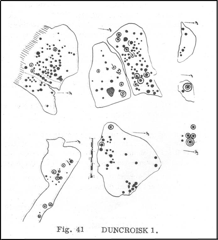
The carvings here were first mentioned in an article by D. Haggart (1895), who described them as “a very remarkable set of incised rock sculptures…discovered lately in this neighbourhood by Mr John McNaughton.” And remarkable they are indeed! In Ronald Morris’ (1981) survey of this site — which he labelled Duncroisk 1 — he counted eight separate rock surfaces that had been carved, marking them as carvings a-h, but there are at least eleven of them here; and in all honesty, if we could strip the surface of the hill of its vegetation, we’d probably find a few more hidden away!
Cup-marked stone
As you’ve walked across the field from the road, past the first unrecorded cup-marked stone near the start of the rocky rise, we reach Mr Morris’s ‘stone A’ near the easternmost end of the ridge, which is just a small slab of stone with “at least 6 cup-marks” on its surface. It’s easily missed in poor light, so watch out. However, if you reach ‘stone b’ (described below), just walk back ten steps and you’ll see it.
Carved Stone B
Ten yards west is ‘Stone B’, seemingly split into two sections, whereupon we find “a cup-and-two-rings and at least 12 cups-and-one-ring, up to 19cm in diameter – some rings gapped, others not, some with and some without a radial groove from the cup, and some with a “runner” or cup in a ring. There are also at least 58 cups” on this section of rock. ‘Stone C’ can also be missed, this time due to its size and the fact that the larger cup-marked surfaces are ahead of you. But assuming you don’t miss it, this carving consists of “a well-preserved cup-and-two-complete-rings 25cm in diameter, and a cup.”
Carved Stone D
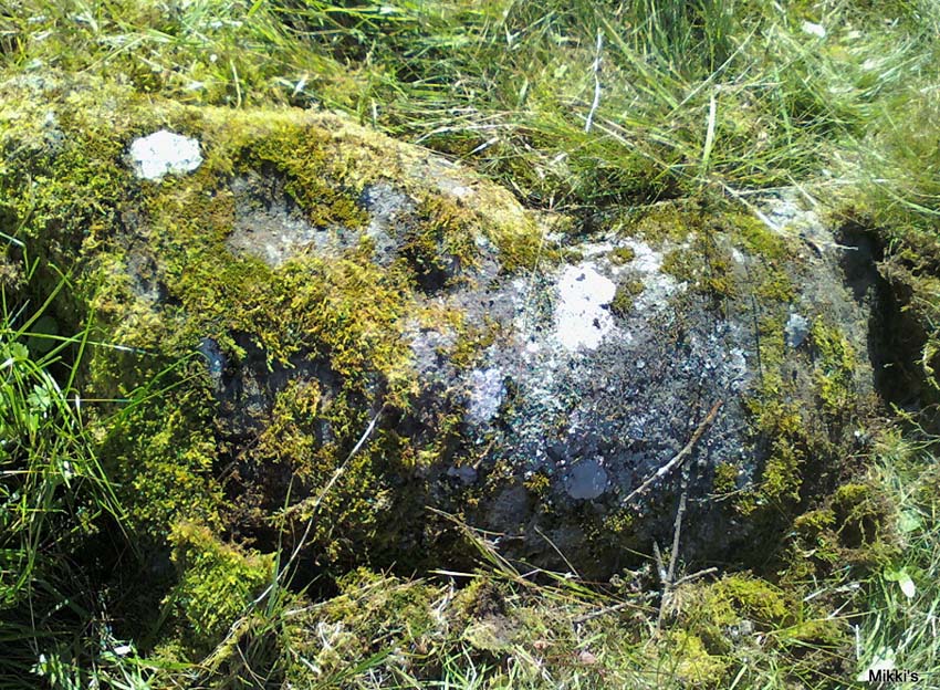
‘Stone D’ is just next to ‘stone C’, but with rather more ornate designs etched upon it. This is one of the more archetypal petroglyph designs that are found in the photo-guides and textbooks. Morris (1981) told that it consisted “of a cup-and-two-complete-rings and 2 cups-and-one-complete-ring up to 20cm in diameter, also a cup-and-one-complete-ring and 2 cups.” The photo here shows it pretty clearly.
Carved Stone ECurious ‘bowl’, top-centre
‘Stone E’ is the next one along, just a foot or two away and Mr Morris (1981) told that the carving consists of “2 cups-and-one-ring up to 13cm in diameters, 1 complete, the others gapped, joined by groove to a cup, and at least 33 cups (C.G. Cash counted 42 in 1911).” Most of the carved elements on this rock are around the edges of the stone. A very large faded circular depression, man-made, is also visible on this section of the petroglyph (above left), suggestive of lunar symbolism.
Carved Stone F
‘Stone F’ is less than 10 yards further west and has the greatest number of cup-markings of the entire group here, as Morris described: “3 cups-and-one-complete-ring up to 9cm in diameter, and at least 80 cups, a few of which are widely scattered over a big area sloping steeply further south, beyond the attached diagram.” It’s perhaps the most notable of the carved rocks along the ridge here — not by virtue of its design, more its geological physique than anything else.
Carved stone G
‘Stone G’ is next along and has a curious look about it, suggestive of more modern times. At first sight it doesn’t seem to have quite the magnitude that Morris’ description affords it, but on closer inspection by rolling some of the covering turf back away from the rock, you can see what he meant. This stone has “10 cups-and-one-complete-ring, up to 10cm diameter…and also 15 cups.” One of the cup-and-rings on this section was found by Morris to have been “the smallest so far recorded by the author in Scotland.”
Then we reach ‘stone H’ at the eastern end of the carved ridge, consisting of simply 3 cup-markings. One of them has a faint arc pecked around it. Further along the rock, a complete cup-and-ring is visible close to the edge.
This entire line of petroglyphs is a fine place in a fine setting, perfect for meditative practices! Other carvings can be found close by: Duncroisk 3 is a coupla hundred yards east across the field just over the fence by the riverside; and Duncroisk 2 is on the other side of the fence down towards the River Lochay on the same side of the adjacent burn less than 100 yards away (though this is trickier to reach). Other prehistoric sites can be found not too far away…
Folklore
Local people tell of having seen curious lights flitting along the edges of the field, river Lochay and roadside close to the carved rocks hereby.
Cross (destroyed): OS Grid Reference – c. SD 881 353
Archaeology & History
Not included in the magnum opus of Henry Taylor (1906), the exact position of this long lost site remains unknown, as even the investigative abilities of Clifford Byrne couldn’t track it down! It was erected in a region full of pre-christian remains and (at the time) living remnants of heathen folklore and practices between Worsthorne and Nelson. Mr Byrne (1974) described his search for the place, saying:
“This cross is of ancient origin and no part of it now remains as far as can be ascertained by investigation, although the memory of it certainly remains, for an elderly gentleman living in the cottages of Holt Hill, Briercliffe, said instantly on being asked about he cross that he had often heard it referred to by older people when he was a boy, although he could not say exactly where in the hamlet the monolith had stood. We are told that the cross is mentioned in a document in the year 1313 when Robert Briercliffe granted away the Sene intacks in the Holt Hill as it lay by Annot Cross on the south side. This implies that it stood on the south side of the road (between) Thursden and Haggate, which is an old road from Burnley to Halifax…”
This would give a rough grid reference for its position around SD 881 353, but nothing appears to be there. However, Byrne told of another intriguing bitta folklore a short distance away which may have had some relevance to the positioning of the cross.
“Down the road to Lane Bottoms, behind some bungalows, is a stone shaft in a depression in a meadow which we are told is an ancient standing stone. Whether this is so is not easy to ascertain for the stone has apparently been used as a gatepost at some time, and further gives indication of having been utilised as a cattle rubbing post.”
Below here we find the old place-name ‘Burwains,’ which clearly indicate a site of a prehistoric burial, though nothing remains of such a place — officially at least. Perhaps a couple of ventures in and around this area need to be done! One final note that Byrne made related to the title of this lost cross, saying:
“The name “Annot” may be of Saxon origin, for the Saxon word annet means solitude, and this would have certainly fitted the area in ages past.”
References:
Byrne, Clifford, A Survey of the Ancient Wayside Crosses in North-East Lancashire, unpublished report 1974.
Taylor, Henry, The Ancient Crosses and Holy Wells of Lancashire, Sherratt & Hughes: Manchester 1906.
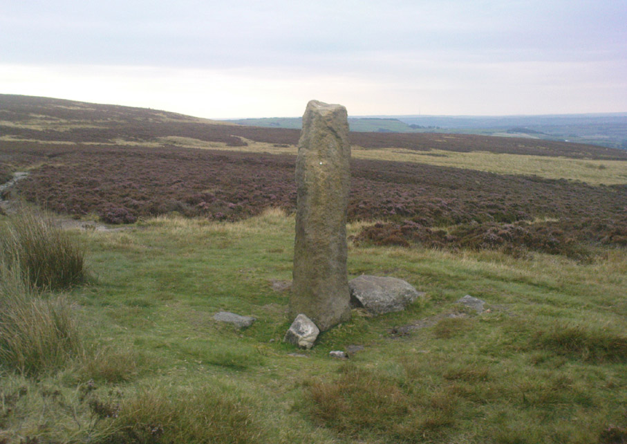
From the village of Midgley, high above the A646 Halifax-to-Todmorden road, travel west along the moorland road until you reach the sharp-ish bend in the road, with steep wooded waterfall to your left and the track up to the disused quarry of Foster Clough. Go up the Foster Clough track for 100 yards and, when you reach the gate in front of you, go over it but follow the line of the straight walling uphill by the stream-side (instead of following the path up the quarries) all the way to the top. Here you’ll see the boundary stone of Churn Milk Joan.
Archaeology & History
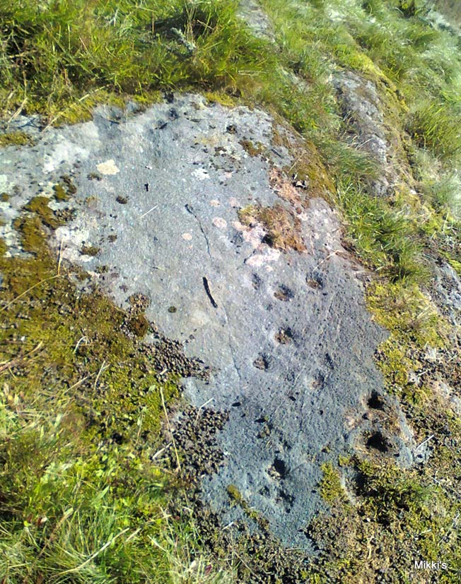
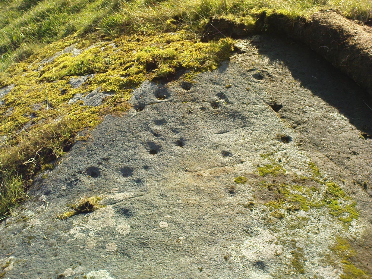
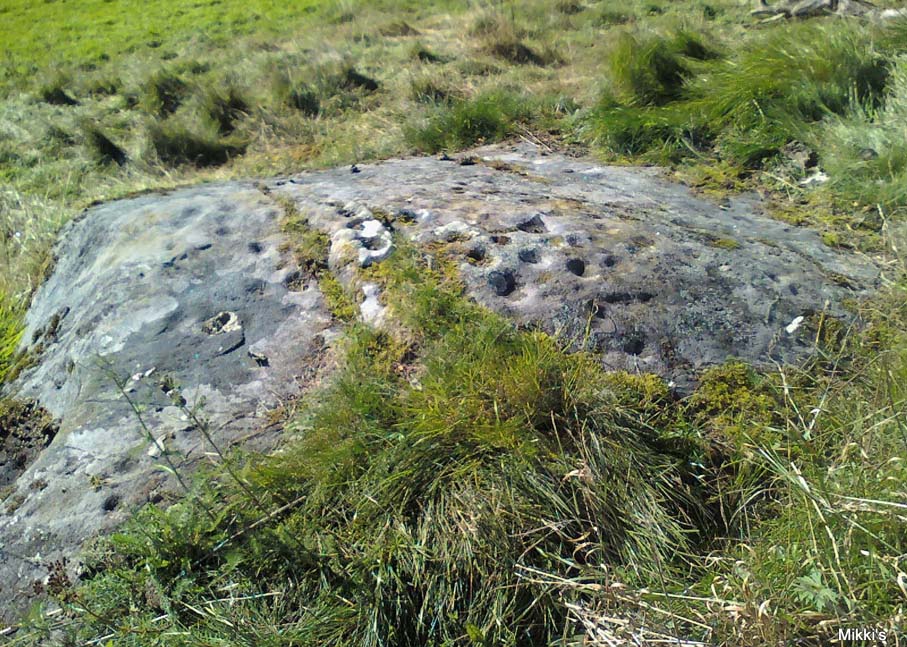
The present large standing stone you see before you isn’t prehistoric. However, the small broken piece on the ground by its side may have been its prehistoric predecessor; and there is certainly something of an archaic nature here — albeit a contentious one — as we find old cup-markings cut into its eastern face.
Two ‘cup-marks’ on eastern face
The upright is roughly squared and faces the cardinal points. It was described in Mr Heginbottom’s (1977) unpublished survey on Calderdale rock art, where he described there being a few cup-markings inscribed on its east- and south-facing edges, some of which may be prehistoric — though they would obviously have had to have been carved upon the upright stone when it still lay earth-fast. However, we must posit the the notion (unless some of you have better ideas) that the tradition of etching cup-marks onto rocks was still occurring in this part of Yorkshire until the late Middle Ages, as this stone was, as we know from boundary records, only placed upright to mark the meeting of the three boundaries of Wadsworth, Hebden Royd and Sowerby.
Churn Milk Joan’s other name, Saville’s Low, originates from the great Saville family who owned great tracts of land across the region in the fourteenth century, possibly when the Churn Milk Joan we see today was created. The word “lowe” may derive from the old word meaning, “moot or gathering place,” which this great stone probably served as due to its siting at the junction of the three townships.*
Folklore
In modern times the stone has become a focus for a number of local pagans and New Agers who visit and ‘use’ the site in their respective ways at certain times of the day, albeit estranged (ego-bound) from the original mythic nature of the site.
The name of the stone comes from an old legend about a milk-maid named Joan who, whilst carrying milk across the moors between Luddenden and Pecket Well, got caught in a blizzard and froze to death. When her body was found many days later, the stone we see here today was erected to commemorate the spot where she died. Although such a scenario is quite likely on these hills, as Andy Roberts (1992) said,
“Considering the sheer amount of sites with similar legends this explanation is unlikely to be true and we should looker deeper for the meaning behind Churn Milk Joan, to be found in its positioning in the landscape and ourindividual feelings about it.” [see profiles for the Two Lads and the Lad o’ Crow Hill sites)
The monolith’s other title, Churnmilk Peg, is the name given to an old hag who is said to be the guardian of nut thickets. How this female sprite came to find her abode upon these high hills is somewhat of an enigma, but it was first stated as such in an article by Andy Roberts (1989) in “Northern Earth Mysteries” magazine. E.M. Wright (1913) noted this supernatural creature in her work on folk dialect, describing it as a West Yorkshire elemental who, along with another one known as Melsh Dick:
“are wood-demons supposed to protect soft, unripe nuts from being gathered by naughty children, the former being wont to beguile her leisure by smoking a pipe.”
Another legend of the stone tells how it is said to spin round three times on New Year’s Eve when it hears the sound of the midnight bells at St. Michael’s church (St. Michael was a dragon-slayer) at Mytholmroyd in the valley below. Another piece of folklore tells that coins used to be left in a small hollow at the very top of the stone which, according to Haslem (1981), was “a gift to the spirit world, to bring luck” – a common folk motif. It may equally originate from the custom of it as a plague stone. This tradition of leaving coins atop of the stone is still perpetuated by some local folk.
Mr Haslem also made some interesting remarks about the nature of Churn Milk Joan standing as a boundary stone, representing something which stands not just as a physical boundary, but as a boundary point between this and the Other- or spirit world. In folklore, streams and rivers commonly carry this theme. But here on Midgley Moor, as a standing stone at the junction of three boundaries, we may be looking at the place as an omphalos: a centre point from which the manifold worlds unfold. (see Almscliffe Crags, the Ashlar Chair and the Hitching Stone)
The other motif here, of milk and snow [both white], have been speculated to represent power of the sun at midwinter, and geomantically we find the position of the stone in the landscape exemplifying this: it stands midway in the moorland scenery facing south, the direction of solar power, yet is bounded as an equinox marker from east and west. The winter tales it has nestled around it are merely complementary occult augurs of its more wholesome elements at this point in the hills.
There is however, another much more potent element that has not been conveyed about the site and its folklore—and one which has more authenticity and primary animistic quality. Regardless of ‘Joan’ or ‘Peg’ being the elemental preserved in the landscape title, the ‘churning’ in its name and the ‘spinning’ of the stone in myth at the end of one year and the start of the next at New Year, are folk memories of traditional creation myths that speak of the cyclical seasons endlessly perpetuated year after year after year, in what Mircea Eliade (1954) called the ‘myth of the eternal return.’ As season follows season in the folk myths of our ancestors, everything related to the natural world: a world inhabited (as it still is) by feelings and intuitions learned from an endless daily encounter, outdoors, with the streams, hills, gales, snow and fires. Their entire cosmology, as with aboriginal people the world over, saw the cycles of the year as integral parts of their daily lives. Here, at Churn Milk Joan with its central landscape position along an ancient boundary, the churning and turning of the year was commemorated and mythologized year after year after year; with maybe even the Milky Way being part of the ‘milk’ in its title, from which, in the shamanistic worlds that were integral to earlier society, the gods themselves emerged and came down to Earth.
References:
Bennett, Paul, The Old Stones of Elmet, Capall Bann: Milverton 2001.
Eliade, Mircea, The Myth of the Eternal Return, Bollingen 1954.
Haslem, Michael, “Churn Milk Joan: A Boundary Stone on Midgley Moor,” in Wood and Water, 1:8, 1980.
Heginbottom, J.A., “The Prehistoric Rock Art of Upper Calderdale and the Surrounding Area,” Yorkshire Archaeology Society 1977.
Ogden, J.H., “A Moorland Township: Wadsworth in Ancient Times,” Proceedings of the Halifax Antiquarian Society, 1904.
Robert, Andy, “Our Last Meeting,” in NEM 37, 1989.
Robert, Andy, Ghosts and Legends of Yorkshire, Jarrold: Sheffield 1992.
Wright, Elizabeth Mary, Rustic Speech and Folk-Lore, Oxford University Press 1913.
* The great stone at the cente of the Great Skirtful of Stones, Burley Moor, which previously stood at the centre of the Grubstones Circle, was just such a moot stone. Upon it is carved the words “This is Rumble’s Lawe”.