Fairies Chest, Embsay Moor, North Yorkshire

Legendary Rocks:  OS Grid Reference – SD 98696 56105

Also known as:

  1. Fairy’s Chest

Getting Here

Fairies Chest on 1853 map

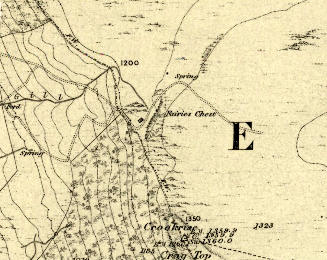
This is an awesome beast! You can either approach it from Nettlehole Ridge ‘stone circle’ as I did, or take the more sensible approach and begin from Embsay village, walking up the path towards Embsay reservoir and onto the moorland heights of Crookrise Crag, 1350 feet above sea level. Worra view! But keep walking a little more, downhill, and it’ll hit you right in the face!

Archaeology & History

Fairy’s Chest, Embsay Moor

Known as an abode of the little people in the 19th century and shown on the earliest Ordnance Survey map of the region, I know of no previous accounts of this giant elongated boulder, forty feet long and nearly the same size as our legendary Hitching Stone that’s nestled below the small cliffs.  The boulder is surrounded by what seems like cairn-material on all sides (though it doesn’t look prehistoric). You’re looking straight west from here, right at the three small paps of Sharp Haw, Rough Haw and Flasby Fell.  If you like huge rocky outcrops, this (and others nearby) will make your day!

Folklore

Said to have been the abode of the little people in ages gone by; though even an old chap we met on our wander here told us how the legends it once held “have died with the old folk it seems.”

© Paul Bennett, The Northern Antiquarian


Nettlehole Ridge, Skipton, North Yorkshire

Stone Circle:  OS Grid Reference – SD 9794 5634

Also Known as:

  1. Crookrise Woods

Getting Here

Nettlehole Ridge 'circle'
Nettlehole Ridge ‘circle’

There are several ways to get here, but I took the one from the road (B6265) walking up the track into Crookrise Woods. Unless you’ve got a decent OS-map with it marked on, this might take some finding to some folk as it’s tucked away on the northern edge of Crookrise Woods (which one Southerner bloke told us was private – though he was ‘allowed’ there!). It’s right on the rounded knoll at the top of the woods, beneath the prominent slopes which lead to the moor.

Archaeology & History

Our old mate and Yorkshire historian Arthur Raistrick seems to have been the first to describe this place in the Yorkshire Archaeological Register of 1964 – though the holy wells writer Edna Whelan told me she knew about the place many years back. Today hidden in woodland and mostly overgrown, Raistrick’s brief description of the place said:

“A small stone circle of six stones set symmetrically within a diameter of 26 feet. The stones vary in size from 21 to 58 inches. Surveyed 1963.”

The site has been badly affected by the erosion of time, forestry and god-knows what else.  Scattered around are numerous small stones giving the impression that it may once have been a cairn-circle, more than a stone circle.  Four of the six stones mentioned by Raistrick (1965) are visible, but none are impressive – and unless you’d read about the place first or found it in Mr Burl’s Stones Circles of Britain… (2000), you  wouldn’t really give it the time of day.

Although sadly disappointing in its present status – completely surrounded by trees, with no view at all – it seems probable that it would have had some geomantic relationship with the hillfort-looking site of Rough Haw immediately west, and very probably the adjacent ritual site of Sharp Haw.  It seems that the equinox sun would set between Rough Haw and the other small rounded hill above.

References:

  1. Burl, Aubrey, The Stone Circles of Britain, Ireland and Brittany, Yale University Press 2000.
  2. Raistrick, Arthur, ‘Yorkshire Archaeological Register: Embsay,’ in Yorkshire Archaeological Journal, 1964.

© Paul Bennett, The Northern Antiquarian