From Gilmerton village, take the A822 Dunkeld road north. Go for about 200 yards and take the little road to Monzie; watching carefully another 200 yards on for the dirt-track on the left taking you across the fields. Go along the track, watching out for the small stones in the field on your right less than 200 yards along. You can’t really miss ’em! This small ring of stones is the Monzie Cairn Circle. The carving is just in front of it!
Archaeology & History
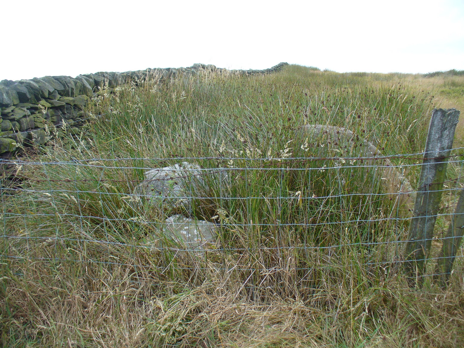
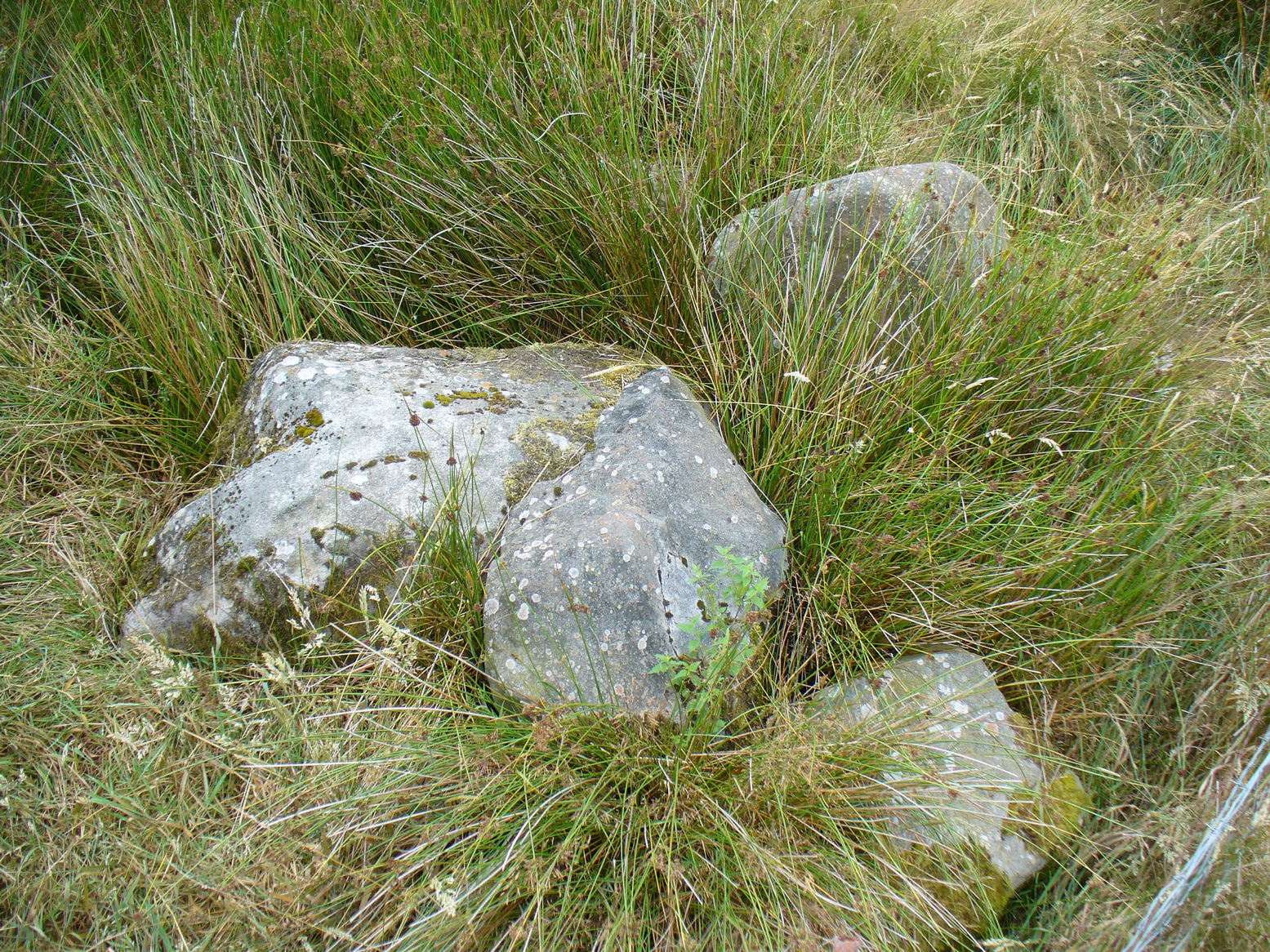
Although we know this brilliant carved stone has some relationship with the Monzie cairn circle only five yards away (it was linked via a man-made stone causeway, running between the circle and the carving), the stone itself is very much deserving of its own entry here — and at the same time I can give Andrew Finlayson’s (2010) excellent book a decent plug aswell! (the superb drawings of the stone, top & bottom, are from Andy’s work)
Allen’s 1882 drawingCarving & proximity of circle
First mentioned (I think) in Simpson’s (1867) early survey, the carving was described soon after by J. Romilly Allen (1882), who gave us an early drawing of the stone. Thought by some to have originally stood upright, the carving was described by Aubrey Burl (2000) as being, “decorated with forty-six cupmarks, cup-and-rings, nine double, one triple, there are grooves and a pair of joined cups.” It’s certainly an impressive carving!
Although the carving has been posited by some archaeologists as an outlier to the Monzie circle, it’s probable that the circle emerged from the carving — a concept that some may find difficult to understand. I’m not aware of any modern excavations here (the last, I think, was in 1938), but my guess would be that the stone causeway laid between the cup-and-ring stone and the circle ran towards the circle from the carving, and not the other way round. The carving is probably older than the stone ring — though of course, without excavation, my idea could be utter bullshit! (there are also some cup-marked stones in the circle aswell – though none as impressive as this)
One of my truly favourite megalith fanatics (despite some of his alignments being out), Alexander Thom, came here and thought this old carving “coincided with a rough stellar alignment from the centre-point of the cairn” (Hadingham 1974); though his notes in Megalithic Rings (1980) tell that,
“from the cupmarked stone beside the circle, the midsummer sun sets above an outlier some 800ft distant.”
The “outlier” that Thom mentions is known as the Witches’ Stone of Monzie, which Simpson (1867) appears to have mistakenly thought was the name of this very carving.
References:
Allen, J. Romilly, “Notes on some Undescribed Stones with Cup Markings in Scotland,” in Proceedings of the Society of Antiquaries Scotland, volume 16, 1882.
Burl, Aubrey, The Stone Circles of Britain, Ireland and Brittany, Yale University Press 2000.
Finlayson, Andrew, The Stones of Strathearn, One Tree Island: Comrie 2010.
Hadingham, Evan, Ancient Carvings in Britain, Garnstone: London 1974.
Simpson, James, Archaic Sculpturings of Cups, Circles, etc., Upon Stones and Rocks in Scotland, England and other Countries, Edmonston & Douglas: Edinburgh 1867.
Thom, Alexander, “Megalithic Astronomy: Indications in Standing Stones,” in Vistas in Astronomy, volume 7, 1966.
Thom, A., Thom, A.S. & Burl, H.A.W., Megalithic Rings, BAR: Oxford 1980.
From the tourist-infested (but lovely) town of Callander, look west to the largest of the nearby mountains — that’s where you’re heading! You can keep along the A84 road out of the town for 4-5 miles (past the Falls and Pass of Leny) till you reach the parking spot on your left. Cross the river and go up into the signposted woodland. Keep walking up thru the trees until the rocky mass emerges above you. You can either keep to the path and follow the long walk round the mountain, or go straight up the crags above you. The top’s in sight!
Folklore
Getting up here is no easy task if you’re unfit — but it’s well worth the effort for the journey alone! And in bygone centuries it seems, local people made it a particular pilgrimage at specific times during the year. Even the name of this great hill has some supposed affinity with holy issues; though some modern english etymologists put a dampener on such things. In Charles Rogers’ (1853) excellent Victorian exposition, he told that,
“Benledi is an abbreviation of the Celtic Ben-le-dia, signifying the hill of God.”
But whether the old heathens who named most of these ancient mountains would echo his oft-repeated derivation is another thing altogether! However, there are other decidedly pre-christian events that used to be enacted here, for the summit of Ben Ledi was, tradition tells, where the sun god was worshipped. It would seem, however, that this tradition is a somewhat watered-down version of it as a site of cosmological and social renewal. (see Eliade 1974) For akin to the annual pilgrimage that happens upon Croagh Patrick in County Mayo, Ireland, here upon Ben Ledi,
“For three days and three nights…the inhabitants of the district in those primitive times convened, at the period of summer solstice, on the summit of the mountain, to join in the rites of heathen worship.”
More recent lore tells the date of such sacred gatherings was Beltane. Also a short distance to the north of the summit of Ben Ledi is a small loch known as Lochan-nan-corp. Mr Rogers again tells us that,
“Here two hundred persons, who were accompanying a funeral from Glenfinglas to the churchyard of St. Bride, suddenly perished; the ground had been covered with snow and the company were crossing the lake on the ice, when it at once gave way.”
It seems a most unusual event. But the tale itself implies that a corpse route passed by the way of this high summit, down to the heathen chapel of St. Bride at the bottom of its eastern face: a huge undertaking in itself with probably archaic origins. Does anyone know owt more about this?
References:
Eliade, Mircea, The Myth of the Eternal Return, Princeton University Press 1974.
Eliade, Mircea, Patterns in Comparative Religion, Sheed & Ward: London 1958.
Roger, Charles, A Week at Bridge of Allan, Adam & Charles Black: Edinburgh 1853.
Stone Circle (destroyed): OS Grid Reference – SE 0898 4393
Also known as:
Bradup Bridge
Brass Castle
Kirkstones Circle
Archaeology & History
Lay-out of the site, c.1929 (after Raistrick)
Not far from the little-known site of Beacon Hill, this once important megalithic ring was described by Arthur Raistrick in 1929 as “the finest stone circle” in West Yorkshire. Sadly however, the complete destruction of the place in recent years has now left us with nothing to go by (you would think such actions were illegal, but we’ll come to that shortly).
The site measured thirty feet across and, until only a few years back, had a distinct embankment surrounding it. In 1885 Robert Collyer described 18 stones here; but in Raistrick’s (1929) survey only 12 were visible. He told:
“The circle is situated on the west side of the Keighley to Ilkley road, in the rough pasture called ‘Brass Castle’…immediately south and west of Bradup Bridge. The circle is approximately 30 feet diameter, but has been very damaged at some period since 1885. At that date 18 stones were standing, but now only 12 remain, though there are large unfilled holes on the sites from which the other stones have been removed. There are slight traces of a bank, but the most notable feature is the large size of the stones (millstone grit from the neighbouring escarpment) of which the circle has been made. There are some traces of a double circle, but it is not possible to be sure of this now. It seems certain that the stones were removed from this circle to repair the neighbouring Bradup Bridge, an act of vandalism always to be deplored… There is no appearance of this circle having been used for interment, nor any record extant of exploration.”
When Eric Cowling (1946) visited the site in the 1930s, his notes indicate that it was much as Raistrick had described a few years prior, telling:
“This circle is situated at the west side of the Keighley-Ilkley road near Bradup Bridge on the Airedale side of Rombalds Moor, near the crest. Only twelve stones remain standing; these are large and apparently obtained from the nearby escarpment (Kirkstones, PB); holes mark the site of stones removed. The ring is thirty feet in diameter with some traces of a circular bank; the position of some stones suggests that the circle may have been continuous. I have heard this place referred to as ‘Kirkstones’ and ‘Brass Castle’, both suggestive names.”
A newspaper account of the site in 1960 reported that 12 stones were still in situ and that “there are large holes from which the other stones have been removed.” This fact was echoed by a local walker, Ken Pickles, who knew the site well and said:
“I first walked this moor in 1945,” he says. “In the late 1960s there were definitely 12 there. It was a perfect stone circle. It offends me that children should be denied things like this.”
As if to affirm the status and number of stones again, when archaeologist Ian Longworth (1965) wrote about it he told that,
“Twelve stones remain in this badly damaged circle, which measures about 30 feet across. The stones are of local millstone grit. Several seem to have been removed from the site to repair Bradup Bridge.”
Sid Jackson’s old drawing
By 1995 only one stone was in situ, but a very distinct, albeit low circular embankment was still in evidence. I sat here quite a few times when I was young, munching mi sarnies, having a rest, alone and with friends (once in the company of holy wells author Edna Whelan and fellow rock art researcher and author Graeme Chappell) before journeying back home. It looked that at least one other stone was buried just beneath the grassy surface on the northeastern side of the banking.
Bradup is included in the respective archaeological magnum opuses of both Burl (2000) and Barnatt (1989); where the latter visited the site in the 1980s and thought it may have been “the last vestiges of a cairn.”
Arthur Raistrick’s (1929) plan shows that at least two stones stood near the centre of the circle, which may have related to a solstice sunrise alignment with the old standing stone at nearby Black Knoll hill on Morton Moor (replaced at an unknown date in the past by a stone cross). And when Mr Raistrick told this to be the best stone circle in the region, he knew what he talking about! He had surveyed many other prehistoric remains and was the leading archaeological authority in the region at the time. Today, we have no such professional authority in the region who is worthy of such an accolade. The sorry series of events that led to the destruction of Bradup’s stone circle took a little time to emerge, but after a series of emails to various departments several years ago, the culpability seemed to spread across several people, each of whom made simple mistakes; but these were mistakes that have led directly to Bradup’s demise. I hope some of you will forgive me telling its story…
Bradup stones removed & dumped near wallBradup stone remains dumped in a pile
I first received an email from a colleague in 2002 asking whether or not I was aware of what seemed to be the final destruction of the Bradup stone circle, as the land-owner from Upwood Farm had been over the field and uprooted some buried stones — plus the last visible upright in the ring — and moved them into a pile at the top southern-end of the field in which the circle previously stood. So a small bunch of us went over to have a look and, much to our horror, found the report to be true. The field itself had been completely levelled and the circular embankment flattened, with the upright stone and any buried ones dragged and dropped into the pile of stones that obviously constituted the megalithic structure we’d sat within and visited so many times down the years up against the wall at the top of the field. Someone — the land-owner it seemed — quite recently in early 2002, had destroyed the Bradup stone circle.
How the hell had this happened…!? So, I contacted those who were supposed to look after the welfare of such monuments.
In 2006, Pippa Pemberton was the person working for English Heritage who had the stately title of ‘Field Monument Warden for West Yorkshire’ and elsewhere — and it was Pippa who told the sorry tale, albeit through the well-disguised erudition of avoiding blame to anyone. Amongst several allegedly ‘professional’ archaeologists who I emailed, it was one to Neil Redfern that was responded to, eventually. As you’ll read below, my email asks how this stone circle had been destroyed, with the lengthy ‘explanation’ giving the official reasoning:
Bradup Stone Circle Destroyed
From: Paul Bennett Sent: 10 March 2006 14:05 To: REDFERN, Neil Subject: Stone circle destroyed nr Ilkley
Hello there!
I sent you an email quite a long time ago (below) concerning the complete destruction of Bradup stone circle on Ilkley Moor, for which I have heard nothing since. I wonder, out of respect, if you could either let me know the circumstances surrounding my query, or perhaps pass me on to the relevant person:
“Out of interest (and on the same moorland region) I wonder if you could let me know who it was from English Heritage who de-scheduled a site once known as the Bradup stone circle (also known as Kirk Stones) after a visit to the place a few years ago? (SE 0897 4393) The incorrect site/location was examined and the real stone circle, close by, was subsequently destroyed by the adjacent land-owner. Evidence of the destruction is still there at the top of the field in the form of a few oddly-piled small boulders.
“I think it important that whoever de-scheduled this site should be taken to task for their error. (I don’t mean sack the poor soul, although it’s evident that some re-training is probably in order.) or perhaps the land-owner taken to task for the destruction of the site.
“I would be interested to hear what you, or one of your fellow workers, think about what’s happened here.
Best wishes – Paul Bennett”
Sometime later, I received the following response:
“Dear Paul
Your email was passed on to me by Neil Redfern, as I am currently the person dealing with scheduled monuments in West Yorkshire. Please accept my apologies for the delay in responding to you – we have been working with Heritage Action on this issue, and it was accidentally assumed that you were associated with that organisation too.
In response to your query I have copied an extract from a recent letter I sent to Heritage Action about Bradup, outlining the history of the case and the justification for its descheduling. I hope that this text answers your concerns. For your information, should you require any further assistance with this case, I recommend that you return to me quickly as I am due to start maternity leave at Easter and we do not yet know who will be dealing with this casework in my absence.
With best wishes
Pippa Pemberton,
English Heritage Yorkshire Region, Field Monument Warden – West Yorkshire & Districts of Scarborough & Ryedale.
Scheduling and location of the Bradup site
Scheduled Monuments are currently provided statutory protection under the 1979 Ancient Monuments and Archaeological Areas Act, which replaced earlier legislation and is itself currently under review by the government (DCMS) in their Heritage Protection Review. Scheduled Monuments are a land-based designation, which means that they are fixed in space, with defined boundaries within which specific protection applies. The legally protected location of a Scheduled Monument is recorded on maps and described in associated documentation. Together these documents provide the legal record of the site and are the basis on which protection is applied.
Our records show that a site at Bradup was scheduled as a stone circle in 1933 at grid reference SE 0895 4391, based on information provided by a partial survey of the site made by Dr A Raistrick in 1920 and on reports recorded in 1885. This site was known by the name of Bradup Stone Circle. The location of this site is shown on the map attached to this email.
Subsequently the Ordnance Survey visited the site in 1961, when R Emsley undertook a measured survey of the locations of the stones and hollows included within the scheduled site. However he noted that the stones appeared, by that stage, to be haphazard in their distribution and he appears to have been unconvinced by the description of the site as a stone circle. On the basis of this visit by Emsley, the Bradup stone circle was marked on the 6” Ordnance Survey map, with the location given by Emsley as SE 0895 4392. In addition, Emsley noted that the unscheduled site known as ‘Kirkstones’ was located nearby at SE 0907 4479, but did not describe this site. We have no information on file about this site.
Visits were then made to the scheduled Bradup site by two Royal Commission / English Heritage Field Monument Wardens in 1981 and 1985, with the purpose of monitoring the management of the site. Both of these officers found the site difficult to distinguish, noting stones in a rough pasture field.
Subsequently, it appears that several other locations have been claimed for the Bradup Stone Circle across several fields in the locality, including SE 0897 4393 (Paul Bennett). This latter would place the circle within the adjacent improved pasture field and outside the previously scheduled area.
Descheduling the site
During 1994, a visit made to the site at SE 0895 4391 under the English Heritage Monuments Protection Programme (MPP) noted that the site described by Raistrick does not correspond with the remains then visible. According to this MPP officer, the spatial relationships between the stones and stone holes differed from those Raistrick recorded whilst he also appeared to have omitted others. In their opinion, the scheduled site was not a stone circle, but “a haphazard group of rocks … situated on a hillside which has been quarried and has naturally occurring gritstone boulders. The site itself consists of a random collection of boulders and small holes left by stone quarrying on a slight rise and has a roughly rectangular hollow in the centre which may be an excavation.” “The site is lacking in any of the other features normally associated with stone circles … Whether the extra stones represented by the stone holes are taken into account or not there are no grounds for considering this site to be a stone circle or any other type of prehistoric monument. It is therefore recommended for descheduling”.
Subsequently the recommendation for descheduling would have passed by the officer to the Monuments Protection team, who would have passed it to the relevant Inspector of Ancient Monuments for their consideration and approval. It would then have been passed to a committee of archaeological advisors for their consideration and approval before finally being submitted to the Department of Environment (now DCMS) for their approval and action.
Review visit to the descheduled Bradup site
In response to Heritage Action’s concerns, a site visit was undertaken to the descheduled site by several members of English Heritage’s Heritage Protection team in November 2005. At SE 0895 4391 they observed a number of exposed stones in a rough pasture field, some earthfast, and also hollows that may represent removed stones. The team could not relate the remains at this location to either Raistrick’s description or the Ordnance Survey drawing and concluded that the remains at this location had been mis-attributed (comprising natural boulders and quarrying) and that descheduling was the appropriate action. If a stone circle had been located in the nearby improved pasture field, which was never protected by scheduling, then any remains have been removed. “Either way [they conclude], de-scheduling was the correct action, and unless evidence is produced that demonstrates surviving prehistoric remains no further action should be undertaken”.
Conclusion
In conclusion then, the site afforded legal protection between 1933 and 1995 as a Scheduled Monument was located in the rough pasture field at SE 0895 4391. Since the 1970s several successive archaeologists have been unable to locate the remains of a stone circle in this location, leading to an interpretation of mis-attribution and the descheduling of this site; an interpretation that has recently been upheld by the Heritage Protection team. There has been no landscape change in this area subsequent to descheduling, with the land-use remaining as rough pasture and the previously protected stones and hollows remaining in place.
Other accounts place a potential stone circle in a nearby field. This potential site was never subject to any legal protection as a designated Scheduled Monument, and any potential surface remains have been removed by the farmer, within his legal rights, during its conversion to improved pasture.”
In this reply, notice the remark describing the position of the circle: “Our records show that a site at Bradup was scheduled as a stone circle in 1933 at grid reference SE 0895 4391, based on information provided by a partial survey of the site made by Dr A Raistrick in 1920 and on reports recorded in 1885.” This is either deliberate misinformation, or bad record-keeping, as neither Robert Collyer’s 1885 reference, nor Arthur Raistrick’s 1929 account cites such a grid-reference. It is possible that when the Ordnance Survey lad, R. Emsley, visited here in 1961, that he looked at the wrong dubious ‘ring’ of low stones over the fence into the heather. Somehow he, or his subsequent record-keepers, mistook what Raistrick said were the “most notable feature (are) the large size of the stones”, for the small earthfast rocks over the fence. This is very poor when you consider that the 1970s 1:10,000 OS-map of this area clearly shows the circle to be in the field, indicating that the Ordnance Survey fella had been, seen and recorded it correctly.
One final element on this “grid-reference” error: I have in front of me the List of Scheduled Monuments in the Bradford District (“The Schedule is currently not available on” their website cos the people who get paid to do such a thing can’t be arsed), dated from the 1990s. The “Bradup stone circle near Bradup Bridge, Morton” is cited as being at “SE 0900 4400” and not the OS grid reference described in the explanation about the site’s destruction. Funny that innit…?
There’s much more that I could say in response to this excuse for de-scheduling and allowing the destruction of Bradup stone circle, but I’m hoping that people can see for themselves that ‘excuses’ are the order of the day in this report. Simply put: the Bradup stone circle was destroyed due to the ineptitude of ‘authorities’ mistaking several natural earthfast rocks at the grid-reference they give (if indeed even that’s the right one for it!) for the real prehistoric circle in the adjacent field. In short, they fucked up – and the email above is their attempt at an excuse to cover up their mistakes. We all know how they cover each others backs when they screw up. If you or I did this, we’d be in court.
Folklore
Also known as the Brass Castle and the Kirkstones (indicating it as a place of worship), Cowling (1946) told how “local lore suggests that the place is haunted.” The name Kirkstones derives from the rock outcrop 800 yards north of here, where the stones which made this site may have come from. A dowsing survey found there to be water beneath the circle, but this wasn’t mapped.
From Litton Cheney go north up the White Way road until it meets the main A35 crossroad. Go across the road, then get over the fence on your right and onto the rise in the hill. These earthworks, or timber circle remains, are under your feet!
Archaeology & History
Lay-out of site by O.G.S. Crawford, 1939
Shown on modern OS-maps as an ‘earthwork’, but ascribed elsewhere as a timber circle, when Stuart & C.M. Piggott visited and surveyed this site in the 1930s, they thought it to be the remains of stone circle. Found on a prominent rise in the landscape with excellent views all round here, the Piggott’s description of the site told:
“It consists of a shallow ditch with internal bank, enclosing a somewhat oval area measuring 75 feet from north to south, and 63 feet from east to west. The ditch, which lies on the southeast, where the ground has been disturbed, does not reach a depth of more than about one foot, while the bank rises nowhere above 2.5 feet. It is possible there was an entrance on the southeast, but the bank is disturbed at this point. On the crest of the bank on the southwest are 3 almost circular depressions, some 6 feet in diameter, and placed 20 feet distant from one another along the circumference of the bank. Another similar depression is on the northeast, while yet another may have existed in the disturbed portion of the bank on the southeast.”
It was these finds which led them to suppose a ring of stones originally surmounted this small hillock, twelve in all.
Ground-plan by O.G.S. Crawford
Another site — which they called ‘Litton Cheney 2’ — was found less than 50 yards to the east of here by a Mr W.E.V. Young and the Piggotts. These remains comprised of, “a very shallow and regular ditch surrounding a circular area 47 feet in diameter. A single sarsen lies on the inner lip of the ditch on the southeast” which, they thought, may have been the solitary remains of yet another stone circle. Three other sarsen stones were found 90 feet south of here, but they were unsure whether they related to the circle or not.
Archaeological remains from here dated from 2200-1400 BC and local researcher Peter Knight (1996) thought that the sites ascribed here as megalithic rings to be correct. He also found that tumuli visible some 5 or 6 miles southeast of here, on top of Black Down Hill (where the Hardy Monument’s found), “marks out the winter solstice sunrise.” A dip in the horizon to the northwest, he claims, also marks the summer solstice sunset from here. Knight also mentions how “both Litton Cheney sites lie close to a ley line going to the Nine Stone Circle and beyond.”
References:
Knight, Peter, Ancient Stones of Dorset, Power: Ferndown 1996.
Piggott, Stuart & C.M., ‘Stone and Earth Circles in Dorset,’ in Antiquity, June 1939.
The best way to get here it is to head from the Cow and Calf Hotel up the hillside to where the great rock is sticking out (the Pancake Stone). From here, head straight onto the moor toward the Idol Stone — close to the Idol Rock which you can see 400 yards south in front of you. From here, follow the footpath up the hill before you and keep on the path towards Lanshaw Lass. About 100 yards on, turn straight west into the heather and keep your eye towards the south. About 250 yards on, about 100 yards away from the Green Crag Top cup-marked boulder, you’ll see it!
Archaeology & History
One of very few solitary standing stones on Ilkley Moor, and one which I relocated after The Old Stones of Elmet (2001) had gone to press — which was a great pity. Nearly four feet tall, this is a good chunky monolith which stands close to being on line with the summer solstice alignment from the nearby Twelve Apostles stone circle. (I was gonna call it the Summer Stone, but thought better of it!)
There’s another recumbent stone, more than five feet tall when erected, 200 yards northwest of here. (This is also very close to being in line with with our chunky monolith, plus the Twelve Apostles. Anyone out there with a GPS who can check if this possible alignment is the last remnant of a summer solstice stone row? It probably isn’t, but it’d be good to find out.) On the same moorland level, heading back down, when the heather’s burnt back you’ll find a number of prehistoric tombs along the edge of the ridge. These don’t appear to be in the archaeological registers.


")