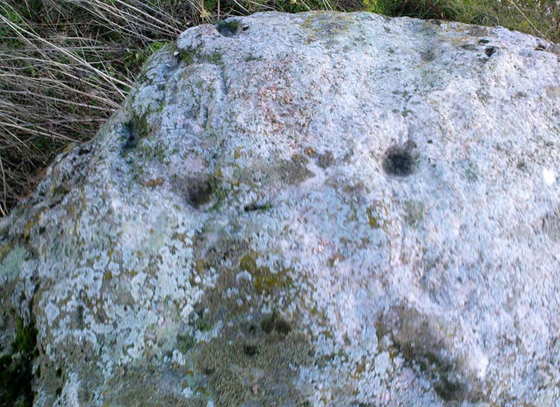
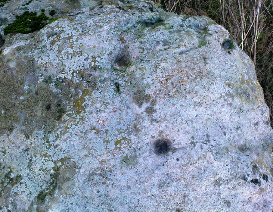
Serpent Mound, Scallasaig, Glen More, Inverness-shire

Cairn:  OS Grid Reference – NG 848 202

Folklore

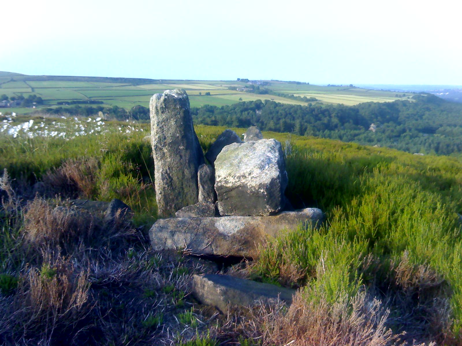
I’m presuming that this burial site is the right one, described in the fine Mr MacGregor’s Peat Fire Flame (1937) as being “by the roadside up near Scallasaig.”  There certainly doesn’t appear to be another alternative site close by (though if I’ve got it wrong, someone please lemme know!).  This place was, said MacGregor, a site “where the people in olden times used to worship the serpent.”

MacGregor spoke with a local man about the myths here and asked how long it had been associated with serpents.

“Och, about two thousand years,” said Mr John MacRae. “The mound was in the shape of a serpent, and when the chief of the people would die, he would be buried in the head of the serpent..”

He continued, saying, “One from London, that was going about searching things like that, opened the mound, and they found in the mound a big stone coffin with a big stone slab on the top. And there the bowl was found with the ashes of the chief of the people at that time. The bowl was taken to the Manse. That’s about fifty years ago. It was there for a few months; and they took it to Edinburgh, to some museum or something. They were saying that there was a funny noise in the Manse when the bowl was lying there. If there was any treasure in the bowl, or in the grave along with the bowl, it was taken out before. You see, had he any treasure – the chief like – guns and money and the like – I’m sure they wouldn’t be putting much money in the grave. It would be going into the grave with the dead man, so, when he would rise in the next world, he would be ready to start at the same game as he was carrying on here on Earth.”

This sounds a little like the folk-memory of an idea of a heathen afterlife – and of course it’d make sense finding such lore here at a tomb.

I’ve come across references to several other serpent mounds scattering the western side of Scotland, but their exact locations have proven hard to pin down. It makes y’ wonder how many more there once were before the christian paradigm became entangled in the myths of the country people.

References:

  1. MacGregor, Alisdair Alpin, The Peat-Fire Flame: Folk-Tales and Traditions of the Highlands and Islands, Ettrick Press: Edinburgh 1937.

© Paul Bennett, The Northern Antiquarian

Bleasdale Circle, Lancaster, Lancashire

Timber Circle:  OS Grid Reference – SD 57717 46004

Getting Here

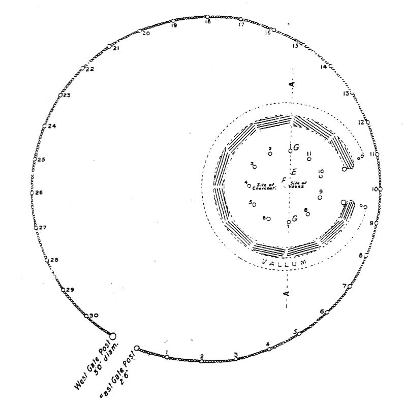
Bleasdale Ring & enclosure plan (Syd Wilson, 1900)

Pretty easy to find, and a nice walk to boot! Head up to Bleasdale Church (worth a look in itself!), keep going up the path north to the aptly named Vicarage Farm.  From here you’ll notice a small copse of trees on your left (east) heading to the hills.  To those of you who like Predator, “it’s up there – in them trees…!”

Archaeology & History

On my first visit here in the company of John Dixon and other TNA regulars, my first impression was “this is a henge” – and noted subsequently that it’s been described as such by several writers.  But the general category given to this fascinating place is a ‘timber circle.’

Bleasdale ‘henge’ circle

First discovered at the end of the 19th century and described in considerable detail by Mr Dawkins (1900), this is a gorgeous-looking monument was erected in at once a gentle and tranquil, aswell as an imposing natural setting, at the foot of Fair Snape Fell (to the northwest) and Bleasdale Fell (due southwest).  These aspects of the landscape would have  had obvious mythic importance to the people who built this ring amongst the trees.  A condensed version of Dawkin’s material was described in J. Holden’s (1980) Story of Preston, that outlined this circle as being,

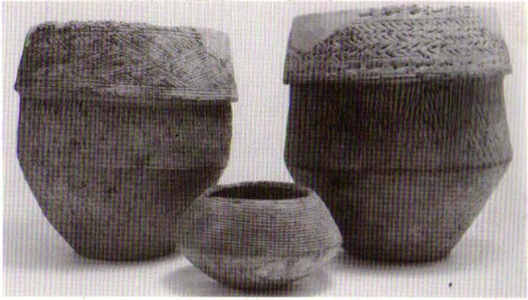
“a centre for religious worship in about 1700 BC.  It was made up of a circle of timber posts which enclosed an area 45 metres in diameter. In the centre was a small mound surrounded by a ring of oak posts and a circular ditch.  Inside the mound there was a grave that had in it two pottery urns filled with human bones and ashes. Examination of the contents of these urns shows that the bodies were wrapped in linen and burnt on a funeral pyre. A small ‘accessory’ cup was found inside one of the urns and this may have contained food or drink for the afterlife.”

Urns from Bleasdale Ring
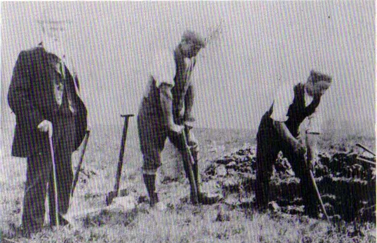
1898 photo of Shadrach Jackson (left) & Tom Kelsall (centre) digging the site

Located within a much larger circular enclosure, the internal Bleasdale ‘henge’ Ring consisted of a small circle of eleven timber posts near the edge of the ditch, and an entrance way to the east, to or from which was an avenue of further wooded posts that led to the edge of the larger enclosure.  It gives the impression that this was some sort of avenue along which a ceremonial procession may have took place, strongly suggesting a ritual function.  Robert Middleton (1996) told that,

“The post circle and barrow appear to respect each other  (in date), whilst the enclosure may be later.  The post circle has been dated to around 2200 BC, although the context and reliability of this date is unclear.”

Looking out eastwards from the middle of the internal henge-style ring and through the ‘entrance’ we find an alignment with a large notch on the skyline which, modern folklore ascribes, is where the midwinter sun rises — which is very believable, but I aint seen it proven anywhere yet.

A much greater and full excavation report of this site was written by Raymond Varley (2010), whose essay I urge fellow antiquarians to read.

References:

  1. Dawkins, W.B., ‘On the Exploration of Prehistoric Sepulchral Remains of the Bronze Age at Bleasdale,’ in Transactions of the Lancashire & Cheshire Antiquarian Society, volume 18, 1900.
  2. Dixon, John, Journeys through Brigantia – volume 8: Forest of Bowland, Aussteiger Publications: Barnoldswick 1992.
  3. Edwards, Ben, “The History of Archaeology in Lancashire”, in Newman, 1996.
  4. Gibson, Alex, Stonehenge and Timber Circles, Tempus: Stroud 1998.
  5. Holden, Jennifer (ed.),  The Story of Preston, Harris Museum: Preston n.d. (c.1980)
  6. Middleton, Robert, “The Neolithic and Bronze Age,” in Newman, 1996.
  7. Newman, Richard (ed.), The Archaeology of Lancashire, Lancaster University 1996.
  8. Sever, Linda (ed.), Lancashire’s Sacred Landscape, History Press: Stroud 2010.
  9. Varley, W.J., ‘The Bleasdale Circle,’ in Antiquaries Journal, volume 18, 1938.
  10. Varley, Raymond, “The Bleasdale Bronze Age Timber Circle,” in Lancashire History Quarterly, 2010.

© Paul Bennett, The Northern Antiquarian


Overton Down Tomb, West Overton, Wiltshire

Cairn:  OS Grid Reference – SU 1305 7052

Getting Here

Overton Down cairn (image © Pete Glastonbury*)

From the Avebury stone circle, walk out eastwards and straight up the ancient Ridgeway for about a mile until it levels out and meets up with the adjoining track upon the hilltop. Instead of going left or right, go straight across and onto the footpath that crosses Overton Down, until you reach the wide horse-racing track lookalike called ‘the Gallops.’  Stop – don’t go on it – and follow the fence down for a coupla hundred yards till you’ll see the fenced-off rise with a modern ‘barrow’ enclosed within. You’re very close! From here, go another 100 yards or so down and keep your eyes on the rise of land with rocks scattered around it.  That’s it!

Archaeology & History

From all accounts, there’s been nowt of any consequence written about this site — which is bloody incredible to be honest!!  We came here on a fine day (that’s Mikki, Geoff and June) in the company of the local Avebury magus, Pete Glastonbury.  Crossing Overton Down towards an experimental “barrow” that some archaeo’s have knocked-up, the rise in the land here stands out quite clearly, saying (at the very least), “look at me!”  But until Pete Fowler (2000) first described this “unrecorded kerbed round barrow” a few years back, it had escaped the noses of all previous archaeological surveys!  How!?

What the hell do archaeologists in the Avebury area do with themselves if they can’t pick this sorta monument out!?  But anyway…

Overton Down cairn – looking NW

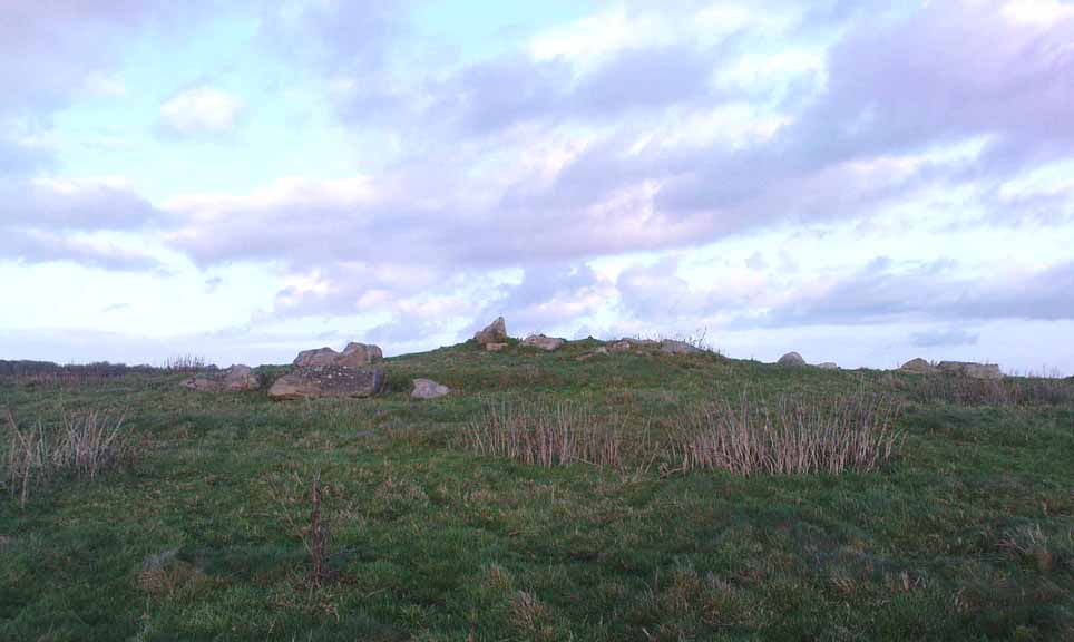
This is quite a large rounded cairn structure by the look of it.  At least 30-feet across, probably kerbed from the initial look (only for a few minutes, sadly).  Local writer Terence Meaden has apparently found the site of some importance in his studies (not yet published).  Its position here in the landscape was what caught my attention more than anything: it stands on the crest of the hill and has superb uninterrupted views far across the Avebury landscape.  This siting was obviously quite deliberate. Less than 100 yards due north of here are two curiously placed stones which may ‘frame’ the cairn for a southern lunar alignment.  I had no time to look at this really, so it would be good if some local Avebury dood could check this out.  The outlying stones may be merely fortuitous, but it’d be good to know for sure!

The site has been plotted amidst a mass of landscape changes dating from the neolithic to medieval periods.  It seems probable, on first impression, that the ‘cairn’ is of Bronze Age in character (though could be earlier), but until detailed analysis has been made we obviously won’t know for sure. A short distance to the south we have the much-denuded Overton Down site X1: another Bronze Age burial that yielded three beaker graves when Fowler excavated the place in the 1960s.

For those of you into geomancy, meditation and the subjective realms of genius loci, this one really grabbed me.  Give it a go and lemme know what you get.  But please, no stupid pagan or New Age offerings — the site doesn’t need that sorta thing.

References:

  1. Fowler, Peter, Landscape Plotted and Pierced: Landscape History and Local Archaeology in Fyfield and Overton, Wiltshire, Society of Antiquaries: London 2000.

* Pete Glastonbury is a Wiltshire-based photographer specialising in Landscapes, Astronomy, Archaeology, Infra-Red, Experimental Digital Photography and High Dynamic Range Panoramic photography.

© Paul Bennett, The Northern Antiquarian

Weston Churchyard, Askwith, North Yorkshire

Cup-and-Ring Stone:  OS Grid Reference – SE 1774 4663

Also Known as:

  1. Carving no.568

Getting Here

Dead easy this. From Otley, take the north road over the River Wharfe and turn left following the signs to Askwith, where you’ll hit Weston village first. Once here, take the small left turn down to Weston Hall and the accompanying church. Go into the churchyard and check the graves!

Archaeology & History

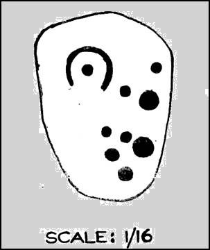
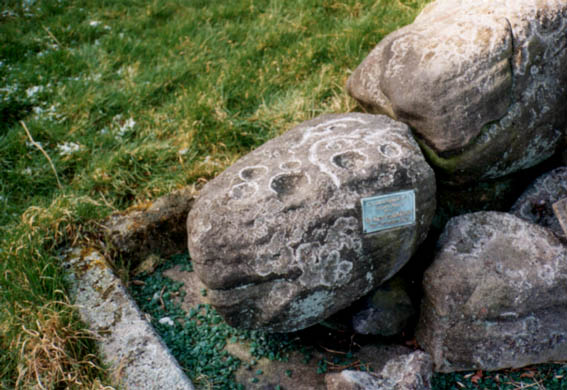
This is a real curiosity.  It’s found in the graveyard of All Saints church, Weston, where one of the graves has several small stones on it, with this small stone with the following cup-and-ring designs upon it.  A plaque has been attached to it as a memorial to one ‘Susan Mary Dawson’.  Strange…

Sid Jackson’s 1958 sketch
Cup-marked stone deliberately placed on a christian grave

It was first written about by Sidney Jackson (1957), but where it first came from and why it has been placed here in a christian setting is something of a mystery.  It’s also odd inasmuch as although we know that there was some form of  ritual or geomantic use of cup-and-rings in relation to neolithic and Bronze Age burials — that such a tradition has been performed by this particular family on this grave.  It is obviously highly unlikely that this family had any knowledge whatsoever of burial traditions in relation to cup-and-ring art (please, shoot me down in flames if you know otherwise), so this re-use of this prehistoric stone is likely to be little other than fortuitous. But then, the occult history of some of the influential families in and around this region in relation to witchcraft, ancient kingship and esoteric practices, might indicate otherwise…

Does anyone know anything about the Dawson family history which might throw light on this modern use of a prehistoric tomb marker?  It has all the hallmarks of once coming from a prehistoric cairn, but we know little of its history prior to 1957.

References:

  1. Boughey, Keith & Vickerman, E.A., Prehistoric Rock Art of the West Riding, WYAS 2003.
  2. Jackson, Sidney, ‘Cup-and-Ring Boulder, Weston Churchyard,’ in Cartwright Hall Archaeology Group Bulletin, 2:16, 1957.

© Paul Bennett, The Northern Antiquarian

Lexden Tumulus, Colchester, Essex

Tumulus:  OS Grid Reference – TL 975 247

Getting Here

Fortunately for the person who lives here, this much overgrown and denuded remains of a fabled tumulus is in their garden!  The mound is divided by a hedge in the back garden, up near the bend of where Fitzwalter Road meets St. Clare Road and the school field backs onto them.  I’ve no idea whether the people who own the gardens are OK with you visiting the site or not. If you wanna look at it, I s’ppose the only thing to do is knock on their door and ask!

Archaeology & History

Plan of the Lexden tumulus (Laver, Archaeologia 1927)

Ascribed as late Iron Age, some of the finds here are distinctly Romano-British.  Indeed, excavations here by P.G. Laver in 1924 uncovered rich Belgic remains akin to the chariot burials found in East Yorkshire! (though not quite as good as them)  There was a considerable collection of gold, silver and other metalwork remains here, along with considerable remains of pottery aswell.  It seems there was a tradition of burials here, with some evidence dating from the Bronze Age — but the majority of remains found in the excavations were from the much later period.  One account attributes the burial mound to have held the body of Cunobelin; the other, the body of Addedomaros of the Trinovante tribe.

Folklore

Quoting from an earlier source (A.H. Verrill’s Secret Treasure, 1931), in Leslie Grinsell’s (1936) fine early survey on British prehistoric tombs, he described the legend of there being hidden treasure here, saying that locally there was

“a belief that it was the burial place of a king in golden armour, with weapons and a gold table.”

But was this legend described anywhere before P.G. Laver’s excavation of the site in 1924…?  It would be very intriguing if we could find this out!

References:

  1. Grinsell, Leslie V., Ancient Burial Mounds of England, Methuen: London 1936.
  2. Laver, P.G., ‘The excavation of a Tumulus at Lexden, Colchester,’ in Archaeologia journal, no.76, 1927.

Links:

  1. Unlocking Essex’s Past: The Lexden Tumulus & Associated Cemetery

© Paul Bennett, The Northern Antiquarian


Acrehowe Circle, Baildon Moor, West Yorkshire

Ring Cairn:  OS Grid Reference – SE 14245 40686

Also Known as:

  1. Coll’s Burial Mound
  2. Rerehowe

Getting Here

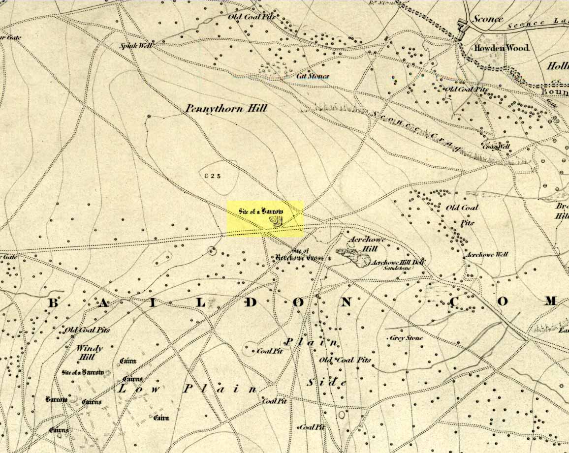
Acrehowe site on 1852 map

Go up through Baildon centre and head onto the moors. Crossing the cattle-grid, a coupla hundred yards further up, turn left. Past the small reservoirs on your left, another 100 yards or so and you reach the brow of the hill.  As you begin going down the road, there’s a small car-park right by the roadside.  The curious remains of the earthworks at the side of the old circle are discernible in the grassland right to its side.

Archaeology & History

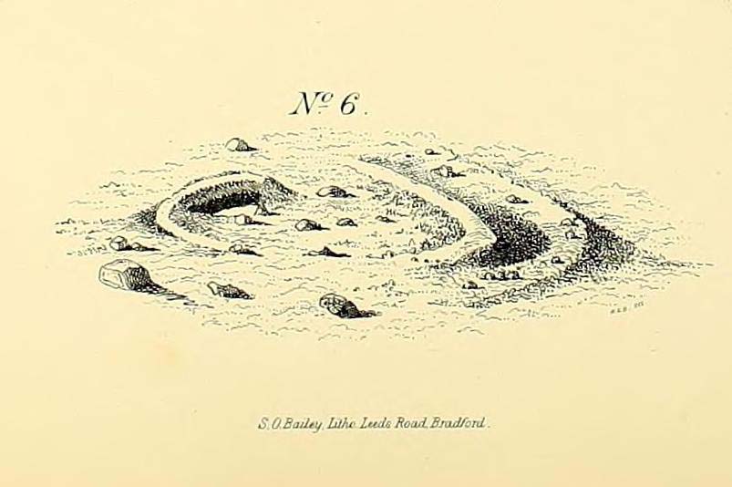
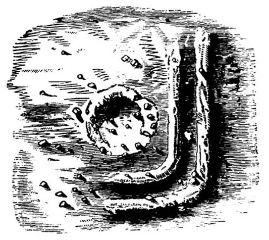
Illustrated on the 6-inch OS-map of 1852 as “Site of a Barrow” (similar to how it appears in the image drawn here by Mr. C.N.M. Colls) a short distance below Pennythorn Hill top, there are still considerable traces of the earthworks surrounding the east and southern sides of what was once some form of ring cairn or tumulus that was once at this prominent place in the landscape.

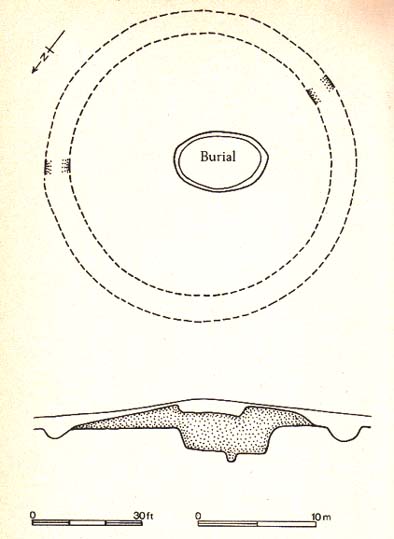
Aerial view of siteThe site was first explored by Mr Colls in 1843 (his results were reported a few years later), who found a loose double-ring of stones, fifty feet across, surrounded by a shallow trench which was most notable on the south and east sides. Two urns were also uncovered near the centre of the ring, nearly two feet down, containing the cremated remains of people.  A few years later, the Leeds historian James Wardell (1869) told a most fascinating note about what happened during their excavation, saying:

“This…examination was attended by a circumstance not soon to be forgotten by the persons engaged therein (on the excavation). They had almost reached the place where the broken urn and bones were deposited when, at once, such a fearful storm of thunder, lightning and rain came on, that they were not only considerably alarmed, but driven from the Common to seek shelter in the village.”

Colls’ 1846 sketch

We hear this sorta thing at many of our ancient places!

Colls 1846 plan

One anonymous writer in 1955 described the site as a ‘stone circle’, and a number of subsequent archaeologists copied this without question; but in all probability this site was more typical of an old cairn circle or ring-cairn, similar in size and design to the Roms Law circle two miles north of here.  However, the earthworks at its side give the impression of some sort of exaggerated hengiform enclosure.

The place-name element howe strongly indicates a burial site and is a suffix found at many prehistoric tombs across northern England.  The prefix ‘acre’ may relate to “a plot of arable or cultivated land, a measure of land (an acre) which a yoke of oxen could plough in a day” (Smith 1956), or may be a corrupted form of the Old English word, ‘acen’, relating to oak trees.  Early literary examples of the place-name would enable a clearer understanding of the prefix element here.

References:

  1. Anonymous, Colls’ Burial Mound Stone Circle, Baildon Moor, Museum Leaflets: Bradford 1955.
  2. Baildon, W. Paley, Baildon and the Baildons (parts 1-15), St. Catherines: Adelphi 1913-26.
  3. Barnes, Bernard, Man and the Changing Landscape, Eaton: Merseyside 1982.
  4. Bennett, Paul, The Old Stones of Elmet, Capall Bann: Milverton 2001.
  5. Colls, J.N.M., ‘Letter upon some Early Remains Discovered in Yorkshire,’ in Archaeologia, 31, 1846.
  6. Collyer, Robert & Turner, J.H., Ilkley: Ancient and Modern, William Walker: Otley 1885.
  7. Smith, A.H., English Place-Name Elements – volume 1, Cambridge University Press 1956.
  8. Wardell, James, Historical Notes of Ilkley, Rombald’s Moor, Baildon Common, and other Matters of the British and Roman Periods, Joseph Dodgson: Leeds 1869. (2nd edition 1881)

© Paul Bennett, The Northern Antiquarian

Enclosure Stone, Bingley Moor, West Yorkshire

Cup-and-Ring Stone:  OS Grid Reference – SE 10983 43368

Also Known as:

  1. Carving no.99 (Boughey & Vickerman)

Getting Here

Enclosure Carving, Stanbury Hill

From East Morton village, take the moorland road, east, and up the steep hill.  Where the road levels out there’s a left turn where a trackway leads onto the moor.  Go up here & keep walking till you hit a moorland ‘footpath’ signpost.  Stop here and walk due west (your left) onto the gently sloping rise and into the mass of the Stanbury Hill enclosure system.  Keep walking for 200 yards or so, where the land begins to slope down to the end of the spur; and just 50 yards before it drops down to the stream below you’ll find a cluster of carved rocks like the Lunar Stone, the Teaspoon Rock, Spotted Stone, etc, all scattered about.  Near these, you’ll find this one!

Archaeology & History

Not to be confused with the carving of the same name on the northern side of these moors (near the Green Crag Slack enclosure), this carved rock gets its name specifically from looking like a lay-out plan of some settlement or enclosure.  It’s unlikely that this title or description has anything to do with the carving, but its the impression it gave me when I first saw it!  But then once you look at the carving from another angle it takes on a different impression.

Enclosure Carving from above

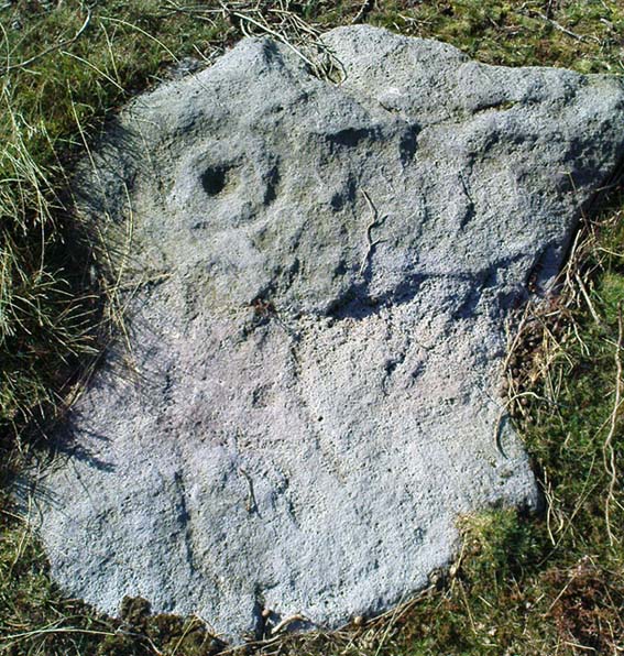
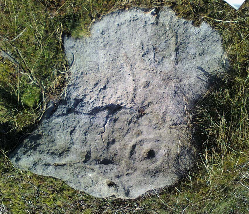
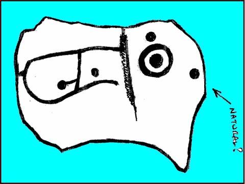
First thought to have been found by Stuart Feather in 1978, it is one of many carvings that occur in what seems to be an extensive prehistoric enclosure or settlement.  There’s a complete cup-and-ring near the western end of the rock, with another distinct cup-marking by its side, and what looks to be a natural cup at the top-end of the stone.  But it was the other section of the carving on the central and eastern side which intrigued me: a curious ‘enclosure’ of lines, with a cup-marking in each section.  Cutting between the cup-and-ring and the enclosure lines is a natural long crack or fissure running roughly north-south through the rock.  It seemed to me (though I could be wrong) that a line had been pecked running along this natural crack — although in Boughey & Vickerman’s (2003) drawing they don’t highlight this.  It also seemed that the carved lines from ‘enclosure’ linked up to the pecked line that was carved along the natural fissure in the rock (as illustrated in my crap drawing!).

Shit drawing of CR99

As with the Lunar Stone nearby: it appears that either this stone was carved at different periods; or else for a long period of time much of the stone was exposed to the elements, whilst a section of it remained covered.  For the distinct cup-and-ring on the western-end is more worn, with more eroded evidence of pecking, than the extended lines on the eastern end of the rock.  I need to go back here and get some better images — and certainly do a much better drawing!

References:

  1. Boughey, Keith & Vickerman, E.A., Prehistoric Rock Art of the West Riding, WYAS 2003.
  2. Hedges, John (ed.), The Carved Rocks on Rombalds Moor, WYMCC: Wakefield 1986.

© Paul Bennett, The Northern Antiquarian

Reddicar Clough, Hallam Moor, South Yorkshire

Long Cist:  OS Grid Reference – SK 2624 8688

Also Known as:

  1. Ash Cabin Long Cist

Getting Here

Despite a footpath being marked on the OS map, there’s none I could find and the only way to get there is to make your way through the heather.  Park at the Wyming Brook nature reserve car park on Redmires road, take the signposted path besides the notice board and follow the line of the dry stone wall. Go through the gate and continue till you come to the end of the wall where a path leads off to your left through the broken wall, follow the path through the boggy bit and head uphill till you get to the highest point of the path by another wall with a path the other side.  From here it gets a little tricky! You’ll now need to go off path heading NNE and down hill till you come to the post-and-wire fencing where you should pick up a slight path heading WNW (your left) and head for the high point about half a mile in front of you. Just before you come to the high point you’ll have to cross the stream (easily done). The cist lays on the flat ground just beyond the brow of the rise.

Archaeology & History

A long cist around 3 feet wide and 6 feet long in a well preserved condition aligned almost — but not quite — East/West on a prominent position on Hallam Moor, commanding views over Ash Cabin flat, Rivelin Valley and the A57 road.  The only restricted view is to the northwest, where the moor rises then drops down again towards the Headstone.

There are 3 side-stones still in situ: the largest around 1 metre tall, the others still in place being about 70cm.  The stones that would have made up the rest of the walls lay close by.

When you’re at the site it’s obvious why it’s in this location: the views are spectacular and afford excellent views of the surrounding area.  A burial site with a vista truly fit for a king!

Archaeologically there’s not much info kicking around that I can find and I’m indebted to Stubob for alerting me to it’s presence.  It’s very unlikely you’d be walking this area for any reason other than to visit the site, as there are decent paths across the moor to the most popular site in this area, the Headstone off to the North West.  Remains of the Ash Cabin Flat stone circle are about 750 yards southeast of here.

A real gem of a site and a “must see” if your in the area.

© Geoff Watson, The Northern Antiquarian


Devil’s Den Cups, Clatford, Wiltshire

Cup-Marked Stone:  OS Grid Reference – SU 15211 69652

Getting Here

Follow the directions to reach the Devil’s Den, a half-mile north of Clatford up the footpath towards the Fyfield Down cup-marked rock.  You can’t miss it!  The cup-markings are on the top of the capstone.

Archaeology & History

First described and illustrated by local historian and photographer, Pete Glastonbury, as far as I’m aware these cup-markings have not previously been included in any of Wiltshire’s archaeological surveys (that can’t be, surely?).  The only reference I’ve found — not untypically — is from one of the early editions of the english Folklore Journal.

...and again!
…and again!
Devil’s Den cup-markings

At least two well-defined cups stand out on the top of the capstone.  Each of them have ‘cracks’ running out of them, with the easternmost one of them (closer to the edge) turning into a channel which runs upwards on the stone, before then leading down off the edge of the rock.  Each cup-mark is very clear, about two inches across and about a half-inch deep.

Archaeologists can check these cups out and work out for themselves whether they’re natural or not.  They’re far more qualified than I on such matters and may be able ascertain other faint remarks on the stone.  The proximity of the nearby Fyfield Down cup-marked rock, several hundred yards to the north, shows that such petroglyphs can be found in this region.  Although we cannot expect many examples of rock art in this area (the rock’s damn tough and takes some burrowing into), it is likely that more carvings await discovery.

Folklore

The capstone on which these cup-markings are seen was told to be immovable and had lore said of it akin to that found at the great Whispering Knights, near the Rollright Stones.  But the main piece of lore describes the cups quite specifically.  In an article by Alice Gomme (1909), she told that:

“if anyone pours water into any of the natural cup-shaped cavities on the top stone at midnight, it will always be found in the morning to be gone, drunk by a thirst-tormented fiend.”

The tale is later repeated in Kathleen Wiltshire’s (1975) survey, where she too mentions the cup-marking (though only one), saying that,

“if a person pours water into the natural cup-shaped cavity on the top stone at midnight it will always be found to be gone in the morning — drunk by the devil.”

This folklore motif — repeated in Grinsell’s (1976) text — is found at rock-art sites in a number of the northern counties, where milk has been poured into the cup-markings (some of which were known as ‘cat stones’) and left overnight for the spirits to drink.   In the case we have recorded at Devil’s Den, the spirit of the place seems to have been demonized, as is common.

Miss Gomme (1909) also reported the curious ingredient that the spirit of a white rabbit with glowing eyes would appear on the capstone at midnight and help the devil demolish the site with the aid of eight oxen!  On this latter matter, I am duly informed by one-in-the-know that, to “those of us that know the locals and their humour, we just know this tale was made up for a visiting townie!”

References:

  1. Gomme, Alice B., ‘Folklore Scraps from Several Localities’, in Folklore Journal, 20:1, 1909.
  2. Grinsell, Leslie V., Folklore of Prehistoric Sites in Britain, David & Charles: London 1976.
  3. Wiltshire, Kathleen, Wiltshire Folklore, Compton Russell: Salisbury 1975.

© Paul Bennett, The Northern Antiquarian

Frensham Common necropolis, Frensham, Surrey

Tumuli:  OS Grid Reference – SU 853 406

Archaeology & History

There are several tumuli near the top of the hill here, but only one of them really stands out.  Nick Thomas (1976) told it to be one “of the best preserved bowl barrows in Surrey.”  A brief description of the relevant tombs, running north to south:

“the first is 75ft across and 6ft high; the second, which has a surrounding ditch 9ft wide, is also 75ft across, but is 8ft high.  The third has a diameter of 42ft and a height of 4ft.  The last is 54ft wide and 5½ft high.  It has a surrounding ditch 8ft wide. ” (Thomas 1976)

None of the tombs had been excavated up to the early 1980s, but I’m not sure if anything has been found since then.  There was also a potential “great stone” up here that was mentioned by John Aubrey in the late 17th century, but nothing has been seen of it since.  In all probability this was a standing stone or the remains of some prehistoric tomb.

Folklore

Several hundred years ago the King’s antiquary, John Aubrey, told the curious tale of the great cauldron that was said to have been found here:

“In the vestry (of Frensham church, in Surrey), on the north side of the chancel, is an extraordinary great kettle or caldron, which the inhabitants say, by tradition, was brought hither by the fairies, time out of mind, from Borough-Hill, about a mile hence. To this place, if anyone went to borrow a yoke of oxen, money, etc., he might have it for a year or longer, so he kept his word to return it. There is a cave where some have fancied to hear music.  On this Borough hill…is a great stone lying along, of the length of about six feet. They went to this stone and knocked at it, and declared what they could borrow, and when they would repay, and a voice would answer when they should come, and that they should find what they desired to borrow at that stone. This caldron, with the trivet, was borrowed here after the manner aforesaid, and not return’d according to promise; and though the caldron was afterwards carried to the stone, it could not be received, and ever since that time no borrowing there.”

In relation to the folklore that is generally attached to the tumulus on top of the hill here from which modern lore ascribes the cauldron to have originated, when A.G. Wade (1928) came to investigate the nature of the site and the folktale he found that,

“there are several folk-tales other than those given by Aubrey.  One relates that it was dug up on Kettlebury Hill, south of Hankley Common, by the monks of Waverley Abbey, and that it was taken by them to Frensham for brewing ale.  Another tale says that it was a loan from the fairies of Thursley — there are tumuli in this parish, south of Ockley Common — and that Mother Ludlam, a medieval witch who lived, according to tradition, in Ludlam’s Cave in Moor Park, was the owner and lender.  The cave was dug by a monk of Waverley Abbey who, when the water supply of the Abbey failed, found that three springs joined here, and by enlarging their outlets and bringing them together he obtained a good supply of fresh drinking water…”

Mr Wade was also unable to satisfactorily show that the Borough Hill named in Aubrey’s survey and Frensham Common hilltop were one and the same.

References:

  1. Aubrey, John, The Natural History and Antiquities of Surrey, E. Curll: London 1719.
  2. Thomas, Nicholas, Guide to Prehistoric England, Batsford: London 1976.
  3. Wade, A.G., “The Great Cauldron of Frensham,” in Antiquity, 2:6, June 1928.

© Paul Bennett, The Northern Antiquarian