Coming up from Otley, make your way up to the Askwith Moor road (the only one that goes across the moors) and park up on the rough parking spot on the right-side (east) of the road. You can’t really miss it. From here walk up the road for less than 500 yards until your reach the rickety gate and the path onto the moors. From here I walked 600 yards east, thru the heather until I reached the wall (close to the Tree of Life Stone) and then followed the wall up for 150 yards, then back up (west) onto the moor again and, about 50 yards along at the foot of the slope, keep your eyes peeled for the earthworky undulations beneath your tiny feet!
Archaeology & History
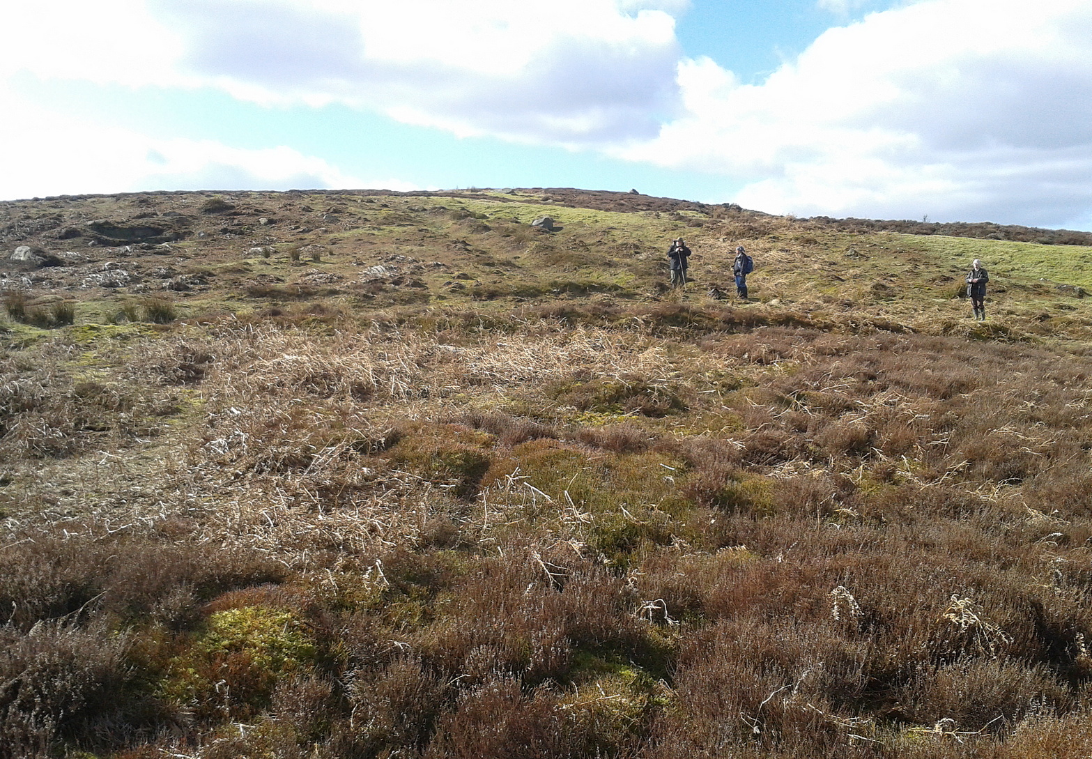
Just below the scattered Snowden Moor settlement we find this curious large structure, first described 75 years ago by the northern antiquarian Eric T. Cowling (1946). Since then, apart from a cursory overview, archaeologists haven’t really paid it much attention.
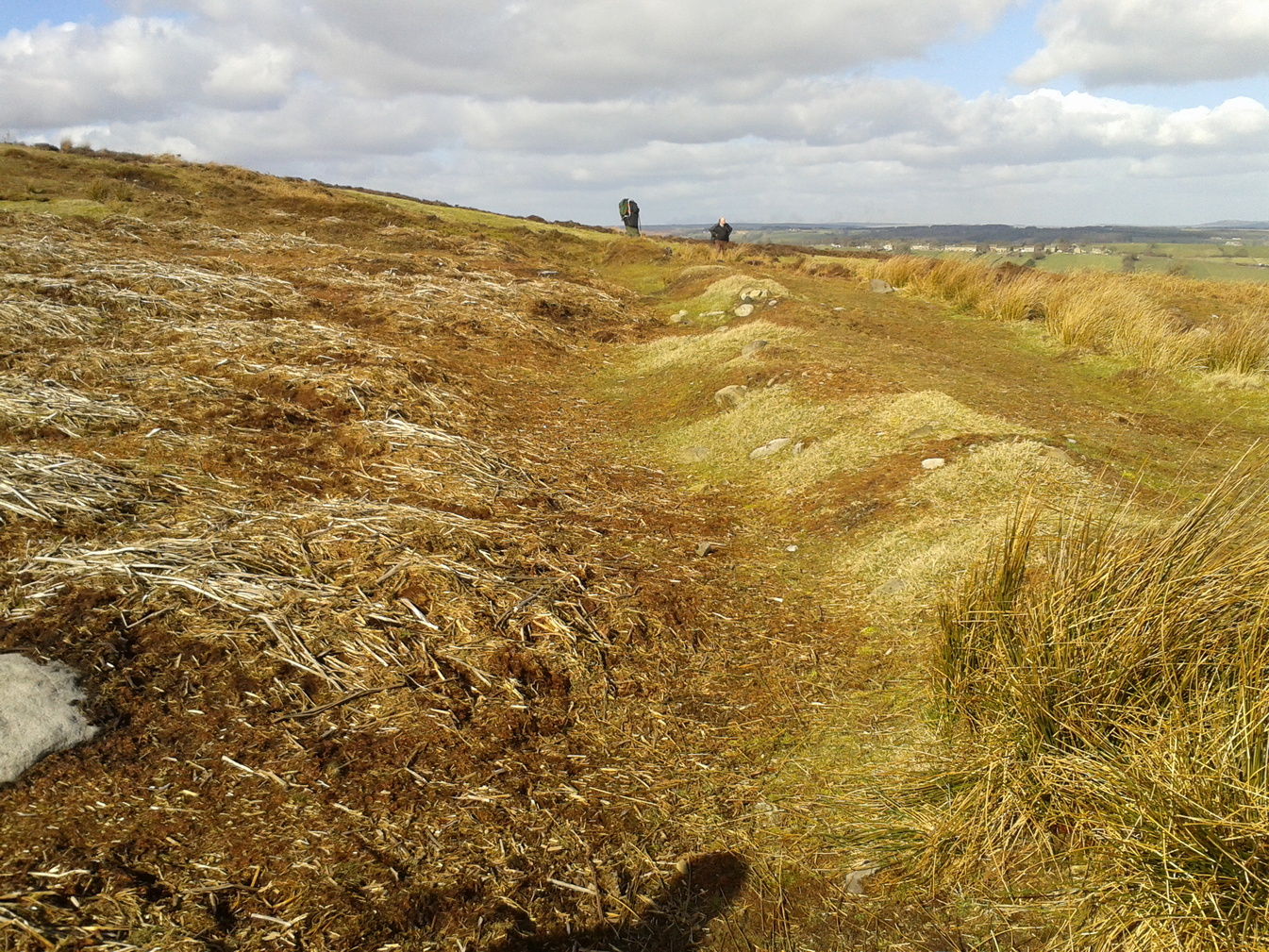
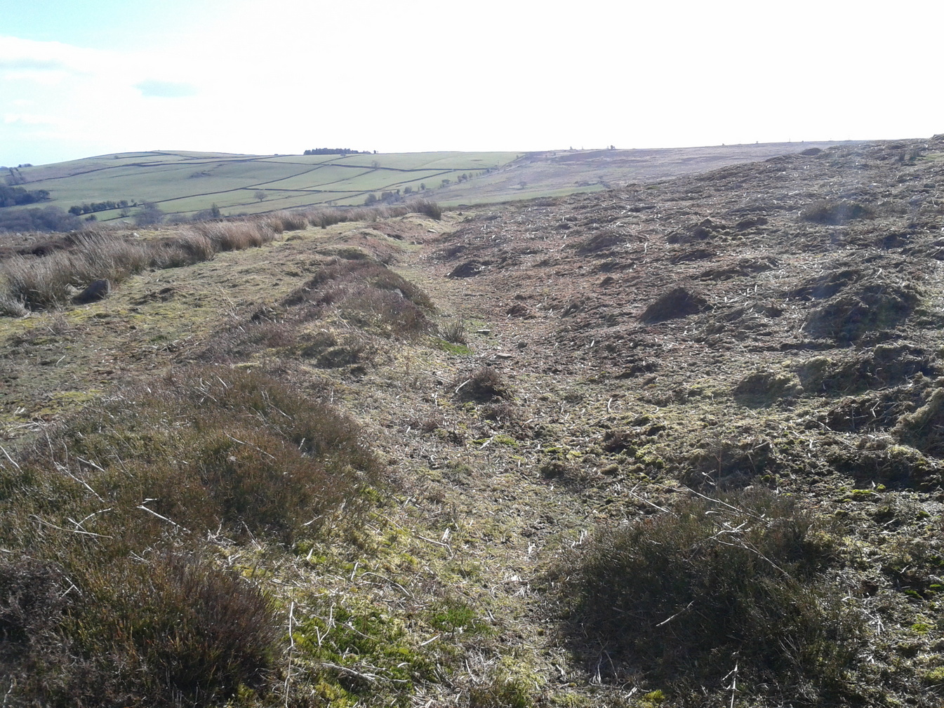
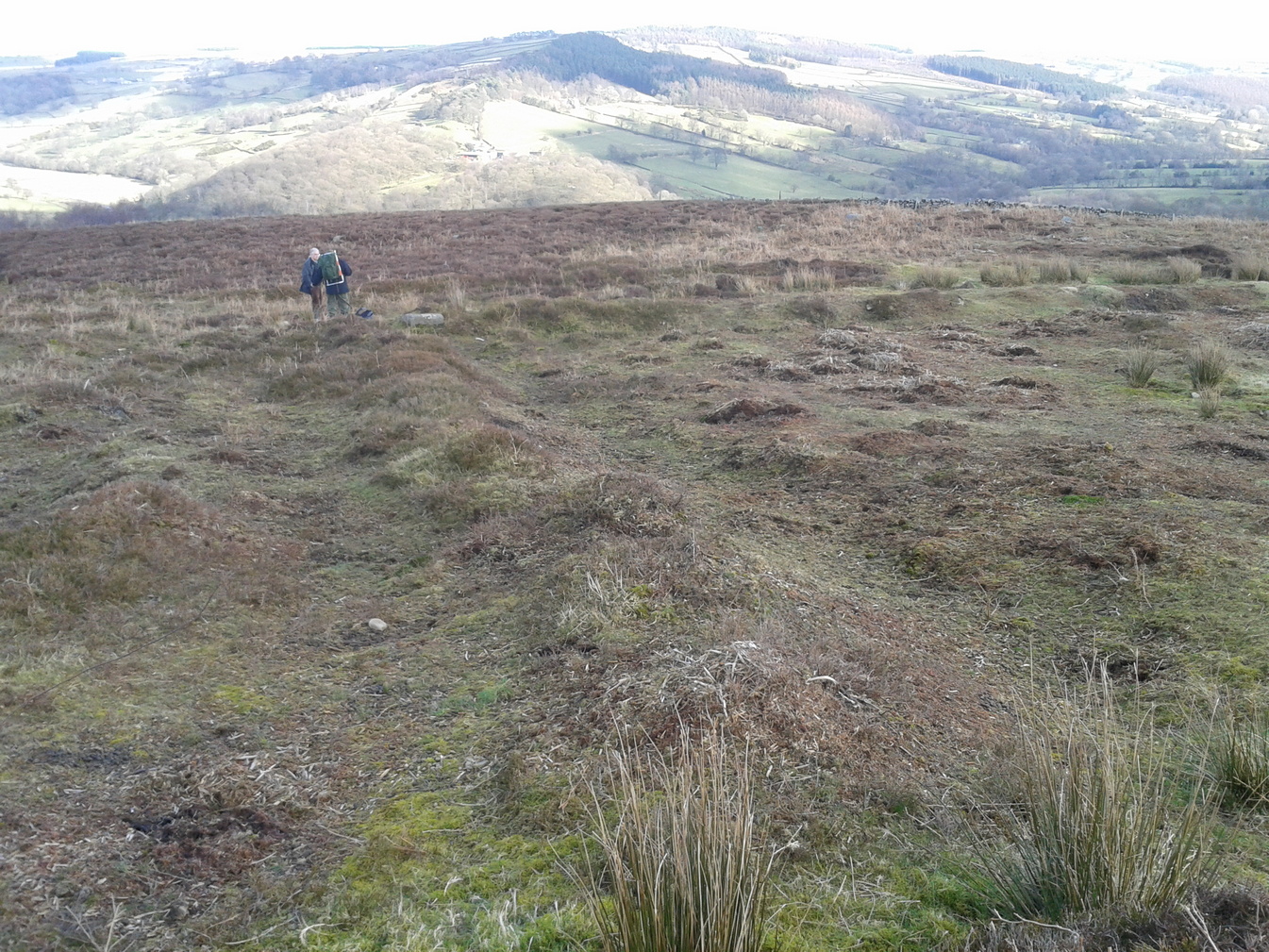
Eastern ditch, looking NEastern ditch, looking S
It’s a large site – and one which Cowling thought was constructed in the Iron Age. He may have been right, but there’s such a profusion of ancient sites on this small moorland area—dating from Neolithic times onwards—that it could be earlier than he thought. It’s an odd site too! Unlike the prehistoric D-shaped enclosure and settlement on the top of the slope less than 100 yards away, and an equivalent D-shaped enclosure to the south, the area inside Cowling’s enclosure ostensibly is on quite sloping ground, with barely a flat level area anywhere inside it. As a result of this, we can safely conclude that it wasn’t where people lived; and the complete lack of any inner hut circles (which you’d expect in a standard enclosure of this size) encourages this view. It’s a bit of a puzzle! Cowling opted for the idea that it was built to enclose cattle – which may be right; but again, even this must be questioned, as there is ample space on more level ground where this could have been done. His description of the site is as follows:
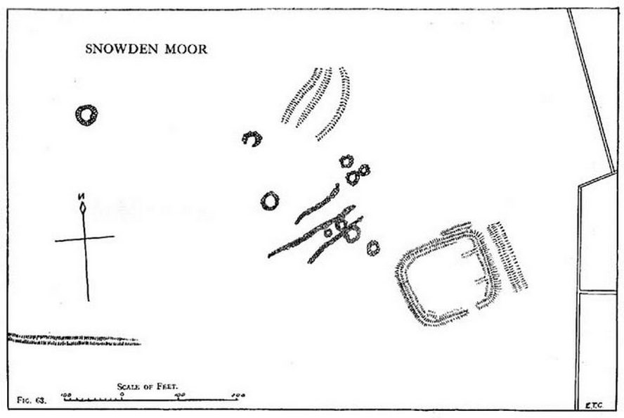
“The most prominent feature (on these moors) is a D-shaped enclosure which covers the nose of the spur; the area is eighty feet from north to south and seventy feet from east to west. The enclosing bank is of piled boulders, three feet high and eight feet wide. Cuttings across the north side revealed no evidence of dry walling, but rather a bank to carry a heavy stockade. A shallow trench runs inside the bank, which is doubled where it is overlooked by higher ground at the northeast corner. A second outer bank at the eastern side has an outer trench. Along the ridge to the east are circles of varying size, probably a hut group. A larger circle (?) of heavy material, some thirty feet in diameter, is isolated on the shelf above Snowden Crags to the west. Strips of wall and remains of enclosures of circular shape abound.”
Cowling’s plan of the siteNorthern bank, looking E
Cowling’s initial measurements of the site underestimated its real size, as the bank and ditch that runs roughly north-south is close to 52 yards—nearly twice as long! The same was found along its east-west size: being 56 yards, which is more than twice what Cowling measured. Altogether, the enclosure measures approximately 225 yards around its outer edges. In fairness, Cowling’s error was probably due to it being covered in vegetation when he came to do his measurements here. …So, if you’re gonna check this place out, make sure you do it in the winter or early spring months, before the bracken encroaches.
There’s a real abundance of prehistoric sites all over this part of the moor, from more settlement remains, cairns, ring cairns and petroglyphs. Make a day out of it.
References:
Cowling, Eric T., Rombald’s Way, William Walker: Otley 1946.
Take the same directions as if you’re going to visit the Naked Jogger Carving (stone 612), not far from the well-known Tree of Life Stone. From the Naked Jogger carving, walk up the small outcrop of rocks that bends above you. Barely 100 yards up when you reach the top, you’ll notice a single large sloping stone barely 50 yards ahead of you in the same field. That’s the spot!
Archaeology & History
This is a little-known beauty of a carving just off the edge of the quiet moors that are littered with prehistoric remains. It was only rediscovered a few years ago — by myself if you believe the writings of rock art student Keith Boughey (2010) in his essay on the validity of so-called “amateurs”who research and discover petroglyphs (Boughey’s essay is scattered with mistakes). But I’d never even visited this carving until two years ago! The stone was in fact found during a field-walk by early members of the Northern Earth Mysteries group in August 1989 (Wilson 1990) and subsequently described and illustrated for the first time by Phil Reeder (1990).
Close-up of main cluster
As can be seen in the photos accompanying this site profile, the rock on which the carving has been done has, at some point in the past, been cut into and its edges have been hacked away and destroyed, literally cutting into the overall design. We have no idea what the original size of the stone was, obviously, but this petroglyph was once larger than the design that we see at present. Such is the price of ‘progress’, as some folk call it.
Anyway – a few months after the carving was rediscovered, Phil Reeder (1990) wrote:
“After a visit to the Tree of Life stone…a cursory inspection by the NEM Group was made on nearby rock outcrops, part of which showed evidence of recent exposure due to soil erosion.
“One stone in particular stood out as five shallow cups and associated rings could be discerned. When cleaned, it became apparent that further carvings extended beneath a thin eroding soil layer. When this layer was cleared, a complex set of carvings were revealed.
“Only preliminary work at the site has been carried out to date, but it appears that the carvings comprise of at least 28 cups, 13 of which have associated rings; several of the cups are linked by gutters forming an intricate design, one gutter part enclosing 11 cups. The carvings on the lower edge of the stone have weathered badly and are difficult to interpret.”
Reeder’s so-called “amateur” description is a good one. Certainly more accurate than the subsequent one by Boughey (“I’m a professional”) & Vickerman (2003):
“Large rock of coarse grit whose surface slopes with the hill. About forty cups, some large, many with single rings, and many curving grooves, the whole forming a remarkable, complex design.”
Phil Reeder’s 1990 drawing
Boughey & Vickerman’s sketch
We can see in the respective drawings by both Reeder (left) and Boughey & Vickerman (right) that some elements which should have been included in the ‘official’ drawing were missed, yet had been accurately included in the earlier ‘preliminary’ drawing, as Mr Reeder put it. I hope that readers will forgive me pointing out these seemingly minor elements; but I do it to illustrate the ineffectiveness of more recent rock art students who are gaining the title of ‘experts’ in this field. It’s important to recognise that, in this field of study, “experts” are few and far between indeed… I’ve certainly yet to meet any!
Northern end of carving
Southern side of carving
The carving is mentioned briefly in Beckensall’s (1999) introductory study, with little comment. But of note here is not only the curious linear feature running between two cup-and-rings, but the position of the stone in the landscape. For if you sit either upon or next to this carving, you are looking east straight across the gorgeous Fewston valley directly at the prominent wooded hill of Sword Point. As it slopes down into the present-day greenery of fields and scattered woods, the Wharfe Valley spreads out to the distant east and, as the sun rises and scatters its rays onto the wet morning stone here, the design on the rock awakens with much greater visual lucidity than that which our daytime eyes bestow to us. In all likelihood, sunrise was an important element in whatever mythic function underscored this curious carving, with its human-like figure rising on its southern side, emerging from the edge of the rock, personifying perhaps the rising solar disc and the living landscape as the daylight breath awoke Earth’s creatures; or maybe it signifies a symbolic group of people gathered together watching the sunrise…
Of course, I’m dreaming… (how very amateur of me! 🙂 )
References:
Barnett, T. & Sharpe, K. (eds.), Carving a Future for British Rock Art, Oxbow: Oxford 2010.
Beckensall, Stan, British Prehistoric Rock Art, Tempus: Stroud 1999.
Boughey, Keith, “The Role of the Amateur in the Study of UK Prehistoric Cup-and-Ring Art,” in Barnett & Sharpe, Oxford 2010.
Boughey, Keith & Vickerman, E.A., Prehistoric Rock Art of the West Riding, WYAS: Leeds 2003.
Chappell, Graeme, “North Yorkshire Rock Art – New Discoveries,” in Northern Earth, no.62, 1995.
Michell, John, The Earth Spirit, Thames & Hudson: London 1975.
Reeder, Phil, “Snowden Carr Rock Carvings,” in Northern Earth Mysteries, no.40, 1990.
Get yourself to the impressive multi-ringed Greystone Allotment carving, then walk to the copse of trees close by and bear left, following the edge of the fence along and following it when it turns down at right-angles, until you hit the bottom corner of the trees, where a path cuts in front of you. From the bottom corner of the trees walk 25-30 yards diagonally away from the trees. It’s under your nose somewhere damn close!
Archaeology & History
This is another archetypal cup-and-ring stone, similar in size and design to the recently discovered Slade (02) carving on Blubberhouses Moor, just over 4 miles (6.5 km) northwest (followers of Alexander Thom’s megalithic inch theory might be interested in assessing the measure of these two). It is one of number clustered in and around this small grass ‘moorland’ region, where a number of carvings perished in the 19th century. Thankfully this one survived. Boughey & Vickerman’s (2003) brief notes on the stone tell:
“Small, rough grit rough of regular oblong shape set very low in turf. Two cups, each with a ring, and connected by a groove.”
On a recent visit to see this carving, Danny Tiernan, Paul Hornby, James Elkington and I were unable to locate it. The carving may well have been destroyed, or moved. If anyone is aware of what has happened to this petroglyph, please let us know. We will be contacting the local authorities to see if any explanation is forthcoming from them.
References:
Boughey, Keith & Vickerman, E.A., Prehistoric Rock Art of the West Riding, West Yorkshire Archaeology Service 2003.
From the Askwith Moor Road parking spot, walk up the road for about 500 yards and head to your right (east) onto the moor. Walk past the upper side of the disused quarry and through the heather for about 200 yards until the moorland slopes down and you’re on another flat moorland ridge. You should now be stood on the edge of the Snowden Crags Necropolis or cairnfield. There’s a large patch of bracken near the top of Snowden Crags in the middle of the prehistoric cemetery. That’s the spot!
Archaeology & History
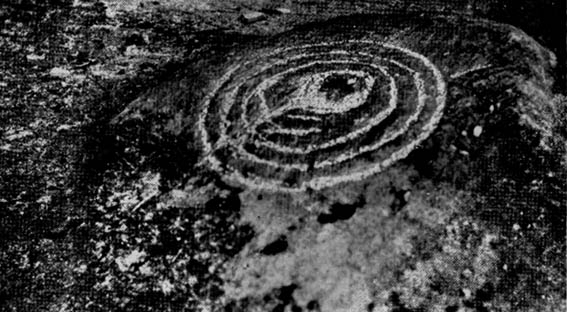
Very little has been written of this site and for years several of us have wondered whether or not a stone circle was the antiquity that was being described in the only singular reference of the place, mentioned almost in passing in Mr Cowling’s (1946) fine survey of this area more than fifty years back, where he reported:
“A large circle of heavy material, some thirty feet in diameter, is isolated on the shelf above Snowden Crags to the west.”
But despite the various explorations of me and a number of other students on these moors over the last 20-30 years, Cowling’s curious singular reference (which some have taken as an error of judgement on his behalf) has remained a mystery. Until now!
South & west portion of the ring (photo credit: Geoff Watson)The complete circle, looking NW (photo credit: Geoff Watson)
Thankfully, with the help and attention of the hardworking Keighley volunteer Michala Potts on Thursday, 20 May, 2010, this large and very well-defined antiquity has been relocated — and a damn fine find it is indeed! It would appear (unless someone has notes to the contrary) that when Cowling did his extensive walkabouts on these and adjacent moors, this Snowden Crags Circle was much overgrown in heather and bracken; and I think we can safely assume this due to him making no further remarks regarding the site. Indeed, it would seem that Cowling’s consequent silence on the matter would lend us to think he never caught good sight of this “large circle” ever again. And upon these moors, that’s easily done when the heather gets deep up here! (numerous cup-and-ring stones on these and other northern moors still lay hidden amidst moorland undergrowth, awaiting rediscovery as a consequence of the deep vegetation) But thankfully now we have a good view of the place.
Wrongly ascribed by Neil Redfern of English Heritage to be a part of Scheduled Monument Record number 28065: Cairnfield, Enclosures, Boulder Walling, Hollow Way and Carved Rocks (it’s actually a short distance north of SMR 28065), the site here was relocated during one of The Northern Antiquarian exploratory walks, assessing the extensive walling, settlement pattern and prehistoric graveyard that scatters the central and northwestern section of the moors here. Michala Potts stopped and shouted for Dave Hazell and I to come and have a look at something she’d found whilst we were carefully peeling turf back from a previously unrecorded site about 100 yards away.
“What is it?” I asked; expecting just another small tomb or new cup-and-ring stone. But her tone of voice was different this time.
“I think you’d better take a look at this,” she emphasized.
As we walked through the shallow heather towards her, it became obvious she was standing in a rough circle of dead bracken, unbroken by the lack of rain over the previous months. We’d actually walked past it a couple of times the previous week and gave it no attention due to the depth of the dead vegetation covering the area. But this time it was different. I got within 50 yards of where Mikki was stood and my footsteps slowed; a couple more steps perhaps; then I stopped dead in my track. My arms lifted up and I held my head gazing at what she appeared to be stood in.
“Aww my god….” I said — transfixed at what was in front of me (I’m easily pleased aswell!).
Snowden Crags circle, looking west (photo credit: Geoff Watson)
I’m not quite sure how long I stood there with my head in my hands. Ten seconds or so. I couldn’t really say. I think it was when Dave caught up to where I stood, rooted, and appeared at my side. We walked a bit closer to make sure that what we could see wasn’t just another one of those curious shapes in the landscape that you find when seeking out prehistoric sites and turn out to be bugger all — but it wasn’t. Instead, Mikki Potts had stumbled upon an average-sized ring of stones, between 1-3 feet tall, and about 13 yards across, with what seemed like an entrance on its southern side, seemingly untouched in the middle of the mass of decaying bracken! It was an exciting find — as it’s not everyday that you come across a previously unrecorded stone circle. But, once we’d calmed down and walked round and round the site to make sure that something man-made was under our feet, we decided to make our way home (we’d been on the moors all day) and get back up to have a more detailed look at the place in a few days time. On Tuesday, May 25, we went back up for a second time and had a better look at the place…
It was another lucky day. For before we even reached Askwith Moor, Mikki pointed out what looked like a small cup-marking on a stone yards from the edge of the River Wharfe. We brushed off a bit of the dusty earth and were greeted the single cup-marked stone we’ve named the Riverbank Stone. It sat there all alone and dusty and we were very tempted to look for more potential carvings along the riverbank, but the Snowden Crags site was calling for attention and so up the hill we walked.
The ring of stones was still covered in a carpet of dead bracken and also had the new shoots of Spring emerging from the Earth, so we spent the next few hours picking up much of the dead bracken and carrying it beyond the outskirts of the circle, hence enabling us to see with greater clarity the monument Mikki had found a few days previously. The hot sun shone down on us all day and it took longer than we expected to shift all the bracken; but eventually, once we’d done it, we were looking at a very distinct man-made circular monument, measuring 13 yards by 12 yards across and, at its highest point, not even three feet above the present ground level. But today’s ground level is certainly much higher than it was when these stones were first placed here — at least 12 inches higher.
Rubble bank, NE-SE section (photo credit: Geoff Watson)
When Mikki first clapped eyes on the place, only a few small upright stones were sticking up amidst the mass of compacted bracken, but once all this had been brushed off we could see the stony earthworks averaging 18 inches high around the edges; and in places this outer ring is nearly 6 feet across. The ring consists mainly of smaller packing stones (perhaps thousands of them) between a number of larger upright stones — a dozen of them — making up the perimeter; but much of this perimeter is still considerably overgrown in compacted vegetation that’s prevented us seeing the ring in its proper glory: what archaeologists in the past have called a rubble bank. On its southern side is what appears to be an entrance, i.e., in this part of the circle there are no larger stones at all and only a handful of small stones have been noticed; but we must take into account the fact that we’ve done no excavation work here and this “entrance” may in fact be illusory, as the centuries of compacted vegetation (in all probability at least 12 inches deep) could be overlaying an unseen portion of the ring. This “entrance” is about 2 yards across.
The circle has similarities in size and design to the better-known site of Roms Law on Ilkley Moor. The difference between the two however is Roms Law has been robbed, whilst the Snowden Crags circle hasn’t even been catalogued. Yet there is a distinct anomaly here.
As we walked through the southern “entrance” and into the circle, we noticed what seemed to be some form of internal walling running roughly north-to-south. This “walling” started about three yards between the southern “entrance” and the inside of the ring, but then it ran roughly through the centre and all the way to the northern perimeter. This was indicated by a distinct rise in the ground which, as you walked over and stomped your feet, proved to be a mass of numerous small stones seemingly a few inches under the ground, some of which were poking through the Earth’s surface. This ingredient alone made me stop and wonder about the nature of the site. Had we come across a cairn circle of some sort? Or were we in fact stood in the middle of a small walled enclosure, which itself sits in the middle of this prehistoric graveyard? Indeed, was this walled enclosure a potential living quarter: some sort of large hut circle with a wall through the centre splitting it in two? It was hard to say for sure. On another visit to this site a couple of weeks later, in the company of Geoff Watson, Paul Hornby and Dave Hazell, this potential internal walling was given a bit more scrutiny.
We were dying to get our hands and feet digging at the heart of this ring of stones but — as yet! — we’ve managed to restrain ourselves. Although carrying off the mass of dead bracken has dislodged a couple of the small fist-sized stones at the edge of the ring (we carefully placed ’em back into position; yet it was only as much as you’d unintentionally disturb if you walked over the place a few times), we needed to use a couple of small brushes to have a look at this apparent internal walling running through the middle of the ring. But after carefully brushing off the dry dead earth, we found this “walling” was nothing of the sort! Instead, it seemed, someone at some time in the past had beaten us to this place! The central walling was, in fact, where someone had dug into the central region of the circle — probably looking for treasure or other wealthy valuables — and in doing so had dislodged a great number of the small stones that were initially in the middle of the ring, and in doing so pushed them up into small piles of stones, away from their original central position, creating an obvious long line of rocks which, once covered with dead vegetation, gave the impression of it being a length of walling. We also found that the mass of rocks that were around the centre of the ring also spread outwards covering all of the ground inside the outer kerb of stones — probably thousands of them. Geoff called this trench in the middle, the Robber’s Trench!
This begged the question: who the hell had been here, dug out a trench in the middle of this cairn circle (possibly taking out whatever remains were in the middle) centuries before the site had even been catalogued? It didn’t seem like it could have been Mr Cowling, as the covering vegetation was much more than a mere 50 years of age; and Cowling would very likely have reported any finds that he might have made here. So it is a mystery that needs solving.* Again, an accurate archaeological excavation would be invaluable here — but I wouldn’t hold your breath. Archaeological officials don’t seem interested in helping here. I was informed by Neil Redfern of the archaeology department of English Heritage for North Yorkshire that they are unable to support any funding that might help towards any decent analysis of this important archaeological arena (probably spent all their cash on prawn sandwiches and tedious autocrats, as usual).
So what we have so far is this: a large flattened circle consisting of at least a dozen upright stones that define the edges. Between these uprights are hundreds, perhaps thousands of smaller stones, making a rubble bank of a near unbroken circle, apart from where there seems a small entrance on its southern side. Inside the circle is a scattered mass of many small stones, typical of cairn material, filling the entirety of the monument; but the central region has been dug into at some time in the past, by persons unknown. It sits on a flat plain of moorland amidst the Snowden Crags Necropolis with around 30 other small cairns. But this particular site is several times larger than all the others, probably indicating that whoever was buried/cremated here was of some considerable importance in the tribal group: a local king, queen, tribal elder or shaman. Whoever it was that this monument was made for, the landscape reaching northwards from here looks across to the giant morphic temples of Brimham Rocks and the heavenly landscape beyond and above them. It is very likely that the Lands of the Ancestors this way beckoned…
References:
Cowling, Eric T., Rombald’s Way: A Prehistory of mid-Wharfedale, William Walker: Otley 1946.
Huge thanks for the help, assistance and photographs of this newly discovered site — and others nearby — to Michala Potts, Dave Hazell, Paul Hornby and Geoff Watson.
* There is a legend that tells of gold and treasure found at a nearby pre-christian well, but this site is a mile to the north of here. Another nearby treasure legend is that of a chap called “Robinson”, who came upon tons of wealth from an unknown source, enabling him to build the eloquent Swinsty Hall a mile northwest of here (though such a chap didn’t actually build Swinsty!). Perhaps there’s some grain of truth somewhere down the line about someone finding some treasure hereby…perhaps here…perhaps not!
AN APPEAL TO SOME DECENT RICH CHAP FOR SOME MONEY TO ENABLE EXCAVATION HERE!
This site and the surrounding monuments have received no archaeological attention of any worth. If it wasn’t for the fact that us amateurs had explored these (and adjacent) moors, this cairn circle would remain unknown, many of the cup-and-rings upon these moors would remain unknown, the extensive enclosures and walling (of indeterminate age and function) would remain unknown, many prehistoric tombs would remain unknown, etc. It is clearly evident that we have quite extensive domestic and ritual remains covering this small moorland region, from the neolithic period onwards. In the event that anyone reading this with a healthy financial backing behind them could work out a financial strategy enabling us to accurately excavate this and the adjacent monuments, please get in touch. We need an archaeologist to be paid for in order that we can do the duties correctly, but there is a group of a dozen volunteers willing to put a lotta work in to do the right job in this and the surrounding sites. Is there anyone out there who has the finance to enable this? I’m serious! Or are these important sites merely going to be left alone for the elements to consume and disappear over time? Surely there are one or two rich antiquarians left in this country who, as in times of old, are willing to help in the investigation of our country’s ancient monuments? Does anyone out there know how we can get the ball rolling?
Dead easy this. From Otley, take the north road over the River Wharfe and turn left following the signs to Askwith, where you’ll hit Weston village first. Once here, take the small left turn down to Weston Hall and the accompanying church. Go into the churchyard and check the graves!
Archaeology & History
This is a real curiosity. It’s found in the graveyard of All Saints church, Weston, where one of the graves has several small stones on it, with this small stone with the following cup-and-ring designs upon it. A plaque has been attached to it as a memorial to one ‘Susan Mary Dawson’. Strange…
Sid Jackson’s 1958 sketchCup-marked stone deliberately placed on a christian grave
It was first written about by Sidney Jackson (1957), but where it first came from and why it has been placed here in a christian setting is something of a mystery. It’s also odd inasmuch as although we know that there was some form of ritual or geomantic use of cup-and-rings in relation to neolithic and Bronze Age burials — that such a tradition has been performed by this particular family on this grave. It is obviously highly unlikely that this family had any knowledge whatsoever of burial traditions in relation to cup-and-ring art (please, shoot me down in flames if you know otherwise), so this re-use of this prehistoric stone is likely to be little other than fortuitous. But then, the occult history of some of the influential families in and around this region in relation to witchcraft, ancient kingship and esoteric practices, might indicate otherwise…
Does anyone know anything about the Dawson family history which might throw light on this modern use of a prehistoric tomb marker? It has all the hallmarks of once coming from a prehistoric cairn, but we know little of its history prior to 1957.
References:
Boughey, Keith & Vickerman, E.A., Prehistoric Rock Art of the West Riding, WYAS 2003.
Jackson, Sidney, ‘Cup-and-Ring Boulder, Weston Churchyard,’ in Cartwright Hall Archaeology Group Bulletin, 2:16, 1957.
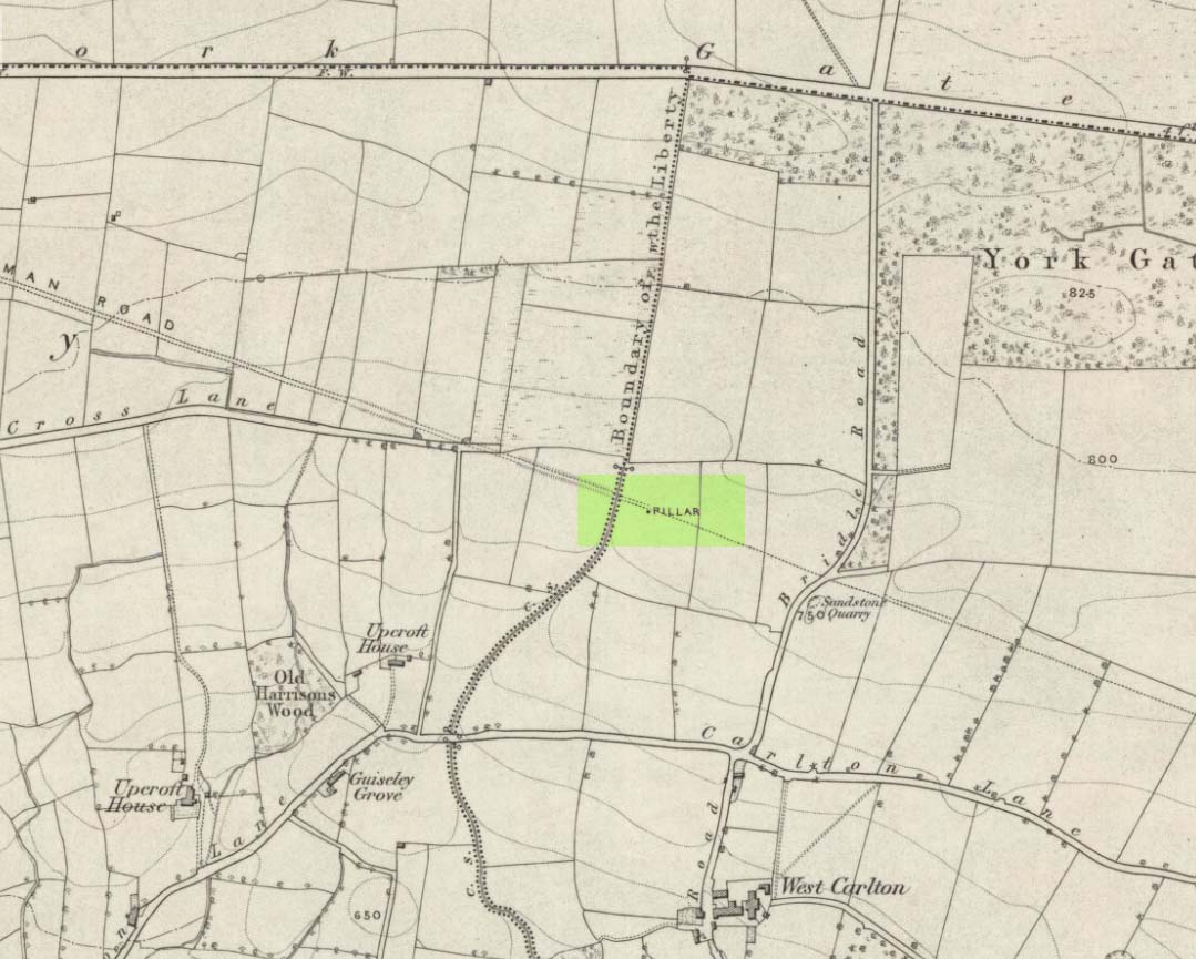
Worth checking this if you aint seen it before! Head up to the back (south-side) of Otley Chevin (where the cup-and-ring Knotties Stone lies sleeping), following the road there and park up near/at the Royalty pub. Take the footpath behind the pub which crosses the fields and once into the second field, head diagonally down to the far-left corner. From here, look over the wall — you can’t really miss it!
Archaeology & History
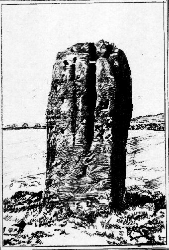
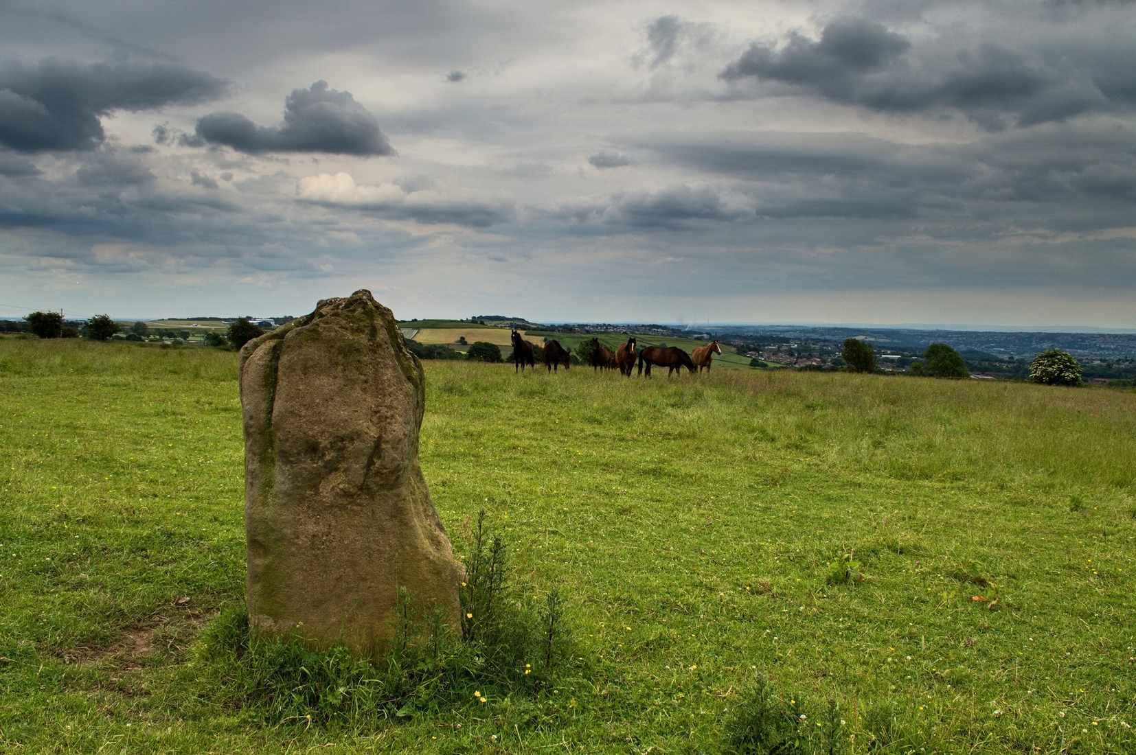
An intriguing site for various reasons. All we have left to see of any value nowadays is this nigh-on 6-foot tall thick monolith, standing alone in the field halfway between West Carlton and Otley Chevin. Completely missed in local archaeological surveys, the place was mentioned briefly by Slater (1880); though it appears to have been first described in detail by Eric Cowling (1946), who suspected the stone may have Roman origins (though didn’t seem too convinced!), saying that:
“near the ground the section is almost oblong, with sides three-feet six-inches by one-foot ten-inches; two feet from top, the section is almost circular.”
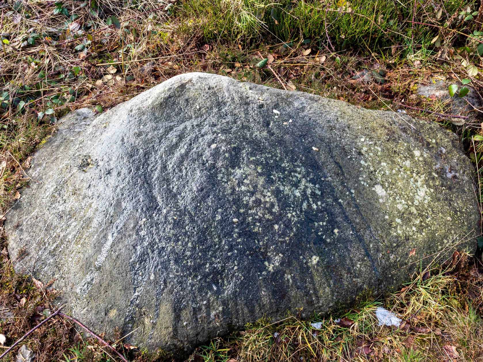
The fact that the stone stands very close to the line of an all-but forgotten Roman road that runs right past it added weight to this thought (the road runs towards a Roman settlement a mile east of here near Yeadon). But this standing stone is unlikely to be Roman. More recent evidence seems to indicate a relationship with a now-lost giant cairn about 100 yards to the south. The only remains we have of this place are scatterings of many small loose stones nearby. And it seems a very distinct possibility that the extra standing stones that were once hereby, stood in a line.
The very first reference I’ve found about this site also indicates that there was more than one stone here in the past! In 1720 this site was known as the ‘Boon Stones’; and the plural was still being used by the time the 1840 Tithe Awards called them the ‘Boul Stones.’ Initially it was thought that both words were plural for “bulls” — as A.H. Smith (1962) propounds in his otherwise superb survey — but this is questionable. (see Folklore)
Folklore
A piece of folklore that seems to have been described first by Philemon Slater (1880) relates to the pastime of bull-baiting here, that is –
“fastening bulls to it when they were baited by dogs, a custom…still known to the Carlton farmers” (North Yorkshire).
Cowling (1946) told that he heard the stone was said to be lucky as well as being a source of fertility. This ‘fertility’ motif may relate to the meaning of the stone’s early name, the Boon Stones. Both boon and boul are all-but obsolete northern dialect words. ‘Boul’ is interesting in its association with a prominent folklore character, as it was used as a contemptuous term “for an old man.” Now whether we can relate this boul to the notion of the ‘Old Man’ in British folklore, i.e., the devil, or satan — as with the lost standing stone of The Old Man of Snowden, north of Otley — is difficult to say.
More interestingly perhaps is the word ‘boon’, as it is an old dialect word for “a band of reapers, shearers, or turf-cutters.” This band of reapers ordinarily consisted of five or six people and would collect the harvest at old harvest times. And as the early description talks of Boon Stones, this plurality would make sense. One curious, though not unsurprising folklore relic relating to these boons was described at another megalithic site (now gone) by John Brand (1908), where in the parish of Mousewald in Dumfries,
“The inhabitants can now laugh at the superstition and credulity of their ancestors, who, it is said, could swallow down the absurd nonsense of ‘a boon of shearers,’ i.e., reapers being turned into large grey stones on account of their kemping, i.e., striving.”
Standing stones with the folklore of them being men or women turned to stone is common all over the world. If we accept the dialect word ‘boon’ as the first name of this old stone, there may once have been some harvest-time events occurred here long ago (and this is quite likely). Equally however, we must also take on the possibility that this Bull Stone has always been a loner and that its name came from the now obsolete Yorkshire word, a bull-steann, meaning a stone used for sharpening tools, or a whetstone.
Take your pick!
References:
Bennett, Paul, The Old Stones of Elmet, Capall Bann: Milverton 2001.
Brand, John, Observations on the Popular Antiquities of Great Britain – volume 2, George Bell: London 1908.
Cowling, Eric T., Rombald’s Way, William Walker: Otley 1946.
Jackson, Sidney, ‘The Bull Stone,’ in Cartwright Hall Archaeology Group Bulletin, 2:5, 1956.
Smith, A.H., English Place-Name Elements – 2 volumes, Cambridge University Press 1956.
Smith, A.H., The Place-Names of the West Riding of Yorkshire – volume 7, Cambridge University Press 1962.
Slater, Philemon, The History of the Ancient Parish of Guiseley, William Walker: Otley 1880.
Standing Stone (destroyed?): OS Grid Reference – SE 1765 5032
Archaeology & History
Eric Cowling (1946) described this lost or destroyed stone as “a squat standing stone at junction of the Askwith bridge-path with the Otley-Timble highway, saying how it gave its name to Stoop Hill, “which it surmounts.” But in several ambles here in search of this old stone, we’ve yet to locate it; though we did find the Stoup Hill cup-marking and possible neighbour on the southern edge of the hilltop.
Folklore
In days of olde, the ‘Old Man’ was the fabled companion of the legendary ‘Old Woman,’ or great cailleach (the christian cult stupidly, somehow, turned this mythic figure into their ‘devil’ – to which it has no relationship whatsoever). Although no specific folktale remains here, the name of this lost stone tells that it had some mythic tale underscoring it; perhaps simply that it marked the burial of some forgotten chief or elder.
From The Royalty hotel, walk along the footpath onto the Chevin itself, turning left then walk about 350 yards east, past the small copse of trees. Just north of the main path before the land slopes down you’ll find it. It’s carved on an earthfast rock about 6 feet long.
Archaeology & History
This is an excellent carving if you’re into cup-and-rings! Eric Cowling (1940) first described the stone* in an article for the Yorkshire Archaeology Society. Although it’s somewhat faded, when the stone’s wet and the sun’s low on the horizon, you can make out more rings than just the three which Boughey & Vickerman (2003) described in their survey.
Folklore
Knotties Stone (E.T. Cowling)
Although the Chevin itself has a tradition of ‘supposed’ heathen goings-on in bygone days, the carving has nothing specific said about it. Although one intriguing bit of info comes from the old Otley historian, Harold Walker (1974), who said that, “blocks of stone were sent from (the) Chevin to form the foundations of the Houses of Parliament”!
Those lying deviants probably smashed up a few bits of extra rock art when they did this — not that those sort of people give a shit about anything unless it’s about money.
References:
Boughey, Keith & Vickerman, E.A., Prehistoric Rock Art of the West Riding, WYAS 2003.
Cowling, E.T., ‘A Classification of West Yorkshire “Cup-and-Ring” Stones,’ in Archaeology Journal, 97, 1940.
Cowling, E.T., Rombald’s Way, William Walker: Otley 1946.
Hotham, John Paul, Halos and Horizons, Hotham Publishing: Leeds 2021.
Walker, Harold, This Little Town of Otley, Olicana: Otley 1974.
* Graeme Chappell tells me that this carving was named after Cowling’s nickname, Knotty!
Although cited as being on Weston Moor, it is closer to Askwith village. From the village, take the north road and shortly before reaching the T-junction, park-up (somewhere!). There’s a small copse of trees on your right and fields above them – that’s where you’re heading. You might have to bimble about a bit before the rock catches your attention, but it’s worth the wandering. Look around!
Archaeology & History
Sketch of the design c.1985
This is an excellent, archetypal cup-and-ring stone that’ll be loved by any real rock art student! Cups-and-multiple rings are the main visual feature to this stone, along with another 20 single cups and another primary cup-and-ring, all on a medium-sized sloping rock face. The carving was first described by Cowling & Hartley (1937). Since their initial discovery, several other writers have mentioned it with little further comment. The smaller but impressive double cup-and-ring carving 543 can be seen at the bottom left of the woodland in front of you – well worth seeing if you’re visiting here!
References:
Boughey, Keith & Vickerman, E.A., Prehistoric Rock Art of the West Riding, West Yorkshire Archaeology Service 2003.
Cowling, Eric T., Rombald’s Way, William Walker: Otley 1946.
Cowling, E.T. & Hartley, ‘Cup-and-Ring Markings to the North of Otley,’ in Yorkshire Archaeological Journal, 33, 1937.
Hotham, John Paul, Halos and Horizons, Hotham Publishing: Leeds 2021.
Ellers Wood is at the very northern edge of the beautiful parish of Askwith and has a very particular ambience of its own. The small cluster of at least 5 cup-and-ring stones in this lovely little woodland gives you the impression that they stood out on their own, living here representing the genius loci of this luscious watery vale, all-but-hidden from all but the lucky few. It’s very likely that there are still more carvings hidden away nearby.
The best way to check them out is simply to walk down past the haunted Dobpark Lodge, where it turns into a footpath and where it crosses the lovely old packhorse bridge at the valley bottom, walk a few hundred yards up the river-side (at the bottom of the fields) until you reach Ellers Wood. Once there, look around. This one’s on the west side of the main stream, close by where it meets up with another small burn coming down from the western wooded slopes.
Archaeology & History
First sketch of the carving, c.1994
In the same region as the Ellers Wood 618 and other carvings and very close to the river, somehow this heavily cup-marked stone evaded the prying eyes of such notaries as Cowling, Stuart Feather and Sidney Jackson – all of whom ventured to look at the other petroglyphs in Ellers Wood. But with good fortune, Graeme Chappell and I re-discovered this fine-looking carving in our explorations in 1993-94 and gave it back the attention it truly deserves.
The main feature here is the clustering of cups into sections, as the drawing indicates. It is listed as “stone 614” in Boughey & Vickerman’s (2003) survey.
References:
Boughey, K.J.S. & Vickerman, E.A., Prehistoric Rock Art of the West Riding, WYAS: Exeter 2003.
Cowling, E.T., ‘A Classification of West Yorkshire Cup and Ring Stones,’ in Yorks. Arch. Journal 1940.
Cowling, Eric T., Rombald’s Way, William Walker: Otley 1946.
Cowling, E.T. & Hartley, C.A., ‘Cup and Ring Markings to the North of Otley,’ in Yorks. Arch. Journal 33, 1937.
Grainge, William, The History and Topography of the Forest of Knareborough, J.R. Smith: London 1871.
Grainge, William, History and Topography of the Townships of Little Timble, Great Timble and the Hamlet of Snowden, William Walker: Otley 1895.


")