Follow the directions to reach the nice Big Rock carving. Once here, walk up the gentle slope less than 100 yards eastwards. Get here before the heather grows back, otherwise it’s unlikely you’ll find it!
Archaeology & History
The Little Stone, Bingley Moor
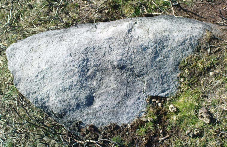
Not previously catalogued, this is just a small trivial little stone with just a single cup-marking on it. There’s a somewhat debatable line which looks more likely on the photo than when you actually see it in situ. As we had the Big Rock just down the slope from here, I thought this could be a little rock, or Little Stone (makes sense!). It was found by your very own Paul and those of you with the wills to seek it out, don’t be disappointed as most are with such a Littlestone. It’s certainly not as rosy as those close by, but hey – it’s another carved rock!
Follow the same directions to reach the Lunar Stone carving. Once here, amble about a few yards to your immediate south and you’ll find it — assuming the heather aint grown back over and covered it!
Archaeology & History
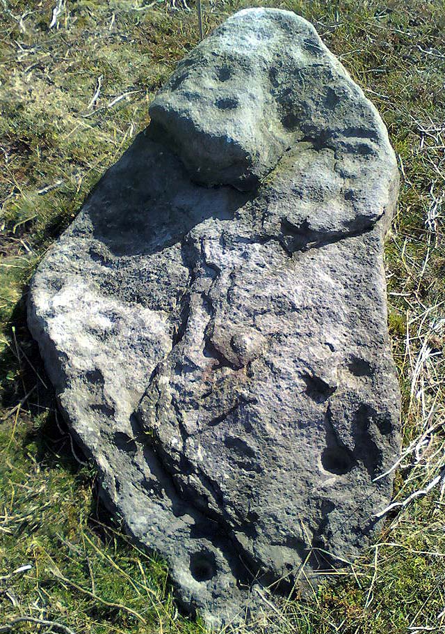
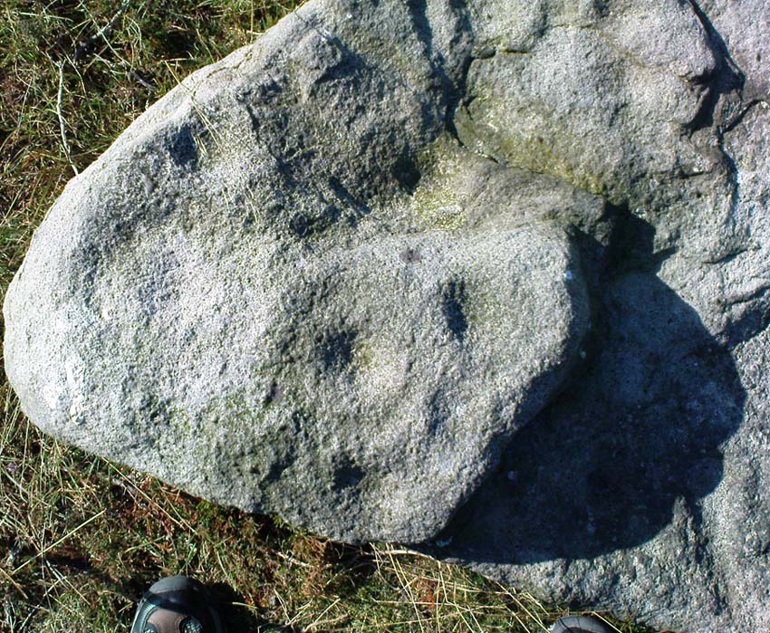
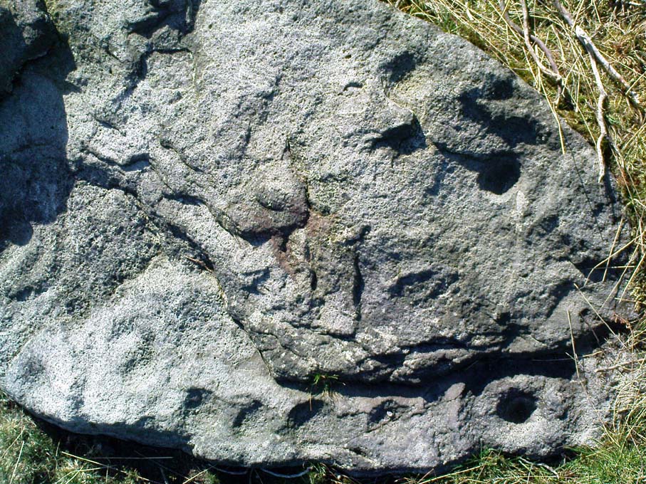
Teaspoon Rock, Stanbury Hill
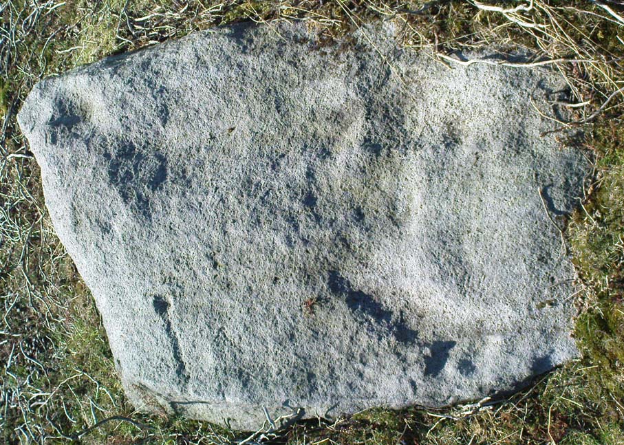
This’d probably be another of those carvings first found by Stuart Feather in his amblings here in the 1970s, but we can’t say for sure. In Boughey & Vickerman’s survey (2003), apart from attributing it as being in two separate positions (mistaking some reference from the English Heritage doods as some other carving – though that shouldn’t surprise anyone!),* they then correctly describe it as having “one cup with groove” running outwards — which we can see quite plainly (lending Michala Potts to say, “it reminds me of a teaspoon!” – hence the title!). There may be as many as four other cups on this rock, though it’s hard to say for sure. Two of them, perhaps, may have a very worn line linking them together (as you can slightly work out on the top-half of the carving) — but again, this is hard to say for sure. Certainly this poor little carving aint quite as decorative as its nearby partners!
References:
Boughey, Keith & Vickerman, E.A., Prehistoric Rock Art of the West Riding, WYAS 2003.
* In their survey this stone was also listed as carving no.98 by mistake, which should now be deleted from subsequent survey listings.
Long Barrow (destroyed): OS Grid Reference – SS 5848 9227
Also Known as:
Cae Bryn-y-garn
Archaeology & History
Described in 1925 in a report by the Royal Institute of South Wales as “the remains of a long barrow,” it seems that all remains of this old site have been destroyed. Where the long tomb once stood are now some bungalows (anyone know if they’re haunted!?).
The tomb was quite an impressive one from all accounts: aligning north-northeast, it was some 20 yards long and 10 yards wide (at its widest), standing between 6-8 feet tall. When building operations started here in 1959, a disturbed mound of stones was noticed, but by 1965 the bungalows had been built where once rested the ancient dead.
The field-name to its immediate east — Cae Bryn-y-garn — tells us the old name of the cairn, as known to local folk. Quite what its folklore may have been, I’ve yet to hear…
References:
Royal Commission on the Ancient & Historical Monuments, Wales, An Inventory of the Ancient Monuments in Glamorgan – Volume 1, HMSO: Cardiff 1976.
Follow the same directions to find the Lunar Stone. Once here, walk just 20 yards southwest and keep your eyes peeled! This is a long flat stone which can easily get overgrown in the heather, so you might need to search around till you find it.
Archaeology & History
Ringtail Stone, Stanbury Hill
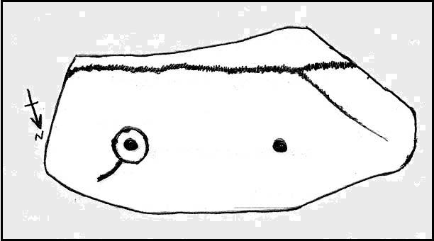
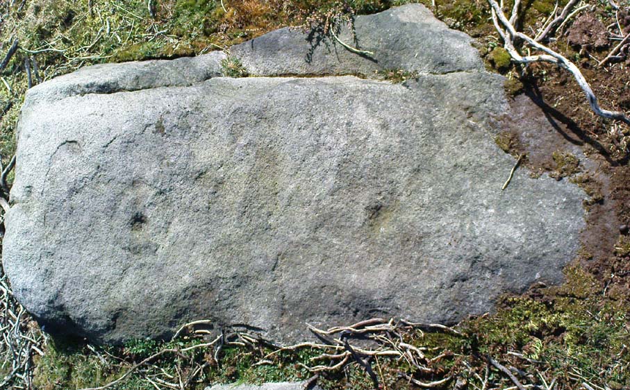
Thought to be another carving first located by Stuart Feather in 1978, though we can’t bne totally sure on that. Curiously omitted from Hedge’s (1986) survey, this old glyph comprises of a single cup-mark near the western end of the stone and a complete cup-and-ring at the eastern-end. It was first illustrated in Boughey & Vickerman’s (2003) fine survey, but they missed seeing a quite distinct line or ‘tail’ coming out the northern side of the cup-and-ring. Nowt special in archaeological terms, but of obvious relevance to the dood who carved it! They thought there may have been two faint cups in the ring, but it isn’t clear by any means.
As with the other carvings nearby, we find it amidst a scattering of prehistoric walling and the remnants of old cairns.
References:
Boughey, Keith & Vickerman, E.A., Prehistoric Rock Art of the West Riding, WYAS 2003.
Follow the same directions as to find the Lunar Stone, Spotted Stone, etc. Go thru East Morton village up the steep moorland road, east, and where the road levels out there’s a right turn and a trackway on your left which leads onto the moor. Go ½-mile up this track till you hit a moorland ‘footpath’ signpost. Stop here and walk due west (left) for a coupla hundred yards. If the heather’s grown back you aint much chance of finding owt – but if there’s only low growth, amble about zigzagging – and keep your eyes peeled!
Archaeology & History
Section of cairn rubble & walling
Although there’s been no written record of the Stanbury Hill remains until very recently, it seems quite probable that Mr Stuart Feather would have come across at least parts of these remains when he uncovered the rock-art in the same vicinity, but he never made public his finds. He was a diligent researcher and finder of cup-and-ring stones, nose to the ground sorta chap, and it would be odd for him to miss the other remains on this hill. For as we now know, there are undeniable evidences of considerable neolithic and/or Bronze Age walling scattered along (mainly) the southern side of Stanbury Hill, running mainly along an east-west axis, but there are also examples of the walling running roughly north-south. In at least one position near the western end of the ridge, halfway down the south-facing slope, is what seems to be the unmistakable trace of an enclosed hearth. At the time of writing a series of archaeological digs are, slowly, being done hereabouts, so it will be good to read their final evaluations.
Very close to some parts of the walling we find the remains of old cairns, and at least one cup-and-ring stone has been carved along the axis of one line of walling (it reminded me very much of the Bronze Age settlement remains found at Snowden Moor, over the northerly horizon, in the Washburn Valley). Several other previously unreported cup-marked stones have also been found here (we’ll highlight them on TNA in the coming weeks).
Upon first impression the remains found upon and around Stanbury Hill seem more related to mortuary practices than what we’d call ‘domestic’ living practices, as the prevelance of carvings and cairns indicates. But we’ve gotta be cautious here, as in many sites the dead were kept with the living; and as we find in many traditional or aboriginal cultures, the land of spirits and that of the living are much more closely allied than in our profane ‘Western’ paradigm.
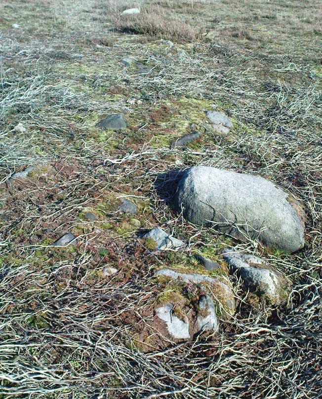
Same direction as the Lunar Stone: from East Morton village take the moorland road, east, up the steep hill. Where the road levels out there’s a right turn and a trackway on your left which leads onto the moor. Go up this track and keep walking till you hit a moorland ‘footpath’ signpost. Stop here and walk due west (left) onto the gently sloping rise of Stanbury Hill. Keep walking for a 250 yards or so, where the land has sloped gently down to the end of the spur; and just 50 yards before it drops down to the stream below, you’ll find a cluster of rocks scattered about. One of the stones here is this one!
Archaeology & History
First reported by Stuart Feather in 1977, this is an excellent carving with an apt title suiting its appearence. Just 13-14 yards west (towards the cluster of other carvings very close by) are the denuded remains of what looks like a robbed cairn. Initially I thought that the archaeologists had been here and turned it over – but it seems not!
Spotted Stone – looking westClose-up of NE section
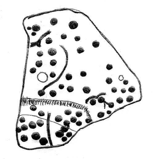
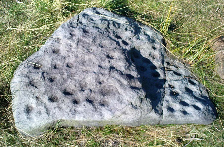
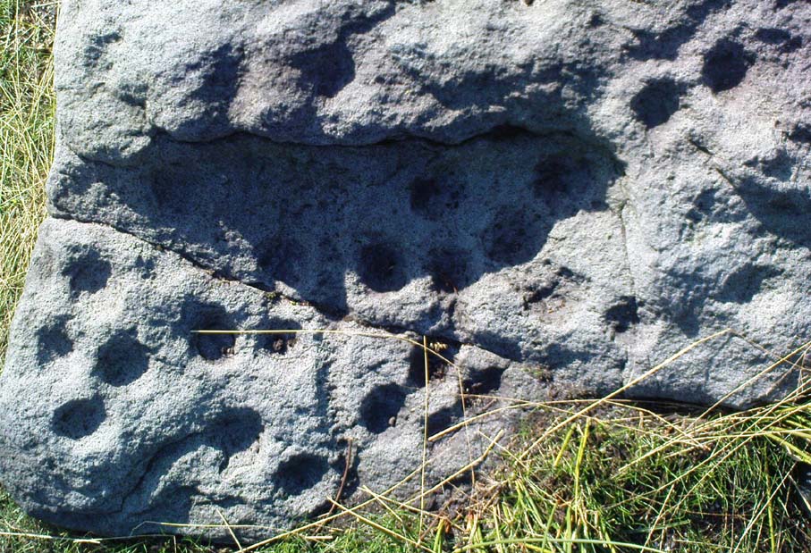
There are between 55 and 61 cup-markings etched onto this stone, with several short lines and ringlets; with one small ridge of two curves ‘arching’ over a couple of cups giving the impression of owl’s eyes! (O.G.S. Crawford would have loved this one in his book, The Eye Goddess!) The stone gave me the distinct impression that it had either once stood upright, or else was part of a burial; and the finding of a prehistoric cairn just a few yards to the west reinforced this thought (although, gotta be said, knowing that cup-&-rings and death is a common theme upon these moors, it’s likely to sometimes afflict my ability to see these carvings with fresh eyes each time I come across them). Added to this is that the carving is in a very good state of preservation, with a considerable lack of general erosion on the cup-marks (as found on the majority of carved rocks on these moors) adding considerably to the thought that this might have once served part of a tomb, or perhaps cist cover and only been brought to the surface in quite recent years. This seems undeniable.
Unless, of course, this carving was etched sometime in the last century…
References:
Boughey, Keith & Vickerman, E.A., Prehistoric Rock Art of the West Riding, WYAS 2003.
Hedges, John (ed.), The Carved Rocks of Rombald’s Moor, WYMCC: Wakefield 1986.
From East Morton village, take the moorland road, east, and up the steep hill. Where the road levels out there’s a right turn, plus (more importantly!) a trackway on your left which leads onto the moor. Go up this traclk and keep walking till you hit a moorland ‘footpath’ signpost. Stop here and walk due west (your left) onto the gently sloping rise of Stanbury Hill. Keep walking for a 250 yards or so, where the land has sloped gently down to the end of the spur; and just 50 yards before it drops down tot he stream below you’ll find a cluster of rocks scattered about. One of the stones here is this one!
Archaeology & History
This is an excellent carving first recorded, it seems, by Stuart Feather in 1977, as cited in the Yorkshire Archaeology Journal’s ‘Listings’ for 1978. It can be found some 27 yards west of a prehistoric cairn near the top of the ridge (14 yards east of the same cairn is the Spotted Stone carving).
Lunar Stone carvingSoutheast section, with 3 cup-and-rings?
We have to assume that when Mr Feather first located this stone that the faint cup-and-rings on the topmost southeast section of the rock had been exposed to the elements from Day 1, so to speak: as the designs here are quite faint and well-worn. Another not unreasonable assumption is that Mr Feather then proceeded to dig away at the rest of the rock, exposing other features on the stone which had laid under the soil for countless centuries, as the northernmost part of the carving has minimal erosion effects on it. Indeed, unless this is true, we have to start thinking that the carving was made over quite lengthy periods of time, due solely to the greater and lesser effects of weathering on different sections of the stone.
As seen in both the diagram and photos, this is a quite extravagent design. Consisting of several cup-and-rings, aswell as a double-ring, it is found amidst a small cluster of equally impressive, albeit very different carved rocks, all appearing to have a quite specific relationship with death and ritual. This and the other stones are found on the western end of a small serpentine ridge of land (Stanbury Hill), with streams flowing on the north and western sides and small remains of marshland to the south. The geomantic feature here, if relevant, relates to movements between the Earth, water, death and the setting sun: quite potent and important issues in the lives of the neolithic and Bronze Age peoples who lived hereby.
Northern section of carving – with calendrical cups?
The title of this stone carving — the Lunar Stone — should be quite evident: the design has all the hallmarks of celestial lunar movements around the ridge of the heavens; or here, pictured along the edges of the rock (symbolic of the firmament), upon and amidst which the moon travels in its rhythmic motion through the heavens. But don’t take that too seriously: it’s just an imaginative flutter that struck my otherwise distraught inability to know what I’m talking about!
References:
Hedges, John (ed.), The Carved Rocks of Rombald’s Moor, WYMCC: Wakefield 1986.
Tumulus (destroyed): OS Grid Reference – TF 232 018
Archaeology & History
Very little was known about this now lost burial mound. It was one of several nearby but, thankfully, the local historian and archaeologist E. Thurnam Leeds (who once lived at the nearby Eyebury Farm) sent a letter to the Society of Antiquaries in London, describing some pottery and other remains that he’d found there:
“The small pot of a late Bronze Age type and the other sherds exhibited were found in a tumulus known as Oliver Cromwell’s Hill, at Eyebury, near Peterborough. As only a portion of the tumulus has been examined as yet, it is proposed to defer a full account of the excavations until further progres has been made. The tumulus is of the round type, about 40 yards in diameter and 5 feet high at the centre. On three sides traces of a ditch were met with, containing soil which had evidently been burnt. Close to the gravel in the centre of the tumulus there were two distinct layers of charcoal, and in two places apparently remains of hearths. The small pot was found only 1½ feet down on the south-eastern side of the mound, 39 feet from the centre. In the centre itself at various depths were found sherds, some of Bronze Age forms; but a pice of a rimmed vase found at a depth of 3 feet 6 inches, about 6 inches above the first charcoal layer, appears to be of Roman date, in which case the centre of the tumulus must have been disturbed in those times, though the charcoal floors were never pierced. Bones of various animals, including sheep, pig, dog and hare, and a large flint flake were also found.”
As far as I’m aware, no further detailed examinations took place at this curiously-named hillock, whose folktale I’ve yet to read.
References:
Leeds, E.T., ‘Letter,’ in Proceedings of the Society of Antiquaries, 22:1, 1910.
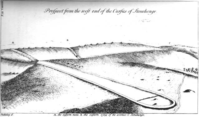
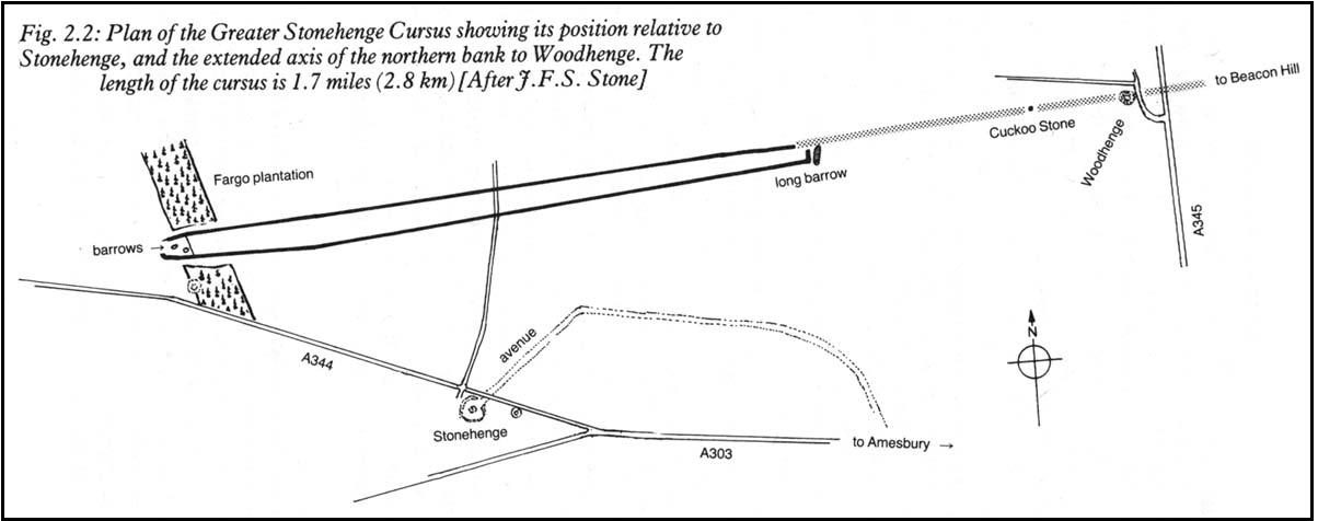
Not far south of the smaller Lesser Cursus monument, this huge linear earthwork was the very first cursus to be described, by William Stukeley no less, who thought it to be an old race-course for charioteers and the like! He stumbled upon this: a curious gigantic linear earthwork feature, stretching for nearly two miles roughly east-west and as wide a football field, cut into the Wiltshire Earth, betraying all notions of ‘primitive’ histories as proclaimed by the ‘intellectuals’ of his day. They were clearly wrong! This immense enigmatic structure, still baffles the same creed of intellectuals to this day — but at least our old ancestors have been granted greater abilities than previously believed. In his book on Stonehenge in 1740, Mr Stukeley described this,
“most noble work, contriv’ed to reach from the highest ground of two hills, extended the intermediate distance over a gentle valley; so that the whole cursus lies conveniently under the eye of the most numerous quantity of spectators. To render this more convenient for site, it is projected on the side of more rising ground, chiefly looking towards Stonehenge. A delightful prospect from the temple, when this vast plain was crowded with chariots, horsemen and foot, attending these solemnities with innumerable multitudes.”
Sir Norman Lockyer propounded its function as astronomical, aligning with the Pleiades around 2000 BC — a date we now know to be inconsistent with its construction, although as John North said in his Stonehenge (1997):
“Lockyer’s chronology was certainly better than the general archaeological consensus at the time.”
But further archaeological alignments and leys have been suggested running eastwards from here. And as Paul Devereux pointed out, “In the case of this cursus, archaeology got there first.” J.F.S. Stone, who carried out some excavations at the cursus in 1947, noted that
“its axis, if projected 1500 yards east, strikes Woodhenge and passes the Cuckoo or Cuckold Stone by the way.”
This was endorsed in 1981 by archaeologists John Hedges and David Buckley:
“In addition to aligning upon Woodhenge, the Greater Stonehenge cursus also sights upon the Cuckoo or Cuckold Stone.”
Alignment to Beacon Hill
In Roy Loveday’s (2006) survey of cursus monuments he told how this alignment goes much further, telling how it aligns “on the lower, northernmost prominence of Beacon Hill 8km away”, crossing Woodhenge on its way. Such suggestions used to bring outcries of derision from the archaeological fraternity, but it seems archaeologists themselves are making such claims more and more these days. At the forefront of modern alignment research in previous decades was Paul Devereux — and it was he who first noted the line-up with the distant Beacon Hill from the Great Cursus, telling:
“The course of the alignment can be extended eastwards a few miles beyond Woodhenge to cross the barrow-dotted ridge of Beacon Hill — a perfect example of a Wakins-style ‘initial point.’ The ridge is highly visible from Woodhenge. It disappears from view as one walks westwards down the cursus, but reappears clearly as the west end is approached. Indeed, the west end is so placed that it is at about the furthest point from which the Beacon Hill ridge , and the intermediate on which the eastern end of the cursus fall, can be seen together.”
…to be continued…
References:
Burl, Aubrey, A Brief History of Stonehenge, Robinson: London 2007.
Hedges, John & Buckley, David G., The Springfield Cursus and the Cursus Problem, Essex County Council 1981.
Loveday, Roy, Inscribed Across the Landscape, Tempus: Stroud 2006.
North, John, Stonehenge, Harper-Collins: London 1997.
Pennick, N. & Devereux, P., Lines on the Landscape: Leys and other Linear Enigmas, Hale: London 1989.
Stone, J.F.S., ‘The Stonehenge Cursus and its Affinities,’ in Archaeological Journal, 104, 1947.
In the midst of the great henge monuments at Thornborough — specifically, the central henge — archaeologist Ian Longworth (1965) said there “was built …a still earlier structure known as a cursus.” This giant monument was one of the earlier such sites located in Britain. Longworth continued, saying:
“This was a ceremonial avenue, running for nearly a mile in a northeast / southwesterly direction. The avenue is defined by ditches 144 feet apart with a bank running along the inside of each ditch. The ditches are now completely filled with plough soil and, as with other cursus monuments in the county, were discovered from the air as two dark lines in the cereal crop… Probably used for ritual ceremonies, no clues remain to show what actually took place.”
Thornborough Cursus (& henges)
This cursus runs almost at right angles to the alignment of the three Thornborough Henges, on the southern side of the central henge, and was first found through the aerial photography of J.K. St. Joseph between 1945 and 1952. When excavation work was carried out, “a crouched burial was found in a stone cist within the southwest end” of the cursus. This end of the monument is rounded, like the Stonehenge Cursus; whilst the northeast end of the monument has not been located. The southwest end of the cursus begins at OS grid-reference SE 2799 7906 and its northeasterly end is roughly at SE 2881 7954. The middle of the known cursus is roughly in Thornborough’s central henge.
Paul Devereux (1989) said that the monument, “which had become silted-up and grass-covered by the time the henge was built, had two main orientations, with a curvilinear, irregular section just to the east of the henge.” Although Norris Ward (1969) thought that the cursus actually went all the way down the River Ure, it stops some distance beforehand, though may obviously have had some important relationship with the waters.
References:
Longworth, Ian H., Regional Archaeologies: Yorkshire, Cory, Adams & Mackay: London 1965.
Pennick, N. & Devereux, P., Lines on the Landscape, Hale: London 1989.
Thomas, Charles, ‘Folklore from a Northern Henge Monument,’ in Folklore Journal, volume 64:3, 1953.
Ward, Norrie, Yorkshire’s Mine, J.M. Dent: London 1969.