Long Cist: OS Grid Reference – SK 2624 8688
Also Known as:
- Ash Cabin Long Cist
Getting Here
Despite a footpath being marked on the OS map, there’s none I could find and the only way to get there is to make your way through the heather. Park at the Wyming Brook nature reserve car park on Redmires road, take the signposted path besides the notice board and follow the line of the dry stone wall. Go through the gate and continue till you come to the end of the wall where a path leads off to your left through the broken wall, follow the path through the boggy bit and head uphill till you get to the highest point of the path by another wall with a path the other side. From here it gets a little tricky! You’ll now need to go off path heading NNE and down hill till you come to the post-and-wire fencing where you should pick up a slight path heading WNW (your left) and head for the high point about half a mile in front of you. Just before you come to the high point you’ll have to cross the stream (easily done). The cist lays on the flat ground just beyond the brow of the rise.

Archaeology & History
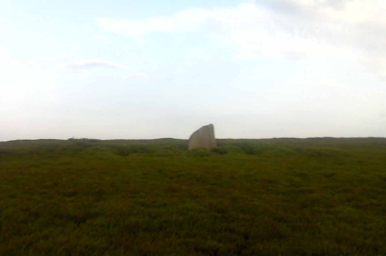
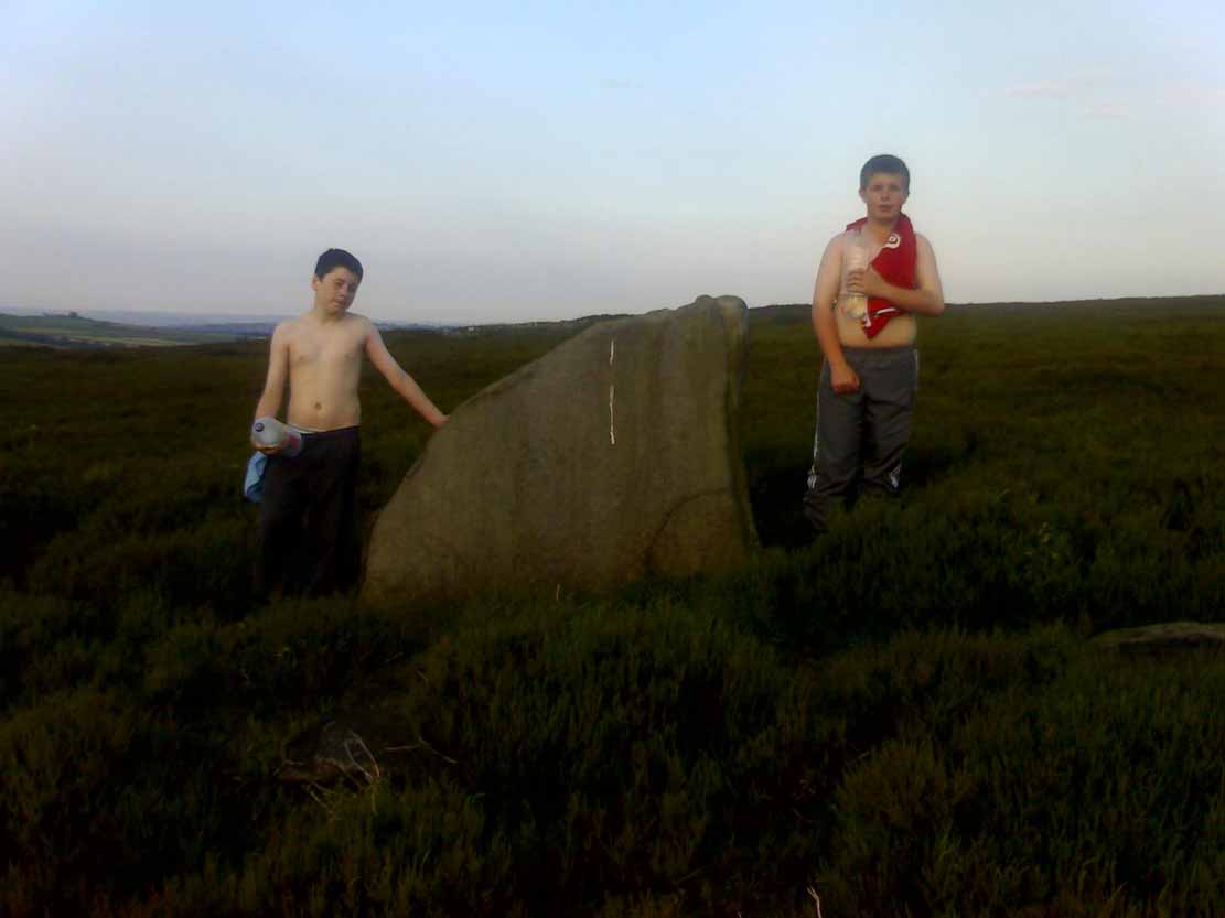
A long cist around 3 feet wide and 6 feet long in a well preserved condition aligned almost — but not quite — East/West on a prominent position on Hallam Moor, commanding views over Ash Cabin flat, Rivelin Valley and the A57 road. The only restricted view is to the northwest, where the moor rises then drops down again towards the Headstone.
There are 3 side-stones still in situ: the largest around 1 metre tall, the others still in place being about 70cm. The stones that would have made up the rest of the walls lay close by.
When you’re at the site it’s obvious why it’s in this location: the views are spectacular and afford excellent views of the surrounding area. A burial site with a vista truly fit for a king!
Archaeologically there’s not much info kicking around that I can find and I’m indebted to Stubob for alerting me to it’s presence. It’s very unlikely you’d be walking this area for any reason other than to visit the site, as there are decent paths across the moor to the most popular site in this area, the Headstone off to the North West. Remains of the Ash Cabin Flat stone circle are about 750 yards southeast of here.
A real gem of a site and a “must see” if your in the area.
© Geoff Watson, The Northern Antiquarian