Little Almscliffe, Stainburn, North Yorkshire

Cup-and-Ring Stone:  OS Grid Reference – SE 23242 52260

Also Known as:

  1. Little Almes Cliffe
  2. Little Almias Cliff Crag

Archaeology & History

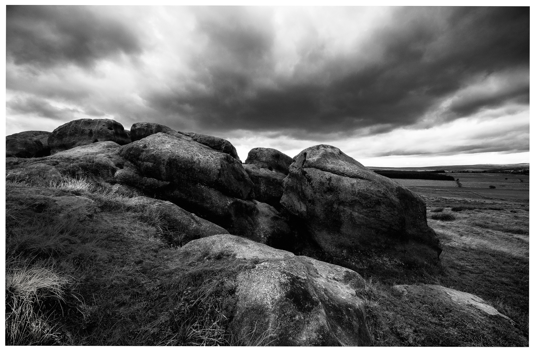
Little Almscliffe Crag (photo by James Elkington)

The crags of Little Almscliffe are today peppered with many modern carvings, such as are found on many of our northern rock outcrops.  Yet upon its vertical eastern face is a much more ancient petroglyph – and one that seems to have been rediscovered in the middle of the 20th century.  When the great northern antiquarian William Grainge (1871) visited and wrote of this place, he told us that, “the top of the main rock bears…rock basins and channels, which point it out as having been a cairn or fire-station in the Druidic days; there are also two pyramidal rocks with indented and fluted summits on the western side of the large rock” – but he said nothing of any prehistoric carvings. Curiously , neither the great historian Harry Speight or Edmund Bogg saw anything here either.

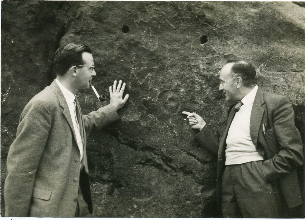
Stuart Feather & Joe Davies here, c.1955
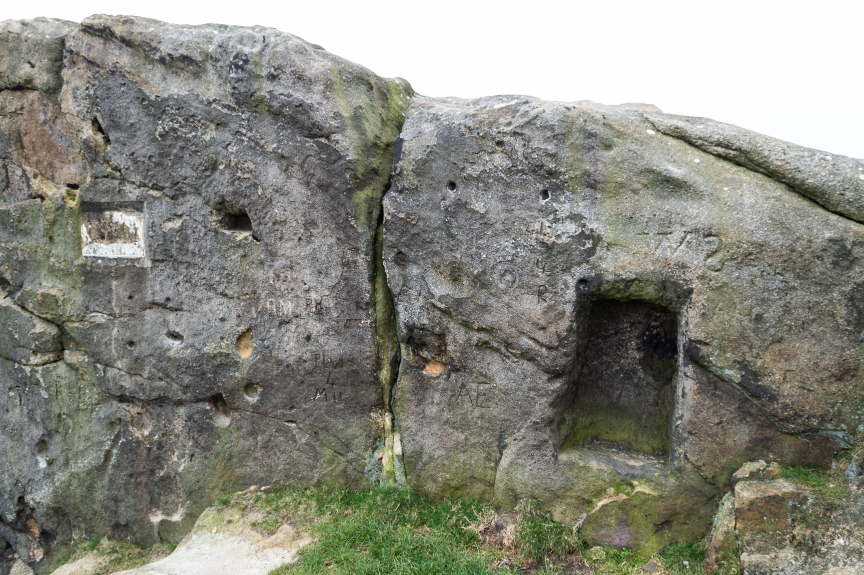
Cup&Ring, left of ‘door’ (photo by James Elkington)

This singular cup-and-ring design seems to have been reported first in E.S. Wood’s (1952) lengthy essay on the prehistory of Nidderdale. It was visited subsequently by the lads from Bradford’s Cartwight Hall Archaeology Group a few years later; and in the old photo here (right) you can see our northern petroglyph explorer Stuart Feather (with the pipe) and Joe Davis looking at the design.  In more recent times, Boughey & Vickerman (2003) added it in their survey of, telling briefly as usual:

“On sheltered E face of main crag above a cut-out hollow like a doorway is a cup with a ring; the top surface of the rock is very weathered and may have had carvings, including a cupless ring.”

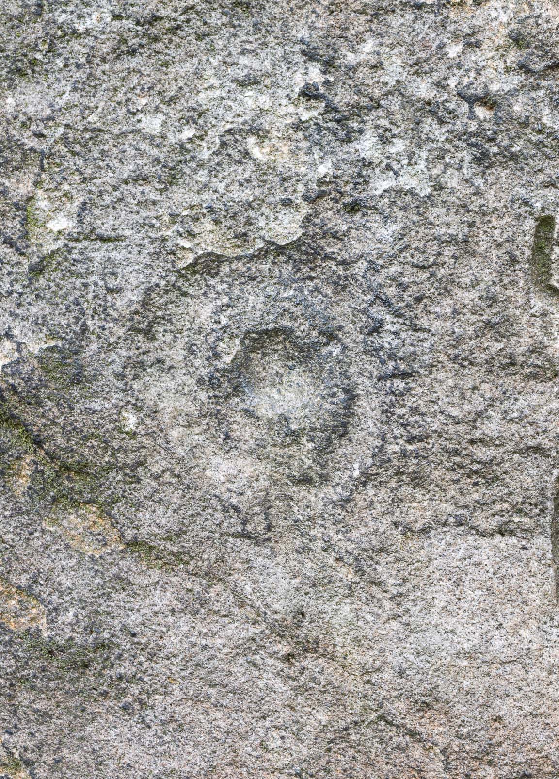
Close up of design

Indeed… although the carving is to the left-side of the large hollow and not above it.  Scattered across the topmost sections of the Little Almscliffe themselves are a number of weather-worn cups and bowls, some of which may have authentic Bronze age pedigree, but the erosion has taken its toll on them and it’s difficult to say with any certainty these days.  But it’s important to remember that even Nature’s ‘bowls’ on rocks was deemed to have importance in traditional cultures: the most common motif being that rain-water gathered in them possessed curative properties.

References:

  1. Bennett, Paul, The Old Stones of Elmet, Capall Bann: Milverton 2001.
  2. Bogg, Edmund, From Eden Vale to the Plains of York, James Miles: Leeds 1895.
  3. Bogg, Edmund, Higher Wharfeland, James Miles: Leeds 1904
  4. Cowling, E.T., Rombald’s Way, William Walker: Otley 1946.
  5. Grainge, William, History & Topography of Harrogate and the Forest of Knaresborough, J.R. Smith: London 1871.
  6. Parkinson, Thomas, Lays and Leaves of the Forest, Kent & Co.: London 1882.

Acknowledgements:  Huge thanks to James Elkington for use of his fine photos on this site.

© Paul Bennett, The Northern Antiquarian

Longbarrow Field, Timble, North Yorkshire

Cairn (lost):  OS Grid Reference — SE 18 53

Archaeology & History

Described in the Field Lore of Timble village by William Grainge (1895) are the names and short histories of some of the local place-names—with this in particular standing out like a veritable sore thumb!  Quite plainly, as Grainge told us,

“The name ‘Longbarrows’ is indicative of some burial mounds of a very early day.  None exist at present.  The land is under the plough, and is about the best in the township.”

But I cannot locate the position of this long-lost site and it’s not shown on any of the early OS-maps hereby.  Grainge said that the land on which it once stood was owned by a local farmer called Charles Dickinson, who leased it out to others.  He wrote:

“Dickinson had in Longbarrows 3 roods* and 23 perches*, and William Jackson’s share in Longbarrows was 1 acre, 3 roods and 21 perches.  Besides these, John Ward of Nether Timble had 1 rood and 17 perches int he same field, a long narrow slip without fence, between Dickinson’s and Jackson’s lots.”

Does anyone know where this was?  One of my suspects is the gathering place of the Fewston witches, a half-mile south of the village; but no remains of anything can be found there today and I may just be barking up the wrong tree.

The area south and west of here is rich in little-known prehistoric heritage, from the cairn-fields of Askwith Moor, the cairn circle at Snowden Crags, the settlements of Snowden Carr and the extensive petroglyphs all over the place!  Giants cairns of the early Bronze Age and neolithic period were also once more numerous upon the moors to the west and south, so the former existence of a long barrow in Timble wouldn’t necessarily be too unusual.  But where was it?!

References:

  1. Grainge, William, The History and Topography of the Townships of Little Timble, Great Timble and the Hamlet of Snowden, William Walker: Otley 1895.

*  A rood is an English unit of area, equal to a quarter of an acre or 10,890 square feet; a perch was a more variable unit of measure, being lengths of 161⁄2, 18, 21, 24 and 25 square feet.

© Paul Bennett, The Northern Antiquarian 

Stone Rings, Pannal, North Yorkshire

Stone Circle (destroyed):  OS Grid Reference – SE 308 527

Archaeology & History 

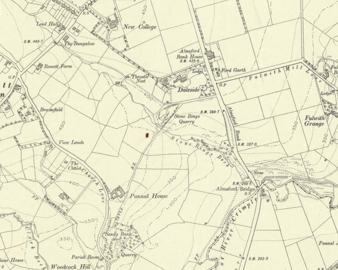
‘Stone Rings’ place-names on the 1910 OS-map

The plurality of the place-name implies that there was more than one circle, but we don’t that know for sure either!  But if there was more than one, it is more likely they were cairn circles than traditional free-standing stones circles.  But once again, we simply don’t know….No remains exist of the “stone rings”—or rings of stone—that once stood here in bygone centuries.  The only remains left are in the place-names of the stream and roads hereby, highlighted on several of the early OS-maps: Stone Rings Lane, Stone Rings Beck and the Stone Rings Quarry—the latter of which is probably the reason why there is nothing to be seen here anymore. But we don’t know for sure.

The grid-reference given here is an approximation.

References:

  1. Smith, A.H., The Place-Names of the West Riding of Yorkshire – volume 5, Cambridge University Press 1961.

© Paul Bennett, The Northern Antiquarian


Briscoe Rigg, Rigton, North Yorkshire

Settlement (destroyed):  OS Grid Reference — SE 2581 5100

Archaeology & History

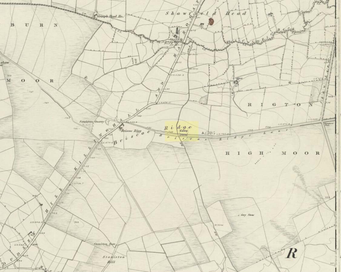
Briscoe Rigg on 1851 map

Highlighted on the 1851 OS-map of the area as a ‘Camp’, all trace of this ancient settlement would seem to have been destroyed.  It was already on its way out when the Ordnance Survey lads looked at it for a second time in 1888, finding barely a trace of it.  Thankfully though, when the clearer eyes of that great northern antiquarian Eric Cowling visited the site in the early 1930s, traces of it could still be made out.  Both he and fellow antiquarian, Mr B.J.W. Kent of Beckwithshaw, did their own investigations; and it is their notes we are most grateful for in describing this forlorn antiquity.  Mr Cowling (1946) wrote:

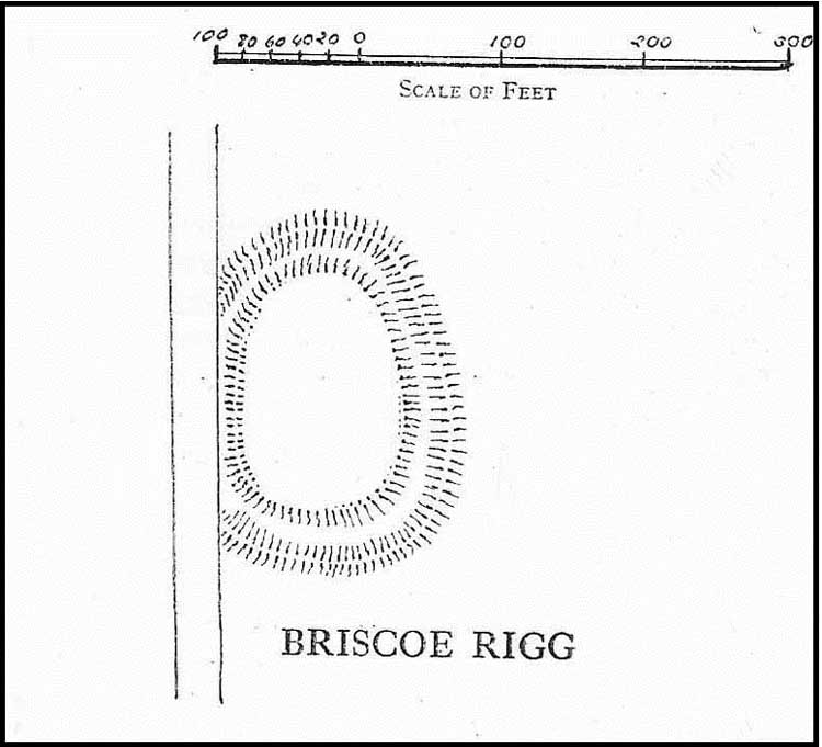
“On the highest point of the enclosed land on the east side of the Briscoe Rigg (to) Rigton road is a small entrenched site.  The enclosed area measures 130 yards from north to south and 70 yards from east to west.  The camp is six-sided, but this appears to be due to bad workmanship and layout rather than intention.  One gains the impression that the original plan was oblong and that the longer sides were bent to conform to the shorter ones.  It is slightly hollow and the whole area is almost levelled by heavy ploughing; the outer bank barely being one foot above the surroundings.  The ditch and outer bank now cover a spread of 60 feet.

“Recent hurried investigations by Mr Kent showed interesting details.  The area seems to have been occupied by hut-sites previous to the hurried digging of a trench some 16ft wide and 6ft deep, going down into the bed-rock nearly 6 feet.  Son after, the ditch was half-filled by boulders and earth amongst which was a fragment of pottery, black in colour and indefinite in type, but probably Roman.  When the ditch was half-full it was used for some time for cooking…”

Cowling’s 1946 site-plan

Cowling also told us there was “a tradition that tools, which by description appear to be socketed celts, were found here when the site was brought under cultivation”, in about 1840.  Mr Kent also discovered various flints hereby, many Mesolithic scrapers and “a fine Bronze Age barbed and tanged point and also a transverse cutting arrow point of the early four-sided types.”

Although these finds from much earlier periods show that people have been living and hunting in the area for an exceptionally long period, the settlement or camp at Briscoe Rigg was probably built in the early Iron Age period and continued to be used into Romano-British times (somewhere between between 500 BCE and 500 CE).

References:

  1. Cowling, E.T., Rombald’s Way, William Walker: Otley 1946.

© Paul Bennett, The Northern Antiquarian


Horn Bank, Rigton, North Yorkshire

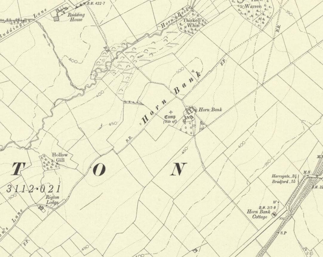
Horn Bank on 1910 map

Settlement (destroyed):  OS Grid Reference – SE 2905 5035

Archaeology & History

Upon the top of the old ridge where ran the ancient trackway between Rigton and Pannal, could once be found a multi-period settlement, long since gone – as happens all too often in this neck o’ the woods.  And unfortunately there doesn’t appear to be any sketch plans of the site.  It was first described by Edward Hargrove (1789) in his historical old rambles around Harrogate and district.  When the scribe reached Horn Bank, he told that here,

“was lately discovered the remains of several entrenchments forming three distinct enclosures, two of a square and one of a circular form.  Not far from these entrenchments, which were probably of Danish origin, was found, in May 1787, the umbo of a shield, with several other fragments of gilt brass…”

In William Grainge’s (1871) magnum opus he told that,

“At Horn Bank, on the crest of the hill east of Rigton, near a farm-house, are the remains of three camps—two of a square, and one of a circular form; they are probably of British and Roman origin. The location is a lofty and commanding one; but the ploughshare has so often passed over them that they are nearly obliterated.”

Just below the settlements Grainge also said how, “a fine spring of water was formed into a bath here many years ago, but the whole is now in a state of ruin.”  This would have likely been the main water supply for the people living here.  Harry Speight (1903) implied the same thing when he investigated the site, saying:

“At a place called Horn Bank, near Rigton, on the west side of the parish, on the crest of the hill on the north side of the Horn Bank farmhouse, there were formerly to be seen very distinct indications of three camps, each encompassed with fosse and rampart. Hargrove supposed them to be Danish, but as two of them were of a square or rectangular form, and the other circular, they were in all probability relics of the Romano-British contest, at first occupied by the native tribes and subsequently as a temporary camp and look-out post by their conquerors. The site commands a wide and uninterrupted view in every direction, while close at hand is a copious spring of good water. This spot many years ago was converted into a bathing-place, but is now broken down and abandoned… The site has long been ploughed, and little or no trace of these earthworks is now discernible.”

The only thing Eric Cowling (1946) could find when he came to the place were faint scars of walling whose shadows were highlighted by the sun when the conditions were just right.  He thought the settlements were Iron Age in nature, but would have continued to be used in subsequent centuries by local people.  It seems a sensible suggestion…

References:

  1. Cowling, E.T., Rombald’s Way, William Walker: Otley 1946.

  2. Grainge, William, History & Topography of Harrogate and the Forest of Knaresborough, J.R. Smith: London 1871.

  3. Hargrove, E., The History of the Castle, Town and Forest of Knaresborough with Harrogate, W. Blanchard: York 1789.

  4. Speight, Harry, Kirkby Overblow and District, Elliot Stock: London 1903.

© Paul Bennett, The Northern Antiquarian


Sarah’s Stone, Borgie, Tongue, Sutherland

Cup-Marked Stone: OS Grid Reference – NC 66791 60343

Getting Here

Sarah, on top of her stone!

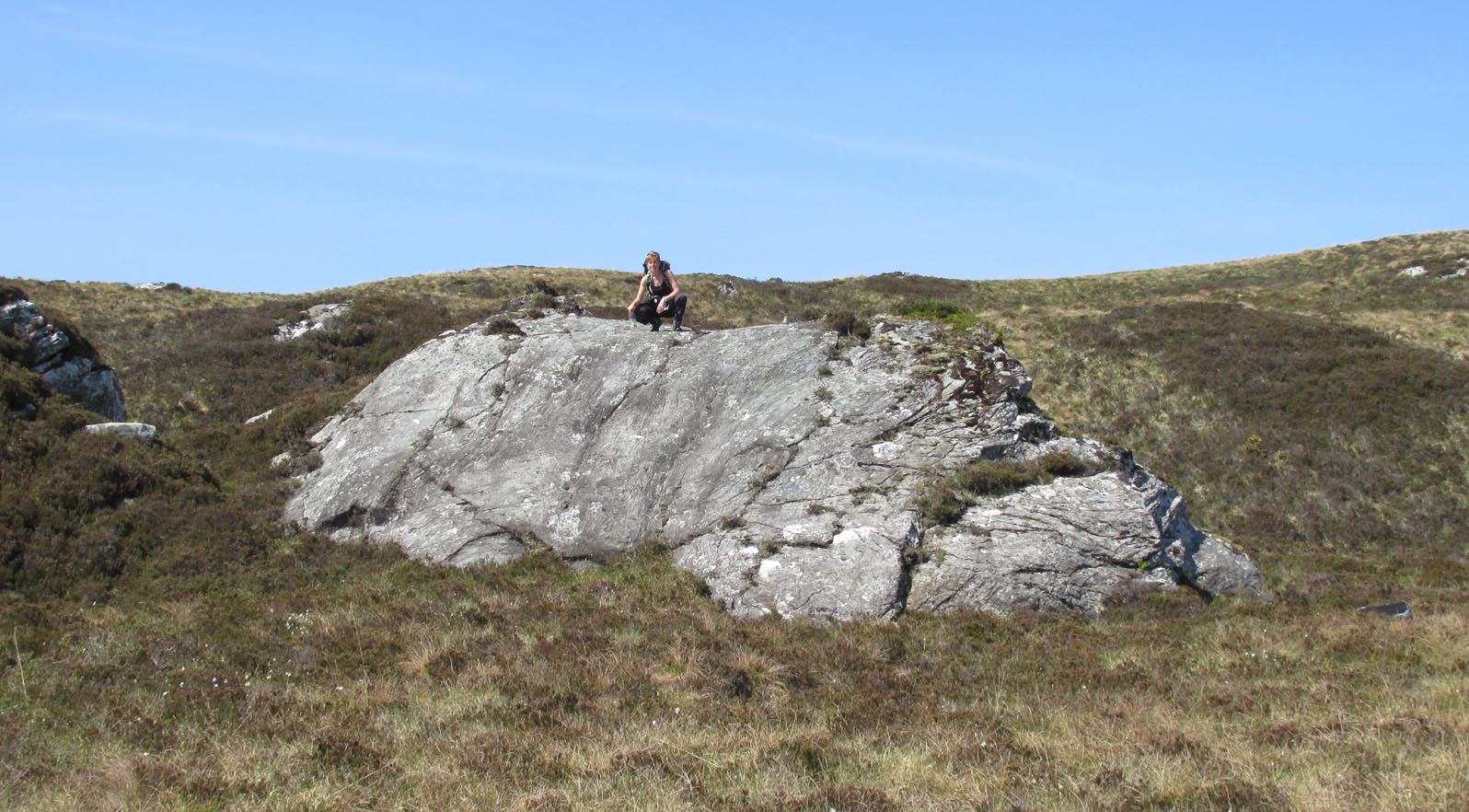
There’s no simple way to reach here – but the landscape alone makes the journey worthwhile.  Roughly halfway along the A836 between Bettyhill and Tongue, take the minor road up to Borgie, past the recently revamped Borgie Hotel for half-a-mile (0.8 km) where, on your left, is Deepburn Cottage.  On the other side of the road, on your left, go through the gate and follow the path uphill. It curves up and to the right where you hit some overgrown walling.  Walk up and along this wall for nearly half-a-mile (it’ll feel like twice that!) and as you approach the crystal blue waters of Lochan a’ Chaorruin, veer right and start walking up the small Torrisdale Burn.  Less than 200 yards along, you’ll see the large isolated rock on your left.

Archaeology & History

Cupmarks top & bottom
Single prominent cupmark

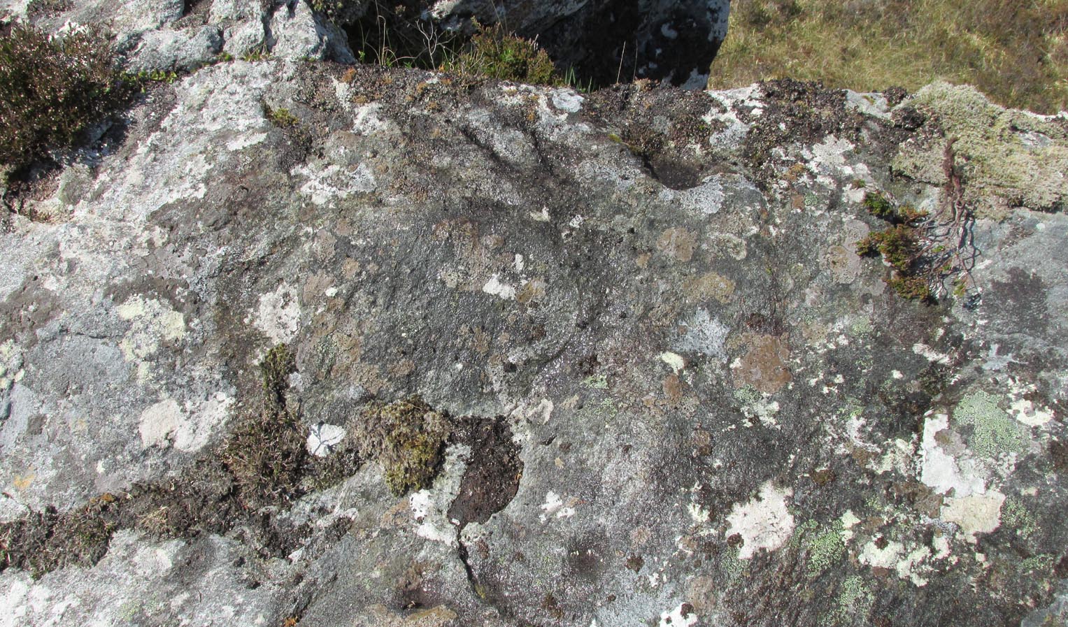
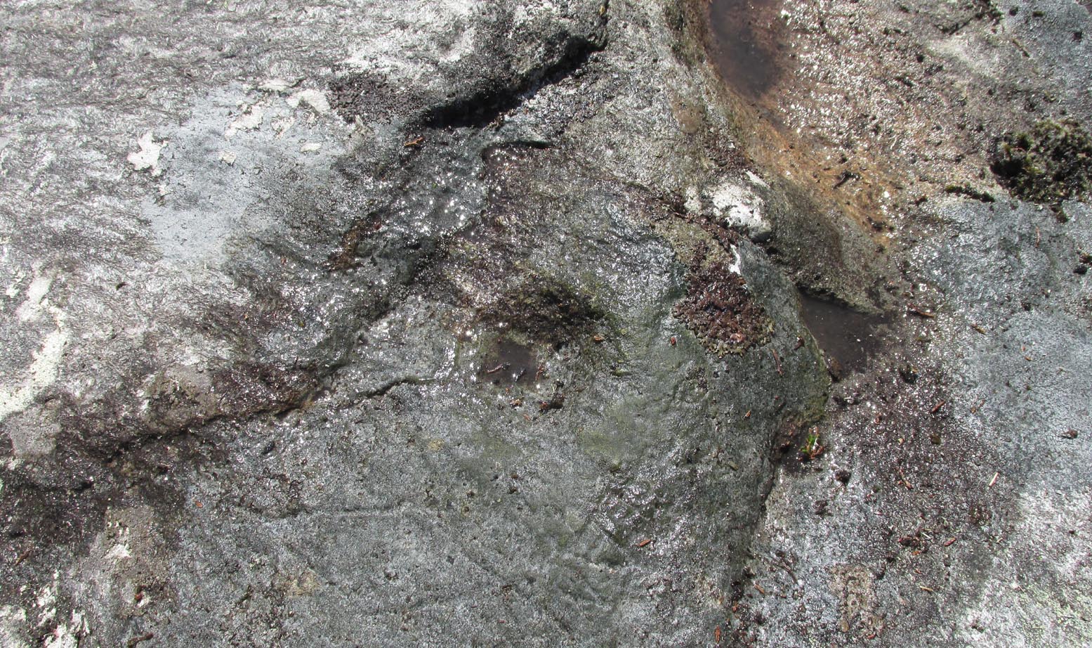
Previously unrecorded, this large boulder sitting above the edge of Torrisdale Burn was rediscovered by Sarah MacLean—hence its name—and has between five and nine cup-marks etched, primarily, on the topmost ridge of the rock.  Its eastern steep-sloping face also has a cup-mark near the middle top-half of the stone.  Apart from three of them (visible in the photos), the other cups aren’t very distinct and unless the lighting is right, you won’t see much here.  This one is probably gonna be of little interest unless you’re a real hardcore petroglyph freak.

Further up this tiny winding glen we reach the faint cup-marked Thorrisdail Stone and a little further on is the impressive ritual site of Allt Thorrisdail.

© Paul Bennett, The Northern Antiquarian


Castleton (2b), Cowie, Stirlingshire

Cup-and-Ring Stone:  OS Grid Reference – NS 85520 88214

Getting Here

Castleton (2) carving

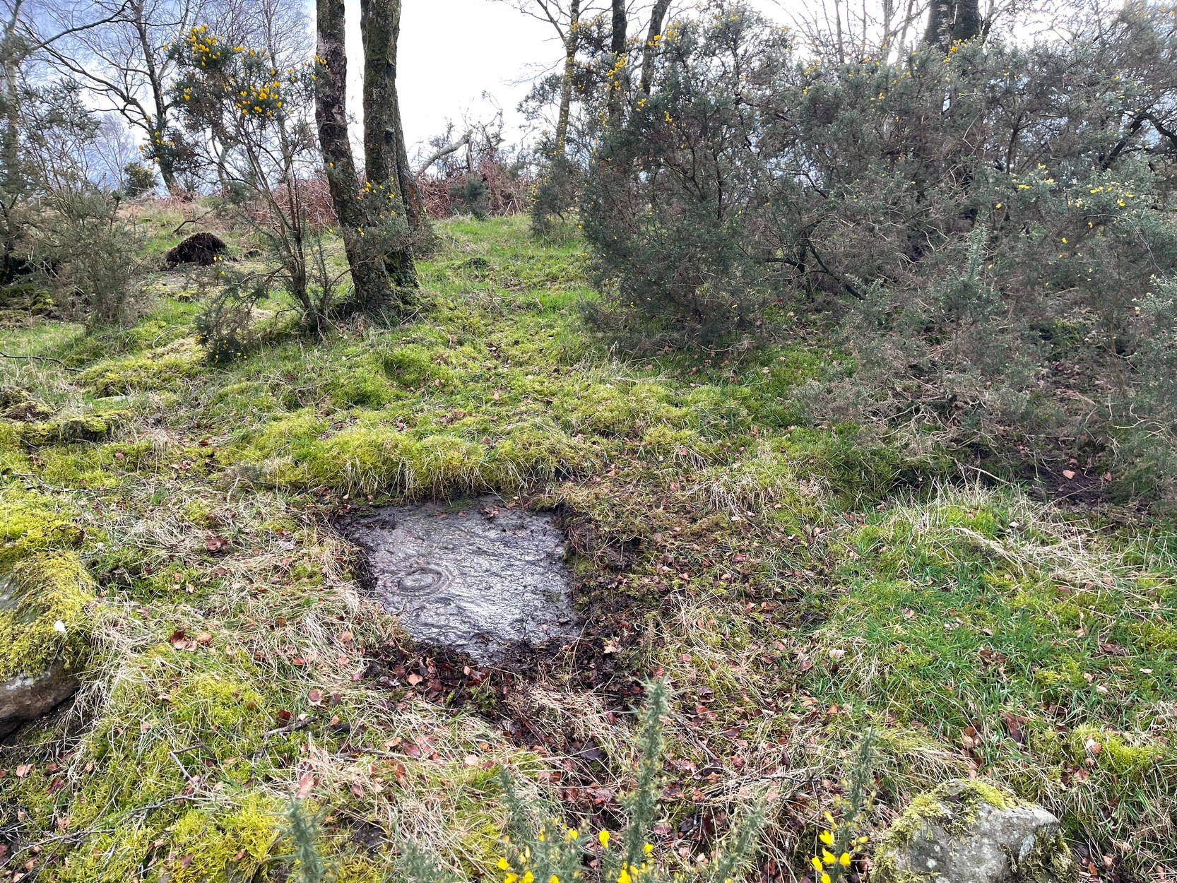
If you’re coming via Castleton Farm, at the back of the farm go through the gate on the right, by the corner of the field and walk along the line of the wall for 200 yards  northwest until you approach the small copse of trees ahead of you.  Just before the trees, instead, walk up the slope, SW, to the other small copse, and about 15 yards along the line of trees, go into them.  Keep your eyes peeled on the upwards sloping ground where a gap in the greenery shows you the stone in question!

Archaeology & History

This is an odd one.  Amidst the array of truly ancient and well-eroded multiple cup-and-ring stones in the incredible Castleton complex, this small design on the northeast slope away from the main cluster, has a distinctly different appearance about it when we compare it to the others along the ridge.  It’s not been done by the same person or people who carved the more ornate designs close by.  Indeed, it seems that it wasn’t even done at the same period but has a history that is much more recent.

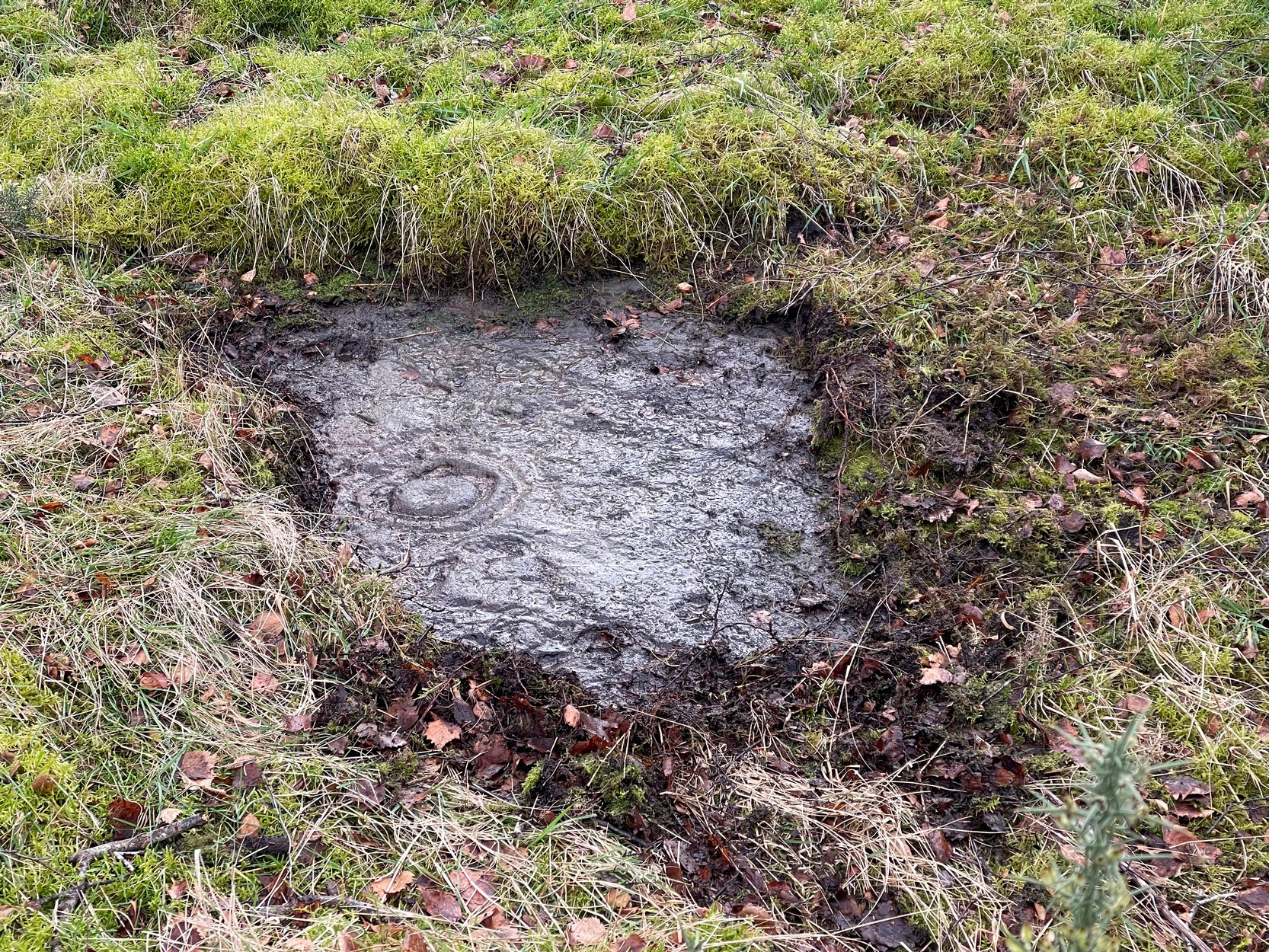
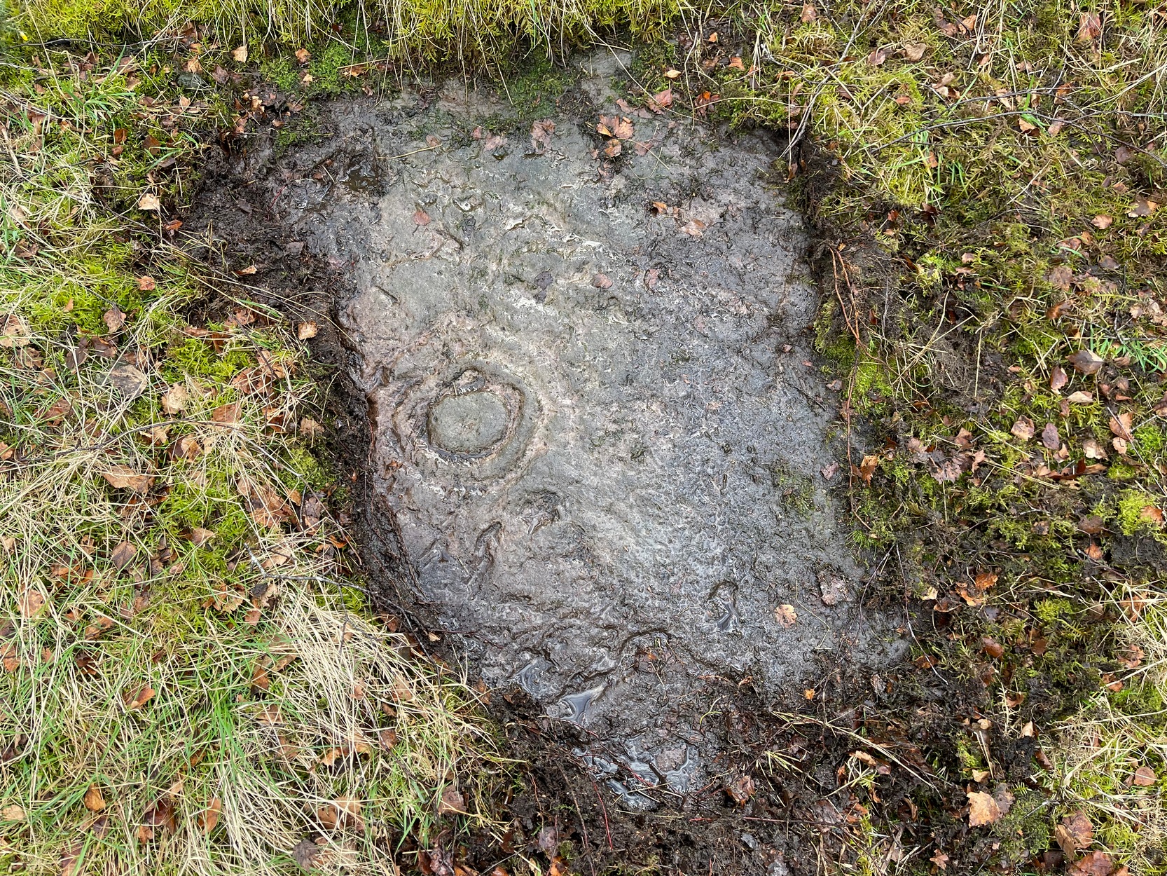
The carving, as you can see in the photos, has a somewhat scruffy look about it when compared to the more usual designs.  If it’s prehistoric, it has the hallmarks of being done by someone with rock art dyslexia!  My own view is that it’s a pretty recent carving. It’s possible, perhaps, that it may have been executed by a medieval christian priest who lived a short distance to the east and whose cross markings are evident on at least one of the other cup-and-rings hereby.  But the carving might be even more recent: perhaps 19th Century in origin.  It just doesn’t have that air of authenticity about it, as any seasoned petroglyph officionado would tell you.  And we have to bear in mind that this was the site of a quarry in the 18th and 19th century, so the carving might have been done at that time by one of the workers to mimic the very ancient and faded designs close by.  Anyhow…

The design consists of two distinct and deeply carved rings around a central raised point, in which it looks as if someone started to create a cup-mark, but never finished the job!  The same can be said of an third outer-ring, whose faint outline is clearly visible in decent light, but which was started but never finished.  Make of it what you will.  When we first found this carving in 2019, someone had been up and already peeled back the turf (“there were a group o’ folk,” the farmer told me), thankfully showing the carving in its crude glory.  The Canmore website informs us that the stone was first unfurled by George Currie in 2006, who said that it was little more than “a ring surrounded by a central boss”—but there’s clearly more to it than that and I wonder if this is actually the same carving that Mr Currie found.

Note: The name of this and the other carvings in the Castleton complex need completely re-designating into an accurate order, as they’ve been defined and redefined by various authors and groups over the years, leaving them in a disorganized haphazard mess.

© Paul Bennett, The Northern Antiquarian

Denoon Law, Glamis, Angus

Hill Fort: OS Grid Reference – NO 35464 44395

Also Known as:

  1. Canmore ID 32139
  2. Law of Denoon

Denoon Law on 1865 map

Getting Here

Travelling north through Balkeerie on the Newtyle/Glamis road, turn right onto the Denoon road and follow it to the T-junction.  Turn right and, a few hundred yards on to your left, the large hillfort of Denoon Law rises up to your left.  You can’t really miss it!

Archaeology & History

Denoon Law from Murleywell

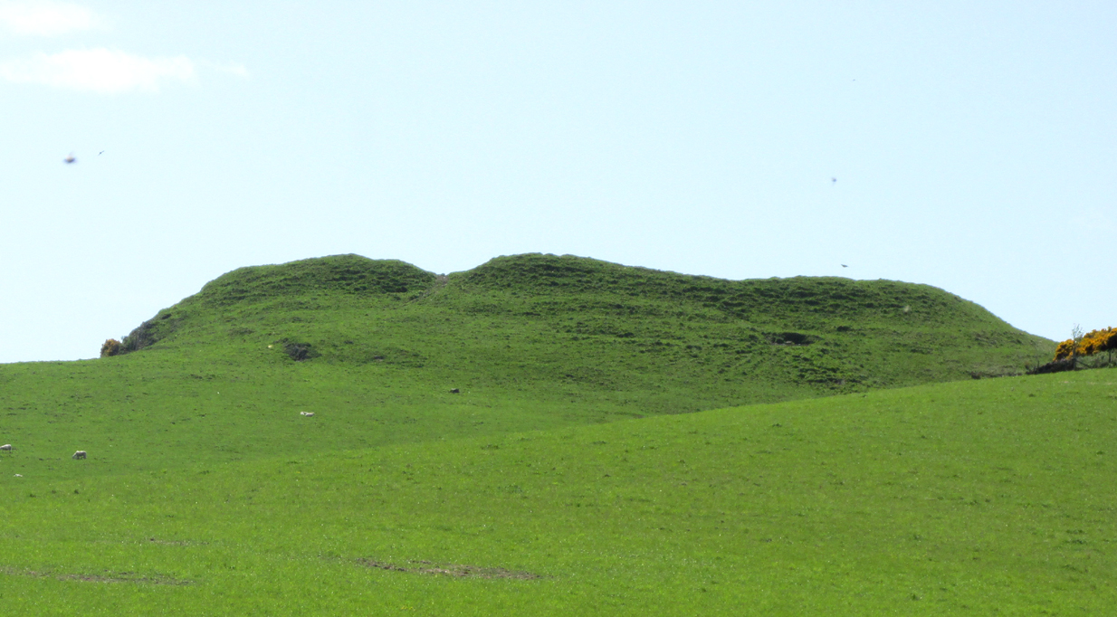
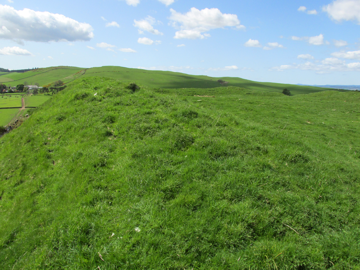
Denoon Law is an impressively lush and green hill fort hidden away in the Sidlaw Hills, in the Denoon Glen, parallel to the Vale of Strathmore. It can be entered froma gap in the ramparts on the north side. Be careful of the precipitous drop from the south east side!

In the County Angus survey by the Royal Commission on the Ancient & Historical Monuments of Scotland (1983), they describes it thus:

‘This fort crowns the summit of Denoon Law, a steep-sided volcanic plug on the NW side of Denoon Glen, a narrow valley at the N end of the Sidlaw Hills. The fort is roughly D-shaped on plan with the chord of the D formed by a long straight rampart that stands above the precipitous SE flank of the hill. It measures 105m from NE to SW by 55m transversely within a rampart that measures up to 17m in thickness and over 5m in external height but is clearly of more than one phase. Where the differentiation is clear, the latest phase of rampart measures about 6m in thickness and overlies the remains of a much thicker earlier rampart. Intermittently visible at the SW end of the fort is an outer face to the later rampart, comprising drystone walling that has, in places, been displaced downslope by the weight of core material behind. This outer face comprises no more than four or five courses of thin sandstone slabs and, although what is currently visible will only be the top of the surviving wall-face, a wall constructed of such material cannot have stoodto  any great height and what we see today is likely to be the remains of some form of comparatively low revetment. In both the earlier and later ramparts there is very little evidence of stone within the core and it appears that the material (boulder clay) for both has largely been derived from several large quarries within the interior of the fort. At the SW corner of the fort most of the rampart has been removed, leaving only the lower part of the outer talus. The fort, or at least its latest phase, had two entrances, one on the NE and another on the NW, both of which are crossed by the remains of a narrow, later, wall that runs around the entire circuit of the fort and may be associated with at least some of the buildings within the interior.

Outwith the main rampart there is a series of three outer ramparts, again with very little evidence for the use of stone in their construction, which run from the edge of the very steep slope at the NE end of the fort, around the N side to the entrance on the NW. All three lines of defence have been reduced to little more than terraces, though there is no evidence for them ever having been cultivated. At the entrance on the NW, the terminals of these ramparts (on both sides of the entrance) are obscured below outwash deposits from the slope above. To the SW of the entrance it is not at all clear what the relationship is between the defences of the fort and the enclosure that occupies the rocky and extremely uneven SW flank of the hill. This enclosure, which has an entrance on the W, could be some form of annexe or it could represent the SW end of an enclosure that once took in both this area and the rest of the summit.

Within the interior of the fort there are the remains of at least nine rectangular buildings, two of them large and open-ended and each overlain by a smaller, later structure. The freestanding buildings are represented by the footings of walls with inner and outer stone faces; close to the entrance on the NE, however, there are two buildings represented by simple rectangular platforms cut into the rear scarp of one of the prehistoric quarries in one case and the hollow of the entrance passage in another. On the N flank of the hill, overlying the outer defences, there are a number of structures, either taking the form of subrectangular structures with walls (and in one case an entrance) or simple scoops into the slope.’

Entrance from the NW

David Dorward’s definition of the name Denoon is from the Gaelic:

‘dun obhainn (+ Scots law) – [hill of the] fort of the streamlet.’

The streamlet is the Ewnie Burn flowing south-east of the Law.

The lush green centre

Folklore

James Cargill Guthrie, in his The Vale of Strathmore: Its Scenes And Legends, gives the following story from an,

‘early time, weird-like, a legend’s muffled chime ‘.

‘The Hill of Denoon was at that remote period accounted sacred or haunted ground. It was the mythical abode of the elfins and fairies, and formerly a fitting haunt for their midnight revelries.

When the silvery moonbeams lovingly slept in dreamy beauty on the green slopes of the enchanted Hill, and the blue bells and the purple heather were wet with the dew of angels’ tears, arrayed in gossamer robes of bespangled gold, with wands of dazzling sheen and lances of magical bright-ness, would the troops of elfins flauntingly dance to the music of the zephyrs, until the shrill cry of the chanticleer put an end for the time to their mystical enchantments.

Suddenly, as in blue clouds of vapour, they noiselessly vanished away, no sound remaining to break the oppressive stillness, save that of the mountain rivulet, as it fretfully leapt from crag to crag, as if piteously regretting the mysterious departure of its ethereal visitors.

South-east rampart

Having forsworn the presence and companionship of the terrestrial inhabitants of earth, it was a sacred dictum in the code of the fairies that no habitation for human beings should be permitted to be built within the hallowed precincts of the enchanted ground. Unable of themselves to guard against such sacrilegious encroachment, they had recourse to the aid of, and formed a secret compact with the demons, or evil spirits, whose sole avocation consisted in doing mischief, and bringing trouble and misfortune on those under the ban of their displeasure. By this compact these evil spirits became solemnly bound to prevent any human habitation whatever from being erected on the hill, and to blast in the bud any attempts whensoever and by whomsoever made to break this implacable, unalterable decree.

It was about this time the alarm-note was sounded, as the Queen of the Fairies, who, with an eye more observant than the rest of her compeers, observed one evening in the moon-light, certain indications of the commencement of a human habitation. Horror and dismay were instantly pictured on the fair countenances of the masquerading troops of merry dancers as the awful truth was ominously revealed to them by the recent workmanship of human hands.

The sheer slope to the south-east

A council of war was immediately held, when it was determined to summon at once the guardian spirits to their aid and protection.

“By our sacred compact,” cried the Queen, “I command the immediate attendance of all the demons and evil spirits of the air, to avenge the insult now offered to the legions of Fairyland, and to punish the sacrilegious usurpers who dare infringe the sanctity of their mystical domains.”

These demons instantly obeyed the haughty summons, and, in the presence of those they had sworn to protect, they in a twinkling demolished the structure, hurling the well-proportioned foundations over the steep rock into the vale beneath !

The builder, doubtless very much surprised and chagrined when he returned to his work in the early dawn of the following morning, was sorely puzzled to account for the entire disappearance of the solid foundations of the great castle he intended to be erected on the Hill. He did not, however, waste much time, or use much philosophic argument, on the matter, and gave orders to prepare new foundation of even a more durable character.

The demons, to show their invincible power, and for the sake of more effect, allowed the new foundations to rise a degree higher than the former, before they gave out their fiat of destruction. In an instant, however, they were again demolished, and the builder this time gravely assigning some fatal shock of Nature as the cause of the catastrophe quietly resolved to repair the damage by instantly preparing new and still more solid foundations.

Additional and more highly skilled workmen were engaged, and everything for a time went favourably on, the walls of the castle rising grandly to view in all the solidity and beauty of the favourite architecture of the period.

Biding their time, the demons again ruthlessly swept away as with a whirlwind every vestige of the spacious halls, razing the solid massy foundations so effectually that not one stone was left upon another !

Things were now assuming a rather serious aspect for the poor builder, who, thinking that he had at last hit upon the true cause of these successive disasters, attributed his misfortunes to the influence of evil spirits. A man of courage and a match, as he imagined, for all the evil spirits of Pandemonium, supposing they were let loose at once against him by the Prince of Darkness, he unhesitatingly resolved to keep watch and ward on the following night, and to defy all the hosts of hell to prevent him rebuilding the projected edifice. The night expected came ; but, alas, alas !

His courage failed when on the blast
A demon swift came howling past,
Loud screeching wild and fearfully,
This ominous, dark, prophetic cry
“Build not on this enchanted ground !
‘Tis sacred all these hills around ;
Go build the castle in a bog,
Where it will neither shake nor shog !”‘

So, if you are planning to visit Denoon Law – remember: RESPECT THE FAERIES!

References:

  1. Guthrie, James Cargill, The Vale of Strathmore: Its Scenes And Legends, Edinburgh, William Patterson, 1875.
  2. Royal Commission on the Ancient and Historical Monuments of Scotland. The archaeological sites and monuments of Central Angus, Angus District, Tayside Region, The archaeological sites and monuments of Scotland series no 18. Edinburgh, 1983.
  3. Dorward, David, The Sidlaw Hills, Forfar, The Pinkfoot Press, 2004.

©Paul T Hornby 2018


Ribigill Souterrain, Tongue, Sutherland

Souterrain (missing):  OS Grid Reference – NC 5821 5471

Also Known as:

  1. Canmore ID 5354

Archaeology & History

The Royal Commission (1911) lads paid a visit to this site in June, 1909, after an earlier report—allegedly by James Horsburgh—told there to have been one close to the right-hand side of the road, but it has long since been forgotten.  The Commission lads told us simply,

“In a park about ¼-mile north of Ribigil farm-house is the site of an earth-house which was closed up many years ago.”

When I asked a number of local people about the place, they knew nothing of it; so I wandered around in the hope that I might find something.  All that I came across, close to where it was described, were two large flat stones covering a hole in the ground on the other side of the fence from the road.  A number of reeds were in the same field and I thought it must have been a well, but when I laid my ear to it, could hear no running water whatsoever.

References:

  1. Horsburgh, James, “Notes of Cromlechs, Duns, Hut-circles, Chambered Cairns and other Remains, in the County of Sutherland“, in Proceedings Society of Antiquaries, Scotland, volume 7, 1870.

© Paul Bennett, The Northern Antiquarian

Pitcur Souterrain (3), Kettins, Perthshire

Souterrain:  OS Grid Reference – NO 2529 3738

Also Known as:

  1. Canmore ID 30539
  2. The Cave
  3. Pitcur II (Wainwright)

Getting Here

Pitcur souterrain entrance

From Coupar Angus, take the A923 road southeast for nearly 2½ miles where you reach the crossroads.  Keeping walking along the A923 for just over 300 yards, then where you come to the second field on your left, follow the line of fencing the slope until you reach an overgrown fenced section.  It’s in there!

Archaeology & History

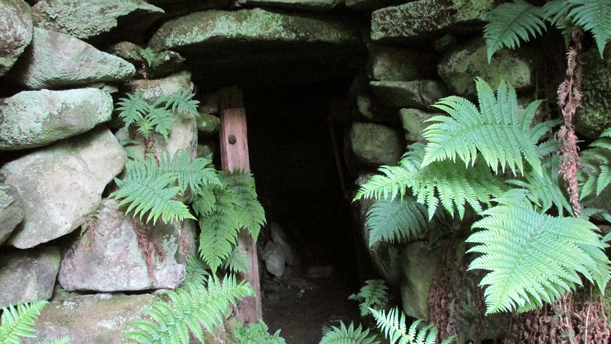
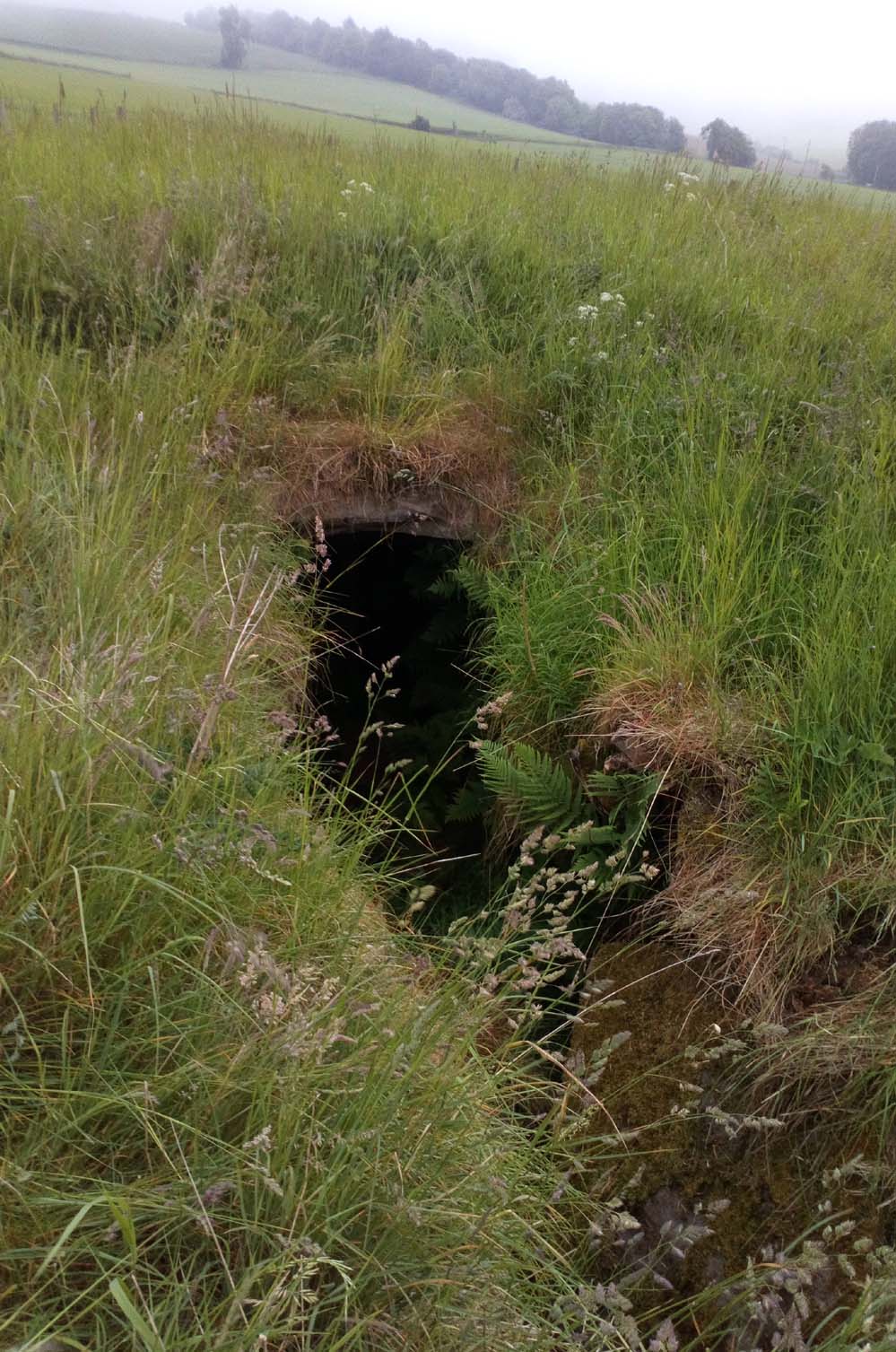
This is a mightily impressive site, which I’ve been looking forward to experience for many an age.  And—despite Nature covering it in deep grasses—it was even better than any of us anticipated.  Souterrains are ten-a-penny in this part of Scotland, but this one’s a beauty!  Here, dug 6-8 feet into the ground are at least two long curvaceous passageways, linked by another stone-roofed passageway—with the longest central passage leading at one end into a completely covered stone hallway, whose end is blocked by a massive fall of earth.  Outside this entrance, laid on the ground, is what looks like a possible old stone ‘door’ that may have once blocked the entrance, now fallen into disuse.  It is too small to have been a roofing stone.  In the walling just outside the entrance, on your left, you will see a faint cup-marked stone (Pitcur 3:5) and a larger cup-and-ring stone (Pitcur 3:6), both just above ground-level.
Inside looking out (photo by Frank Mercer)

Outside looking in (photo by Frank Mercer)

The site is evocative on so many levels: not least because we still don’t know what the hell it was used for.  The over-used idea that souterrains were cattle-pens makes no sense whatsoever here; the idea that they were food storage sites is, I suppose, a possibility; that they were possible shelters for people during inter-tribal raids is another; and equally as probable is that the deep dark enclosed construction was used by shamans, or neophytes enclosed for their rites of passage.  Iron Age archaeology specialist Ian Armit (1998) thought there may well be some as yet undiscovered “timber roundhouse” associated with this souterrain, awaiting excavation.  He may be right.  When we came here the other week we found previously unrecorded cup-and-ring carvings, at a site already renowned for decent petroglyphs.  A post-winter visit will hopefully bring us more finds.

The general history of this strange site is captured in Wainwright’s (1963) survey of souterrains, in which he wrote:

“Pitcur II was discovered in 1878 when a large stone, hit by a plough, was removed to reveal an underground passage.  Mr John Granger, tenant of Pitcur farm, excavated the souterrain himself, and twenty-two years later his son, Mr A. Granger Heiton, said that the only objects found by members of his family were ‘a small red clay bowl of Samian ware in pieces’ and ‘a Roman coin.’  The latter, according to David MacRitchie, ‘has been lost sight of’.  Mr Granger Heiton also told McRitchie that ‘one or two other coins were reported as having been found’, but were not seen by his father.

“As an excavation, Mr Granger’s effort seems to have been unsatisfactory by any standards, and it was followed by a ‘supplementary excavation’ conducted by Mr R. Stewart Menzies.  This was more successful as a relic-hunting operation, if not as an archaeological excavation, for between one hundred and two hundred finds are reported, including ‘a bronze pin’ and ‘a quantity of stones, beads, etc.’  But these too ‘seem to have been mislaid.’
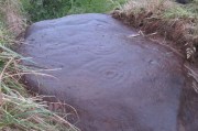
Newly-found Pitcur 3:2 carving

Curiously Mr Wainwright made little mention of the impressive petroglyphs within this complex, save to say that “they were too heavy to be removed and ‘mislaid’.”  There are at least seven of them at Pitcur-3: four complex cup-and-ring designs and three basic cup-marked stones (described individually in separate site-profiles).  They have all been incorporated into the walls and roofing stones. At least one of these is so eroded (Pitcur 3:2) that there is little doubt it was re-used from a now-lost neolithic structure; the rest may have been from Bronze Age sites (also lost) and their respective lack of erosion shows they have been inside this Iron Age structure, away from Nature’s wind and weathering effects. It is likely that the re-use of these carvings in Pitcur-3 was of significance to the builders; although we cannot be sure as to what their function may have been within the souterrain.  It’s quite possible that some form of ‘continuity of tradition’ as posited by David MacRitchie (1890) was in evidence, over that huge time scale from the neolithic into the Iron Age, relating specifically to the animistic plinth implicit in all early agrarian cultures.

But the first real overview of the site was written at the end of the 19th century by David MacRitchie (1900), over twenty years after its rediscovery in 1878.  His account was a good one too:

“The Pitcur house consists of one long subterranean gallery, slightly curved throughout most of its length, and bending abruptly in a hook shape at its western end. From this western end a short broad gallery or room goes off, curving round the outside of the ‘hook.’ The length of the main gallery, following the medial line, and measuring from the extreme of the entrance at either end, is almost 190 feet; while the subsidiary room is 60 feet long. For most of its length, this subsidiary room is 10 feet wide, measuring at the floor level. On account of this unusual width, it is reasonable to suppose that its roof was of timber; for although the walls slightly converge at the top, reducing the intervening space to 8 or 9 feet, the span is still so great that a flagged roof would scarcely have been practicable. To be sure, the walls might have been raised several courses higher, in the usual ‘ Cyclopean arch,’ and thus the interval to be bridged would become sufficiently narrowed at a height of say 12 feet. But there is no indication that the walls of any portion of this earth-house ever rose higher than the present level of their highest parts. Thus the inference is that this subsidiary room may have been roofed with timber.”
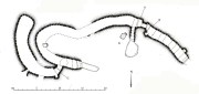
Modern groundplan (after RCAHMS, 1994)

MacRitchie’s 1900 groundplan

It may, but we have no remaining evidence to tell us for sure. MacRitchie cited possible evidences from elsewhere to add weight to this thought, but had the humility to leave the idea open, telling simply how “no vestige of a roof is visible at the present day, and the whole of this side room is open to the sky,” as with the majority of this entire souterrain.  In my opinion, more of it would have been roofed in stone slabs, but these would seem to have been robbed.  Certainly a well-preserved cup-marked stone (Pitcur 3:3) laying up against one of the walls appears to have slid from its topmost covering position into where it now rests in the passageway (near ‘b‘ in MacRitchie’s plan).

Continuing with Mr MacRitchie’s account, he (like most of us) found the underground section most impressive, telling:

“This covered section is unquestionably the most interesting and instructive of the whole building; for, as already stated, the other parts are more or less ruined and roofless. A few remaining flags lying in the unroofed part of the main gallery show, however, that it once possessed the usual stone roof throughout its entire length. This was rendered possible by the comparative narrowness of the main gallery, the width of which on the floor averages about 6 feet. The greater breadth of the subsidiary gallery will be realised by glancing at the cross section, a-b in the plan.

“The Pitcur earth-house had at least three separate entrances, namely, at the points h, i, and j.  The subsidiary room appears also to have had an independent connection with the, outside world, at the point g, and perhaps also f, though the latter may only mark a fireplace or air-hole, for the condition of the ruin makes it difficult for one to speak with certainty. The entrance at i, which slopes rapidly downward, is roofed all the way to d; and consequently this short passage remains in its original state.

“Within the covered portion, and quite near its entrance, a well-built recess (e in the plan) seems clearly to have been used as a fireplace, although the orifice which presumably once connected it with the upper air is now covered over.  Another and a smaller recess in the covered portion (k in the plan) can hardly have been a fireplace, and it is difficult to know what it was used as.

“One other point of interest is the presence of two cup-marked stones (p and q on the plan). Of these, the former is lying isolated on the surface of the ground near the entrance i, while the latter forms one of the wall stones beside the doorway c.”
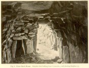
‘Fireplace’ near the entrance

The internal ‘cave’ section has that typical damp smell and feel to it, beloved of underground explorers.  As we can see in MacRitchie’s old photo of the site, the seeming ‘fireplace’ that he mentions is very obvious. Frank Mercer posited the same idea about this underground alcove when he first saw it, and it makes a lot of sense.  On the left-upright stone in the photo (right) you can just make out a single cup-marking (Pitcur 3:7) which we found when we visited; another one may be on the inside edge of the same fireplace.  If you climb up on top of the souterrain close to where the opening of the fireplace would have been, you’ll see the impressive Pitcur 3:5 petroglyph; whilst the Pitcur 3:1 carving is difficult to see (though Mr Mercer noticed it), just above ground-level, beneath the covering stone ‘m‘ in MacRitchie’s plan.  All in all, a bloody impressive place!

Folklore

In earlier centuries the site was known locally as The Cave, yet considering how impressive it is, folklore and oral tradition seem sparse.  Even David MacRitchie (1897) struggled to find anything here.  But in one short article he wrote for The Reliquary, he thought that stories of little-people may have related to Pitcur-3:

“A tradition which a family of that neighbourhood has preserved for the past two centuries, has, in the opinion of the present writer, a distinct bearing upon the “cave” and its builders.

“This is that, a long time ago, a community of “clever” little people, known as “the merry elfins,” inhabited a “tounie,” or village, close to the place. The present inheritors of the tradition assume that they lived above ground and do not connect them at all with this “cave,” of whose existence they were unaware until a comparatively recent date. But, in view of a mass of folk-lore ascribing to such “little people” an underground life, the presumption is that the “tounie” was nothing else than the “cave”. This theme cannot be enlarged upon here; but a study of the traditions relating to the inhabitants of those subterranean houses will make the identification clearer.

“It may be added that the term “Picts’ house” applied to the Pitcur souterrain, is in agreement with the inherited belief, so widespread in Scotland, that the Picts were a people of immense bodily strength, although of small stature.”

References:

  1. Armit, Ian, Scotland’s Hidden History, Tempus: Stroud 1998.
  2. Barclay, Gordon, “Newmill and the ‘Souterrains of Southern Pictland’”, in Proceedings Society of Antiquaries, Scotland, volume 110, 1980.
  3. Mackenna, F.S., “Recovery of an Earth House”, in The Kist, volume 4, 1972.
  4. Mackie, Euan, Scotland: An Archaeologial Guide, Faber: London 1975.
  5. MacRitchie, David, The Testimony of Tradition, Kegan Paul: London 1890.
  6. MacRitchie, David, “Pitcur and its Merry Elfins,” in The Reliquary, 1897.
  7. MacRitchie, David, “Description of an Earth-house at Pitcur, Forfarshire,” inProceedings Society of Antiquaries, Scotland, volume 34, 1900.
  8. Neighbour, T., “Pitcur Souterrain (Kettins parish)”, in Discovery & Excavation Scotland, 1995.
  9. Royal Commission on the Ancient & Historical Monuments of Scotland, South-East Perth: An Archaeological Landscape, HMSO: Edinburgh 1994.
  10. Wainwright, F T., The Souterrains of Southern Pictland, RKP: London 1963.
  11. Warden, Alex J., Angus or Forfarshire: The Land and People – Descriptive and Historical – 5 volumes, Charles Alexander: Dundee 1880-1885.
  12. Young, Alison, “Cup-and ring Markings on Craig Ruenshin, with some Comparative Notes“, in Proceedings Society of Antiquaries, Scotland, volume 72, 1938.

Acknowledgements:  This site profile would not have been made possible were it not for the huge help of Nina Harris, Frank Mercer & Paul Hornby.  Huge thanks to you all, both for the excursion and use of your photos in this site profile. 🙂

© Paul Bennett, The Northern Antiquarian