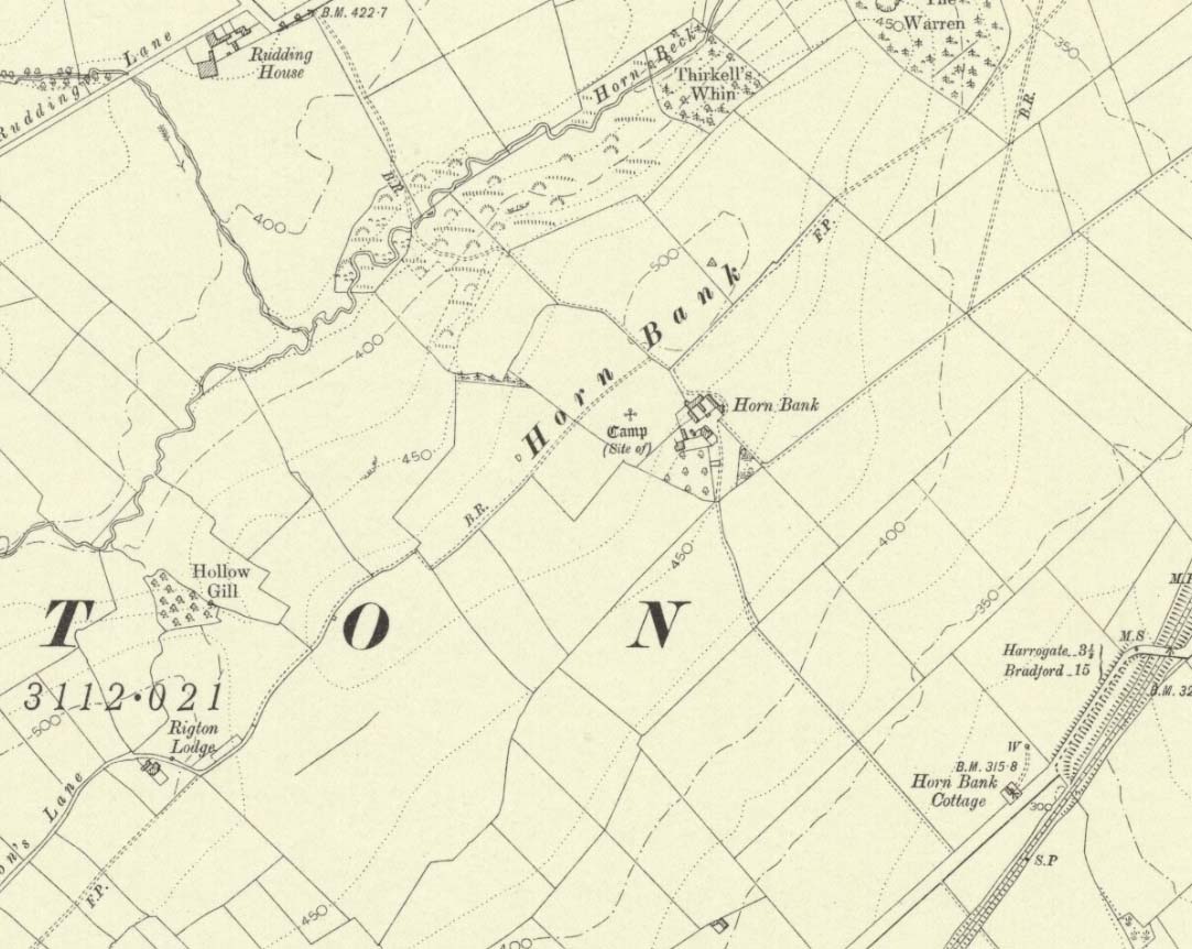
Settlement (destroyed): OS Grid Reference – SE 2905 5035
Archaeology & History
Upon the top of the old ridge where ran the ancient trackway between Rigton and Pannal, could once be found a multi-period settlement, long since gone – as happens all too often in this neck o’ the woods. And unfortunately there doesn’t appear to be any sketch plans of the site. It was first described by Edward Hargrove (1789) in his historical old rambles around Harrogate and district. When the scribe reached Horn Bank, he told that here,
“was lately discovered the remains of several entrenchments forming three distinct enclosures, two of a square and one of a circular form. Not far from these entrenchments, which were probably of Danish origin, was found, in May 1787, the umbo of a shield, with several other fragments of gilt brass…”
In William Grainge’s (1871) magnum opus he told that,
“At Horn Bank, on the crest of the hill east of Rigton, near a farm-house, are the remains of three camps—two of a square, and one of a circular form; they are probably of British and Roman origin. The location is a lofty and commanding one; but the ploughshare has so often passed over them that they are nearly obliterated.”
Just below the settlements Grainge also said how, “a fine spring of water was formed into a bath here many years ago, but the whole is now in a state of ruin.” This would have likely been the main water supply for the people living here. Harry Speight (1903) implied the same thing when he investigated the site, saying:
“At a place called Horn Bank, near Rigton, on the west side of the parish, on the crest of the hill on the north side of the Horn Bank farmhouse, there were formerly to be seen very distinct indications of three camps, each encompassed with fosse and rampart. Hargrove supposed them to be Danish, but as two of them were of a square or rectangular form, and the other circular, they were in all probability relics of the Romano-British contest, at first occupied by the native tribes and subsequently as a temporary camp and look-out post by their conquerors. The site commands a wide and uninterrupted view in every direction, while close at hand is a copious spring of good water. This spot many years ago was converted into a bathing-place, but is now broken down and abandoned… The site has long been ploughed, and little or no trace of these earthworks is now discernible.”
The only thing Eric Cowling (1946) could find when he came to the place were faint scars of walling whose shadows were highlighted by the sun when the conditions were just right. He thought the settlements were Iron Age in nature, but would have continued to be used in subsequent centuries by local people. It seems a sensible suggestion…
References:
-
Cowling, E.T., Rombald’s Way, William Walker: Otley 1946.
-
Grainge, William, History & Topography of Harrogate and the Forest of Knaresborough, J.R. Smith: London 1871.
-
Hargrove, E., The History of the Castle, Town and Forest of Knaresborough with Harrogate, W. Blanchard: York 1789.
-
Speight, Harry, Kirkby Overblow and District, Elliot Stock: London 1903.
© Paul Bennett, The Northern Antiquarian