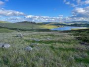
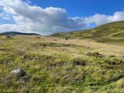
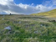
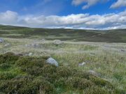
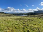
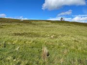
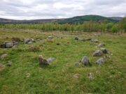
Newbigging, Lethnot and Navar, Angus

Stone Circle (destroyed):  OS Grid Reference – NO 5414 6935

Archaeology & History

Site location in 1863

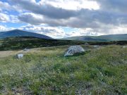
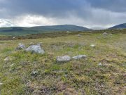
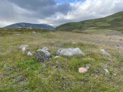
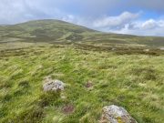
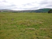
Entered in Aubrey Burl’s (2000) magnum opus as a stone circle, the site has also been reclassified as a ring cairn or cairn circle, for obvious reasons.  We can haggle about definitions if we wanna get a bit anal about it, but even from what little we know, this was an impressive looking site to say the least!  Burl (1976) originally suggested that it may have been a recumbent stone circle: an Aberdeenshire outlier, so to speak—and he may have been right. Sadly the place has been destroyed, like so many megalithic rings in this neck o’ the woods.

It was first mentioned, albeit briefly, by Alexander Gardner in his 1843 summary of the parish in the New Statistical Account where he told that, “there are the remains of a Druidical Temple at Newbigging near the remains of an ancient Castle or Tower called Dennyfern.”  Our main source of information comes via the early Ordnance Survey lads after they’d visited the place in 1861.  They wrote:

“Though nothing now remains of this Circle but one very large upright stone, measuring 5 feet 4 inches high, 9 feet in circumference at the base, and 6 feet 3 inches at the top, yet its site is plainly traceable, and is slightly raised from the ground around it.  It was an immense Cairn, 40 feet in diameter according to the farmer of Newbigging, containing 400 cartloads of stones which he removed …The one Stone standing is so large that this may be considered to be the remains of a “Stone Circle” of which the large quantity of small stones formed the raised plateau, the ring of which is still visible.”

The great regional historian Andrew Jervise (1853) culled a few extra snippets of information about the place, telling us:

“Some fifty years ago, a good specimen of concentric circles stood on the farm of Newbigging, about half-a-mile north of the house, on an elevated part of the mountain; but, of the twenty or thirty large stones that enclosed an area of from fifty to sixty feet in diameter, only one remains, the rest having been carried away for various utilitarian purposes.  This boulder, which is about eight feet high, is sometimes called the Druidical, but more commonly the “Stannin’ Stane of Newbiggin’,” and many flint arrow-heads have been found in its vicinity.  When demolished, the middle of the area of the inner circle was found to be filled with small stones to the depth of about three feet, under which lay a quantity of black clammy earth, mixed with pieces of charcoal, while a track about two feet broad, composed of loose red sandstone, laid to the depth of a few inches, ran directly through the clammy earth and pebbles, from side to side of the outer circle.”

Alex Warden (1884) mentioned the remaining Stannin’ Stane of Newbiggin’ in his survey of the area, and the monolith was still in place when Cruikshank (1899), the local minister, wrote his detailed history book, but he added little more by way of Jervise’s description, merely telling that the stone circle

“on Newbigging must have been in its original state interesting and remarkable.  It was composed of upright stones of great size, as we can see by the only one now remaining, which is known as “the Stannin’ Stane of Newbiggin’.”  The blasted massive remains of the other stones form the foundation of the field dyke close by.”

It’s obvious that Burl’s idea that this circle was a recumbent one is based on Jervise’s description of it being “a good specimen of concentric circles” with the internal cairn structure giving it additional archaeomythic clout.  Its complete destruction prevents us knowing anything more.

References:

  1. Barnatt, John, Stone Circles of Britain – volume 2, BAR: Oxford 1989.
  2. Burl, Aubrey, The Stone Circles of the Britain Isles, Yale University Press 1976.
  3. Burl, Aubrey, The Stone Circles of Britain, Ireland and Brittany, Yale University Press 2000.
  4. Cruikshank, F., Navar and Lethnot: The History of a Glen Parish in the North-east of Forfarshire, Black & Johnston: Brechin 1899.
  5. Jervise, Andrew, The History and Traditions of the Land of the Lindsays in Angus and Mearns, Sutherland and Knox: Edinburgh 1853.
  6. Royal Commission on the Ancient and Historical Monuments of Scotland, The Archaeological Sites & Monuments of Central Angus, Angus District, Tayside Region, HMSO: Edinburgh 1983.
  7. Warden, Alex J., Angus or Forfarshire: The Land and People – Descriptive and Historical – volume 4, Charles Alexander: Dundee 1884.

Acknowledgements:  Huge thanks for use of the Ordnance Survey map in this site profile, reproduced with the kind permission of the National Library of Scotland

© Paul BennettThe Northern Antiquarian
Craigendowie, Lethnot and Navar, Angus

Stone Circle (destroyed):  OS Grid Reference – NO 5225 6924

Archaeology & History

Site shown on 1865 map

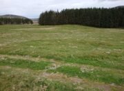
All remains of this stone circle have long since bitten the dust.  It was already described in the past tense when Alexander Gardner wrote his summary of the parish in the New Statistical Account in 1843 where he told that, “there are the remains of two or three small Druidical temples, one at Newbigging, one at Blairno, and one said to have been at Craigendowie, but now demolished.”

A few years later Andrew Jervise (1853), in his classic tome on the Mearns, gave us the best description of the place, based either on his own personal visit here, or one given to him by a local when he was surveying the history of the area.  He wrote:

“In the vicinity of Craigendowie … among the mass of artificial-looking cairns (which are said to be the graves of warriors), there was a small circle, composed of a quantity of stones about the same size, and ranged in the same manner, as those at Fernybank…. Unlike the latter, this circle was never thoroughly explored, even at the time of its removal more than forty years ago, and if as old as prehistoric times, it cannot now be said in how far it may have been a place of sepulture.  Craigendowie has, perhaps, its true etymon in the Gaelic Craigandubh, or “the black rock,” for the craig is an immense black rock close by the river-side; but, according to a truer etymology, as well as popular story, it implies the “rock of the funeral cairn,” or perhaps the “craig of battle or mischief;” and, if any reliance can be placed on the tales regarding the malicious actions of the kelpie in the dark pool beside it, or in the story of warriors having fallen in the neighbourhood, the latter rendering may not be altogether inept!”

When the Ordnance Survey lads wrote about it their Name Book (1861) they told simply of its memory, saying,

“There is now nothing remaining to mark the site except a portion of the ground being still uncultivated, nor is there any person who recollects seeing any remains.  It is supposed to have been demolished in making an old road through it, the track of which is still plain.”

And, later still in Cruikshank’s (1899) major work on Lethnot township he added little extra information other than saying that “it was situated in the field in front of the farmhouse (but) is entirely destroyed.”

References:

  1. Cruikshank, F., Navar and Lethnot: The History of a Glen Parish in the North-east of Forfarshire, Black & Johnston: Brechin 1899.
  2. Jervise, Andrew, The History and Traditions of the Land of the Lindsays in Angus and Mearns, Sutherland and Knox: Edinburgh 1853.
  3. Royal Commission on the Ancient and Historical Monuments of Scotland, The Archaeological Sites & Monuments of Central Angus, Angus District, Tayside Region, HMSO: Edinburgh 1983.
  4. Warden, Alex J., Angus or Forfarshire: The Land and People – Descriptive and Historical – volume 4, Charles Alexander: Dundee 1884.

Acknowledgements:  Huge thanks for use of the Ordnance Survey map in this site profile, reproduced with the kind permission of the National Library of Scotland

© Paul BennettThe Northern Antiquarian
Golan Well, Glenisla, Angus

Hut Circles:  OS Grid Reference – NO 1974 6559

Getting Here

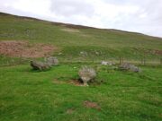
Hut circle (2), looking south

From Alyth, take the B954 road north to Glen Isla, or from Kirriemiur northwest up the B951.  Whichever your route, once you pass the Kirkton of Glenisla about 10 miles up, make sure you DON’T cross the river bridge a mile past here—instead take the tiny right-turn just before the bridge and go up here (past Folda) for just over 2 miles and then park up where the signpost tells Cateran Trail (if you’ve crossed the next river bridge, you’ve gone 150 yards too far).  Walk up the track and, after a mile, it levels-out just where it swerves to go back downhill.  Once here, walk off the track and up onto the moorland on your right (south) adn where the land levels out, zigzag around, keeping your eyes peeled for the circular stone enclosures.  There are several of them.

Archaeology & History

On the way back from seeking out a forgotten holy well at Auchenchapel in the hills above Glen Isla last week, I stumbled across a small group of hut circles which, it turns out, weren’t in the record books.  Unfortunately I found them near the end of the day, so it was a bit of a rush-job zooming back and forth taking quick photos of what was there, i.e., at least three hut circles, probably Iron Age in origin (although I’ve seen Bronze Age circles just like these) constructed very close to each other, with a possible fourth one buried in deeper heather nearby.  The circles have been built on a high exposed ridge linking Glen Isla to Glen Clova a few miles to the east, but when these were built this area would obviously have possessed a good cover of birch, hazel and other trees, protecting the structures from the elements.

Hut circle (1) looking NW
Golan Well hut circle (1)

The first one—hut circle (1) (at NO 19765 65581)—has been built and cut into a slight slope in the hillside, with the floor inside obviously leveled out.  Measuring roughly 16 yards across from outer wall to outer wall, the entrance to the building seems to be on the eastern side and the average height of the walling all round is roughly 2 feet.  On the whole the structure is in very good condition, with hardly any damage done despite its great age.  It was obviously built for a single family, but was no doubt used over and over for many centuries.

Hut circle (2) looking NE
Hut circle (2) looking SW

The second of the circles (at NO 19741 65590) is just 15-20 yards away to the northwest.  Slightly smaller than hut circle (1) and also built into slightly sloping ground, its walls are a little more sturdy and slightly wider than its compatriot and were built around at least two earthfast boulders making it structurally much stronger.  Measuring roughly 15 yards across from outer wall to outer wall, the entrance to this circle is at the southeast.  Once again, this would have been perfect for a single family to live in.

Hut circle (3) looking NW
The small hut circle (3)

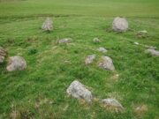
The third of the hut circles found this day was the smallest of the group and suggests that it would have housed only one person.  The stones making up this small circle are unusually large for such a small structure, which made me think at first that it may have been a cairn—but the more I looked, the more I realized that this wasn’t the case.  Somewhat more oval in shape than the other two, unlike its compatriots some parts of the walls seem to have been disturbed and knocked down to the side.  The poor little fella measures only 8 yards across, but its walls were still nice and sturdy being roughly a yard wide all round.

Line of ancient walling

What seemed to be a fourth hut circle was covered in deep heather close to the cluster of three, but we need another visit here to work out whether this suspicion is correct or not.  Much more certain is the existence, less then a hundred yards northwest of here, of a very distinct line of ancient walling, about a yard wide, suggesting that the hut circles were encircled by a much larger enclosed structure.  I paced along this walling for 60 yards, whereafter it disappeared into the heather.

It’s extremely likely that other unrecorded prehistoric remains are still to be found in this area.  So get y’ walking boots on and get that nose of yours a-twitching across these ‘ere ancient hills!

Acknowledgements:  Huge thanks for Prof. Paul Hornby, for getting us up here and having another fine day fine on the hills…

© Paul BennettThe Northern Antiquarian
Auchenchapel, Glenisla, Angus

Hut Circle:  OS Grid Reference – NO 19957 65342

Getting Here

From the circle, looking S

From Alyth, take the B954 road north to Glen Isla, or from Kirriemiur northwest up the B951.  Whichever route you take, goes for miles, then past the Kirkton of Glenisla for another mile make sure you DON’T cross the river bridge—instead take the tiny right-turn just before the bridge and go up here (past Folda) for just over 2 miles and park up where the signpost tells Cateran Trail (if you’ve crossed the next river bridge, you’ve gone 150 yards too far).  Walk up the track for a mile where it just about levels-out, before swerving back downhill again and, shortly after crossing a burn, turn right and head downhill into the heathlands.  About 350 yards down, right beside the track, this overgrown hut circle lives!  Y’ can easily walk straight past it if you’re not careful.

Archaeology & History

The hollowed hut circle

In a beautiful setting, this good-sized Iron Age hut circle (possibly earlier), roughly fourteen yards across, sits within a wider archaeological environment of human settlements all round here from medieval and later periods, most of which has almost entirely disappeared beneath the vegetation on these gorgeous moorlands.  It’s one of a number of remaining prehistoric circles that still live amidst the later remains and would have housed a good-sized family or two.  The walls alone are roughly six-feet thick all round, making it a very solid building indeed!  In all likelihood, other hut circles have been torn down for use in the construction of the later medieval buildings nearby.  Thankfully, like the very well-preserved cluster up the slope above Golan Well, this one survived.

© Paul BennettThe Northern Antiquarian
Priest’s Stone, Lethnot & Navar, Angus

Standing Stone (destroyed):  OS Grid Reference – NO 5404 6892

Archaeology & History

Priest’s Stone on 1865 map

Despite being shown on the early OS-maps of the area, I can find few references this place.  The Ordnance Survey lads themselves, when visiting here in 1863, merely told that this it was “a standing stone of which nothing is known except the name.  It is 3 feet high, three feet in diameter at base, and a foot and a half at top.”  Even in Cruikshank’s (1899) definitive survey of this township he could add little more, merely telling:

“About a quarter-of-a-mile north of Bellhill is a field known as “the Priest’s Field.” There is a large right stone in the middle of it, called “the Priest’s Stone,” and it is so given on the Ornance Survey map. not simply because such is the local name, but also because the skilled surveyors after examining it concluded that it had been used for sacrifice. It stands just behind the site of the old farm steadying of Upper Argeith, or vulgarly, Townhead.”

Quite what he meant by saying that “it had been used for sacrifice,” god only knows!  But the writer was the local minister and so would have been possessed by the usual delusions.  Anyhow, the stone was uprooted and destroyed by the farmer at Newbigging, sometime prior to 1958.  Idiot!

A half-mile north of this could once be seen a stunner of a site: a double-ringed giant tomb from where hundreds of cartloads of stone were taken.  It too no longer exists!

References:

  1. Cruikshank, F., Navar and Lethnot: The History of a Glen Parish in the North-east of Forfarshire, Black & Johnston: Brechin 1899.
  2. Royal Commission on the Ancient and Historical Monuments of Scotland, The Archaeological Sites & Monuments of Central Angus, Angus District, Tayside Region, HMSO: Edinburgh 1983.

Acknowledgements:  Huge thanks for use of the Ordnance Survey map in this site profile, reproduced with the kind permission of the National Library of Scotland

© Paul BennettThe Northern Antiquarian

Fernybank, Glen Esk, Lochlee, Angus

Ring Cairn (destroyed):  OS Grid Reference – NO 5381 7877

Archaeology & History

Location of site on 1864 OS-map

This is one of many sites that were thankfully recorded by the fine pen of Andrew Jervise (1853) in the middle of the 19th century, without whose diligence in antiquarian interests all knowledge would have vanished.  His works remind me very much of those by the late-19th early-20th century writer Harry Speight in Yorkshire, whose veritable madness on that region’s history remains unsurpassed even to this day.  But I digress…

Jervise told us that,

“About the year 1830, while the tenant of Fernybank was levelling a hillock in the haugh between the farm-house and the Powpot Bridge (about two miles north-west of Colmeallie), he removed a number of stones varying in length and breadth from eighteen to twenty-four inches. They were ranged singly, and stood upright in a circle at short distances from each other, enclosing an area of about twelve feet in diameter. On the knoll being trenched down, the encircled part (unlike the rest of the haugh, which was of a gravelly soil) was found to be composed of fine black earth; but on several cart-loads being removed, operations were obstructed by a mass of stones that occupied much the same space and form as the layer of earth. Curiosity prompted the farmer to continue his labours further, but after digging to the depth of three or four feet, and finding stones only, he abandoned the work in despair, without having discovered anything worthy of notice… Had this cairn been thoroughly searched, it is probable that some traces of sepulture might have been found in it.”

A short time after this however, Jervise reported the finding of “old warlike instruments, both in the shape of flint arrow-heads and stone hatchets, have been found in the same haugh, and so late as 1851 a spear-head made of iron, and about fifteen inches long, was also discovered; it was much corroded, but had part of the wooden hilt in it.”  These were prehistoric artifacts that were subsequently moved to Edinburgh’s central museum where, I presume, they remain to this day.

About ten years later the Ordnance Survey lads came here and were fortunate to be able to meet with the same man who’d uncovered the site.  They told that,

“in contradiction to (Jervise’s narrative), the tenant of Fernybank who gave the information to Mr. Jervise, states that he continued the search to the bottom of the Cairn and found a quantity of Charred wood.”

There were a number of other prehistoric sites in this neck o’ the woods, many of which were also destroyed but, again, were thankfully recorded by Mr Jervise.

References:

  1. Jervise, Andrew, The History and Traditions of the Land of the Lindsays in Angus and Mearns, Sutherland and Knox: Edinburgh 1853.

Acknowledgements:  Huge thanks for use of the Ordnance Survey map in this site profile, reproduced with the kind permission of the National Library of Scotland

© Paul BennettThe Northern Antiquarian

Wellford, Fern , Angus

Standing Stone (destroyed):  OS Grid Reference – NO 483 603 (approximation)

Archaeology & History

In an area once teeming with megaliths, this is but one that lost its life in the 19th century.  It would seem that the only reference of its existence—and demise—comes from the pen of the great regional historian Andrew Jervise (1853) who, in a description of the nearby holy well of St Ninian, in a field near Wellford,

“within the last half century there were two or three large rude boulders nearby, which were called Druidical stones.”

References:

  1. Jervise, Andrew, The History and Traditions of the Land of the Lindsays in Angus and Mearns, Sutherland & Knox: Edinburgh 1853.

© Paul BennettThe Northern Antiquarian

Beauly Avenue, Downfield, Dundee, Angus

Cup-Marked Stone (lost):  OS Grid Reference – NO 3975 3340

Also Known as:

  1. Magdalen’s Kirkton Stone

Archaeology & History

In the mid-1890s, workmen ploughing one of the fields near the steading at Magdalen’s Kirkton farm hit a large stone beneath the soil.  It turned out to be the covering stone of a prehistoric burial, or cist, that was aligned east-west.  Whilst the remains in the cist had all but turned to dust, the covering stone had a number of cupmarks on it.  It was described only briefly by R.N. Kerr (1896), who told that,

“The stone forming the lid of the cist is cup-marked.  It weighs 5 cwt., 1 qr., 21½ lbs., and its thickness varies from 9 to 12 inches.  There are 40 or more cup-markings on it, varying from 1 to 3 inches in diameter.”

It would seem that no sketches were made of this carving and I’ve been unable to find any more details about it. Help!

References:

  1. Kerr, R. N., “Notice of a Burial Cist found on the Farm of Magdalen’s, Kirkton, on the Estate of Balmuir, near Dundee,” in Proceedings Society Antiquaries, Scotland, vol. 30, 1896.

© Paul BennettThe Northern Antiquarian

Wheen, Glen Clova, Angus

Settlement:  OS Grid Reference – NO 3661 7044

Getting Here

Section of a hut circle

From Kirriemuir town centre up the B956 Kinnordy Road, turn left where it goes along the B955 road for several miles towards Cortachy, following the same route as if you’re going to the curious Whitehillocks stone circle.  Literally two miles (3.2km) along the road past Whitehillocks farmhouse, a large “parking” spot is at the right-hand side of the road.  From here, walk along the road for 230 yards and go thru the gate on your left.  The first low-rise hut circle is to your immediate right; and from here, meander along the track ahead of you, keeping your eyes peeled…

Archaeology & History

Despite being initially difficult to make out (as the photos here indicate), once your eyes have adjusted to the landscape morphology, you realise what an impressive prehistoric complex you’re wandering through.  Saying that, it’s primarily a site that’s gonna be of interest to antiquarians, archaeologists and historians, as this is a settlement you’re looking at, lacking in megaliths, petroglyphs and similar ritual sites.

First enclosure, through the gate on your right
Cairn in the meadows

The first site that you’ll probably notice is visible from the road—but it’s not the first part of the settlement that you’ll pass.  Immediately through the gate (as I’ve said) is the embanked rise of earth—only one or two feet high—making up the first notable hut circle (NO 36612 70453), measuring roughly 15 yards across.  The shape and form of this circle typifies the others in the arena ahead of you, so that once you’ve made yourself aware of what this one looks like, you’ll be able to see the others with greater ease.  Another low embanked circle of roughly the same size is just a few yards away at NO 36605 70439.

Straight back onto the track you’ll notice another larger D-shaped enclosure immediately on your left (NO 36622 70406), about 17 yards across; this is accompanied by what looks like a cairn immediately right of the track (NO 36609 70413), but this is actually a much smaller D-shaped enclosure, just right for one or two people.

The small rounded hill in front of you has what may be a circular enclosure on its top, but I wasn’t too sure about it.  But looking down from this hill is the most visible of all the structures in the settlement (NO 36580 70307)—and the one I mentioned as being visible from the road.  At first it’s a little deceptive in appearance, as you get the impression that the oval of stones (top photo) is what constitutes this hut circle, when in fact this element may be mediaeval in nature as it’s been built on top of an earlier Iron Age (?) enclosure.  You can barely see this earlier form at ground level, so it’s best to walk back up the rounded hillock and cast your gaze back and forth and round the side of the ring of stones.  You’ll see, eventually, the shallow overgrown walling of a larger oval-shaped enclosure, measuring eighteen yards across, whose edges start from the bottom of the hillock and arc around to the outer edges of the stone construction.

Hut circle, NO 36573 70230

Back onto the track and further into the meadows, the next hut circle you’ll meet is (keep your eyes peeled) right by the track-side (NO 36573 70230).  It has wide embanked walls that are low to the ground and completely overgrown, measuring 15 yards (E-W) by 18 yards (N-S), with what looks to be the original entrance or door on its south-side.  A similar large circle exists on the other side of the track a little bit further along (NO 36499 70138).

There’s much more to this settlement, including lengths of walling in the grasslands below the last two circles and where, if you look carefully, you’ll see one of at least two cairns in this area.  On the other side of the road are one or two other small hut circles and a much larger construction in the field further down the road, measuring 25 yards in length (NO 36569 70481).  This would seem to be the largest of the lot.

The age of this settlement probably covers a considerable period of time: beginning perhaps in the Bronze Age, certainly in the Iron Age and all the way through into the mediaeval period where, all down Glen Clova, remnants of such hamlets still live beneath the soil.  This entire arena is bathed in silence, save the wind and call of the birds.  Tis a beautiful space to spend a few endless hours…

© Paul BennettThe Northern Antiquarian

Whitehillocks Farm, Glen Clova, Angus

Stone Circle:  OS Grid Reference – NO 37095 66958

Getting Here

Whitehillock stone circle

From Kirriemuir town centre up the B956 Kinnordy Road, turn left where it goes along the B955 road for several miles towards Cortachy.  Keep going on the B955 for a few more miles into the quiet beauty of Glen Clova.  A third-of-a-mile (0.5km) past Glenarm house, the road splits.  Take the right-hand road, which goes down and across the river below.  Keep on this road for just over a mile (1.8km) and as you approach the large farmhouse of Whitehillock—about 200 yards before it—keep your eyes very well focused in the field on your left and you’ll see a mass of large fallen stones right up against the other side of the fence.  You’ve arrived.

Archaeology & History

Internal “cairn”

A half-mile north of Clach na Brain, or the Stone of the Raven (a stone that was traditionally used to beat woven cloth after it had been washed), we come across this ruined stone circle, which has seen better days.  Not shown on any of the early OS-maps, nor found in the standard megalithic catalogues (Barnatt 1989; Burl 2000), its existence seems to have been logged for the first time by some of the Royal Commission doods in 1999, but of late its veracity as a prehistoric site has been questioned as the local farmer alleged it to have been built by his father sometime in the 20th century.  It might have been – but if he did, he made a bloody bad job of it!  The site doesn’t have that “new” look about it and, unless someone told you that this was a stone circle, you wouldn’t give it a second look!  That aside…

The stones have been placed around the edge of a small rise in the land, within which is a scatter of small and reasonably large stones that give the impression of a cairn at its centre.  All but one of the stones (the eastern one) is still standing and measures about 3 feet in height.  The rest are either laid down or near to collapse and measure between four and six feet in length.  Without an excavation of the site, we cannot be certain of its age, but the official records still have it listed as a stone circle.  We await further examination…

References:

  1. Dorward, David, The Glens of Angus, Pinkfoor Press: Forfar 2001.

© Paul BennettThe Northern Antiquarian