Robin Hood & Little John Stones, Whitby, North Yorkshire

Standing Stones (destroyed?):  OS Grid Reference – NZ 9171 0952

Also Known as:

  1. Robin Hood’s Pillars

Archaeology & History

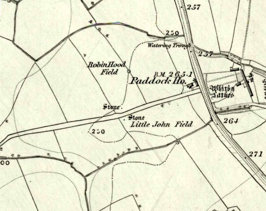
The 2 stones on 1853 map

The 2 stones on 1853 map

References to these old standing stones are scarce—at least in archaeology books anyway.  Even the usually diligent masters of Burl (1993) and Thom (1990) missed them!  But thankfully our folklorists and antiquarians with their keen interest in popular culture have written about these long lost monoliths, which could once be seen in fields just a mile or so south of Whitby town.

The earliest known account of the site is as the “Robyn-Hood-stone” in records dating from 1540 CE cited in the Cartularium Abbathiae de Whiteby (1881).  It was later described in land registers in 1713 and the fields in which they stood were—and still are—respectively known as Robin Hood’s Close and Little John’s Close.

These Whitby monoliths—like their namesakes in Northamptonshire— weren’t too big.  In Mr Young’s (1817) early description, when the stones were still visible, he told how Robin Hood’s stone was “a stone pillar about a foot square and four feet high”, and Little John’s Stone was “a similar pillar about two-and-a-half feet high.”  Mr J.C. Atkinson, the editor of the Cartularium (1881), also told that the two stones were “still in situ in the earlier part of the present century,” continuing:

“Both stones have now been removed, and are, I was informed, set up again near the enclosing fence of the field in which they stood. Almost beyond question , like the other monoliths of the district, they marked the site of ancient British interments.”

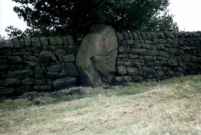
So—do the remains of these old stones still exist somewhere close by as J.C. Atkinson said, either in the walling, as a gatepost, or just pushed over and now covered in grass (like the long lost Thief Thorne standing stone near Addingham)?  Are any northern antiquarians living close by who might enable their rediscovery?

Folklore

A number of writers exploring the mythic histories of Robin Hood have included this site in their surveys, usually repeating the earlier creation myths about them that could be heard in popular culture.  The Whitby historian George Young (1817) told the tale:

“According to tradition, Robin Hood and his trusty mate, Little John, went to dine with one of the Abbots of Whitby, and, being desired by the Abbot to try how far each of them could shoot and arrow, they both shot from the top of the Abbey, and their arrows fell on the west side of Whitby Laithes, beside the lane leading from thence to Stainsacre; that of Robin Hood falling on the north side of the lane and that of Little John about a hundred feet further, on the south side of the lane.”

Whitby folklorist P.S. Jeffrey (1923) took this myth literally, saying how the distance of the arrows fired by the respective folk heroes was “scarcely credible, as the distance in each case is about a mile-and-a-half.”  However, the earlier historian Lionel Charlton (1779) thought the incredible feat quite credible!

The distance between the Abbey and the stones is 1.36 miles (2.2km); but it may be that the direction related in the tale was more important than the distance, as the alignment between the two sites runs northwest to southeast—or southeast to northwest, whichever you prefer!—and may relate to an early astro-archaeological alignment.  Might…..

References:

  1. Anonymous, “Robin Hood in Yorkshire“, in Yorkshire Folk-Lore Journal – volume 1, T.Harrison: Bingley 1888.
  2. Anonymous, “Whitby Arms,” in Yorkshire Folk-Lore Journal – volume 1, T.Harrison: Bingley 1888.
  3. Benedicti, Ordinis S., Cartularium Abbathiae de Whiteby – volume 2, Andrews: Durham 1881.
  4. Burl, Aubrey, From Carnac to Callanish, Yale University Press 1993.
  5. Charlton, Lionel, The History of Whitby and Whitby Abbey, T. Cadell: York 1779.
  6. Doel, Fran & Goeff, Robin Hood: Outlaw or Greenwood Myth, Tempus: Stroud 2000.
  7. Green, Barbara, The Outlaw Robin Hood – His Yorkshire Legend, KCS: Huddersfield 1992.
  8. Gutch, Mrs, County Folk-lore – volume 2: North Riding of Yorkshire, York and the Ainsty, David Nutt: London 1901.
  9. Jeffrey, P. Shaw, Whitby Lore and Legend, Whitby 1923.
  10. Mitchell, W.R., Exploring the Robin Hood Country, Dalesman: Clapham 1978.
  11. Parkinson, Thomas, Yorkshire Legends and Traditions – volume 2, Elliot Stock: London 1889.
  12. Thom, A., Thom, A.S. & Burl, Aubrey, Stone Rows and Standing Stones – 2 volumes, BAR: Oxford 1990.
  13. Young, George, The History of Whitby and Streoneshalh Abbey – volume 2, Clark & Medd: Whitby 1817.

© Paul Bennett, The Northern Antiquarian


Slack Bottom Stone, Heptonstall, West Yorkshire

Standing Stone:  OS Grid Reference – SD 98374 28800

Also Known as:

  1. Dawson City Field Stone

Getting Here

Go all the way up and through Heptonstall village until you reach the hamlet of Slack, by the road junction.  From here walk down the road as if you’re going back into Hebden for less than 200 yards, then take the footpath on the left downhill and walk along. After a couple of stiles, keep a keen eye on the walling where the holly trees are, above the tree-line of Hardcastle Crags.  You’ll see it soon enough!

Archaeology & History

Slack Bottom stone

Arguably the best-named standing stone in Britain, it was first discovered by Absalom Voist in the late 1990s (and first described in my Old Stones of Elmet), hiding away in the more modern walling, beneath a holly tree.  But the stone itself is very nicely eroded and seems of good age, aswell as being a good near-six-foot tall specimen of a standing stone, just above the tree-line south of Hebden Dale.  The stone gets its name from the fact that it’s at the bottom end of Slack village (which is actually called ‘Slack Bottom’ – with a house-sign there above the door to prove it!).  It may be part of what was originally some original Iron Age walling instead of an authentic standing stone — tis hard to say really — but it’s a nice stone nonetheless.  David Shepherd (2003) named this stone as ‘Dawson City Field’ in his later survey of megaliths in upper Calderdale.

Not far from here, along the edge of the woodland, is the little-known remains of an old cross-base which I think has eluded all previous surveys.  Next time I’m up here, I’ll try remember to get some photos of the place!

References:

  1. Bennett, Paul, The Old Stones of Elmet, Capall Bann: Milverton 2001.
  2. Shepherd, David, ‘Prehistoric Activity in the Central South Pennines,’ in Proc. Halifax Ant. Soc., 2003.

© Paul BennettThe Northern Antiquarian


Reap’s Cross, Heptonstall Moor, West Yorkshire

Cross:  OS Grid Reference – SD 94360 30269

Also Known as:

  1. Long Stoop
  2. Ralph’s Cross

Getting Here

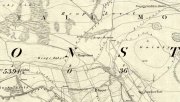
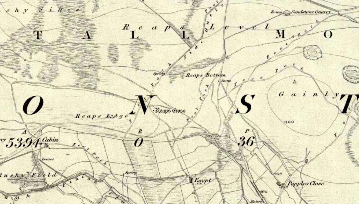
Reaps Cross on 1851 OS-map

Reaps Cross on 1851 OS-map

From Hebden Bridge go up the Heptonstall road, going round the village and onto and through Slack, keeping straight on the road until it goes uphill for a short distance, then levels out; then watch out for the small right-turn at Colden and the single-track road heading to a dead-end.  Go right to the end, the very end, and go through the gate and walk up the track onto the moor.  As you reach the ridge and the moorlands open up before you, note the small ‘standing stone’ on your right, about 10 yards off-path— and there, 100 yards the opposite direction to your west, the tall upright Reaps Cross is sat on the moortop.  Y’ can’t miss it!

Archaeology & History

Found in the middle of a beautiful nowhere not far from the prehistoric standing stone on Standing Stone Hill, this old tall monolith was said to have stood as a marker beside the old road which ran from Halifax over the moors to Colne, until the more recent Widdop Road became the more preferred route.  Known locally as the Long Stoop, in 1900 George Tyack said of it,

“This stone, which is composed of millstone grit, lay for a long tine broken and overthrown, but has in recent years been replaced on its original site and restored.  It is a simple Latin cross standing twelve feet high amidst the heather of the Yorkshire moors.”
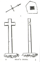
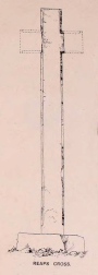
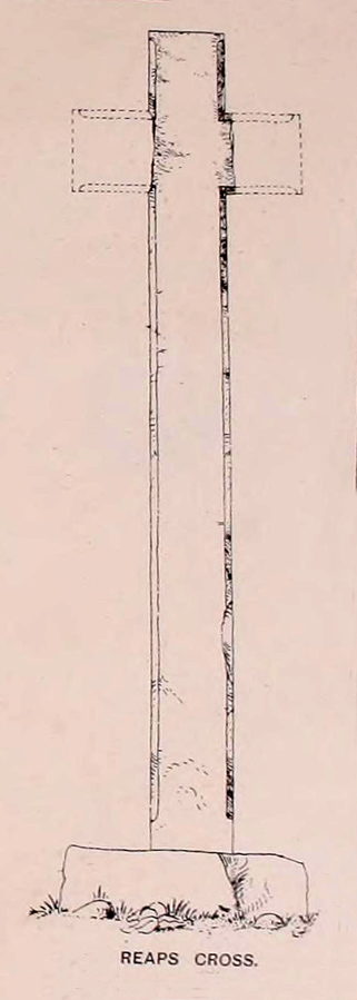
Longbottom's 1897 sketch

Longbottom’s 1897 sketch

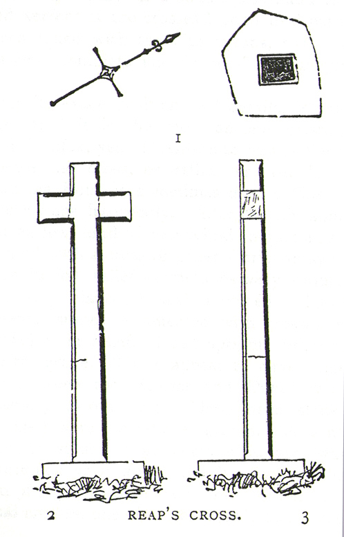
Waddington's 1884 sketch

Waddington’s 1884 sketch

Shortly before Tyack’s description, the local historian John Longbottom (1897) wrote a series of articles on the old stone crosses of the region and gave us this old sketch of the site (right).  Even in his day the cross had been “wilfully thrown down” (probably by the screwy Puritans at that time), but a short time later it had been “repaired and restored to its original position.”  In Longbottom’s day there were short ‘arms’ extending outwards from near the top of the obelisk, defining it as a distinct ‘cross’, but these have subsequently been lost following further local demolition attempts. He told how,

“Reaps Cross is known locally to shepherds, gamekeepers and farmers at ‘T’ Long Stoop’, and…apart from its religious associations, it forms an important landmark, now as in ancient times, to many a poor weary traveller crossing the dreary and lonesome hills between Lancashire and Yorkshire.”

The cross keeps getting knocked over, by both lightning and idiots of various persuasions; but thankfully the old fella keeps getting resurrected and put back in its place. It’s history is a curious one.  When Clifford Byrne (1974) wrote about the site in his unpublished survey, he told how

“This cross appears to be of medieval origin and…in 1973 the monolith lay broken, one section lying in the grass, whilst the other section still stood in the pedestal.  It is seen to have been broken once before, for the remains of iron clamps are seen on both sections.  The arms have been broken off in some age… A local farmer insisted that the correct name was Ralphs Cross not Reaps Cross, and it should be noted that a section of moor at Widdop (the valley with the high cliffs) is named after a Ralph.”

Standing some 12 feet tall, this is the highest of all the crosses in West Yorkshire and obviously some considerable work went into its creation all those centuries ago.  Nobody is sure when it was first made, but the educated guess is 12th century.  Why it was erected here, way off from anywhere in the middle of the wild moors, is equally puzzling.  It may have had something to do with the nearby medicinal springs; it may have been as a guide-post to travellers—”to Rastric Greave”, according to Waddington (1884); it may have marked an ancient religious route; or it may have distracted people away from the prehistoric upright that gave its name to Standing Stone Hill, a short distance to the west  We simply don’t know.  It’s well worth visiting though, as the moorland landscape up here is truly expansive and civilization seems thankfully centuries away…

Folklore

Local tradition told that the cross marked an old corpse route, along which the dead were carried before being buried at Heptonstall.  Here at Reaps Cross, the bodies were rested by the weary travellers.  If this is true, it is probable that the ancient standing stone more than half-a-mile to the west once had something to do with such old rites and routes.

References:

  1. Bennett, Paul, The Old Stones of Elmet, Capall Bann: Milverton 2001.
  2. Byrne, Clifford, A Survey of the Ancient Wayside Crosses in North-East Lancashire, unpublished MS, 1974.
  3. Longbottom, John, “Ancient Crosses in Halifax Parish – Part 2,” in Halifax Naturalist, 2:8, June 1897.
  4. Taylor, Henry, The Ancient Crosses and Holy Wells of Lancashire, Sherratt & Hughes: Manchester 1906.
  5. Tyack, George, The Cross in Ritual, Architecture and Art, William Andrews: London 1900.
  6. Waddington, J. Arthur, “The Crosses in and Around Burnley,” in Transactions of the Burnley Literary & Scientific Club, volume 1, 1884.

© Paul BennettThe Northern Antiquarian


Gray Stone, Burley, Leeds, West Yorkshire

Legendary Rock:  OS Grid Reference – SE 28659 34229

Also Known as:

  1. Giant’s Stone

Getting Here

Originally located at SE 28449 34364, the site is now to be found halfway along Westfield Road, where it meets up with Hollis Place, along the footpath at the back of the school, set back against the walling.  A plaque by the rock kinda gives the game away!

Archaeology & History

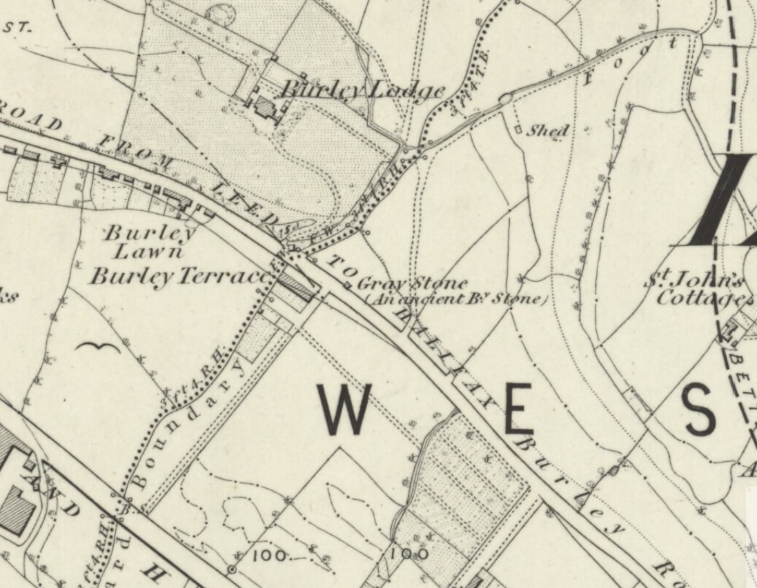
Gray Stone on 1852 map

Gray Stone on 1852 map

The large vandalised stone you see here—sprayed-painted quite eloquently it has to be said!—is apparently a replica of the old stone which could once be found about 300 yards northwest of here.  Typifying stones of this name—graygrey and variants thereof—the original Gray Stone was an old boundary marker (Smith 1956), and the last reference to it as an archaeological site was by James Wardell (1853), who even in his day said that it was “almost buried in the ground, on the Burley Road.” It is shown on the first OS-map by the roadside, close to the junction of Woodside View and Burley Road, but was said to have been removed at the beginning of the 20th century and moved to its new and present position.  However, somewhere along the line, the original stone has been destroyed and the thing that we see today has taken its place.

The original Gray Stone may have been a standing stone, but we cannot be certain about this.  The present boulder stands about four feet tall and is a rather fat-looking standing stone. You can just about squeeze round the back of it, around which is an incised line which cuts around the stone – but this obviously quite modern. A plaque stands in front of the stone, telling its brief history.  (if anyone can send us some photos of the site that would be great – I’ve gone and lost mine, somehow!)

Folklore

A creation myth of this site tells it to have been made by a giant, who threw the Gray Stone from the appropriately named Giant’s Hill (a supposed old camp, now destroyed), less than a mile southeast of here: an alignment which corresponds closely to the midsummer sunrise. In throwing it, he was said to have left the indentations of his finger-marks in the rock – thought to have been cup-markings.  Examples of other cup-and-ring stones occur a short distance west, at Kirkstall.

References:

  1. Bennett, Paul, The Old Stones of Elmet, Capall Bann: Milverton 2001.
  2. Smith, A.H., English Place-Name Elements – 2 volumes, Cambridge University Press 1956.
  3. Wardell, James, The Antiquities of the Borough of Leeds, John Russell Smith: London 1853.

© Paul BennettThe Northern Antiquarian


Town Cross, Alloa, Clackmannanshire

Cross:  OS Grid Reference – NS 88559 92686

Also Known as:

  1. Burgh Cross
  2. Canmore ID 47169
  3. Market Cross
  4. Mercat Cross

Getting Here

Alloa Cross, Bank Street

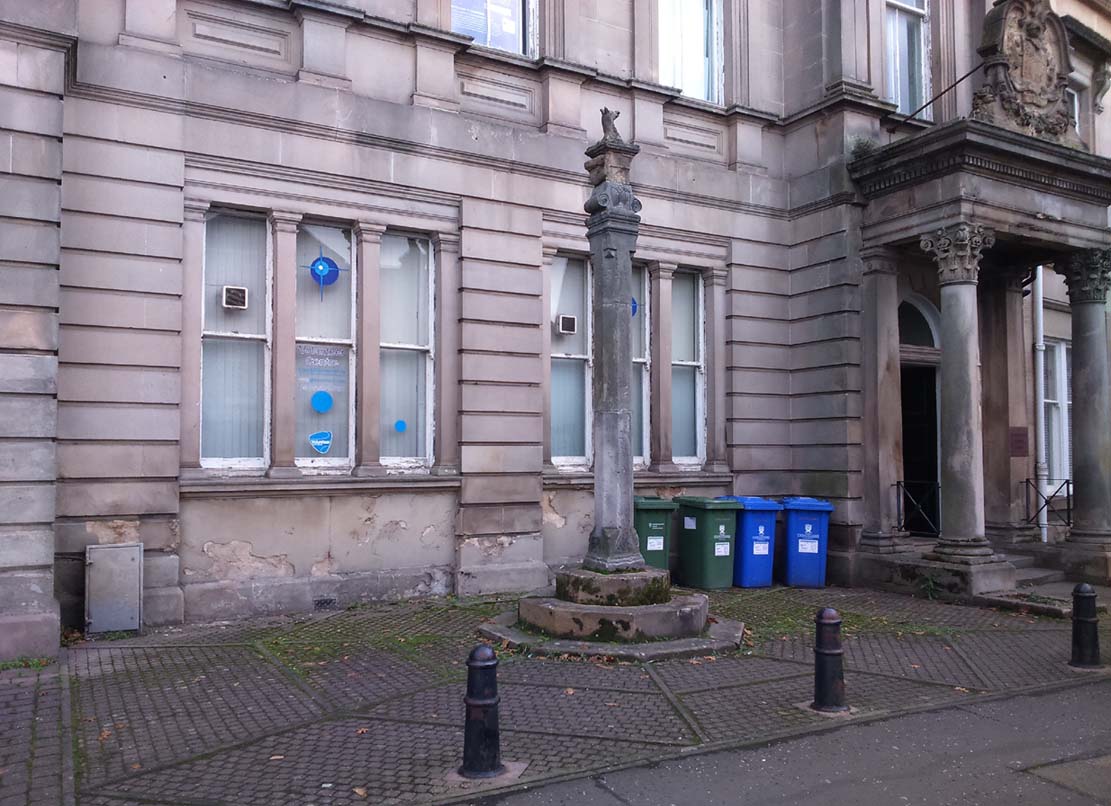
Get into the small town of Alloa, where the buses stand at Shillinghill.  From here walk southwest down Mill Street, which runs into Bank Street.  Keep your eyes peeled on your right-hand side, where outside one of the old municipal buildings you’ll see it standing upright.

Archaeology & History

Although now standing against the old buildings halfway down Bank Street, Alloa’s Mercat or Burgh Cross was initially set up at the crossroads 162 yards (148m) away, where Mar Street meets Mill Street and Bank Street.  It was moved to its present position sometime in the 1880s and knowledge of its early history is scant.

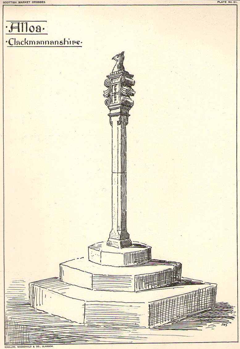
Standing some ten feet high, the monument was described in John Small’s (1900) rare magnum opus, in which he detailed the architectural features of the monument, telling us that,

John Small’s sketch

“The shaft, which rests on a base and three steps, is of the usual square section, with splayed angles, stoped at top and bottom, the top stop being rather peculiar.

The head of the Cross is composed of an oblong stone set upright, characteristic of the late type seen in Keikleour and Kinrossie.  The oblong is ornamented at the sides with debased volutes and acanthus leaves, the whole crowned by a wreath from which rises a griffin’s head, part of the supporters of the Arms of the Lords of the Manor, Lord Mar and Kellie.”

References:

  1. Anonymous, The Alloa Illustrated Family Almanac, MacGregor & Steedman: Alloa 1887.
  2. Mair, Craig, Mercat Cross and Tolbooth, John Donald: Edinburgh 1988.
  3. Royal Commission on the Ancient & Historical Monuments, Scotland, Inventory of Monuments and Constructions in the Counties of Fife, Kinross and Clackmannan, HMSO: Edinburgh 1933.
  4. Small, John W., Scottish Market Crosses, Eneas Mackay: Stirling 1900.

© Paul BennettThe Northern Antiquarian

The Grey Lady, Lundie, Angus

Standing Stone (destroyed):  OS Grid Reference – NO 3069 3609

Also Known as:

  1. Canmore ID 31894

Getting Here

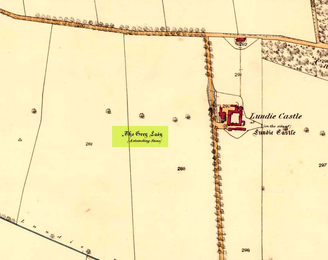
Grey Lady on 1860 OS-map

The site of the stone is on the top of a ridge due west of Lundie Castle and is best approached from the minor road between Lundie and Denhead, but at the time of my site visit a steel gate had been erected across the field just before the site of the stone together with a large festoon of electric fencing, which I did not cross.

Archaeology & History

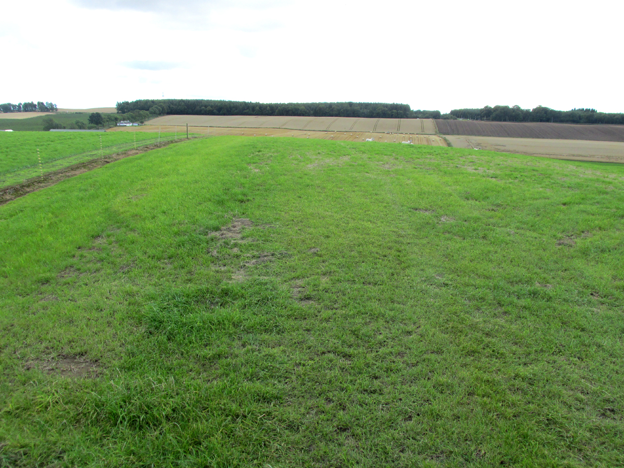
The Grey Lady stood on the near grassy horizon

The Ordnance Survey name book describes the stone, the informants being Mr. Pattullo junior and Mr. Bett of Pitermo:

This name is applied to a Standing Stone a little to the west of Lundie Castle. It is about 4 feet high, between two & three broad & rather a Kidney Shape. …Some think of druidical origin, but young Pattullo intends to blast it shortly“.

The rough grass probably marks where she stood.

And indeed it seems the feckless youth did have his wicked way with The Grey Lady, who had been a landmark for millennia, for she sadly no longer exists. In view of the folklore attaching to the stone, it may be worth speculating whether the kidney shape denoted a lunar symbolism for the stone.

Folklore

The OS name book states:

“The ladies of Lundie Castle have romance connected with it – that a white lady is to be seen walking round it on a certain night of every new moon.”

Reference:

  1. Ordnance Survey Name Book; Forfarshire (Angus) volume 66 (1857-61)

© Paul T. Hornby, The Northern Antiquarian 2017

Lytham Cross, Lytham, Lancashire

Wayside Cross: OS Grid Reference – SD 3603 2718

Getting Here

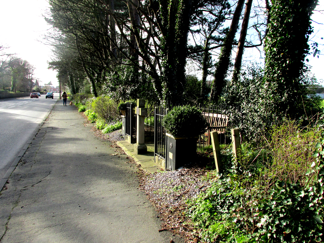
Roadside position of the cross

The cross is situated in a small railed enclosure adjoining the pavement on the North side of Church Road on the west side of Lytham, opposite Lowther Gardens.

Archaeology & History

Henry Taylor (1906), author of The Ancient Crosses And Holy Wells Of Lancashire, writes:

“The old market place of Lytham is triangular in shape…Church Road leads out of it, and not far from the church the pedestal of an ancient cross was at one time to be seen. The words ‘Site of Benedictine Priory’ occur on the map close to Lytham Hall, indicating the position of this small religious house, dedicated to SS Mary and Cuthbert, and subject to Durham.”

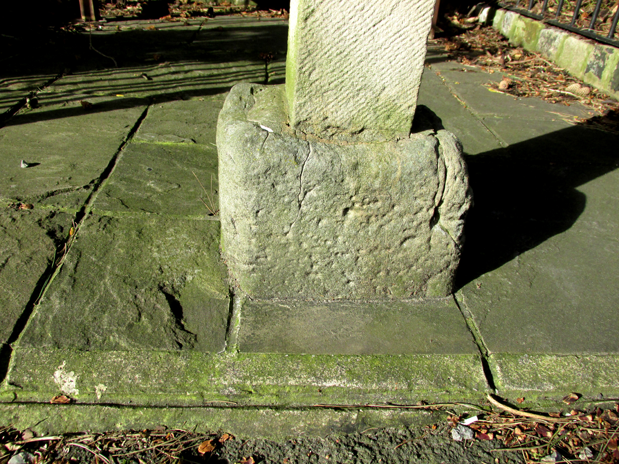
The mediaeval base set into the pavement in 2009

Lieutenant-Colonel Fishwick writes in his History of the Parish of Lytham:

“Not far from the Parish church on the road to Blackpool is still to be seen the stone socket of a cross, and tradition says that it marks one of the resting places of the body of St. Cuthbert when carried to Durham”

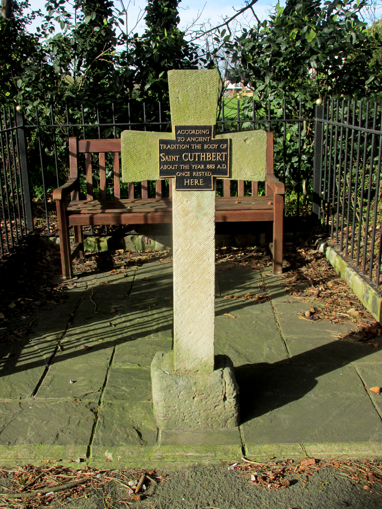
All that survives of the mediaeval original is the socketed base, into which a modern carved stone cross has been inserted. A bronze plaque attached to the cross reads:  “According to ancient tradition the body of St Cuthbert about the year 882AD once rested here.”

The modern cross with its bronze plaque.

It is not known whether the destruction of the original cross was the handywork of the local ‘Cross Smasher’ Rev. Richard Wilkinson.

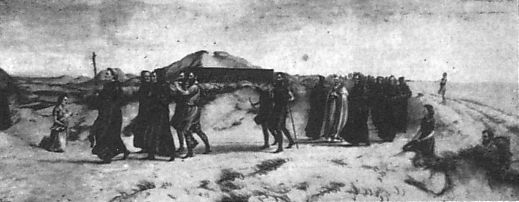
According to an online source, The Very Reverend Monsignor Gradley commissioned a painting by Charles E. Turner entitled: ‘The Monks of Lindisfarne arriving at Lytham with the body of St. Cuthbert, A.D. 878’, intended to be hung in St Joseph’s Seminary, Upholland.  Gradley wrote in the October 1889 edition of Merry England magazine:-

” In 875 Halfdene invaded Bernicia, the northern portion of Northumbria, . . . Lindisfarne was no longer a safe place for the monks, and they dared no longer expose their great treasure, the relics of St. Cuthbert, to the ruthless impiety of the northern hordes, With their Bishop Eardulf they set out on a weary pilgrimage of seven years.… From Yorkshire they proceeded to Lancashire, and as we find that the holy relics rested at Mellor, near Blackburn, we may suppose they would journey through Ribblesdale, passing on their way the ruined city of Bolmetonacae, the modern Ribchester. They were a numerous company, for besides the venerable Bishop Eardulf there were the Abbot of Carlisle, the monks of Lindisfarne, and many of the natives of that island. In going to Lytham it is probable the party would pass through Preston, where a few houses had gathered about the church built in honour of St. Wilfrid, the great contemporary of St. Cuthbert.

‘The Monks of Lindisfarne arriving at Lytham with the body of St. Cuthbert, A.D. 878’, by Charles E. Turner.

Their way from Preston to Lytham lay through a country abounding in forest and fen. But they would have the advantage of the old Roman road as far as Kirkham. However, the pilgrims met with a hospitable reception, and to this day Lytham is the seaside home of St. Cuthbert on our western coast.”

A small plaque on an adjacent bench records that the cross was re-dedicated by the Very Reverend Michael Sadgrove, M.A., Dean of Durham on Sunday 6th September 2009.

References:

  1. Taylor, Henry, The Ancient Crosses and Holy Wells of Lancashire, Manchester, Sherratt and Hughes, 1906.
  2. Fishwick, Lieutenant-Colonel, The History of the Parish of Lytham in the County of Lancaster, Manchester, The Chetham Society, 1907.
  3. Gradley, Most Reverend Monsignor, Article in the October 1889 edition of Merry England magazine, abstracted by www.amounderness.co.uk

Acknowledgements:  With thanks to Sue Ybarras for directing me to this site.

© Paul T. Hornby, The Northern Antiquarian 2017


Stump Cross, Goosnargh, Lancashire

Wayside Cross:  OS Grid Reference – SD 57287 37421

Also Known as:

  1. Historic England Grade II Listed Building No. 1165108

Getting Here

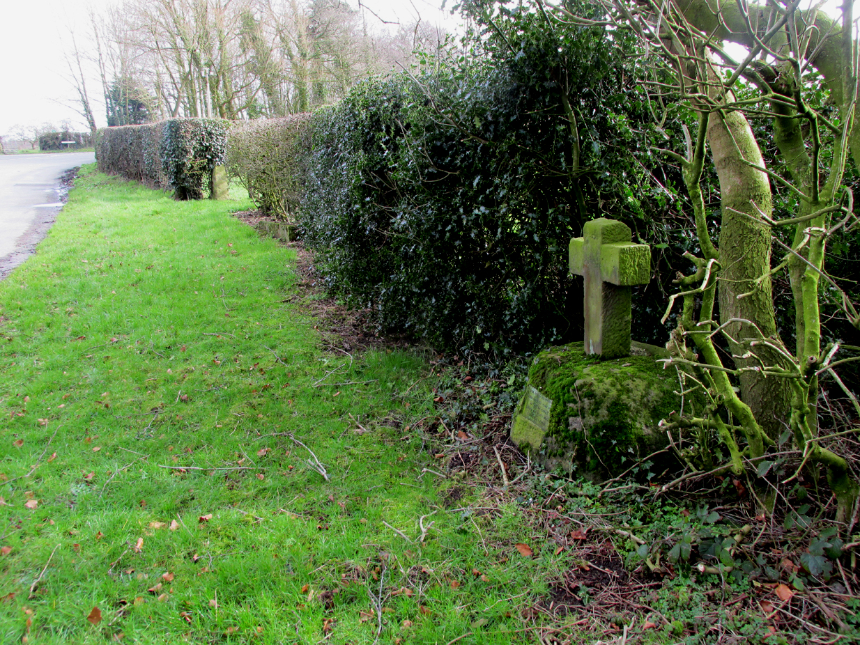
The Position of the Cross near the road junction.

The cross is situated on the verge at the west side of the B5269 road near its junction with Ashley Lane at Stump Cross, north-east of Goosnargh.

Archaeology & History

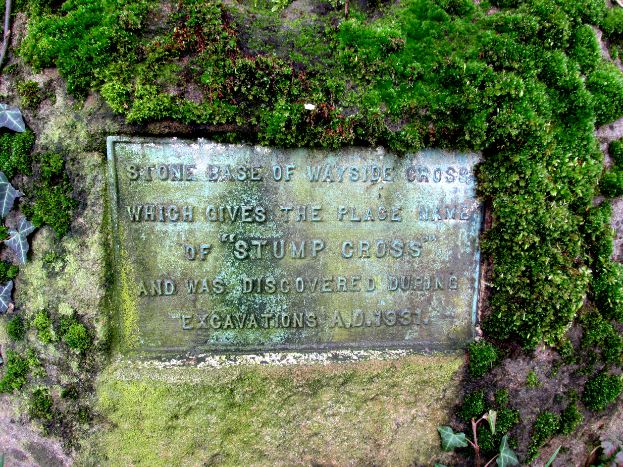
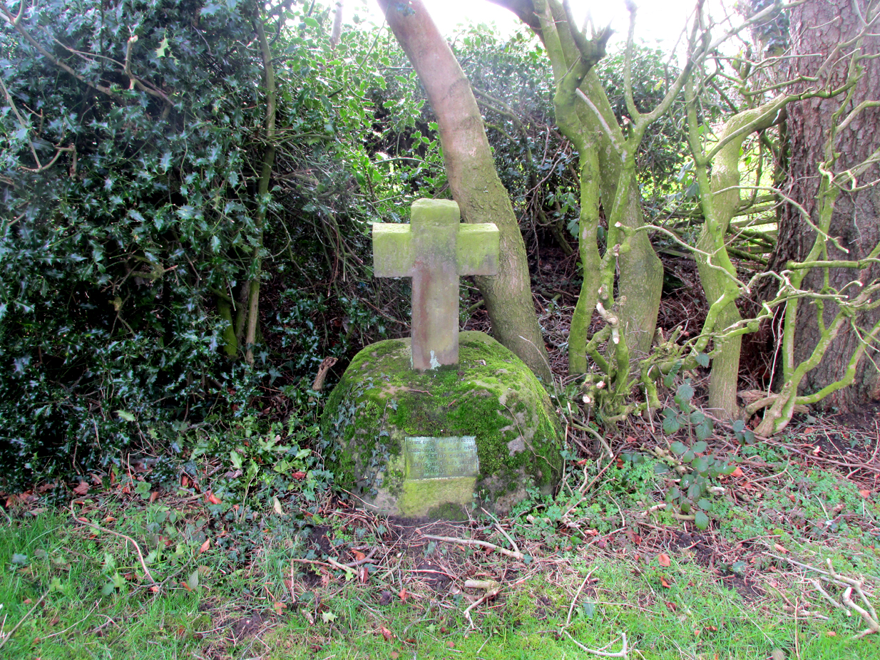
All that survives is the socketed base of the mediaeval cross, into which a small modern carved stone cross has been inserted. A bronze plaque attached to the base informs the reader that the cross gives its name to the locality, and that the base was discovered during excavations in 1931.

Richard Cookson (1888), in his Goosnargh Past & Present, writes:

“We have the remains of several upright crosses in this township called “cross stones” all being placed near to some public road or path. The corpses of the Roman Catholics are rested at those stones on their way to internment, and those funeral attendants who are of that persuasion kneel down and offer up a short prayer for the repose of the soul of the departed individual whose body they are conveying to the grave.”

Further to the destruction of crosses in the township, Cookson writes:

“…the Reverend Richard Wilkinson, late minister, of anti-Romanistic notoriety, in his frenzied hostility to the Roman Catholics, caused [the cross] to be broken up and removed…”

The site is listed by Henry Taylor, in his 1906 magnum opus on Lancashire crosses, and speaking generally on the destruction of wayside crosses in the Hundred of Amounderness, he writes:-

The bronze plaque
Modern cross inserted into the Mediaeval socket

“The destruction of so many crosses, which at one time existed in this part of the Hundred, is due to the vandalism early in the nineteenth century of a vicar of Goosnargh, named Wilkinson. He was a vehement Protestant, and owing to his notoriety as a Prophet, was allowed to do much as he liked with these ancient monuments. Many crosses, indeed, it is said, were pulled down with his own hands. His prophesies foretelling the deaths of various persons often unfortunately came true, and he was thus, in this superstitious part of England, dreaded as a wizard. As this work of demolition took place before the date of the Ordnance Survey, there were in all probability many more crosses erected in Mediaeval times in this district than we have now any knowledge of, and it is quite possible that some of the crosses so recklessly destroyed may have been, like those at Halton and Heysham, of pre-Norman date and of great historical value. Fragments of them might even now be found were a diligent search be made.”

Further to this speculation as to the antiquity of these destroyed crosses, it is interesting to note the approximately parallel orientation of roads and field boundaries to the east of the Stump Cross. This may point to the area having been subjected to Roman survey, and the site of the Stump Cross having once been a shrine to the gods of the agrimensores (Roman surveyors) that had been Christianised.

References:

  1. Cookson, Richard, Goosnargh: Past and Present, Preston, H.Oakey, 1888.
  2. Taylor, Henry, The Ancient Crosses and Holy Wells of Lancashire, Manchester, Sherratt and Hughes, 1906.
  3. Richardson, Alan, The Roman Surveyors in Cumberland, P3 Publications: Carlisle 2008.

© Paul T Hornby, The Northern Antiquarian 2017

Spurn Clough, Fence, Higham, Lancashire

Standing Stone:  OS Grid Reference – SD 8249 3685

Archaeology & History

First noted on 1848 OS-map

Following a request to see if anyone could locate a lost standing stone in Fence (in the Forest of Pendle) not far from my home, I took up the challenge to locate this relic.  One evening in July 2017, I decided to go take a look and having studied all maps I was fairly sure of its old position.  Upon finding the deep ravine and the old field boundaries, I followed the line of old mature beech trees (perhaps 250-300 years old) that shroud the deep clough.  Behind the biggest beech tree, but now some 10 feet down the slope, there I found the said standing stone, now recumbent and partly stuck into the earth due to its weight (approx 1.5 tonne). 

Spurn Clough Stone, laid halfway down the slope

It appears to have either fallen on its own accord as the steep sides of clough are soft clays, unstable and eroding, or it has been pushed out of the way by a previous landowner. It is made of millstone grit and is likely a glacial erratic from off the top of the local fells; it is not of the same type of fine gain flaggy bedrock that exists in the river below.  There are no more similar boulders within the clough other than a few small boulders in the bed of the stream.  This stone is big: being about 4ft by 3ft and 5ft long that is visible, with considerably more into the banking.

Exact position of the stone on the 1893 OS-map

I think it is worth approaching the local landowner to seek his approval to try and re-erect this standing stone in a position away from the crest of the ravine. It obviously was locally important and worthy of noting on the OS Map of 1848 and was not cut up and used as local walling stone, so it either was a boundary marker or held other folklore significance.

Research so far indicates no name is attached to the standing stone, but nearby is a ‘Hoarstones Lodge’ mentioned as a place for the Pendle witches to meet and the ravine and stream is called Spurn Clough, so I feel it apt to name it the Spurn Clough Standing Stone—unless I uncover another name used for the stone.  It’s nice to locate a lost standing stone!

Now I throw open the question: should it be restored to its upright position and made safe from falling down the clough?

© Nick Livsey, The Northern Antiquarian

Old Wife’s Stone, Batley, West Yorkshire

Standing Stone? (destroyed):  OS Grid Reference – SE 2428 2329

Archaeology & History

Old Wifes Stone on 1854 map

My first hint at the existence of this once valuable archaeological relic came as a result of me seeking out the history and folklore of some hitherto unknown, forgotten holy wells in the Batley and Dewsbury area.  I located the material I was looking for on the old wells, but my fortuitous discovery of this site, the Old Wife’s Stone, blew me away!

It was the place-name of ‘Carlinghow’ about one mile northwest of the grid-reference above that initially caught my attention.  From an antiquarian or occultist’s viewpoint, it’s intriguing on two counts: the first is the element ‘how‘ in Carlinghow, which can mean a variety of things, but across the Pennines tends to relate to either an ancient tribal or council meeting place, or a prehistoric burial cairn: an element that wasn’t lost in the giant archaeology survey of West Yorkshire by Faull & Moorhouse (1981).  But the first part of this place-name, ‘carling‘, was the exciting element to me; for it means ‘old woman,’ ‘old hag,’ ‘witch’ or cailleach!  The cailleach (to those who don’t know) was the prima mater: the Great Mother deity of our pre-christian British ancestors.  Meaning that Carlinghow hill was a hugely important sacred site no less—right in the heart of industrial West Yorkshire!  What is even more intriguing—or perhaps surprising—is that we have no record of such a powerful mythic creature anywhere in local folklore… Or so it first seemed…

Memory told me that no such prehistoric remains were recorded anywhere in that area—and certainly no prehistoric tombs.  I scoured through my library just to triple-check, and found the archaeological records as silent as I first thought.  Just to make sure I spent a day at the Central Library, where again I found nothing… So then I explored the region on the modern OS-maps, only to find that much of the area where the Carlinghow place-name existed was, surprisingly, still untouched by housing and similar modern pollutants. This was a great surprise to say the least.  And so to check for any potential archaeological sites which might once have been in the Carlinghow area, I turned to the large-scale 1850 OS-maps (6-inch to the mile).

This is when I came across the Old Wife’s Stone, marked in the middle of fields on the outskirts of old Batley.  There was no notice of it being a standing stone, or a simple boulder, or archaeological relic—nothing.  But its place-name compatriot of ‘Carlinghow’ was the rising hill about a mile to the northwest.  In days of olde, if Carlinghow was indeed the ‘burial tomb of the Old Woman’ or ‘meeting place of the cailleach’ (or whatever variants on the theme it may have been), it may have marked the setting sun on the longest day of the year if you had been standing at the Old Wife’s Stone – a midsummer sunset marker no less. (There are other ancient and legendary sites scattering northern England and beyond that are dedicated to the Cailleach, like the Old Woman Stone in Derbyshire, the Old Wife’s Neck in North Yorkshire, the Carlin Stone in Stirlingshire, the Old Woman Stone at Todmorden, Carlin Stone of Loch Elrig and many more.)

As if these curious ingredients weren’t enough to imply something existed in the heathen pantheon of Batley before the Industrialists swept away our indigenous history, we find echoes of the ‘Old Woman’ yet again, immediately east; this time where the animism of water and trees enfolded Her mythos in local rites and traditions, thankfully captured by the pens of several writers, and transmuted into another guise—but undeniably Her!  But that, as they say, is for another day and another site profile…

Position of stone in 1894

So is our Old Wife’s Stone (or for that matter, Carlinghow’s old tomb) still in evidence?  A school has been built where it was highlighted on the 1854 OS-map and, from the accounts of local people, seems to have long since disappeared.  The stone looks to have been incorporated into a length of walling, sometime between 1854 and 1888, and a bench-mark of “BM 318.2” carved onto it.  But when the Ordnance Survey lads re-surveyed the area in 1905, this had gone.  I have been unable to find any more information about this site and hope that, one day, a fellow antiquarian or occult historian might be able to unravel more of its forgotten mythic history.

References:

  1. Faull, M.L. & Moorhouse, S.A. (eds), West Yorkshire: An Archaeological Survey to 1500 AD – volume 1, WYMCC: Wakefield 1981.
  2. Goodall, Armitage, Place-Names of South-west Yorkshire, Cambridge University Press 1914.
  3. Keighley, J.J., ‘The Prehistoric Period’, in Faull & Moorhouse, 1981.
  4. o’ Crualaoich, Gearoid,  The Book of the Cailleach, Cork University Press 2004.
  5. Smith, A.H., English Place-Name Elements – volume 2, Cambridge University Press 1956.
  6. Smith, A.H., The Place-Names of the West Riding of Yorkshire – volume 2, Cambridge University Press 1961.
  7. Wright, Joseph, English Dialect Dictionary – volume 1, Henry Frowde: London 1898.

Acknowledgements:  Many thanks for the assistance of Simon Roadnight and Julia King in the Batley History Group.

© Paul Bennett, The Northern Antiquarian