Our Lady’s Well, Liberton, Edinburgh, Midlothian

Holy Well:  OS Grid Reference – NT 2640 7008

Also Known as:

  1. Canmore ID 52100
  2. Lady’s Well

Archaeology & History

In Thomas Whyte’s (1792) lengthy survey of Liberton village, as it was in the 1790s, we come across what seems to be the earliest description of this long-lost sacrede site on the northwest side of the parish.  In writing of the beauty of the countryside hereby in those times, he told how,

“on the north by the rivulet called Braid’s-burn, near which there is a well which has the appellation…of the Lady’s or Virgin Mary’s well, famous for its large current, and the salubrity and lightness of its waters.”

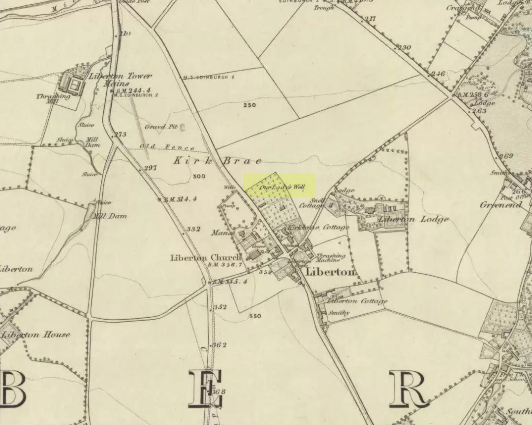
Site of Our Lady’s Well

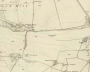
Our Ladys Well on 1855 map

Mr Whyte believed that its dedication to Our Lady went way back, probably before Liberton parish was given to St. Cuthbert in the 11th or 12th century (whose own holy well could once be found several miles north, near Leith).  Generally, wells that are dedicated to ‘Our Lady’, refer to the Virgin Mary; but prior to any christian affectation, the animistic genius loci of the waters would have been a local spirit.

It was visited and described by the Ordnance Survey lads in the Name Book of 1851, in which they said that Our Lady’s Well was,

“The site of a celebrated well situated in a hollow on the farm of Liberton Tower Mains, and dedicated to St. Mary, as it and the field is well known to be called to this day, “The lady’s Field” & Well”.  This well however about 50 years ago underwent a drainage during some improvements that were making on the land.  In its covered condition it takes a S.E. course till its Confluence with the Braid Burn where it is shown to this day as the water coming from the Lady’s Well, and from which a body of crystalized water flows copiously. It was supposed that a chapel was somewhere Convenient which gave rise to the name, but all traces have long since disappeared….”

“There is no tradition recorded among the County people as to whether this was a holy well, or resorted to for superstitious purposes. But it is well ascertained to have been once a remarkable well & an object well known and though now covered-in, the place is still well known, as is also the name.”

Although this holy well was shown on early and late 19th century OS-maps as ‘covered’,  trying to find its exact position today has proven difficult.  When Paul Hornby and I visited the site after some heavy rains in June, 2017, we found a large pool of water in the field exactly as shown on the old map.  This was, however, misleading, as the owner of the land and the Blackford Glen Western Riding school—a Mr John Fyfe—told us that they had, for years, always wondered about its exact position, but been unable to ascertain it with any certainty.  The pool in the field always appeared after the rains, he said.  He did tell us however, that many years ago when he was digging in order that the Braid Burn stopped flooding his property, he came upon a length of ancient piping running in the direction of the burn, some 5 or 6 feet down, whose use he could not ascertain—but which might have once conducted the waters from the Lady Well away.  No water was running through it though.

Near the middle of Liberton village a century or so ago, another holy well of the same name could once be seen less than a mile to the east.

References:

  1. Bennett, Paul, Ancient and Holy Wells of Edinburgh, TNA 2017.
  2. Good, George, Liberton in Ancient and Modern Times, Andrew Elliot: Edinburgh 1893.
  3. Walker, J. Russel, “‘Holy Wells’ in Scotland,” in Proceedings of the Society of Antiquaries of Scotland, vol.17 (New Series, volume 5), 1883.
  4. Whyte, Thomas, “An Account of the Parish of Liberton in Mid-Lothian, or County of Edinburgh,” in Archaeologia Scotica, volume 1, 1792.

Acknowledegments:  Huge thanks to John Fyfe and his wife for their help when we were exploring this site.

© Paul BennettThe Northern Antiquarian


Lytham Cross, Lytham, Lancashire

Wayside Cross: OS Grid Reference – SD 3603 2718

Getting Here

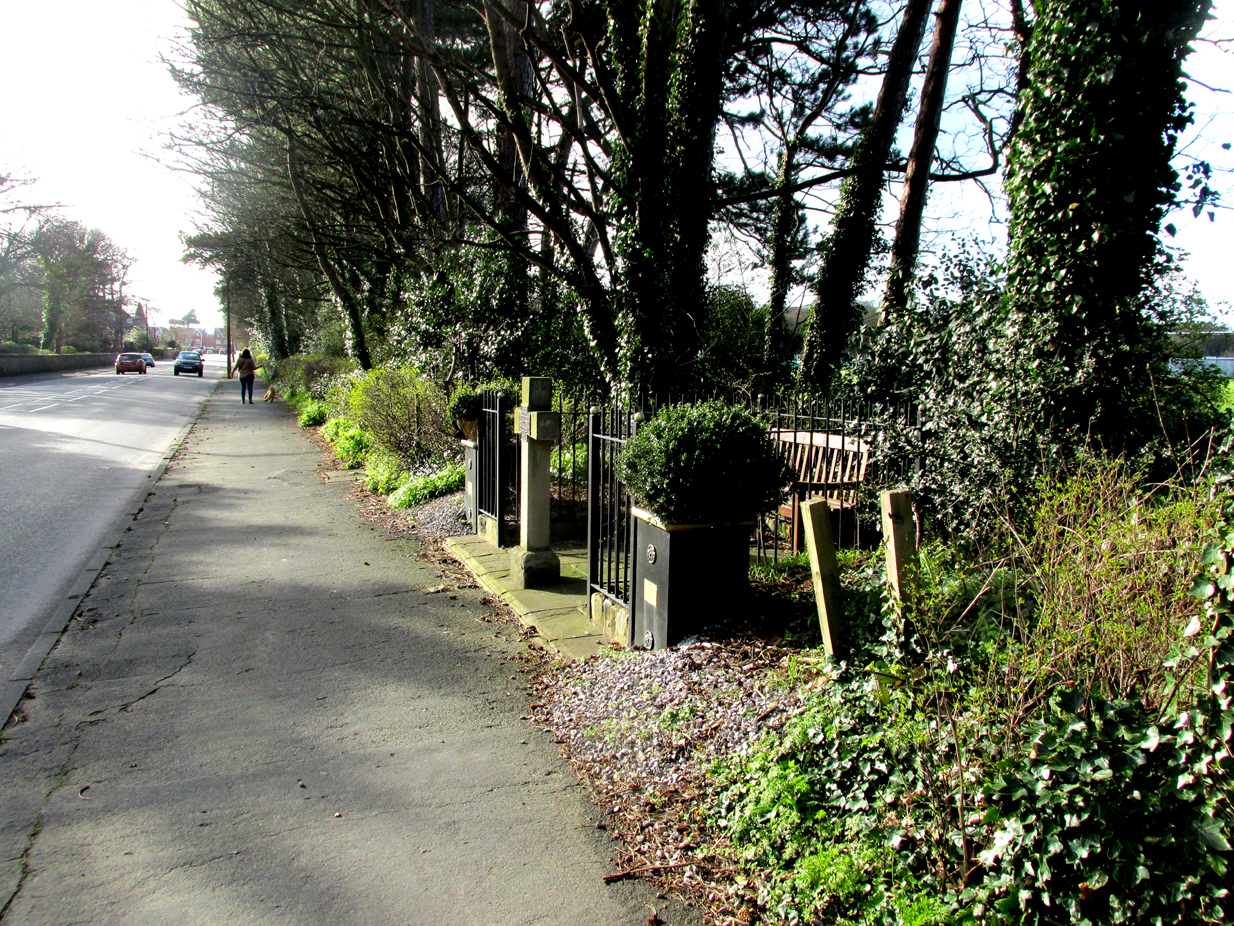
Roadside position of the cross

The cross is situated in a small railed enclosure adjoining the pavement on the North side of Church Road on the west side of Lytham, opposite Lowther Gardens.

Archaeology & History

Henry Taylor (1906), author of The Ancient Crosses And Holy Wells Of Lancashire, writes:

“The old market place of Lytham is triangular in shape…Church Road leads out of it, and not far from the church the pedestal of an ancient cross was at one time to be seen. The words ‘Site of Benedictine Priory’ occur on the map close to Lytham Hall, indicating the position of this small religious house, dedicated to SS Mary and Cuthbert, and subject to Durham.”

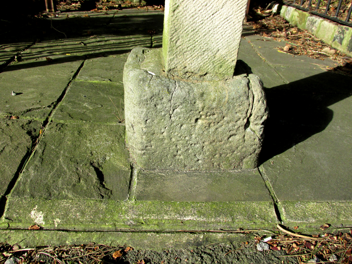
The mediaeval base set into the pavement in 2009

Lieutenant-Colonel Fishwick writes in his History of the Parish of Lytham:

“Not far from the Parish church on the road to Blackpool is still to be seen the stone socket of a cross, and tradition says that it marks one of the resting places of the body of St. Cuthbert when carried to Durham”

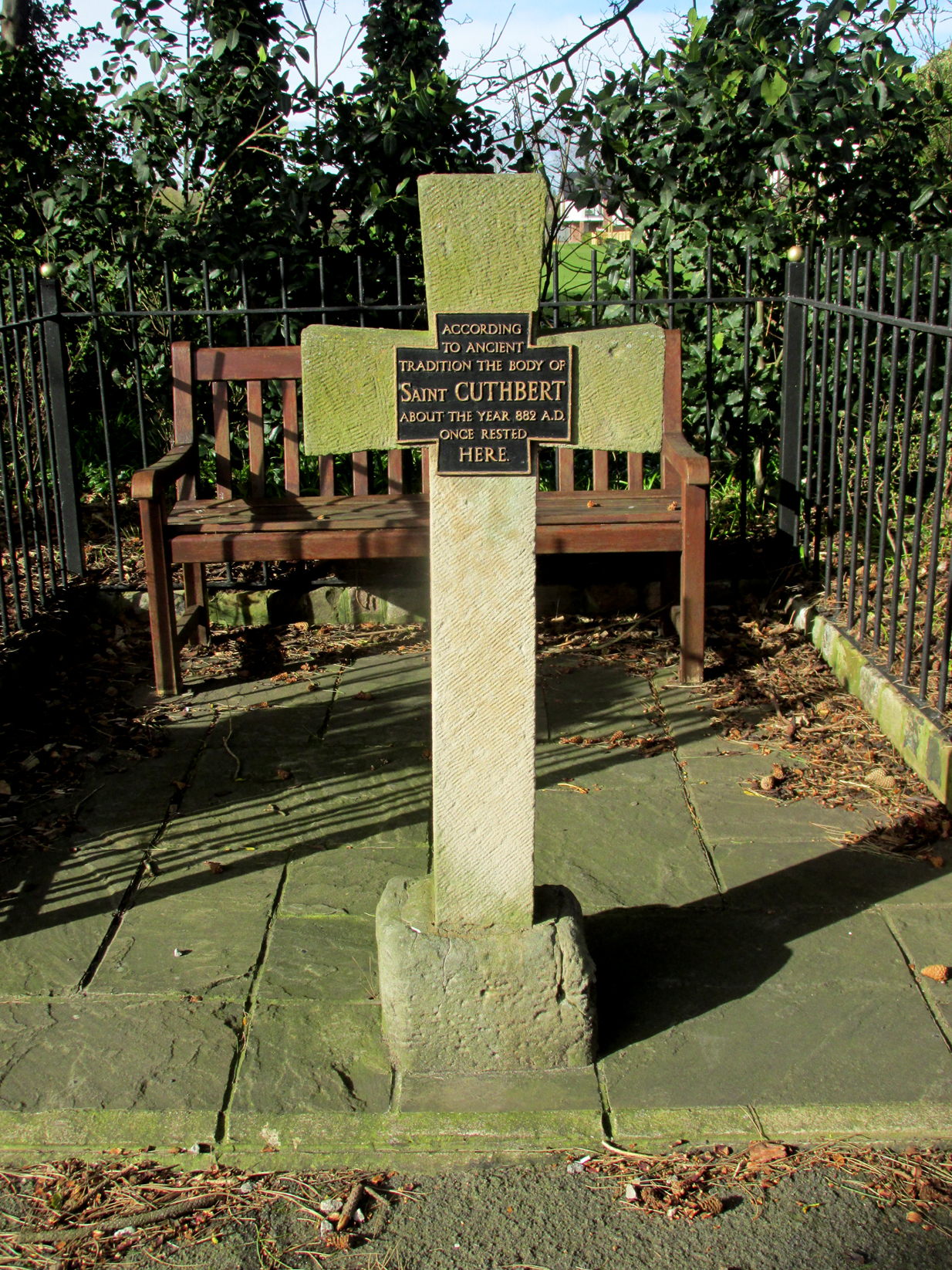
All that survives of the mediaeval original is the socketed base, into which a modern carved stone cross has been inserted. A bronze plaque attached to the cross reads:  “According to ancient tradition the body of St Cuthbert about the year 882AD once rested here.”

The modern cross with its bronze plaque.

It is not known whether the destruction of the original cross was the handywork of the local ‘Cross Smasher’ Rev. Richard Wilkinson.

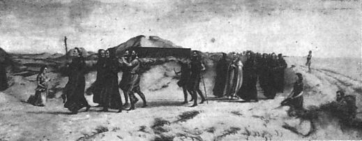
According to an online source, The Very Reverend Monsignor Gradley commissioned a painting by Charles E. Turner entitled: ‘The Monks of Lindisfarne arriving at Lytham with the body of St. Cuthbert, A.D. 878’, intended to be hung in St Joseph’s Seminary, Upholland.  Gradley wrote in the October 1889 edition of Merry England magazine:-

” In 875 Halfdene invaded Bernicia, the northern portion of Northumbria, . . . Lindisfarne was no longer a safe place for the monks, and they dared no longer expose their great treasure, the relics of St. Cuthbert, to the ruthless impiety of the northern hordes, With their Bishop Eardulf they set out on a weary pilgrimage of seven years.… From Yorkshire they proceeded to Lancashire, and as we find that the holy relics rested at Mellor, near Blackburn, we may suppose they would journey through Ribblesdale, passing on their way the ruined city of Bolmetonacae, the modern Ribchester. They were a numerous company, for besides the venerable Bishop Eardulf there were the Abbot of Carlisle, the monks of Lindisfarne, and many of the natives of that island. In going to Lytham it is probable the party would pass through Preston, where a few houses had gathered about the church built in honour of St. Wilfrid, the great contemporary of St. Cuthbert.

‘The Monks of Lindisfarne arriving at Lytham with the body of St. Cuthbert, A.D. 878’, by Charles E. Turner.

Their way from Preston to Lytham lay through a country abounding in forest and fen. But they would have the advantage of the old Roman road as far as Kirkham. However, the pilgrims met with a hospitable reception, and to this day Lytham is the seaside home of St. Cuthbert on our western coast.”

A small plaque on an adjacent bench records that the cross was re-dedicated by the Very Reverend Michael Sadgrove, M.A., Dean of Durham on Sunday 6th September 2009.

References:

  1. Taylor, Henry, The Ancient Crosses and Holy Wells of Lancashire, Manchester, Sherratt and Hughes, 1906.
  2. Fishwick, Lieutenant-Colonel, The History of the Parish of Lytham in the County of Lancaster, Manchester, The Chetham Society, 1907.
  3. Gradley, Most Reverend Monsignor, Article in the October 1889 edition of Merry England magazine, abstracted by www.amounderness.co.uk

Acknowledgements:  With thanks to Sue Ybarras for directing me to this site.

© Paul T. Hornby, The Northern Antiquarian 2017


Our Lady’s Well (2), Liberton, Edinburgh, Midlothian

Holy Well (destroyed):  OS Grid Reference – NT 2763 6970

Also Known as:

  1. Canmore ID 51720
  2. Christening Well
  3. Lady Well

Archaeology & History

Our Ladys Well on 1855 map

Mentioned in passing by John Geddie (1926)—who was skeptical of any ‘holy’ associations here—this was one of two holy wells in Liberton parish with the same name.  Whilst one is on the northwest side of the parish, this was closer to the centre of the village on the piece of land known as the Kirk Brae.  It was some 200 yards northeast of the old church at the crossroads, originally dedicated to St. Cuthbert, whose feast day was March 20 — or right next to the Spring Equinox, perhaps when the waters here had greatest virtues.

Highlighted on the earliest OS-map of the region, little is known of it via the written records.  Our primary account comes from the Name Book of 1852, where they told:

“An ancient well, known by more ancient settlers as the Christening Well, from the circumstance of this being the only one, from which water was taken in Ancient times for Baptizing; the water being considered the purest; hence it was dedicated to the Virgin.”

References:

  1. Bennett, Paul, Ancient and Holy Wells of Edinburgh, TNA: Alva 2017.
  2. Geddie, John, The Fringes of Edinburgh, W. & R. Chambers: Edinburgh 1926.
  3. Morris, Ruth & Frank, Scottish Healing Wells, Alethea: Sandy 1982.

© Paul Bennett, The Northern Antiquarian 


St. Cuthbert’s Well, Waverbridge, Cumbria

Holy Well:  OS Grid Reference – NY 21479 48615

Also Known as:

  1. Haly Well
  2. Helly Well

Getting Here

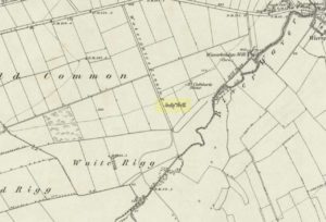
St Cuthberts Well on 1868 map

A mile east of Waverbridge, turn down the track called Watergates Lonning. Before you reach the bottom, on the left side of the straight track is a spring of water. This is the old holy well.

Archaeology & History

Although much used in bygone times, very little of it can be seen nowadays.  When John Musther (2015) wrote about it recently, he told that although it was

“Once known for its copious amount of remarkably pure and sweet water, it is now only a trickle by a tree.”

Nearly three hundred yards away across the fields northeast of this small spring of water, was once seen “a pretty large rock of granite, called St. Cuthbert’s Stone“, whose mythic history will have been intimately tied to the holy well.

Folklore

In the second volume of William Hutchinson’s History of the County of Cumberland (1794), he tells that the St. Cuthbert’s Well,

“is a fine copious spring of remarkably pure and sweet water which…is called Helly-well, i.e. Haly or Holy Well. It formerly was the custom for the youth of all the neighbouring villages to assemble at this well early in the afternoon of the second Sunday in May, and there to join in a variety of rural sports. It was the village wake, and took place here, it is possible, when the keeping of wakes and fairs in the churchyard was discontinued. And it differed from the wakes of later times chiefly in this, that though it was a meeting entirely devoted to festivity and mirth, no strong drink of any kind was ever seen there, nor anything ever drunk but the beverage furnished by the Naiad of the place. A curate of the parish, about twenty years ago (c.1774), on the idea that it was a profanation of the Sabbath, saw fit to set his face against it; and having deservedly great influence in the parish, the meetings at Helly-well have ever since been discontinued.”

References:

  1. Hutchinson, William, The History and Antiquities of the County of Cumberland, volume 2, F. Jollie: Carlisle 1794.
  2. Musther, John, Springs of Living Waters: The Holy Wells of North Cumbria, J.Musther: Keswick 2015.

© Paul Bennett, The Northern Antiquarian