Sharp Haw (1), Flasby, North Yorkshire

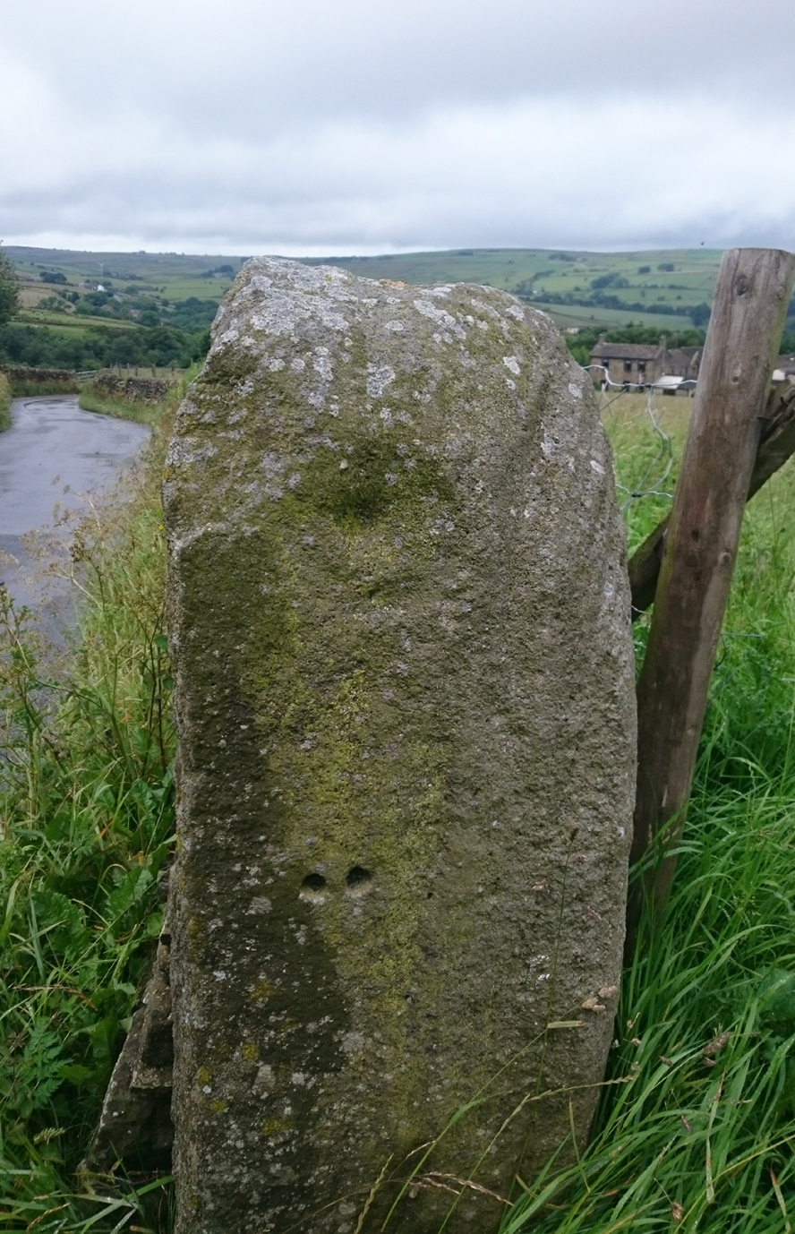
Cup-Marked Stone:  OS Grid-Reference – SD 96279 55034

Getting Here

The Sharp Haw stone

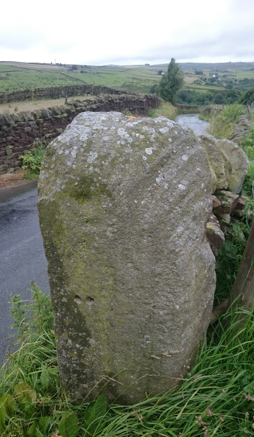
From Skipton head up the B6265 Grassington Road and after a short distance you will reach the Craven Heifer Pub on your left.  About ¾-mile past the pub is a small turning on your left called Bog Lane. Go along here for about ¼-mile till you come to a sharp left bend and on the right you will see a gateway with room to park. Once here you’ll notice a sharp-pointed hill—and that’s Sharp Haw!  Go through the gate, up the gravel track parallel to the wall on your left for 500 yards.  Where the wall ends take the small path on your right and walk up here for ¾-mile where the path splits again.  Take the right-hand path for 85 yards and the stone is on the left of the path.

Archaeology & History

Positions of cup-marks

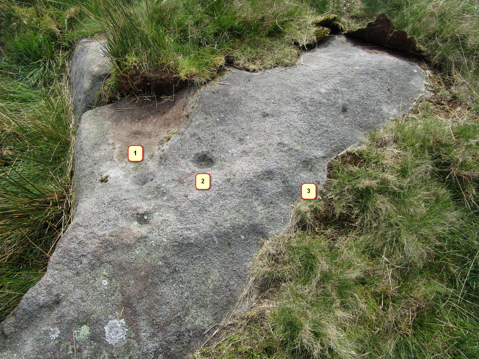
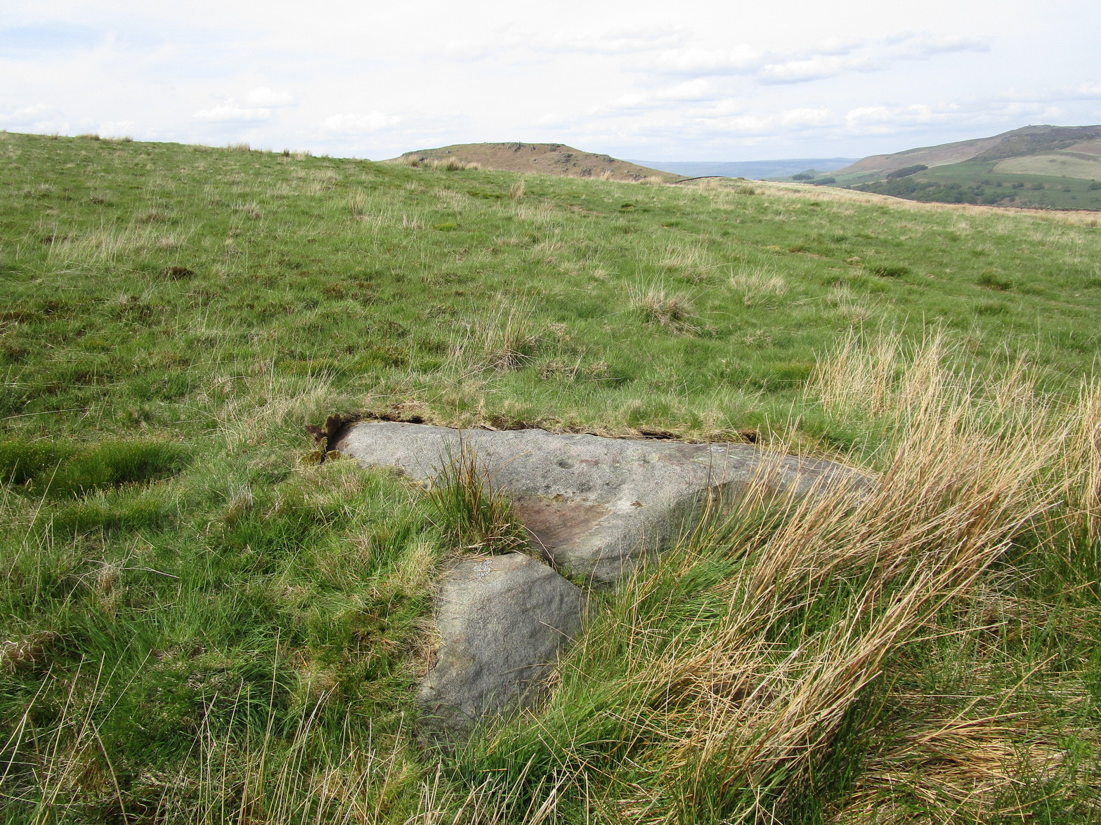
Nowt special to look at, this is merely an elongated earthfast female stone that will be hard to find when the reeds grow high.  The design consists of at least three cup-marks, with the most prominent one near the middle of the stone.  A second one is shallow and on its northern side, near the middle; whilst the third one on its southern side was uncovered when we peeled back the vegetation; the peck marks are still visible.  In the photo to the left I’ve placed numbers below the position of the respective cup-marks.  In a cursory meander here, we found no other carvings – but that doesn’t mean there aren’t any!

© Paul BennettThe Northern Antiquarian

Old Lane Carving, Cowling, North Yorkshire

Cup-and-Ring Stone:  OS Grid Reference – SD 97300 42625

Getting Here

Old Lane Cup-and-Ring, Cowling

Old Lane Cup-and-Ring

This Stone is situated on Old Lane, Cowling, North Yorkshire. To get here coming from Crosshills, you come straight through the village and past the shops . About 250 yards after the shops you will come to a sharp left hand bend, as you have gone round this corner you will see a sign pointing to Oakworth (Old Lane). You need to turn left here (up by the cemetery) and continue for about half a mile up that lane till you come to a sharp left hand bend. Once you have gone round that left hand bend you will see a driveway on the right, the stone is situated opposite in the gateway. Hope you can find it and enjoy it like i do every time  i pass it.

Archaeology & History

...and from another angle

…and from another angle

I’ve driven past this stone most days and never noticed the markings, then one particular day the weather was a bit miserable but the lighting was just right to illuminate this little gem. Was this lump of rock a standing stone or have modern day folk took advantage and moved it here to be used as a gatepost? I don’t think we ever will know.

(Editor’s Note – Somewhere at the back of my moss-infested mind, is some inkling that a carving on a gatepost similar to this was uncovered in the 1950s or ’60s by either Stuart Feather or Sidney Jackson.  I’ll trawl thru the old magazines in the coming months and see what I can find.  It’s bugging me!  It may well be a different carving (let’s hope it is!), and until then this has to be classified as a new discovery. PB)

© Chris Swales, The Northern Antiquarian


Sheep Scar Circle, Giggleswick, North Yorkshire

Ring Cairn:  OS Grid Reference – SD 80519 66474

Also Known as:

  1. Borrins Top

Getting Here

Sheep Scar cairn circle, looking east

From Settle, take the same direction as if you’re visiting the giant Apronful of Stones cairn.  Walk past it, keeping to the walling for 350 yards (319m) until you reach the gate on your right.  Go through this and walk along the grassy footpath ahead of you for 75 yards (68.5m) and there, right by your left-hand side, you’ll see this low grassy circular embanked monument, or cairn circle.

Archaeology & History

This gorgeous, little-known cairn circle, hiding almost unseen beside the ancient grassy pathway that leads down to the haunted Borrins Wood, sits innocently, forgotten by those who would claim its importance.  When this overgrown ring of stones was first built, the trees of Borrins Wood grew around the sacred court of this monument, watching rites committed to the ancestors, annually no doubt at the very least, under guidance of the Moon.  But now such ways have been swept from the memory of those living, into worlds made-up of artifacts, linear time and dualist ideals, and our thoughts when brought here are encloaked by beliefs not worthy of such a place.  Like many other small rings of stone, this was important for the rites of the dead.  For here we can see a small stone-lined cist (grave) near the middle still growing from the Earth, with the small outer ring encircling the place of rites.  It was obviously of ‘religious’ importance to those who lived here, probably even centuries after initial construction.

Embankment and central ‘grave’
Central & southern section of the ring

Similar in size and structure to the Roms Law Circle on Burley Moor, this site on the hills above Giggleswick seems to be Bronze Age in nature.  From outer-edge to outer-edge the rough circular monument measures approximately 14½ yards (13m) north-south, by 15½ yards (14m) east-west, with an outer circumference of about 49 yards (43m).  The edges of the ring, as you can see in the photos, is made up of an embankment of thousands of small stones and rubble, measuring between 1-2 feet high and between 2-3 yards across.  The old cist in the middle of the ring—about 1 yard by 2 yards—has been dug into at some time in the past and a small mound of stones surround this central grave.  The entire monument is very much overgrown, but still appears to be in relatively good condition.  A new excavation of this and nearby prehistoric monuments would prove worthwhile.

The ruined circle has a tranquil spirit, enclosed within a rich green panoramic landscape, enhanced with the breaking of old limestone and gnarled hawthorns.  Other prehistoric cairns can be found nearby and the remains of a previously unrecorded prehistoric enclosure stands out on a small rise 164 yards (150m) southeast.  We’ve found other unrecorded prehistoric remains in this arena which will be added to TNA, as and when…

References:

  1. Speight, Harry, The Craven and Northwest Yorkshire Highlands, Elliott Stock: London 1892.

Links:

  1. Images & Walk to the Sheep Scar Circle and Nearby Sites

© Paul Bennett, The Northern Antiquarian


Sheep Scar Cairn, Giggleswick, North Yorkshire

Cairn:  OS Grid Reference – SD 80678 66436

Getting Here

Paul Hornby on the old mound

Follow the same directions as if you’re visiting the Apronful of Stones giant cairn, above Giggleswick.  Walk past the giant cairn for a coupla hundred yards until you reach the large section of fallen walling, which you can clamber over and head towards the small rise of the Sheep Scar enclosure 100 yards in front of you.  Walk to the far end of this walled enclosure and look down the slope to your left, for 50-60 yards where you’ll see a small rocky mound rising above the edge of the hollow footpath.  That’s it!

Archaeology & History

This lovely old overgrown prehistoric cairn seems to one of what were once the remains of many other old tombs that scattered this grassy rocky plain, on the western ridge between Stainforth and Settle.  Although there are what seems to be the remnants of others nearby, this particular stone heap, its edges buried beneath centuries of earth, is a fine little-known specimen that deserves attention after so long a period in the sleep of ignorant moderns.  The cairn is found within an area that Harry Speight (1892) called the “Field of the Dead”, where he came across “traces and remains of human graves which carry us back to the far dim ages of unwritten history.”  Whether he saw this particular cairn rising up above the edge of the old track that winds up from Borrins in the valley below, he doesn’t say — but I’d be amazed if the diligent Speight missed it!

The overgrown cairn, looking NW
Cairn centre, with Sheep Scar enclosure above

Standing more than a yard high, when Paul Horby and I paced this old ruin, it measured 10 yards by 12 yards across — though so much loose and overgrown stone was beneath the surface that it could be much bigger.  The top of the cairn had come loose, perhaps explored by some antiquarian in times gone by, exposing a considerable mass of small rounded and misshapen rocks, typical of such constructions.  When Harry Speight found the place more than a hundred years earlier, he described the situation much as we’d found it, telling of,

“other mounds of similar and smaller dimensions within the same area, some of which have been examined, but others do not appear to have been disturbed.  Many of the barrows or ‘raises’ have at some time or other been carelessly dug into in the hope of finding valuables, and as doubtless in most cases nothing was found but rude chests or coffins, containing bones, these were tossed aside and no record of them deemed worthy of preservation.”

A situation we find still prevalent thanks to the ignorance of some archaeologists in some regions of Yorkshire to this day (despite what they tell folk).  We could see nothing of any note in our brief look at this old cairn, except that it had the usual hallmarks of prehistory in its form, probably Bronze Age.  Possible remains of other similar-sized cairns can be seen a little further up the slope on the northeastern edges of the enclosure.  The prehistoric Sheep Scar Cairn Circle and other ancient remains scatter the fields all round here; something indicated by the place-name Borrins found in the woods below the ridge, meaning simply, ‘burial place.’ (Smith 1956: 57-8)

References:

  1. Smith, A.H., English Place-Name Elements – volume 1, Cambridge University Press 1956.
  2. Speight, Harry, The Craven and Northwest Yorkshire Highlands, Elliott Stock: London 1892.

© Paul Bennett, The Northern Antiquarian


Sheep Scar Enclosure, Giggleswick, North Yorkshire

Enclosure:  OS Grid Reference – SD 80648 66374

Getting Here

Aerial view of enclosure

To reach here, follow the same directions to get to the Apronful of Stones giant cairn.  Walk on the footpath past the cairn for about 200 yards until you reach a large gap where the old walling has collapsed.  Go through this and walk across the limestone rocks, towards the small rocky hillock rising up 100 hundred yards in front to your east (not the more rounded one to the north).  That’s it!

Archaeology & History

This is a most intriguing find, and one to which I can find no other literary reference (though I aint checked Brayshaw’s Giggleswick).  An undeniably large natural hillock has been modified and added to by people at some considerable time long ago and at some considerable effort!  Measuring more than 47 yards (43m) roughly east-west, and 21 yards (19m) north-south, the most definable man-made remains here is the length of elliptical walling on the southern and western edges.  The internal circumference of the enclosure measures roughly 113 yards (103m) all round the edges.  The northern and eastern sides of the hill would appear to be mainly natural, but seem to have been modified a little — not unlike the mass of settlements and enclosures a few miles to the east, like Torlery Edge, Lantern Holes and others around Malham Moor and district.

The site needs professional assessment: first to ascertain its period (which seems Iron Age on first impression, but could be much later), and second to ascertain its nature.  On the ridges close by we find a veritable mass of archaeological remains, ranging between Bronze Age to Medieval in nature.  The giant Apronful of Stones is only 172 yards (158m) south; the Sheep Scar cairn circle 156 yards (143m) northwest; and one of the remaining Sheep Scar cairns only 58 yards (53m) away.  And hopefully when we return to the place next week (fingers crossed!), we’ll be able to get some more photos of the walling you can see that define some edges of the site…

…to be continued…

References:

  1. Brayshaw, Thomas & Robinson, Ralph M., A History of the Ancient Parish of Giggleswick, Halton & Co.: London 1932.

© Paul Bennett, The Northern Antiquarian


Skyrakes West, Stirton, Skipton, North Yorkshire

Cup-Marked Stone:  OS Grid Reference – SD 965 544

Getting Here

Skyrakes West cup-marks

Takes a bitta finding this one!  Take the B6265 road north out of Skipton, and about a mile along, turn left up the small road to Stirton village.  But once on the level and the open countryside opens to your right, where there’s a notable bend in the road and a track goes up into the field, stop!  Walk up past the closed fields and, where the open country starts, veer to the left track (not up the official footpath).  Keep walking up here till you’re approaching the bend in the old walling; but veer into the grasses, right, about 50 yards before it.  Good luck!

Archaeology & History

Very recently, Mr Paul Hornby called us to come and check a number of features he’d come across on a portion of open countryside not far from Skipton.  At the very least it was gonna be a nice day out, ambling abaat and seeing some potentially new prehistoric sites — and we weren’t to be disappointed!

Close-up of cups
Single cup-mark nearby

Although this site aint much to write home about, it is found close to a number of other recently rediscovered prehistoric features.  Upon a fairly large stone a coupla hundred yards east of a supposed tumulus to the southern ridge of Sharp Haw, we find an arc of three cup-markings on the rock’s northeastern face, with a possible fourth cup along the same line (though I aint sure misself).  And that’s it I’m afraid.  Nowt else. (and I’ll try getting some better images when we’re next up there)  Another stone nearby to the west has a near-perfect single cup-marking on its flat surface.

ACKNOWLEDGEMENTS:

Huge thanks to Paul Hornby for the use of his photos!

© Paul Bennett, The Northern Antiquarian


Simon’s Seat, Skyreholme, North Yorkshire

Sacred Hill:  OS Grid Reference – SE 0788 5981

Getting Here

Simon’s Seat in the centre & the Lord’s Seat immediately east

Tons of ways here.   To those who drive, take the Grassington-Pateley Bridge (B6265) road and a couple of miles past the village of Hebden, you’ll see the high rocks climbing on your southern horizon, with another group of rocks a few hundred yards along the same ridge.  That’s it!

Archaeology & History

This is an awesome site, full of raw power. It commands a brilliant view all round, but it is the north which truly draws the eye’s attention. Beneath the great drop of this huge outcrop is the haunted and legendary Troller’s Ghyll. The scent of as yet undisclosed neolithic and Bronze Age sites purrs from the moors all round you and there can be little doubt that this was a place of important magick in ancient days.

What seems to be several cup-markings on one of the topmost rocks are, to me, authentic. Harry Speight mentioned them in his 1892 work on the Craven and Northwest Yorkshire Highlands – but there are a number of other rocks in this giant outcrop with “possibles” on them.

Folklore

The name of this great rock outcrop has long been a puzzle to historians and place-name experts.  One tale that was told of Simon’s Seat to the travelling pen of one Frederic Montagu in 1838, told that,

“It was upon the top of this mountain that an infant was found by a shepherd, who took it to his home, and after feeding and clothing it, he had the child named Simon; being himself but a poor man, he was unable to maintain the foundling, when it was ultimately agreed to by the shepherds, that the child should be kept “amang ’em.”  The child was called Simon Amangham and the descendants of this child are now living in Wharfedale.”

The usually sober pen of Mr Speight thinks this to have been one the high places of druidic worship, named after the legendary Simon Druid. “It is however, hardly likely,” he wrote, “that he ever sat there himself, but was probably represented by some druidical soothsayer on whom his mystic gifts descended.”

I’ve gotta say, I think there’s something distinctly true about those lines. Visit this place a few times, alone, during the week, or at night – when there’s no tourists about – and tell me it isn’t…

References:

  1. Bogg, Edmund, Higher Wharfeland, James Miles: Leeds 1904.
  2. Montagu, Frederic, Gleanings in Craven, Simpkin Marshall: London 1838.
  3. Speight, Harry, The Craven and Northwest Yorkshire Highlands, Elliott Stock: London 1892.

© Paul Bennett, The Northern Antiquarian