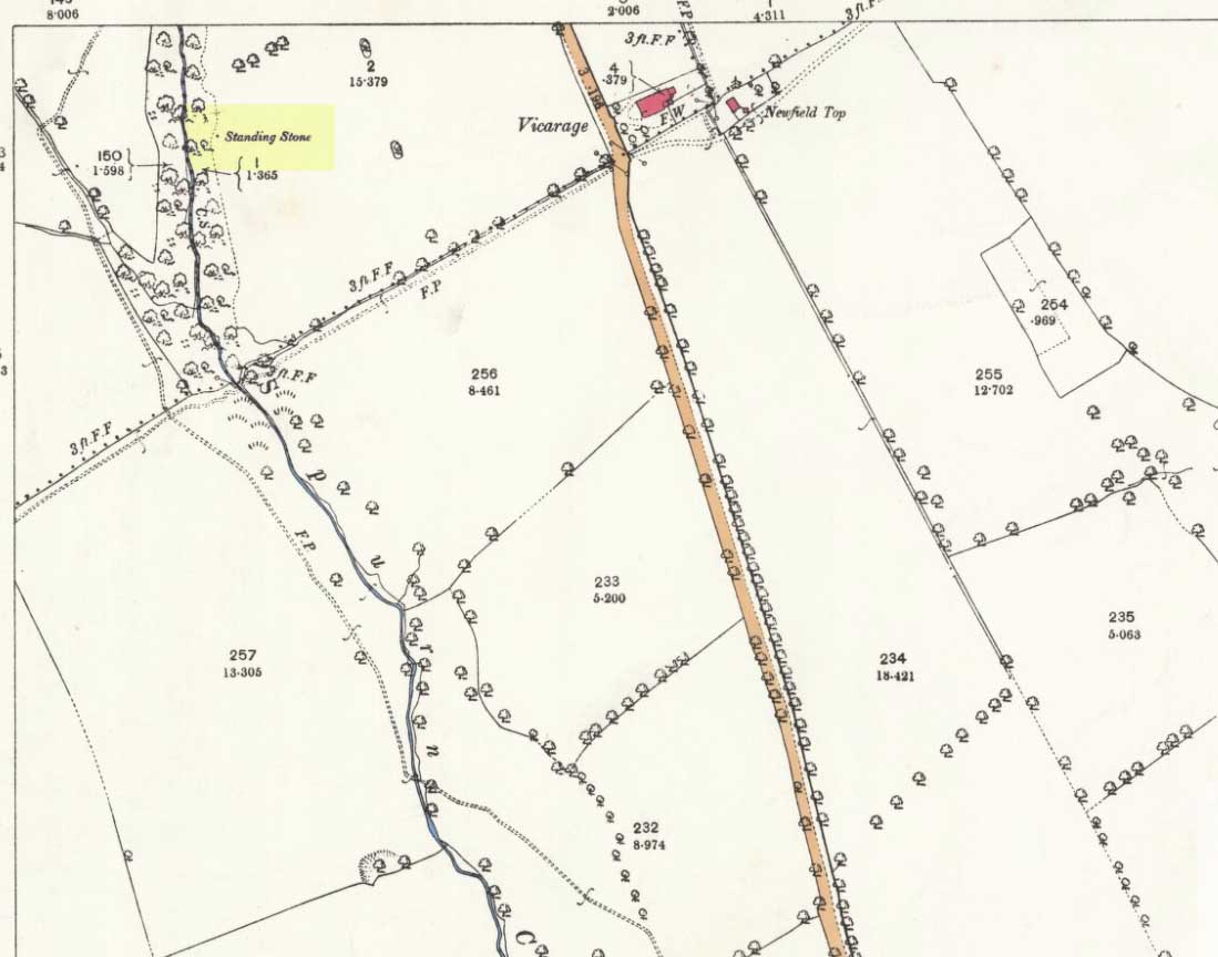
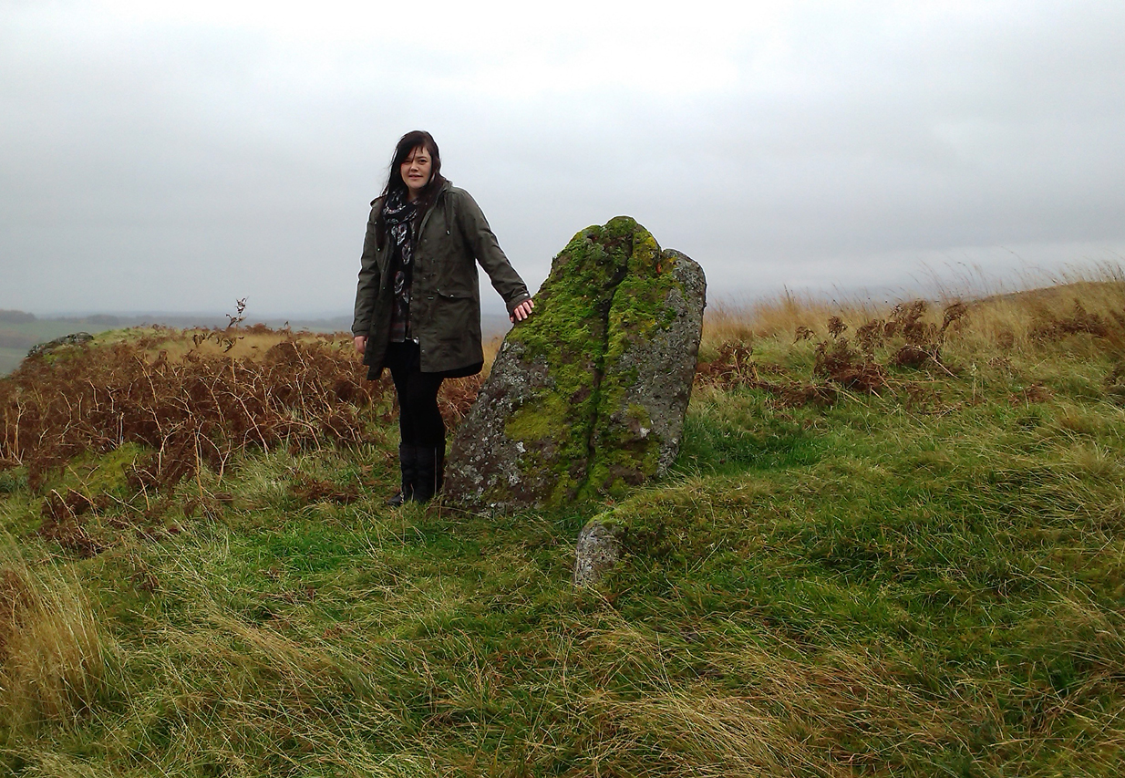
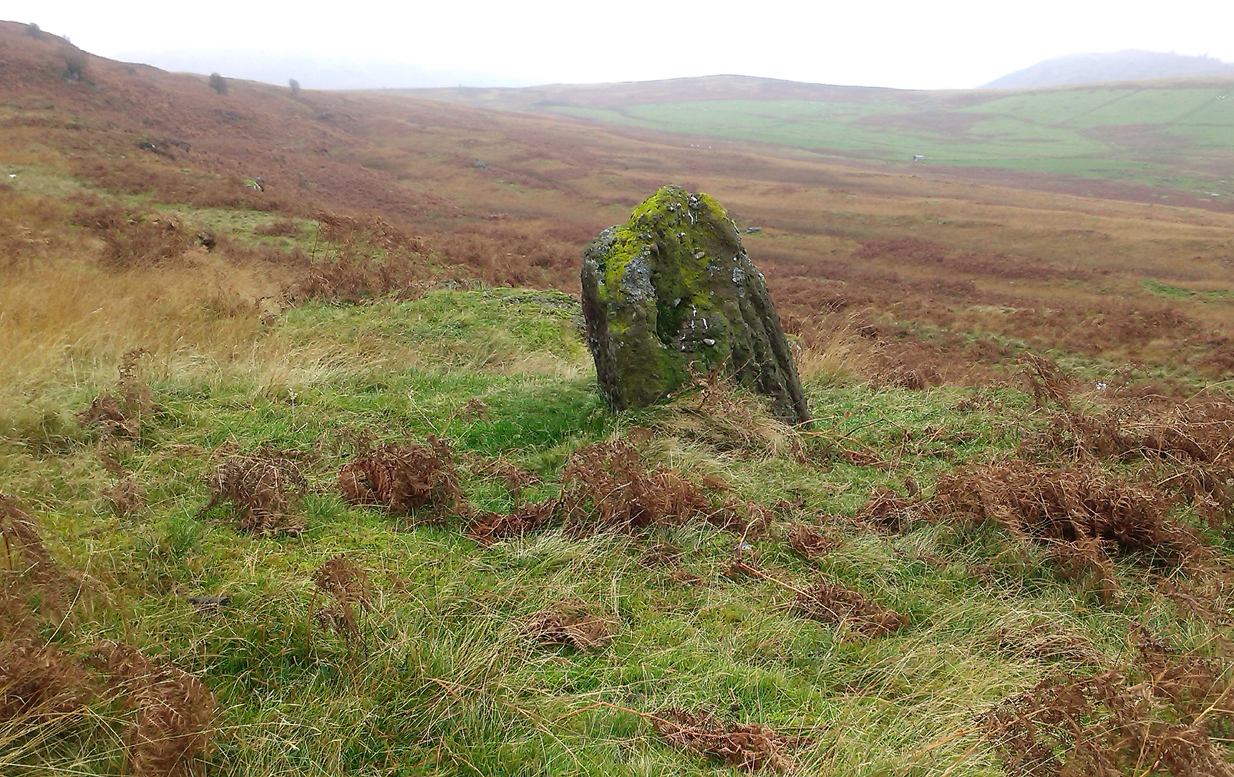
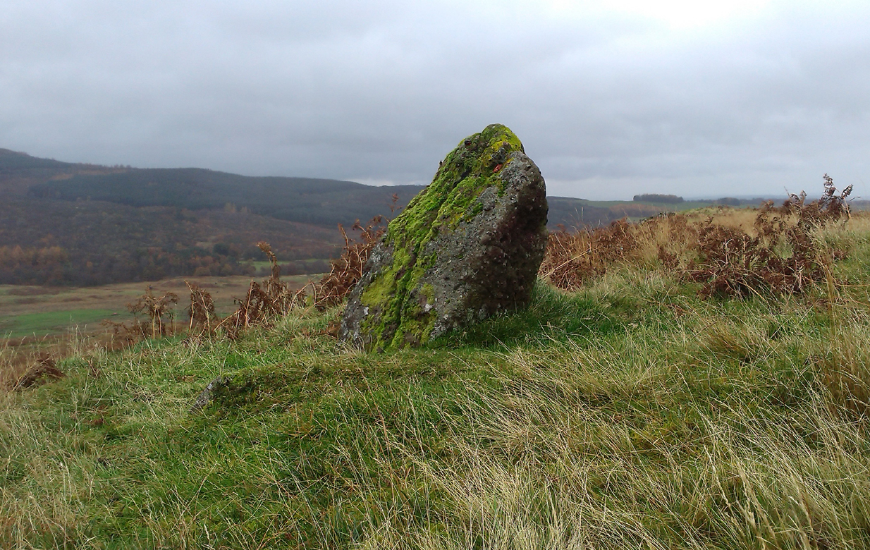
Following a request to see if anyone could locate a lost standing stone in Fence (in the Forest of Pendle) not far from my home, I took up the challenge to locate this relic. One evening in July 2017, I decided to go take a look and having studied all maps I was fairly sure of its old position. Upon finding the deep ravine and the old field boundaries, I followed the line of old mature beech trees (perhaps 250-300 years old) that shroud the deep clough. Behind the biggest beech tree, but now some 10 feet down the slope, there I found the said standing stone, now recumbent and partly stuck into the earth due to its weight (approx 1.5 tonne).
Spurn Clough Stone, laid halfway down the slope
It appears to have either fallen on its own accord as the steep sides of clough are soft clays, unstable and eroding, or it has been pushed out of the way by a previous landowner. It is made of millstone grit and is likely a glacial erratic from off the top of the local fells; it is not of the same type of fine gain flaggy bedrock that exists in the river below. There are no more similar boulders within the clough other than a few small boulders in the bed of the stream. This stone is big: being about 4ft by 3ft and 5ft long that is visible, with considerably more into the banking.
Exact position of the stone on the 1893 OS-map
I think it is worth approaching the local landowner to seek his approval to try and re-erect this standing stone in a position away from the crest of the ravine. It obviously was locally important and worthy of noting on the OS Map of 1848 and was not cut up and used as local walling stone, so it either was a boundary marker or held other folklore significance.
Research so far indicates no name is attached to the standing stone, but nearby is a ‘Hoarstones Lodge’ mentioned as a place for the Pendle witches to meet and the ravine and stream is called Spurn Clough, so I feel it apt to name it the Spurn Clough Standing Stone—unless I uncover another name used for the stone. It’s nice to locate a lost standing stone!
Now I throw open the question: should it be restored to its upright position and made safe from falling down the clough?
Standing Stone? (destroyed): OS Grid Reference – SE 2428 2329
Archaeology & History
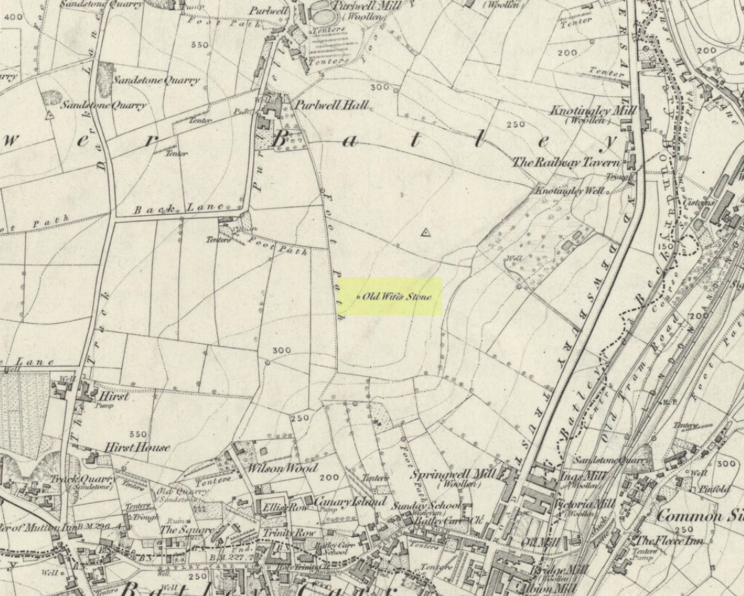
Old Wifes Stone on 1854 map
My first hint at the existence of this once valuable archaeological relic came as a result of me seeking out the history and folklore of some hitherto unknown, forgotten holy wells in the Batley and Dewsbury area. I located the material I was looking for on the old wells, but my fortuitous discovery of this site, the Old Wife’s Stone, blew me away!
It was the place-name of ‘Carlinghow’ about one mile northwest of the grid-reference above that initially caught my attention. From an antiquarian or occultist’s viewpoint, it’s intriguing on two counts: the first is the element ‘how‘ in Carlinghow, which can mean a variety of things, but across the Pennines tends to relate to either an ancient tribal or council meeting place, or a prehistoric burial cairn: an element that wasn’t lost in the giant archaeology survey of West Yorkshire by Faull & Moorhouse (1981). But the first part of this place-name, ‘carling‘, was the exciting element to me; for it means ‘old woman,’ ‘old hag,’ ‘witch’ or cailleach! The cailleach (to those who don’t know) was the prima mater: the Great Mother deity of our pre-christian British ancestors. Meaning that Carlinghow hill was a hugely important sacred site no less—right in the heart of industrial West Yorkshire! What is even more intriguing—or perhaps surprising—is that we have no record of such a powerful mythic creature anywhere in local folklore… Or so it first seemed…
Memory told me that no such prehistoric remains were recorded anywhere in that area—and certainly no prehistoric tombs. I scoured through my library just to triple-check, and found the archaeological records as silent as I first thought. Just to make sure I spent a day at the Central Library, where again I found nothing… So then I explored the region on the modern OS-maps, only to find that much of the area where the Carlinghow place-name existed was, surprisingly, still untouched by housing and similar modern pollutants. This was a great surprise to say the least. And so to check for any potential archaeological sites which might once have been in the Carlinghow area, I turned to the large-scale 1850 OS-maps (6-inch to the mile).
This is when I came across the Old Wife’s Stone, marked in the middle of fields on the outskirts of old Batley. There was no notice of it being a standing stone, or a simple boulder, or archaeological relic—nothing. But its place-name compatriot of ‘Carlinghow’ was the rising hill about a mile to the northwest. In days of olde, if Carlinghow was indeed the ‘burial tomb of the Old Woman’ or ‘meeting place of the cailleach’ (or whatever variants on the theme it may have been), it may have marked the setting sun on the longest day of the year if you had been standing at the Old Wife’s Stone – a midsummer sunset marker no less. (There are other ancient and legendary sites scattering northern England and beyond that are dedicated to the Cailleach, like the Old Woman Stone in Derbyshire, the Old Wife’s Neck in North Yorkshire, the Carlin Stone in Stirlingshire, the Old Woman Stone at Todmorden, Carlin Stone of Loch Elrig and many more.)
As if these curious ingredients weren’t enough to imply something existed in the heathen pantheon of Batley before the Industrialists swept away our indigenous history, we find echoes of the ‘Old Woman’ yet again, immediately east; this time where the animism of water and trees enfolded Her mythos in local rites and traditions, thankfully captured by the pens of several writers, and transmuted into another guise—but undeniably Her! But that, as they say, is for another day and another site profile…
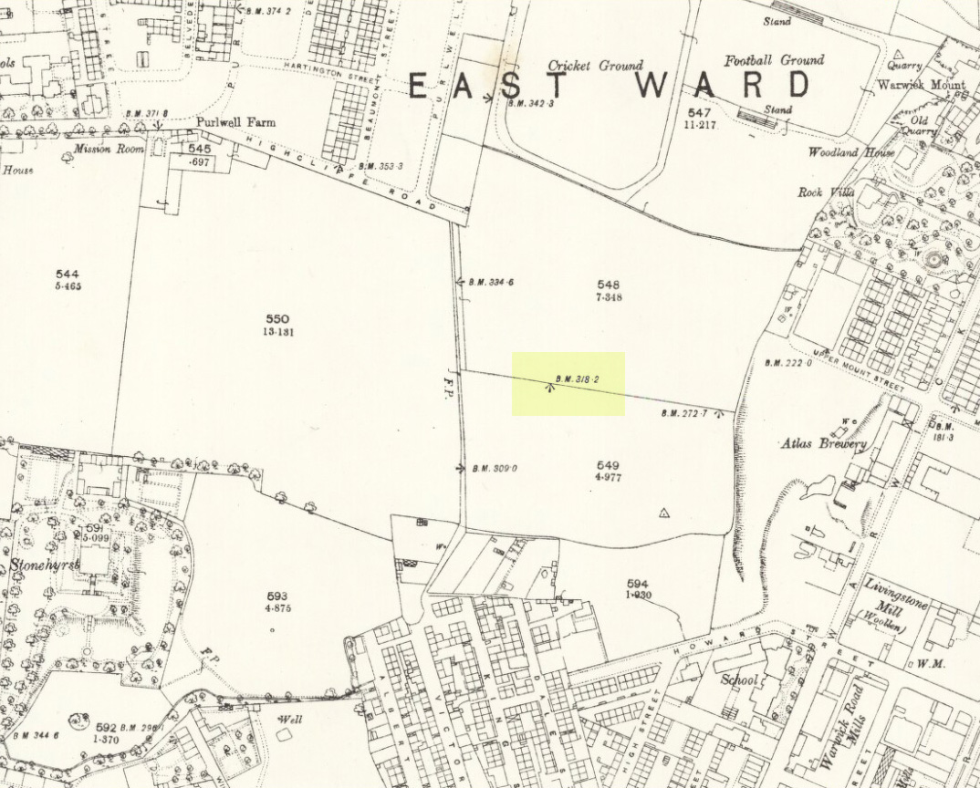
Position of stone in 1894
So is our Old Wife’s Stone (or for that matter, Carlinghow’s old tomb) still in evidence? A school has been built where it was highlighted on the 1854 OS-map and, from the accounts of local people, seems to have long since disappeared. The stone looks to have been incorporated into a length of walling, sometime between 1854 and 1888, and a bench-mark of “BM 318.2” carved onto it. But when the Ordnance Survey lads re-surveyed the area in 1905, this had gone. I have been unable to find any more information about this site and hope that, one day, a fellow antiquarian or occult historian might be able to unravel more of its forgotten mythic history.
References:
Faull, M.L. & Moorhouse, S.A. (eds), West Yorkshire: An Archaeological Survey to 1500 AD – volume 1, WYMCC: Wakefield 1981.
Goodall, Armitage, Place-Names of South-west Yorkshire, Cambridge University Press 1914.
Keighley, J.J., ‘The Prehistoric Period’, in Faull & Moorhouse, 1981.
o’ Crualaoich, Gearoid, The Book of the Cailleach, Cork University Press 2004.
Smith, A.H., English Place-Name Elements – volume 2, Cambridge University Press 1956.
Smith, A.H., The Place-Names of the West Riding of Yorkshire – volume 2, Cambridge University Press 1961.
Wright, Joseph, English Dialect Dictionary – volume 1, Henry Frowde: London 1898.
Acknowledgements: Many thanks for the assistance of Simon Roadnight and Julia King in the Batley History Group.
Standing Stone (destroyed): OS Grid Reference – NT 2421 7317
Archaeology & History
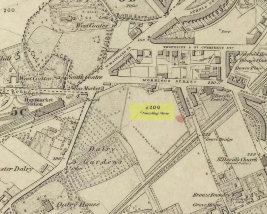
Standing Stone of Dalry, 1853
Not far from Edinburgh city centre, heading out towards Haymarket just off Morrison Street where the large car-park is, once stood a possible prehistoric standing stone. Not that long ago either… It was highlighted on the OS-map of 1853, but had been destroyed by the end of the 19th century when the Industrialists cut railway lines across its ground. The stone was shown in non-antiquated lettering, indicating there was no tradition of its prehistory. It may have been part of a folly, but I can find no account to indicate this. Do any Edinburgh historians or researchers know anything more about it? Help!
From Blubberhouses church by the crossroads, walk up the slope (south) as if you’re going to Askwith, for 100 yards or so, taking the track and footpath past the Manor House and onto the moor. Once you hit the moorland proper, take the footpath that bears left going down into heather and keep going till you hit the dead straight Roman Road path running west onto Blubberhouses Moor. Carry along the Roman Road for about 200 yards as though you are going towards the Eagle Stone, and looking right (if you squint) you can just make out a small pimple on the top of the moors about a quarter of a mile away. That is where you are heading (be warned – it is boggy getting there).
Archaeology and History
James Stone, looking NE
Discovered (or rather ‘noticed’) by James Turner and James Elkington in July 2016 (hence the name James Stone), this standing stone is of an indeterminable age – although it does look ancient. Standing more than 5 feet tall, and in the middle of nowhere, it is fairly difficult to get to unless you want to get wet feet. It is situated very close to a small and unexcavated prehistoric settlement and we could find no physical evidence of any tracks nearby (although Google Earth does show what looks like one or two very short, faint tracks near the stone, which is the old ‘Benty Gate’ track).
It could be a boundary stone, although doubtful – it has a feel to it that says it is prehistoric, although this is just guesswork on our part. I can find no reference to it in Cowlings Rombalds Way (1946) and there seems nothing about it in either of William Grainge’s (1871; 1895) detailed history works of the region.
Mr Turner gazing at the stone
At first we thought it unlikely to be a new find, however the stone is difficult to see from the Roman Road (I had been up here dozens of times before I noticed it) and seeing that people rarely go up here anyway, and it is relatively difficult terrain getting to it, it is not surprising that no one has bothered visiting it. It would take someone who is quite keen on megaliths to want to examine it and it is well off any tracks.
Having said that, it is a nice find and it could be linked in some way with the small unexcavated settlement nearby, or possibly the large Green Plain settlement nearly a mile away. Well worth a visit…bring your wellies!
References:
Cowling, Eric T., Rombald’s Way, William Walker: Otley 1946.
Grainge, William, The History and Topography of Harrogate and the Forest of Knaresborough, John Russell Smith: London 1871.
Grainge, William, The History and Topography of the Townships of Little Timble, Great Timble and the Hamlet of Snowden, William Walker: Otley 1895.
Standing Stone (destroyed): OS Grid Reference – NT 2139 7001
Archaeology & History
Cloven Stone on 1855 map
Highlighted on the earliest OS-map of 1855 and the Knox Map of 1816 in non-antiquated lettering as a ‘Standing Stone’, the Edinburgh historian Stuart Harris (1996) thought it was an authentic site. He was probably right. First named in land rentals in 1631, it was known by local people as the Clovenstone and used to stand in a park of the same name, before quarrying works extended into the area and destroyed it in the 1870s. Mr Harris thought that it may have been a pair of uprights, but the term ‘cloven’ could just as well mean it was a stone that had a split in it.
References:
Harris, Stuart, The Place-Names of Edinburgh, Gordon Wright: Edinburgh 1996.
Standing Stone (lost): OS Grid Reference – SE 2522 5010
Archaeology & History
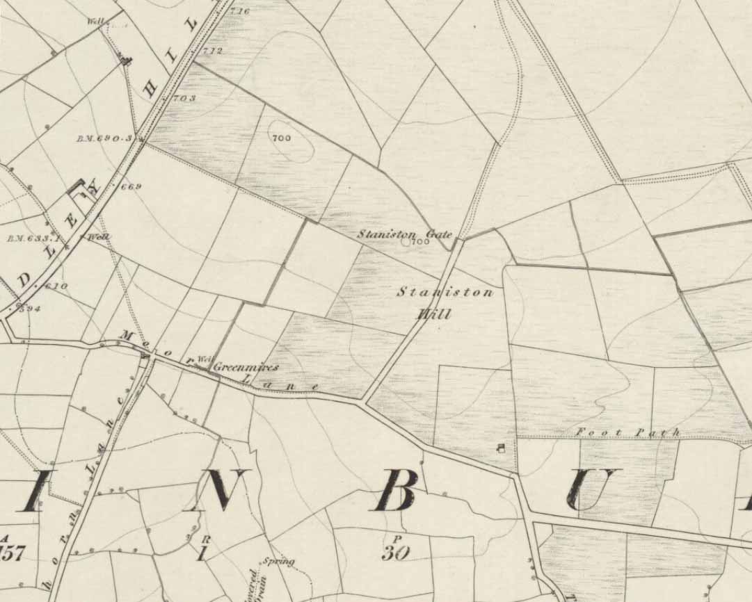
Staniston Hill on 1851 map
This long-lost standing stone gave its name to the small hill between the geological giants of Little Almscliffe and Almscliffe Crags, ‘Staniston Hill.’ Described as early as the 13th century in the Cartulary of Fountains Abbey as ‘Standandestan’, its precise whereabouts is unknown—but it’s damn close to the grid-reference cited here. As the early OS-map shows, a small rounded hill occurs a short distance northwest of the small copse of trees now growing. The monolith may have been felled by some grumpy christian, or it could be standing in some nearby walling. Local antiquarians, dowsers or archaeologists may or may not find a search for it worthwhile…
Its position between the two Almscliffe Crags makes it very close to marking the midway point of a natural solstice marker: the Winter sunrise from Little Almscliffe and summer sunset from the greater Almscliffe.
References:
Bennett, Paul, The Old Stones of Elmet, Capall Bann: Milverton 2001.
Smith, A.H., The Place-Names of the West Riding of Yorkshire – volume 5, Cambridge University Press 1961.
Follow the same directions as if you’re visiting the Dissenter’s Well. The cross stands right next to it!
Archaeology & History
This is one of two old stone crosses with the same name within a mile of each other (the other could be found in the walling along Warley Wise Lane). Included in Taylor’s (1906) stunning magnum opus on the wells and crosses of Lancashire, the site was mentioned in a boundary dispute in the year 1592. He told how a local man called Mr Carr said,
“John Parkinson, ‘of the age of ffour score and thirtiene year or thereabouts’ stated that Tom Cross and the Graystone were by credible report the boundaries, as well of Lancashire and Yorkshire, as of the manors of Colne and Cowling.”
Years later when Clifford Byrne (1974) surveyed the crosses of East Lancashire, he gave us more details about the site, saying:
Photo by Phil WaterworthTom Cross, looking N
“Tom Cross is built into the wall hard by Copy House Farm… At the foot of the Copy House Cross is a well, carved out of a solid block of stone. The water apparently trickles into the well from a spring at the back of the wall , and the overflow spills into the field. The top section of the cross is missing, probably it was vandalized at the time of the Reformation or some time afterwards. It appears that the well was used and probably laid down by the Congregational Church dissenters from the late 17th century. At that time, a law was passed, soon to be repealed, which decreed that every man should attend his Parish Church. This meant that those who wished freedom to practise religion in their own form had to firstly attend the Parish Church and then hold a meeting privately afterwards. At that time, and under those circumstances, it was obviously sensible to meet far away from the Parish Church, and apparently Tom Cross was chosen to meet this need. The children of the Dissenters would be privately baptised in this well at the foot of the monolith into which, a cross was deeply incised.
Tom Cross is mentioned in a lawsuit in the year 1592 and a map exists dated slightly earlier which shows another cross in the area on Greystone Moor near Blacko…”
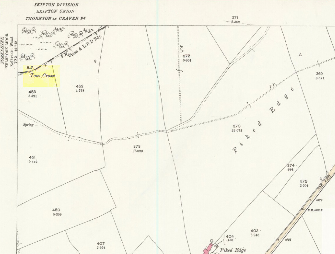
Tom Cross stone
Byrne suggested that the name ‘Tom Cross’ relates to a boundary cross, but this is not substantiated in local dialect or place-name surveys (who say nothing!). Instead, Joseph Wright (1905) gives us the possibility of Tom being simply, “a kind of rock”; although a variety of other associations relate it children’s games, customs and goblins. The word may derive from the Gaelic ‘tom’, relating to a mound, or clump, or knoll in the landscape (Watson 1926). I’d go for one of these misself. Makes sense.
References:
Byrne, Clifford H., “A Survey of the Ancient Wayside Crosses in North East Lancashire,” unpublished manuscript, 1974.
Taylor, Henry, The Ancient Crosses and Holy Wells of Lancashire, Sherratt & Hughes: Manchester 1906.
Watson, W.J., The Celtic Placenames of Scotland, Edinburgh 1926.
Wright, Joseph (ed.), English Dialect Dictionary – volume 6, Henry Frowde: Oxford 1905.
Acknowledegments: Big thanks to Chris Swales for guiding me to the site; and to the old Teddy Man, DannyTiernan.
Turn off the A91 road at Gateside and go down Station Road, crossing the old railway line at the bottom. From here, cross the fields to your left and the site of the circle will be found in the field to the north east of Easter Nether Urquhart Farm.
Archaeology & History
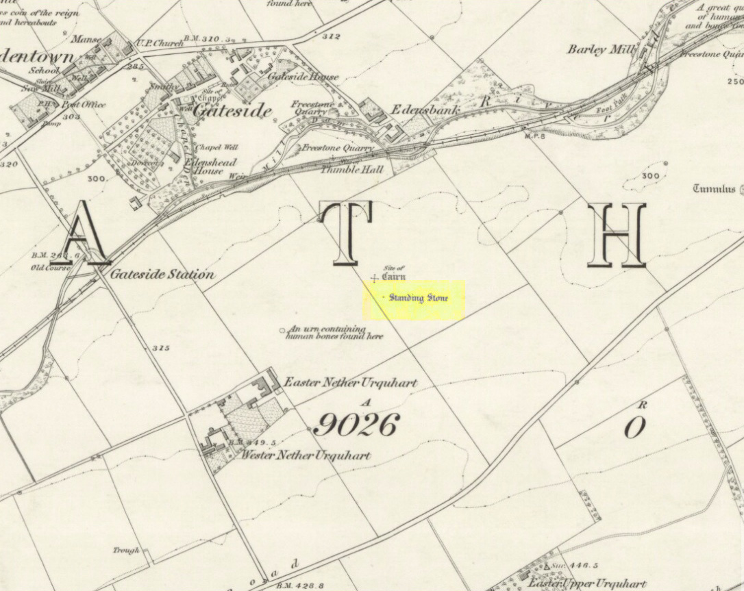
Marked on the 1856 6″ Ordnance Survey map as a “standing stone,” earlier references record this as being the survivor of a stone circle. Not listed in Aubrey Burl’s (2000) magnum opus, this circle was on the edge of the site of a major battle between the Romans and the native defenders, and large amounts of human remains have been found in the vicinity. Referring to an adjacent cairn, Lieutenant-Colonel Miller wrote in 1829:
“A very fine Druid’s Temple stood on the south side of it, consisting of seven very large stones. All these were blasted with powder and removed, except half the one of them, which still marks the spot.”
Of the same cairn, the Reverend Andrew Small wrote in 1823:
“This cairn stood a little north of an ancient Druids’ temple, only one stone now remaining, out of ten of which it formerly consisted.”
The Ordnance Survey Name Book for 1853-55 imparts the following:
“This standing Stone is about 13 chains on the South side of the River Eden opposite Edensbank but whether it is the remains of a druid’s temple or set up to mark something relative to the battle contested between the Romans and Caledonians according to Messrs. Miller & Small, it is difficult to determine. It stands about 4 feet 10 inches high and its sides are about 2 feet broad…many of the inhabitants consider it to have been a druid’s temple…”
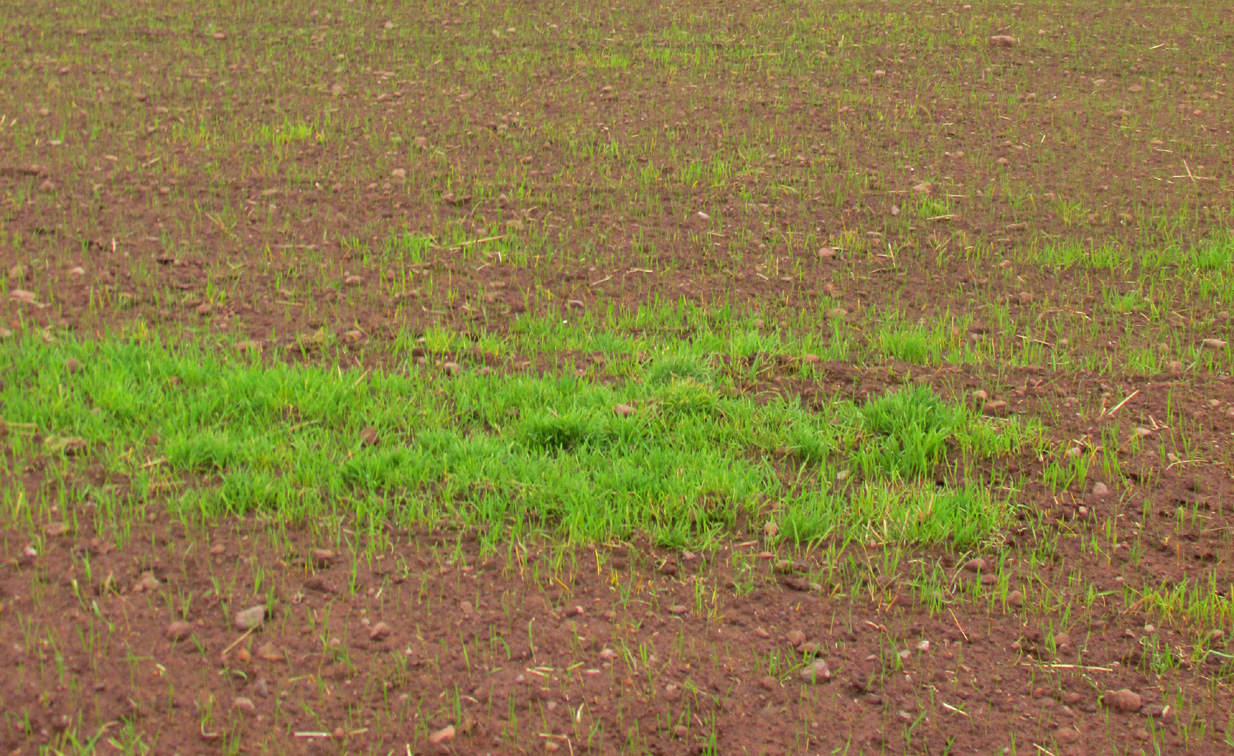
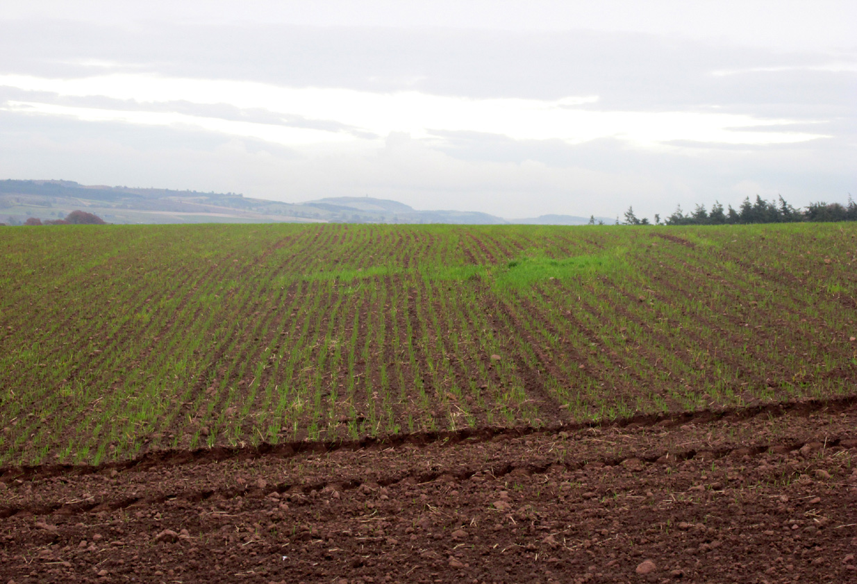
A close-up of the sitePosition of the circle, evident in crop-growth
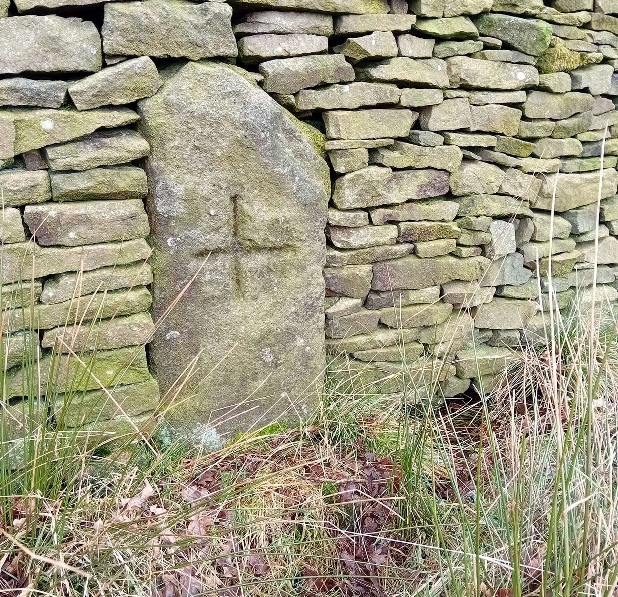
J.S. Baird of Nether Urquhart informed an Ordnance Survey officer in 1956 that the remaining stone was broken up and removed around 1952, and measured 5 feet high with a girth of 9 feet at the base. Near the top of the stone, on the south-side were two slight cracks weathered to suggest a simple incised cross.
On the day of my November field-visit the winter barley was sprouting and it was interesting to see how much better it was growing at the place where the remaining stone had stood.
Burl, Aubrey, The Stone Circles of Britain, Ireland and Brittany, Yale University Press 2000.
Miller, Lieutenant-Colonel, “An Inquiry respecting the site of the battle of Mons Grampius (Read 27th April 1829 and 25th January 1830),” in Proceedings of the Society of Antiquaries of Scotland, Volume IV, 1857.
Small, Reverend Andrew, Interesting Roman Antiquities Recently Discovered in Fife Ascertaining the site of the Great Battle fought betwixt Agricola and Galgacus, John Anderson & Co: Edinburgh 1823.
Take the directions to the hugely impressive Dunruchan A standing stone. Walk directly south, over the gate and follow the fence straight down the fields, crossing the burn at the very bottom. Walk over the boggy grassland and start veering uphill, southeast. You’ll notice the land goes up in geological ‘steps’ and, a few hundred yards up, a small standing stone pokes up on the near skyline ahead of you. Head straight for it!
Archaeology & History
This small standing stone was first noted after a quick visit to the major Dunruchan megalithic complex in the summer of 2016. Photographer James Elkington was taking images of the landscape and the standing stones when he noticed a stone on the horizon a half-mile away. As we were in a rush, he took a couple of photos from different angles on the way back to the car—both of which looked promising. And so, several months later, we revisited the site again. Lisa, Paul and Mr Fukner and I meandered up the geological steps of the hillside until we reached the site in question.
Looking northwestLooking northeast
Standing just over four-feet tall, this solitary stone overlooks the megalithic Dunruchan complex a half-mile or so to the north and northwest. Like the Dunruchan C monolith, this smaller upright is conglomerate stone. Paul Hornby noted what may be a single cup-marked stone roughly 100 yards east along the same ridge. (Please note that the grid-ref may be slightly out by perhaps 50 yards or so at the most. If anyone visits and can rectify my ineptitude on this matter, please let me know.)
From Colne or Laneshaw Bridge, head up the Skipton Old Road which heads up towards Bleara Moor (with its prehistoric cairns). Way before that though, about 100 yards before you reach the Black Lane Ends pub, turn left up the track to Jerusalem Farm. Go past it, through the gates and keep on the track until, another coupla hundred further uphill, you’ll see it on the skyline ahead of you…
Archaeology & History
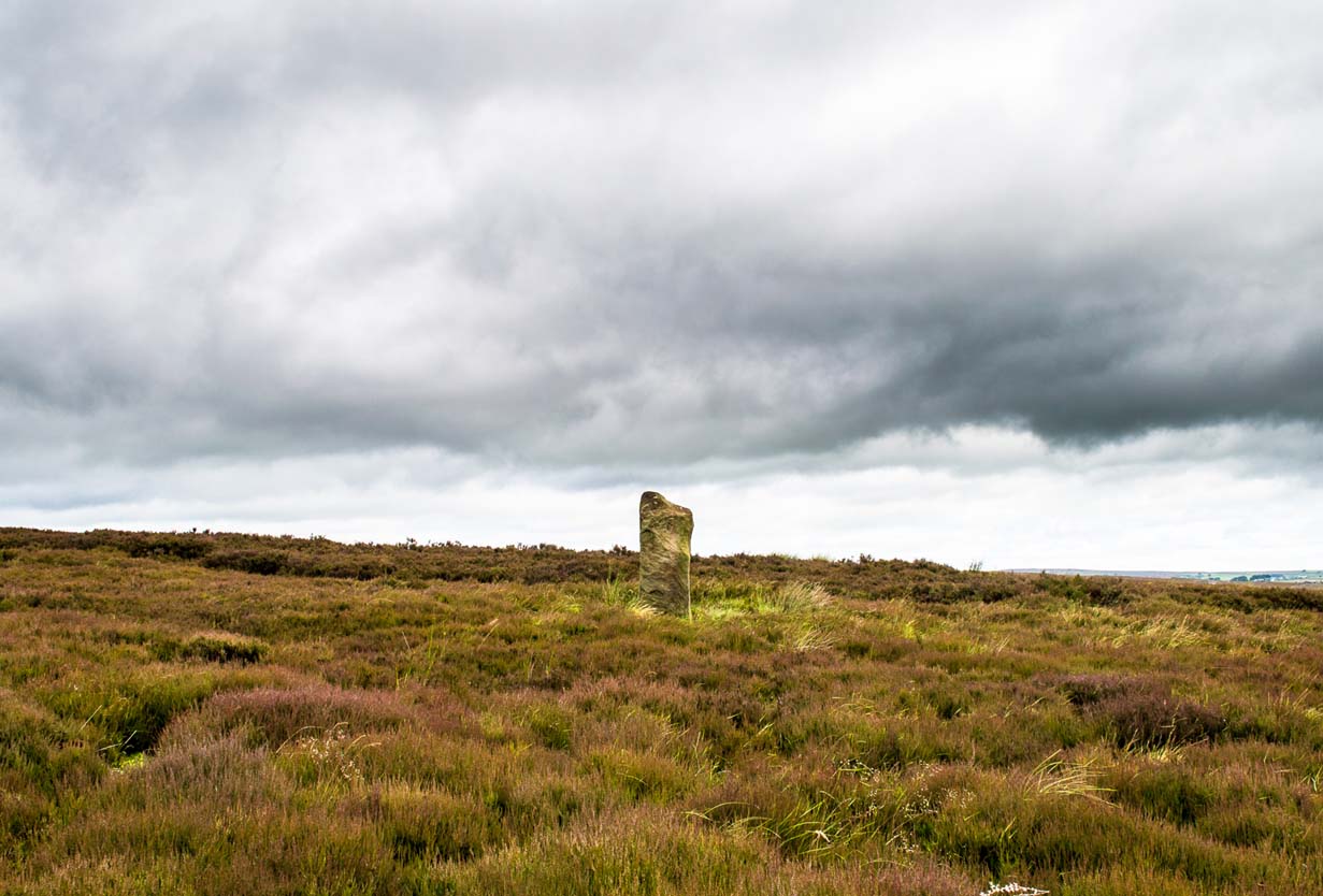
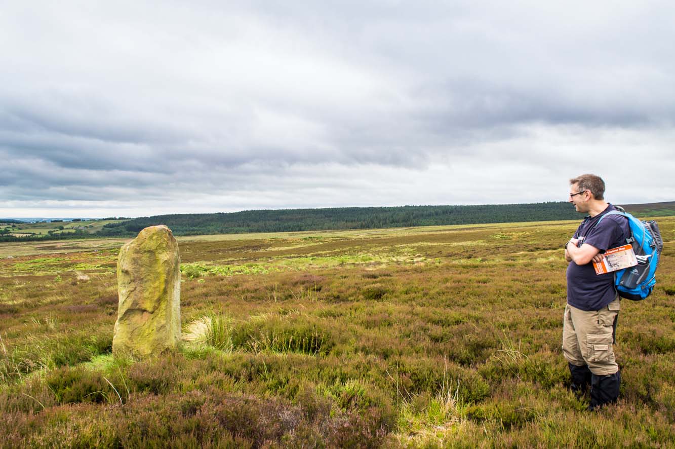
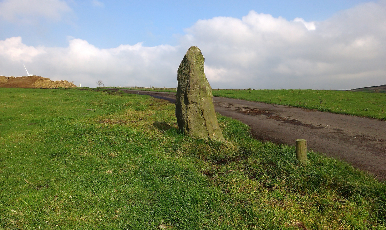
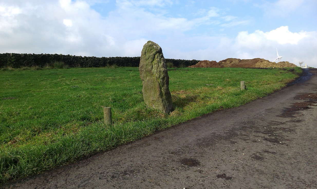
There appears to be no previous reference to this standing stone, found high upon the lonely ridge beside the old track that runs between Laneshaw Bridge and Kelbrooke and Earby. Well eroded on all sides, it isn’t shown on the early or recent maps and has evaded the archaeological registers of the area (but this is Lancashire, where archaeology has been damn lazy on the county’s prehistoric relics until very recently). It may have been laid down for an age, only recently resurrected—we simply do not know. Standing nearly five-feet tall, on its top western face is what looks like a very faded cup-marking, but this may be a fortuitous Rorscharch. There are no marks or holes in the stone to indicate it has ever been used as a gatepost.
Looking far into the eastLooking northwest
I was guided here by the northern antiquarian and stonemason Chris Swales a few weeks ago and was quite taken aback by its position in the landscape—which is outstanding! Apart from being blocked to the west by the rise of the Great Edge, the views to the north through east and south and superb. On the far eastern skyline rises the legendary Hitching Stone, between which is the seemingly cairn-less Knarrs Hill.
Further north along the track we reach the old Dissenter’s Well and its moving companion, the Tom Cross (which has marked different parts of the Lancashire and Yorkshire boundary). Other than this, we know nothing more. An intriguing spot and well worth visiting!