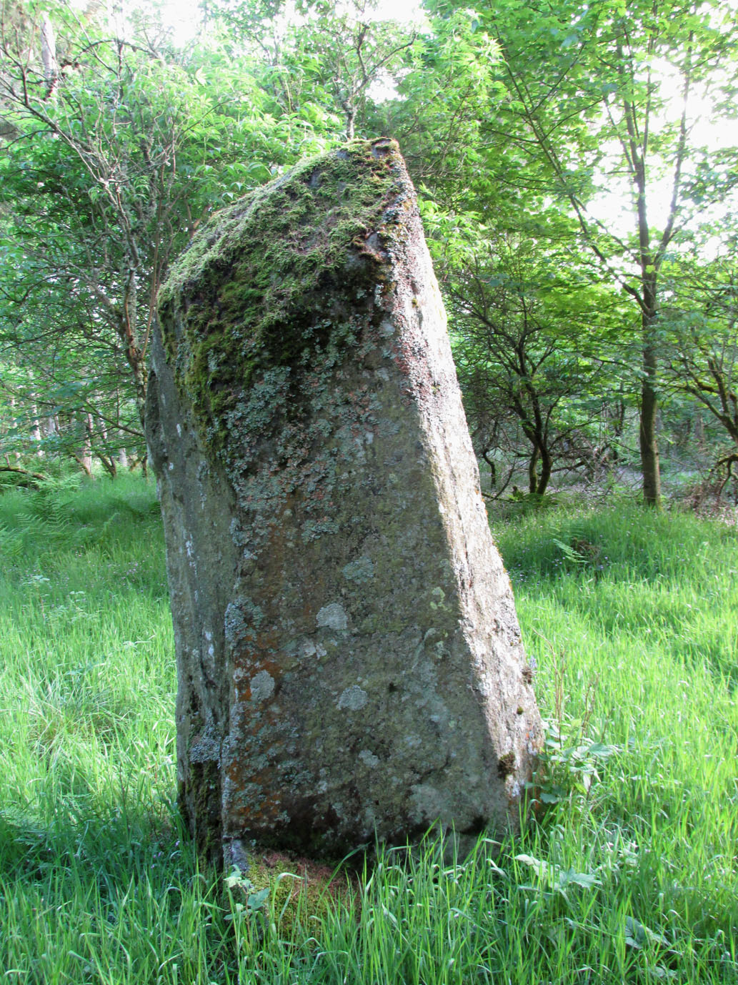
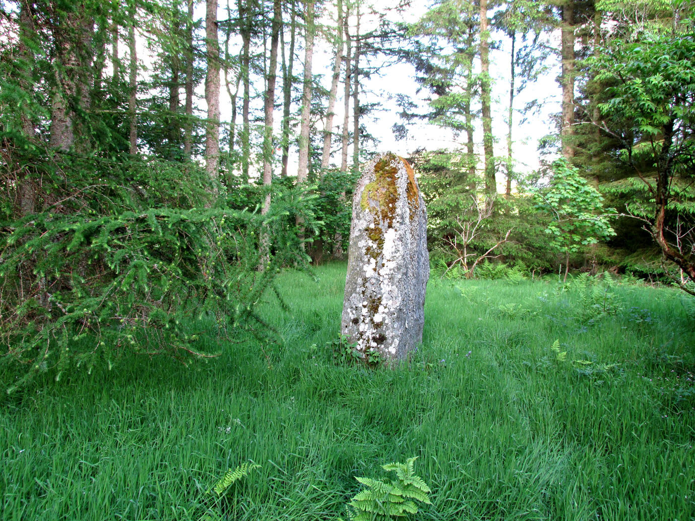
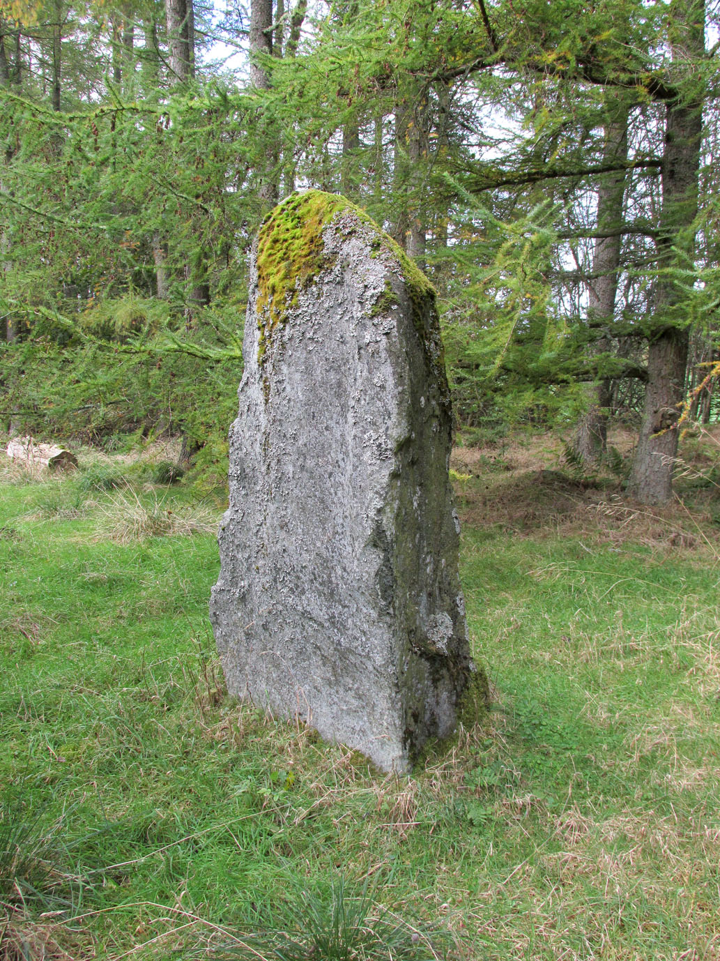
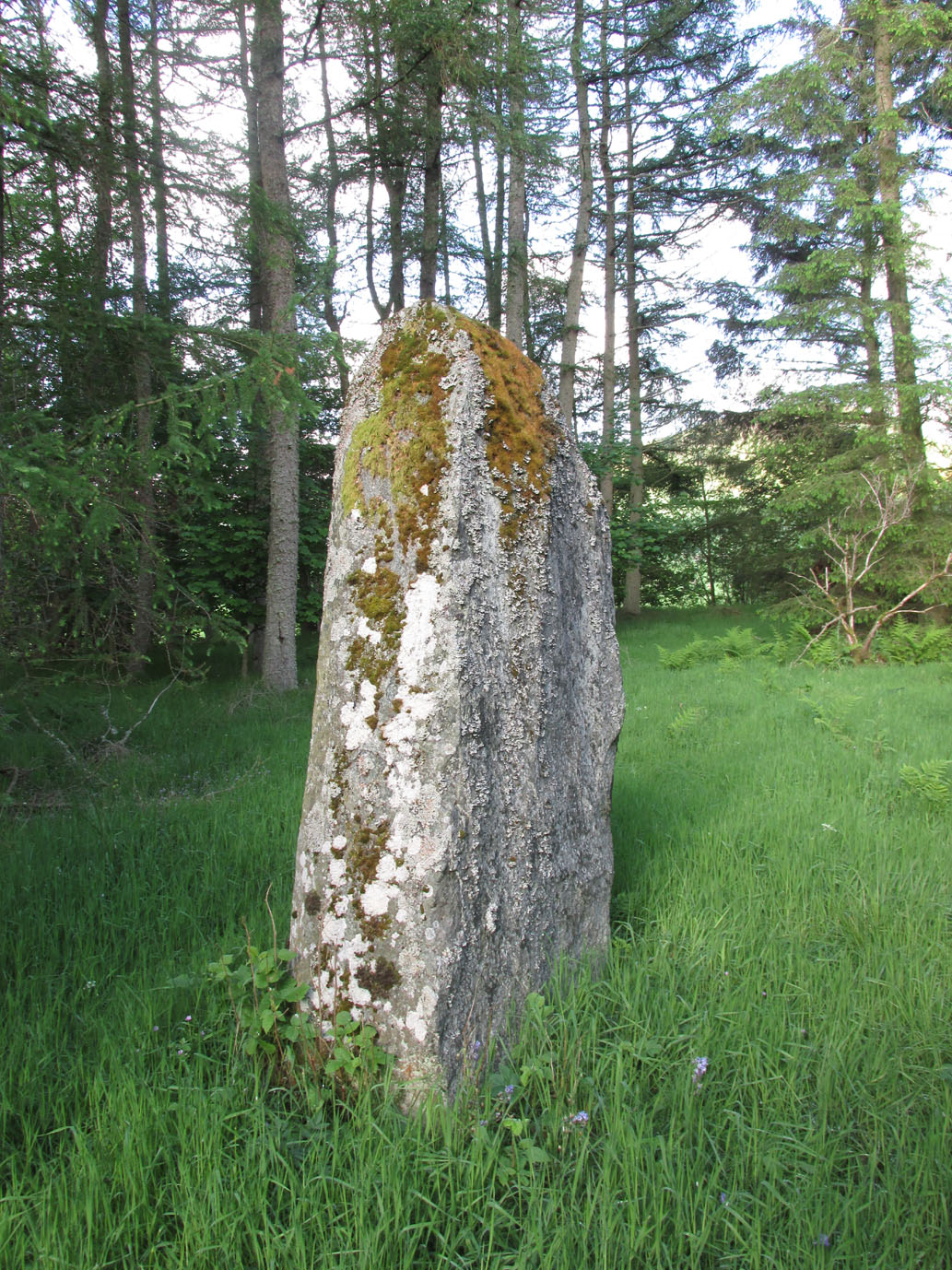
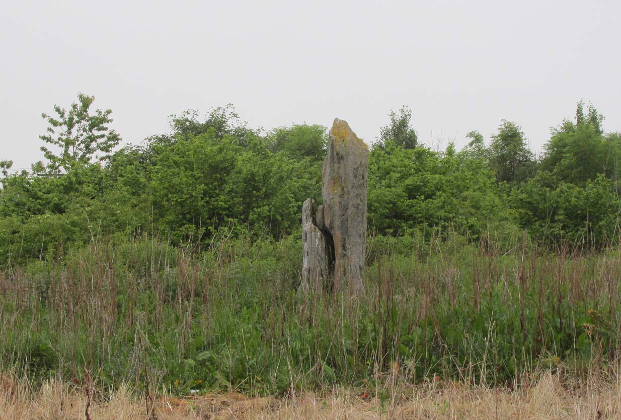
Kilry, Glen Isla, Angus

Standing Stone: OS Reference – NO 2432 5449

Also Known as:

  1. Canmore ID 31093

Getting Here

Take the B954 north from Alyth, and turn left onto the unclassified road at Craigisla House, turning right at Dykehead, then take the right fork at Faulds. Park up by the school about ¼ mile further on, and the stone is in a wooded glade on the opposite side of the road along a track to the left of ‘Standing Stone’ cottage.

Archaeology and History

Quoted in the Canmore database, A.J. Warden, writing in 1882, described the stone:

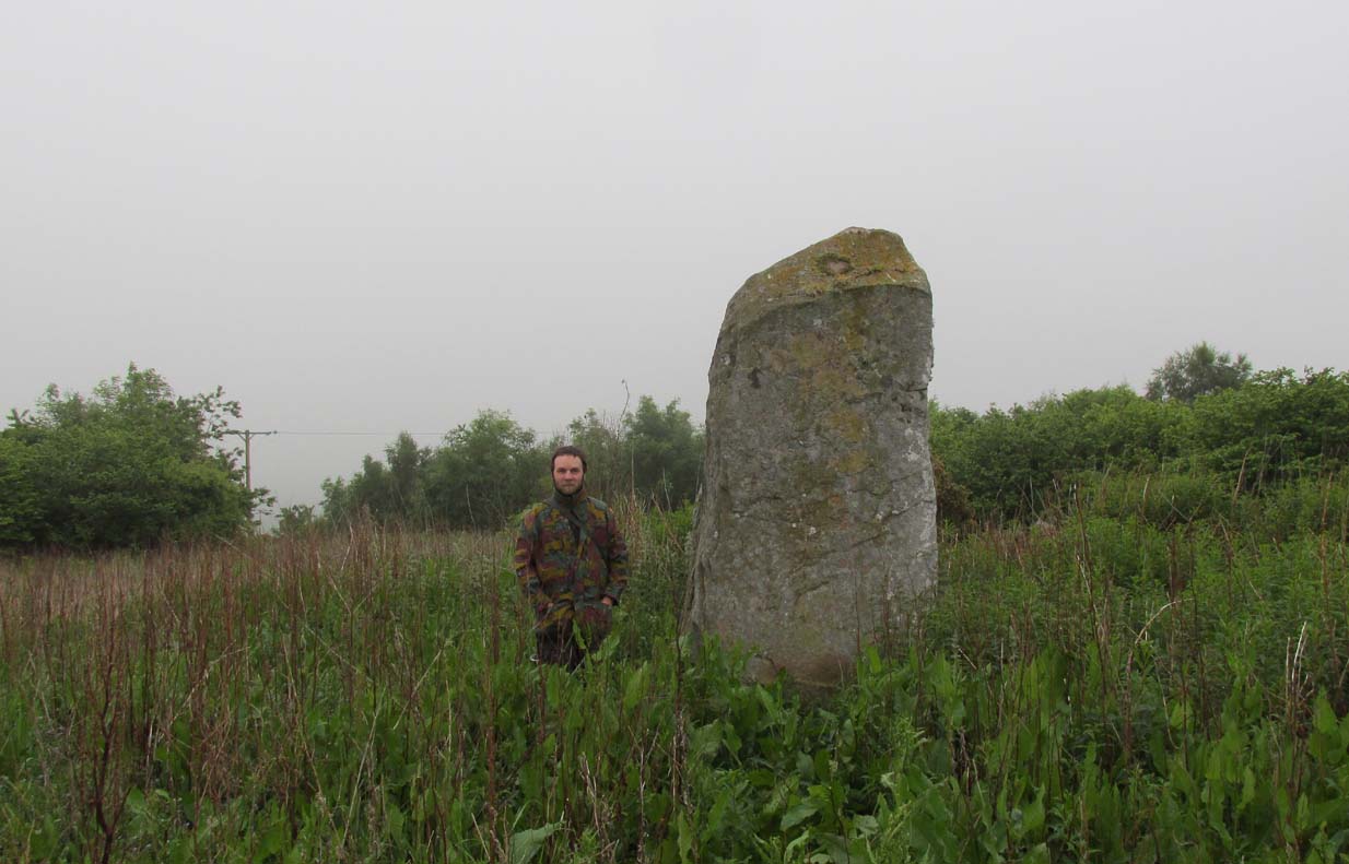
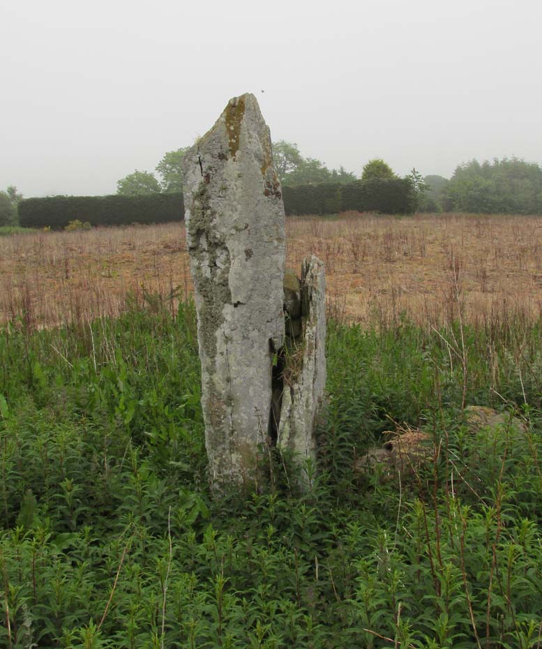
The standing stone on Broomhall estate is a large amorphous whinstone, standing in a small field near the confluence of the Kilry Burn and the River Isla.  It is c.7′ high and c. 10′ in circumference at the base. Tradition states that it commemorates a battle fought between the laird of Kilry and the Durwards of Peel.’

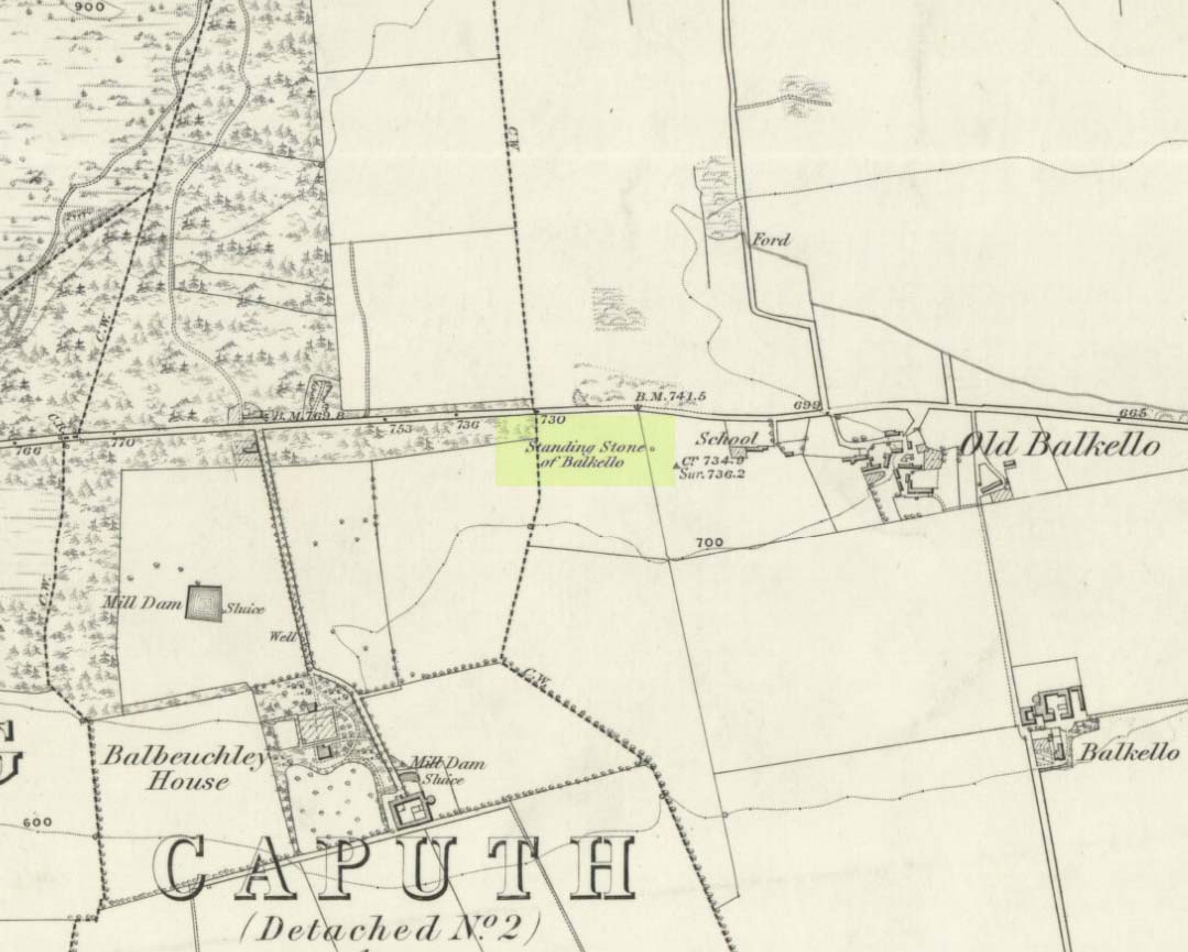
On the OS map the stone is aligned with the Pitmudie Stones and the Knowehead of Auldallan Stones to the north east.

References:

  1. Warden, A.J.,  Angus or Forfarshire: The Land and People, Descriptive and Historical – volume 3, Dundee 1880-5.

© Paul Hornby, The Northern Antiquarian


Ghaist Stane, Fern, Angus

Standing Stone:  OS Grid Reference – NO 4832 6173

Getting Here

Ghaist Stane on 1865 OS-map

Ghaist Stane on 1865 OS-map

Whichever route you take to reach this lovely hamlet, hiding away in deep greenery, when you get to the one and only road junction, where it goes downhill (towards the old church), look just above you just below the first tree.  All but covered in vegetation, the ruined stone lays down there. Climb up and see!

Archaeology & History

Tis up on the verge here

Tis up on the verge here

An exploration of this site was prompted when fellow antiquarian, Paul Hornby, came across the curious place-name of ‘Ghaist Stane’ when he was looking over some old Ordnance Survey maps of the region.  So we met up and took a venture over there!  Last highlighted on the 1865 map (when the old village was known as Fearn, not the modern spelling), even the Canmore lads had missed this one.  But it’s not easy to find….

After meandering back and forth by the village roadside, on the tops of the walls, into the field above, Paul eventually said, “Is that it?!” just above the roadside, almost buried in vegetation below the roots of a tree.  So I clambered back up and brushed some of the vegetation away – and there it was – in just the place that the old OS-map showed it to be (give or take a few yards).

The remains of the stone measure roughly 3 feet by 3 feet; with the present upper portion of the stone being of a lighter colour than the lower portion, indicating that this section of the stone was the portion that was underground when it was standing upright.  Its history is fragmentary, but we know that it was almost completely destroyed in the middle of the 19th century.  Notes from the Object Name Book of the region in 1861 told,

“The “Ghaist Stane”…formerly well known, is becoming little known from the stone having been recently blasted in making the Dike it now forms a part of, but it may be observed in the wall as a huge stone much larger than those beside it in the Dike. It does not project now from the side of the Road.”

Now the stone is almost entirely forgotten and lays covered, ignored, even by local people.  It could do with being resurrected and its heritage preserved before it disappears forever.

Folklore

The uncovered Ghaist Stane

The uncovered Ghaist Stane

The word “ghaist” is a regional dialect word meaning “a ghost or goblin”, inferring that the site was haunted.  And, considering the inherent animistic cultural psychology of the people here in earlier centuries, we must also consider the distinct possibility that the stone itself was the abode of a resident spirit, perhaps an ancestral one of a local chief, or queen, or elder of some sort.

In James Guthrie’s (1875) analysis of the folklore of Fern township, he told of the peculiarly odd violent brownies of the district and thought that they and the spirit of the Ghaist Stane were one and the same.

“In addition to the leading characteristics of Brownies in general the more prominent of these being, that they forded the rivers when their waters were at their highest, and that the sage femme always landed safely at the door of the sick wife—the brownies of Ferne are connected with scenes of cruelty and bloodshed.  This peculiarity would seem to indicate that the brownie and the ghaist of Feme, were one and the same.  The Ghaist Stane is in the vicinity of the church.   To this piece of isolated rock, it is said this disturber of the peace was often chained as a fitting punishment for his misdeeds, but tradition is silent as to the brownie being similarly dealt with, which strengthens the supposition that they were, in this quarter at least, generally regarded as one being.”

The spirit of the Ghaist Stane roamed far and wide in the district it seemed, and a long rhyme telling a tale of the ghaist was once well-known in the area which, thankfully, Mr Guthrie gave us in full:

THE GHAIST O’ FERNE-DEN

There liv’d a farmer in the North,
(I canna tell you when),
But just he had a famous farm
Nae far frae Feme-den.
I doubtna, sirs, ye a’ hae heard,
Baith women folks an’ men,
About a muckle, fearfu’ ghaist —
The ghaist o’ Ferne-den!
The muckle ghaist, the fearfu’ ghaist,
The ghaist o’ Ferne-den;
He wad hae wrought as muckle wark
As four-au’-twenty men!

Gin there was ony strae to thrash,
Or ony byres to clean,
He never thocht it muckle fash
0′ workin’ late at e’en!
Although the nicht was ne’er sae dark,
He scuddit through the glen,
An’ ran an errand in a crack —
The ghaist o’ Ferne-den!

Ane nicht the mistress o’the house
Fell sick an’ like to dee,—
“O! for a oanny wily wife!”
Wi’ micht an’ main, cried she!
The nicht was dark, an’ no a spark
Wad venture through the glen,
For fear that they micht meet the ghaist —
The ghaist o’ Ferne-den!

But ghaistie stood ahint the door,
An’ hearin’ a’ the strife,
He saw though they had men a score,
They soon wad tyne the wife!
Aff to the stable then he goes,
An’ saddles the auld mare,
An’ through the splash an’ slash he ran
As fast as ony hare!

He chappit at the Mammy’s door—
Says he — “mak’ haste an’ rise;
Put on your claise an’ come wi’ me,
An’ take ye nae surprise!”
“Where am I gaun?” quo’ the wife,
“Nae far, but through the glen —
Ye’re wantit to a farmer’s wife,
No far frae Ferne-den!”

He’s taen the Mammy by the hand
An’ set her on the pad,
Got on afore her an’ set aff
As though they baith were mad!
They climb’d the braes—they lap the burns—
An’ through the glush did plash:
They never minded stock nor stane,
Nor ony kind o’ trash!

As they were near their journey’s end
An’ scudden through the glen:
“Oh!” says the Mammy to the ghaist,
“Are we come near the den!
For oh! I’m feared we meet the ghaist!”
“Tush, weesht, ye fool! “quo’ he;
“For waur than ye ha’e i’ your arms,
This nicht ye winna see!”

When they cam to the farmer’s door
He set the Mammy down:—
“I’ve left the house but ae half hour—
I am a clever loon!
But step ye in an’ mind the wife
An’ see that a’ gae richt,
An’ I will tak ye hame again
At twal’ o’ clock at nicht!”

“What maks yer feet sae braid?” quo’ she,
“What maks yer een sae sair?”
Said he, — “I’ve wander’d mony a road
Without a horse or mare!
But gin they speir, wha’ brought ye here,
‘Cause they were scarce o’ men;
Just tell them that ye rade ahint
The ghaist o’ Ferne-den!”

References:

  1. Guthrie, James C., The Vale of Strathmore – Its Scenes and Legends, William Paterson: Edinburgh 1875.

© Paul BennettThe Northern Antiquarian


Formal, Bridge of Craigisla, Lintrathen, Angus

Standing Stone (fallen):  OS Grid Reference – NO 25618 54024

Also Known as:

  1. Canmore ID 31046

Getting Here

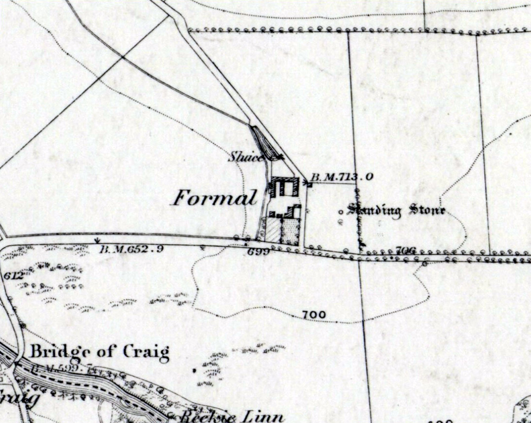
Standing Stone on 1865 map

Standing Stone on 1865 map

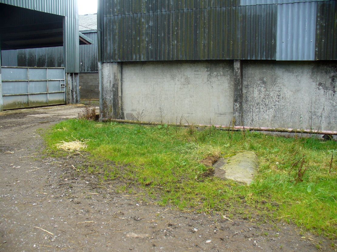
From Alyth village, take the B954 road north for several miles.  At the sharp bend of the road when you’ve crossed the Bridge of Craigisla, a few hundred yards along take the next road left.  Barely 100 yards along, stop!  Walk into the where the large farm-buildings are and keep your eyes peeled on the ground, just in front of the first farm building.  A large long stone measuring about 7-feet (2.1m) is thereby beneath your very feet!

Archaeology & History

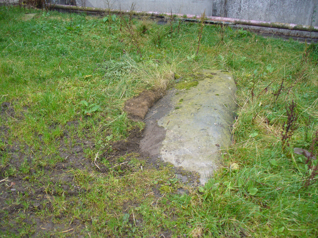
Formal Stone, laying down

Formal Stone, laying down

At the edge of the farm-buildings this all-but-forgotten standing stone lays prostrate, almost hidden, and slowly being covered by the soil and grasses, nearly falling away past the eyes of history.  It’s a pity, as this fallen stone would have stood some six-feet upright, with a couple of feet of it underground.  When it was mapped by the Ordnance Survey lads in the 1860s, a portion of the stone remained standing.  This was echoed in the survey of the Object Name Book in 1861 in which the buildings of Formal were described:

“A fine farm house and offices the property of the late Robert Smith Esqr. of Balharry – in the stackyard is a broken standing stone, to which my attention was drawn by Alexander Annand of Blackdykes and the (parish) Minister.”

Thankfully the present-day farmer here would like to have the stone stood back upright, so hopefully its resurrection aint gonna be too far away.

Formal Stone, looking east

Formal Stone, looking east

Formal Stone, looking south

Formal Stone, looking south

The stone isn’t lying in its original upright position.  It used to stand nearly 10 yards east of here, and was knocked down and rolled into its present spot when an earlier adjacent building was erected.  Another large boulder in the corner where the walls meet (at NO 25585 54044), just through the gates, may also have had some megalithic relationship with the fallen monolith.

© Paul BennettThe Northern Antiquarian

Balkello, Tealing, Angus

Standing Stone:  OS Grid Reference – NO 36332 38305

Also Known as:

  1. Canmore ID 31871
  2. The Standing Stone of Balkello

Getting Here

Balkello Stone, W of Tealing

From the little village of Kirkton of Auchterhouse, take the winding road uphill east as if you’re heading to Tealing.  About 1⅓ mile along, where the road has straightened out, keep your eyes peeled on your right (to the south) where—if the vegetation isn’t too high—you’ll see a tall upright stone in the field.  You’ll have to walk along the roadside until you find a gate into the overgrown field.  Good luck!

Archaeology & History

Not to be confused with the legendary Martin’s Stone of Balkello ⅘-mile to the southeast, this is a little-known standing stone hiding above a mass of boscage ‘pon a quiet ridge that fades focus away from the world.  It’s a bittova giant, all but forgotten it seems, and with little history to speak of in literary terms at least.  When we visited the place a short while ago, summer nettles and willowherbs obstructed our initial contact—but we got to the fella eventually.

This dood lives & sleeps at the stone!

Looking east

Standing more than nine feet high and about five feet across, it’s quite a slender monolith that has seen better days.  Its southern face is crumbling away and a large section of it is close to splitting off completely (surely a case for Historic Scotland to fix?).  As you can see in the photos, upper portions of the stone have fallen into the widening crack that promises to fell the stone at some time in the not-too-distant future.  Let’s get it sorted —before it collapses!

Balkello Stone on 1865 map

It was highlighted on the first OS-map in 1865 as the Standing Stone of Balkello, although without antiquated lettering.  But unless there is excellent reason to suggest this was erected in recent times (it wasn’t), its ‘prehistoric’ status needs activating—cos it’s surely prehistoric!  We all thought so anyhoo…  It’s well worth checking out when you’re in the area!

Folklore

When the Ordnance Survey lads first visited the site in 1861, local people informed them that the stone was said to be,

“in Connection with some others in the Parish (and) are supposed to have (been) used to point out the Roads as they were then, merely beaten paths.”

Alfred Watkins students take note!

Acknowledgements:  Huge thanks as always to Paul Hornby, Nina Harris & Frank Mercer for their assistance in our visit here.

© Paul BennettThe Northern Antiquarian


Barrow Hill Stone, Chastleton, Oxfordshire

Standing Stone (destroyed):  OS Grid Reference – SP 257 282

Archaeology & History

We have found only one reference to this lost standing stone that could once be seen adjacent to the very well-preserved Chastleton Barrow Camp to the east of the village. In her scarce little work on the history of Chastleton House, Margaret Dickins (1900) told that,

“the oldest thing to be seen at Chastleton is the prehistoric stone, which till lately served as a field gate post on the Barrow Hill.”

This monolith was one in a series of megalithic sites in and around the village that have been destroyed due to the actions of ill-informed land-owners. In this case, the standing stone was in close association with the subsequent Iron Age encampment (this missing stone should not be confused with the nearby Goose Stones, greatly damaged).

References:

  1. Bennett, P. & Chanter, James, The Complete Rollright Stones, forthcoming
  2. Dickins, Margaret, Chastleton House, Walker: Stratford 1900.

© Paul Bennett, The Northern Antiquarian

Strand Cross, Westminster, London, Middlesex

Cross (destroyed):  OS Grid Reference – TQ 3077 8093

Also Known as

  1. Stone Cross of the Strand

Archaeology & History

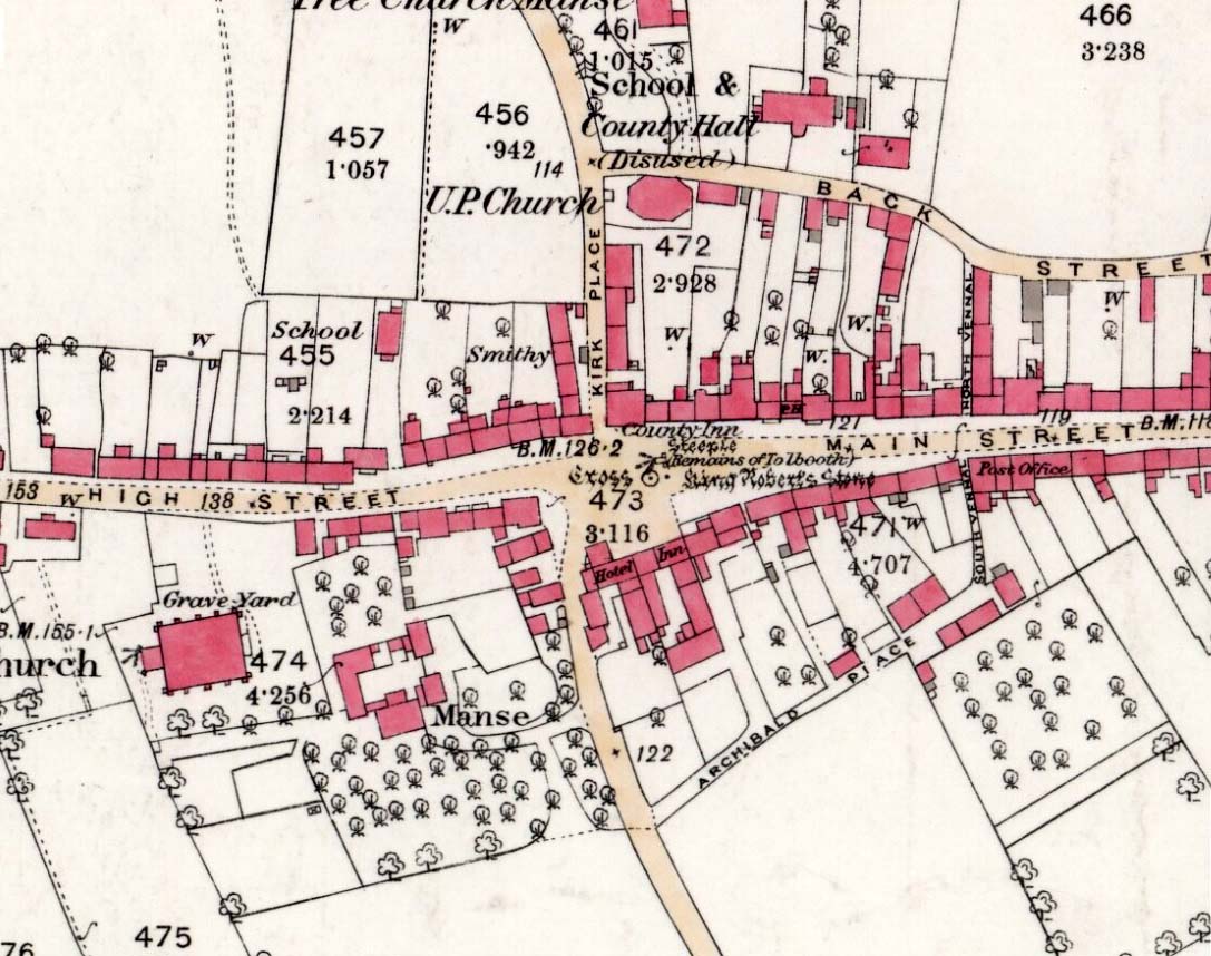
First mentioned in Latin manuscripts from 1274 CE, the best description of this long lost monument, curiously, appears to be in Gover’s Place Names tome.  In a slightly edited format he told us the following:

“There was a stone cross “without the bar of the New Temple” traditionally supposed to have been erected by William Rufus “in devotion to the Holy Cross and for the health of the souls of himself and his mother, Queen Maud… It was in the Strand, possibly on the site of the present church of St. Mary.  It is referred to as crucem lap’ in 1274; la Crois de Piere in 1293; …Stonecrouch in 1337; crucem fractum in 1342…”

In subsequent notes Gover et al (1942) tell of a man they found in historical records to be Thomas le Barber, “described alternatively  as being Thomas le Barber atte Stonecourche” in the Calendar of Rolls records of 1337, and again in the 1339 accounts.

Of the cross itself, information is minimal and scattered.  It was destroyed several centuries ago but is mentioned in a number of old books on the history of the city.  The historian Thomas Allen (1829), for example, told that

“opposite to Chester Inn stood an ancient cross.  On this cross in the year 1294, the judges sat to administer justice, without the City.”

It was also a site where legal pleas for the county of Middlesex were to be held, at “the Stone Cross of lad Straund” as it was then known.  Due to the early administrative function delivered from this cross, it strongly implies the place to have been a moot site prior to the erection of the cross, probably dating from the period in which tribal elders met here.

A Mr Newton tells in his London in the Olden Time that the top of the cross was damaged and knocked off by the crazy christians around the time of the Reformation and that for many years stood headless.  When Vallance (1920) came to describe it, he told merely that,

“the Strand Cross, near Covent Garden.  This cross was hexagonal on plan, and comprised four stages.  It was standing in 1547, but was ultimately removed, its site being occupied by the Maypole, which was spoken of in 1700 as new.”

The Strand Cross would have been on the ancient ley (not one of those ‘energy lines’ invented by New Age fantasists) described first of all by Alfred Watkins (1925)—running from St. Martins-in-the-Field to St. Dunstan’s in Fleet Street—but he seems to have been unaware that the monolith ever existed.  The alignment was subsequently described in more detail in Devereux & Thomson’s (1979) work on the same subject, but its existence seems to have evaded them too!  Chris Street (2010) did include it in his much more detailed walk down the same ley.   A maypole was also known to exist close to the site of the cross; with one account showing that the two monuments existed at the same time in 1543.

As the site seemed to have been an early moot spot, the Strand Cross may have been an omphalos in early popular culture (before the christians of course), or at the very least, a site of popular animistic tradition.

References:

  1. Allen, Thomas, The History and Antiquities of London – volume 4, Cowie & Strange: London 1829.
  2. Anon., Rotuli Hundredorum – 2 volumes, G. Eyre and A. Strahan: London 1812.
  3. Aungier, George James, Croniques de London, Camden Society: London 1854.
  4. Devereux, Paul & Thomson, Ian, The Ley Hunter’s Companion, Thames & Hudson: London 1979.
  5. Gover, J.E.B., Mawer, Allen & Stenton, F.M., The Place-Names of Middlesex, Cambridge University Press 1942.
  6. Newton, William, London in the Olden Time, Bell & Daldy: London 1855.
  7. Stevenson, W.H. (ed.), Calendar of the Close Rolls Preserved in the Public Record Office, HMSO: London 1900.
  8. Street, Christopher E., London’s Ley Lines, Earthstars: London 2010.
  9. Vallance, Aymer, Old Crosses and Lychgates, Batsford: London 1920.
  10. Watkins, Alfred, The Old Straight Track, Methuen: London 1925.

© Paul Bennett, The Northern Antiquarian
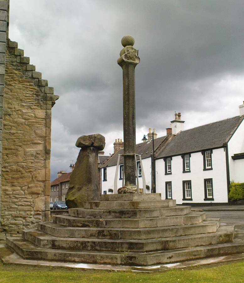

Cow Cross, Finsbury, London, Middlesex

Cross (destroyed):  OS Grid Reference – TQ 3180 8181

Archaeology & History

Site of Cow Cross on 1896 map

Site of Cow Cross on 1896 map

Not far from the long lost Fag Well could once be seen this old stone monument.  Although not illustrated on the first Ordnance Survey maps of the inner city, it is highlighted on the 1896 edition (as shown here), just where Cow Cross Street meets Charterhouse Street—right by the boundary line—and is marked as ‘Site of Cow Cross’.

The cross gained its named from the cattle market that was held here from very early times, on the boundary of the lands of the Knights Hospitallers in the 12th century.  Cattle itself–both horses and cows—were actually slaughtered at the market by the cross: a practice that has thankfully stopped (in public at least).  Despite the place-name being referenced in many early accounts, actual descriptions of the cross are few and far between due to it being destroyed at quite an early date.  When John Stow came to write his history of London in 1603, he told that it was no longer standing.  Whether the cross replaced an earlier standing stone, we simply do not know…

References:

  1. Gover, J.E.B., Mawer, Allen & Stenton, F.M., The Place-Names of Middlesex, Cambridge University Press 1942.
  2. Temple, Phillip (ed.), Survey of London – volume 46, LCC: London 2008.
  3. Vallance, Aymer, Old Crosses and Lychgates, Batsford: London 1920.

© Paul Bennett, The Northern Antiquarian
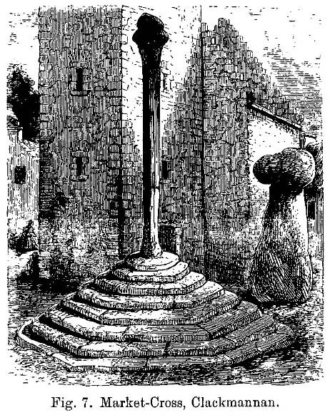

Broken Cross, Westminster, London, Middlesex

Cross (destroyed):  OS Grid Reference – TQ 322 812

Archaeology & History

In truly that most unholy of places in England—Westminster, London—there was, in bygone times, a slightly more sacred site which, earlier still, might have been where a standing stone stood…. Might….  But such days are long gone down there.  A gathering place of local people in very early times, the Broken Cross was, according to Vallance (1920),

“erected by the Earl of Gloucester in the reign of Henry III (1216-1272), but it did not stand very long.  Its site is said to have been ‘the place of the meeting of the Folkmote…near St. Martin’s-le-Grand, about midway between the Northgate of the precinct (of St. Paul’s) and the church of St. Vedast.’  On 5th September 1379, agreements were drawn up for letting the stations about the Broken Cross to five divers persons.  The cross was bodily taken down in 1390.”

Yet its name was maintained in street-names for many years later, simply as ‘Broken Cross’.  Its position would have been very close to Cheapside.

George Gomme (1880) pointed out that such early folk moots were the development of tribal gatherings grafted from megalithic meetings onto early christian assemblies, pointing out how such assemblies for laws and councils were made at nearby St. Paul’s as early as 973 AD.

References:

  1. Gomme, George Laurence, Primitive Folk-Moots, Sampson Low: London 1880.
  2. Gover, J.E.B., Mawer, Allen & Stenton, F.M., The Place-Names of Middlesex, Cambridge University Press 1942.
  3. Vallance, Aymer, Old Crosses and Lychgates, Batsford: London 1920.

© Paul Bennett, The Northern Antiquarian
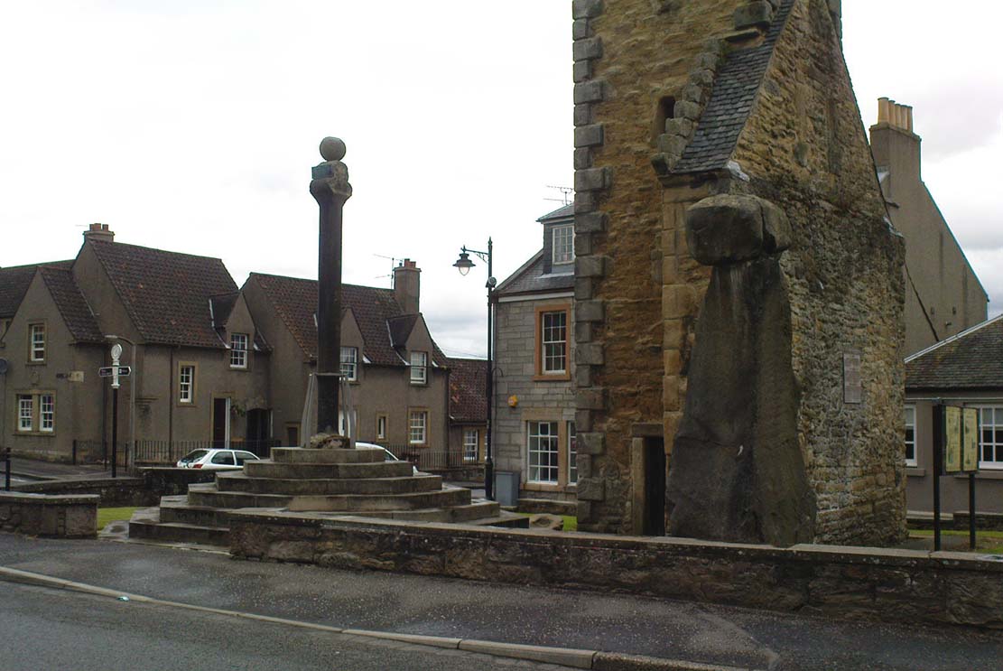

Old Lane Carving, Cowling, North Yorkshire

Cup-and-Ring Stone:  OS Grid Reference – SD 97300 42625

Getting Here

Old Lane Cup-and-Ring, Cowling

Old Lane Cup-and-Ring

This Stone is situated on Old Lane, Cowling, North Yorkshire. To get here coming from Crosshills, you come straight through the village and past the shops.  About 250 yards after the shops you will come to a sharp left hand bend, and once you have gone round this corner you will see a sign pointing to Oakworth (Old Lane).  You need to turn left here (up by the cemetery) and continue for about half a mile up that lane until you come to a sharp left-hand bend. Once you have gone round that left-hand bend you will see a driveway on the right, the stone is situated opposite, in the gateway.  Hope you can find it and enjoy it like I do every time I pass it.

Archaeology & History

...and from another angle

…and from another angle

I’ve driven past this stone many times, almost every day and never previously noticed any markings.  Then, one particular day, the weather was a bit miserable but the lighting was just right to illuminate this little gem.  Was this lump of rock a standing stone, or have modern day folk took advantage and moved it here to be used as a gatepost? I don’t think we ever will know.

(Editor’s Note – When Chris first informed us of this carving, I wondered whether or not it had anything to do with a cup-and-ring found on a gatepost in the 1950s or ’60s by Stuart Feather or Sidney Jackson, but this was not the case.  This petroglyph therefore, is yet another one that our users have discovered and it has to be classified as a new find. Keep up the good work sir!  PB)

© Chris Swales, The Northern Antiquarian
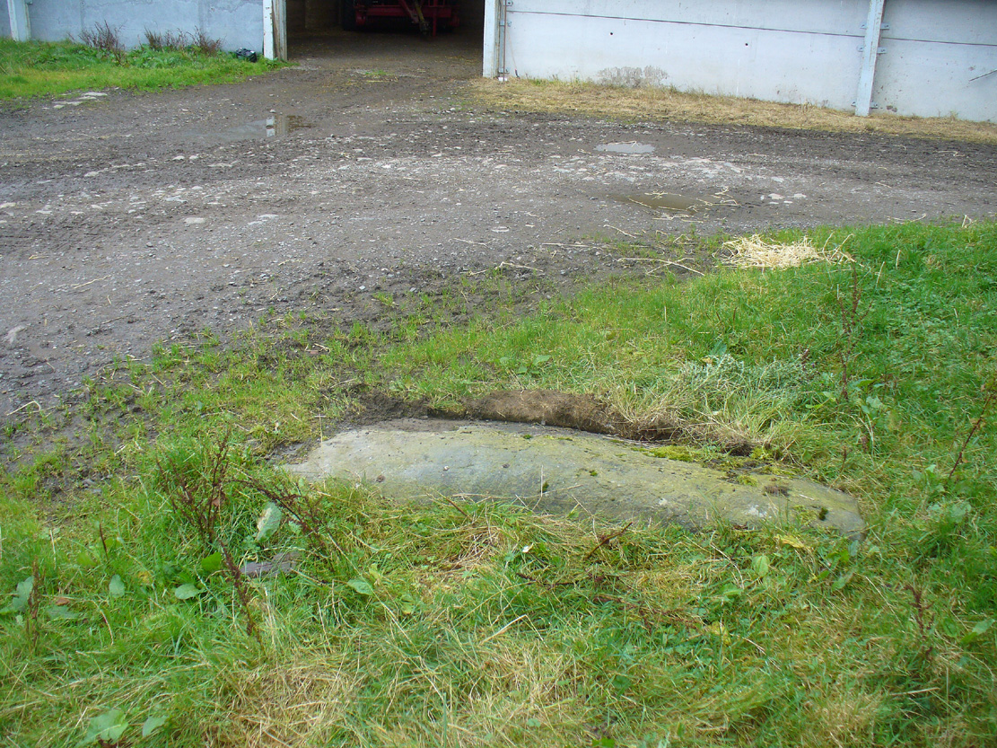

Robin Hood & Little John, Castor, Cambridgeshire

‘Standing Stones’:  OS Grid Reference — TL 1395 9839

Also Known as:

  1. St. Edmund’s Stones

Archaeology & History

1885 OS-map of the site

1885 OS-map of the site

A curious and intriguing site with as many questions about its nature as there is its folklore.  Moved around by the conniving fuckwit politicians from Huntingdonshire, to Northants to Cambridge nowadays, one wonders where those fools will place it next!  Listed by a number of archaeologists as prehistoric standing stones, it seems pretty obvious from photos and the descriptions of many amateur students that—unless some original monoliths have been reworked a few centuries back—the narrative given by local historian W.H.B. Saunders (1888) outlines their more probable origin and history.  That’s not to say that the stones aren’t old—just not that olde…. Mr Saunders reasoned that they were dug and transported from more than 5 miles northwest of their present spot, telling that:

“Nothing can rob the stones of their undoubted antiquity.  The Barnack quarries have been exhausted for the last 600 years at least.  It is evident therefore, that the stones were placed in their present position at a time when the Barnack quarries were being worked.  That would be in the days of Robin Hood, and also when the Abbey of St. Edmund’s Bury, built of Barnack stone, was being erected.”

His words make sense when you look at the stature of the monoliths in question.  They’re cut and squared to the edges, with Robin Hood being the taller of the two stones, about 30 feet southwest of the Little John stone.  They have been written about quite extensively by historians down the centuries, from William Camden onwards.  One early account of the stones was written by Symon Gunton (1686) who told:

“I find in the charter of King Edward the confessor…that the abbot of Ramsey should give to the abbot and convent of Peterburgh 4000 eeles in the time of Lent, and in consideration thereof the abbot of Peterburgh should give to the abbot of Ramsey as much freestone from his pitts in Bernack, and as much ragstone from his pitts in Peterburgh as he should need.

“Nor did the abbot of Peterburgh from these pits furnish only that but other abbies also, as that of St. Edmunds-Bury: in memory whereof there are two long stones yet standing upon a balk in Castor-field, near unto Gunwade ferry; which erroneous tradition hath given out to be draughts of arrows from Alwalton church-yard thither; the one of Robin Hood, and the other of Little John; but the truth is, they were set up for witnesses, that the carriages of stone from Bernack to Gunwade-ferry, to be conveyed to S. Edmunds-Bury, might pass that way without paying toll; and in some old terriars they are called St. Edmund’s stones.  These stones are nicked in their tops after the manner of arrows, probably enough in memory of S. Edmund, who was shot to death with arrows by the Danes.  The balk they stand upon is still call’d St Edmund’s Balk.  They are supposed to be the petrify’d arrows of those two famous archers.”

Thom's sketch showing his midwinter alignment

Thom’s sketch showing his midwinter alignment

These traditions have subsequently been copied by all local historians.  So it is something of a curiosity to find our archaeologists—from Clarke (1960) and F.M. Pryor (1972) to Aubrey Burl (1993)—to cite these as prehistoric monoliths.  My suspicions as to their reasons relates to the folklore of the stones which are echoed at many truly prehistoric places like the Devil’s Arrows, etc.  The nature of the tale is an aboriginal creation myth, relating to the formation of sites as understood in animistic mythic structures.  But this archaeological misunderstanding brought the more scientific mathematical mind of Alexander Thom (1990:1) here in the 1980s where coincidence showed a common astronomical alignment.  Thom wrote:

“Clearly visible from the site, at an azimuth of 229°.22 is the lowest point of a low saddle on the horizon.  The col, Fig.1 (above), subtends an arc of about 0°.67 of azimuth, observed minimum altitude 0°.21.  For an estimated temperature of 44°F, correction for refraction at sunset is about 0°.54, and for solar and semi-diameter and parallax of respectively 0°.27 and 0°.002, the ‘observed’ declination is found to be -23°.92, which indicates a date of about 1860 BC.

“No presently obvious horizon marker was evident upon inspection of the open fields forming the horizon, but this does not mean that a foresight was never erected.  Without the evidence of a foresight it cannot be claimed that the two stones were placed for accurate calendrical reasons, but undoubtedly they indicate by themselves the winter solstice.”

The folklore may indicate the possibility that these two medieval standing stones replaced earlier ones, but no remains of such relics exist today.

References:

  1. Burl, Aubrey, From Carnac to Callanish, Yale University Press 1993.
  2. Clarke, R. Rainbird, East Anglia: Ancient Peoples and Places, Thames & Hudson: London 1960.
  3. Gover, J.E.B., Mawer, A. & Stenton, F.M., The Place-Names of Northamptonshire, Cambridge University Press 1975.
  4. Grinsell, Leslie V., Folklore of Prehistoric Sites in Britain, David & Charles: London 1976.
  5. Gunton, Symon, The History of the Church of Peterburgh, Richard Chiswell: London 1686.
  6. Mee, Arthur, Bedfordshire and Huntingdonshire, Hodder & Stoughton: London 1973.
  7. Morton, John, The Natural History of Northampton-shire; with Some Account of the Antiquities – 2 volumes, R. Knaplock: London 1712.
  8. Pryor, F.M., Prehistoric Man in the Nene Valley, Nene Valley Research: Peterborough 1972.
  9. Saunders, W.H.B., Legends and Traditions of Huntingdonshire, Simpkin Marshall: London 1888.
  10. Serjeantson, R.M. (ed.), The Victoria County History of Northamptonshire – volume 2, London 1906.
  11. Thom, Alexander, Thom, A.S. & Burl, Aubrey, Stone Rows and Standing Stones – volume 1, BAR: Oxford 1990.
  12. Thom, A.S., “A Solstitial Site near Peterborough,” in Journal of the History of Astronomy, 11, 1980.

© Paul Bennett, The Northern Antiquarian