St. Palladius’ Footprint, Camusvrachan, Glen Lyon, Perthshire

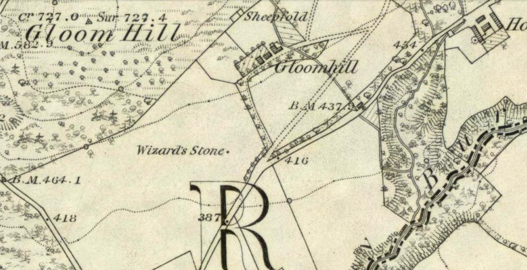
Legendary Stone:  OS Grid Reference – NN 62626 47685

Also Known as:

  1. Craig Dianaidh
  2. Rock of Safety

Getting Here

The rocky cairn of St. Palladius

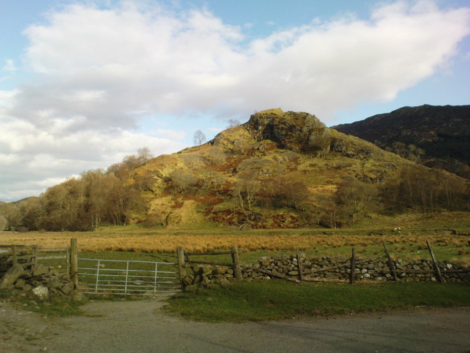
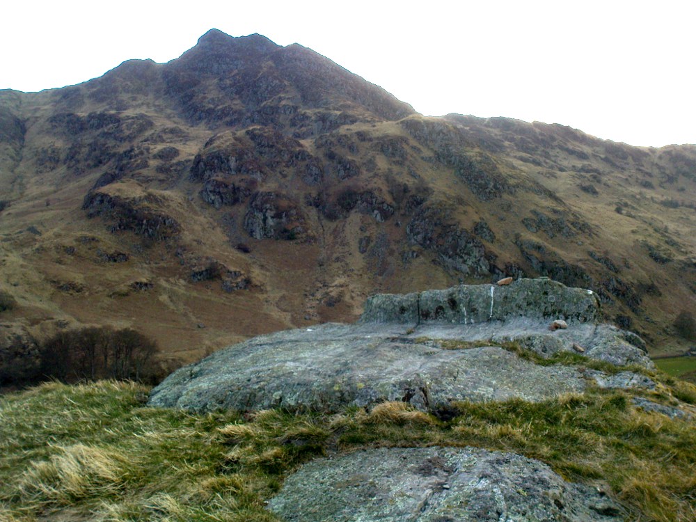
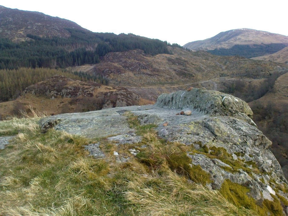
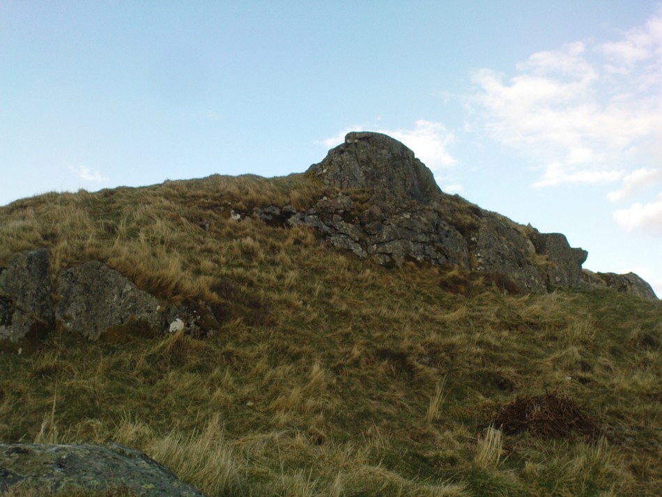
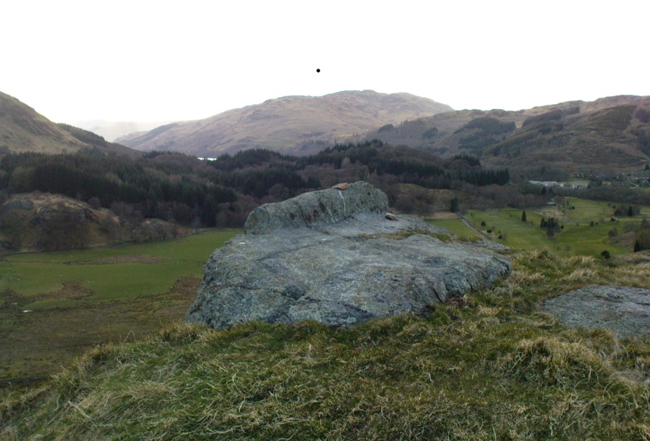
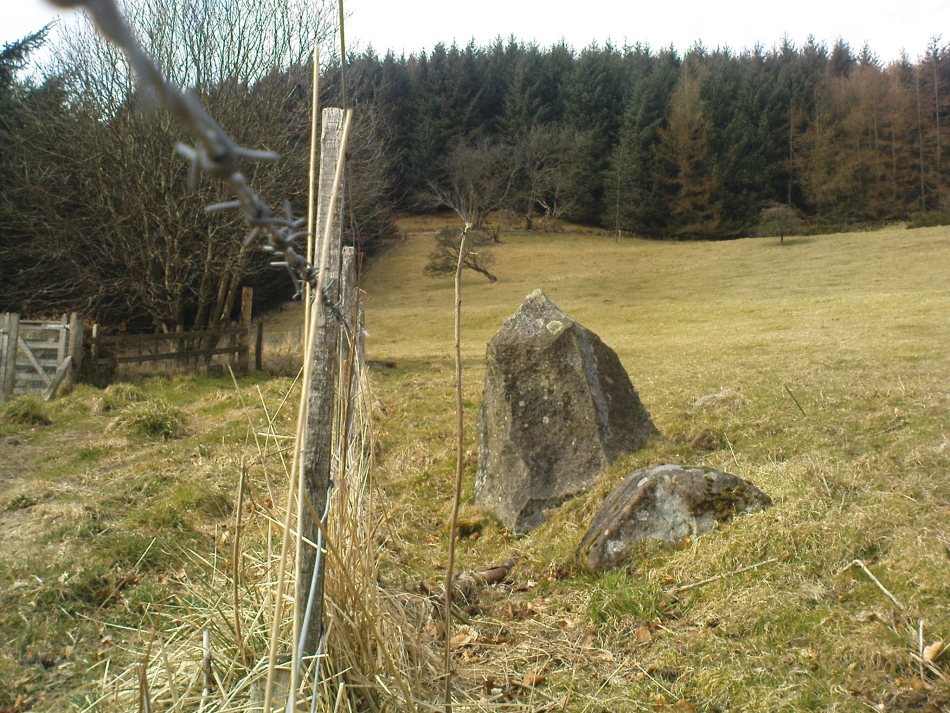
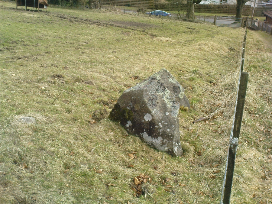
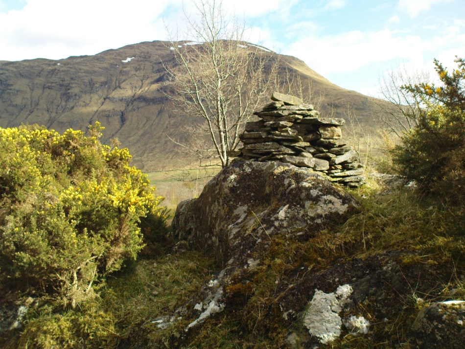
From Fortingall, get to the standing stone of Adamnan’s Cross a few miles down the stunning Glen Lyon.  Barely 100 yards before you reach the stone, notice the overgrown gorse-covered rocky rise across the road, just past Craigianie Farm.  As you climb to the top of this small rocky rise, you’ll see a cairn of stones on its top.  Just below it, into the solid rock, you’ll see a footprint-shaped hollow etched into the stone.  If it seems hidden, just keep looking – you’ll find it…

Archaeology & History

St. Palladius Stone, Glen Lyon

When Ratcliffe Barnatt (1944) visited Glen Lyon in the 1940s, this legendary rock was one of his stopping points.  “When we have passed by Ruskich and Slatich,” he wrote, “we come to that sacred spot, Craig Dianaidh, the Rock of Safety, where, until about 1480, solemn and judicial meetings were held.”  The old rock was known through recent ages, “as a preaching hill, a motehill and a justiciary court,” said Hilary Wheater (1981), and upon its top is the curious ‘footprint’ which Nature’s blood would fill on all but the hottest of summers.  It is this geological feature that gave the stone is name, long ago.

Of known historical events here, Wheater further told:

“It was on this rock…that the Baron Courts of Glenlyon were held.  Law and order was kept by regular courts held by the Chief or Landowner. The Baron-Bailiary of each area was appointed by Royal Charter.  Fifteen men were chosen as a jury and the laird or his baile presided.  To this court were brought all the problems and grievances of the people.  Here the miller accused several men of refusing to take part in the compulsory ‘hamganging’ of a new millstone; here a man was fined for brewing ale without a license; here a neighbour was accused of putting the ‘evil eye’ on the cow of the croft next door so it produced no milk; and here a man was prosecuted for ‘taking of ane sore horse of his to Rannoch in the summer of 1629 and putting on him ane great burder of timber, and letting him go through the wood where he stuck between two trees all night and the timber on his back.’  However, he was acquitted when he was able to prove that the horse was fit enough after this for another man to be able to take it to Edinburgh soon after.”

St Palladius Footprint

As well as being a moot site, it is more than probable that this footprint, like the one near the top of Dunadd in Argyll—and others scattering the Highlands and beyond—was an initiation stone, perhaps for local tribal elders or ancient kings.  Janet Bord (2004) writes about them as places of ritual inauguration in her survey of such places.

Folklore

The legendary site, looking south

This legendary rock would probably have had earlier mythic association than the one ascribing it to St. Palladius—but as yet I have found no written lore telling the nature of such a spirit, so would only perhaps discern the original genius loci by lengthy encounters with the rock in question, through mist and storm and wintry months, alone.  It is known in local folklore that Palladius was in fact an urisk: a solitary spirit of steep streams that few humans encounter due to their lonely habits amidst hidden abodes in dark and ancient gorges.  Such urisks dwelt in numbers amongst many of the steep falls in this landscape — and still do, if the words of old locals are to be believed. Here,

“St Palladius was a goblin saint, an urisk that dwelt in a mountain burn and was sanctified by the people.”

…and some rocks by the stream up the mountain immediately above this “footprint” was one of the places the urisk was known to dwell.

…to be continued…

References:

  1. Barnatt, T. Ratcliffe, The Road to Rannoch and the Summer Isles, John Grant: Edinburgh 1944.
  2. Bord, Janet, Footprints in Stone, Heart of Albion Press 2004.
  3. Fraser, Duncan, Highland Perthshire, Standard Press: Montrose 1969.
  4. Wheater, Hilary, Aberfeldy to Glenlyon, Appin Publications: Aberfeldy 1981.

© Paul Bennett, The Northern Antiquarian


Rocking Stone, Warley Moor, Halifax, West Yorkshire

Legendary Rock:  OS Grid Reference – SE 03399 30199

Also Known as:

  1. Sleepy Lowe

Getting Here

The old rocking stone, on the right
Looking east at the stone

From Denholme, take the A6033 Hebden Bridge road up, but shortly past the great bend turn off right up the steep road towards the moorland windmills until you reach the flat dirt-tracked road, past the reservoir below.  A coupla hundred yards past the track to the reservoir, take the footpath south into the tribbly grasslands and moor.  A few hundred yards down you’ll note the large rock outcrop ahead of you. The rocking stone is there!

Archaeology & History

The old rocking stone

A small moorland arena with a neglected history. Many lost memories surround this site, with barely legible ruins from medieval and Victorian periods prevailing against scanty snippets of neolithic and Bronze Age rumours and remains.  The rocking stone here—which moves slightly with a bit of effort—sits amidst a gathering of other large rocks, some of which have debatable cup-markings on their smoothly eroded surfaces.

Our rocking stone, resting 1350 feet (411m) above seal level, was first mentioned in John Watson’s (1775) magnum opus, who gave a quite lengthy description of the site, telling us that,

“On a common called Saltonstall-moor, is what the country people call the Rocking-stone… The height of this on the west side (which is the highest) is, as I remember, about three yards and a half.  It is a large piece of rock, one end of which rests on several stones, between two of which is a pebble of a different grit, seemingly put there for a support, and so placed that it could not possibly be taken out without breaking, or removing the rocks, so that in all probability they have been laid together by art.  It ought to be observed, that the stone in question, from the form and position of it, could never be a rocking stone, though it is always distinguished by that name.  The true rocking stone appeared to me to lie a small distance from it, thrown off its centre.  The other part of this stone is laid upon a kind of pedestal, broad at the bottom, but narrow in the middle; and round this pedestal is a passage which, from every appearance, seems to have been formed by art, but for what purpose is the question.”

Dubious cupmarks
Dubious cups
Watson's 1775 drawing of the Rocking Stone
Watson’s 1775 drawing of the Rocking Stone

Watson then goes onto remark about other rocking stones in Cornwall and further afield with attendant “druid basins” on them, noting that there were also “rock basins” found here on Warley Moor, a few of which had been “worked into this rocking stone,” which he thought, “helps to prove that the Druids used it.”  And although these rock basins are large and numerous over several of the rocks on this plateau, like the cup-markings that also scatter the surfaces, they would seem to be Nature’s handiwork.

Turner's 1913 drawing
Turner’s 1913 drawing

Some 60 years later when the literary thief John Crabtree (1836) plagiarized Watson’s words verbatim into his much lesser tome, it seemed obvious he’d never ventured to explore the site.  But in the much more valuable historical expansion written by John Leyland around 1867, he at least visited the site and found the old stone, “still resting on its shady pedestal.” Later still, when Whiteley Turner (1913) ventured this way on one of his moorland bimbles, he added nothing more to the mythic history of these west-facing megaliths…

Folklore

Still reputed locally to have been a site used by the druids; a local newspaper account in the 1970s also told how local people thought this place to be “haunted by goblins.”

References:

  1. Bennett, Paul, The Old Stones of Elmet, Capall Bann: Milverton 2001.
  2. Crabtree, John, Concise History of the Parish and Vicarage of Halifax, Hartley & Walker: Halifax 1836.
  3. Leyland, F.A., The History and Antiquities of the Parish of Halifax, by the Reverend John Watson, M.A., R.Leyland: Halifax n.d. (c.1867).
  4. Smith, A.H., The Place-Names of the West Riding of Yorkshire – volume 3, Cambridge University Press 1961.
  5. Turner, Whiteley, A Spring-Time Saunter round and about Bronte Lane, Halifax Courier 1913.
  6. Watson, John, The History and Antiquities of the Parish of Halifax, T. Lowndes: London 1775.

© Paul BennettThe Northern Antiquarian


St. Fillan’s Chair, Dundurn, Comrie, Perthshire

Legendary Rock:  OS Grid Reference – NN 7081 2325

Also Known as:

  1. Canmore ID 24876
  2. Dundurn
  3. Fillan’s Chair
  4. St. Fillan’s Bed

Getting Here

Dundurn, near St. Fillans

Not hard to find. Between the small towns of Comrie and St. Fillans along the A85 road, keep your eyes peeled for the small but rocky crags that rise in front of the background of dramatic mountains not far from the roadside to the south. It looks truly majestic even on a dull day. Just as you reach the eastern edge of St. Fillans village, take the small road over the river-bridge and go to the golf club. Walk past the golf club itself, keeping along the track that leads you to Dundurn hill.  It’s easy enough. Then climb to the very top of the hill where you’ll find this curious, large, flat bed-like rock right in front of you!

Archaeology & History

The rocky bed or 'chair' of St Fillan
St Fillan’s rocky bed or ‘chair’

The archaeological data for St. Fillan’s Chair relates more to the folklore practices of the people upon Dundurn hill than anything else and ostensibly little can be said by such students. The place is more satisfying for geologists than archaeologists, who would adore the rocky fluctuations and geophysical propensities with greater verve than any archaeologist could muster! For this rocky bed-shaped feature is a fascinating structure whose only potential interest to archaeologists are what may be a couple of reduced cup-marks on the top of the stone (and even then, such potential rock art is more the province of religious historians and anthropologists than archaeologists).

Small quartz offerings left on St Fillan's Chair at Beltane
Small quartz offerings left on St Fillan’s Chair at Beltane
The view of the Chair from below
View of the Chair from below

But this ‘bed’ or ‘chair’, as it was locally known, was – and it seems, still is – important in the social history of the area, as its folklore clearly tells.  The ‘chair’ plays an important part in the holistic role of Dundurn as a hill, a fort, a healing centre, an inauguration site, and very probably an omphalos: a sacred centre whereupon the ordination of shamans, kings and the cosmos as a whole was brought to bear here… (these features will be explored in greater depth when I write a singular profile of Dundurn as a ‘fort’).

Folklore

Looking west over St Fillan's Chair
Looking west over St Fillan’s Chair

The character of St. Fillan was described by James Cockburn (1954) as “an Irish Pict” and the “son of a King – his father being Angus mac Nadfraich who died in battle in 490 AD.”  Quite an important dood in his day! The relationship this early christian figure had with this Chair was in its supposedly curative properties.  Yeah…you read it right: curative properties!  As with countless rocks all over the world, some of Nature’s outcrop boulders were imbued with a spirit of their own and, when conditions and/or the cycle of the spirit ‘awoke’, healing attributes could be gained from the place. And such was the case at St. Fillan’s Chair, especially on Beltane morning (May 1).  And some element of this traditional pilgrimage is still done; for when the author Marion Woolley and I visited the site on Mayday 2013, it was obvious that some people had been up earlier that Beltane morning and left some offerings of quartz stones on the top end of the bed.

The earliest written reference of this medicinal virtue was told in the Old Statistical Account of Perthshire (1791):

The rock on the summit of the hill, formed, of itself, a chair for the saint, which still remains. Those who complain of rheumatism in the back, must ascend the hill, sit in this chair, then lie down on their back, and be pulled by the legs to the bottom of the hill. This operation is still performed, and reckoned very efficacious.

More than a hundred years later, the sites was still being used and was described in similar vein in MacKinlay’s (1893) excellent study:

“On the top of green Dunfillan, in the parish of Comrie, is a rocky seat known in the district as Fillan’s Chair. Here, according to tradition, the saint sat and gave his blessing to the country around. Towards the end of last century, and doubtless even later, this chair was associated with a superstitious remedy for rheumatism in the back. The person to be cured sat in the chair, and then, lying on his back, was dragged down the hill by the legs. The influence of the saint lingering about the spot was believed to ensure recovery.”

The origins of this dramatic rite were probably pre-christian in nature and we should have little doubt that St. Fillan replaced the figure of a shaman or local medicine woman of some sort. The ritual “dragging down the hill” may be some faint remnant of initiation rites…

References:

  1. Cockburn, James H., The Celtic Church in Dunblane, Friends of Dunblane Cathedral 1954.
  2. Eliade, Mircea, Rites and Symbols of Initiation, Spring: Woodstock 1995.
  3. Finlayson, Andrew, The Stones of Strathearn, One Tree Island: Comrie 2010.
  4. Hunter, John, Chronicles of Strathearn, David Philips: Crieff 1896.
  5. MacKinlay, James M., Folklore of Scottish Lochs and Springs, William Hodge: Glasgow 1893.
  6. Shearer, John, Antiquities of Strathearn, David Philips: Crieff, 1883.
  7. Skene, William F., Celtic Scotland (3 volumes), Edmonston & Douglas: Edinburgh 1876-1880.
  8. Toulson, Shirley, Celtic Journeys in Scotland and the North of England, Fount: London 1995.

Links:

  1. Nataraja’s Foot: The Curious Incident of Dundurn

© Pual BennettThe Northern Antiquarian


Wizard’s Stone, Dollar, Clackmannanshire

Legendary Stone:  OS Grid Reference – NS 9656 9904

Getting Here

Wizard's Stone on the 1866 OS map
Wizard’s Stone on 1866 OS map

From Dollar town centre, take the road up to the gorgeous Castle Campbell, but instead of turning up towards the castle, keep on the road, uphill, for another quarter-mile.  As the road begins to level out, a small field and driveway on your left heads up to Kiloran house. Stop here, and note the stone in the field, right by the fence alongside the footpath which runs uphill by the field-side up into the woods.  That’s the Wizard’s Stone.

Archaeology & History

The small Wizard's Stone, Dollar
The Wizard’s Stone, Dollar

This site doesn’t seem to be the remains of an authentic prehistoric standing stone (unlike the one along the same ridge a mile east at Castleton), but is more of a memorial rock relating to some witch traisl that occurred here several centuries ago.  By virtue of this, I felt it needed to be included on TNA.

Not listed by Canmore, the stone is found in an area with a rich cluster of heathen place-names—most intriguing of which is the ‘Lochy Launds’ woodland, right above where this Wizard’s Stone now rests.  The stone has been broken into smaller pieces in recent years—as the photos here show—and the small standing stone which remains is barely 3 feet tall at the edge of the field.

The local writer and historian Rennie McOwan (1989) told that it marked the spot where a warlock was burned in the 16th century.  Years later, a local land-owner called John Moir erected the stone here as a memorial to the event.  This was subsequently echoed by fellow local history writer Bruce Baillie (1998), when he wrote:

“A large whinstone in a field in a field is known as ‘The Wizard’s Stone’, having been set there by one of the Moirs to take the place of a rotting stake said to mark the spot where the last Dollar witch (and, naturally, the last Scots one), named Forrester, was burnt, though this is probably folk confusion with the vicar of Dollar, Thomas Forrest.”

Angus Watson (1995) could find no early references of this stone, other than it being mentioned in the 1860 Ordnance Survey Name Book.  Further information on the site would be most welcome.

Folklore

Wizard's Stone, looking down to the road
Wizard’s Stone, looking down to the road

Reputedly one of the haunts and gathering places of the witches of the area, this spot was also known as Lochyfaulds, which the place-name giant W.J. Watson (1926) tell us means the ‘place of the Black Goddess,’ like the “Valley of the Black Goddess” of Glen Lochay, 40 miles to the northwest of here near Killin.  Modern folklore ascribed the wizard here to have been Merlin—as highlighted in the adjacent place-name of “Merlin Park.”

References:

  1. Baillie, Bruce, History of Dollar, DMT: Dollar 1998.
  2. McOwan, Rennie, The Green Hills, CDL: Alloa 1989.
  3. Watson, Angus, The Ochils: Placenames, History, Tradition, PKDL: Perth 1995.
  4. Watson, W.J., The History of the Celtic Place-names of Scotland, Edinburgh 1926.

© Paul Bennett, The Northern Antiquarian


Mount Cross, Cornholme, Todmorden, West Yorkshire

Cross:  OS Grid Reference – SD 91460 27280

Also Known as:

  1. Idol Cross

Getting Here

Mount Cross, near Cornholme

The site can be approached by going up the almost hidden long steep winding lane off the A646 in Cornholme; but if you don’t know the area it’s probably best approached from the well known Bride Stones, above Todmorden.  From here, go west along the road running 100 yards or so above the Bride Stones, past the old pub, past Hawk Stones farm, and turning left downhill about a quarter-mile on.  A coupla 100 yards down, there’s a track to your left.  As you start walking along you’ll see a standing stone on the grassy rise in front of you on your left.  That’s it!

Archaeology & History

Mount Cross on 1848 map

Said by local writer Geoff Boswell (1986) to be “the oldest religious memorial in Todmorden,” this old stone, more than 4-feet tall, is still in good condition and can be found beside the Old Causeway: a prehistoric trackway running between Lancashire and Yorkshire which is said by archaeologists to have been an old, but established trade route.  It was suggested by some to have been erected as a cross as early as the 7th century.  Generally known as the Mount Cross, it is also known as the Idol Cross, as legend reputes it to have been the site of pagan practices; hence its repute as being haunted. Its alleged heathen history is probably true (history records describe an old “rude stone” that was once found beneath the legendary Bride Stones nearby, which was moved many centuries back).

The Calderdale Council website tells that,

“Towards the bottom of the shaft on the NE side are what appears to be extremely faint traces of vine-scroll decoration which would suggest a fairly early date for the cross, possibly tenth or eleventh century. The irregularity of the carving overall tends to indicate that the cross is no earlier.”

Folklore

Said to have stood upon or beside a small tumulus until the 20th century. Jessica Lofthouse (1976) reported that a local farmer said of this stone. “Queer things happened here long since. They worshipped idols here.” Locally attributed to be haunted, the old stone was said to have a history of “uncanny happenings.”

References:

  1. Bennett, P., The Old Stone Crosses of West Yorkshire, unpublished MS, 1995.
  2. Boswell, Geoff, On the Tops around Todmorden, Delta G: Todmorden 1986.
  3. Lofthouse, Jessica, North Country Folklore, Hale: London 1976.

© Paul Bennett, The Northern Antiquarian


Birley Spa, Birley, Sheffield, South Yorkshire

Healing Well:  OS Grid Reference SK 4090 8361

Getting Here

Birley Spa building
Birley Spa building

Birley Spa is now open for special events and the first Saturday in the summer months; however it is best to check that the site is open as it is open by volunteers. It can be viewed from the outside when closed and can be reached off the A1635 take Occupation Lane then Birley Spa Lane on the left and once passing a school on the left there is a lane going into the woods on the left by a side, down here is the Spa. There is some parking.

Archaeology and history 

The spa bath
The spa bath

Our first record is when it was established as seven baths by Earl Manners. A work by Platt (undated but around 1930s) contains much of the information and it is from this work I have taken most of the notes. The earliest establishment of the spa is thought to be in the early 1700s being built by a Quaker named Sutcliffe. The spa then consisted of a square stone building with a cold bath within with a bolt fixed on the inner side to ensure privacy. This structure appeared to exist until 1793 when the bath was ruined and filled with stones. In 1843, the Earl Manvers who owned the Manor developed this spa for a larger and more upmarket clientele.  An administrative committee was appointed and even a Bath Charity was started so that poor people could benefit and take the waters. Unfortunately the baths did not make profit and by 1895 only one plunge bath remained; the Hotel apparently ceased to function as such about 1878.  It is believed that Earl Manvers removed the marble from the warm bath for his own use. The site then went into a slow decline. In the 1920s and 30s a children’s pleasure ground was established but the grounds were closed in 1939, due to the prohibition of assemblies of crowds, introduced as a safety factor in case of air raids.  The buildings and grounds were allowed to decay and become very dilapidated. Since the building of the Hackenthorpe Housing Estate in the 1950s Sheffield Corporation have become owners of the property.

The spa stream
The spa stream

Fortunately unlike other sites, the bath house still exists, probably as a consequence of the first floor being used as community centre. The cold bath was derelict and rubbish strewn, but a splendid restoration has been undertaken. The bath house can be found in a small wooded dell in the housing estate. Despite predations by vandals on the house, the interior reveals an impressive oval stone lined cold bath with steps into the water either side. To the other side are a small collection of artifacts and the history of the site. There is also the store room where coal was stored for the warm bath which no longer exists.

Folklore

Very little folklore is recorded other than the belief that the site has an ancient origin, the spring being located along Neolithic trade routes and indeed implements have been found in the vicinity. Some authorities have noted that there was a Roman bath here supported by the proximity to the Rykneid way. There is however no direct archaeological evidence to support this theory and it may have been spread around by the proprietors to support the quality of the water;  and the Leeds chemist West analysed the waters stating that they were beneficial for those suffering from constipation.

References:

  1. Platts, T. L., The History of Birley Spa 
  2. Parish, R. B., (2010) Holy wells and healing springs of Derbyshire.
  3. www.insearchofholywellsandhealingsprings.wordpress.com

Copyright © Ross Parish


St. Catherine’s Well, Westhorpe, Southwell, Nottinghamshire

Holy Well:  OS Grid Reference – SK 684 532

Getting Here

St Catherine's Well, Westhorpe
St Catherine’s Well, Westhorpe

To find Westhorpe, take the lane on the left as one leaves Southwell, and then the next left, Bath Lane. The cottage is the only house on this lane and the well arises on the edge of its private garden.  Ask permission to view.

Archaeology and History

The earliest record of a religious institution here is in 1482, when a chapel was erected dedicated to the saint.  Whether this was built to cater for those who sought the well is unclear, but it seems likely.  Little is recorded of its mediaeval history.  Of its post-Reformation history, Dickinson (1819) notes that a Mr. Burton of Norwood Park built a house and bath at the site in 1720.  He appears to have used the saint as support for its properties as:

“Over the head of the fountain was a plate, on which some Latin verses were inscribed, much to the honour of the tutelary saint, and the reputation of the water.”

Stone slab describing the well
The running waters
The running waters

It is thought that the cottage and barn at the site may be the remains of this venture, although, I was informed by the occupant that the barn had mediaeval features.  When Bob Morrell (1988) visited he was also told that a bath-like structure with steps down was located nearby, but an exact location was unknown, and the current occupiers were similarly unaware of it when I visited.  This was probably a relic of Mr Burton’s exploitation.  This appears to have been a brief period, for as Shilton (1818) notes, it

“…would have retained them to this day, had there been the due accompanyments (sic) for luxurious lounge, intrigue and scandal commodiously attached.”

Modern stone wall above well

St. Catherine’s Well itself is found between Bath Cottage and the barn.  It arises in a brick-lined square structure capped with a broken slab.  This sits on an older structure which has the appearance of calcareous rock; although any petrifying properties are not noted by previous authors.  When first visited the well house was dry; however, a more recent visit in spring showed a considerable flow (despite a dry winter). It flowed from a clay pipe within the well house and leaves through a smaller pipe set into the calcified part and then down to the dumble below. In this dumble appear to be some dressed stone which may have been part of the original structure.  Beside the well on the bank above is a small slate monument which records:

“A chapel dedicated to St. Catherine existed here in medieval times but it is thought to have fallen into disuse at the dissolution. A spring and well with reputed healing properties near the chapel was still patronised in the 1800s by those seeking relief from rheumatism. The present bath cottage was erected on the site of the chapel. D.J Hall Southwell.”

Folklore

Not much but its waters were said to be a cure for rheumatism being particularly cold.

References:

  1. Dickinson, W. (1787), A History of the Antiquities of the Town and Church of Southwell, in the County of Nottingham.  Nottingham.
  2. Morrell, R. W. (1988), Nottinghamshire Holy Wells and Springs.  Nottingham
  3. Parish, R.B. (2010), Holy wells and healing springs of Nottinghamshire.  Nottingham
  4. Rattue, James (1995), The Living Stream: Holy Wells in Historical Context, Boydell: Woodbridge.
  5. Shilton, R. P. (1818), The History of Southwell in the county of Nottinghamshire. Nottingham.

© Ross Parish, The Northern Antiquarian 


Bowling Green Stone, Shipley, West Yorkshire

Cup-Marked Stone:  OS Grid Reference – SE 14505 37525

Also Known as:

  1. Carving no.8 (Boughey & Vickerman)
  2. Shipley Old Hall Carving

Getting Here

Carved stone beside the path

From Shipley town centre open market, take the Kirkgate road up to Saltaire, past the old town hall. On the other side of the road take the little path into the Bowling Club, in the trees (if you hit the church you’ve gone too far).  Once standing in front of the bowling green itself, you need to walk along the left-side path. Two-thirds of the way down, now laid in the ivy-covered area below the old quarry face, you’ll find what you’re looking for.

Archaeology & History

I remember first seeking out this carving when I was still at school and wondering how the hell it got here – and believed it to be a fallen standing stone at the time!  It seems that the stone was cut and readied for use as a gatepost instead, at some time long ago.

Close-up showing cups & lines
In its previous locale

The curious cup-marked stone has travelled about a bit, somehow.  Formerly at the edge of a field in the grounds of Bradford Grammar School 3 miles away (at SE 1523 3583), the fella was then built into the wall of the now-demolished Shipley Old Hall, before reaching its present resting place at the edge of the bowling green.  Consisting of around 16 cup-markings with carved lines seeming to link them here and there, it was first mentioned by the late great Sydney Jackson (1955) in an early edition of the Bradford Archaeology Journal.  The carving was recently included in the Boughey & Vickerman (2003) survey, where they described it as,

“Medium-sized fairly smooth grit rock with coarse line down top, probably natural, evidence of quarrying on edge.  Sixteen or seventeen cups, one with a groove out has a deeper cut within it and twelve of the others are linked in pairs by short grooves.  This has been interpreted as feathering for quarrying, but the grooves are across the line of likely split, rather than along it.”

And for those of you who live nearby: if you check this out, see if you can locate an earthfast boulder near here which I recall having a cluster of distinct cup-marks running on top of the rock along one side. I couldn’t find it when I looked a short while ago, it’s not in the archaeology survey lists, and it remains lost—in the heart of Shipley no less!

References:

  1. Boughey, Keith & Vickerman, E.A., Prehistoric Rock Art of the West Riding, WYAS: Wakefield 2003.
  2. Jackson, Sydney, “Cup-Marked Boulder, Shipley Old Hall,” in Bradford Cartwright Hall Archaeology Group Bulletin, 1:10, 1955.

© Paul Bennett, The Northern Antiquarian


Lady’s Well, Tullibody, Clackmannanshire

Holy Well:  OS Grid Reference – NS 8563 9548

Archaeology & History

Lady Well on 1866 map

My initial thoughts about this holy well, was that it had been destroyed—but thankfully I was wrong.  It had been intruded upon by roadworks along the B9140, with the original water source affected, but it was re-routed and can still be found below the south-side of the main road.  It was highlighted on the 1866 Ordnance Survey map of the area When the Royal Commission (1933) lads visited the site in 1927 they told that,

“It has no features of special interest. It is 4′ in diameter, but is so much filled up with stones and debris that it is now not more than 2′ deep.”

The site was mentioned in Ruth & Frank Morris’ (1982) survey, but with no additional information. I’ve not been able to find out whether the ‘lady’ of this well was a saintly woman of religious importance, or just one of us commoners!  Does anyone know?

References:

  1. Morris, Ruth & Frank, Scottish Healing Wells, Alethea Press: Sandy 1982.
  2. Royal Commission on the Ancient & Historical Monuments, Scotland, Inventory of Monuments and Constructions in the Counties of Fife, Kinross and Clackmannan, HMSO: Edinburgh 1933.

© Paul Bennett, The Northern Antiquarian


Grassmainston Well, Clackmannan, Clackmannanshire

Sacred Well: OS Grid Reference – NS 92478 93403

Getting Here

The spring emerges in the dip, by the fence

From Clackmannan Main Street, go down the Cattle Market and straight across at the junction, downhill.  Keep going on the country lane for half-a-mile watching out for Grassmainston Farm on the left. Go past here and up the next dirt-track for a few hundred yards, watching out for a copse of trees on your left a coupla hundred yards away.  Go to the very top corner of the copse, following the stream to its source. That’s it!

Archaeology & History

In a truly fascinating historical case of witchcraft (there was a lot of it in this area according to court and church records), heard in Clackmannan on 16th July, 1700, a certain spring of water, or well, was described, where acts of healing and sympathetic magick were performed and, it would seem, was quite well known to the people cited in the case. It seems very likely from reading the account, that the well in question had magical repute locally. The well was not named, but thankfully the information in the case has allowed us to identify the place in question.  When I came here a month or two ago, the well was very overgrown (hence the poor photo above), so I’m gonna go back for another look at the place when Winter’s brushed back the vegetation.

The tale surrounding the well was included in Simpkin’s (1914) Folklore Society survey of Fife and Clackmannan a hundred years ago, and is as follows:

“John Scobie, younger, in Clackmannan, was called, who being of age thirty-eight, was sworn and interrogated if he went up with his uncle to a south-running well at Grassmainston. Deponed that he did go up with him, alone, the first night, and as his uncle was casting off his clothes at the well, the deponent saw a black man …coming from Kersemill; and when he came to the head of Robert Stupart’s folds there was a great squealing among the cattle.  Also, when deponent had his uncle down to sprinkle him, he saw a brindled cat come out from among the corn within a little distance from him. He put magic powders upon his uncle when he was naked, which he had received from his said uncle’s wife, Margaret Bruce, who remarked to the deponent that the woman who directed (them), “would get a flee before he came back”; and that, at his return, at Goldney, he heard a terrible noise as of coaches, and that he was dripping of sweat when he came into the house.

“The said Margaret had forbidden them to speak in going or coming, which injunction they observed. When they came to call the deponent to go the second night he refused, till the deceased Robert Reid came and took him, and they both went with him, and saw the black man and the cat, and heard the cattle squeal as aforesaid and, when they were coming back again, there came a great wind upon the trees on the side of the Devon and, when he was crossing the Cartechy Burn his uncle’s foot slipped and he fell in the burn. Thereupon Robert Reid said, “The cure is lost. There is no helping of you now!” And so they spoke from thenceforth until they came home; for Margaret Bruce, the said James Scobie’s wife, told them that if he fell into the water he would not be cured. The witness further added that when they told Margaret that her husband had fallen into the water, she wept. ”

The magickal well in this case would appear to be one identified at the very top of the small copse of trees immediately north of Grassmainston farmhouse, just 3-400 hundred yards away up the slope. It is a “south-running well” as cited in the case and no other water source is immediately apparent. It would be good if any students or antiquarians living near Alloa could check local library records and see if there’s any further information about this site.  A short distance north of here is the curiously-named ‘Serpent Wood’, with its old well, fallen stone and lost legends…

…to be continued…

References:

  1. Simpkins, John Ewart, County Folklore – volume VII: Examples of Printed Folk-Lore Concerning Fife, with some Notes on Clackmannan and Kinross-Shires, Folk-Lore Society: London 1914.

© Paul Bennett, The Northern Antiquarian