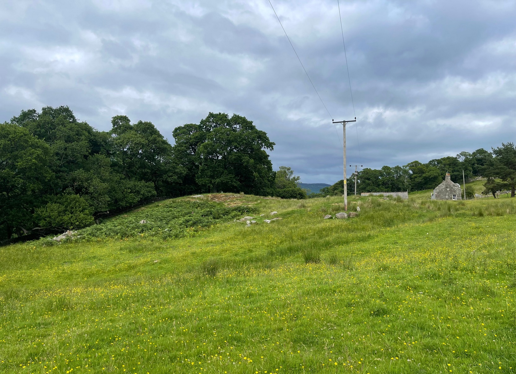
Simply follow the directions to reach the Dunruchan monoliths ‘D’ and ‘E’ and then zigzag through the heather to their immediate south—from just a few dozen yards away, to up to 300 yards west. Keep your eyes peeled for the stoney little rises in the heather as you walk back and forth and you’ll see at least some of these cairns.
Archaeology & History
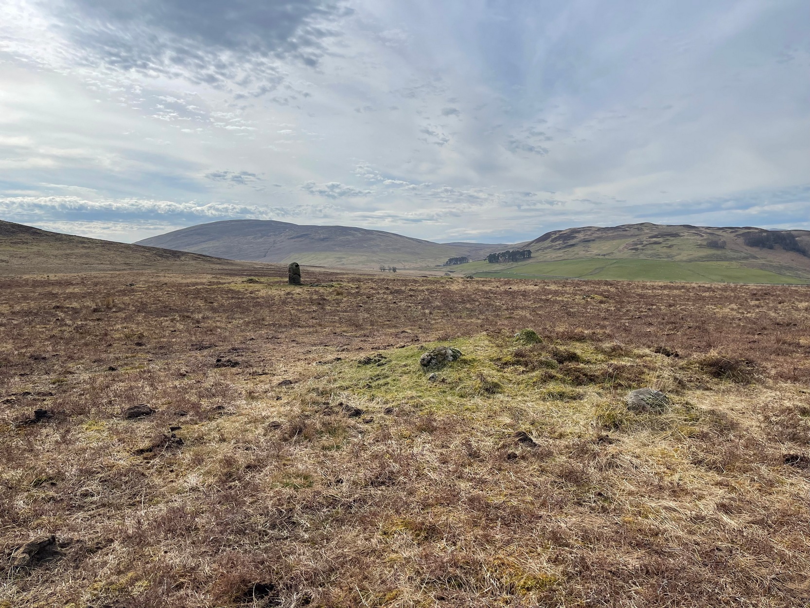
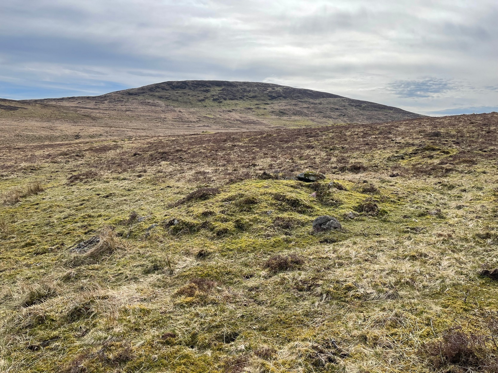
Not to be confused with the large cairn scatter on the grassy plain of Aodann Mhor a short distance north-west (whereon stands the magisterial Dunruchan A monolith), many of which which may be just field clearance cairns. This small group found a short distance east, south and west of Dunruchan stones ‘D’ and ‘E’ are more typical burial cairns. They each average between five and six yards across and none are more than three feet high. We first noticed them about ten years ago and on subsequent visits kept looking them over, but the deep heather ensured they were hard to see. But, after a recent heather-burning exercise on the moors, they are at thankfully visible—for a short time at least.
Cairn SE of Dunruchan ‘D’Cairn S of Dunruchan ‘D’
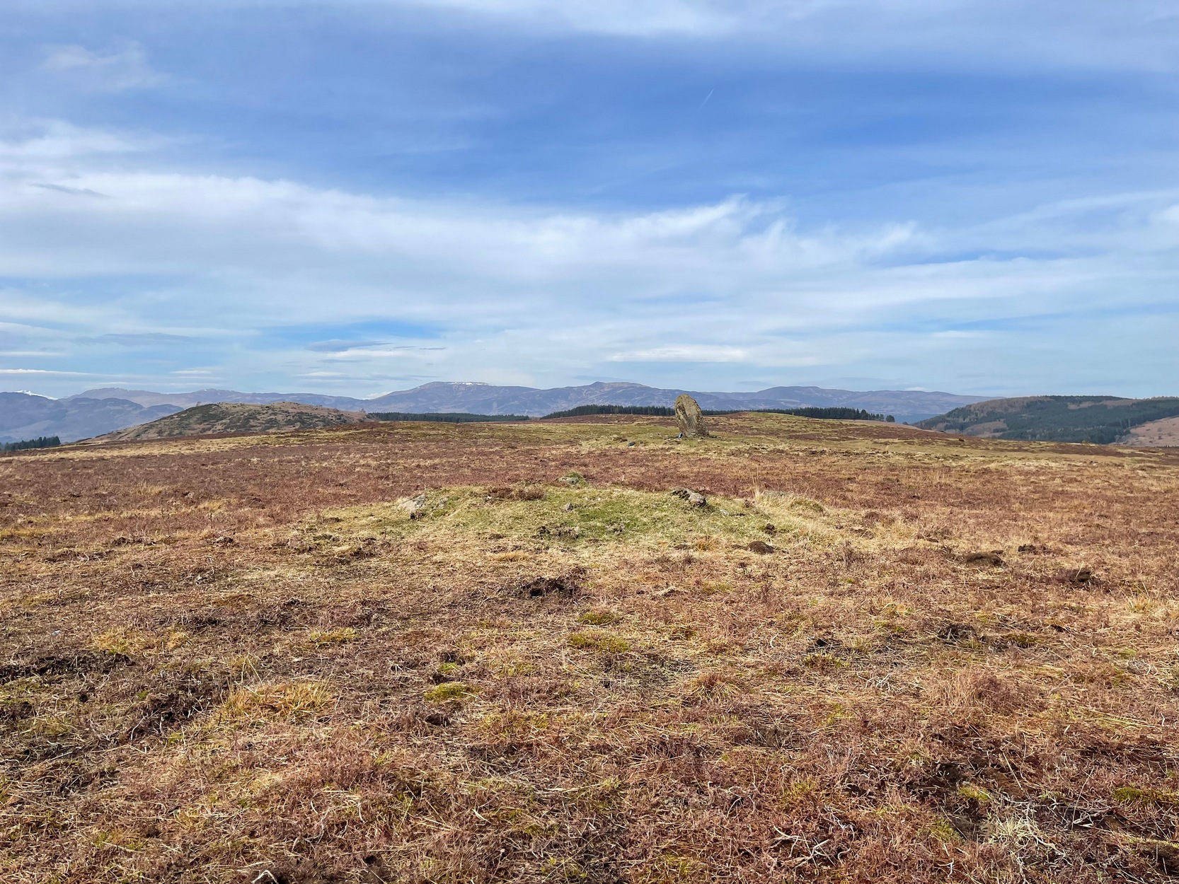
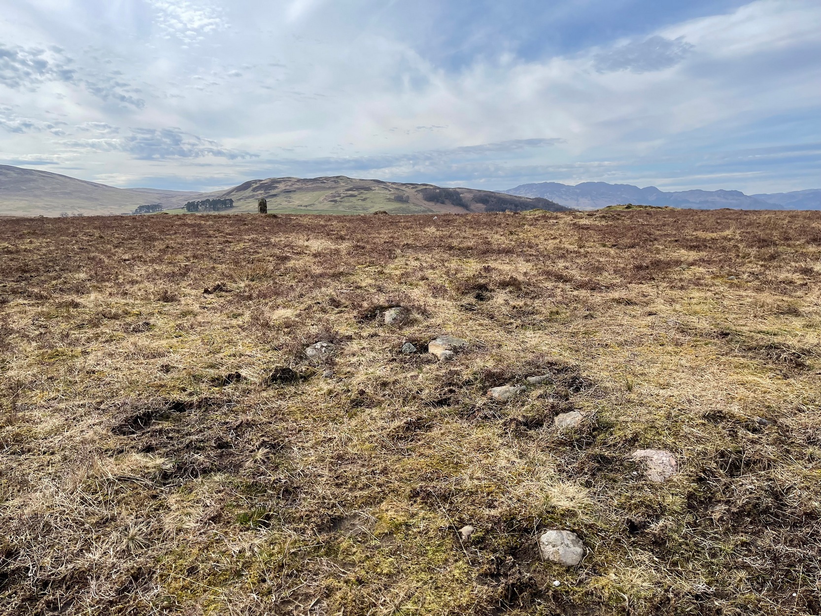
At the time of writing, probably the best one to see is found 40 yards south of Dunruchan D and 47 yards north-east of Dunruchan E and may have the astronomers amongst you running for the theodolites! It has that distinct look about it when you see it in context with the landscape and adjacent standing stones. The westernmost cairn that’s (presently) known here is 300 yards west of the Dunruchan E stone, just past the Dunruchan enclosure, at NN 7873 1676. It’s likely that there are other unrecorded prehistoric sites in this area.
Low line of ancient walling
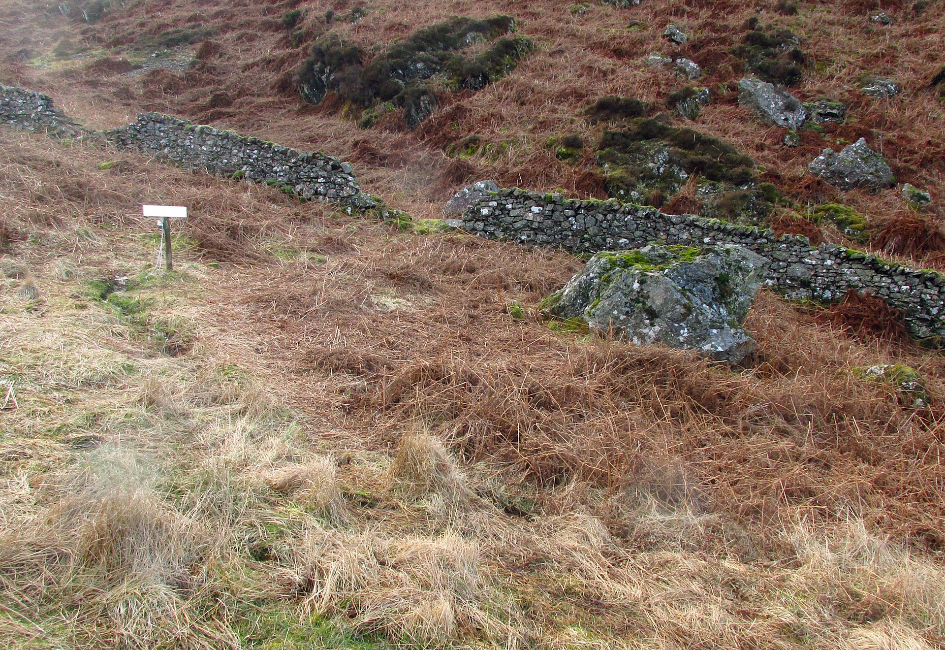
Amidst this section of the moors is a line of very low walling that runs a short distance east-to-west, towards the Dunruchan ‘E’ stone. A lot of old walling exists hereby, mainly visible in the fields to the east, but this particular line is much smaller and of a different age by the look of things, presumably older. It has the appearance of walling more usually associated with prehistoric hut circles, but in this case runs in a straight line towards the standing stone. Curious…
Folklore
The standing stones on this plain and the cairns here are said to be the graves of fallen Roman soldiers, slain by our tribal Scots two thousand years ago. In all honesty though, these are likely to be much older than any of those Roman savages.
Standing Stone (lost): OS Grid Reference – NN 795 168
Archaeology & History
When Fred Coles (1911) visited the giant impressive Dunruchan standing stones, he told that “some distance to the east” of the Dunruchan E stone, “near the unnamed stream…my friend Mr James Simpson has seen another great Stone, but lying prostrate.” When he visited the area the weather beat him back (easily done up here!) and prevented him “from wandering far over the moor, and therefore this Stone was not observed.” It remains lost. (the grid-reference given for this site is an approximation)
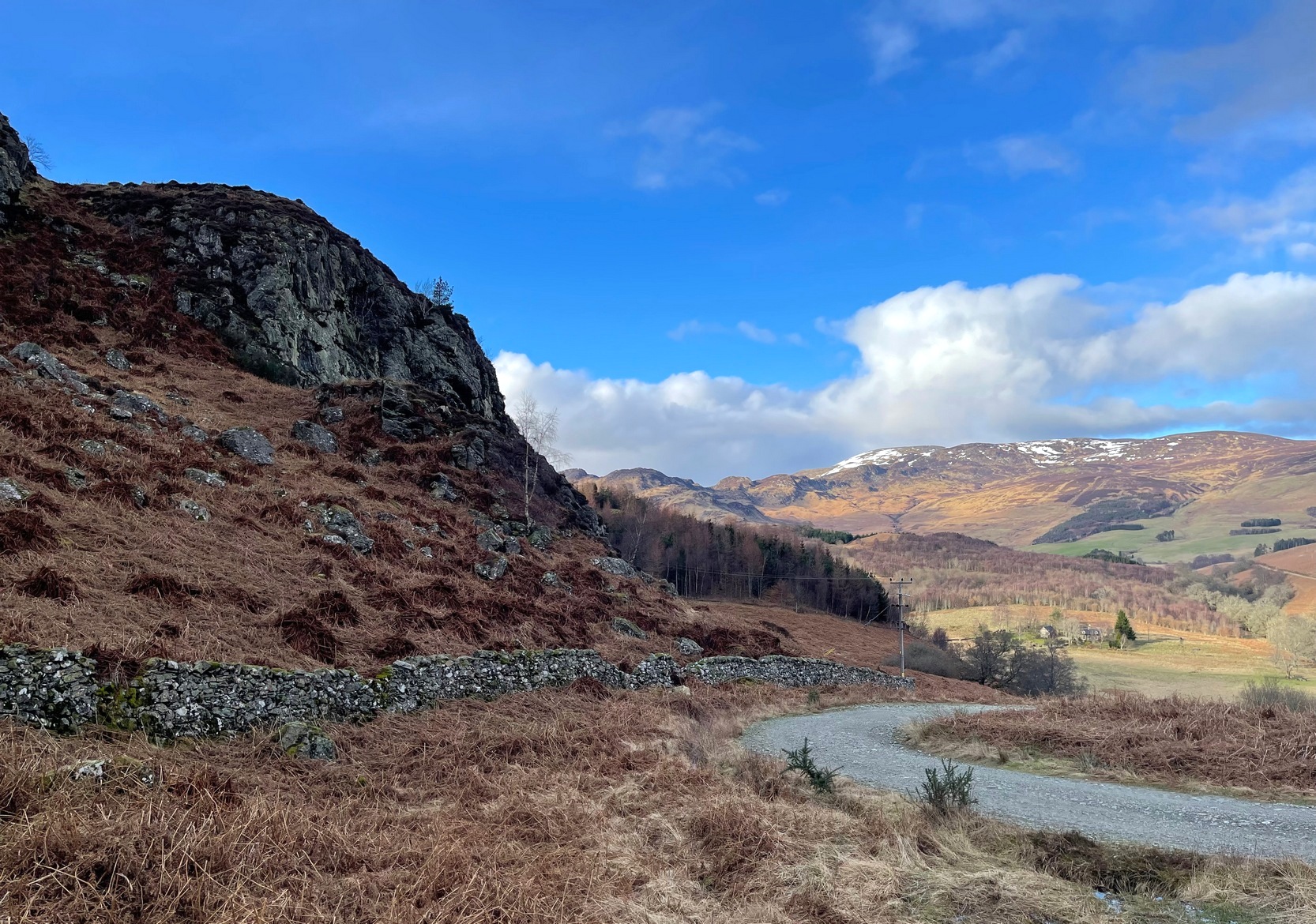
From Comrie village, take the long winding steep road up past the Devil’s Cauldron towards Glen Lednock. After 1½ miles the road begins to level-out and you come out from the trees and about 400 yards along there’s a dirt-track on your left. Park here! OK, now walk further along the road (not the dirt-track) for less than 100 yards and take the footpath up the slope (if this is blocked—it shouldn’t be!—you can walk further along until your reach the next track on your left). Go up this footpath for 200 yards till you reach the track by the large bend; and then walk up it for another 200 yards where there’s another large bend. On your right, past the solitary big rock, you’ll see the sign…
Archaeology & History
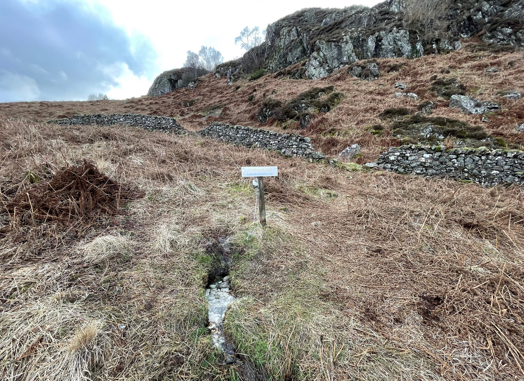
Sign of the Kinkhoast Well
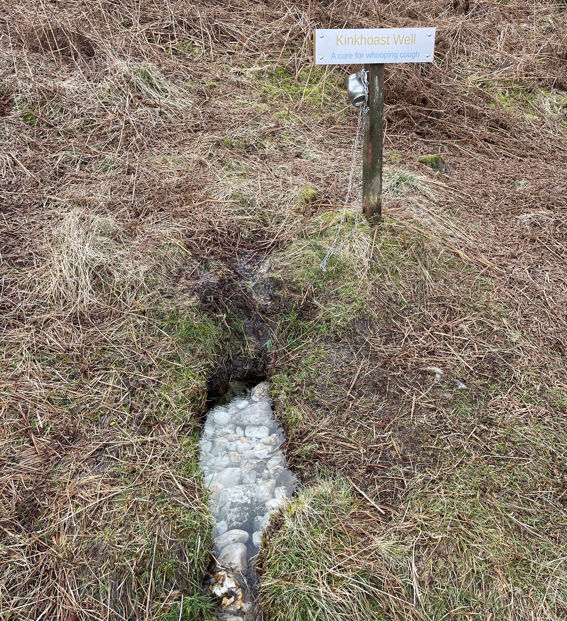
A little-known healing well that all but fell out of existence until, thankfully, some local folks recently decided to revive it. A sign stands above the back of this spring of water as it emerges from the Earth telling you that it’s the Kinkhoast Well. Its clear waters form into a very small pool, wherein are dozen of small white pebbles and and quartz pieces, very smooth and obviously worn by decades, if not centuries, of local folk giving the spirit of these waters—the genius loci—and offering in exchange for its healing virtues in the hope that it cures them of the whooping cough, of which this well is renowned.
It’s one of many whooping cough wells that are found in the Perthshire hills—and most are actually large boulders with hollows into which the rainwater collects and it is this that is used medicinally and not necessarily the spring water. A curious thing indeed…. and I’ve come across Highland folk who were taken to them when they were young children who’ve told me that their whooping cough was subsequently cured! Intriguingly, there is a large boulder just below this well, upon whose top is a natural bowl in which rainwater collects—and although I can find nothing specific telling of such a tradition here, above Comrie, it’s possible that the relationship between stones and wells, found at other places in the Highlands, also existed here.
Small pool full of white offering stonesWell & stone in close attendance
The name Kinkhoast itself (and variables thereof) is a Scottish dialect word, found from Galloway and into the Highlands. Jamieson (1880) describes it as literally “hooping cough”, with a brief note on the disease being cured by water drank from a shell. Meanwhile, in Grant & Morison’s (1960) massive work, they give numerous examples of the term, most of which relate to the same “whooping cough”, with some examples of folk remedies to abate the disease, including one of parents sending their children to take a drink from the “Kinker Steen Wall”—in that case from the parish of Logie. Examples of the very same tradition are known at other kinkhost sites. Check the place out when you’re in the area—and rest for a while to drink in the beautiful views…
References:
Anonymous, “Comrie Folklore – Kingcough Well,” in Crieff & District Post, no.31, August 2012.
Grant, William & Morison, David D. (eds), The Scottish National Dictionary – volume 5, SNDA: Edinburgh 1960.
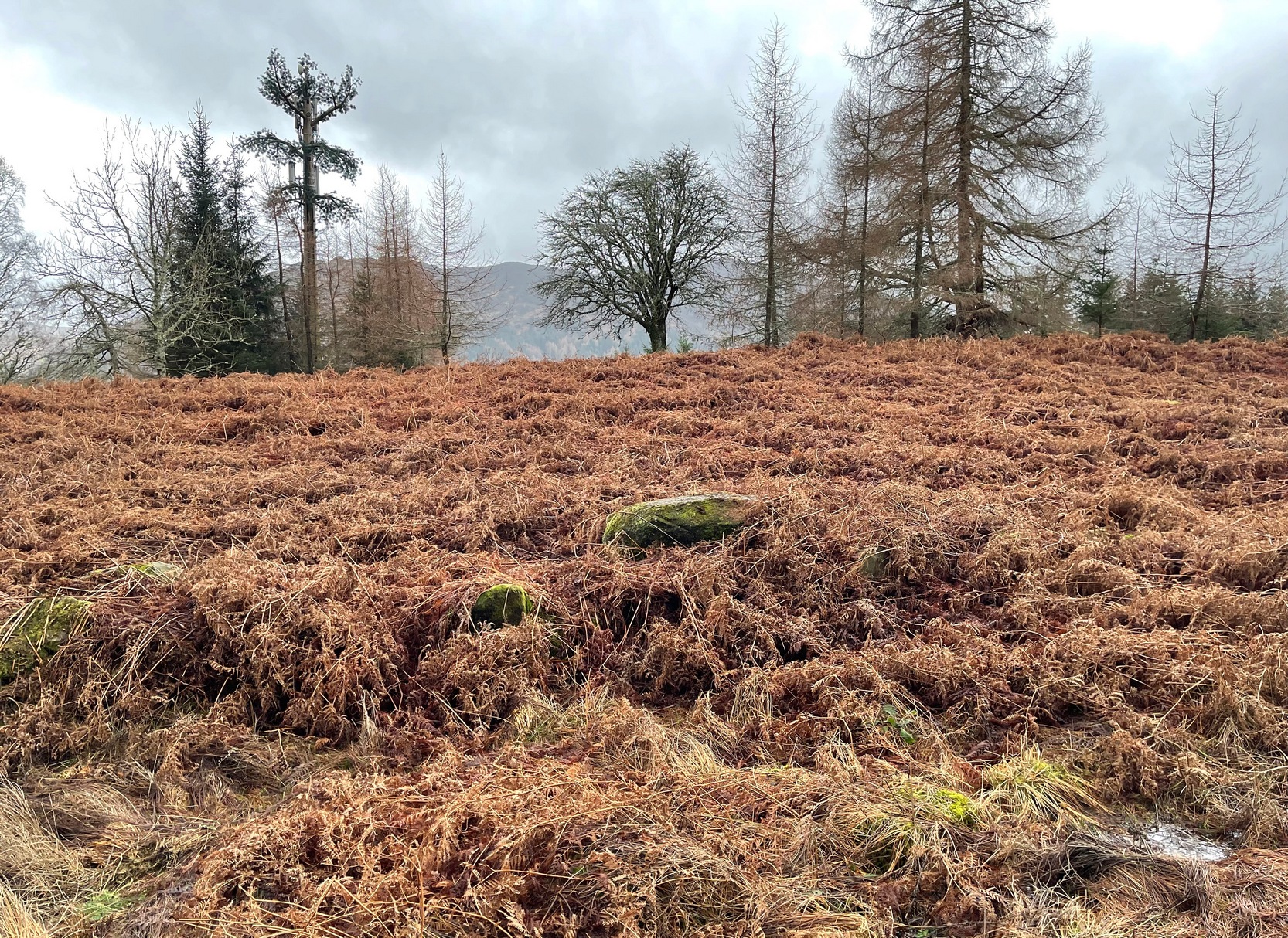
Along the A85 road between Comrie and St Fillans, just over a mile out of Comrie, on the right-hand side (north) of the road is the small farm-track into the fields where the ruined stone circle of Tullybannocher lives. Walk up this track (known as Maam Road), past the stones, and keep going uphill for more than a mile (literally 1 mile up, another track turns sheer right, but ignore it) where the track eventually levels-out; keep walking for another 600 yards, slightly downhill, until you reach a distinct fork in the track where you need to veer right, uphill, and keep walking up the track for ⅔-mile (1km) where you’ll eventually see a cottage ahead of you. 150 yards before this, to your left, down the slight slope and just as it begins to slope back up again on the other side, there’s some olde walling with a coupla big stones in it. It’s there!
Archaeology & History
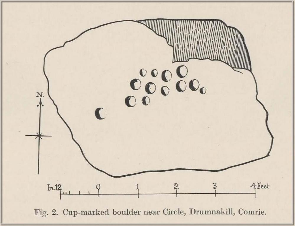
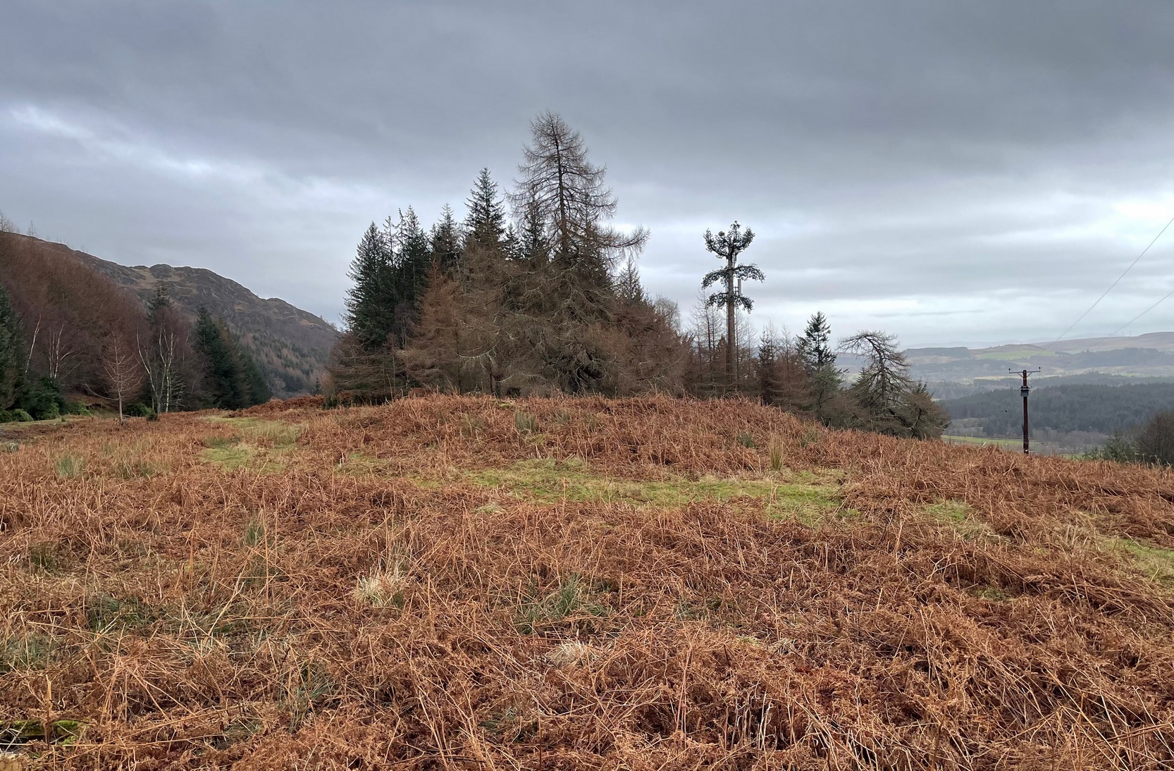
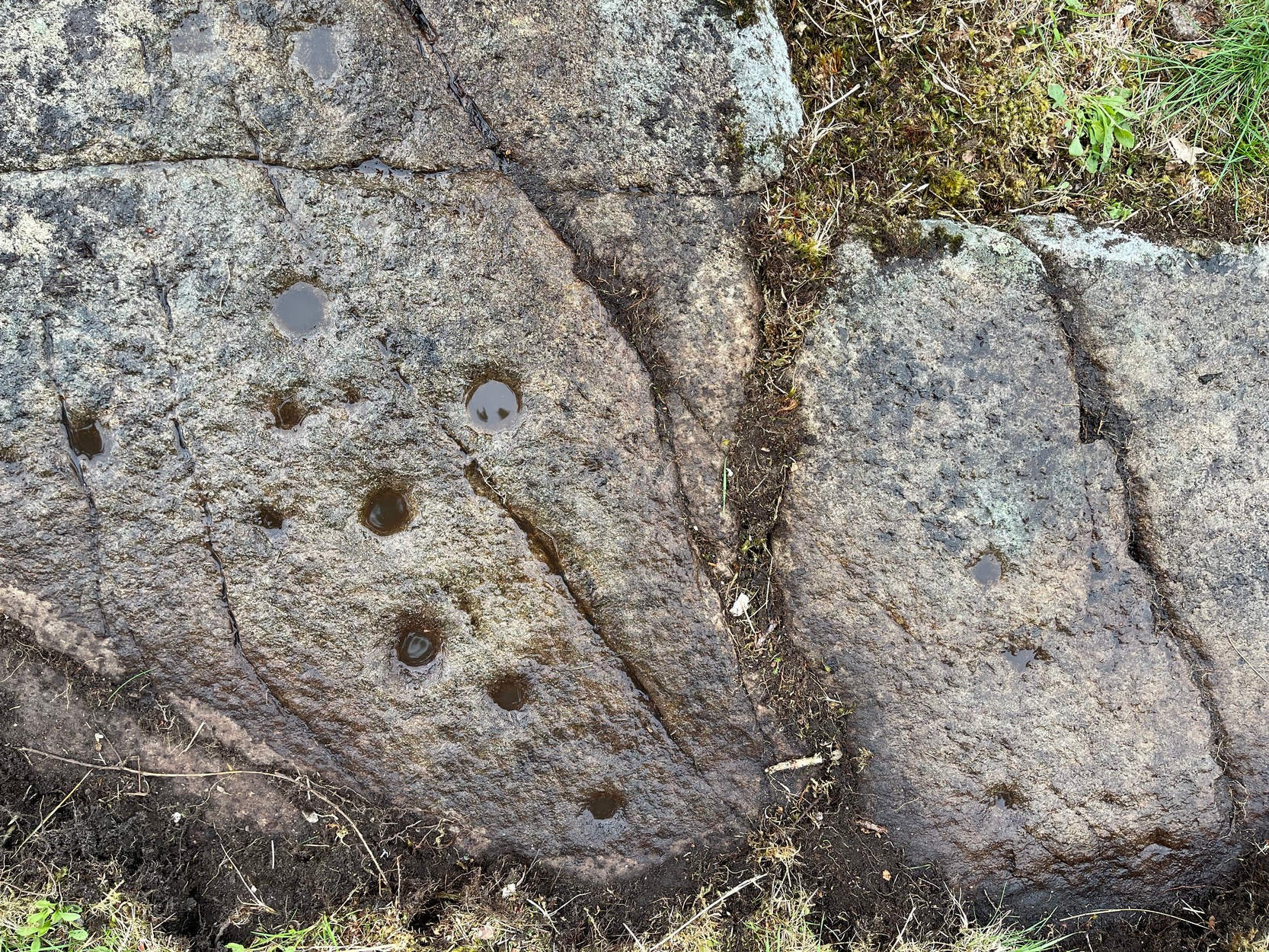
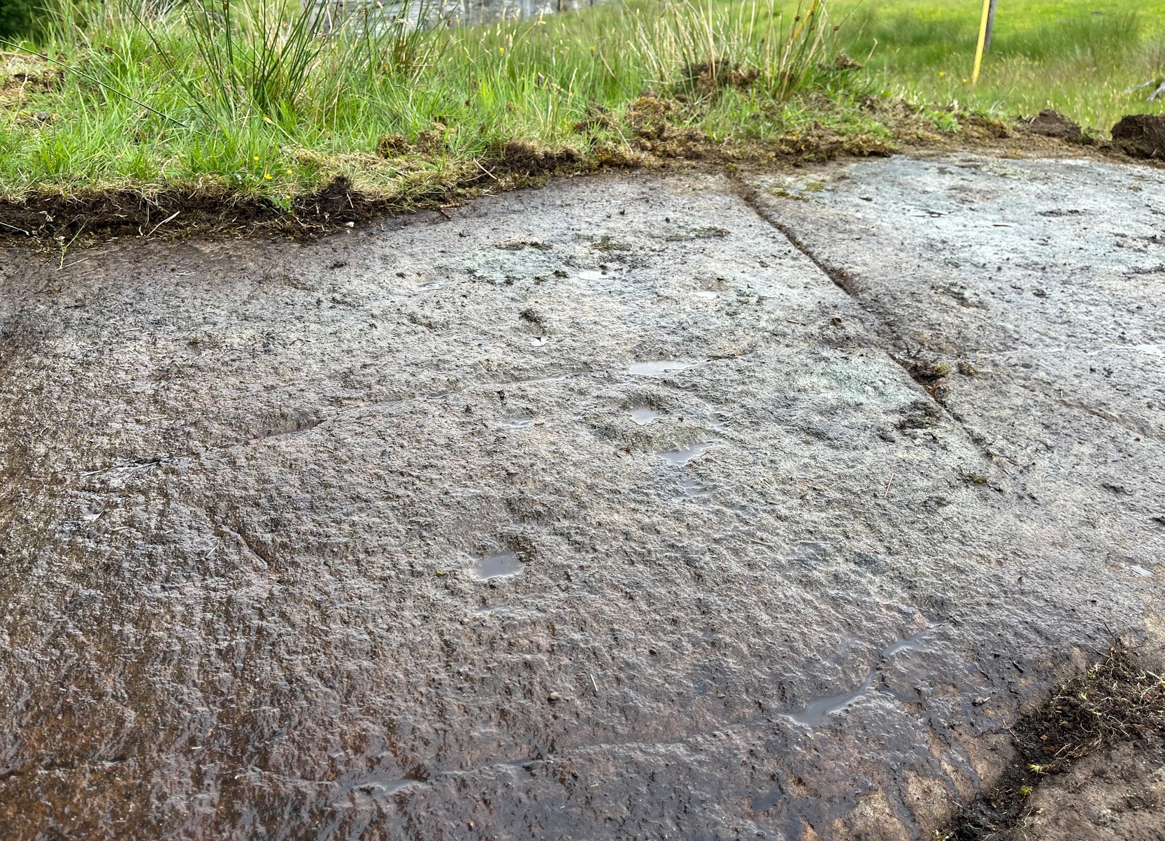
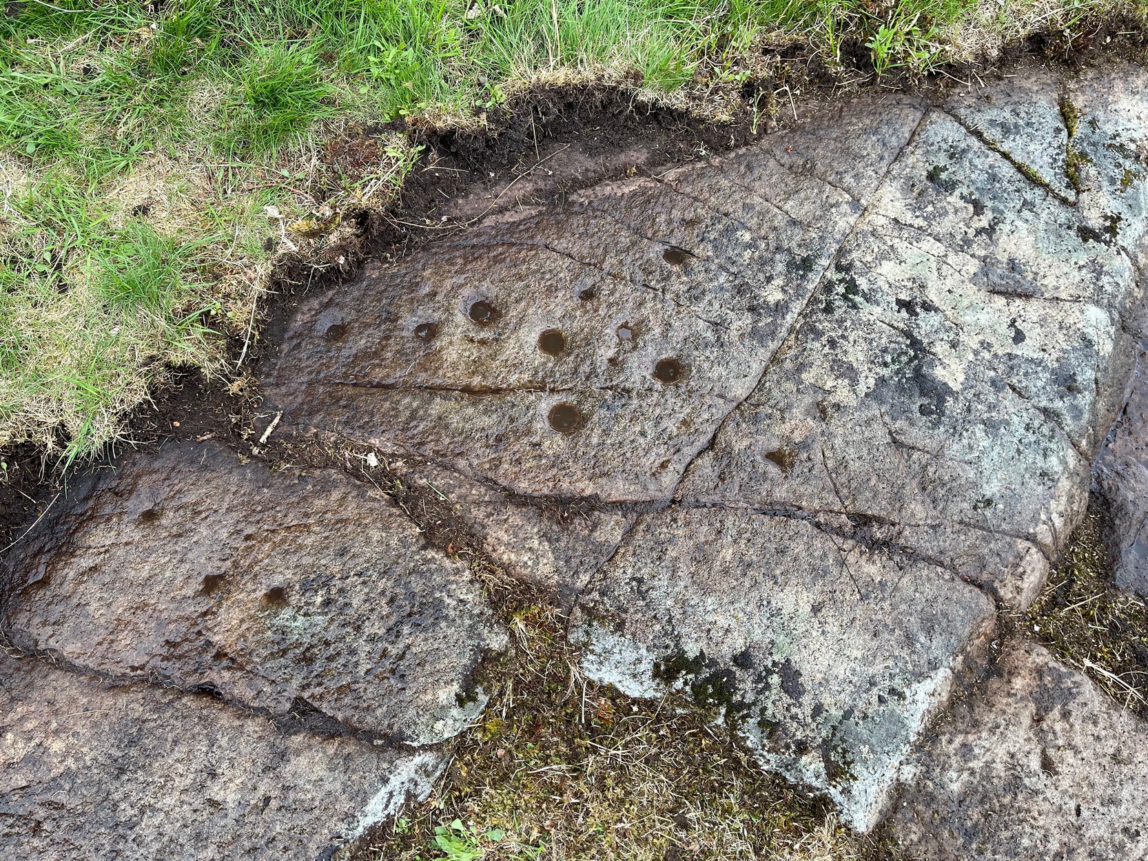
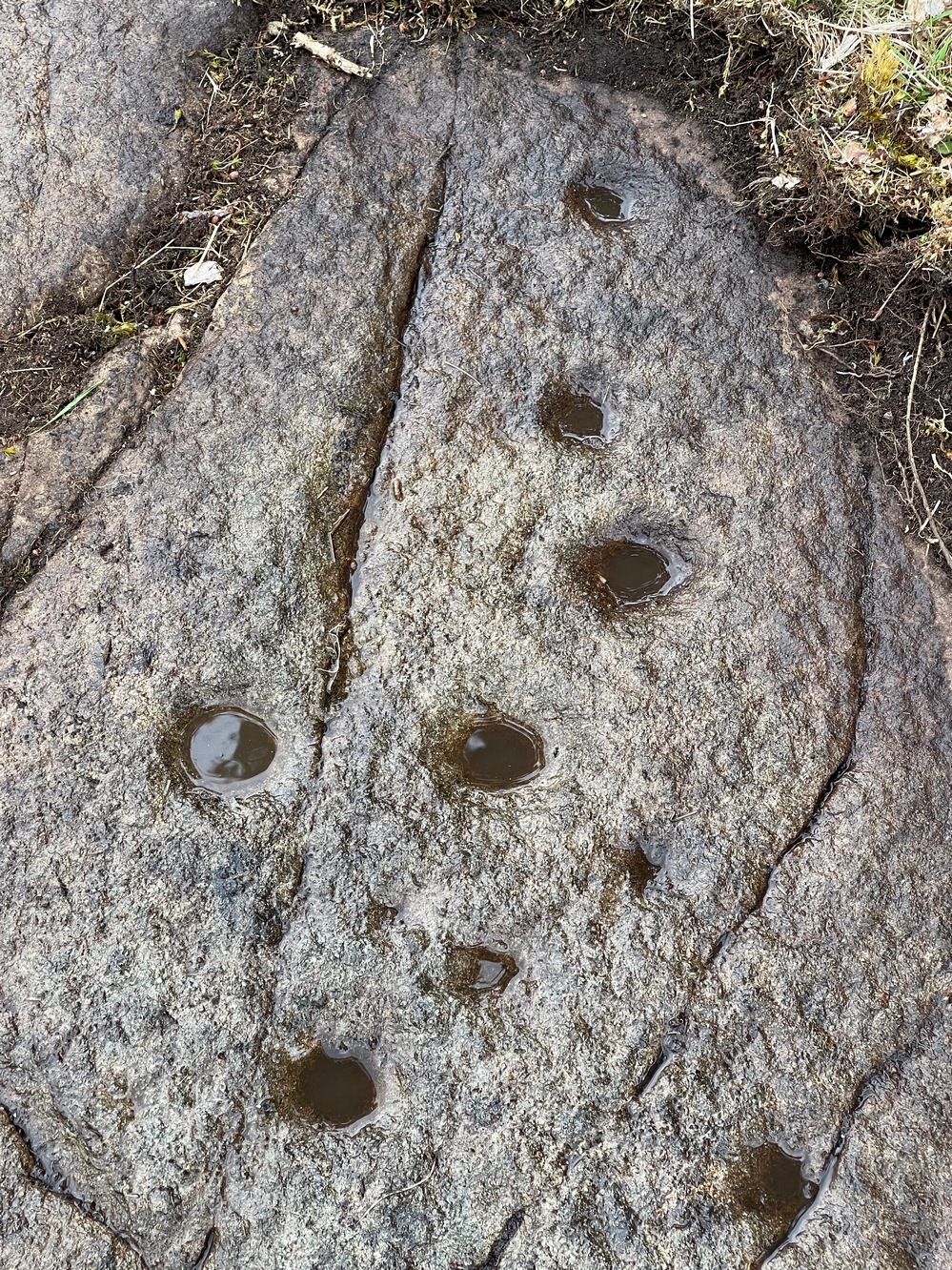
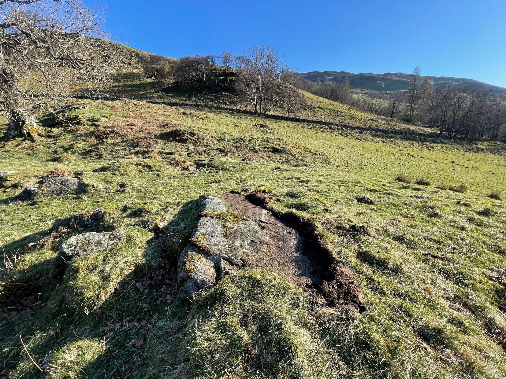
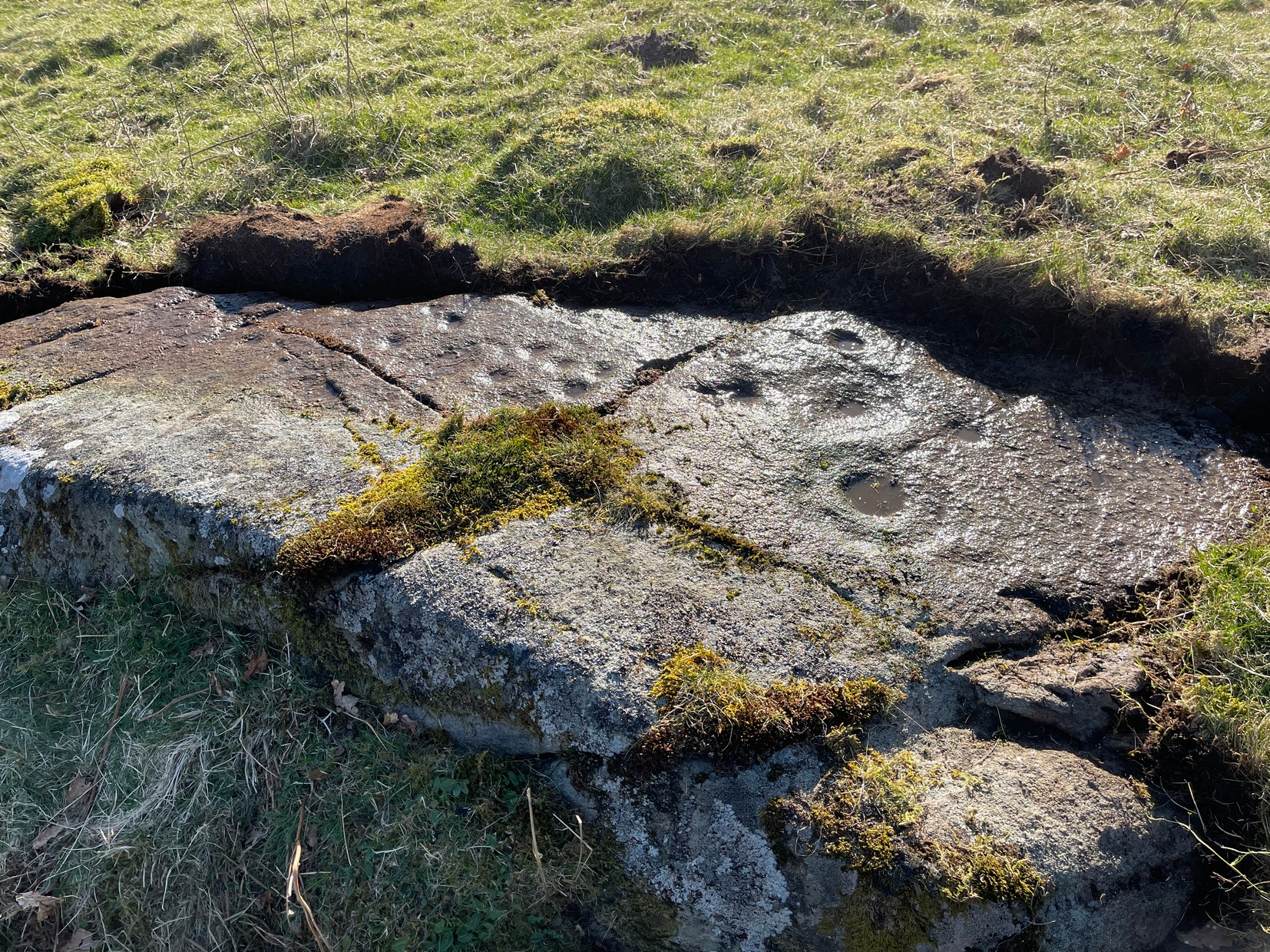
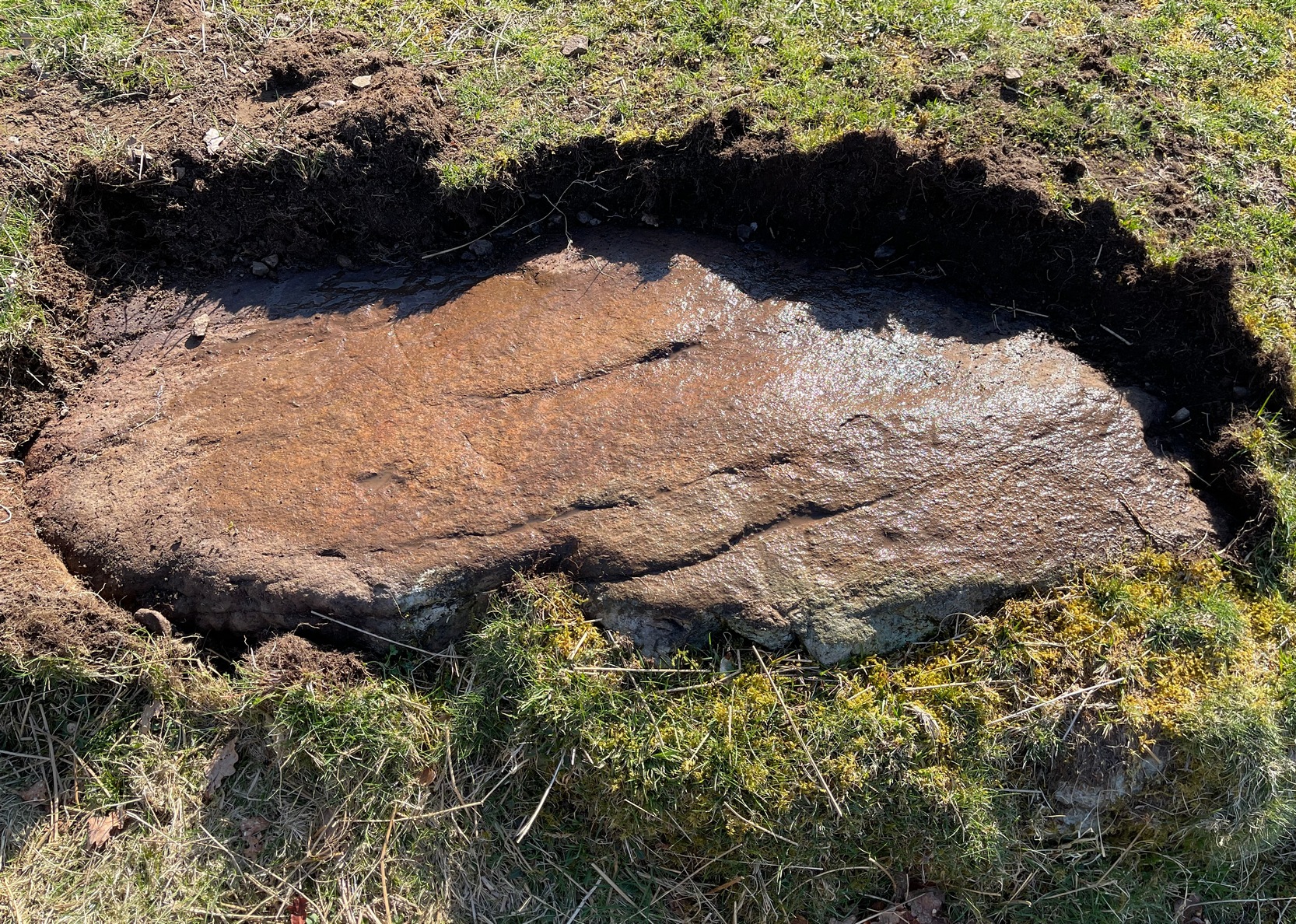
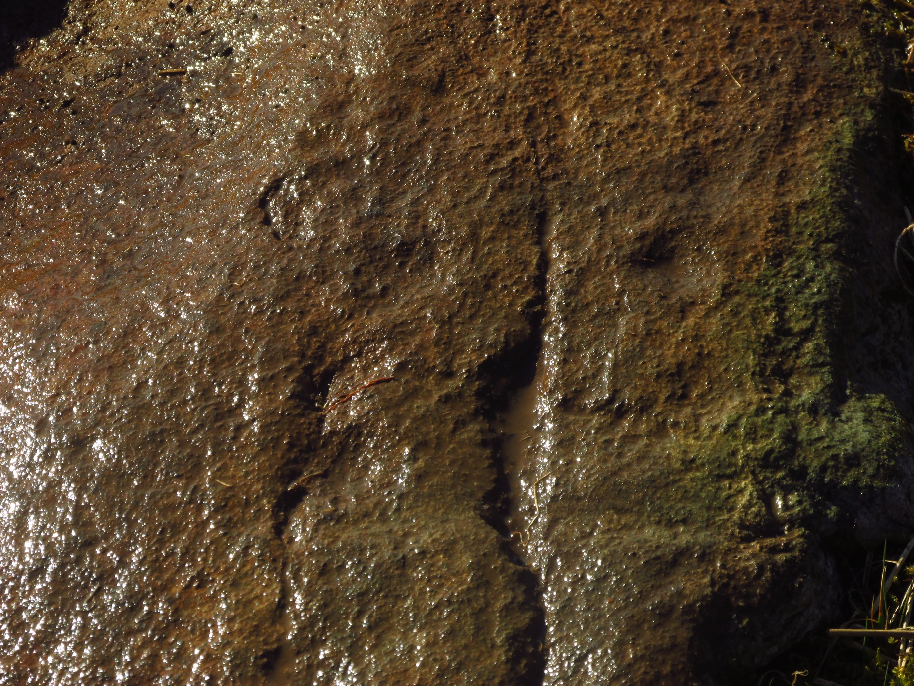
When James MacIntosh (1888) first visited this carving in the 19th century—which is close to the curious cairn of Druim na Cille just 75 yards to the west—he described there being a group of seven large stones forming, what he thought, might have been a large enclosure. I think he was right. Several of these stones can still be seen: each of them along some ancient walling that swerves in an arc to the east. One of these stones has a number of cup-marks on it.
Fred Coles’ 1991 sketchThe carving, from the track
The design isn’t too impressive when compared to others in this neck o’ the woods, but they’re very distinct. We visited the place on a truly dark grey day: conditions that don’t usually allow for good visibility regarding cup-marks; but thankfully the cups along this stone are quite deep and hard to miss. Running along one section of the stone are what Gow called, “eleven beautifully formed cups, varying from 2¼ to 4 inches in diameter and from half an inch to an inch in depth.” When Fred Coles (1911) came here he counted thirteen cup-marks. There may be fourteen.
The stone does possess some more recent groove marks made by a metal instrument, possibly a tractor or perhaps when local workmen stuck up a microwave tower close by. Thankfully it hasn’t directly affected the cups on the stone. Check it out when you visit the nearby ring cairn.
Along the A85 road between Comrie and St Fillans, just over a mile out of Comrie, on the right-hand side (north) of the road is the small farm-track into the fields where the ruined stone circle of Tullybannocher lives. Walk up this track (known as Maam Road), past the stones, and keep going uphill for more than a mile (literally 1 mile up, another track turns sheer right, but ignore it) where the track eventually levels-out; keep walking for another 600 yards, slightly downhill, until you reach a distinct fork in the track where you need to veer right, uphill, and keep walking up the track for ⅔-mile (1km) where you’ll see a cottage ahead of you. About 50 yards before the house, down the slope on your left, a large rounded mass covered in bracken is the site you’re after.
Archaeology & History
This is an odd site, in more ways than one. In the 18th and 19th century, local people told that it was “a very ancient churchyard, so old, indeed, that the grave-stones among the rank grass are scarcely discernible.” (Carment 1882) This lore was reinforced by the fact that, as James Gow (1888) put it,
“within living memory that a burial took place here, and the tradition is that people came to bury the “wee unchristened bairns” from long distances, such as Loch Tayside, Glendochart, Balquhidder, and Strathyre.”
Looking W, at the circleThe old mound, looking SE
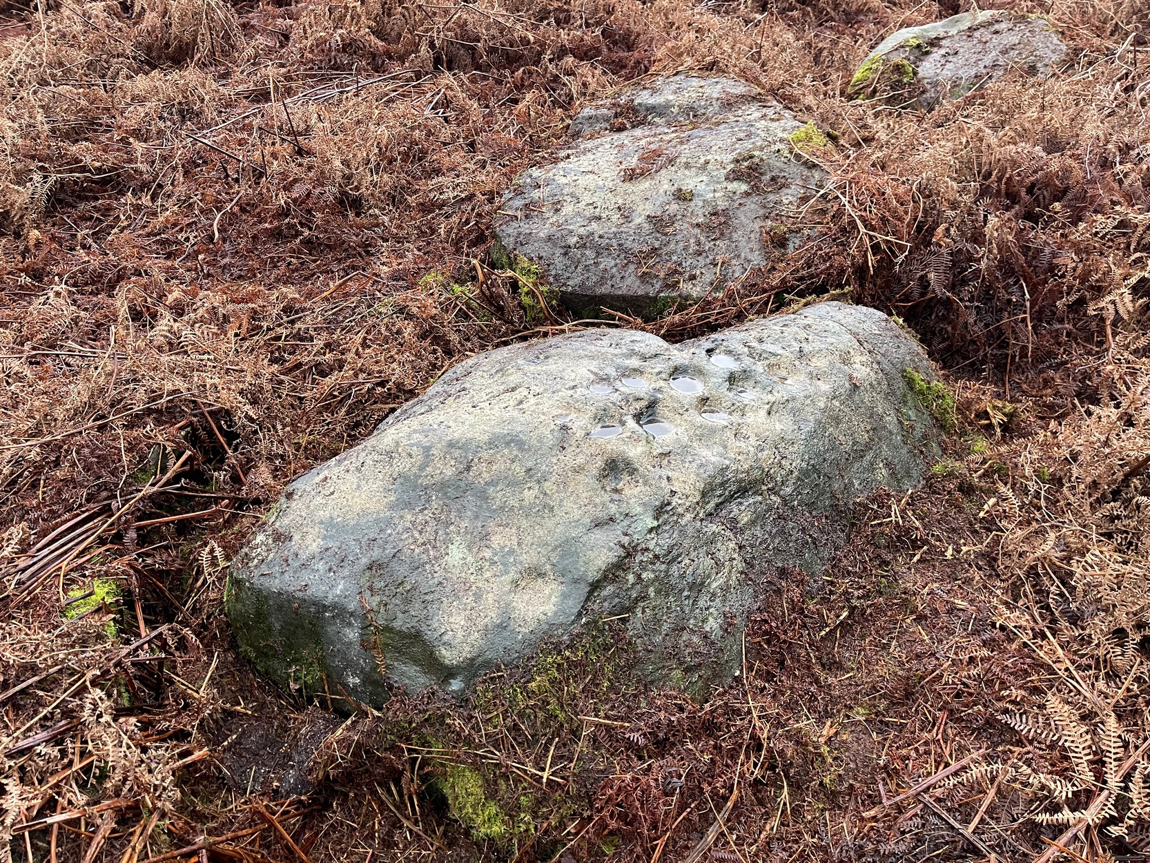
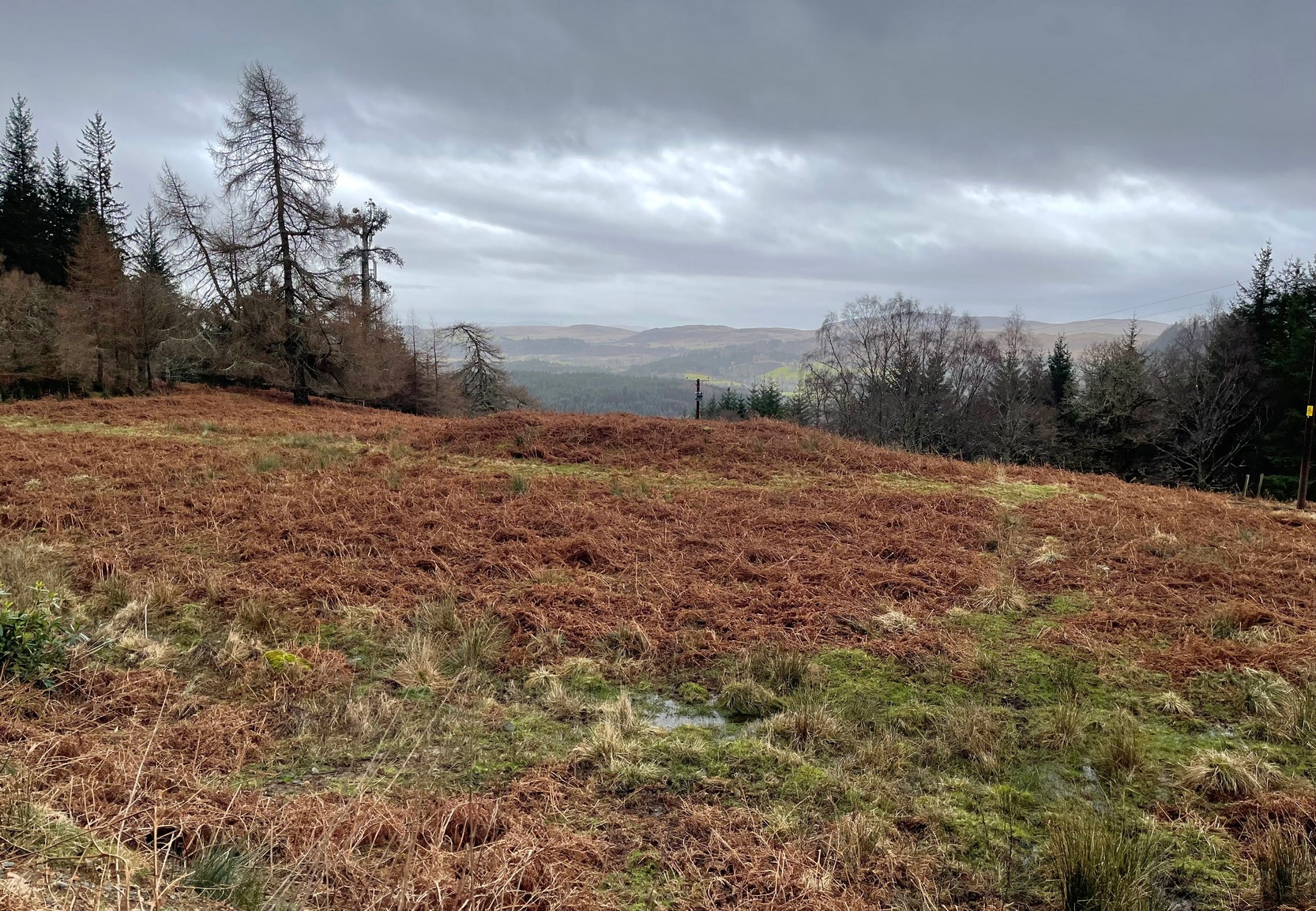
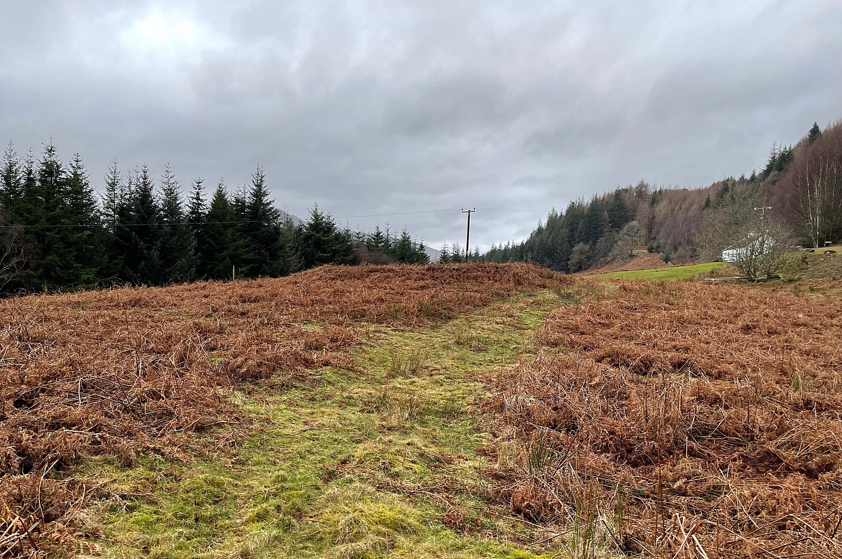
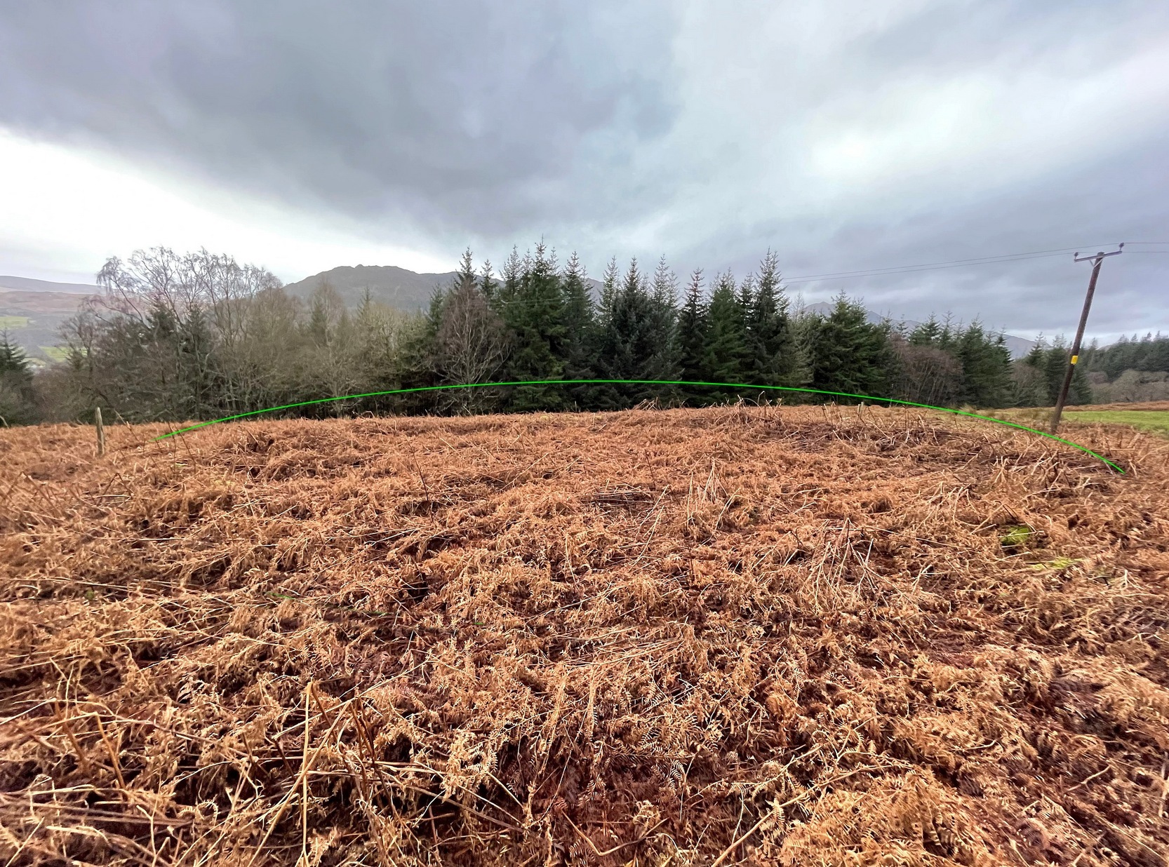
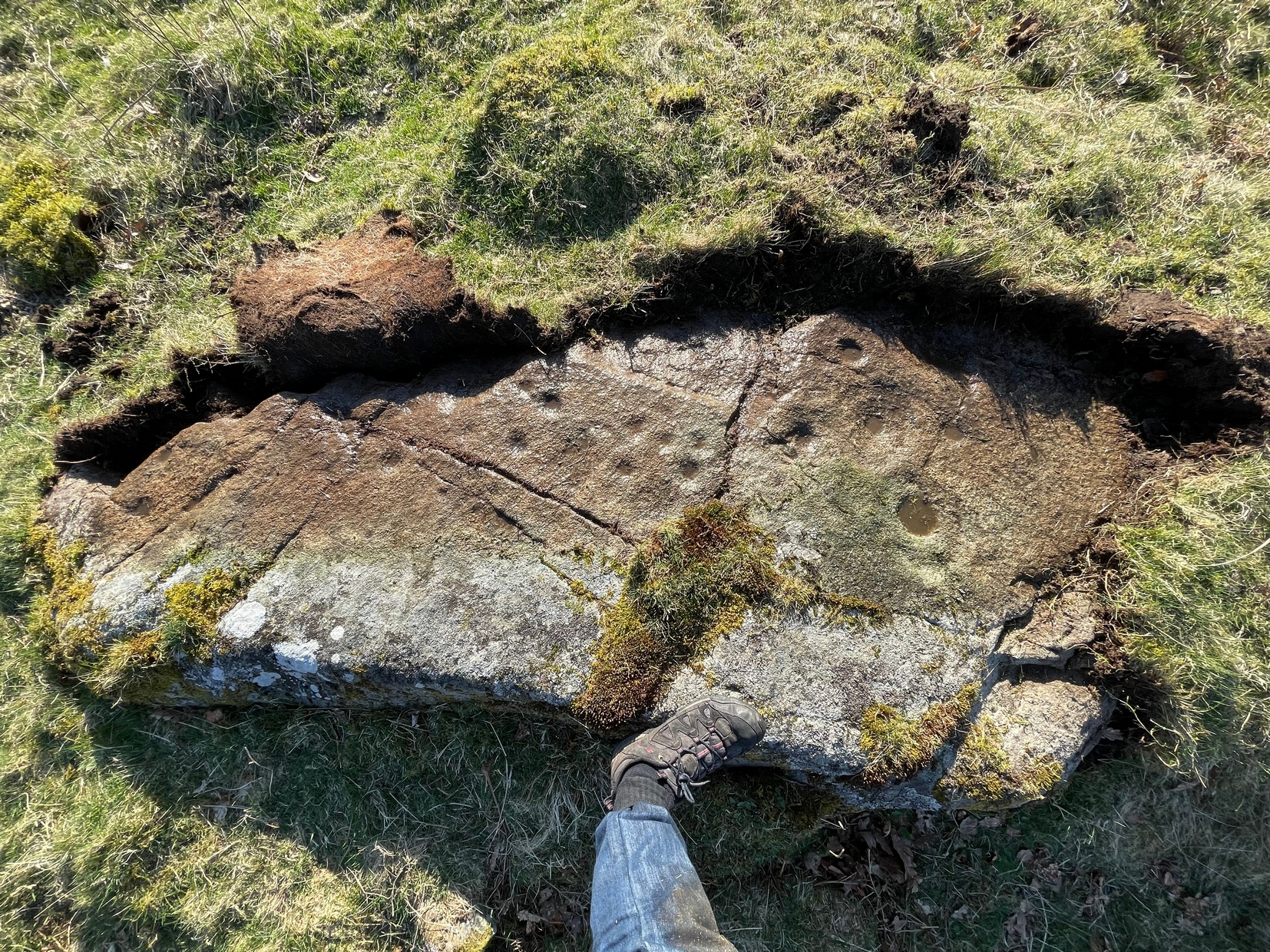
That’s a lot of effort and a considerable distance for some people to travel! But the age and nature of this site is curious. It very name, Drum-na-kill derives from either “ridge of the burial ground” or the “hill of the chapel” (and variants thereof)—yet there are no records of any such early church or religious cell here. That doesn’t mean, of course, that there never was one. A wandering Culdee priest may have set up camp here more than a thousand years ago after doing his service with the fading druids of Dull, less than 20 miles to the north. Such things, never written down, will obviously have happened in these mountains and cannot be discounted merely due to a lack of scripts. But we simply don’t know. When Mr Gow described the place—as “a raised enclosure 25 to 30 feet in diameter, with, a turf-covered wall or rampart 3 or 4 feet high surrounding it”—he emphasized that “in former times (it) was used as a burying ground for unbaptised infants.” (large numbers of Highlanders weren’t in the slightest bit interested in the ways of the Church) So how far back in time did this tradition go…?
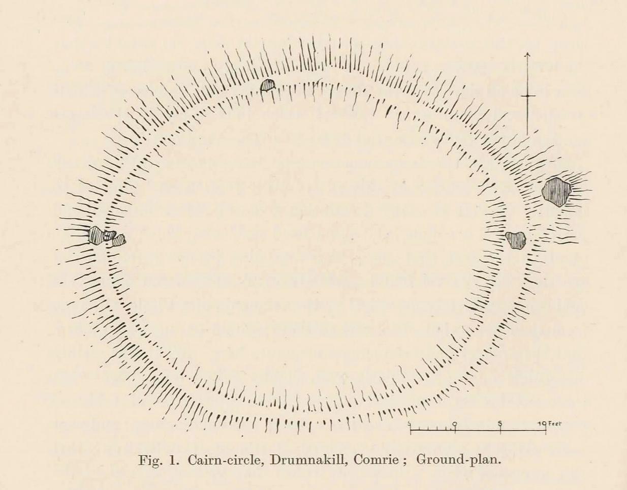
Well, Gow thought the place to be an early christian site. But when Fred Coles came here more than thirty years later, during his massive survey of the Perthshire stone circles, he deemed it to be a much earlier construction. A “cairn circle” no less—which would give it a more Bronze Age footprint. And this definition has stuck. Coles (1911) told that,
Coles’ 1911 diagramRaised ‘walling’ highlighted
“This Cairn-circle is about seventy yards east of the shepherd’s cottage, and it slightly resembles others already noticed in Perthshire. It measures from crest to crest of its circular ridge 44 feet 3 inches east and west by 37 feet 10 inches north and south. Several large blocks of stone lie exposed on the crest, and many others can be felt as one walks along it. The ridge is completely oval-circular, having no break or passage-way, and encloses a flattish, rather uneven space measuring about 34 feet in diameter. The height above the outside ground at the best-preserved portions is fully 4 feet.”
More than a century later, its not changed much—although if you were to believe the updated Trove website, “the cairn has been destroyed in the process of land improvement.” Which is untrue. As the albeit darkened photos here show (we visited it on a truly dark grey day), the raised cairn, despite being covered in a mass of deep bracken, is clearly in a condition similar to what Coles described. It looks like a typical example of this type of monument, of considerable size, with reasonably well-defined edges and comprising the usual scattered mass of stones in and around it. The large boulders that Coles described don’t seem to be in evidence, but these were apparently shifted a few decades back and added to the enclosure walling to the east. To honest, only the untrained eye would miss the place! Check it out when you’re looking at the cup-marked stone, less than a hundred yards to the east…
References:
Carment, Samuel, Scenes and Legends of Comrie, James P. Mathew: Dundee 1882.
Go along the minor single-track road on the south-side of Loch Earn (between Edinample and the ugly Lochearn Leisure Park) and roughly halfway along the loch, there’s rough parking near Ardvorlich House (the starting spot for walking up Ben Vorlich). Walk east past the track to Ardvorlich, staying on the lochside road, for about 400 yards and then go up the dirt-track on your right. Walk up here for about 200 yards and, before you reach the trees, notice a small gate in the walling above you on your right, about 70 yards up the slope. Go through here and bear immediately left, up to the large oak on the large dome of rock. From the oak, with your back to the wall, take about 10 steps forward. You’re here!
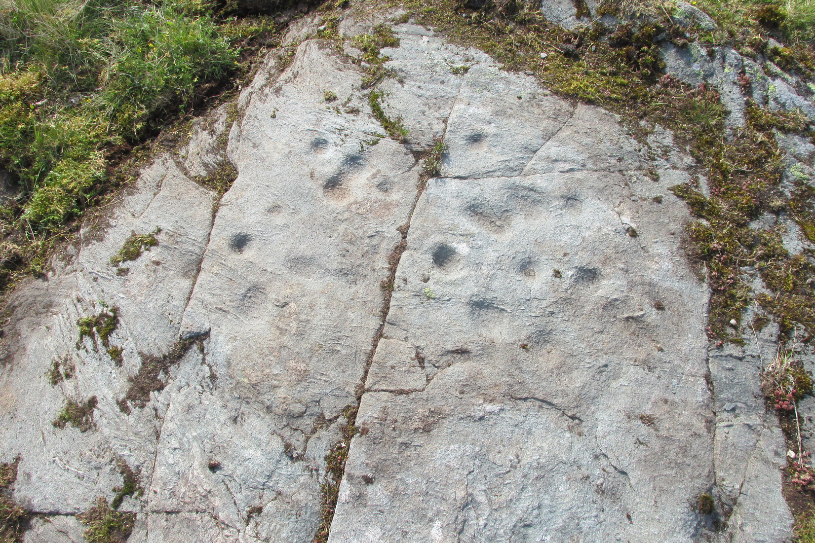
Archaeology & History
Deep cups & faint rings
The singular short reference to this impressive design was by George Currie (2011) who told us that it “bears at least 17 cup marks, three of which have single rings.” But there are in fact six of them with rings, possibly seven—with a few additional cup-marks scattered across the wider rock surface. It’s quite impressive, although on our visit here the daylight was gray and so the photos I have of the site do not do it justice. The sun popped out a couple of times, but only for a few minutes and we weren’t able to take advantage of it quickly enough.
The distinctive section of this petroglyph are the deep cup-marks on its northern side: fourteen of them, three of which have faded shallow rings around them—or rather, uneven oval-shaped surroundings. The cup-marks have obviously been worked and re-worked over the centuries, whereas the rings were given less repetitive attention, for whatever reason. This is a pattern found at a great number of cup-and-ring stones across the country.
Shallow cups, faint ringsAnother angle of deep cups
From this cluster of deep cups, walk two or three yards south onto the slightly lower smooth rock surface, where we find a much less pronounced scatter of several shallow cup-marks—may be five, may be six—but three of them have faint rings around them. They were difficult to see on our visit here due to the poor light. There’s what may be another incomplete cup-and-ring another two or three yards further along on the same rock face: a cup, certainly; the faint ring, perhaps. We need to revisit this in better light.
The rock surface continues for quite some distance all round here in the shape of a large dome, much of it covered in vegetation of varying depths. There are openings showing the bare rock and, at several other spots there are several other cup-marks, although none are as deep as the ones we’ve just described. On the edge of one piece, about three yards north of the deep cups, a couple of worn cup-marks are near the edge of one rise; two others are clearly notable a yard or so WNW of the deep cups; whilst there are several other single cups near and not-so-near of the main design. It all requires a lot more work before we see the entire picture.
It’s a gorgeous site: silent with the feel of winds and waters and the scree of buzzards touching the senses: elements that, at some petroglyphs, had mythic relevance…
References:
Currie, George, “Comrie: Balimeanach (BC 2), Cup-marked Rock”, in Discovery & Excavation Scotland, New series – volume 12, 2011.
Acknowledgements:Huge thanks for use of the Ordnance Survey map in this site profile, reproduced with the kind permission of the National Library of Scotland.
Loch Earn (between the villages of Lochearnhead and St Fillans) has a road running on each side: the north-side is the A85, the south-side is a minor single-track road. You need to be on the south-side. Roughly halfway along the loch, there’s rough parking near Ardvorlich House; and from the track to Ardvorlich, keep on the lochside road, walking east for about 400 yards and then go up the dirt-track on your right. Walk up here for 450 yards until your reach the cottage. There’s a field above you to the left with some small crags near the top: walk uphill (through the gate) for 175 yards and on the topmost crags you’ll see a telegraph pole. The cup-and-ring stone is right next to it!
Archaeology & History
The first and only reference to this stone followed its rediscovery by George Currie (2011) in one of his many bimbling forays seeking out these old carvings. He told, in his usual minimalist manner that,
“A stretch of bedrock adjacent to a telegraph pole on a terrace above Balimeanach farmhouse bears thirteen cup marks, at least two of which have single rings, including the largest at 70 x 25mm.”
Line of cup-and-rings
View from above
The two cup-and-rings are next to each other on the northen side of the stone, with one based on a small concave depression in the rock itself; but next to this is what seems to be another, third and very faint incomplete cup-and-ring (you can see it in some of the photos here). We walked round and round this and whilst it seems quite obvious, some elements of it appear to be based on natural cracks in the stone, accentuated with minimal pecking by the artist. These three cup-and-rings are next to each other in a veritable Orion’s Belt formation, with a single cup hanging down from the middle.
Carving, looking south
Looking across the design
The other main section of the carving consists of a series of plain cups, scattered in a typically chaotic form and clustering mainly round the centre of the stone; whilst on its southern tip a single cup sits quietly.
When we peeled the turf back to see the entire carving, we found there was a considerable scatter of broken quartz all along the western edge of the stone. This element was also found at the Balimeanach (2) carving less than ten yards away and we’ve found this at a number of other petroglyphs in Perthshire and beyond. Even more intriguing was a large carved stone spearhead covered in soil alongside the quartz scatter! We left this where we found it.
In all probability, there are other carvings that remain undiscovered beneath the turf all along this ridge. Get y’ gardening gloves out!
References:
Currie, George, “Comrie: Balimeanach (BC 3), Cup-marked Rock”, in Discovery & Excavation Scotland, New series – volume 12, 2011.
Less than ten yards south of the Balimeanach (3) petroglyph, this innocuous-looking cup-marked stone can be seen. Paul Hornby and I came across it when looking for the adjacent carving. Comprising of between three and five very faint shallow cups, when we peeled some of the turf over we found a broken hand axe resting on the rock itself. We assumed that this had been the instrument that had been used to knock the cups into being. There were also many small shards of quartz crystal all along the inner edge of the stone: a feature that we and others have found at quite a number of carvings in the Scottish mountains. We left the ruined hand axe where we found it.
4? faint cups in a square
The impression we got here is that the cups are so shallow because the design was never actually completed. Instead, perhaps, they turned to look at the stone ten yards away and thought it was a better choice to cut a more ornate design… Perhaps… It seems pretty likely that other unrecorded carvings will be found close by on the many turf-covered rocks in this area.
Acknowledgements:Huge thanks to Paul Hornby for use of his photo in this site profile.
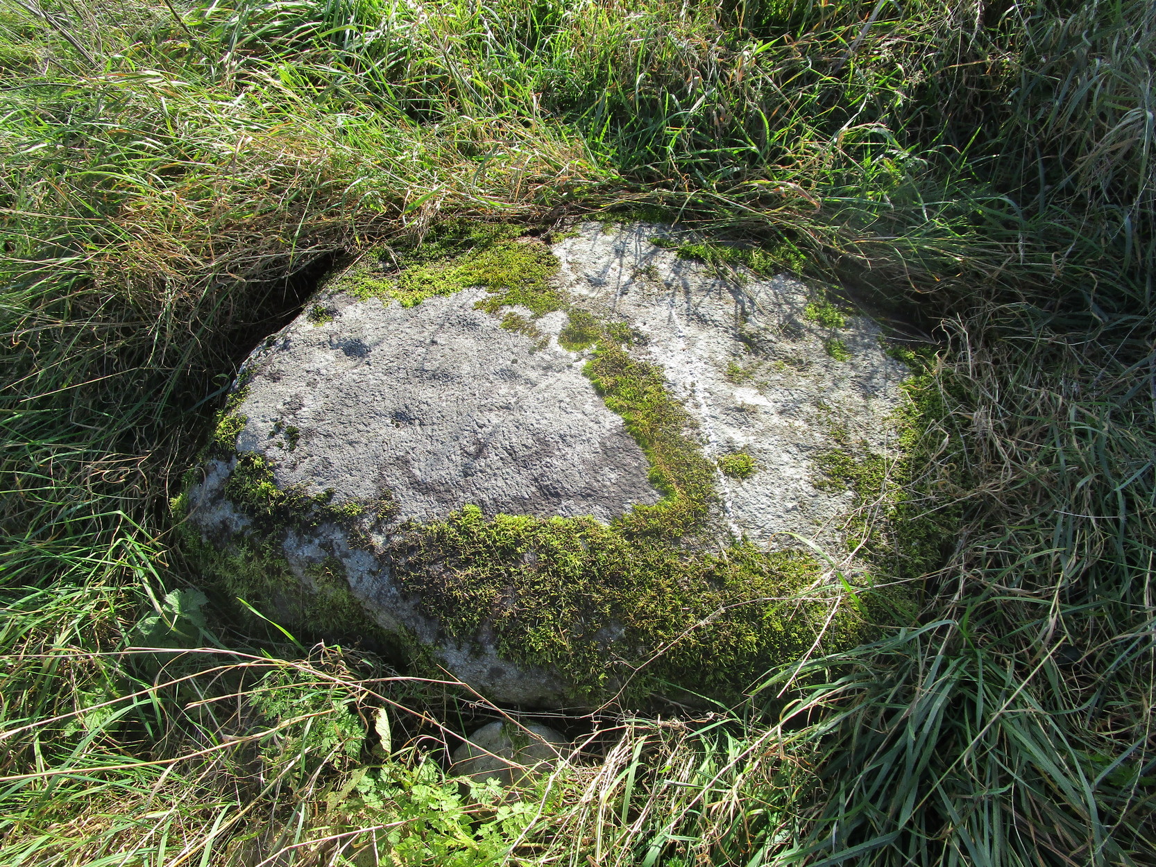
From Comrie take the B827 road (towards Braco) out of town and where the fields open up on both sides of you, 400 yards along the straight road you’ll see a large bulky stone right by the roadside (it’s the standing stone known as the Roman Stone). Stop here and look on the ground just a couple of yards past the monolith where, amidst the grasses and mosses, you’ll see this small smooth stone (you might have to roll some of the mosses back to see it properly).
Archaeology & History
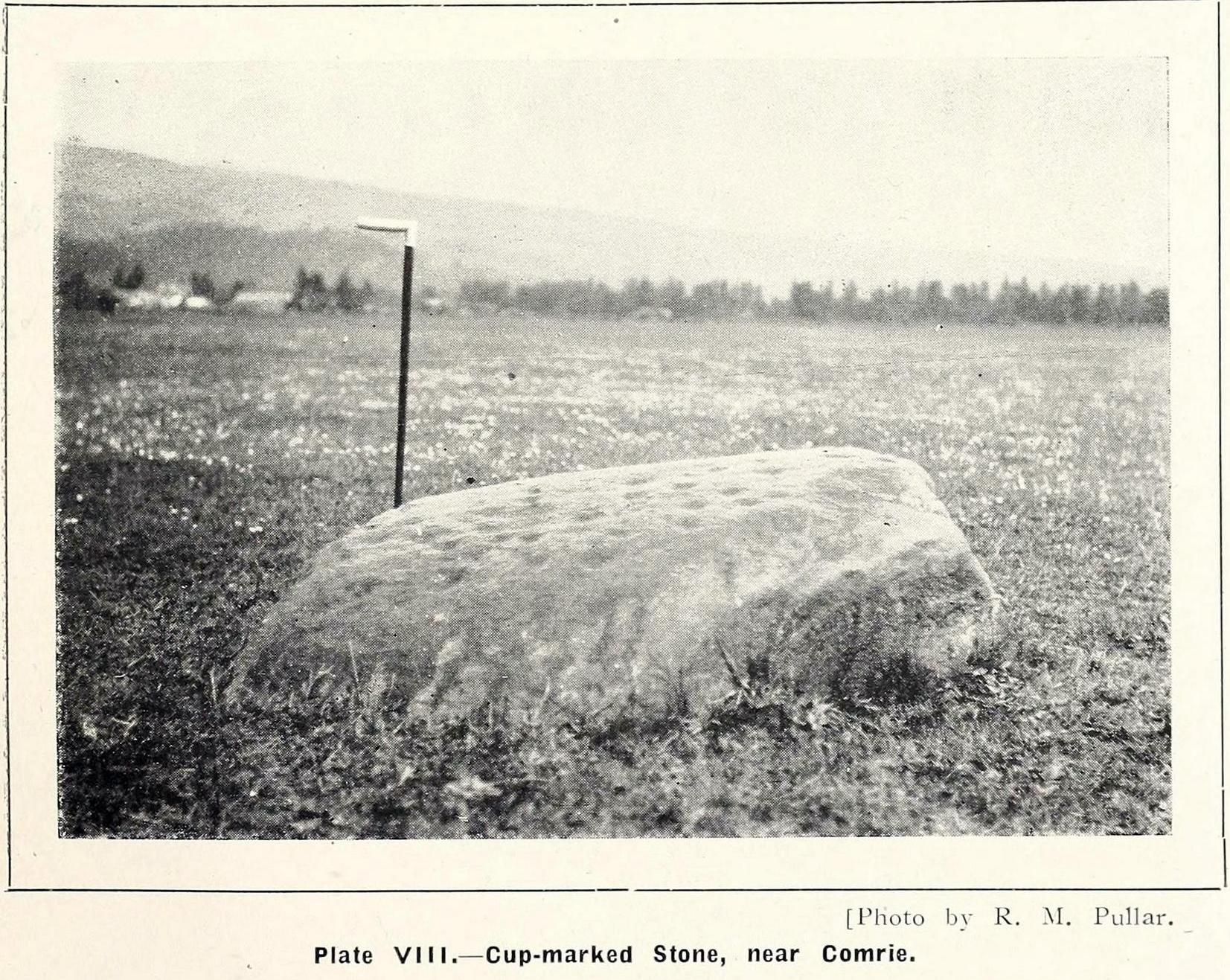
More than a hundred years ago when John MacPherson (1896) wrote his essay on the history of this area, he described there being “three large stones, supposed to be the remains of a Druidical temple.” He was talking about the Roman Stone here, with its two companions—although only the Roman Stone remains upright today. He noted that one of them, on the ground was “a round, flat boulder” which “bears upon its surface cup-marks arranged in irregular concentric circles.”
This seems to have been the first mention of the carving. Fifteen years later when the great Fred Coles (1911) looked at the same standing stones, he found the adjacent petroglyph to still be in situ, stating that,
“The surface is covered with a group of twenty-two neatly made cups … the majority being about 2 inches in diameter, with a few much smaller. Two cups measure only 1 inch in diameter.”
R.M. Pullar’s 1914 photo
Fred Coles’ 1911 sketch
A few years after this, members of the Perthshire Natural History Society on an excursion to Glen Artney in May 1914, stopped here to have a look at the same standing stones and they also pointed out that one of the stones “lying on the ground…is remarkable for the numerous cup-marks on its surface.” In truth, it’s not that remarkable compared to some of the other carvings, but it’s still worth checking out when visiting the other sites in the area. Many of the cups that were visible a hundred years back are difficult to make out unless the light is good; and it seems as if some of them have been chipped away, perhaps due to farming activity.
References:
Barclay, W., “Winter Session, 1914-1915,” in Transactions & Proceedings Perthshire Society Natural Science, volume 6, 1919.
Coles, Fred, “Report on Stone Circles in Perthshire, Principally Strathearn,” in Proceedings Society Antiquaries, Scotland, volume 45, 1911.
Hunter, John, Chronicles of Strathearn, David Philips: Crieff 1896.
Mac Pherson, John, “At the Head of Strathearn,” in Hunter’s Chronicles of Strathearn (David Philips: Crieff 1896).
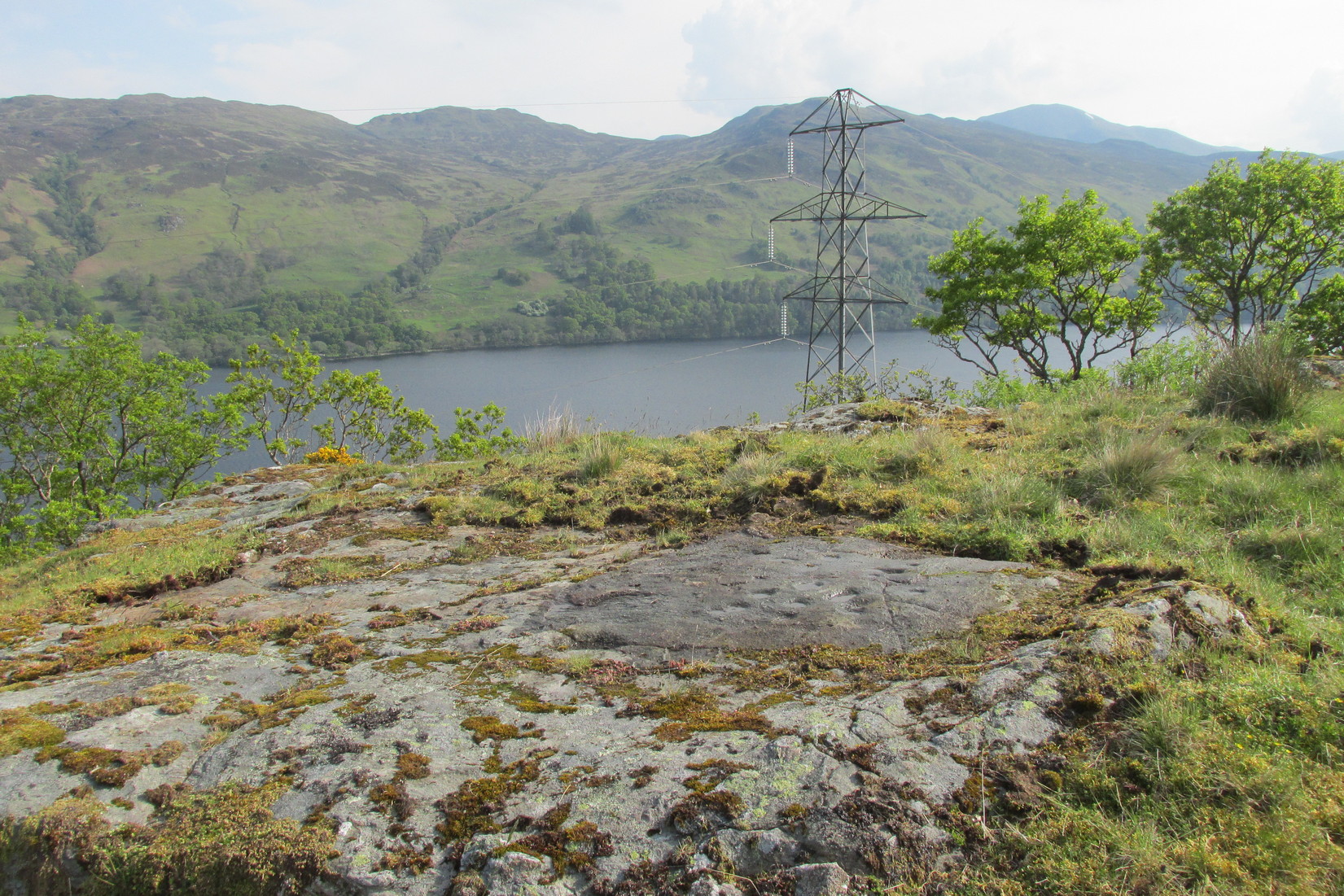
1½ miles out of St Fillans on the A85 road towards Lochearnhead you reach the boating marina by the lochside. 100 yards or so past this, park up. Cross the road and walk 50 yards to your right then follow the dirt-track up into the trees. After ⅓-Mile (0.5km) turn left to the old house on your left and follow the green path around it, then around the right-side of the rocky knoll to the Wester Glentarken (1) and (2) carvings. From here walk straight uphill, direct north, past the pylon and onto the rocky outcrop behind the gorse shrubs. You’re here!
Archaeology & History
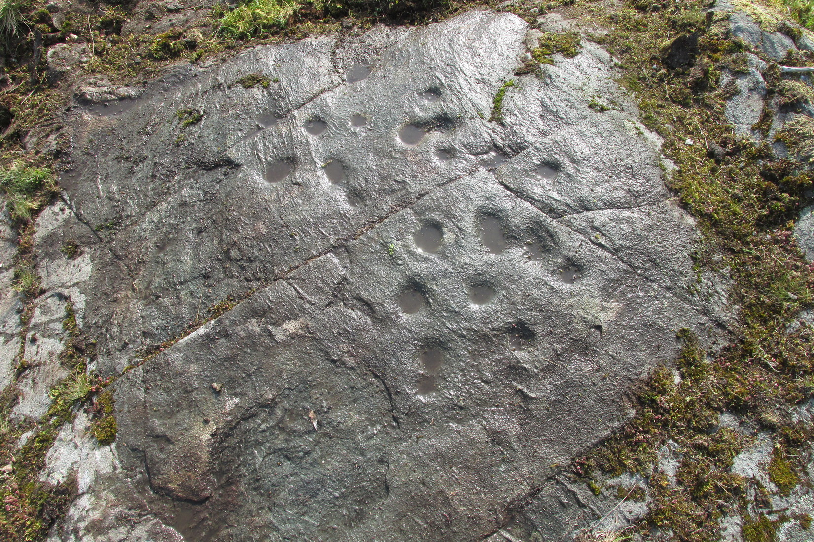
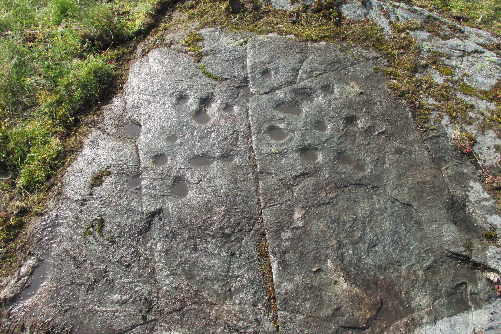
Away from the edge of this relatively flat rock surface, hemmed in between three geological scars, this decent petroglyph shows its memory to prying eyes. It was first described by George Currie (2005) as being just “17 cups (and) one pair of cups are linked”, but there are, as usual, more elements to it than that.
Faint cup-&-rings visible
As we can see quite clearly in the photos here, two of the cups possess rings around them. One of the cup-and-rings near the middle of the mass of cups is complete, with a short line running out of it and into the longest of the natural cracks that frame the design and that runs all the way across the surface of the stone. This cup-and-ring plays a part in a rough circle of cup-marks surrounding a central cup, with one of the outer cups possessing a companion just outside the ring. Two cups in this circle are elongated. There is a possibility that the cup-and-ring I’ve mentioned has another line running from it into the cupmark at the centre of the circle.
On the same side of the long natural crack, outside the circle of cups, is another cup with a faint ring around it. Tis difficult to say whether or not this was originally complete, but when we zoom in it’s pretty damn close!
Framed secondary cluster
The carving when dry
On the other side of the long natural crack is a haphazard spread of nine more cup-marks, with at least one of them seeming to possess a very faint incomplete ring around it. You can just make it out in one of the attached photos. From some angles it seems that two other cups may possess fragments of carved rings around them, but more visits are needed in better light before we can say this with any certainty. One of the cups in this cluster is elongated, whilst two other cups in this bunch are conjoined. Another crack to the side of this secondary cluster has one or two more cups cut into it. Altogether we have between 19 and 21 cups on this petroglyph, with rings around several of them. Worth checking out when you visit this neck o’ the woods. And, of course, if you’re a serious rock art researcher, scan the slopes hereby as other carvings yet remain hidden. You can almost feel them breathing…..
References:
Currie, George, “Wester Glentarken, Perth and Kinross (Comrie parish), Cup-marked Rocks,” in Discovery & Excavation Scotland, volume 6, 2005.