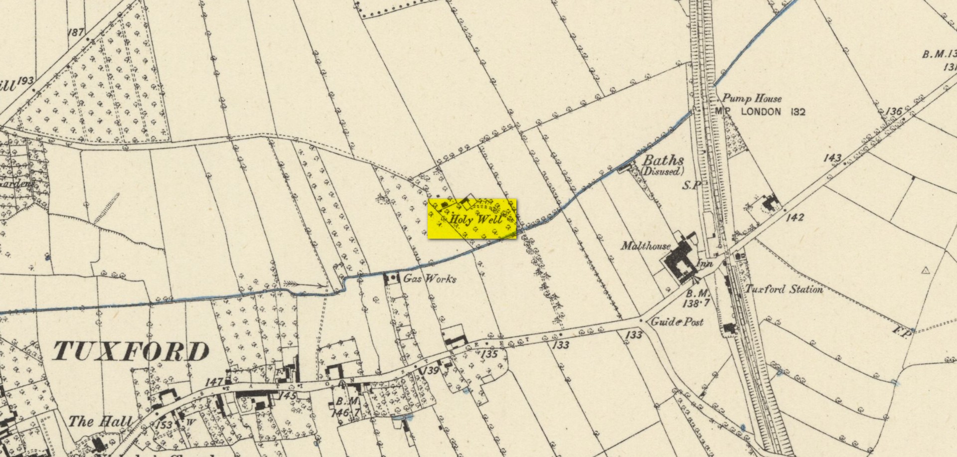
Holy Well: OS Grid Reference – SK 70051 59725
Also Known as:
- Holy Well
Archaeology & History
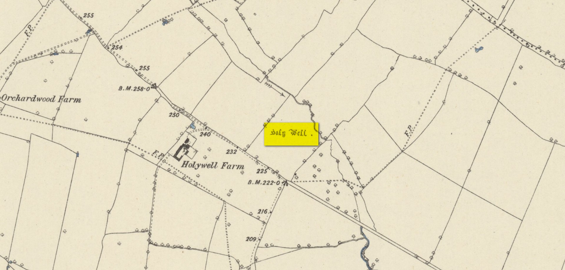
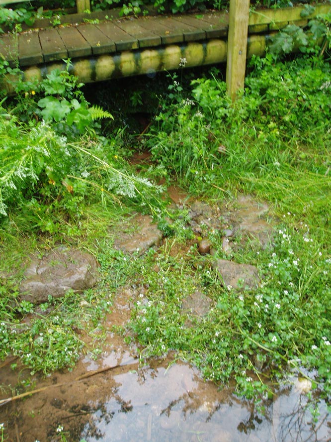
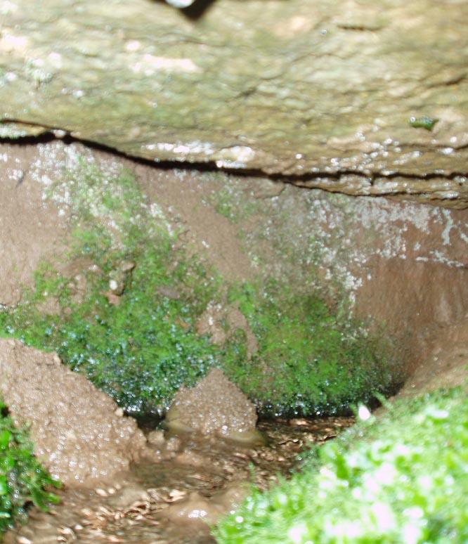
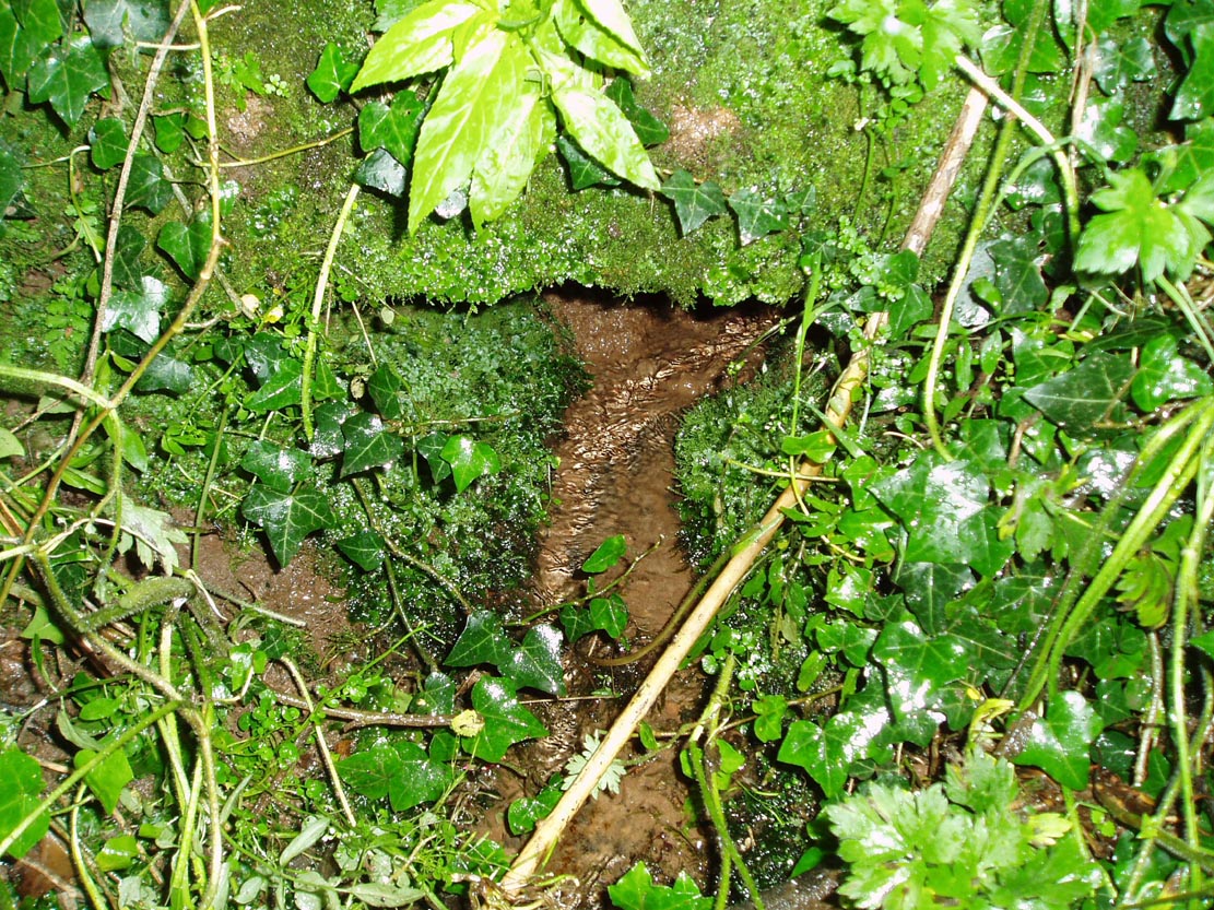
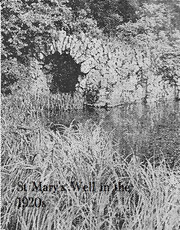
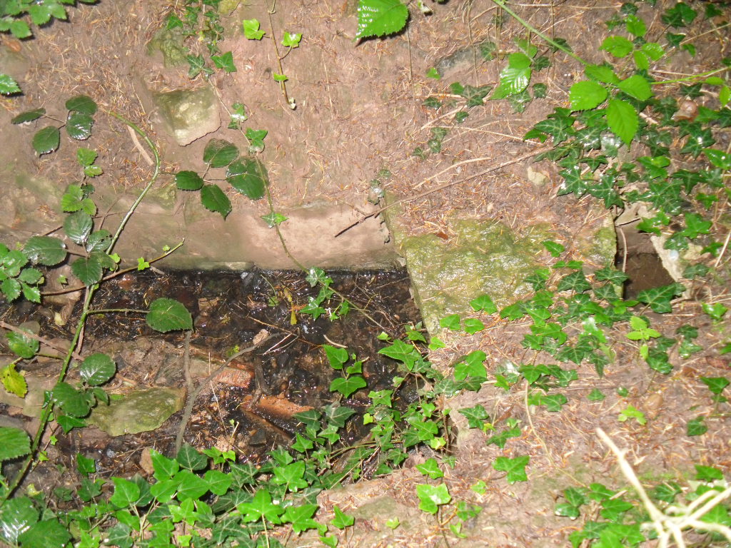
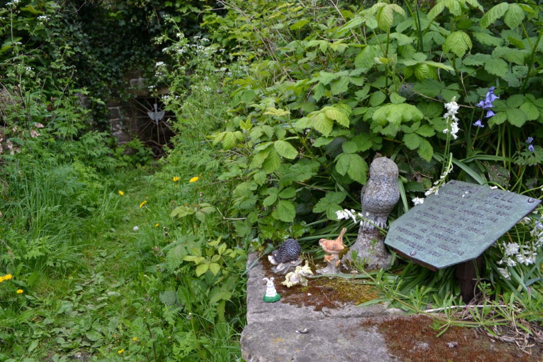
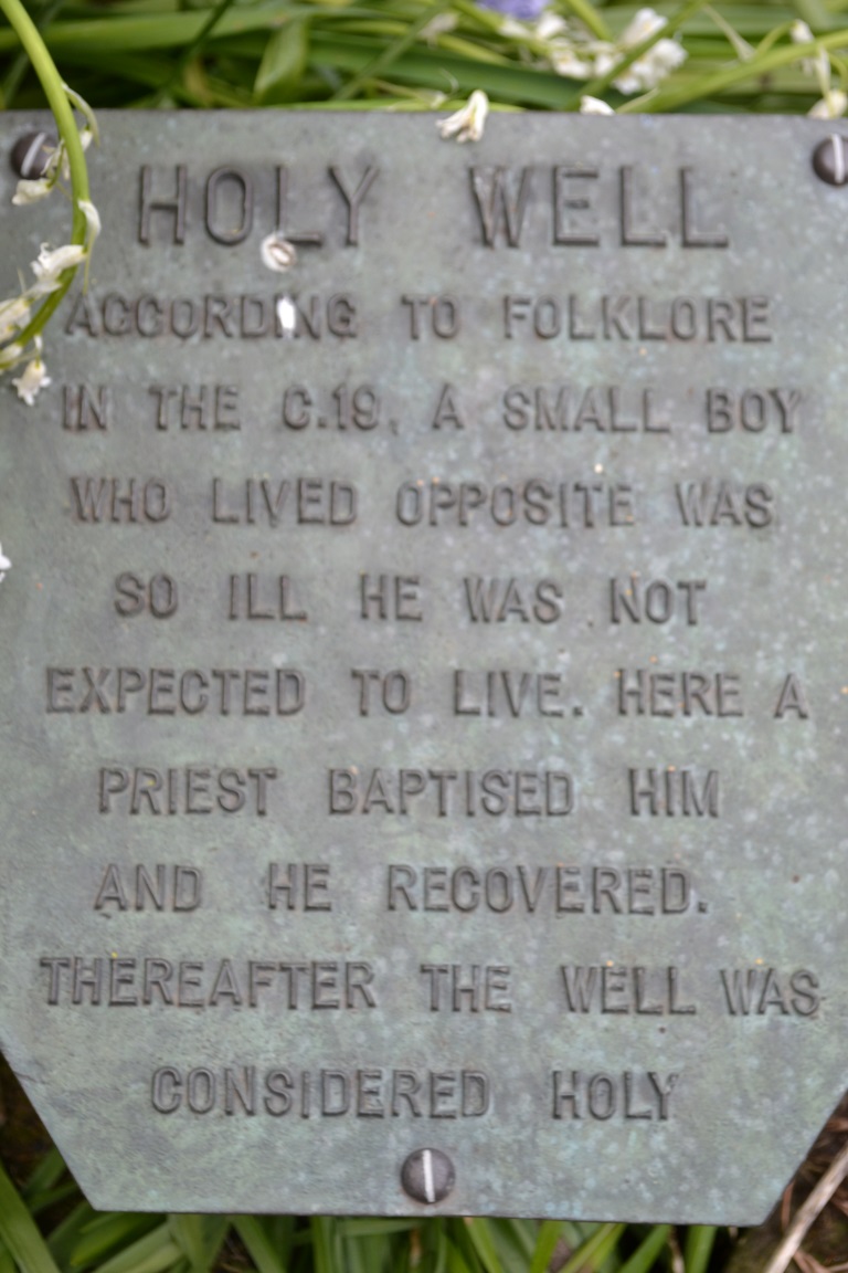
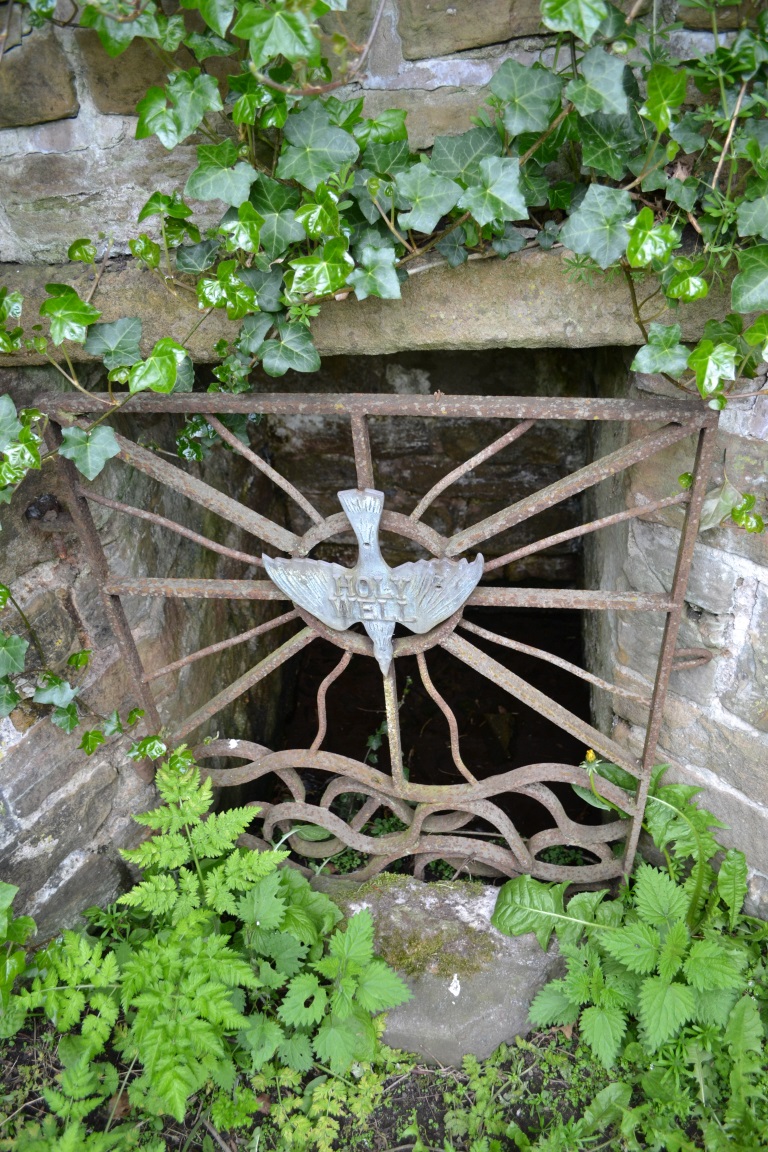
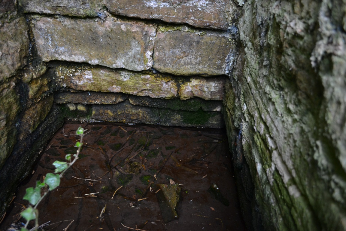
Found on the south-side of the stream a few hundred yards northeast of the aptly-named ‘Holywell Farm’ and highlighted on the early Ordnance Survey maps of the region, this once important sacred site is today, according to local folk, little more than an overgrown muddy patch, visited by very few and hard to see underfoot. It was described, albeit briefly in Leonard Jacks’ (1882) beautiful work, where he told that, “About a mile from the house is to be seen a holy well, a place of interest, which is undoubtedly connected with the past history of the place.”
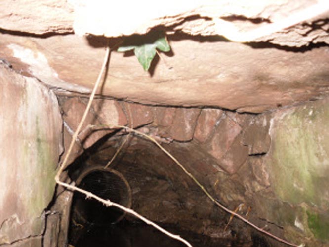
In medieval times, the manor of Winkburn was the seat of the religious Order of the Knights Hospitallers, otherwise known as the Knights of St John of Jerusalem, to whom Bob Morrell (1988) professed this well to have been dedicated. He described there being a small structure around the water source, wondering whether it may have been a bath of sorts to convey water to the nearby house, but remains of this can no longer be seen. It would seem that a good ground survey of the site is required, at the end of Winter when all the vegetation has fallen back, to see if the waters can be recovered and the Holy Well brought back to life for local people. Fingers crossed! 🙂
Folklore
The water from St. John’s Well was said to be good for sore eyes. The religious celebration day of St. John is traditionally around June 24, usually overlaying earlier summer solstice celebrations.
References:
- Jacks, Leonard, The Great Houses of Nottinghamshire and the County Families, W. & A.S. Bradshaw: Nottingham 1882.
- Gover, J.E.B., Mawer, Allen & Stenton, F.M., The Place-Names of Nottinghamshire, Cambridge University Press 1940.
- Morrell, Robert, Nottinghamshire Holy Wells and Springs, Nottingham 1988.
Acknowledgements: Huge thanks for use of the Ordnance Survey map in this site profile, reproduced with the kind permission of the National Library of Scotland.
© Paul Bennett, The Northern Antiquarian