From Bettyhill village, take the A836 road east (as if you’re heading towards Thurso) for literally 1½ miles (2.4km) and take the left turn to Farr (signposted). Exactly a mile along, just past the gated house above the road on your right, in the sloping field below it, you’ll notice a seemingly innocuous scatter of stones doing nothing in particular in the grassland. That’s it!
Archaeology & History
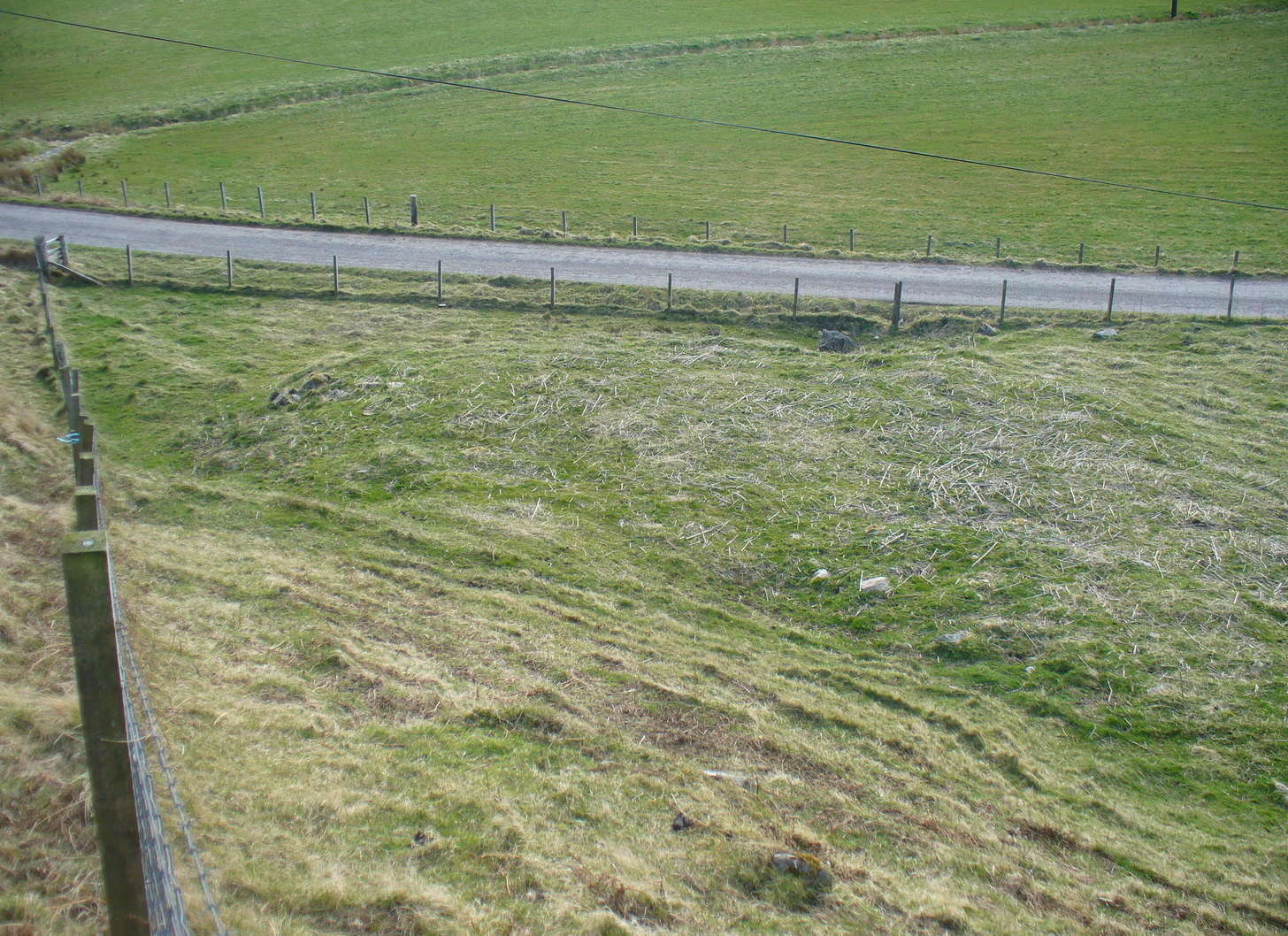
There’s not too much to look at here, apart from a very overgrown mass of loose stones seemingly piled up near the bottom of the sloping hillside. It was first noted when James Horsburgh (1870) explored the prehistoric sites of the region, but even then the site was mentioned with some brevity, telling simply:
“On the way from Farr to Borve Castle, there are the foundations of a Pictish tower at Clarkhill, the stones of which are larger than usual, being square blocks.”
Looking down on the ruins
His description regarding its precise whereabouts wasn’t very clear, but it was located some years later by the Royal Commission (1911) who subsequently added the site to their Inventory. They found that the broch was “at the extreme west end of a low rocky ridge on which are situated the buildings of a croft bearing the name of The Dun.” They reported, even then, that only a few large stones of the broch remained visible. `
The site was included in Euan Mackie’s (2007) magnum opus, where he described the only remains left of this “possible broch” to be “the basal course of the outer wall…forming an arc about 9.0m long.”
MacKie, E W., The Roundhouses, Brochs and Wheelhouses of Atlantic Scotland c.700 BC-AD 500 – volume 2, British Archaeological Report: Oxford 2007.
Royal Commission Ancient & Historical Monuments, Scotland, Second Report and Inventory of Monuments & Constructions in the County of Sutherland. HMSO: Edinburgh 1911.
Acknowledgements: With thanks to the old crew of Aisha and her little Lara for getting me up here, oh so many years ago now…..
Stone Circle (destroyed): OS Grid Reference – NN 9424 5871
Archaeology & History
Missing from the primary surveys of Burl (2000) and Barnatt (1989), a mention of this long lost site was made by local historian Hugh Mitchell (1923) in his survey of the area. He told that,
“On the east side of the Moulin road beyond the Hydro Hotel a knoll and a clump of trees will be noticed on the right, inside the Hydropathic grounds; this knoll is known as the Cnoc Dubh, or “Black Knoll” and still bears an uncanny reputation as being an old site of Pagan worship. There was at one time a stone circle on it, but the stones are said to have been broken up, fully 100 years ago, to build the old farmhouse of Balnadrum.”
Something ancient was there, obviously, as it was mentioned in another earlier account—albeit just a tourist guide of Atholl—which said that, on
“the knoll known as Knock-Dhu, within the (Pitlochry Hydro) grounds, are the remains of a pre-historic fort, now overgrown with pine trees.”
References:
Anon., Atholl Illustrated, L. Mackay: Pitlochry c.1910.
Dixon, John H., Pitlochry Past and Present, L. Mackay: Pitlochry 1925.
Mitchell, H., Pitlochry and District: Its Topography, Archaeology and History, L. Mackay: Pitlochry 1923.
Take the A836 road west out of Bettyhill, down the road and cross the river on the tiny bridge. From here, go over the gate on the right-hand side of the road and follow the edge of the river towards the sea. Crossing the large extensive sands, you’ll reach a large sand and gravel rise ahead of you. Once on top of this natural feature, walk NNE for 550 yards (0.5km) until you reach one of many extensive sandy expanses in the grasses (and pass tons of archaeological remains as you walk!). You’ll get there!
Archaeology & History
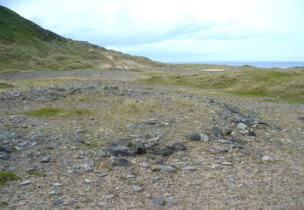
Arc of south, west & north walling
On this naturally raised sand-and-gravel platform at the edge of this beautiful sandy coastline in the far north of Scotland, walking in search of this particular enclosure, you’ll meander past a whole host of prehistoric sites and remains – some of which are plain to see, others hiding almost just above ground level, barely visible. But if you’re an antiquarian or historian, this plateau is a minefield of forgotten history!
The site is shown on the 1878 Ordnance Survey map of the region as a “hut circle”, which it may well have been—but this is a large hut circle and was more probably a place where a large family would easily have lived. When I visited the place the other week, there were no internal features visible. It is a large ring of stones made up of thousands of small rocks whose walls are low and scattered, barely a foot above present ground-level in places, and barely two-feet at the very highest. It has been greatly ruined or robbed of other architectural elements and an excavation is in order. My initial evaluation is that this structure is at least Iron Age in origin. In Angus Mackay’s (1906) venture here in the early 1900s, he suggested that this and the other “circular rings” were “cattle folds.”
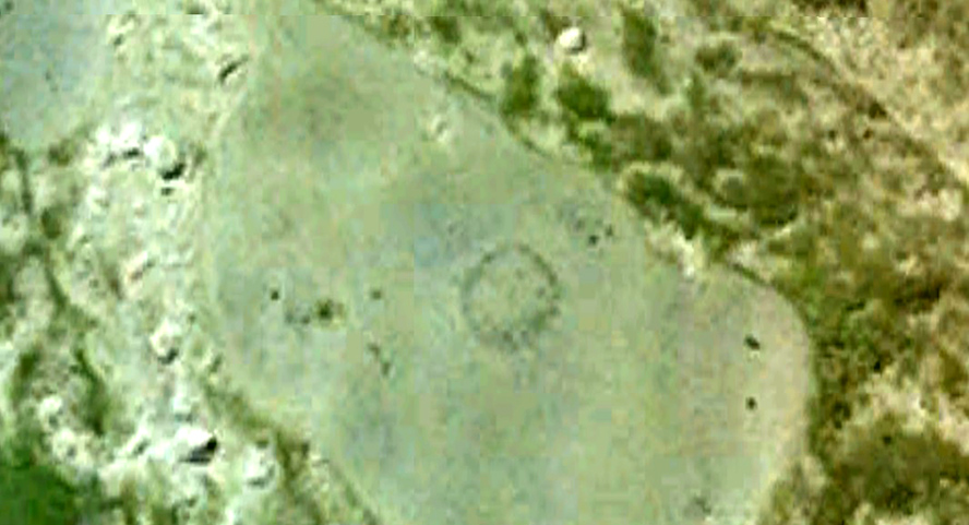
Aerial view, looking straight down
Looking down from the broch above
The enclosure measures, from outer-edge to outer-edge of the walling, 16.5 yards (15.1m) east-west by 18 yards (16.5m) north-south, and has a circumference of roughly 52.5 yards (4mm); although an accurate measure of its circumference is hampered by the scatter of spoilage from the collapsed walls stretching outwards. Only the western walled section remains in reasonably good condition.
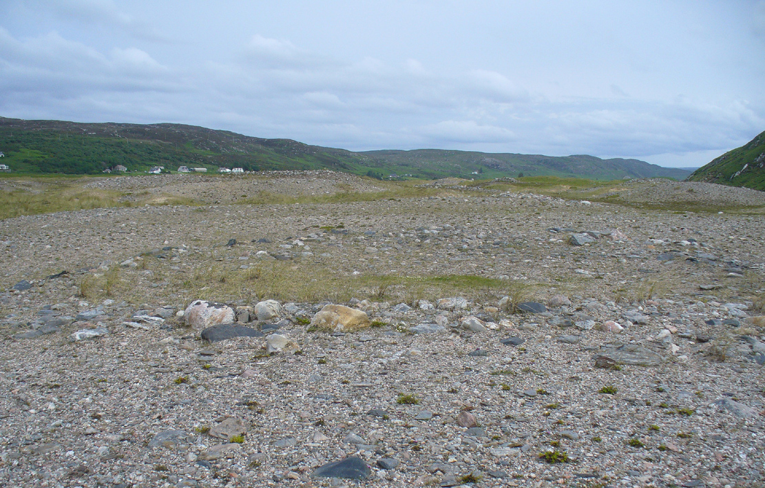
Looking south, thru the enclosure
Close by are many cairns, some of which are prehistoric. A chambered cairn on the same ridge less than 200 yards away, with another enclosure of the same type yards away, clearly shows that people have lived and used this raised section of land for thousands of years. We know that people were still living here at the end of the 18th century which—for me at least—begs the question: what ancient traditions, customs and lore did these people know about, which may have dated back into truly ancient history? …And then the english Clearances destroyed them…
Royal Commission on Ancient & Historical Monuments, Scotland, Second report and inventory of monuments and constructions in the county of Sutherland. HMSO: Edinburgh 1911.
Take the A836 road west through Bettyhill and downhill, turning right and going over the small bridge at the bottom. From here, go over the gate on the right-hand side of the road and follow the edge of the river towards the sea. Crossing the large extensive sands, you’ll reach a large rise ahead of you and, to the left (west) a burn tumbles down from the hills above. Walk up it and head to the rocky rise on the level 50 yards past the burn. You’re here!
Archaeology & History
Once you’ve clambered the rocky hill to reach the broch, you’ll be damn impressed. This is a real beauty – although from the outside it looks nothing of the sort. The outer wall is a veritable jumbled mass of rocks piled on top of each other in a manner that looks as if human hands once fumbled them in some sort of order, long since fallen away. Around the western side of the structure, faint remains of steps lead up towards more ordered-looking walling ahead of you. Before you walk up the remains of steps, notice the more structured walling, about three feet high to your right, curving around the large structure you are already inside the edges of.
Whether you walk up the stepped remains or simply up the outer walling, once you see the internal stone walling of this high cliff broch, you’ll be impressed. It’s a big bugger – and in damn good condition when you consider that it’s probably 2000 years old, or more! A large round walled structure, about three feet high all round, well sheltered from the wind and rains, measures some 30 feet across.Arc of outer western wall
The internal living quarters
Eastern section of the broch
The site is still known by some local people as a “Pictish Tower” and was described as such on the 1878 Ordnance Survey map (see above) and its Gaelic name is Ca an Duin(Mackay 1906). The probability of the brochs as being Pictish in origin is more than likely. Tradition up here speaks of them as such – and we know that such traditions go back many centuries in these isolated areas. An early mention of this Pictish Tower was given in James Horsburgh’s (1870) essay, but it wasn’t described in any real detail until the Royal Commission (1911) fellas looked at the site. They wrote:
“On the summit of the hill which rises to the W of the gravelly plateau opposite Bettyhill, and on the N side of the track which leads from Strathnaver to Torrisdail, is situated a broch. It is called the “Sandy Dun”. The wall is probably erect for a considerable height, but the interior is largely filled up with blown sand. The entrance is from the SW. The interior diameter is 29 feet and the thickness of the wall 12 feet. Near the top of the wall in the interior is a projecting ledge, about 10 feet wide, running all around. The slabs which form it are an integral part of the structure and the wall is thicker below than above. The outer face of the wall is much ruined…”
Gazing NE from inside the broch
Although some of the internal walling has been taken away since the 1911 survey, the interior of the site has been cleaned up by local people and it is presently in a very good condition indeed. The broch may have been built onto an earlier fortified structure, rising above the stunning prehistoric settlements and necropolis on the sandy plateau immediately below. It would make sense – as many earlier Neolithic and Bronze Age remains look up at the prominent rock pinnacle it’s built upon from the sandy plain below, almost as if it was a natural temple in the animistic traditions of the earlier peoples.
If you visit this gorgeous region, the Baile Mhargaite broch should definitely be on your list of sites to see.
Folklore
Old lore told that this broch was attacked by outside invaders many centuries ago. Mr Horsburgh (1870) told that,
“an old woman hid a croc of gold previous to the dun being attacked, and measured the distance from it with a clew of thread.”
MacKie, E W., The Roundhouses, Brochs and Wheelhouses of Atlantic Scotland c.700 BC-AD 500 – volume 2, British Archaeological Report: Oxford 2007.
o’ Reilly, Kevin & Crockfird, Ashley, What to See Around Bettyhill, privately printed 2009.
Royal Commission on Ancient & Historical Monuments, Scotland, Second report and inventory of monuments and constructions in the county of Sutherland. HMSO: Edinburgh 1911.
Acknowledgements: Immense thanks go to Aisha Domleo and Unabel Gordon for their help getting me up here. This site profile would not exist without their encouragement.
This ancient fort could once be seen in the ancient woodlands on the western side of the Mill Glen, above the village, going into the Ochils—but it was completely destroyed, as usual, by the Industrialists when they quarried the entire structure out of existence. It was a big thing too, by all accounts. When Stewart Cruden (1964) saw it, shortly before its final demise, it was still impressive to look at. He told that the fort consisted of a deep rock-cut ditch with a stone wall on the inside and the remains of a stony rampart on the outside. Although damaged it still measured 300 feet across. Its interior contained an almost precise circular enclosure, more than eighty feet across inside the remains of a large stone wall some twelve feet thick.
Nearly a hundred years earlier, Miss Christian MacLagan (1875) told it to be much bigger! Not only did she report how locals remembered a stone roof on top, but it possessed three concentric circular walls, thirty-five apart, with the central area eighty feet in diameter—much as Cruden later reported. However, even in MacLagan’s day, she told how many of the stones from the fort were being used to construct sheepfolds. This destruction was being lamented by the local historian William Gibson (1883), who wrote:
“On the west side of the burn, and overtopping the village, stands the beautiful Castle Craig, wooded to the top, and on which stood, in ancient times, a round Pictish fortress, the traces of which can still be distinctly seen. This craig is, I think, one of the most picturesque objects on the Alva estate, and it is a very great pity that it should be so disfigured by the extensive quarrying operations that are being at present carried on at it.”
On the top of the quarry edges can still be found old walled remains crumbling at the edge of the huge cliffs, but these are unlikely to have been attached to the ancient fortress, and may just be the fragmentary memories of the sheepfolds built from the old fort.
Folklore
Tradition told that this was one of the old forts of the Picts who lived in the Ochils. If it was a fort, then the Pictish tradition is probably true. Old lore also told that some of the stones from the fort were used in the construction of Stirling Castle, 7.8 miles (12.6km) to the west.
References:
Corbett, L., et al., The Ochil Hills, Forth Naturalist & Historian 1994.
Cruden, Stewart H., “Castle Craig, Tillicoultry,” in Discovery & Excavation Scotland, 1964.
Feacham, Richard, Guide to Prehistoric Scotland, Batsford: London 1977.
Maclagan, Christian, The Hill Forts, Stone Circles and other Structural Remains of Ancient Scotland, Edinburgh 1875.
Royal Commission on the Ancient & Historical Monuments, Scotland, Inventory of Monuments and Constructions in the Counties of Fife, Kinross and Clackmannan, HMSO: Edinburgh 1933.
Royal Commission on the Ancient & Historical Monuments, Scotland, The Archaeological Sites and Monuments of Clackmannan District and Falkirk District, Society of Antiquaries of Scotland 1978.
Watson, Angus, The Ochils: Placenames, History, Tradition, PKDC: Perth 1995.
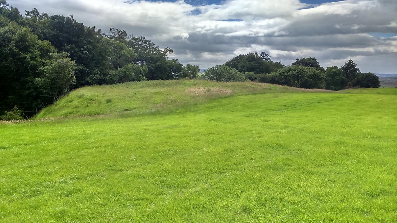
Take the A873 from Thornhill to Aberfoyle, and literally 1 mile west of Thornhill turn right up the track up and past Easter Borland farm (as if you’re heading up to Auchensalt). 250 yards past the farm, a large field opens up. Walk 100 yards east along the side of the wall towards the trees and follow the tree-line upstream 250 yards (don’t go into the lovely little glen) until, on your right, you’ll see a reasonably large area of grassland that rises up, with a steep-ish slope down to the burn below. This is the remains of the broch.
Archaeology & History
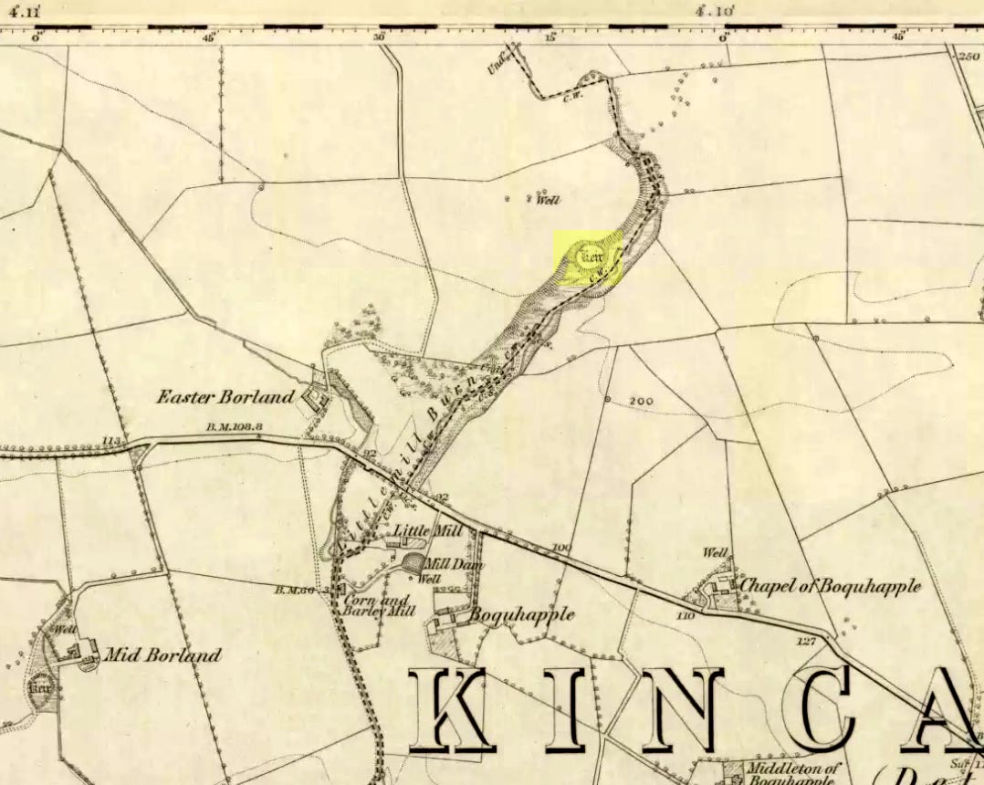
Shown as a ‘Keir’ on the 1866 OS-map, this is an old Scottish dialect word, barely used at all nowadays (folk need to start using it again!) which meant “an ancient fortification” or “rude forts”. The word is mentioned in early Statistical Accounts in 1795 and in the Second Account of 1845 the “Kiers at Auchinsalt” are mentioned specifically, albeit in passing….
Auchinsalt ‘Keir’ on 1866 map
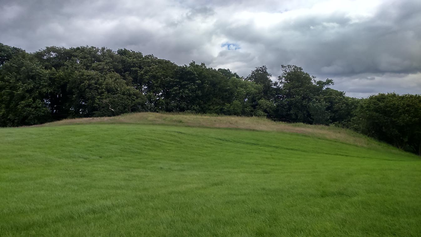
When we visited the site yesterday, very little could be seen due mainly to the summer vegetation covering the area. A very small section of open walling was noted on its western side, and beneath the undergrowth a roughly oval structure was in evidence on the rise between the edge of the field and the drop into the small glen below. Something obviously man-made lies beneath the grasses, but in the last 100 years or so there has been debate as to whether it was a fort, a dun or a broch. The consensus at the mo, tells Euan Mackie (2007), is that it’s a broch!
Auchinsalt broch, looking east
Measuring some 25 yards across, the walling that makes up the broch was between 4-6 feet wide all round, and about 2 feet high. There seemed to be aggregates of large scattered stones inside and outside the main oval feature. If there was an entrance, it seemed to be at the western side, but I wasn’t sure about this. In truth, unless you’re a hardcore broch fanatic, you’d be truly disappointed with the dilapidated state of this monument. Much better ones can be seen just a few miles away…
References:
Chrystal, William, The Kingdom of Kippen, Munro & Jamieson: Stirling 1903.
Grant, William (ed.), The Scottish National Dictionary – volume 5, SNDA: Edinburgh 1960.
MacKie, Euan W., The Roundhouses, Brochs and Wheelhouses of Atlantic Scotland c.700 BC-AD 500, BAR: Oxford 2007.
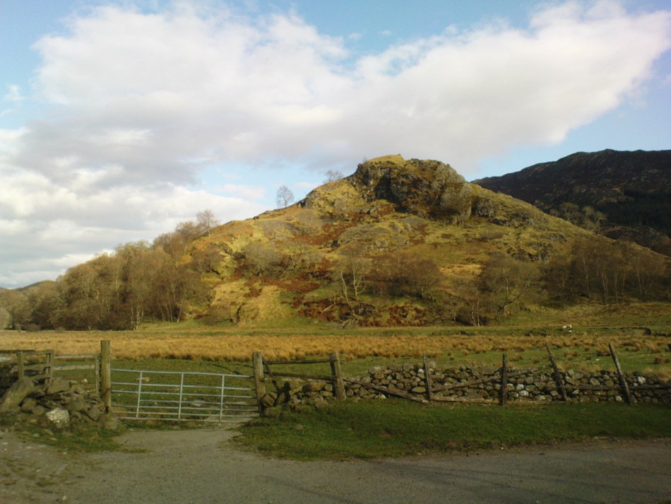
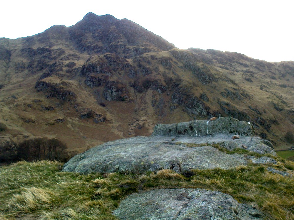
Not hard to find. Between the small towns of Comrie and St. Fillans along the A85 road, keep your eyes peeled for the small but rocky crags that rise in front of the background of dramatic mountains not far from the roadside to the south. It looks truly majestic even on a dull day. Just as you reach the eastern edge of St. Fillans village, take the small road over the river-bridge and go to the golf club. Walk past the golf club itself, keeping along the track that leads you to Dundurn hill. It’s easy enough. Then climb to the very top of the hill where you’ll find this curious, large, flat bed-like rock right in front of you!
Archaeology & History
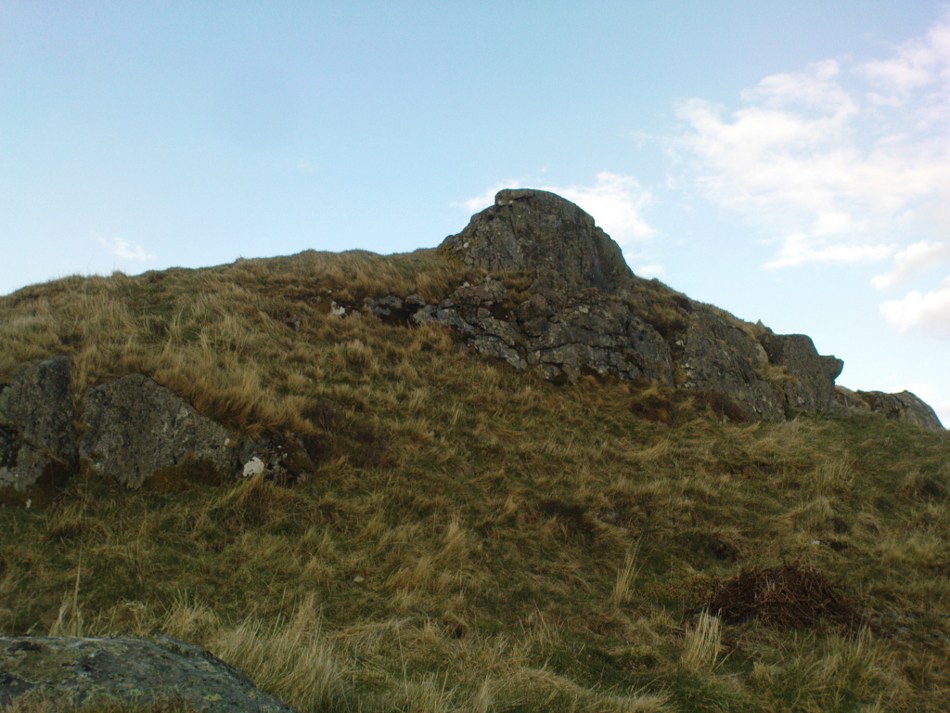
St Fillan’s rocky bed or ‘chair’
The archaeological data for St. Fillan’s Chair relates more to the folklore practices of the people upon Dundurn hill than anything else and ostensibly little can be said by such students. The place is more satisfying for geologists than archaeologists, who would adore the rocky fluctuations and geophysical propensities with greater verve than any archaeologist could muster! For this rocky bed-shaped feature is a fascinating structure whose only potential interest to archaeologists are what may be a couple of reduced cup-marks on the top of the stone (and even then, such potential rock art is more the province of religious historians and anthropologists than archaeologists).
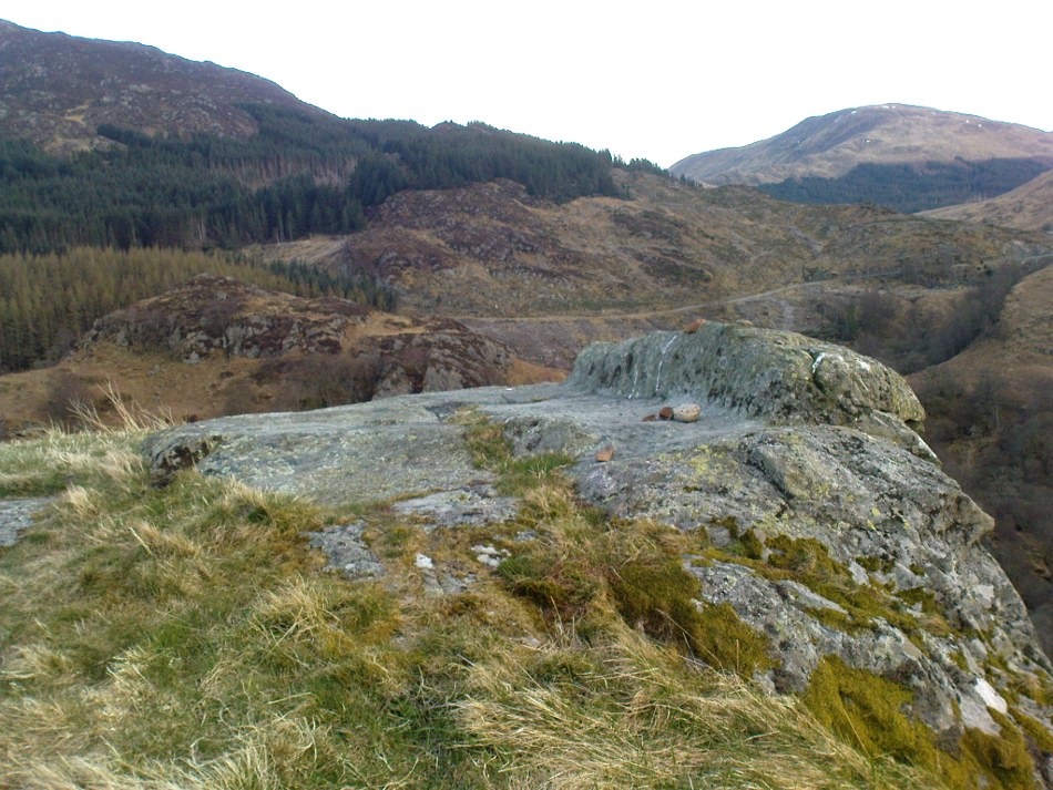
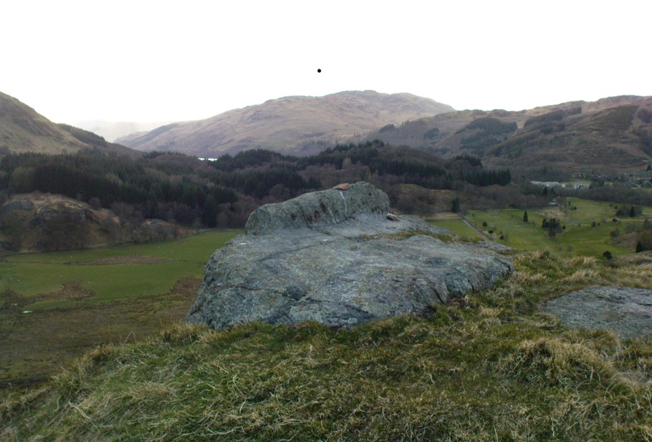
Small quartz offerings left on St Fillan’s Chair at BeltaneView of the Chair from below
But this ‘bed’ or ‘chair’, as it was locally known, was – and it seems, still is – important in the social history of the area, as its folklore clearly tells. The ‘chair’ plays an important part in the holistic role of Dundurn as a hill, a fort, a healing centre, an inauguration site, and very probably an omphalos: a sacred centre whereupon the ordination of shamans, kings and the cosmos as a whole was brought to bear here… (these features will be explored in greater depth when I write a singular profile of Dundurn as a ‘fort’).
Folklore
Looking west over St Fillan’s Chair
The character of St. Fillan was described by James Cockburn (1954) as “an Irish Pict” and the “son of a King – his father being Angus mac Nadfraich who died in battle in 490 AD.” Quite an important dood in his day! The relationship this early christian figure had with this Chair was in its supposedly curative properties. Yeah…you read it right: curative properties! As with countless rocks all over the world, some of Nature’s outcrop boulders were imbued with a spirit of their own and, when conditions and/or the cycle of the spirit ‘awoke’, healing attributes could be gained from the place. And such was the case at St. Fillan’s Chair, especially on Beltane morning (May 1). And some element of this traditional pilgrimage is still done; for when the author Marion Woolley and I visited the site on Mayday 2013, it was obvious that some people had been up earlier that Beltane morning and left some offerings of quartz stones on the top end of the bed.
The earliest written reference of this medicinal virtue was told in the Old Statistical Account of Perthshire (1791):
The rock on the summit of the hill, formed, of itself, a chair for the saint, which still remains. Those who complain of rheumatism in the back, must ascend the hill, sit in this chair, then lie down on their back, and be pulled by the legs to the bottom of the hill. This operation is still performed, and reckoned very efficacious.
More than a hundred years later, the sites was still being used and was described in similar vein in MacKinlay’s (1893) excellent study:
“On the top of green Dunfillan, in the parish of Comrie, is a rocky seat known in the district as Fillan’s Chair. Here, according to tradition, the saint sat and gave his blessing to the country around. Towards the end of last century, and doubtless even later, this chair was associated with a superstitious remedy for rheumatism in the back. The person to be cured sat in the chair, and then, lying on his back, was dragged down the hill by the legs. The influence of the saint lingering about the spot was believed to ensure recovery.”
The origins of this dramatic rite were probably pre-christian in nature and we should have little doubt that St. Fillan replaced the figure of a shaman or local medicine woman of some sort. The ritual “dragging down the hill” may be some faint remnant of initiation rites…
References:
Cockburn, James H., The Celtic Church in Dunblane, Friends of Dunblane Cathedral 1954.
Eliade, Mircea, Rites and Symbols of Initiation, Spring: Woodstock 1995.
Up above the roadside leading down the gorgeous Craobh Haven road, we not only find remains of a previously unrecorded standing stone, but we see this little-known overgrown fort that has been described as a “galleried dun” by the Royal Commission (1988) lads. Known in folk tradition as the “castle of the black dogs” and an important place in the great legends of the Finns, in archaeological terms the Royal Commission described the site as:
“Oval in plan, the dun measures about 13m by 10m within a wall which varies from 3m to 4m in thickness. Considerable stretches of the outer face survive and on the N it rises to a height of 1.7m in ten rough courses; the inner face is less well preserved, but a long stretch is visible on the NW. There are traces of a gallery within the thickness of the wall on the NW; it was entered through a narrow passage, the S-side wall of which it stands to a height of 0.4m in three courses. A second break in the line of the inner face, 2.5m to the NE, is either another entrance to the gallery or the entrance to a second chamber. Depressions in the thickness of the wall on the S may indicate the presence of yet another intramural feature. The entrance to the dun lies on the WSW; it measures about 1m in width at the outer end, 1.8m at the inner end, and is checked for a door 1m from the exterior. On the NE there is a short stretch of facing at right-angles to the line of the wall, and this may be a straight-joint similar to that at Castle Dounie…or one side of a postern gate. In the interior there are the remains of at least two animal-pens and a modern rectilinear cairn. There is no trace of the midden-deposit noted by Campbell & Sandemann to the W of the dun, and the cairns and stretches of field-walling on the N flank of the ridge are of relatively recent date.”
Folklore
Close to a little-known cailleach site, this ruined fortress was one of the many places which the illustrious historian and folklorist Archibald Campbell told about in his awesome series of Waifs and Strays of Celtic Tradition (1889). The tale of the fort was known to local people as “The Fight between Bran and Foir and is as follows:
“The black dog, Foir, was the brother of Bran, the far-famed hound of Fionn. Foir was taken early from his dam, and was afterwards nurtured by a band of fair women, who acted as his nurses. He grew up into a handsome hound, which had no equal, in the chase or in fight, in the distant North. His owner, Eubhan Oisein, the black-haired, red-cheeked, fair-skinned young Prince of Innis Torc (Orkney ?) was proud, as well he might be, of his unrivalled hound. Having no further victories to win in the North, his master determined to try him against the strongest dogs in the packs of the Feinne.
“He left home, descended by Lochawe, and entered Craignish through Glen Doan. Before his arrival, the Fienne, after spending the day in the chase, encamped for the night in the upper end of Craignish. Next day Fionn arose before sunrise, and saw a young man, wrapped in a red mantle and leading a black dog, approaching towards him at a rapid pace. The stranger soon drew near, and at once declared his object in coming. He wanted a dog-fight, and so impatient was he to have it, and so restless by reason of his impatience, that he suffered not his shadow to dwell a moment on one spot.
“Fifty of the best hounds of the Feinne were slipped at last, but the black dog killed them all one by one. A second and then a third fifty were uncoupled, but the strange dog disposed of them as easily as he did of the first.
“Fionn now saw that all the dogs of the Feinne were in serious danger of being annihilated, and therefore he turned round and cast an angry look on his own great dog Bran. In a moment Bran’s hair stood on end, his eyes darted fire, and he leaped the full length of his golden chain in his eagerness for the fight. But something else besides the casting of an angry look was still to be done to rouse the fierce hound’s temper to its highest pitch.
“He was placed nose to nose with his rival, and then his golden chain was unclasped. The two hounds, brothers by blood, but now champions on opposite sides, at once closed in deadly fight; but for an adequate description of the struggle between them the reader must consult the bards. See the “Lay of the Black Dog”, in Islay’s Leabhar na Feinne, the McCallum’s Ancient Poetry, etc.
“The contest lasted from morning to evening, and victory remained, almost to the close, uncertain; but in the end Bran vanquished Foir, and, by killing the latter, amply revenged the death of the three fifties. The Feinne buried their own dogs, and the stranger, with a sore heart, laid his black hound in the narrow clay bed.
“This great dog-fight, so celebrated in Gaelic lore, is said to have been fought at Lergychony, in Craignish. It is further said that the place was called Learg-a-choinnimh, or the “Plateau of Meeting”, because it was there the two hounds met in fight. There are, of course, many other places in the Highlands which claim the honour of being the scene of this legendary contest.”
References:
Campbell, Archibald, Waifs and Strays of Celtic Tradition – volume 1, David Nutt: London 1889.
Royal Commission on the Ancient & Historical Monuments of Scotland, Argyll – Volume 6: Mid-Argyll and Cowal, HMSO: Edinburgh 1988.
Take the A907 road between Clackmannan and Comrie and, close to Bogside Farm at the roadside, but on the other side of the road where the bridge crosses a burn, take the dirt-track uphill and into the woodland. About 300 yards up (before you hit the signs pointing you to the farm) , walk uphill into the trees on your left until the ground levels out. Look around! (and best visited between December and May, before the bracken covers the place)
Archaeology & History
Visiting this site is pleasure in itself. Situated in an open forest, with traditional pine trees in abundance, there are scattered amidst the edges of this large oval-shaped Iron Age structure, the aged boughs of ash and beech, centuries old, along its edges and throughout the woods. It is a truly superb setting! When visited by the Royal Commission lads in April, 1925, they found the remains here in good condition. A few years later in their impressive Inventory, they told:
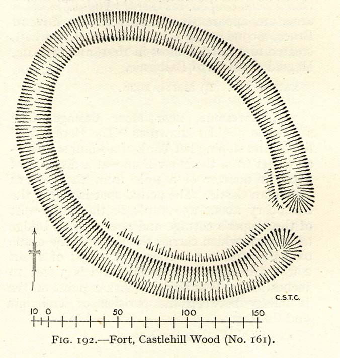
“In Castlehill Wood, about 250 yards to the southwest of Bogside Railway Station, and at an elevation of 200 feet above sea-level, is a small plateau of very regular oval form with its major axis northwest and southeast. It is surrounded by a single ditch, the well-marked enclosure thus produced having a maximum measurement of 185 by 135 feet. At the southeast the ditch has been left uncut in order to provide a passage for entrance. This passage has been about 20 feet wide, and at its inner end there are on either side faint traces of a low mound, which in all probability once ran right round the edge of the enclosure and which may have been palisaded.”
RCHAMS 1933 plan of site
Sadly when I came here a few days ago, much of the was very overgrown with bracken and other vegetation, making it impossible to see the site properly and preventing any decent photos. We’ll go back here in a few months time to get better images!
Folklore
This site was mentioned, albeit briefly, in David Beveridge’s (1885) magnum opus on the history of Culross. With equal brevity he noted several standing stones in the region, saying how tradition afforded them a Danish origin. This site was the same for
“a tradition prevails that after the battle of Inverkeithing the Danish army or a portion of it retreated to a station in the north of Culross parish, where they erected the earthwork or camp of Castlehill, still existing near the Burrowine Farm.”
References:
Beveridge, David, Culross and Tulliallan: Its History and Antiquities – volume 1, William Blackwood: Edinburgh 1885.
Royal Commission on the Ancient & Historical Monuments, Scotland, Inventory of Monuments and Constructions in the Counties of Fife, Kinross and Clackmannan, HMSO: Edinburgh 1933.
Not to be confused with the ‘fort’ shown on modern OS-maps on the wooded slopes a few hundred yards to the south, the denuded remains of this site were shown on an 18th century map of the area (the Breadalbane estate plans). Probably Iron Age in nature, the local historian William Gillies (1938) described the place in his fine work,
“According to the atlas of 1769 there were ruins of an ‘Ancient Castramentation’ at Firbrush Point on the farm of Auchmore. An examination of this little peninsula revealed the foundation of a very thick wall that at one time ran across its neck, and formed a defence on the landward side. It is probable that the stones were removed for the erection of the small pier and harbour close by.”
An assessment of the site by some of the Scottish Royal Commission lads in the late 1970s found no remains of the thick walling and it seems all remains of this fort have sadly been destroyed.
References:
Gillies, William A., In Famed Breadalbane, Munro Press: Perth 1938.
Royal Commission on the Ancient & Historical Monuments of Scotland, Archaeological Sites and Monuments of Stirling District, Central Region, Society of Antiquaries of Scotland 1979.