Thor’s Stone, Thurstaston, Cheshire

Legendary Rock:  OS Grid Reference – SJ 24474 84933

Also Known as:

  1. Thor’s Rocks

Archaeology & History

Thor’s Rock (after J.Picton)

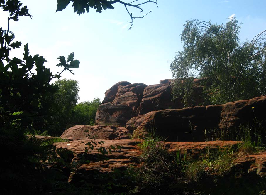
On Thurstaston Common a 298 foot high hill has a large red sandstone outcrop, on the landward side, known as Thor’s Stone. One large rectangular block of stone that is 50 feet in length, 30 feet wide by 25 foot high has been eroded over thousands of years. Described by J.A. Picton in 1877 as “the Great Stone of Thor,” the village itself seemed to have gained its name from this prominent mass of rocks.  It was described first of all in the Domesday book, as Turstanetone, and both village and rocks have been written as variants on the original ever since.  The place-names writers Mills & Room (1998) ascribe the name to being a “farmstead or village of a man called Thorstein”; but it’s just as likely to derive from “a farmstead of/at Thor’s Stone.” (Harrison 1898)  As early landscape features were traditionally equated with animistic and mythic lore, the Viking god Thor is more probable than some unlikely chap called Thorstein.

More than 100 miles southeast of here, we find another Thor Stone in the village of Taston, showing similar megalithic etymology.

Folklore

Local folklore tells that the rock is named after the Norse god Thor – he who causes thunder and lightning.  Viking settlers from Thingwell apparently settled here in the 10th century AD and, according to legend, these settlers used the stone as a pagan altar with blood sacrifices taking place here.  A creation myth of the site tells that Thor tossed the large stone here in anger; and yet another says that the stone was raised here to commemorate the battle of Brunanburh in 937 AD.  In modern more times, Morris dancers meet here and enact their rites on Mayday mornings.

The outcrop has been eroded away over thousands of years by the weather, post glacial erosion and even quarrying, leaving strange shapes, features and projections in the soft sandstone. There is much recent graffiti to be seen all over the rock, especially on the summit and sides including one set of graffiti carved by Professor Taylor in 1879.  There used to be a “fairy well” near the stone but this disappeared long ago.  Children took flowers to the well to decorate it, while adults visited it to receive a cure for various ailments of the body.  At nearby Thurstaston Hall, Christina Hole (1937) reported there lived the ghost of a troubled woman.

References:

  1. Harrison, Henry, The Place-Names of Liverpool, Elliot Stock: London 1898.
  2. Hole, Christina, Traditions and Customs of Cheshire, Williams & Norgate: 1937.
  3. Mills, A.D. & Room, Adrian, A Dictionary of English Place-Names, Oxford University Press 1998.

© Ray Spencer, The Northern Antiquarian

Old Wife Ridge, Heyshaw Moor, Dacre, North Yorkshire

Sacred Hill:  OS Grid Reference – SE 159 626

Getting Here

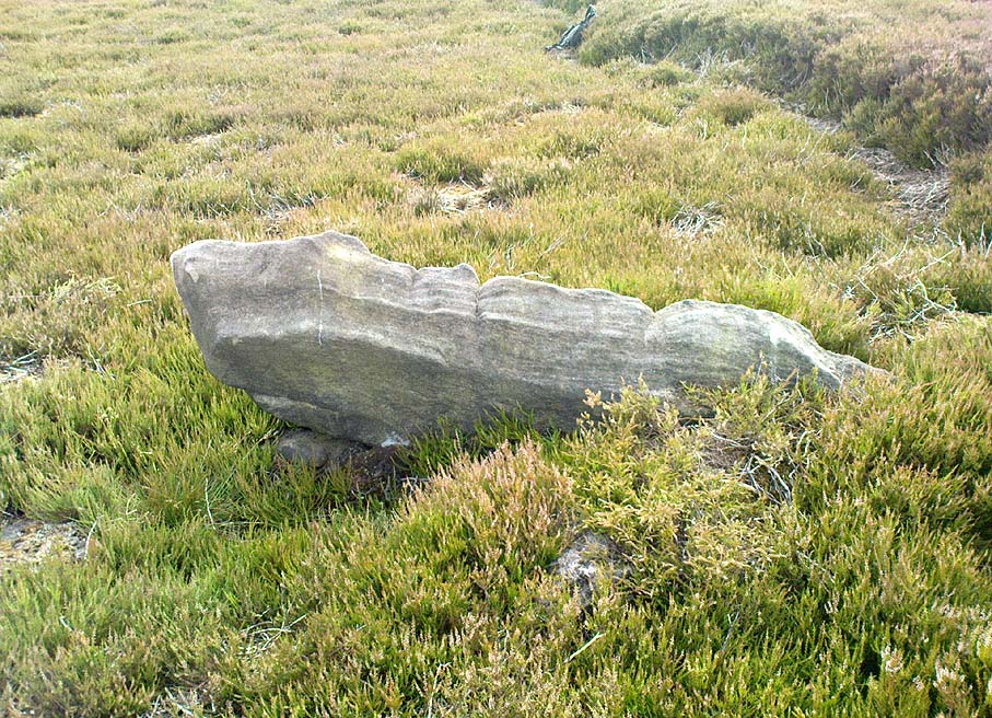
Long worn stone on Old Wife Ridge

From the bottom of Pateley Bridge, just out of town take the left turn to Bewerley and go through the village; or from Glasshouses follow the road over the River Nidd and round.  Both ways take you to meet the steep and winding Nought Bank Road, which you should follow all the way to the top of the moorland hill.  You can just park up by the footpath taking you east.  Then cross the road and walk west on the dirt-track to Rowan Tree Crags.  100 yards along, the gentle sloping moor on your left is the Old Wife’s Ridge.

Archaeology & History

The academic history of this moorland is poor, save occasional notes about lead mining and quarrying (Jennings 1967).  Speight (1894) describes the finding of large pieces of lead-worked Roman inscriptions nearby that were found in January 1735 — one of which had the letters ‘BRIG’ cut into it, thought to be a referral to the land or deity, Brigantia.  Examples of prehistoric rock art occur at nearby Guisecliff Woods, due east, but there are no specific notices about the archaeology of this hillside.

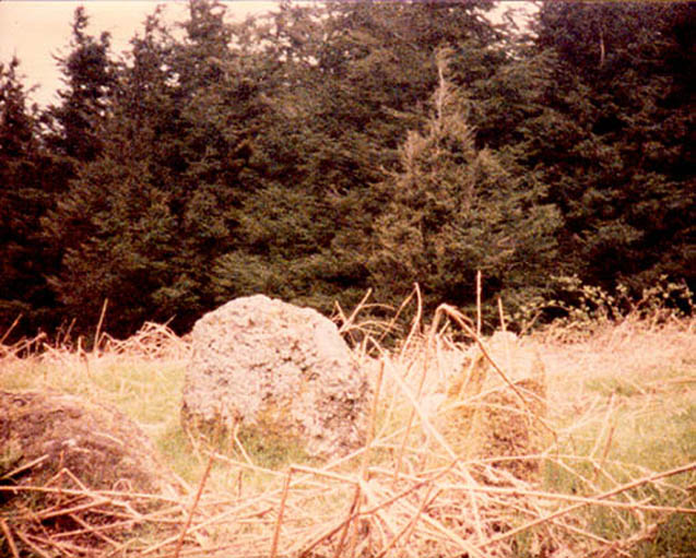
Long overgrown stone at Old Wife Ridge

When we visited the place yesterday, much of the heather had been burned (the previous year) and we found two stones which looked suspiciously as if they had stood upright in the past, and may have had played some part in the naming and myth of the Old Wife on this part of the moors.  I can find no other records of any remains here.

Folklore

References to the Old Wife scatter our northern lands and invariably refer to an aspect of the heathen Earth Mother of our peasant ancestors, particularly in Her aspects of winter and early spring.  In Scotland and Ireland She was commonly known as the cailleach.  Sadly I can find no extant lore relating to Her mythic aspects in the landscape on these hills.  A field-name to the south, Nanny Black Hill, may have related to the Old Wife.

References:

  1. Jennings, Bernard (ed.), A History of Nidderdale, Advertiser Press: Huddersfield 1967.
  2. o’ Crualaoich, Gearoid, The Book of the Cailleach, Cork University Press 2003.
  3. Speight, Harry, Nidderdale, Elliot Stock: London 1894.

© Paul Bennett, The Northern Antiquarian

Nussey Green (404), Appletreewick, North Yorkshire

Cup-Marked Stone:  OS Grid Reference – SE 0739 6254

Getting Here

Nussey Green CR404 (after ‘QDanT’)

Park at Stump Cross Caverns on the B6265 road, then walk down the road for 200 yards till you reach the track on your left running over the fields in the direction towards Simon’s Seat.  Walk on the track for about 600 yards until there’s a change of direction in the adjacent walling and then watch out for the dirt-track on your right, curving towards the small valley (if you hit the Skyreholme Wall carving (413), you’ve gone 100 yards past the turn-off). Go on here until you see the overgrown track on your left into a small disused quarry, and head right, down the grassy slope, checking out the few stones ion front of you 20 yards down.  You’re damn close!

Archaeology & History

Carving no.404 (after Boughey & Vickerman)

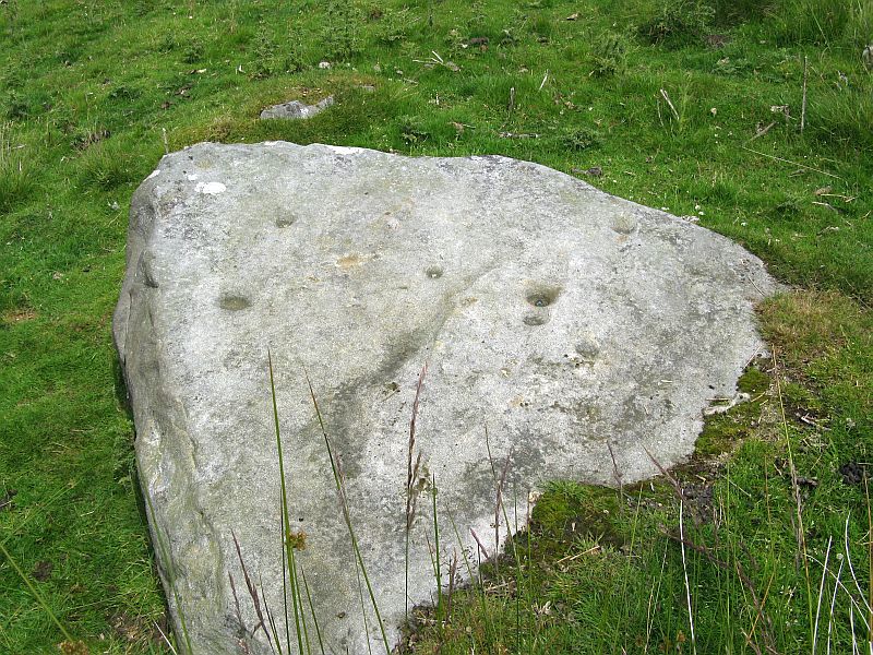
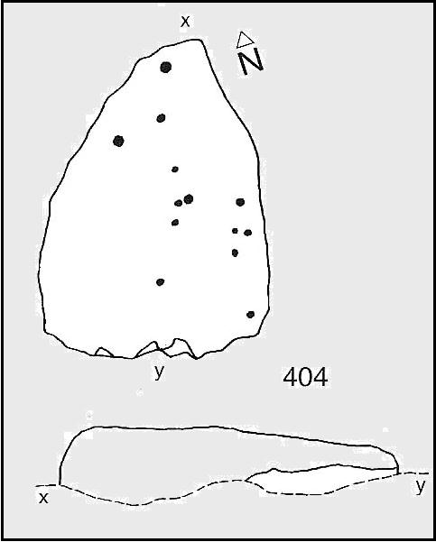
A simplistic carving that was first described by fellow antiquarian Stuart Feather (1964), this is one of at least four cup-marked stones in a small group here, above the valley of Skyreholme Beck — better known at this part of the valley as the Troller’s Ghyll, haunt of various heathen lore.  Although some of the carving has now been covered by the growing Earth, you can still see the majority of the design.

It is a flat, roughly triangular stone described by rock art students Boughey & Vickerman (2003) and having 13 cup-markings on it.  To get a full look at the entire carving, you may have to roll a bit of the turf away from one side of the rock.

Folklore

Although we have no lore relating to this specific carving, the small valley over which this carving looks was long known as the abode of the legendary bharguests, or black dogs: underworld creatures of earlier heathen myths.  Faerie lore can also be found a short distance further up the same stream.

References:

  1. Boughey, Keith & Vickerman, E.A., Prehistoric Rock Art of the West Riding, WYAS: Wakefield 2003.
  2. Feather, Stuart, “Yorkshire Archaeological Register 1963: Appletreewick, W.R.,” in Yorkshire Archaeological Journal, volume 41, 1964.

Links:

  1. Nussey Green Rock Art – more notes & images

© Paul Bennett, The Northern Antiquarian

St Winefride’s Well, Holywell, Flintshire

Holy Well:  OS Grid ReferenceSJ 1851 7627

Also Known as:

  1. Ffynnon Gwenfrewi
  2. St. Winifred’s Well

Getting Here

St.Winifred’s Well

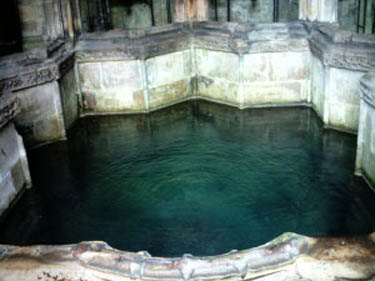
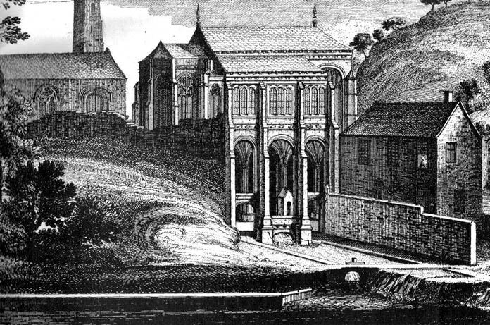
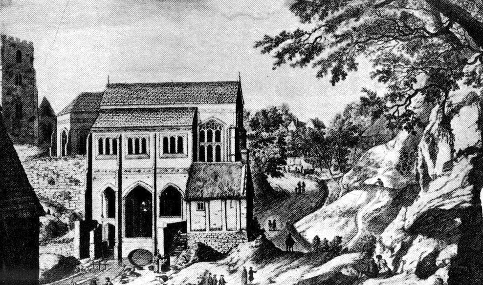
From the Chester ring road head into north Wales along the coast road (A548) from Connah’s Quay for about 13 miles taking you through Flint. After 12 miles turn left into Holywell town (Treffynnon). At the western end of the town go down the Greenfield-Mostyn road back towards the A584 taking you down a hill.  After 500 hundred yards you arrive at the holy well/shrine and pilgrimage centre on the right-hand side; there is parking on the opposite side of the road. There is a small entrance fee, but as well as the famous healing well and bathing pool, they have a gift shop, toilet facilities and a late medieval/Gothic two-storey structure that is built over the polygonal, vaulted well chamber, whilst at the side (at the corner of the hill) stands another Gothic chapel from 1500.

History and Legend

According to the well known legend, a young Welsh girl called Winefride or Gwenfrewi, was the daughter of patrician parents, Thenith (Thewyth) and Gwenlo, who lived at Bryn-y-Castell (Treffynnon) at the beginning of the 7th century AD.  She was a very religious girl who was known for her kindness and charities to people in the area that was then called Tegeingl (after the Decengle tribe).  Winefride grew up to be a very beautiful young woman which troubled her because she had no wish to marry, only to live a life of chastity and serve God as only she knew how.

St. Winefrides Well 1742

One day a local chieftain from Hawarden (Penarlag) called Caradoc ap Alyn came hunting in the area. He became very thirsty so stopped off at the house where Winefride lived with her parents.  However, on this particular day her parents were attending the local church where St Beuno, her uncle, was conducting a service.  Prince Caradoc soon began to seduce her so she ran to the church but with the prince in hot pursuit.  When he caught up with poor Winefride, she again resisted him so he took his sword and beheaded her.  Her severed head fell to the ground and rolled down a hill and where it came to rest a spring of water gushed forth from the ground.  Her parents and uncle came rushing out of the church at which point St Beuno cursed the evil prince, who was calmly wiping blood from his sword, causing him to sink into the ground — never to be seen again.  St. Beuno then placed the severed head back into place, restoring Winifred to life again but leaving her with a thin scar round her neck.

Later, Winifred was entrusted for her education to St Beuno whom sent her to various holy men including St. Elerius at Gwytherin near Llanwrst.  Here she became abbess of a convent that had been founded by Elerius, with his mother St. Theonia as first abbess; and it was here for the next 40 years that Winifred lived out her life.  She was said to have died at Gwytherin in either 65o or 670 AD.  Her body was first interred in the churchyard there, however in 1138 her relics were transferred to Shrewsbury Abbey.  Sadly however, her shrine there was destroyed in the 16th century and now only a few relics remain with a finger-bone being housed at a convent in Holywell.

Mythology and Folklore

St. Winefrides Well 1750

The holy well and shrine of St. Winifred at Holywell became a place of pilgrimage during the middle-ages and many miracles of healing were wrought there.  The sick were cured of infirmities of the legs and body; crutches were left at the well and many were cured of leprosy, eye complaints, loss of hearing, being not able to bear a child, mental illness, palsy and lung disorders etc.  During the Reformation the holy well suffered much, but from the 17th century onwards pilgrims were returning to the holy place and, more recently it has become the Welsh Lourdes and still pilgrims come in droves from all over Wales and beyond.  The vaulted Gothic structure covering the well shrine is richly carved with bosses depicting various characters including St Beuno, Earl Stanley, Lady Margaret Beaufort, biblical characters, animals and an abbot of Basingwerk abbey, but there is also much recent graffiti too.  A tall statue of St Winefride looks down over the well while candles burn all around.  In the larger bathing pool outside, a stone lies at one side — this is claimed to be where St. Beuno sat whilst teaching his young niece.  Red stains on stones at the front of the well-basin were long taken to be the martyr’s bloodstains, but now these are thought to be iron oxide pigmentation on the lichens.  Today the people still come either to bathe in the special pool, throw coins in the well, or fill bottles with holy water from a tap on the wall.  Faith in miracles of healing is still much in evidence here and may it continue to be for many years to come.  Everyone is welcome here, you don’t have to be a Roman Catholic!

References:

  1. UneXplained - LiebreichBord, Janet & Colin, Sacred Waters, Paladin: London 1986.
  2. David, Christopher, Saint Winefride’s Well  – A History and Guide, Gomer Press: Llandysul 2002.
  3. Edwards-Charles, Thomas, Saint Winefride and Her Well – The Historical Background, Holywell 1962.
  4. Heath, Sidney, In the Steps of the Pilgrims, Rich & Cowan: London 1950.
  5. Jones, Francis, The Holy Wells of Wales, University of Wales Press: Cardiff 1992.
  6. Liebreich, Karen, UneXplained: Spine-tingling tales from Real Places in Great Britain and Ireland, Kindle 2012.
  7. Simcock, Richard, North Clwyd At Random, Countryside Publications Ltd: Chorley 1986.
  8. Spencer, Ray, A Guide to the Saints of Wales and the West Country, Llanerch: Felinfach 1991.

Copyright © Ray Spencer 2011


Pillar of Eliseg, Pentrefelin, Llangollen, Denbighshire

Cross:  OS Grid Reference – SJ 20267 44522

Also Known as:

  1. Eliseg’s Pillar

Getting Here

The Eliseg Pillar

From Llangollen, take the A542 north for about three miles up along the famous Vale of Llangollen.  At the ruined abbey of Valley Crucis continue along the same road for another ½-mile whence, at the side of the road in a field and upon a small mound, stands the ancient monument: the Pillar of Eliseg.

Archaeology & History

The sandstone pillar or pillar-shaft stands upon a large square-shaped base stone which sits atop a tumulus — a Bronze Age burial mound (cairn) inside which were found, during excavations in 1803, the remains of a body, perhaps that of a Romano-British or Dark-Ages chieftain (possibly Eliseg?), with what were described as “blue stones” both beneath and on top; the cremated body lying within a stone-slab chamber along with a silver coin.  But the ancient pillar monument itself is much later in date — probably mid-9th century AD, though there has been speculation by some historians that the pillar was actually a tall cross, alas without its head, dating from a couple of centuries earlier, with the inscription being carved onto it sometime between 840-845 AD.  It was erected by Prince Cyngen fab Cadell (Concenn) about the year 844 in memory of his great-grandfather Eliseg or Elise.  Cyngen died in Rome in 854 AD.

Over the centuries the pillar has suffered from the ravages of time.  Its long Latin inscription was originally 31 lines divided into readable paragraphs running horizontally but now only 7 or 8 of these lines are visible.  But fortunately the writer and historian Edward Lhuyd made a drawing of the monument and its inscription back in 1696.  The inscription when translated reads as follows:

1. Concenn son of Cadell, Cadell son of Brochmail, Brochmail son of Eliseg, Eliseg son of Guoillauc

2. Concenn therefore being great-grandfather of Eliseg erected this stone to his great-grandfather Eliseg

3. It is Eliseg who annexed the inheritance of Powys…throughout nine (years) from the power of the English which he made into a sword-land by fire

4. Whosoever shall read this hand-inscribed inscription stone, let him give a blessing on the soul of Eliseg

5. It is Concenn Who…with his hand…to his own kingdom of Powys…and which…the mountain…the monarchy Maximus…of Britain…Concenn, Pascent…Maun, Annan.

6. Britu, moreover, (was) the son of Guorthigirn (Vortigern) Whom (St) Germanus blessed and whom Severa bore to him, the daughter of Maximus the king who slew the king of the Romans and

7. Convarch painted this writing at the command of his king Concenn

8. The blessing of the Lord (be) upon Concenn and all members of his family and upon all the land of Powys Until the day of judgement or doom. Amen.

The upper section of the pillar, which is broken at the top, was re-erected on top of the burial mound in 1779 which probably means that the monument is not in its original place.  The lower section was sadly broken away from the shaft during the English Civil war and has long since disappeared. However, this monument is still quite an impressive site and can be seen from a great distance around.

References:

  1. Bartrum, P.C.,  Early Welsh Genealogical Tracts, Cardiff: UWP, 1966.
  2. Barber, Chris, More Mysterious Wales, Paladin 1987.
  3. Houlder, Christopher, Wales: An Archaeological Guide – the prehistoric, Roman and early medieval field monuments, Faber and Faber, London 1974.
  4. Tyack, George S., The Cross in Ritual, Architecture and Art, William Andrews: London 1900.
  5. Westwood, J.O., Lapidarium Walliæ – The Early Incised and Sculptured Stones of Wales, Oxford University Press 1879.

Copyright © Ray Spencer 2011 


Ashleigh Barrow, Darwen, Lancashire

Tumulus (destroyed):  OS Grid Reference – SD 696 208

Also Known as:

  1. Whitehall Tumulus
Ashleigh Barrow urns (after John Dixon)

Archaeology & History

Early accounts of this site tell of its destruction in the 19th century, but a modern reconstruction of the site has been made close to where it once stood.  And this tomb sounded quite impressive!  Within the ‘tomb’ were found a large number of urns, one of which was curiously empty.  In John Dixon’s excellent Journeys through Brigantia (2003) work he told that,

“Contemporary reports about its excavation state that it was of circular form about 30 yards in diameter, being formed on a naze or promontory of an undulating plateau overlooking the Darwen valley.  Its height was said to vary between 10 to 12 feet on the east side and between 2 or 3 feet on the west, the centre being about 6 feet in diameter and consisting of a slight hollow.

“Ten interments appear to have been made, one being just a heap of burnt bones, the others, having been enclosed in urns, the majority of which are badly broken, consisted of ashes and fragments of bone together with unrecognizable pieces of bronze.  Two urns also contained ‘incense cups’ and another a 7½-inch bronze knife or dagger.

“The design of the urns is similar to those from the Middle Bronze Age… All but two of the urns were found within an area 21 feet by 14 feet, whilst one was 40 feet away.  They were, with one exception, placed in the Earth with the orifice pointing upwards and were covered with slabs, the depth at which they were found varying from 1 to 2 feet.”

Remains of the urns can be seen on display in the Darwen Library.

Folklore

Once again in John Dixon’s (2003) fine Journey’s through Brigantia volume, we read of folklore relating to the respect of the dead which local people used to give this old tomb, telling:

“Many superstitions were attached to the barrow and its destruction in the 1860s, with the country people speaking of the place being haunted by ‘boggarts’ and children having been known to take off their clogs or shoes and walk past it barefoot in the night time.”

References:

  1. Dixon, John, Journeys through Brigantia – volume 11: East Lancashire Pennines, Aussteiger Publications: Barnoldswick 2003.

© John Dixon & Paul Bennett, The Northern Antiquarian 

Bedd y Cawr, Llanymynech, Montgomeryshire

Chambered Cairn (destroyed):  OS Grid Reference – SJ 266 223

Also Known as:

  1. Llanymynych Hill
  2. Llech y Wydhon
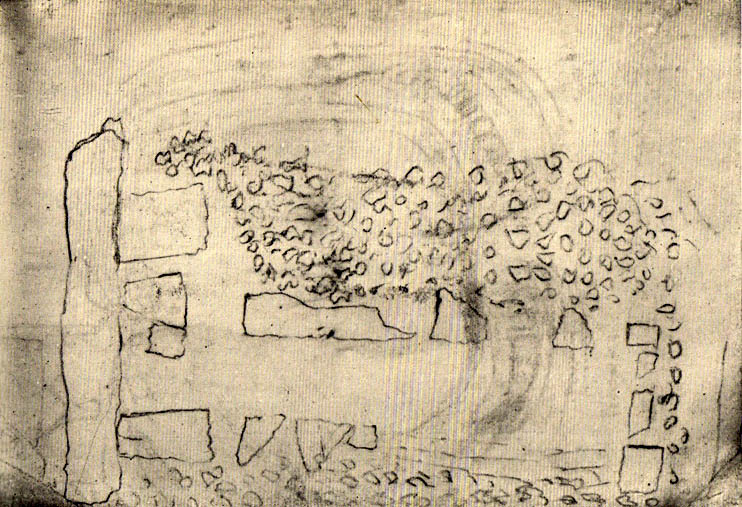
Scruffy 1835 ground plan of the lost tomb

Archaeology & History

An exact grid-reference for this once-impressive chambered tomb is difficult as “nothing remains of this site at the present day” (Daniel 1950) and the majority of the hilltop itself (a prehistoric hillfort no less), has been turned into one of those awful golf courses which are still spreading like cancer over our ancient hills.  It was obviously very close to the Shropshire border, as the folklorist Charlotte Burne (1853) said the grave was “on the Shropshire side of Llanymynech Hill,” perhaps placing it in the township of Pant.  But traditionally it remains within Llanymynech, within and near the top of the huge hillfort and east of Offa’s Dyke.

The old tomb was mentioned in an early letter of the great druid revivalist, Edward Lhwyd, who left us with the old ground-plan, reproduced above; and based on Lhwyd’s drawing and early narratives, Glyn Daniel (1950) thought the site “was perhaps a gallery grave”.  The best description we have of Bedd y Cawy was penned by John Fewtrell (1878) in his essay on the local parish in which he told:

“This interesting relic of antiquity stood on the north-eastern end of the hill.  It was formed of four upright stones, on the top of which was placed a flat slab measuring 7ft by 6ft, and 18 in thickness.  It is known by the name “Bedd-y-Cawr” (the Giant’s grave).  The British name appears to support the theory that the cromlech is a burying place, and not an altar devoted to religious purposes.  The word is derived probably from the Welsh cromen, a roof, or vault, and lech, a stone, meaning a vault formed by a slab supported upon uprights ; or, according to some, ” the inclining flat stone”.  Rowlands derives it from the Hebrew cærem-luach, “a devoted stone”, but this is far-fetched for a word or name in common use among our British forefathers.  Many regard the cromlech as a distinct species of monument, differing from either a dolmen or a cairn.

“When the covering of stones or earth has been removed by the improving agriculturist, the great blocks which form the monolithic skeleton of the mound and its chamber usually defy the resources at his command.  As the skeleton implies the previous existence of the organised body of which it formed the framework, so, upon this theory, the existence of a ‘ cromlech ‘ implies the previous existence of the chambered tumulus of which it had formed the internal framework.  Sepulchral tumuli were formerly classified according to their external configuration or internal construction; but more extended and critical observation has shown that mere variations of form afford no clue to the relative antiquity of the structures. But as it has always been the custom of the prehistoric races to bury with their dead objects in common use at the time of their interment, such as implements, weapons, and personal ornaments, we have in these the means of assigning the period of the deposit relatively to the Stone, Bronze, or Iron age.” Sometimes no traces whatever of human remains are found in the chamber.  Search was made to some depth in this cromlech, but nothing was found.”

In Fewtrell’s same essay he also described another megalithic site (also destroyed) on the southwestern part of the Llanymynech Hill, where,

“stood two rows of flat stones, parallel, 6 feet asunder, and 36 in length. A tradition exists which states that in digging near this place a Druid’s cell was discovered, but of what shape or size it does not relate.  There were a number of human bones and teeth in a state of good preservation also discovered.  In digging between the parallel rows a stratum of red earth was found, about an inch thick.”

Folklore

As the name of this old tomb tells, it was once reputed as “the Grave of the Giant”, but in Charlotte Burne’s huge work on the folklore of Shropshire (volume 1), she told it to be the tomb of his lady:

‘The Giant’s Grave’ is the name given to a mound on the Shropshire side of Llanymynech Hill, where once was a cromlech, now destroyed. The story goes that a giant buried his wife there, with a golden circlet round her neck, and many a vain attempt has been made by covetous persons to find it, undeterred by the fate which tradition says overtook three brothers, who overturned the capstone of the cromlech, and were visited by sudden death immediately afterwards.”

There is also a legendary cave beneath Llanymynech Hill which have long been regarded as the above of goblins and faerie folk.  More of this will be told in the profile for the hillfort itself.

References:

  1. Burne, Charlotte Sophia (ed.), Shropshire Folk-lore, Trubner: London 1853.
  2. Daniel, Glyn E., The Prehistoric Chamber Tombs of England and Wales, Cambridge University Press 1950.
  3. Fewtrell, John, “Parochial History of Llanymynech,” in Collections Historical & Archaeological Relating to Montgomeryshire, volume 11, 1878.
  4. Wynne, W.W.E., “Letters of E. Lhwyd,” in Archaeologia Cambrensis, vol.3, 1848.

© Paul Bennett, The Northern Antiquarian

Redmire Maypole, North Yorkshire

Maypole (destroyed):  OS Grid Reference – SE 0458 9121

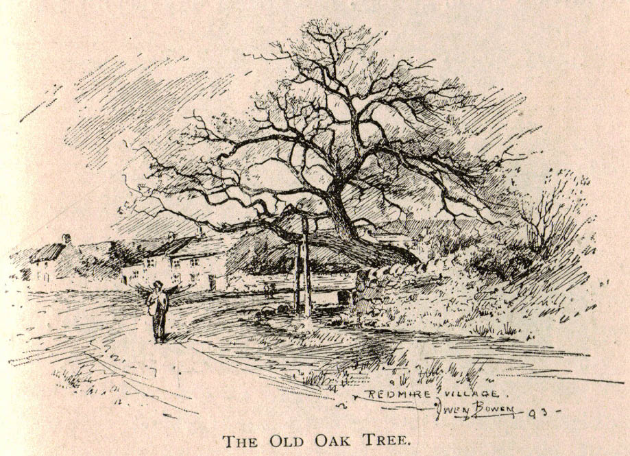
Redmire’s ancient Oak

Archaeology & History

As with many of Britain’s old maypoles, the one at Redmire has long since disappeared and no local in the 20th century appears to have had any memory of it.  However, it was mentioned in Victorian times and described in McGregor’s (1989) fine history work on the village:

“At one time, somewhere on the Green, stood a maypole which was destroyed by lightning.  I never heard the memory of it recalled during my early life, but it is mentioned in their books by both Barker and Bogg.  The remnants of it appear to have been there in 1850 or 1852, as Barker, writing at that time says, ‘A maypole, rare in Yorkshire, stands on the Green.  It was shivered to pieces by the electric fluid, during a thunderstorm, in the summer of 1849.  This poor maypoles catastrophe would have been regarded by the old Puritans as a direct and visible manifestation of the wrath of heaven at such a heathenish practice.’  Redmire, as we know, took pleasure in dancing in the 19th century, and continued to do so, especially after the building of the Town Hall…”

When Edmund Bogg came here at the end of th 19th century, he saw “the base of the ancient maypole…near to, a twisted and ancient oak” whose ancient branches were being held upright by large wooden posts.  This sacred oak itself was said to “still cast its shade over a small spring of water.”  Unfortunately I ‘ve found no more about this lost pagan relic…

References:

  1. Barker, W.G.M.J., The Three Days of Wensleydale, Charles Dolman: London 1854.
  2. Bogg, Edmund, Wensleydale and the Lower Vale of Yore, E. Bogg: Leeds n.d. (c.1900)
  3. McGregor, Isabelle, Redmire – A Patchwork of its History, privately printed: Redmire 1989.

© Paul Bennett, The Northern Antiquarian


Glenrickard, Brodick, Isle of Arran, Argyll

Chambered Cairn:  OS Grid Reference – NS 00499 34665

Also Known as:

  1. Canmore ID 40204

Getting Here

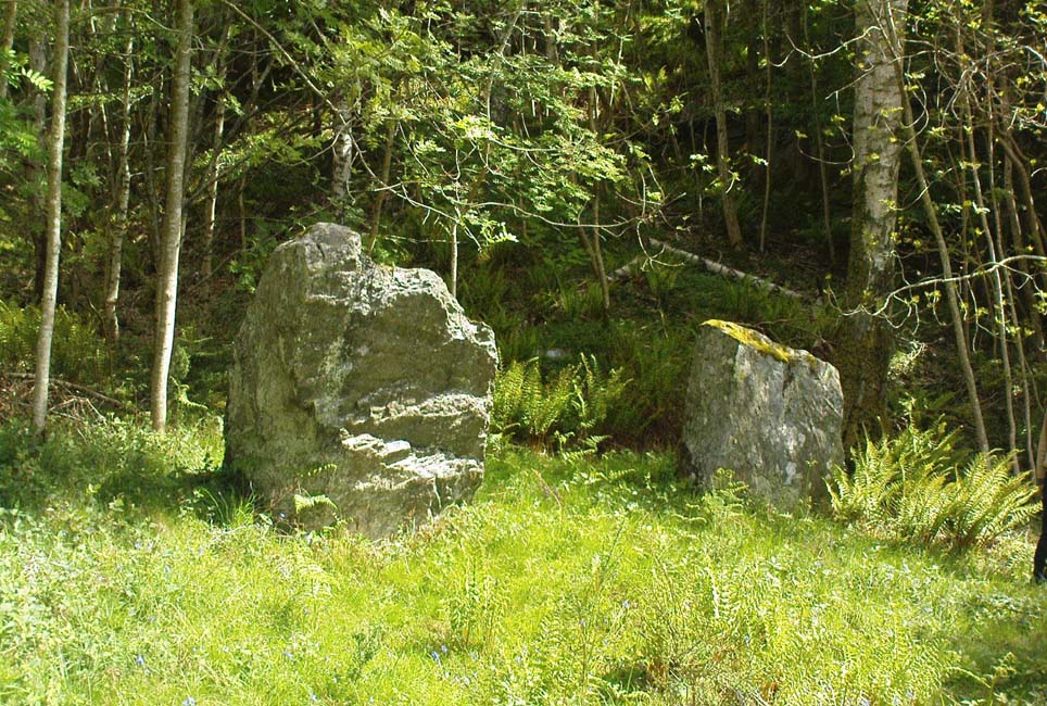
Upright stone at Glenrickard

From Brodick, walk up the Glencloy dirt-track towards the friendly Kilmichael Hotel but turn off on the left shortly before hand, up another footpath, crossing the stream until you eventually reach the derelict house which was built into the edges of this old tomb.  Upon the small rise above here, at the edge of the forestry commission trees, you’ll notice the overgrown ruins of the old tomb.

Archaeology & History

The remains here are somewhat overgrown and ramshackled, but I still like this place and in my younger days used to spend a lot of time here.  It can get quite eerie in some conditions and seems to validate some of the folklore said of it.  The site was described in Balfour’s (1910) magnum opus as:

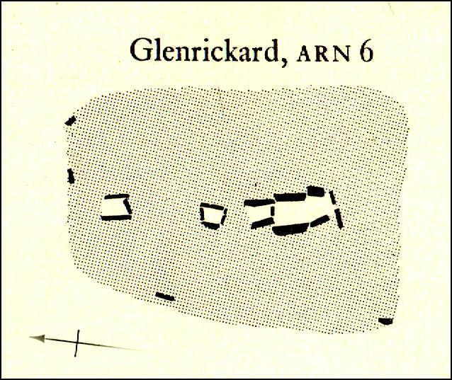
“Situated in Glen Cloy, on the moor above Kilmichael House, close to a cottage called Glenrickard.  There are no traces of a cairn or of a frontal semicircle. The chamber is formed of rather light flags, with their upper edges nearly on the same level, so that the monument is more like a series of cists than a chamber.  The roof and end stone have gone; there are two portal stones, but the gap between them is only 7 inches.  The chamber is directed N and S, with the portal to the south.  There have been three compartments, but they are rather smaller than usual, the third from the portal being only 3 feet 10 inches long by 2 feet 2 inches broad.  Two feet 6 inches from this compartment is another cist, which is possibly a short cist representing a secondary interment, and 10 feet farther north is a second ruined cist placed at a different angle.  This last has the appearance of a short cist, but it is not carefully constructed and differs little from the component compartments of the chamber.   The structure is anomalous, and may perhaps be regarded as representing a phase of degeneration in the transitional period.”

Glenrickard ground-plan (after Henshall 1972)
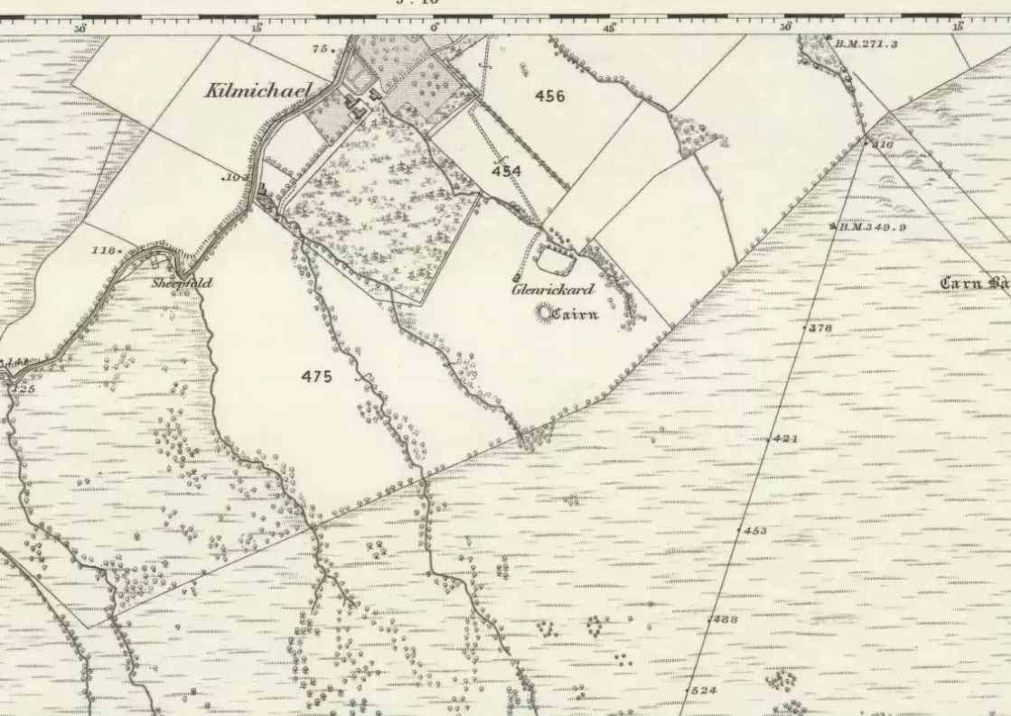
Glenrickard on 1868 map

Audrey Henshall (1972) later descried the site in greater details in her own magnum opus and told that “two rude clay urns of the primitive flower-pot pattern (were) found in the chamber”, along with “calcined bones, said to have been in the two vessels.”

Folklore

Said by local people to be haunted, the spirit of the tomb was said to have been disturbed upon the building of the derelict house below it.  Ghosts of a middle-aged couple and young child have been seen in the house; whilst the spirit of the site can generate considerable fear to those who visit the place when it is ‘awake.’  To those who may visit this out-of-the-way tomb, treat the site with the utmost respect (and DON’T come here and hang a loada bloody crystals around the place in a screwy attempt to “clean” the psychic atmosphere of the place. If you’re that sort of person, don’t even go here! The spirit of the place certainly wouldn’t want you there).

References:

  1. Balfour, J.A., The Book of Arran: Archaeology, Arran Society: Glasgow 1910.
  2. Henshall, Audrey Shore, The Chambered Tombs of Scotland – volume 2, Edinburgh University Press 1972.

© Paul Bennett, The Northern Antiquarian 


Newtyle, Dunkeld, Perthshire

Standing Stones:  OS Grid Reference – NO 04489 41057

Also Known as:

  1. Doo’s Nest
  2. Druid’s Stones
  3. New Tyle

Getting Here

Newtyle’s standing stones

From Dunkeld travel southeast on the A984 road to Caputh and after about 1½ miles, set back a few yards from the road amidst the trees below the Newtyle Quarries (whose mass of slate and loose rocks cover the slopes), you’ll see these two large monoliths.  There’s nowhere to park here, but there’s a small road a coupla hundred yards before the stones aswell as a space to park on the verge by the side of the road a few hundred yards after them.  Take your pick!

Archaeology & History

When we visited these two tall standing stones a few weeks ago, guerilla archaeologist Hornby and I were a little perplexed at the state of these stones, wondering whether they were a product of the fella’s who dug the quarries above here, or whether they were truly ancient.  It seems the latter is the consensus opinion!

They were described by the great Fred Coles (1908) in one of his lengthy essays on the megaliths of Perthshire, where he thought the two stones here were all that remained of a stone circle that once stood on the flat, above the River Tay, but whose other stones “were destroyed in the making of the road” which runs right past here.  Not so sure misself!  He told that,

“An old cart-track runs up between the stones, leading from the main road…up to the quarry. The mean axis of the two stones runs N 13° W and S 13° E (true), and although their broader faces do not point towards the centre of a circle on the west, it is certainly much more probable that the other stones were on this side, the lower and flatter ground, than on the east, where the ground slopes and is more broken and rough.

“Both stones are of the common quartzose schist, but they differ considerably in shape.  A is 6 feet 7 inches high at the north corner, but only 4 feet 10 inches at the south, and its vertical height at the east is only 3 feet.  The basal girth is 13 feet 3 inches, and in the middle 15 feet 9 inches.  The broad east face measures 5 feet.  Stone B is level-topped and 5 feet in height; it has a basal girth of 12 feet 4 inches, and at the middle of 11 feet 8 inches.  Its two broad faces are of the same breadth.”

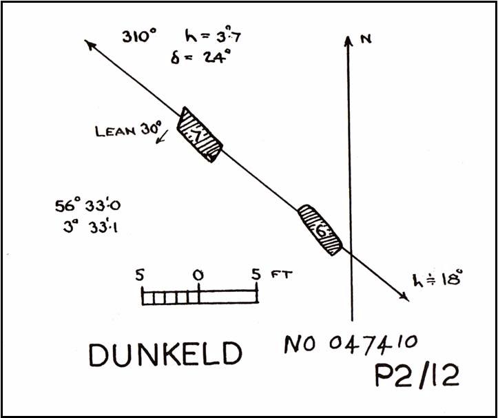
Little else was said of the two stones for many years and, to my knowledge, no real excavation has been undertaken here.  But when Alexander Thom (1990) visited the site he found that,

“This two stone alignment showed the midsummer setting sun.  The south stone may possibly, by itself, have shown the setting Moon at major standstill.”

Aubrey Burl’s description of the stones was succinct and echoed much of what Coles had said decades earlier, telling:

“Two very large stones stand only 9 feet (2.7m) apart in an unusually closed-in environment for a Perthshire pair.  The ground rises very steeply to the east.  To the west the stones overlook the valley of the River Tay.

“Both are of local quartzoze schist and are ‘playing-card’ in shape.  As usual it is the westernmost stone that is taller, 7ft 2in (2.2m) in height.  Its peak tapers almost to a point.  Conversely, its partner is flat-topped and only 4ft 9in (1.5m) high.  The pairing of such dissimilarly shaped stones has led to the interpretation of them as male and female personifications.”

Alex Thom’s groundplan
Back of the smaller stone

Burl’s latter remark thoughtfully recognises that such animistic qualities are found in many other cultures in the world and this ingredient was also an integral part of early peasant notions in Britain; therefore such ingredients are necessities to help us understand the nature and function of megalithic sites.  We must be cautious however, not to fall into the increasingly flawed modern pagan notion of such male and female ‘polarizations’, nor the politically-correct sexist school of goddess ‘worship’ and impose such delusions upon our ancestors, whose worldviews had little relationship with the modern pagan goddess fallacies, beloved of modern Press, TV shows and pantomime festival displays.

Folklore

In Elizabeth Stewart’s history of Dunkeld, she narrates the tale told by an earlier historian who told that,

“these two upright stones at the Doo’s Nest, but says they are supposed to mark the graves of two Danish warriors returning from the invasion of Dunkeld.”

References:

Burl, Aubrey, From Carnac to Callanish, Yale University Press 1993.
Coles, Fred, “Report on Stone Circles Surveyed in Perthshire – Northeastern Section,” in Proceedings of the Society of Antiquaries, Scotland, volume 42, 1908.
Stewart, Elizabeth, Dunkeld – An Ancient City, Munro Press: Perth 1926.
Thom, A., Thom, A.S. & Burl, Aubrey, Stone Rows and Standing Stones – 2 volumes, BAR: Oxford 1990.

© Paul Bennett, The Northern Antiquarian