Legendary Tree: OS Grid Reference – NO 19 32
Also Known as :
- Bogle Busk
- Bogle Buss
Archaeology & History

The site on the 1867 OS Map
Perusal of a 25″ OS map of 1867 shows, in almost microscopic lettering, a feature marked ‘Bogle Bush’. I transferred the approximate location onto a modern map and set off to make a field visit, honestly not expecting to find anything almost a century and a half later.
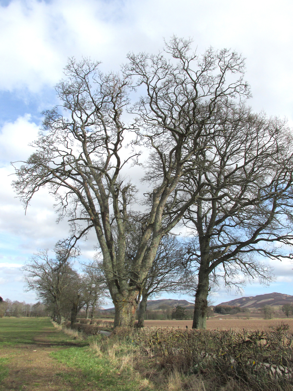
The Bogle Bush
As I walked down the designated road I was drawn to an ancient multi branched or trunked tree, the trunks held together by a hefty iron band. The band had been placed there many years ago as it was being absorbed by the growth of the tree. Unlike the other trees in the road the foot of this tree had crocus and grape hyacinth in flower, as if deliberately planted.
The band was forged and fitted by Kinrossie Blacksmith and Kirk Elder David Gray at the end of the nineteenth century, following the collapse of one of the three trunks then standing.
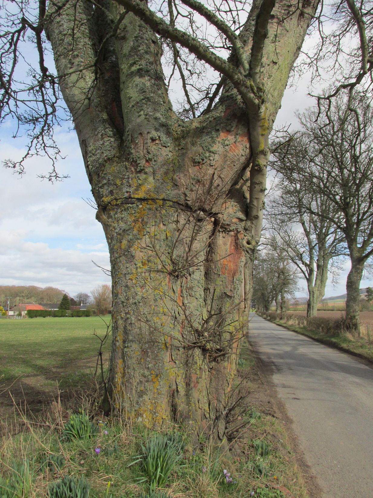
The band holding the tree together
The online Ordnance Survey Name Books for Perthshire, compiled prior to the survey of the 1867 map, list Robert Millar of Flowerdale, Mr James Stewart of Kinrossie and Mr Fraser of St Euchans as the informants that ‘This name is applied to a Birch Tree situated on the north side of the road leading from Saucher to Kinrossie. Mr Millar says that there is a superstitious tradition existing in the locality that Bogles have been seen &c at this tree’.
Whether Mr Millar and his co-informants were trying to mischievously mislead the (probably) English Ordnance Survey officials, we will never know, but the tree is in fact a Sycamore! And the 1901 25″ OS map shows the tree as the ‘Bogle Busk’.
Folklore
There has been speculation that the Bogle Bush may have long forgotten links with Macbeth whose fortess at nearby Dunsinnan Hill overlooks it, adding the rider that Sycamores only live 200 years or so before falling and then regenerating on the same spot, implying that a mother tree could have been on the same spot in Macbeth’s time.
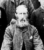
David Gray, Blacksmith and Kirk Elder of Kinrossie.
Local folklore states that ‘a great calamity will befall Kinrossie’ should the Bush collapse. The tree is a local icon that’s ‘aye been there’ according to a local resident and it seems to be a local geo-caching site, judging by the small container of ‘stuff’ hidden in a plastic container underneath a couple of pieces of bark at the base of the trunk on my visits.
Please note that if you decide to visit, this is not a wishing tree, so do not hammer coins into the bark or suspend rags from the branches. Respect the Bush and the local people to whom this is an iconic tree.
My thanks to local resident Morag Hislop for leading me to further information on this site.
References:
- Scotland’s Place Names
- Collace Parish Millenium Committee, Off The Main Road, 2nd edition: Kinrossie District Recreation Club, 2010
© Paul T. Hornby, The Northern Antiquarian
