Guisecliff Wood (629), Bewerley, North Yorkshire

Cup-and-Ring Stone:  OS Grid Reference – SE 16415 63565

Also Known as:

  1. Carving no.629 (Boughey & Vickerman)

Getting Here

A box of cup-and-rings!

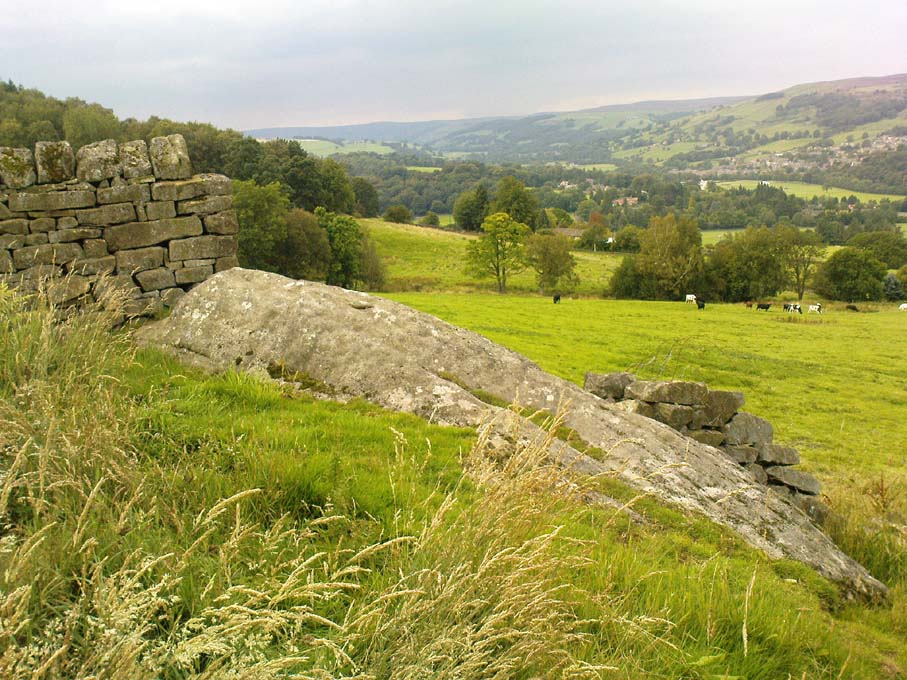
Takes a bitta finding this one – especially a this time of year when the bracken’s high – but it’s worth the walk.  You’re probably best finding your way to the open-air carving on the slopes above Westcliff Farm, the Guisecliff Wood 626 carving (it’s pretty easy to find).  From here, walk eastwards across the top of the two fields until you hit the old gate that take you back into the woods.  Now it gets difficult!  Walk less than 100 yards in the same direction, if you’re lucky, along the small footpath that runs pretty level through the trees, keeping your eyes peeled for a large sloping rock above you.  I’d say that it’s probably best to start checking the relevant rocks (large ones) after 50 yards in the trees, just to be on the safe side.  If you aint been here before it’s probably best to check it out at the end of Winter or during Spring time.  Good luck!

Archaeology & History

As noted by several people in our visit here the other day, some aspects of this carving are similar in design to the Tree of Life Stone on the eastern edge of Askwith Moor, 10 miles south of here.  But the features on this large carved rock have intriguing elements of their own here: not least of which is the large square ‘box’ into which a cluster of otherwise normal cup-and-rings are enclosed.  It’s a unique feature in prehistoric carvings in this part of the world — although such ‘box’ motifs can be seen further north at Dod Law in Northumberland.

The fainter cup-and-rings
Boughey & Vickerman’s 2003 drawing

There are two distinct sections of carvings on the stone, both of which have a similar tree-motif patterns, but the boxed one grabs your attention more once you’ve sat with the stone for a while. The other small cluster of cups are a little more difficult to notice, but once you see them they almost grow into life!  You can just make out the surrounding rings and lines around some of these fainter cups, which I tried to capture in the photos (but without much success).

Our visit here didn’t pass without some voicing the thought that ‘box’ section could have been added at a much later date — perhaps a Victorian addition?  But we could be way off the mark with that one!

There’s every likelihood of other carvings being found in and above the woodlands here, though any further exploratory excursions here can wait till winter time, as the Nature’s summer growth here is considerable and covers most of the rocks in green.  The carving was first described in Boughey & Vickerman’s (2003) text as a

“Very large rock with extensive flat surface on which there seems to be two separate designs.  Seven cups are joined in a branch-like pattern, the whole within a square groove from which the ‘stem’ of the branch just protrudes; away from this is an approximately linear feature with three cups enclosed by linked rings at one end and then six more cups with a partial ring.”

If you’re a rock art enthusiast, or a real healthy heathen, this site is well worth checking out!

References:

  1. Boughey, Keith & Vickerman, E.A., Prehistoric Rock Art of the West Riding, WYAS 2003.

Links:

  1. More images of Guisecliff Wood carvings

© Paul Bennett, The Northern Antiquarian


Guisecliff Wood (626), Bewerley, North Yorkshire

Cup-and-Ring Stone:  OS Grid Reference – SE 16078 63641

Also Known as:

  1. Carving no.626
  2. Hogback Stone
  3. Lower Intake carving
Carving 626, looking NNW

Getting Here

From Pateley Bridge take the B6265 road towards Grassington, turning left just a coupla hundred yards over the river bridge, towards Bewerley.  Go through the hamlet and take the second on the right, up the steep zigzagging lane.  A half-mile up the hill, watch out for the track onto Westcliff Farm.  Go along here and onto the footpath, then as you walk through the field, look uphill where the long wall runs into the trees, and you’ll see a rock in the walling near the top.  That’s it!

Archaeology & History

Just over the edge of the northern section of The Intakes at the western end of Guisecliff Wood, on a large rock in the walling near the very top of the field above Westcliff Farm, we find this little-known but very impressive cup-and-ring stone.

Close-up of some cups
Boughey & Vickerman’s drawing

Upon first sight the rock was aptly described by Danny Tierney as being like a Viking Hogback Stone with cup-markings along the sloping side of the long rock as it grew into the drystone walling.  He had a point!  It’s a curious carving (how many times do I say that!?), with the majority of the cup-marks and lines etched into the south-sloping face of the rock.  Other cups found further down the stone stretch along the eastern side towards ground level; and we have a small line of cups etched onto the normal horizontal face halfway along the stone.

The carving was rediscovered by Stuart Feather in the ‘Sixties and was all-but-forgotten until Boughey & Vickerman (2003) rejuvenated it in their catalogue.  They told it to be:

“Large rock of coarse grit lying with long uneven surface E to W, at ground level to S and E, but with high N and W faces.  Up to eighty cups but some may be due to pebbles or other natural causes; one cup has two half-rings which, like some grooves visible, suggest a now incomplete design.”

The fascinating ‘boxed’ cup-and-ring stone of Guisecliff Woods 629 can be found less than 200 yards east of here, in the trees, and is certainly worth seeking out!

References:

  1. Boughey, Keith & Vickerman, E.A., Prehistoric Rock Art of the West Riding, WYAS 2003.
  2. Feather, Stuart & Hartley, C.E., “The Yorkshire Archaeological Register, 1964: Bewerley. W.R.”, in Yorkshire Archaeological Journal,  volume 41, 1965.

Links:

  1. More images of Guisecliff Wood carvings

© Paul Bennett, The Northern Antiquarian


Heyshaw Moor (north), Dacre, North Yorkshire

Cairns:  OS Grid Reference – SE 16218 63253

Getting Here

Heyshaw cairn, looking NW

From the road between Pateley Bridge and Summerbridge, the B6165, turn down to Glasshouses, following the road through the village and round past the reservoir; then as the road bends, keep to your left and go the steep zigzaggy hill, stopping where a gravel parking space is on the right-hand side of the road, by the bend.  From here, cross the road and walk up the footpath to Yorke’s Folly.  Go over the wall and along the footpath by the wall (the Nidderdale Way) for a coupla hundred yards.  Then turn into the heather about 50 yards up from the walling.  Look around!

Archaeology & History

Heyshaw Moor cairn no.1

There’s no previous reference to this site.  It was found yesterday and is one of several such small heaps of stones (cairns) found along the flat ridge of moorland just south the hugely impressive of Guisecliff Crags on the northern edge of Heyshaw Moor.  The one illustrated here is probably the best of the several we found and may be indicative of a previously undiscovered cairnfield.  On a visit to the western side of the moors a few months ago we found another small cluster of similar cairns in very good condition, much like the one pictured here.  It would appear to be prehistoric in nature — although the existence of an old track that ran nearly 20 yards to the west may indicate its previous use as a marker cairn.  On the slopes below here (north) there are several examples of cup-and-ring stones, which tend to indicate the proximity of prehistoric graves.  This cairn could well be such marker.

We also found evidence of other early human remains on this ridge and further up the moor (walling, rectangular building, possible cairn circle), but there appears to be no literary information explaining its nature.  Further visits are needed here.

© Paul Bennett, The Northern Antiquarian


Old Wife Ridge, Heyshaw Moor, Dacre, North Yorkshire

Sacred Hill:  OS Grid Reference – SE 159 626

Getting Here

Long worn stone on Old Wife Ridge

From the bottom of Pateley Bridge, just out of town take the left turn to Bewerley and go through the village; or from Glasshouses follow the road over the River Nidd and round.  Both ways take you to meet the steep and winding Nought Bank Road, which you should follow all the way to the top of the moorland hill.  You can just park up by the footpath taking you east.  Then cross the road and walk west on the dirt-track to Rowan Tree Crags.  100 yards along, the gentle sloping moor on your left is the Old Wife’s Ridge.

Archaeology & History

The academic history of this moorland is poor, save occasional notes about lead mining and quarrying (Jennings 1967).  Speight (1894) describes the finding of large pieces of lead-worked Roman inscriptions nearby that were found in January 1735 — one of which had the letters ‘BRIG’ cut into it, thought to be a referral to the land or deity, Brigantia.  Examples of prehistoric rock art occur at nearby Guisecliff Woods, due east, but there are no specific notices about the archaeology of this hillside.

Long overgrown stone at Old Wife Ridge

When we visited the place yesterday, much of the heather had been burned (the previous year) and we found two stones which looked suspiciously as if they had stood upright in the past, and may have had played some part in the naming and myth of the Old Wife on this part of the moors.  I can find no other records of any remains here.

Folklore

References to the Old Wife scatter our northern lands and invariably refer to an aspect of the heathen Earth Mother of our peasant ancestors, particularly in Her aspects of winter and early spring.  In Scotland and Ireland She was commonly known as the cailleach.  Sadly I can find no extant lore relating to Her mythic aspects in the landscape on these hills.  A field-name to the south, Nanny Black Hill, may have related to the Old Wife.

References:

  1. Jennings, Bernard (ed.), A History of Nidderdale, Advertiser Press: Huddersfield 1967.
  2. o’ Crualaoich, Gearoid, The Book of the Cailleach, Cork University Press 2003.
  3. Speight, Harry, Nidderdale, Elliot Stock: London 1894.

© Paul Bennett, The Northern Antiquarian