Cup-and-Ring Stone: OS Grid Reference – SE 0467 6373
Archaeology & History
Hartlington Moor (2) stone
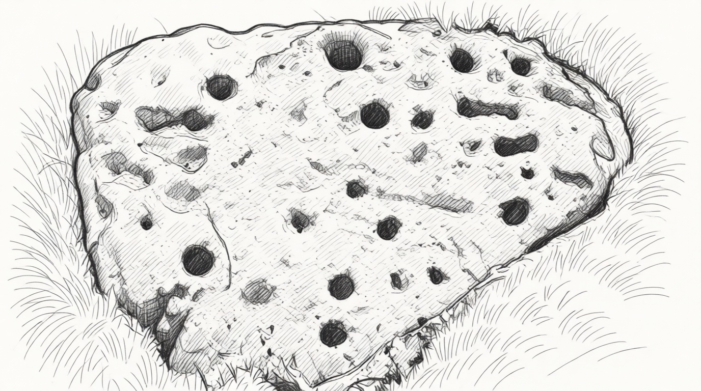
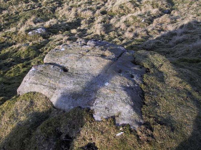
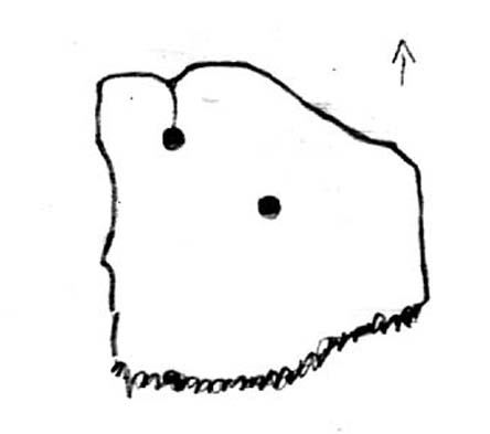
After visiting the Hartlington Moor Lane carving, walk further up the track for bang-on 400 yards and you’ll reach a gate on your right. In the field here, about 150 yards in, is an ornate cup-marked stone, which has had the dung of a hundred animals and other natural effects dumped upon it in recent years and, as a result, remains hidden at the mo. A sketch of it was made some time back, showing it’s general design, but it would be good to get some good photos of it (let us know if you manage to locate it).
The carving covers most of the surface of this low rounded stone and a number of the cups are quite deep, which suggests that it had been hidden from view for a long time. There are up to 54 cups, several of which are linked together by carved grooves, giving it what some folk call an ‘hour-glass’ feature. Near the middle of the stone it looked as if there was a faint cup-and-ring with a carved line running out of it.
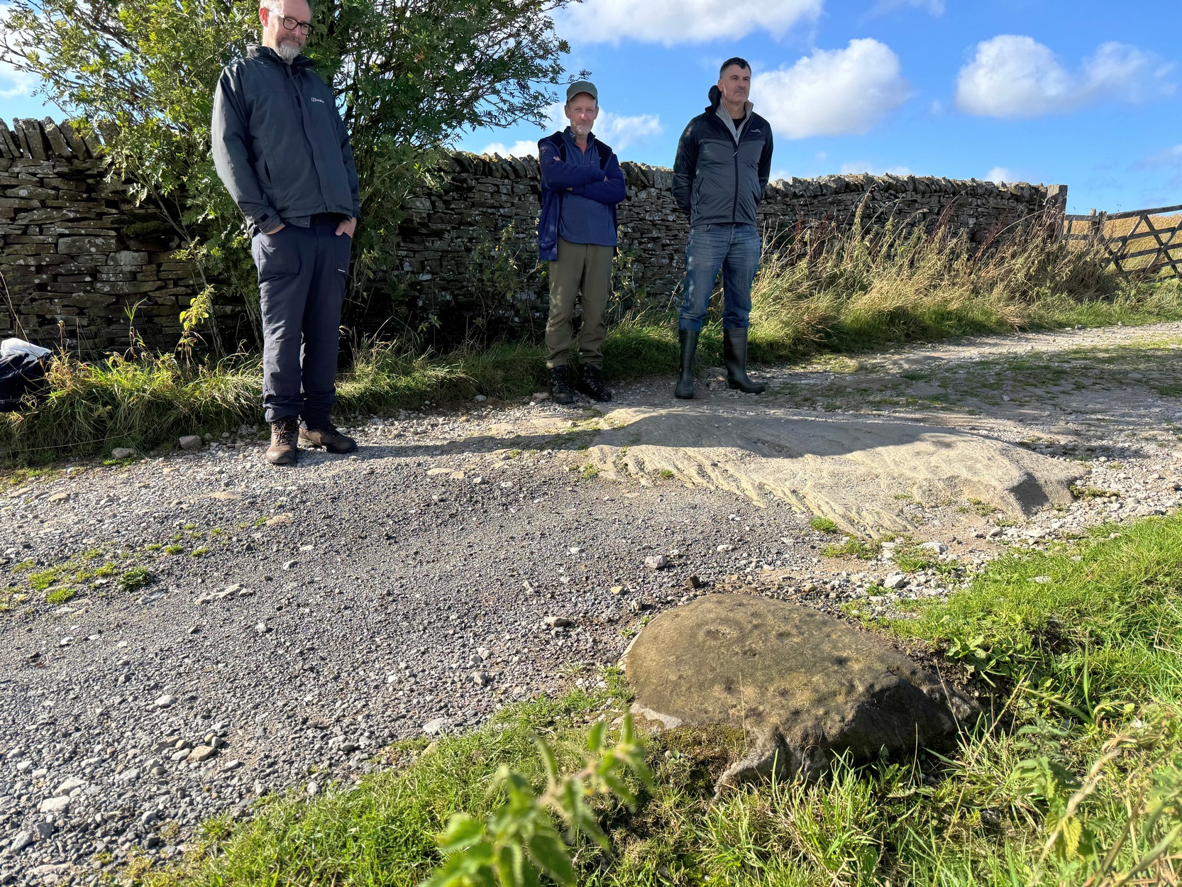
The worst part about getting to this stone is finding somewhere to park on the B6265 road if you’re visiting by car! The best spot (as of writing) seems to be a small clearing that the farmer has made by the roadside near one of his gates. From Hebden village travel literally one mile (1.62km) east up the B6265 road and (keep your eyes peeled!) you’ll reach the small left-turn down to Hartlington Raikes (and on your left is a dirt-track) – but keep going straight on past this turning for another 450 yards where the farmer’s cleared the edge of the road against his field. Do not obstruct his field! (he’ll have every right to move it with his tractor if you’re an idiot) Naathen – walk back on yourself to the dirt-track (known as Hartlington Moor Lane) 450 yards away and walk up it for 300 yards where there’s a small tree on to your left. On the opposite side of the track, just below the wall right at the very edge of the track itself, you’ll see the small rounded carved stone.
Archaeology & History
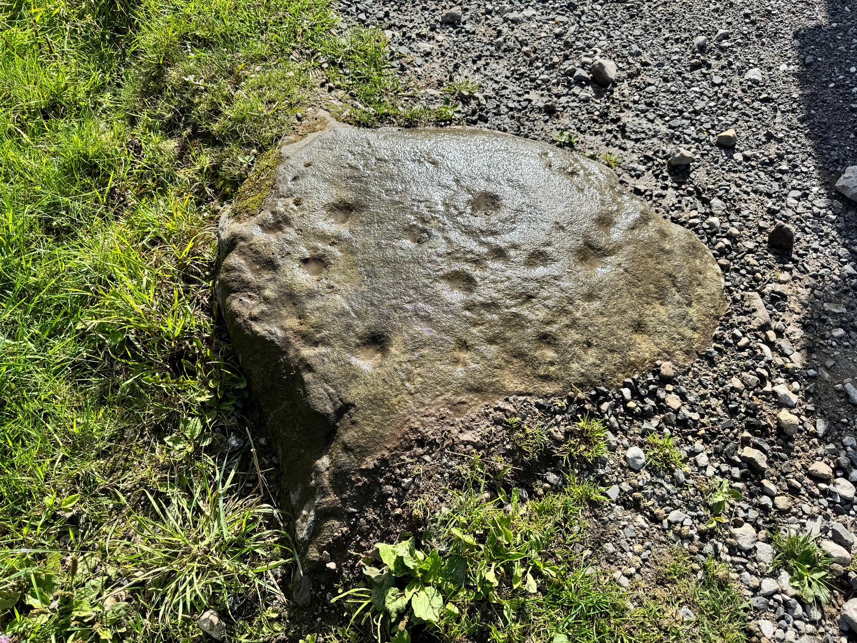
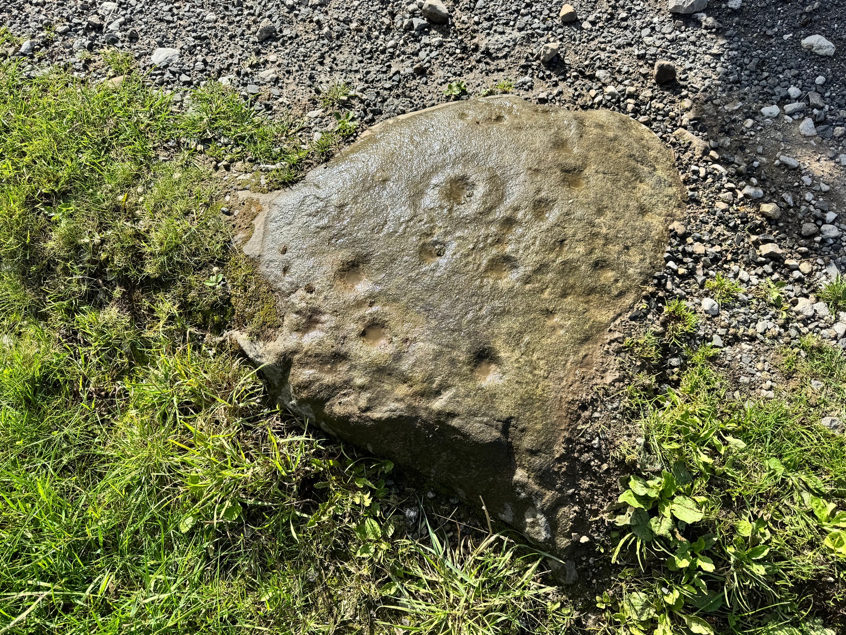
Adjacent to a large, flat, elongated ovoid stone that nearly covers the width of the dirt-track is this much smaller stone with a decent scatter of cup-marks on it that was rediscovered only a few years ago by Yvonne Luke of Ilkley.
A rock art menagerie of Morley, Chappell & HothamHartlington Moor Lane (1)
The petroglyph comprises of two standard cup-and-rings, one of which has a carved groove running from the cup to the ring. There may be up to nine other single cup-marks on the stone, many of them quite worn (as you’d expect with it living on a track!); but some of these may be the result of natural erosion. Nonetheless, most of them seem to be the real deal. There are also several oval ‘notches’ on the design, but these may have been made by agricultural/farm machinery scratching across the stone.
From this carving, if you venture another 400 yards up the Hartlington Moor Lane track and go through the gate on your right, about fifty yards into the field is another carving at grid-ref SE 0467 6373, covered in cup-marks, but now covered over in vegetation. If you get a chance to make the stone visible again, let us know! It’s likely that other unrecorded carvings are hiding away in the adjacent fields.
Acknowledgements: With appreciations to Tony Morley, John Hotham and Graeme Chappell for getting us up to this olde stone. Cheers fellas!
Along the B6265 Pateley Bridge-Grassington road, roughly halfway between Stump Cross Caverns and the turn to Skyeholme and Applecross (New Lane) is a dirt-track on your right-hand side called Black Hill Road. Walk down here for a few hundred yards till y’ reach the gate on the right. A track goes downhill to the psilocybin-rich pastures of Nussey Green. Several hundred yards down, to the right-hand side of the track, we find this and its several companions. Look around!
Archaeology & History
Sketch showing cups
Just a few yards away from the Skyrehome Carving-404, this very basic petroglyph was rediscovered by Stuart Feather (1969) during one his many forays in this area. Although the stone has what initially seems to be a number cup-marks on it, it seems only two of them are man-made. The rock art students Boughey & Vickerman (2003) think there may be up to four of them.
References:
Boughey, Keith & Vickerman, E.A., Prehistoric Rock Art of the West Riding, WYAS 2003.
Feather, Stuart, “Appletreewick, W.R.: Black Hill,” in Yorkshire Archaeological Journal, volume 42, part 167, 1969.
Going down (south) off the B6265 Black Hill Road towards Skyreholme, turn right and go all round the hill ahead of you, but instead of looking to the right (where other carvings, described elsewhere, are found), turn left where the collapsed entrance to a mine-shaft is visible about 50 yards up the hill on the left. Walk up here, keeping to the right side of the collapsed mine, till you reach this rock.
Archaeology & History
Only for the purist petroglyph fanatics amongst you, the rock art students Boughey & Vickerman (2003) allege there to be four cup-markings here—and debatable ones at that—but we could really only make out the topmost cup, shown in the picture and an elongated one (which they think may have been two cups merged into one). A faint “X” is also carved on the stone, possibly from the mining days.
References:
Boughey, Keith & Vickerman, E.A., Prehistoric Rock Art of the West Riding, WYAS: Wakefield 2003.
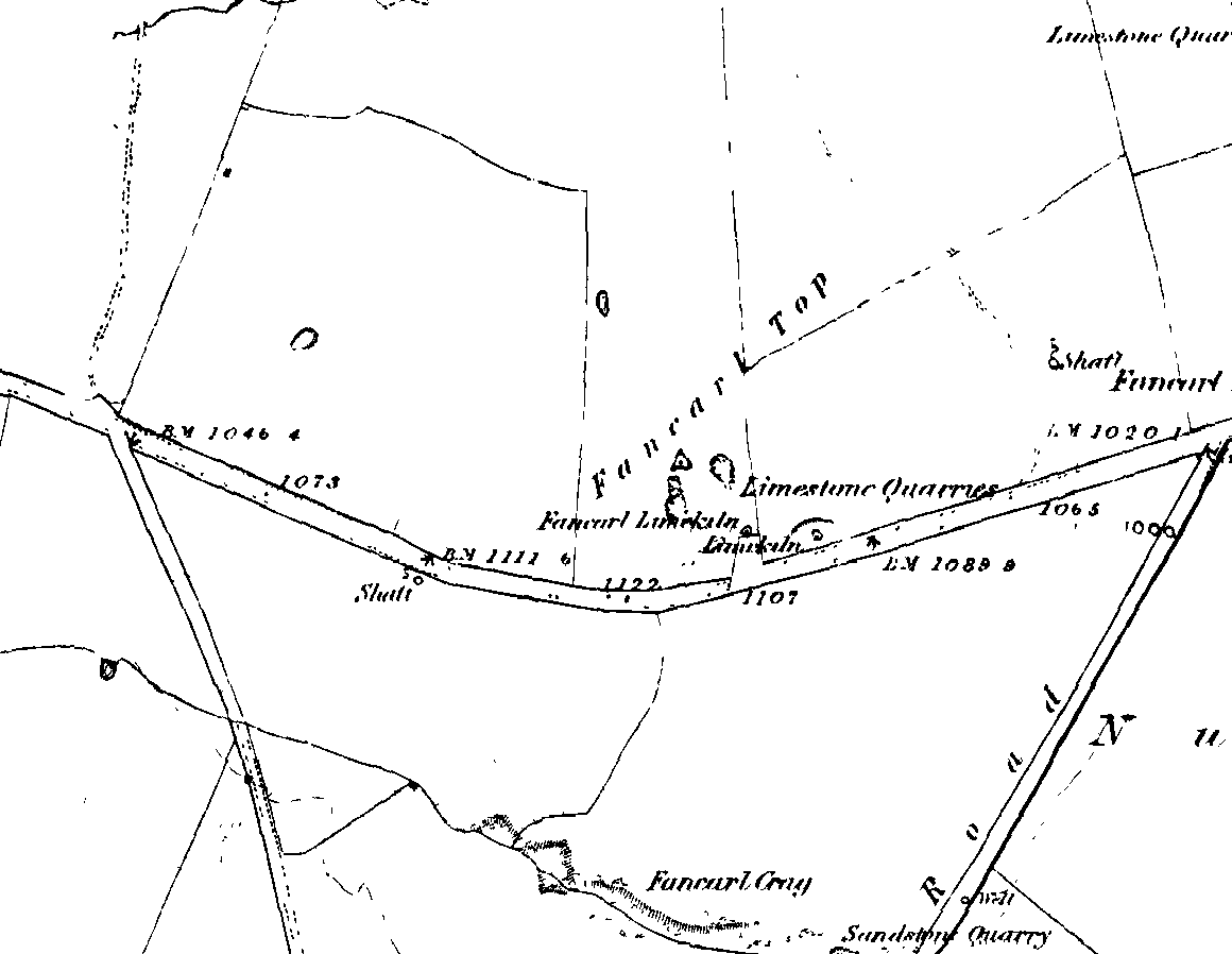
1st edition OS-map – the unmarked circle’s near the middle
Along the B6265 road between Grassington and Pateley bridge, heading east, past the hamlet of Hebden, a mile or so on where the road goes uphill, stop where it levels out a bit (before it goes further uphill to Stump Cross), a half-mile before the rocky outcrop of Nursery Knott on the left (north) side of the road. A gate into the field on the same side is what yer after, with a small disused quarry therein. Go up here to the quarry-top and then walk uphill for literally 100 yards and the curious small ring is right there.
Archaeology & History
Appletreewick stone circle (courtesy Paul Daw)
This small stone circle sitting on the grassy ridge overlooking the ritual rocks of Simon’s Seat and central Wharfedale to the south and the Yorkshire heathlands east and west, is probably not what it once was. Overcome by the excess of industrial workings in the fields and moors all round here, it is probable that its present condition is far from its original state. Indeed, if we move back to the 18th century, we find that place-name and map evidences tell us the site was a tomb. The 1771 Greenwood map names the site as the Fancairn — an etymological curiosity in itself, possibly deriving from the ‘Windy Cairn’, which makes sense. The place-name fell into its present title of ‘Fancarl’ after the great Ordnance Survey chaps came, heard dialect and went on their way…
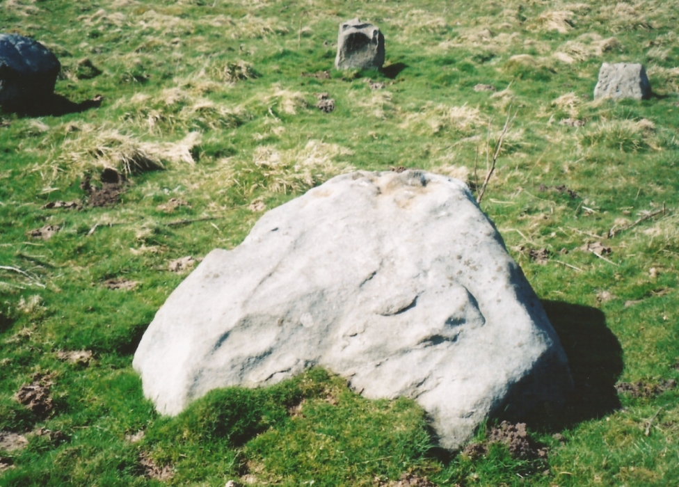
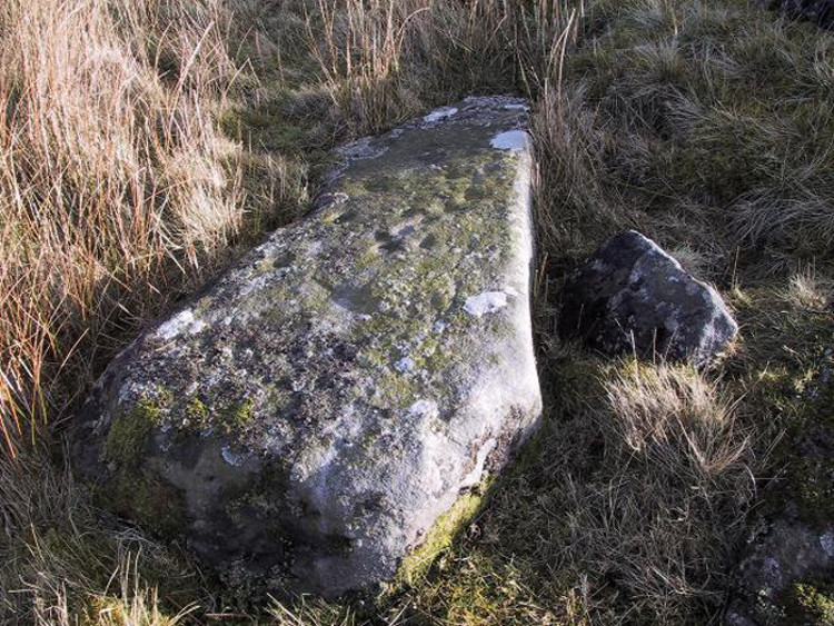
The largest rock in the ring (courtesy Paul Daw)
The circle doesn’t appear to have been noted by the great Yorkshire historians Harry Speight and Edmund Bogg in their literary rambles here (rather odd), but was brought to our attention first of all (in a literary sense anyway) by Arthur Raistrick. (1965) He first “surveyed” the site in 1950, but said little until a short remark was printed in the Yorkshire Archaeological Journal, where the notes told it to be one of “two stone circles, one with clear standing stones, 30ft in diameter, and the other a double circle of small recumbent stones, 12ft in diameter.”
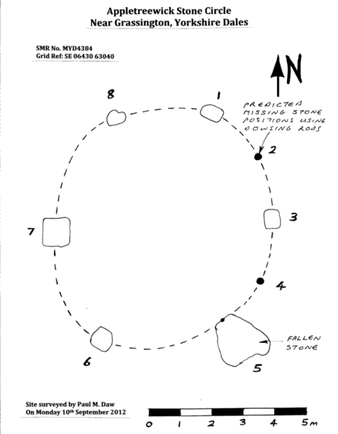
Ground-plan & missing stones (by Paul Daw)
The second, smaller double circle he mentions is probably a hut circle or cairn, faint traces of which are seen in the adjacent field. Remains of a prehistoric enclosure were also once evident in the same field; and thankfully to the south (across the road) we can still find many examples of cup-and-rings at Skyreholme.
John Barnatt (1989) and Aubrey Burl (2000) include the site in their relative major surveys, with both of them citing the circle, of six small stones, to measure 8.5m by 7.5m. The survey shown of this small stone ring was done by Paul Daw following his visit to the site on Monday 10th September 2012.
Folklore
Although we can only see six stones in this ring today, when the surveyor Paul Daw (2012) did a ground-plan of the place, he also did a dowsing survey of the site and found there were originally two extra stones on the eastern side of the circle. An archaeological dig would be interesting to see if post-holes or the remains of these two additional stones are under the turf. He wrote:
My dowsing survey revealed that the stone circle measured 7.7 metres diameter (N-S) and 7.0 metres (E-W). A reaction was received over the centres of stones 1, 3, 6, 7 and 8 indicating that they are still standing in their original positions, but stone number 5 to the south-south-east of the circle had a reaction at its northern end, which indicates that it was once standing but had fallen outwards. It is not therefore an earthfast stone, as speculated by A. Raistrick, when he visited the site. The stone measures 1.65 m x 1.65 m x 800 mm and fans out like a shell from bottom to top. It would have been an impressive stone when standing, but was top heavy, and the most likely stone to fall.
Stones 1, 3, 6, and 8 are all of a similar size, are much more stable, and stand at about 500 mm high. Stone 7 in the western sector is 800 mm high, and measures 950 mm x 850 mm, and looks like a rectangular block, with slightly rounded edges.
I also obtained a reaction at positions 2 and 4, indicating that there were once stones standing in these positions. To the north of the stone circle there are a number of stones lying on the surface. A. Raistrick suggested that there may have been another small stone circle in this area, but my dowsing rods did not detect anything, and it is probable that these are random stones lying on the surface.
This entire region is bedevilled with faerie, goblin and giant lore, plus creation myths of our peasant ancestors (Sutcliffe 1929) — some still living if you’re lucky enough to talk with the old folk, who might tell you a thing or two, or might not, depending on how you smell.
References:
Barnatt, John, The Stone Circles of Britain – 2 volumes, BAR: Oxford 1989.
Burl, Aubrey, The Stone Circles of Britain, Ireland and Brittany, Yale University Press 2000.
Daw, Paul M., “Appletreewick Stone Circle, Yorkshire Dales,” unpublished survey report 2012.
Take the B6265 east out of Grassington, thru Hebden, for another 2 miles till you pass the tiny road down to Skyreholme on the right. Another few hundred yards on, past Nussey Farm and Dry Gill house, park up and look for the track going south into the moors. Go down the track called Black Hill Road for a few hundred yards till y’ reach the gate on the right. A track bends downhill to the psilocybin-rich pastures of Nussey Green. Several hundred yards on, to the right-hand side of the track, we find this and its companions. Look around!
Archaeology & History
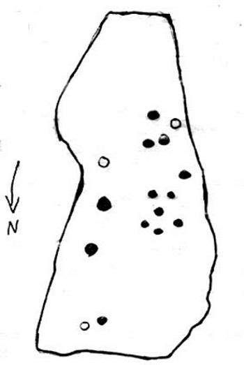
Quick sketch of design
This medium-sized, recumbent standing-stone-shaped boulder has perhaps fifteen cup-markings on it. It’s a plain carving with others of a similar ilk in the area. First described by Stuart Feather in 1970 as one of “two cup-marked rocks” he found when ambling around; in Boughey & Vickerman’s (2003) survey they give it the wrong grid reference, though describe it correctly as a “long flat rock of irregular outline (with) fourteen to sixteen cups.” A cluster of other carvings are nearby, though some have been destroyed through mining operations.
References:
Boughey, Keith & Vickerman, E.A., Prehistoric Rock Art of the West Riding, WYAS: Wakefield 2003.
Feather, Stuart, “Appletreewick, W.R.,” in Yorkshire Archaeological Register, 1969, Yorkshire Archaeological Journal, part 168, 1970.
A slight walk to get here. Follow the same directions as if you’re going to the Eller Edge 431 carving. Once here, walk west as if you’re going into the middle of the field, keeping your eyes peeled about 20 yards along for a small-ish rounded stone with nice colours of lichen amidst the grasses. If you’re patient, you’ll find it soon enough!
Archaeology & History
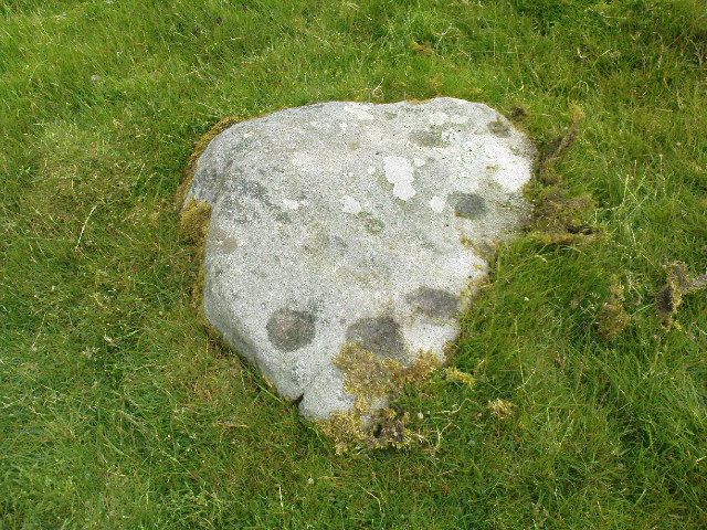
This is another simple cup-marked stone on the grassland ridge overlooking higher Wharfedale. The carving here is a little clearer and more well-defined than that of its close neighbours, with a number of simple cups visible on its rounded surface. We counted seven such cups on our cloudy-day visit, but Boughey & Vickerman (2003) thought there might be a little more, describing the stone simply:
from another angleB & V’s drawing
“Small lichen-covered rough grit rock. About eight cups and two depressions.”
A rubbing of this small stone (as practiced by English Heritage and rock art students alike) would prove useful in bringing out any other ingredients in the ancient design. And whilst you’re in this field, have a look at the curious Spiral Stone and some of the other cup-markings close by.
References:
Boughey, Keith & Vickerman, E.A., Prehistoric Rock Art of the West Riding, WYAS: Wakefield 2003.
A slight walk to get here, but well worth it once you arrive! Follow the same directions as if you’re going to the Eller Edge 426 carving. Once you reach this stone, notice the larger rounded rock about 20 yards to your west, a bit further down the field. You can’t really miss it!
Archaeology & History
A large rounded stone just on the meadows before it begins to slope more steeply downhill, there are several of those large natural ‘bowls’ that we see on a lot of cup-marked and not-so-cup-marked stones in our northern hills. These basins or bowls may, at times, may have had significance for our ancestors, but it’s the cluster of cup-markings on this stone which are of importance to us here. There are perhaps as many as a dozen cup-marks here, all very well worn, and mostly to be seen on the eastern sides of the rock. When I came here with Paul Hornby and QDanT a few months back, the cloud cover stayed with us all day, so I didn’t get any decent images of the carving. Ne’er mind…
Close-up of faint cups
The stone was described by Boughey & Vickerman (2003) simply as:
“Very large, uneven, rough grit rock with face with scooped-out areas sloping down to grass. Eleven possible cups and six basins.”
A plain carving, perhaps only of interest to the fanatics amongst you. But if you do visit here, check out carving 432, 431, and others in the same field.
References:
Boughey, Keith & Vickerman, E.A., Prehistoric Rock Art of the West Riding, WYAS: Wakefield 2003.
A slight walk to get here. Follow the same directions as if you’re going to the Eller Edge 426 carving, but as you reach the field edge, walk up the slope (in the field itself) along the side of the wall. You’ll pass rudimentary Carving 431 and about 30 yards further uphill this little fella will catch your eye! You can’t really miss it.
Archaeology & History
Another basic cup-marked stone that’s probably only gonna be of interest to the purists amongst you. A single cup-marking sits on the edge of a small patch of old dark lichen, although the rock art students Boughey & Vickerman (2003) reckon there could be another two on here—but I aint so sure misself. The stone was described by them simply as:
“Medium-sized rectanguar rock of medium gritstone, with vertical edges except for finely striated sloping W side. One cup near possibly quarried edge and perhaps two more.”
Single faint cup-mark
Another single cup-marked stone of the same size, type and quality as this one can be found on another stone not far from this stone, which aint in the Boughey & Vickerman survey. There’s also evidence of ancient lines of walling close by, but with little surface clues as to its age.
References:
Boughey, Keith & Vickerman, E.A., Prehistoric Rock Art of the West Riding, WYAS: Wakefield 2003.
Park at Stump Cross Caverns on the B6265 road, then walk down the road for 200 yards till you reach the track on your left running over the fields in the direction towards Simon’s Seat. Walk on the track for about 600 yards until there’s a change of direction in the adjacent walling and then watch out for the dirt-track on your right, curving towards the small valley (if you hit the Skyreholme Wall carving (413), you’ve gone 100 yards past the turn-off). Go on here until you see the overgrown track on your left into a small disused quarry, and head right, down the grassy slope, checking out the few stones ion front of you 20 yards down. You’re damn close!
Archaeology & History
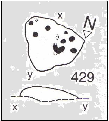
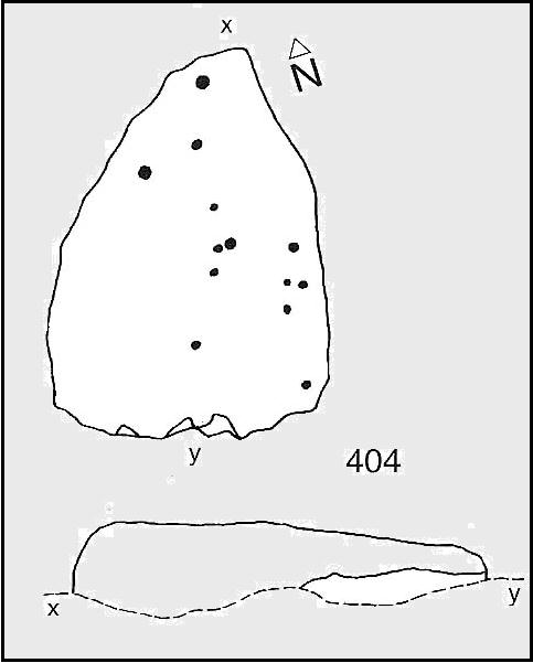
Carving no.404 (after Boughey & Vickerman)
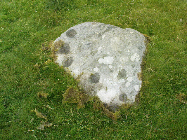
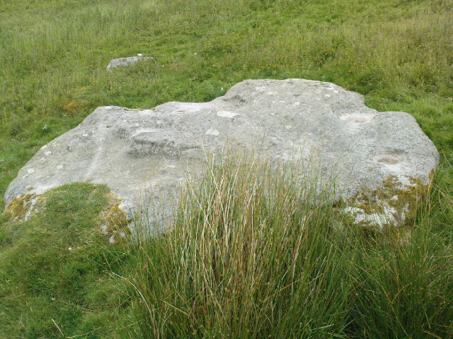
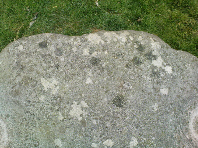
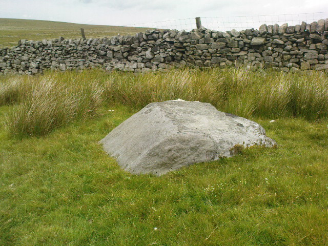
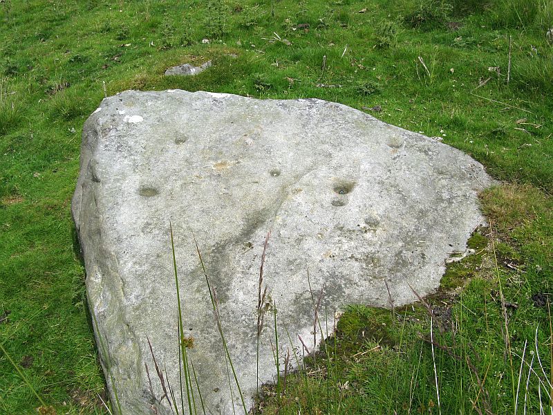
A simplistic carving that was first described by fellow antiquarian Stuart Feather (1964), this is one of at least four cup-marked stones in a small group here, above the valley of Skyreholme Beck — better known at this part of the valley as the Troller’s Ghyll, haunt of various heathen lore. Although some of the carving has now been covered by the growing Earth, you can still see the majority of the design.
It is a flat, roughly triangular stone described by rock art students Boughey & Vickerman (2003) and having 13 cup-markings on it. To get a full look at the entire carving, you may have to roll a bit of the turf away from one side of the rock.
Folklore
Although we have no lore relating to this specific carving, the small valley over which this carving looks was long known as the abode of the legendary bharguests, or black dogs: underworld creatures of earlier heathen myths. Faerie lore can also be found a short distance further up the same stream.
References:
Boughey, Keith & Vickerman, E.A., Prehistoric Rock Art of the West Riding, WYAS: Wakefield 2003.