Tom Cross, Colne, Lancashire

Cross:  OS Grid Reference – SD 92102 43175

Also Known as:

  1. Copy House Cross

Getting Here

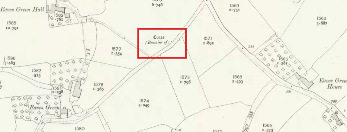
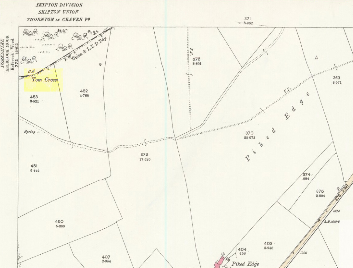
Tom Cross on 1892 map

Follow the same directions as if you’re visiting the Dissenter’s Well.  The cross stands right next to it!

Archaeology & History

This is one of two old stone crosses with the same name within a mile of each other (the other could be found in the walling along Warley Wise Lane).  Included in Taylor’s (1906) stunning magnum opus on the wells and crosses of Lancashire, the site was mentioned in a boundary dispute in the year 1592.  He told how a local man called Mr Carr said,

“John Parkinson, ‘of the age of ffour score and thirtiene year or thereabouts’ stated that Tom Cross and the Graystone were by credible report the boundaries, as well of Lancashire and Yorkshire, as of the manors of Colne and Cowling.”

Years later when Clifford Byrne (1974) surveyed the crosses of East Lancashire, he gave us more details about the site, saying:

Photo by Phil Waterworth
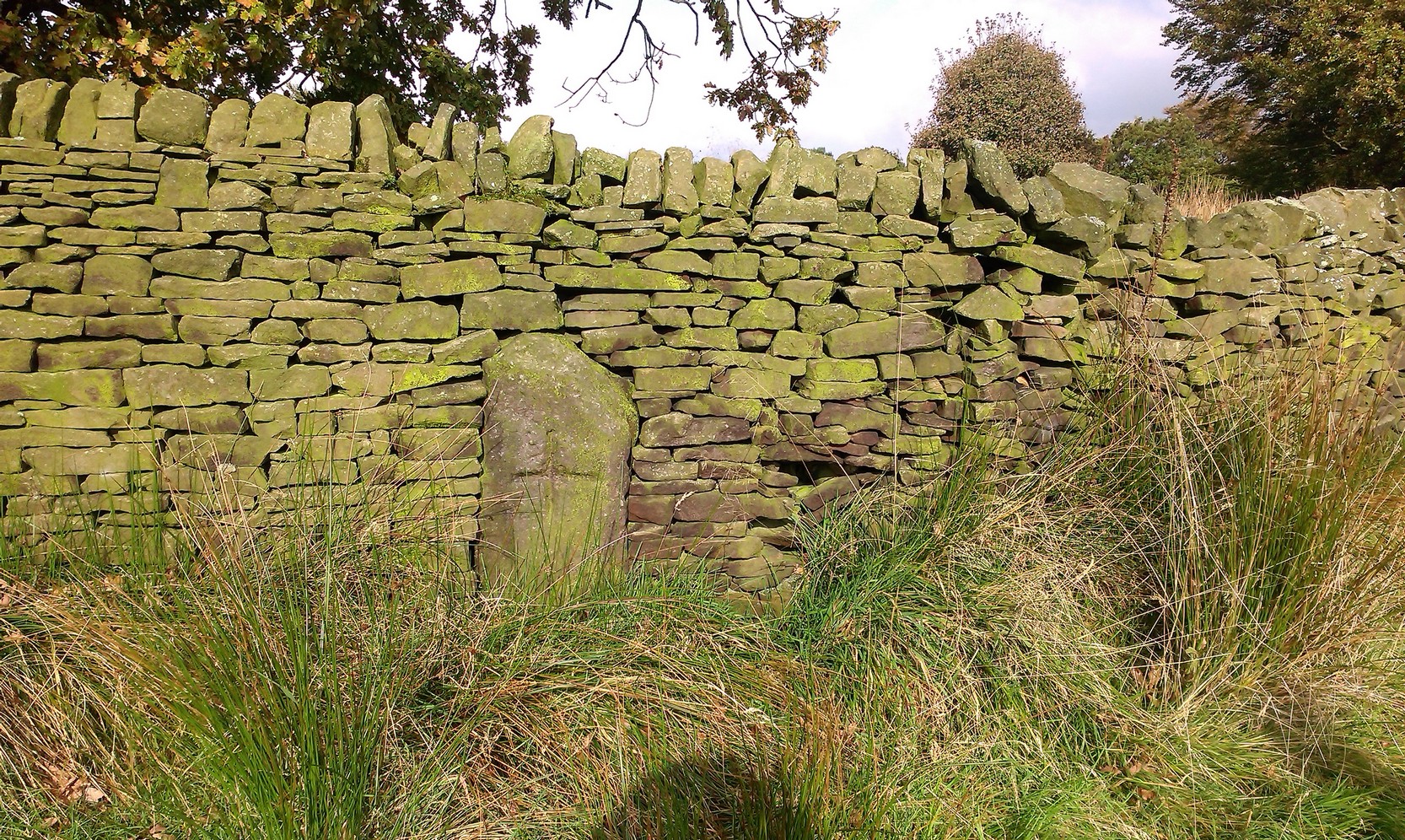
Tom Cross, looking N

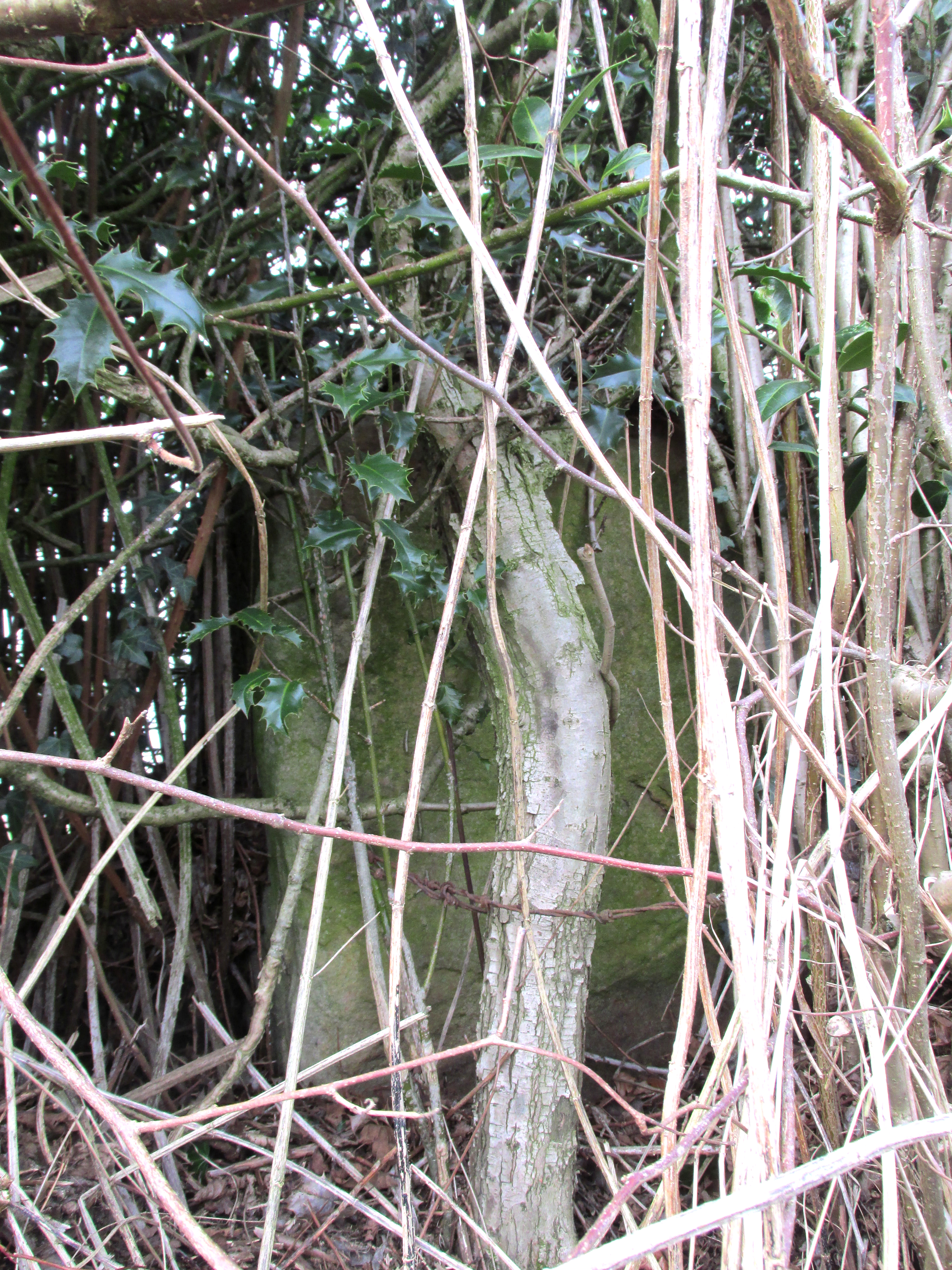
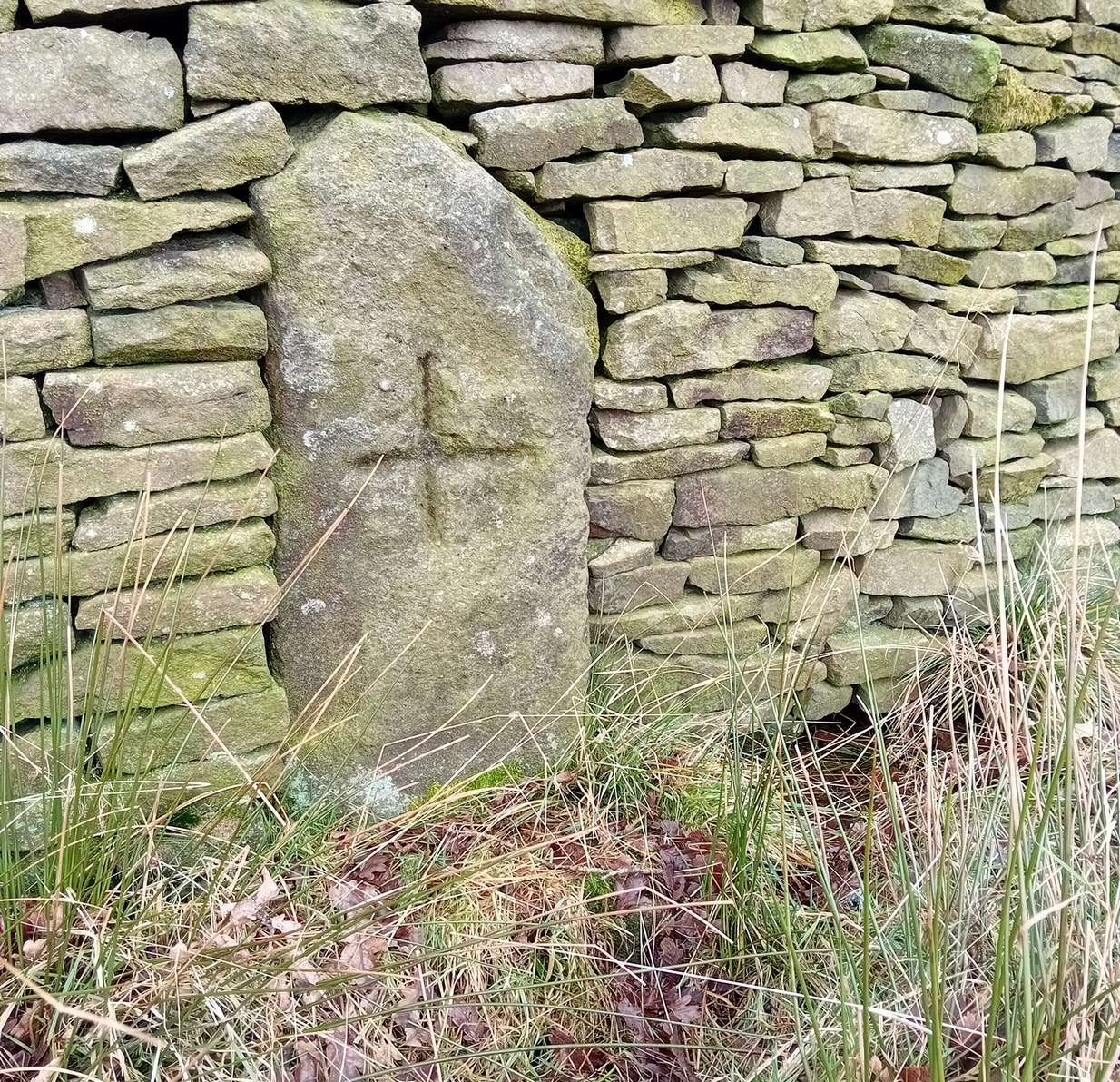
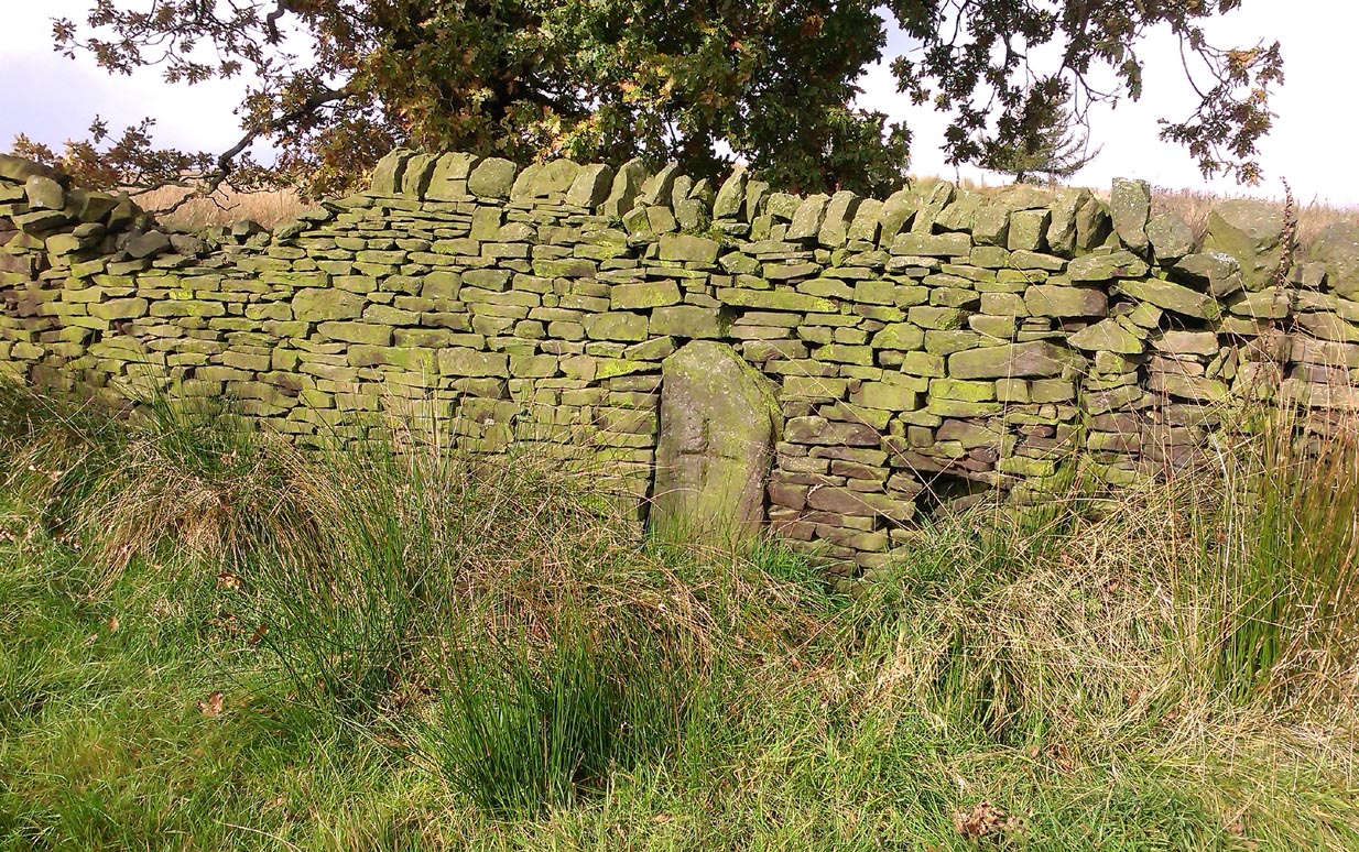
“Tom Cross is built into the wall hard by Copy House Farm… At the foot of the Copy House Cross is a well, carved out of a solid block of stone.  The water apparently trickles into the well from a spring at the back of the wall , and the overflow spills into the field.  The top section of the cross is missing, probably it was vandalized at the time of the Reformation or some time afterwards.  It appears that the well was used and probably laid down by the Congregational Church dissenters from the late 17th century.  At that time, a law was passed, soon to be repealed, which decreed that every man should attend his Parish Church.  This meant that those who wished freedom to practise religion in their own form had to firstly attend the Parish Church and then hold a meeting privately afterwards.  At that time, and under those circumstances, it was obviously sensible to meet far away from the Parish Church, and apparently Tom Cross was chosen to meet this need.  The children of the Dissenters would be privately baptised in this well at the foot of the monolith into which, a cross was deeply incised.

Tom Cross is mentioned in a lawsuit in the year 1592 and a map exists dated slightly earlier which shows another cross in the area on Greystone Moor near Blacko…”

Tom Cross stone
Tom Cross stone

Byrne suggested that the name ‘Tom Cross’ relates to a boundary cross, but this is not substantiated in local dialect or place-name surveys (who say nothing!).  Instead, Joseph Wright (1905) gives us the possibility of Tom being simply, “a kind of rock”; although a variety of other associations relate it children’s games, customs and goblins. The word may derive from the Gaelic ‘tom’, relating to a mound, or clump, or knoll in the landscape (Watson 1926).  I’d go for one of these misself.  Makes sense.

References:

  1. Byrne, Clifford H., “A Survey of the Ancient Wayside Crosses in North East Lancashire,” unpublished manuscript, 1974.
  2. Taylor, Henry, The Ancient Crosses and Holy Wells of Lancashire, Sherratt & Hughes: Manchester 1906.
  3. Watson, W.J., The Celtic Placenames of Scotland, Edinburgh 1926.
  4. Wright, Joseph (ed.), English Dialect Dictionary – volume 6, Henry Frowde: Oxford 1905.

Acknowledegments:  Big thanks to Chris Swales for guiding me to the site; and to the old Teddy Man, Danny Tiernan.

© Paul Bennett, The Northern Antiquarian 

Grey Stone, Newsholme Dean, Oakworth, West Yorkshire

Cup-Marked Stone:  OS Grid Reference – SE 00621 40841

Also Known as:

  1. Carving no.2 (Boughey & Vickerman)

Getting Here

Grey Stone, Newsholme Dean

Take the same directions as if you’re visiting the Cob Stone Field carving; but instead of going into the field on your right, walk down the track about 100 yards towards the large barn below.  As you walk down keep your eyes peeled to the field on your left and, right up against the wall of the barn, you’ll see a large boulder resting quietly. That’s what yer after!

Archaeology & History

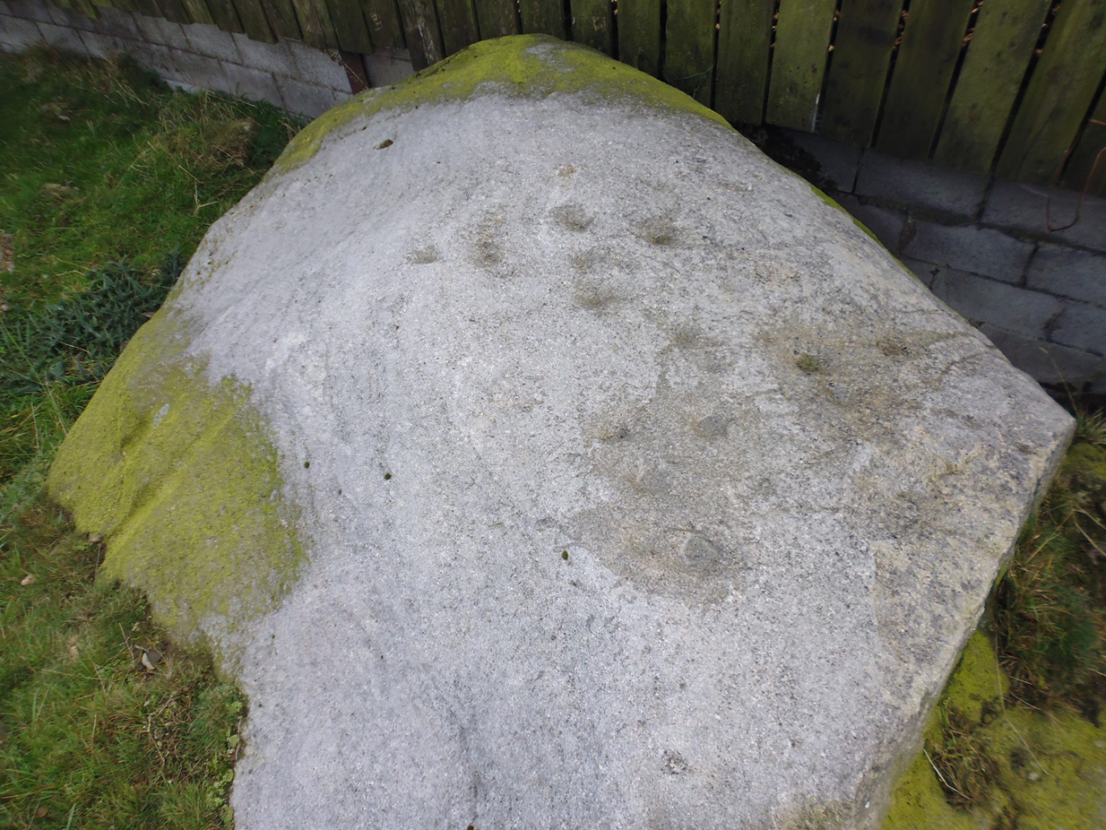
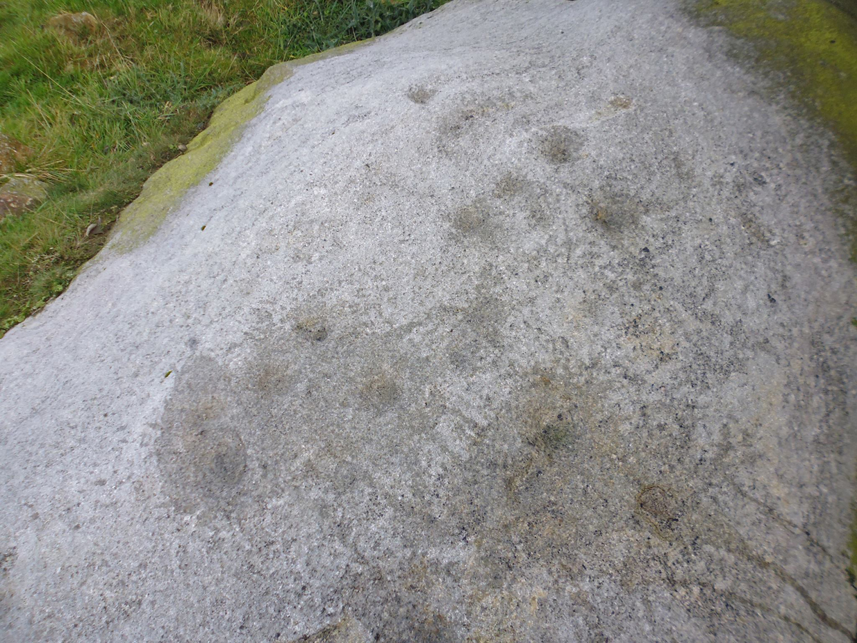
This large faded cup-marked rock whose western side has been split off in recent years, has a scatter of “up to 21 small shallow worn cups” on its upper surface.  They can be difficult to see in some light, but they’re definitely there (as Ray Spencer’s photos clearly show), fading slowly into Nature’s winds and storms.  A couple of ‘lines’ running down the edge of the stone are  due to modern farm-workings.

Close-up of the cups
Sketch of the design

Several other rocks in this and adjacent fields have what may be faded remains of other cup-markings, but without guidance from a geologist or a stone-mason, we can’t know for sure whether they’re authentic or not.  It’s likely that there are other authentic carvings hiding in this area—they just need sniffing out!

References:

  1. Boughey, Keith & Vickerman, E.A., Prehistoric Rock Art of the West Riding, West Yorkshire Archaeology Service 2003.

Acknowledgements:  Huge thanks to Ray Spencer for us of his photos in this site profile. Thanks Ray.

© Paul Bennett, The Northern Antiquarian 

Picketts Beck East, Askwith Moor, North Yorkshire

Cup-and-Ring Stone:  OS Grid Reference – SE 1708 5054 —  NEW FIND

Getting Here

Cup-and-ring stone in situ

From the Askwith Moor Road parking spot, head across the road and take the directions to the Woman Stone carving about 510 yards (467m) across the moors to the west.  From here, look straight down the slope and head towards the largest boulder at the bottom, 20-30 yards away.  About 10-20 yards to the right of this, zigzag about in the vegetation until you find the small stone amidst the bracken.  You’ll find it!

Archaeology & History

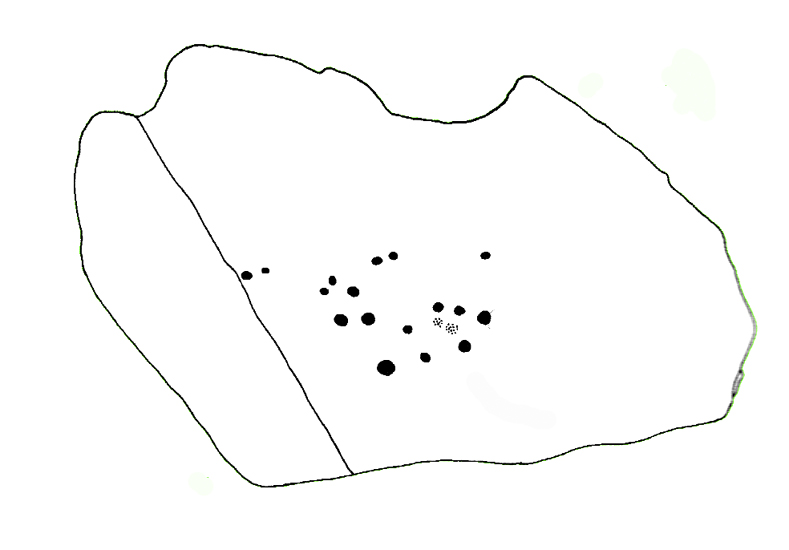
This small stone, whose natural contours and cracks have been utilised in the design of the petroglyph, may once have been part of a prehistoric tomb, perhaps rolled or thrown downhill from the nearby Askwith Moor Cairnfield.  I say this due to the size and portability of the stone, i.e., it’s small and barely earthfast, giving an increased likelihood that its present position was not its original one.  But we might never know…

Rough sketch of the design
Close-up of the carving

It’s almost archetypal in design, being a primary cup-and-ring, with what appears to be a faint inner ring etched marginally within the larger notable incomplete circle, just an inch beyond the inner central cup.  From this same cup runs a carved line, out to the near edge of the small stone.  Single cup-marks occur on the edges of the rock, as can be seen in the photos: three, possibly four of them.  One of the cups, where the stone narrows to a rounded point, may also have had a partial ring around it.  When we found this stone a few weeks ago, the day was grey and overcast and the light was poor, so our photos do not highlight the carving too well.

(Note: the OS grid-reference for this stone is an approximation: pretty damn close, but not close enough. If someone ventures here and can get the exact grid-ref, we’d be most grateful.)

© Paul Bennett, The Northern Antiquarian 


Wester Cairnfield (02), Askwith Moor, North Yorkshire

Cup-Marked Stone:  OS Grid Reference – SE 1698 5070

Getting Here

Faint cupmarks clearly visible

From the Askwith Moor Road parking spot, head west to the Askwith Moor cairnfield. Keep walking west, going downhill past the main cluster of rocks.  If you begin zigzagging amidst the heather hereby, you’ll eventually come across this relatively small stone which, even when the heather is deep, thankfully rises to the surface.  The Wester Cairnfield 1 carving is close by.

Archaeology & History

Although I presumed that Graeme Chappell and I found this petroglyph when we surveyed the area in the 1990s, I cannot find an early account of it in my files, so must presume that when James Elkington, James Turner and I came across it a few weeks ago, it was the first view of the stone in many a century… It’s another simple carving, only of interest to the mad rock art hunters out there.

...and from another angle
…and from another angle

When we first found it, it seemed to me (with the sunlight effects on the stone) that two cup-marks had been etched here; but as Mr Elkington pointed out, from the angle he was looking at the stone, there were another two.  He was right.  But it’s nothing special to look at, sadly, and is probably only of interest to the real hardcore petroglyph nutters amongst you. (please note that the grid-ref for this carving needs revising and may be 50 yards either side of the one given)

© Paul Bennett, The Northern Antiquarian 


Wester Cairnfield (01), Askwith Moor, North Yorkshire

Cup-Marked Stone:  OS Grid Reference – SE 16966 50674

Getting Here

Cup-mark near top-right

From the Askwith Moor Lane parking site, take the directions to the Askwith Moor Cairnfield.  Walk westwards for about 100 yards down the gradual slope, towards the boggy land below, but before reaching the reeds, still in the moorland heather, there are a scatter of rocks.  Just keep zigzagging about until you find it. It’s a reasonably large stone.

Archaeology & History

'Cup mark' on vertical face
‘Cup mark’ on vertical face

This is one of several simple cup-marked stones found down the slopes about 100 yards west of the Askwith Moor Cairnfield.  When James Elkington, James Turner and I re-surveyed this area again recently, I wondered whether it was a newbie or had already been located when Graeme Chappell and I did our tedious surveying of this region in the 1990s—and it turned out that we did!  The carving is nothing special to look at, even if you’re a petroglyph zealot.  Comprising of a distinct single cup-mark on the top nose of the rock, another is visible on the vertical south face, and another possible is on its eastern face.

1894 map of shooting target

When we look at the early maps of this area, we find that to the north and south of this stone once existed ‘Shooting Houses’.  As we can see on the attached map, the position of one of the shooting targets is very close to the location of this stone and so we must conclude that the cups on the vertical face were done by gunshot and are not prehistoric. However, the distinct cup on top of the stone retains its prehistoric link.

© Paul Bennett, The Northern Antiquarian 


Hawksworth Moor Cairnfield (01), West Yorkshire

Cairns:  OS Grid Reference – SE 140 443

Getting Here

One of Hawksworth Moor's cairns
One of Hawksworth Moor’s cairns, looking west

Take the same directions as if you’re visiting the Great Skirtful of Stones giant cairn on the boundary of Burley and Hawksworth.  Cross the wire fence on its southern-side and, cross the (usually overgrown) prehistoric trackway 50-60 yards away.  Keep in the same direction onto the pathless moor for about the same distance again, zigzagging back and forth, keeping your eyes peeled for some small overgrown rocky rises.  You’ll find ’em.

Archaeology & History

Not to be confused with the much larger Bronze Age graveyard further south on the same moorland, this little-known prehistoric cemetery has had little of any worth written about it since the 19th century and—like many sites on these moors—has received no modern archaeological attention.

Close-up of one of the cairns
Two of the cairns, looking NW

On my last visit to this site with James Elkington in 2015, only four of the heather-clad cairns were visible; but if you explore here after the heather has been burned away, a half-dozen such tombs are found in relatively close attendance to each other.  They are each about the same size, being roughly circular and measuring between 3-4 yards across, 10-12 yards in circumference and a yard high at the most. As you can see in the attached images, they are quiet visible even when the heather has grown on them.

Another cairn in this group

This small cairnfield may stretch across and link up with the secondary cairnfield a half-mile to the southwest.  More survey work is required up here.

As with the circle of Roms Law and the Great Skirtful of Stones, this relatively small cluster of cairns seems to have had a prehistoric trackway approaching it, running roughly east-west.  A short distance west are the much-denuded waters of the Skirtful Spring.

References:

  1. Bennett, Paul, The Old Stones of Elmet, Capall Bann: Milverton 2001.
  2. Faull, M.L. & Moorhouse, S.A. (eds.), West Yorkshire: An Archaeological Guide to AD 1500 (4 volumes), WYMCC: Wakefield 1981.
  3. Wardell, James, Historical Notes of Ilkley, Rombald’s Moor, Baildon Common, and other Matters of the British and Roman Periods, Joseph Dodgson: Leeds 1869. (2nd edition 1881).

Acknowledgements: Huge thanks to James Elkington for use of his photo in this site profile.

© Paul Bennett, The Northern Antiquarian


Lower Lanshaw Stone (02), Askwith Moor, North Yorkshire

Cup-and-Ring Stone:  OS Grid Reference – SE 16059 50875

Getting Here

Lanshaw cup-and-ring nearby
Lanshaw cup-and-ring stone

Start at the Askwith Moor parking spot on Askwith Moor Road, then walk down the road (south) 300 yards till you reach the gate and track on the other side of the road, heading southeast.  Following the track onto the moor and take the footpath on your right after 75 yards. Follow this along until you hit the gate & fence.  Climb over this, then follow the same fence along (left) and down, and keep following the fence and walling all the way on until you reach the very bottom southwestern edge of Askwith Moor itself.  Now, walk up the slope to your right and, near the top of this rise 250 yards away, past Lower Lanshaw 01 carving, in some ancient walling, you’ll find it!

Archaeology & History

A very faded cup-and-ring carving can be found about 30 yards northeast of the Lower Lanshaw cup-marked stone, just as the hill slopes down to the overgrown stream.  It rests on the lower edges of the prehistoric (probably Bronze Age) enclosure in which other archaeological remains can be found.  Although the photo here highlights what seems to be 3 cups on the south-face of the rock, only one of them seems authentic.  A pecked “line” also seemed evident, but the light conditions were poor when we were here.  It does seem that there’s a faded ring around one of the cups, as you can see in the photo.

© Paul Bennett, The Northern Antiquarian 


Stanbury Hill North, Bingley Moor, West Yorkshire

Cup-Marked Stone:  OS Grid Reference – SE 1097 4339

Getting Here

Stanbury HIll cup-marked rock

Take the directions as if you’re visiting the ornate petroglyphs known as the Lunar Stone and the Spotted Stone. Walk past them and down the slope, NW, as if you’re heading to the small valley a few hundred yards away. As you reach the bottom of the slope, closer to the stream, a large boulder catches your attention. This carved stone is just a few yards before you reach it.

Archaeology & History

This simple cup-marked design below the northern slope of Stanbury Hill has, on its northeastern sloping face, a single cup-mark; then, past a curiously-etched line (probably more recent) is a larger circular feature, like a very shallow ‘bowl’ as in the one found in the superb Stag Cottage petroglyph complex 300 miles north (and several other carvings). A few yards away, a large single cup-mark has been etched onto another stone.  As with quite a few carvings in this region, they have been missed in the standard archaeocentric surveys.

© Paul Bennett, The Northern Antiquarian


The Maypole, Alconbury, Huntingdonshire

Maypole (removed):  OS Reference Number TL 18554 75972

Getting Here

Maypole Square, outlined in red on the 1901 OS map

Maypole Square forms the junction of High Street, Church Way and Chapel Street in the centre of the village.

Archaeology & History

The Alconbury Maypole had passed out of living memory by 1942, but was historically attested by the ‘Maypole Square’ in the centre of the village.

Folklore

C.F. Tebbutt wrote in 1950:

“At Alconbury, it is remembered that about 1890 an old soldier, who lived in the corner house (east end) of the row of cottages facing Maypole Square, used to dig holes in the road opposite the row and set up May bushes there on May day”.

References:

  1. C.F.Tebbutt, “Huntingdonshire Folk and their Folklore”, in Transactions of the Cambridgeshire and Huntingdonshire Archaeological Society, Volume VI, part V, 1942.
  2. C.F.Tebbutt, “Huntingdonshire Folk and their Folklore II”, in Transactions of the Cambridgeshire and Huntingdonshire Archaeological Society, Volume VII, part III, 1950.

© Paul T. Hornby 2016 The Northern Antiquarian


The Maypole Tree, Little Paxton, Huntingdonshire

Maypole & Ritual Tree (destroyed):  OS Grid Reference TL 18831 62757

Getting Here

Imposing trunk of The Maypole Tree, right background

The road layout of the village has changed since the destruction of the Tree, but its approximate position was on the north side of the present High Street, at the junction with the east side of St James’ Road.

Archaeology & History

The Little Paxton Maypole Tree was a very late survival of a tradition where Mayday revellers danced around an actual tree rather than a symbolic tree in the form of a maypole.  It was described as “a tall straight elm tree” that stood in front of what was then the village Post Office, and from what may be the only surviving photograph, it appears that only the very substantial trunk survived of what was clearly a very old tree.

The 1887 6" OS Map, showing the Maypole Tree outlined in red
1887 6″ OS Map, showing the Maypole Tree outlined in red

A Miss Ethel Ladds, who had been born in Little Paxton, recalled in the early 1940s:

I remember the old tree very well, it was always called ‘the Maypole’, but I don’t know any more about it, except that they used to dance round it“.

The St Neots Advertiser recorded that the Maypole Tree was blown down in a great gale on 24th March 1895.

Folklore

While this writer has been unable to find direct folklore relating to the Little Paxton Maypole Tree, it may be worth remarking that botanically the Elm tree is a cousin of the Stinging Nettle, the Hop and Cannabis.  Another Elm Tree used for May revels was the Tubney Elm, near Fyfield in Berkshire and recorded by Matthew Arnold, in his ‘Scholar Gipsy’.

References:

  1. C.F. Tebbutt, “Huntingdonshire Folk And Their Folklore”, in Transactions of the Cambridgeshire & Huntingdonshire Archaeological Society, Volume VI, Part V, 1942
  2. C.F. Tebbutt, “Huntingdonshire Folk And Their Folklore”, in Transactions of the Cambridgeshire & Huntingdonshire Archaeological Society, Volume VII, Part III, 1950
  3. Gerald Wilkinson, Epitaph For The Elm, Arrow Books, London, 1979

© Paul T. Hornby 2016 The Northern Antiquarian