Fairy Well, Wragby, West Yorkshire

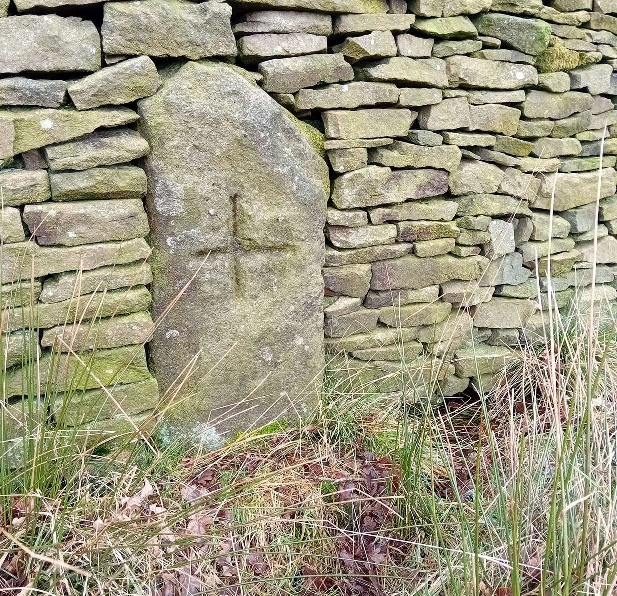
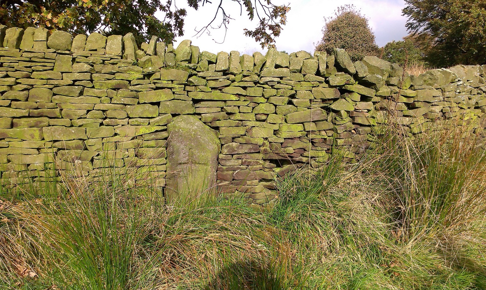
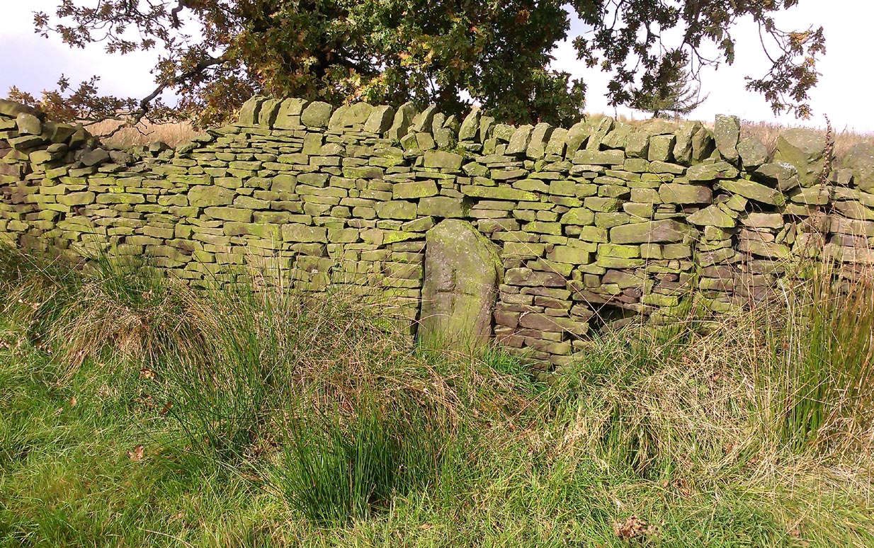
Sacred Well (destroyed):  OS Grid Reference – SE 3953 1570

Archaeology & History

The precise whereabouts of this site isn’t known with absolute certainty, but, following research by the respected folklorist and pagan historian Steve Jones of Wakefield, the grid-reference cited here has a high degree of probability about it.  I certainly agree with Steve about its location.

Pond in Fairy Wood, shown on the 1893 OS-map
Fairy Wood near Nostell, probable home of the Well

Known about in the 19th century, I was fortunate in coming across what seems to be the only reference to the place whilst perusing the scrapbook notes of local historian John Wilson (1903).  Were it not for him we would have lost all knowledge of its existence and the local tale told of it, albeit watered into a dying belief in these supernatural creatures, would have faded completely before its final physical demise.  Wilson was described as a “diligent a student of local history,” who possessed a great collection of rare booklets and pamphlets on Yorkshire history and was a “careful an observer and recorder of all pertaining to past times.”  Of this Fairy Well, Wilson scribed the following poem:

At Nostell is a Fairy Well,
Hard by the margin of a wood
Wherein once dwelt, as old men tell,
The little folks of fickle mood ;
Till smoke and steam denied the dell
And made them quit both wood and well.

Blythe Henry Carr, mine ancient friend,
— So bravely keeping on his feet ;
May death long spare him,
still to wend His way along the village street,
Within the cobbler’s shop to spend
A pleasant hour — mine ancient friend.

The woodman at the Priory
In old Sir Rowland’s halcyon days
Was Thomas Watson, gay and free,
Who roused with song the woodland ways
A friend of Henry Carr’s was he,
—The woodman at the Priory.

This Watson many a tale could tell
Of fairies red and fairies green,
That in the wood and by the well
On summer evenings he had seen:
Of elves that thereabouts did dwell
This Watson many a tale could tell.

Whoever heard of such a thing!
He said that persons, known to him,
At eve would flasks of liquor bring,
And leave them, lying near the brim
Of this — the wondrous Fairy Spring —
Whoever heard of such a thing !

Was ever such a tale yet told ?
He said, that, when the morning came,
Each flask lay empty, and, behold !
Near each a drunken elf. O, shame !
The vice of those of mortal mould :
— Was ever such a tale yet told ?

Then question I mine ancient friend:
“Did no one seize the tipsy sprites? ”
“Not they ! for sudden is his end
On whom the fairy vengeance lights.”
With solemn eyes that fear portend
Thus answers me mine ancient friend.

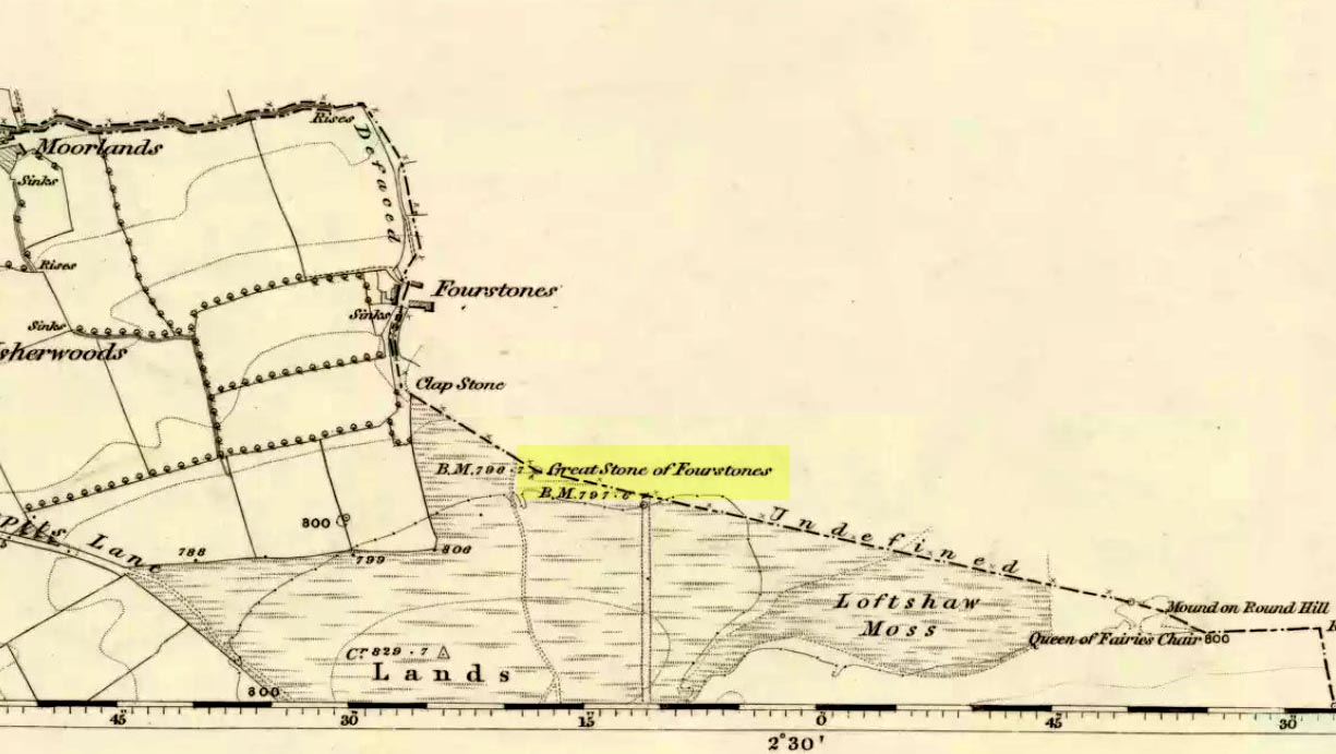
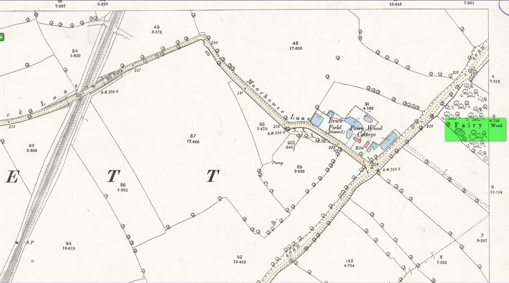
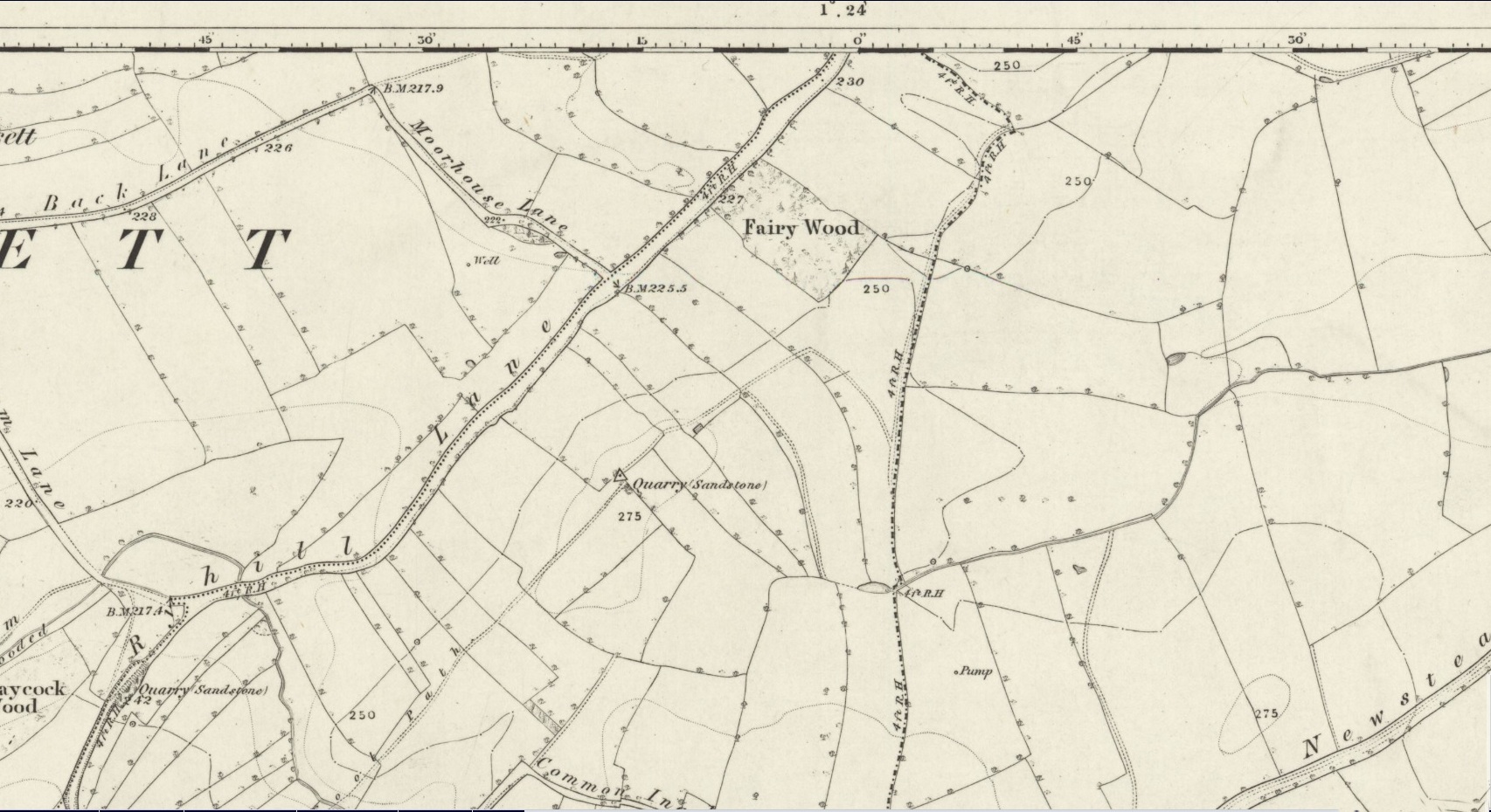
Steve Jones already knew of the Fairy Wood, which was highlighted on the 1841 and 1854 6-inch-to-the-mile OS-map of the area—but no “Well” is shown in the woods.  However, as Steve discovered, following a subsequent visit by the Ordnance Survey lads in 1891, they showed on their 25-inch-to-the-mile map of the woods a distinct small pond in the trees not far from the roadside.  This, he thought, was probably the Fairy Well referred to by Wilson. It would seem so.  Adjacent to the woods, the 1853 Tithe Award cite the existence of a field also dedicated to the fairy folk, known simply as Fairy Close.

References:

  1. Smith, A.H., The Place-Names of the West Riding of Yorkshire – volume 1, Cambridge University Press 1961
  2. Wilson, John, Verses and Notes, A. Hill: Corley 1903.

Acknowledgements:

Huge thanks to the research by Steve Jones of Wakefield, without whose work the location of the Fairy Well would have remained a mystery.  Also, thanks as always for use of the early edition OS-maps, Reproduced with the kind permission of the National Library of Scotland

© Paul BennettThe Northern Antiquarian

Watcher Stone, Ilkley Moor, West Yorkshire

Cup-Marked Stone:  OS Grid Reference – SE 11816 46563

Also Known as:

  1. Carving no.109 (Hedges)
  2. Carving no.263 (Boughey & Vickerman)
  3. White Wells 05

Getting Here

Watcher Stone by the path

From Ilkley, go up to White Wells (ask a local if y’ get stuck) and walk round the back of the building. Walk to the trees and then follow the footpath up onto the moors; but after 70 yards a small footpath on your right goes up the slope.  Take this and after about 90 yards it veers round to your left, following the contours up towards the copse of trees.  Another 100 yards up it meets with another path and once here, just yards in front of you, right by the side of the footpath, is the stone in question.

Archaeology & History

First described in John Hedges (1986) survey, this simple cup-marked stone typifies many petroglyphs on these moors: a barely visible design much eroded by centuries of wind and water, with markings perhaps only of interest to the devoted student and explorer.  But at least it’s a good place to sit, rest and watch the valley below.

Looking down at the cups
Hedges 1986 sketch

This old fella looks to have only five cupmarks on its supper surface, one of which is elongated, as shown in Hedge’s drawing.  However, when he saw this, he thought the elongated ‘cup’ consisted of three of them in a line, all linked up.  He saw a “medium sized smooth grit rock standing in grass, its surface triangular in shape, with flat top sloping slightly N to S.  Three cups connected by a groove, c. four other cups, all shallow and worn.”

This description was echoed in Boughey & Vickerman’s survey (2003), where they thought that the “triangular top surface has about seven worn cups, three connected by a short groove.”  But if the light isn’t quite right, this can be very difficult to see.

References:

  1. Boughey, Keith & Vickerman, E.A., Prehistoric Rock Art of the West Riding, WYAS: Wakefield 2003.
  2. Hedges, John (ed.), The Carved Rocks on Rombalds Moor, WYMCC: Wakefield 1986.

Links

  1. The Watcher Stone on The Megalithic Portal


Pen Howe (2), Sleights Moor, Sleights, North Yorkshire

Tumulus:  OS Grid Reference – NZ 8566 0369

Archaeology & History

The low rise of Pen Howe-2

Prehistoric companion to the more pronounced Pen Howe (1) Bronze Age cairn just 20 yards to the west, this overgrown tumulus is hardly noticeable when the heather’s deep and is probably only of interest to dedicated antiquarians and geomancers.  Its position in the landscape, whilst not as prominent as its companion and the nearby Breckon Howe, would still have been important to its builders and the relative proximity of the two tombs may imply a continuity of tribal companionship in the Land of the Dead.  But hey! – that’s just a silly idea of mine! 🙂

Rising barely three feet above ground level, this is slightly smaller than Pen Howe (1), being just 13 yards across; and there is no indication that it has ever been dug into.

References:

  1. Elgee, Frank, Early Man in Northeast Yorkshire, Frank Bellows: Gloucester 1930.

Acknowledgements:  Big huge thanks to my Lindsay Mitchell for getting us up to see this old tomb (which is nearly as old as Linzi 🙂).

© Paul BennettThe Northern Antiquarian


Pen Howe (1), Sleights Moor, Sleights, North Yorkshire

Tumulus:  OS Grid Reference – NZ 85638 03722

Getting Here

Pen Howe from the north

Along the A169 road between Sleights and Pickering, some two miles south of Sleights turn right as if you’re going to the tombs of Flat Howe and the Bride Stones, but just park up 80 yards along by the cattle grid.  From here, a fence runs southeast and the mound is on the near skyline, just over 100 yards away.  Just walk through the heather to reach it.

Archaeology & History

Shown on the first OS map of the area in 1853, this somewhat overgrown prehistoric tomb is one of two in close attendance to each other (see Pen Howe 2); and is some 435 yards (398m) away from the more prominent Breckon Howe tomb to the southwest.  Like others on Sleights Moor, no real archaeological attention has been paid here, with Frank Elgee (1930) only giving it the slightest mention in passing.

Pen Howe on 1853 map
Pen Howe, looking SE

Smaller than its nearby companions of Flat and Breckon Howe, the overgrown cairn raises about four feet above ground level and about 20 yards across.  Probably Bronze Age in origin, it has a slightly concave top that gives the impression that someone at sometime in the not-too-distant past has had a bittova dig here to see if there’s owt inside.  But we have no record of such a thing.

surmounted by a relatively recent boundary stone, sits at the highest point on the moors in these parts.  Despite this (as with others on these moors), very little has been written about the place and it has received only minimal attention in archaeology tomes.  Even the renowned pen of Frank Elgee (1912; 1930) gave it only passing mention.  Perhaps it aint a bad thing to be honest.

References:

  1. Elgee, Frank, Early Man in Northeast Yorkshire, Frank Bellows: Gloucester 1930.

Acknowledgements:  Big huge thanks to my Lindsay Mitchell for getting us up to see this old tomb and its companion.  (which is nearly as old as Linzi 🙂 )

© Paul BennettThe Northern Antiquarian


Tom Cross, Colne, Lancashire

Cross:  OS Grid Reference – SD 92102 43175

Also Known as:

  1. Copy House Cross

Getting Here

Tom Cross on 1892 map

Follow the same directions as if you’re visiting the Dissenter’s Well.  The cross stands right next to it!

Archaeology & History

This is one of two old stone crosses with the same name within a mile of each other (the other could be found in the walling along Warley Wise Lane).  Included in Taylor’s (1906) stunning magnum opus on the wells and crosses of Lancashire, the site was mentioned in a boundary dispute in the year 1592.  He told how a local man called Mr Carr said,

“John Parkinson, ‘of the age of ffour score and thirtiene year or thereabouts’ stated that Tom Cross and the Graystone were by credible report the boundaries, as well of Lancashire and Yorkshire, as of the manors of Colne and Cowling.”

Years later when Clifford Byrne (1974) surveyed the crosses of East Lancashire, he gave us more details about the site, saying:

“Tom Cross is built into the wall hard by Copy House Farm… At the foot of the Copy House Cross is a well, carved out of a solid block of stone.  The water apparently trickles into the well from a spring at the back of the wall , and the overflow spills into the field.  The top section of the cross is missing, probably it was vandalized at the time of the Reformation or some time afterwards.  It appears that the well was used and probably laid down by the Congregational Church dissenters from the late 17th century.  At that time, a law was passed, soon to be repealed, which decreed that every man should attend his Parish Church.  This meant that those who wished freedom to practise religion in their own form had to firstly attend the Parish Church and then hold a meeting privately afterwards.  At that time, and under those circumstances, it was obviously sensible to meet far away from the Parish Church, and apparently Tom Cross was chosen to meet this need.  The children of the Dissenters would be privately baptised in this well at the foot of the monolith into which, a cross was deeply incised.

Tom Cross is mentioned in a lawsuit in the year 1592 and a map exists dated slightly earlier which shows another cross in the area on Greystone Moor near Blacko…”

Tom Cross stone
Tom Cross stone

Byrne suggested that the name ‘Tom Cross’ relates to a boundary cross, but this is not substantiated in local dialect or place-name surveys (who say nothing!).  Instead, Joseph Wright (1905) gives us the possibility of Tom being simply, “a kind of rock”; although a variety of other associations relate it children’s games, customs and goblins. The word may derive from the Gaelic ‘tom’, relating to a mound, or clump, or knoll in the landscape (Watson 1926).  I’d go for one of these misself.  Makes sense.

References:

  1. Byrne, Clifford H., “A Survey of the Ancient Wayside Crosses in North East Lancashire,” unpublished manuscript, 1974.
  2. Taylor, Henry, The Ancient Crosses and Holy Wells of Lancashire, Sherratt & Hughes: Manchester 1906.
  3. Watson, W.J., The Celtic Placenames of Scotland, Edinburgh 1926.
  4. Wright, Joseph (ed.), English Dialect Dictionary – volume 6, Henry Frowde: Oxford 1905.

Acknowledegments:  Big thanks to Chris Swales for guiding me to the site; and to the old Teddy Man, Danny Tiernan.

© Paul Bennett, The Northern Antiquarian 


Great Stone of Fourstones, Lowgill, North Yorkshire

Legendary Stone:  OS Grid Reference – SD 66972 66292

Also Known as:

  1. Big Stone
  2. Four Stones

Getting Here

The Great Stone of Fourstones

From near the middle of the large village (or small town!) of High Bentham, go down Station Road, over the river — where the road becomes known as Thickrash Brow! — and keep going for about a mile.  The landscape opens up into the hills and there, on the left-hand side of the road, is a car-parking spot with a footpath taking you straight up to the large boulder a 100 yards on: that’s our Great Stone!  You can’t really miss it.

Archaeology & History

Great Stone on 1847 map

A meeting place of local tribes in more ancient days, the moorland plain upon which the Great Stone sits, beckons to a vast landscape on all quarters (north, south, east and west) calling the elders from their lands for annual rites and decisions to befit the health of the land and the people.  The stone rests on the ancient boundary of Yorkshire and Lancashire, just on the Yorkshire side, and was visited annually in more later centuries during the beating of the bounds, to define the edges of the local township.

Graffiti & cup-marks on the top

First described in a Yorkshire inquisition account from 1307, this Big Stone was visited by Harry Speight (1892) who described it as measuring 30 feet round and 12 feet high.  I came here for the first time in the 1980s when I was hitch-hiking into the Scottish mountains, but a good old “local” (from the Yorkshire side) took a detour to show me the place!  Once here, I climbed up the very worn “steps” which were carved into the side of the boulder several centuries back and it didn’t surprise me to find a number of cup-markings (no discernible rings) on its top surface.  When I came here again with Michala Potts and Paul Hornby yesterday, I couldn’t believe how many people had carved their names on top of the Great Stone in the intervening years — it’s almost covered in modern graffiti and the old cup-markings were much harder to see.  Taylor (1906) mentions them briefly in his holy wells survey, saying how,

“This great boulder is ascended on its eastern side by fourteen steps, and on the top are two circular holes about two inches deep and two inches in diameter.”

There used to be three others boulders very close to this one (hence its title), making a natural stone circle, but they were “broken up for sharpening scythes” a couple of hundred years back.  A much wider archaeological survey of this region is long overdue.

Folklore

Great Stone, looking east

Harry Speight (1892) told how the (original) Four Stones were the creation of our old friend the Devil, long ago, who dropped them in one his many megalithic travels across our land. The stones were also the meeting place of ancient councils, from the tribes either side of the Yorkshire-Lancashire border. Their presence here also had mythic relationship with the Queen of the Fairies Chair, about a mile southeast, along the same boundary line.

Weird how folklore changes. Whilst old Mr Speight told how the devil created the once great four stones that were here, many years later Jessica Lofthouse (1976) told how the three missing stones – which had been here “since the world began” – were actually taken from here by Old Nick. Carrying them over the land,

“His load he dropped on Casterton Fell, where the rocks he discarded, the Devil’s Apronful, are still lying around. He selected the most suitable, dressed them and carried them in panniers down to the (River) Lune”

— and built the legendary Devil’s Bridge at Kirkby Lonsdale – which itself has strange tales to tell.  Another creation myth about the Great Stone is told on the plaque near the stone, alongside the footpath, which tells:

“Legend has it that it is a small part of the debris hurled by the giant Finn McCool across the Irish Sea in a fit of anger.”

It’s very obvious that a lotta mythic landscape material has been neglected and overlooked around this site.  Something we need to remedy, if we can, in the coming years…

References:

  1. Lofthouse, J., North Country Folklore, Hale: London 1976.
  2. Speight, Harry, The Craven and Northwest Yorkshire Highlands, Elliott Stock: London 1892.
  3. Taylor, Henry, The Ancient Crosses and Holy Wells of Lancashire, Sherratt & Hughes: Manchester 1906.

© Paul Bennett, The Northern Antiquarian 


Spell Howe, Folkton, East Yorkshire

Tumulus:  OS Grid Reference – TA 0657 7878

Archaeology & History

This once impressive tumulus a half-mile east of the village was first mentioned in the Bardney Cartulary in the early 13th century, where is was written as Spelhou.  Suggested by Olof Anderson (1934) to have been an early moot site — “the meeting place of the Torbar Hundred” — this appears to be confirmed in Smith’s (1937) etymological analysis where he ascribes Spell Howe to be literally, “‘Speech mound’, from OE spell, speech and haugr” (burial mound).  Rising about four-feet above ground level, this is a traditional ’round barrow’ type of tumulus.  In recent years, reports tell that it has been built onto with some fencing.  Hopefully the present land-owners now look after the place!

References:

  1. Anderson, O.S., The English Hundred-Names, Lunds Universitets Arsskrift 1934.
  2. Mortimer, J.R., Forty Years Researches in British and Saxon Burial Mounds of East Yorkshire, Brown & Sons: Hull 1905.
  3. Smith, A.H., The Place-Names of the East Riding of Yorkshire and York, Cambridge University Press 1937.

© Paul Bennett, The Northern Antiquarian


Green Gates stone (257), Ilkley Moor, West Yorkshire

Cup-and-Ring Stone:  OS Grid Reference – SE 11499 46049

Also Known as:

  1. Carving no.103 (Hedges)

Getting Here

Green Gates (257) stone

Take the road from Ilkley town centre up towards the White Wells and keep following it along until it curves up and onto the moor itself and becomes a rocky dirt-track.  Go up here, past the old quarries (left) until you hit the footpath which runs east (left) onto the flat level of the moorland. Follow this footpath along for literally half-a-mile, where a footpath runs up onto the tops of the moorland.  Go up here for 100 yards and you’ll see a small standing stone by the right-hand side of the footpath; on the left, into the moorland about 20 yards away, this carving is to be found!

Archaeology & History

This is an excellent, archetypal cup-and-ring stone carving and is in a very good state of preservation.  Found just a few yards away from the aptly-named Pitchfork Stone, the carving here on a large single stone mainly comprises of a double cup-and-ring.  A couple of other possible outlying cup-marks can be seen: one just below the double-ring, and the other towards the top-end of the rock.  It was first reported by Stuart Feather in the Bradford Archaeology Group’s journal in 1961, then listed in the surveys of Hedges (1986) and his followers.

Carving 257, looking NE

When Michala Potts, Dave Hazell and I we visited this carving the other day, some halfwit had been up here in the not-too-distant past and, as with some of the carvings on the moors north of Ilkley, had daubed some paint or oily resin onto the carvings themselves to specifically highlight aspects of the carved rock (not one part of the uncarved stone had anything on it).  We aint quite sure exactly what the substance is that’s been daubed onto the carvings (it aint ordinary paint), but seems like an oil or industrial substance.  And, whoever’s done this, obviously seems to have some knowledge of the rock art they’re painting over: they certainly have good grid-references and enjoy walking the hills.  This aint just some idiot/s into vandalizing the carvings for the sake of it, nor the whim of some airy-fairy New-Ager.  Whoever’s done this (and it’s been done on other cup-and-rings around this locale) have deliberately set out to locate and paint over specific carvings — a number of them off-path — with the intention it would seem to highlight them for photographic enhancement.  So — whichever retard has done this, might I suggest that you keep your industrial waste where it belongs: either in your own house, or preferably up your mother’s arse, where you obviously first emerged from.  If anyone knows who is doing this to the carvings round here, please email me (anonymously if necessary) with all relevant info.  Any such communications regarding this matter will be kept strictly confidential.

References:

  1. Boughey, Keith & Vickerman, E.A., Prehistoric Rock Art of the West Riding, WYAS: Leeds 2003.
  2. Hedges, John, The Carved Rocks on Rombald’s Moor, WYMCC: Wakefield 1986.

© Paul Bennett, The Northern Antiquarian


Rawthey Bridge, Fell End, Ravenstonedale, Cumbria

Stone Circle (destroyed):  OS Grid Reference – SD 714 978

Archaeology & History

This is yet another stone circle that’s been destroyed. It seems to have been described first by Nicolson & Burn (1777) — as “a circle of large stones, supposed to be a monument of druid worship” — but a century later when Reverend Nicholls (1877) came to describe it, he was talking of it in the past tense, saying:

“Fifty years ago there was a circle of stones on the high road leading from Kirkby Stephen to Sedbergh, near Rawthey Bridge, supposed to be a monument of Druid worship.  These stones, I have been informed by Mr. William Alderson of Brigg, were blocks of limestone, about three feet high, and were inconsiderably removed for the purpose of helping to build the abutment on the Ravenstonedale side of the present bridge which spans the Rawthey, and bears (the) date 1822.  The holes in which the stones stood are, however, yet visible, although overgrown with grass.  Collectively they form a circle.”

One writer later (1967) told that the site “seems to have stood on the moor to the left of the road opposite the confluence of the Sally Beck with the Rawthey.”  As far as I’m aware, little more is known of the site. Omitted from Burl’s magnum opus, it was included in Waterhouse’s (1985) fine survey of Cumbrian megaliths, but with no further details.  But another Victorian writer (Thompson 1892) thought it more likely that the ‘circle’ here was, in fact, more likely a barrow or grave-mound.  Sadly, we’ll probably never know…

References:

  1. Anon., Sedbergh, Garsdale and Dent, Reeds: Penrith 1967.
  2. Nicholls, Rev. W., The History and Traditions of Ravenstonedale, John Heywood: Manchester 1877.
  3. Nicolson, J. & Burn, R., The History and Antiquities of the Counties of Westmorland and Cumberland, London 1777.
  4. Thompson, Rev. W., Sedbergh, Garsdale and Dent, Richard Jackson: Leeds 1892.
  5. Waterhouse, John, The Stone Circles of Cumbria, Phillimore: Chichester 1985.

© Paul Bennett, The Northern Antiquarian