Holy Well (destroyed): OS Grid Reference – TA 026 223
Archaeology & History
This curiously-named, lost holy well was to be found somewhere between the old terrace at West Field and the old road of West Acridge, but even when Henry Ball (1856) wrote about it, the site had passed into history. He told that,
“In the old enclosures to the west of the town was a spring of clear water called St. Trunnion’s well, and in a field in the West Acridge a very old thorn tree called St, Trunnion’s tree, which was standing in 1736; but who St. Trunnion was is not known…”
The close proximity of the tree with the well is highly likely. Throughout the British Isles there are many relationships where sacred trees and wells of the same name are next to each other and we have little reason to doubt this was the case here. However, unless local historians can uncover some old field-name maps, the exact location of the site seems to have been lost. It was named as St Tronians in 1665; with his sacred tree mentioned in early enclosure awards dated 1681 and 1697 respectively.
The enigmatic saint ‘Trunnion’ is thought to derive, not from some old hermit or heathen holy dood, but from the corruption of an early word: “a perversion of Trin-union or Tri-union, used as an asservation or oath”; although another option cited by Cameron (1991) is that it derives from “trinune, trin-une, referring to the Trinity”—which would explain the sanctification of the waters.
Healing Well (destroyed): OS Grid Reference – SE 22 33
Archaeology & History
Ths curiously-named site is described just once in very early field-name records as the ‘Fukewell’. Included in A.H. Smith’s (1961) magnum opus, he passes over the place-name without comment. But in finding his 12th century literary source, we read that it was located on some land given to the monks of Kirkstall Abbey, Leeds. Written in early disjointed Latin, we find that the Fukewell was mentioned on a grant that described five acres of land given by one Adam Samson to the monks of the Abbey. On one of the acres was a site known as the Cold Well, whilst the Fuke Well was found on a piece of land adjacent to a house, but its precise location seems to have been lost. Nothing is mentioned about it by great Pudsey historan Simeon Raynor, despite him naming a number of other wells in the area – so we must presume that the site had already gone when he came to write his work.
But what does the word fuke actually mean? There is nothing to explain it in Wright’s Dialect Dictionary, nor other regional dialect or place-name works. I was wondering if it derived from the old english word ‘fuck’, which was common parlance in earlier centuries. ‘Fucking’ was a word that didn’t have the debased christian ideology attached to it: of something not to be talked about, or be hidden. To have a fuck, or go fucking, was always quite normal; and to most people in the real world we use the same term with absolute ease – because we all do it! But this etymological idea is pure speculation on my part. Can anyone give clear light to fuke’s real meaning?
References:
Fryer, Peter, Mrs Grundy, Dennis Dobson: London 1963.
Lancaster, W.T. & Baildon, W. Paley (eds.), The Coucher Book of the Cistercian Abbey of Kirkstall, Thoresby Society: Leeds 1904.
Smith, A.H., The Place-Names of the West Riding of Yorkshire – volume 3, Cambridge University Press 1961.
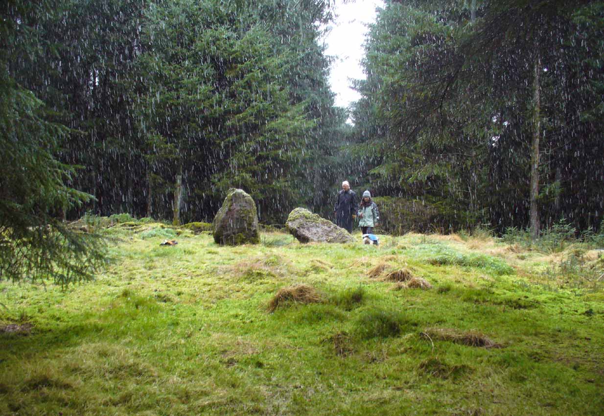
Of the 2 ways to reach here: one via the Crow Road, up to Waterhead Farm and then meandering through the forest—we took the other one! From the car park at the western end of Carron Reservoir, take the track into the forest. Stick to the track closest to the loch until, after crossing the small river bridge, veer right at the next junction 200 yards on. Another 600 yards (0.5km) along, take the right turn and walk all along this track to the very end. From here, take your feet down into the opening along the small burn and stick to this gap in the trees for 100 yards or so, where the gap in the trees veers left. Keep walking for another 200 yards.
Archaeology & History
These stones might take some finding, but they’re worth the effort if you like your megaliths. When Nina, Paul and I visited them yesterday, the meander turned into what have become known as Barmy Bennett Bimbles as we ventured off-path and into the forest, wading through marshland and getting our eyes poked out in the dense trees! And then the snow came. Twas gorgeous to be honest…
Machar Stones, looking SE
Machar Stones, looking west
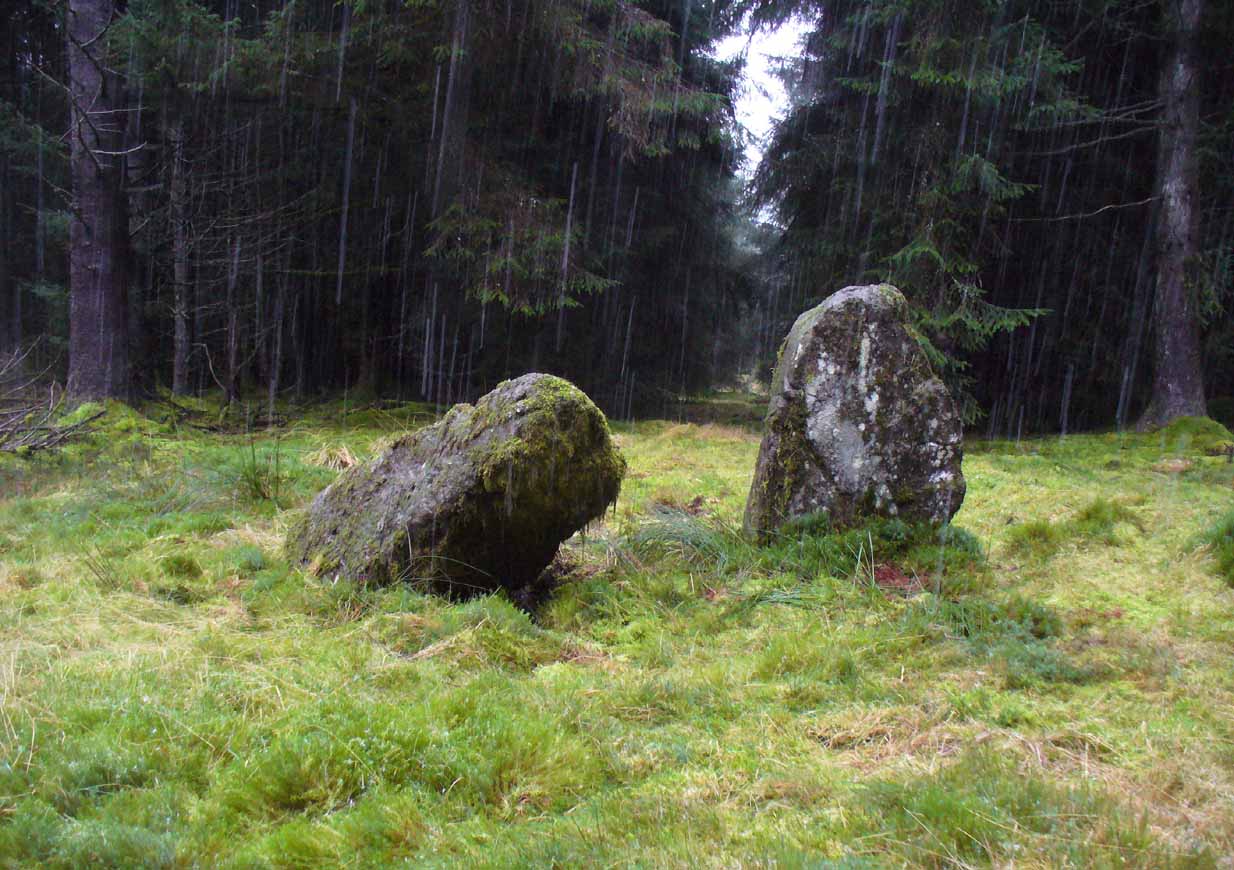
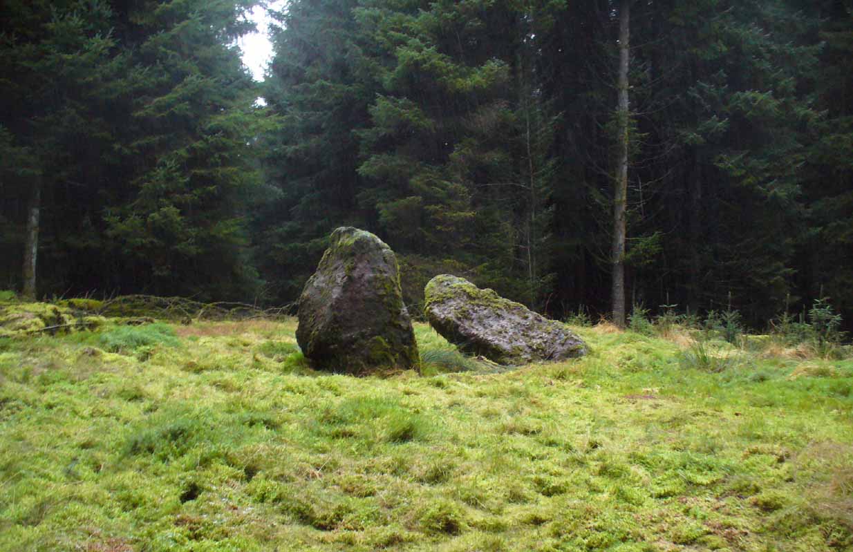
Probably neolithic in origin, the Machar Stones are set upon an elevated rise above the confluence of the Bin Burn and the River Carron on what seems to be an enhanced artificial platform, akin to those which some stone circles and ring cairns are mounted upon. Around the edges of the stones themselves, the earth has been dug into at some point in the past, as evidenced by the distinct oval dip in the ground surrounding the stones; although I can find no antiquarian accounts describing such a dig. There is the possibility that these stones may once have marked the site of a prehistoric tomb.
Once you walk ten yards away from the stones in any direction, you begin to walk downhill. Sadly the trees presently obscure any view from the stones, completely silencing the panorama that quite intentionally awoke from here in centuries gone by, disabling any immediate visual landscape analysis or geomancy. The proximity of the two rivers was probably relevant in the construction of the stones; as may be the ridge between the Little and Meikle Bin to the southeast.
First described in Nimmo’s Stirlingshire (1817) as “a druidical remain…in the parish of Fintry, about the middle of the moor towards Campsie and northwest of the Meikle Bin”, another early account of these megaliths was in H.G. Smith’s (1896) work on the parish of Strathendrick, before the imposition of the modern ‘forest’ occurred and the views from the stones were unrestricted. After describing their geographical position, he told:
“On a comparatively level part of the muirland between the two rivers and under Meikle Bin, there are two old standing stones known locally as the Machar Stones, this name being derived from the Gaelic magh, a plain. The more northerly stones measures 8 feet in height, and the other is 5 feet 7 inches high. Little…is known of the origin of these standing stones… They were apparently in some way connected with the religious worship of the prehistoric inhabitants of the land. The general uniform direction in which they point, which is to the north of east, looking as nearly as possible to the quarter of sunrise at the summer solstice, seems to point to their having been erected by a race of sun worshippers.”
Machar Stones, looking NW
Around the same time, A.F. Hutchison (1893) gave a lecture on these and other Stirlingshire megaliths, giving slight variants on the heights of the monoliths, adding that “the two stones are standing in a line pointing to 220°.” Sadly, even the great authorities of Aubrey Burl (1993) and Alexander Thom (1990), in their respective tomes on the subject, were unable to define any astronomical alignments here. Hutchison puzzled about the seeming artificiality of the platform upon which the stones appear to have been set, though wrote how “geological authority pronounces it to be a quite natural formation.”
As to the name of the site, William Grant (1963) ascribes the word ‘Machar’ and its variants to mean “a stretch of low-lying land adjacent to the sand” or “low-lying fertile plain”—which doesn’t seem relevant here, unless it was so named by people living on the higher grounds. It seems odd… As does the alignment of the stones. When Nina Harris stood between the stones with a compass to work out the cardinal points, the stone that was leaning was due north of the upright stone. When she walked several yards away from them, the compass deviated and we were given a more northeast-southwest alignment from stone to stone. This isn’t too unusual as we find similar magnetic anomalies at other megalithic sites in Britain (see Devereux 1989), due to a variety of geophysical ingredients.
Royal Commission 1954 photo
Not that your bog standard archaeo-tomes ever mention magnetic anomalies, as basic physics is too complex a subject for your standard archaeo-types! Instead however, we just get the usual measurements and data-sets, much as the Royal Commission (1963) lads gave us after their visit here in 1954—but at least there was no forest when they came here! They were fortunate. “These two stones,” they told us,
“stand on a slight eminence in open moorland, half a mile ENE of Waterhead farmhouse and at an elevation of 850ft… Described by Nimmo’s editor as “a Druidical remain”, they have also been nown as the Machar Stones. The more northerly stone, a four-sided pillar of irregular section, has fallen almost prostrate and its whole length, 7ft 6in, is revealed. At the centre it measures 3ft in width by 2ft 6in in breadth. The other stone stands 4ft 6in further S. It is a slab…standing to a height of 5ft and measuring about 2ft in thickness. Its width is 2ft 8in at ground level, 3ft 8in at a point 2ft above this, and 2ft at the top.”
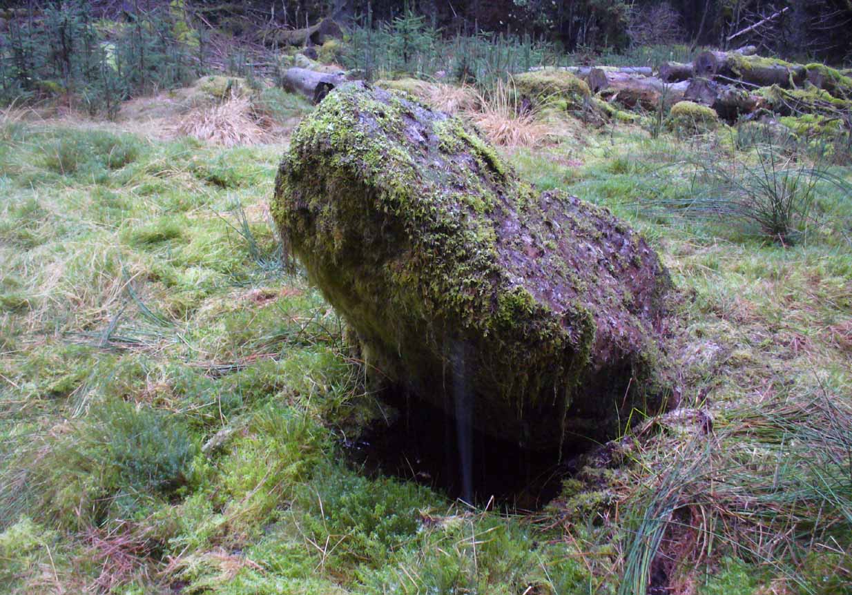
They posit the idea that the reason the taller stone is leaning at such an angle was due to there being a prehistoric cist nearby which had been ‘excavated’ by peoples unknown, who then took it upon themselves to explore the Machar Stones with similar venture.
The ‘cup-marked’ stone
In recent years it has been said that there are cup-markings on the leaning stone, seven of them apparently. When we visited yesterday they were difficult to make out. There were a number of ‘cups’ on the stone, but these were debatable and seemed more the result of conglomerate disintegration than man-made. A couple of them were perhaps ‘possibles’. However, the light was poor and I’d prefer another visit before making my mind up!
The Machar Stones are quite evocative megaliths, despite their lack of grandeur. Maybe it was the snow. Maybe it was the trees. Maybe it was me. Or probably a mix of all three and more; but this had a real feel to the place. Well hidden, miles from human touch or visits, awaiting just the occasional visitor—and in this weather (of floods, downpours, cold and snow) saturated humans would be the only sorts of crazy people whose spirits would risk getting completely lost to find them. And my god were they worth the effort! Paul, Nina and I thought so anyway!
References:
Burl, Aubrey, From Carnac to Callanish, Yale University Press 1993.
Devereux, Paul, Places of Power, Blandford: London 1990.
Feachem, Richard, Guide to Prehistoric Scotland, Batsford: London 1977.
Grant, William (ed.), Scottish National Dictionary– volume 6, SNDA: Edinburgh 1963.
Royal Commission on the Ancient & Historical Monuments Scotland, Stirlingshire – volume 1, HMSO: Edinburgh 1963.
Royal Commission on the Ancient & Historical Monuments of Scotland, Archaeological Sites and Monuments of Stirling District, Central Region, Society of Antiquaries of Scotland 1979.
Thom, A., Thom, A.S. & Burl, Aubrey, Stone Rows and Standing Stones – 2 volumes, BAR: Oxford 1990.
Acknowledgements: Huge thanks to Nina Harris and Paul Hornby for their endurance and endeavor in locating these great old stones, in attendance with the great rain, snow and deep muddy bogs!
Standing Stone (destroyed): OS Grid Reference – NO 486 339?
Archaeology & History
The only reference I can find about this site is in A.J. Warden’s (1880) massive survey of the county of Angus—previously called ‘Forfarshire’—where, in his discussion of the hillforts of the area, he told us that,
“About a quarter of a mile distant from The Laws is the Gallow Hill of Ethiebeaton. In a field, a little to the south, there formerly stood a large upright stone called Tods Stone.”
All trace of it disappeared when quarrying operations were undertaken there, also destroying a number of prehistoric tombs close by. The monolith may have had some association with the tombs, but we cannot be certain.
The name of the stone,tods, probably derives from the word ‘foxes’, although we cannot be certain of this either, as there are a variety of other Scottish dialect words relating to ‘tod’that may have had bearing on the name.
If anyone has any further information about this long lost site, we would gladly welcome it.
References:
Grant, William (ed.), The Scottish National Dictionary – volume 9, SNDA: Edinburgh 1973.
Warden, Alex J., Angus or Forfarshire – volume 1, Charles Alexander: Dundee 1880.
Sacred Well (destroyed): OS Grid Reference – SE 0973 4091
Archaeology & History
Lund Well on 1852 map
Once found in a cluster of three little wells all very close to each other near the top of the field where the Crossflatts roundabout joins up with the Aire-Valley trunk road, this is an intriguing site if you happen to be a pagan, or have an interest in druidism — and for one main reason: its name. When I first came across a reference to the place about 25 years ago, the only piece of information I could find about it came from the arduous detailed researches of the Victorian industrial historian J. Horsfall Turner who, unfortunately, neglected to record much of the fading folklore in the region at his time. Marked on the 1852 6-inch Ordnance Survey map, ‘Lund’ was a bit of an etymological curiosity, and Mr Turner (1897) thought the well’s name was little other than that of a local mill owner, whose nickname was ‘Lund’ Thompson. He was guessing of course…and I thought little more about it…
Years later when looking through A.H. Smith’s (1961-63) magnum opus on the place-names of West Yorkshire, I found that he didn’t include the Lund Well in his survey. However, an eventual perusal of Kenneth Cameron’s (1996) work told that in Old Norse place-names (and there is a preponderance of such places scattering Yorkshire and Lancashire), lund or lundr was a “‘small wood, grove,’ also had a meaning, ‘sacred grove’.” The word is echoed in old French, launde, meaning ‘forest glade’. In A.H. Smith’s (1954) earlier etymological magnum opus he said that the word derives from a “small wood, grove, also a sacred grove, one offering sanctuary.” However, Margaret Gelling (2000) urged caution on the origin of lund as a sacred grove and erred more to the usual English tendency of depersonalizing everything, taking any animistic attribution away from its root meaning; but we must urge caution upon her caution here! Neither Joseph Wright (English Dialect Dictionary, vol.3 1905) nor William Grant (Scottish National Dictionary, vol.6, 1963) have entries for this word, so we must assume the Scandinavian root word origin to be correct.
One vitally important ingredient with the Lund Well is its geographical position. For across the adjacent River Aire the land climbs uphill—and a few hundred yards above we reach the well-known and legendary Druid’s Altar, with its Druid’s Well just below. This association is what suggests our Lund Well may have had a real association with a “sacred grove of trees”, as—despite us knowing very little about them—we do at least know that druids performed rites in sacred groves. In Greenbank’s (1929) historical analysis of the Druid’s Altar, he was left perplexed as to the origin of its name as all early accounts and popular culture assigned it this title, and so he opted for the probability that the druids did indeed once perform rites here. If this was true, then our seemingly innocuous Lund Well once had a much more sacred history than anyone might have thought. Sadly, through their usual ignorance of such matters, the industrialists destroyed it….
References:
Cameron, Kenneth, English Place-Names, Batsford: London 1996.
Gelling, Margaret, Place-Names in the Landscape, Phoenix: London 2000.
Greenbank, Sydney, The Druid’s Altar, Bingley, R.G. Preston: Bingley 1929.
Smith, A.H., English Place-Name Elements – volume 2, Cambridge University Press 1954.
Smith, A.H., The Place-Names of the West Riding of Yorkshire – 8 volumes, Cambridge University Press 1961-63.
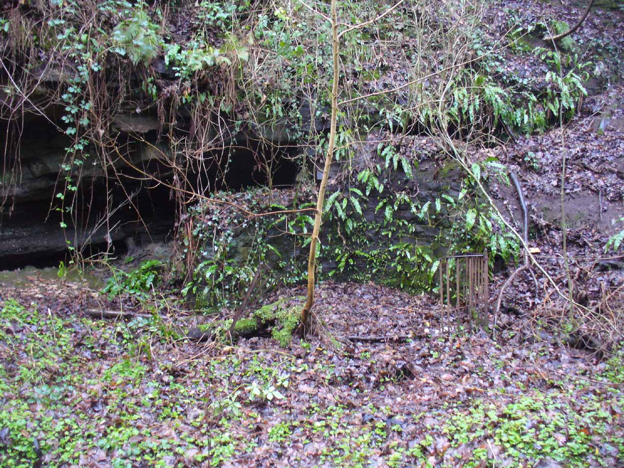
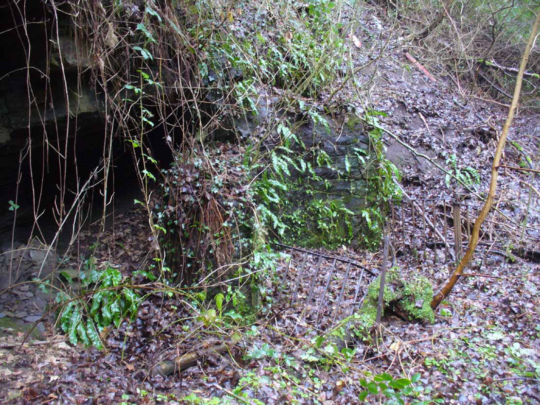
There must be an easier way to visit this site than the method I used. Which was: along Cambuslang’s Main Street (A724), turn up the B759 Greenlees Road for nearly 500 yards, turning left onto Vicarlands Road. Notice the grass verge and steep slope immediately to your left. Walk into the tree-lined gorge, following the left-side along the edges of the fencing. About 150 yards down the steep glen, note the very denuded arc of stone-walling and rickety fencing on the other side of the burn. That’s it! (broken glass and an excess of people’s domestic waste are all the way down; very difficult to reach, to say the least!)
Archaeology & History
Found in a dreadful state down the once-beautiful Borgie Glen, this is one of the most curious entries relating to sacred and healing springs of water anywhere in the British Isles. Indeed, the traditions and folklore told of it seem to make the site unique, thanks to one fascinating factor…..which we’ll get to, shortly…..
Remains of the Borgie Well
The name ‘Borgie’ is an oddity. Local historians J.T.T. Brown (1884) and James Wilson (1925) wondered whether it had Gaelic, Saxon or Norse origins, with Brown thinking it may have been either a multiple of a simple bore-well, or else a title given it by a travelling minister from Borgue, in Kirkcudbright. Mr Wilson took his etymology from the very far north where “there is a stream called the Borgie” (just below the Borgie souterrain). This is said to be Nordic in origin, with
“borg, a fort or shelter, and -ie, a terminal denoting a stream. It is almost certain that our Borgie has the same origin; that is, ‘the fort or shelter by the stream.’”
The Borgie Well was described by a number of authors, each of whom spoke of its renown in the 19th century and earlier. One of my favourite Glasgow writers, Hugh MacDonald (1860), had this to say about the place:
“There are several fine springs in the glen, at which groups of girls from the village, with their water pitchers, are generally congregated, lending an additional charm to the landscape, which is altogether of the most picturesque nature. One of these springs, called “the Borgie well,” is famous for the quality of its water, which, it is jocularly said, has a deteriorating influence on the wits of those who habitually use it. Those who drink of the “Borgie,” we were informed by a gash old fellow who once helped us to a draught of it, are sure to turn “half daft,” and will never leave Cambuslang if they can help it. However this may be, we can assure such of our readers as may venture to taste it that they will find a bicker of it a treat of no ordinary kind, more especially if they have threaded the mazes of the glen, as we have been doing, under the vertical radiance of a July sun.”
Borgie Well, looking south
It’s somewhat troublesome to reach, but a beautiful landscape indeed is where, today, only remnants of the Borgie Well exist. A very eroded semi-circle of walling and iron bars protects what was once the waters of the well—which have long since fallen back to Earth. Behind it, right behind it, overhangs the cliff and a small cave: a recess into the Earth with its very own feeling. It has the look and feel of a witch’s or hermit’s den with distinct oracular properties. This geomancy would not have gone unnoticed by our ancestors. In this enclaved silence, the once bubbling waters beneath the cliffs give a feel of ancient genius loci—a memory still there, despite modernity. Whether this crack in the Earth and its pure spring waters was some sort of Delphic Oracle in days gone by, only transpersonal ventures may retrieve… Perhaps…
In the 19th century a path took you into the glen from the north, and a commemorative plaque was erected here by a Dr Muirhead, where now lie ruins. It read:
The Borgie Well here
Ran many a year.
Then comes the main verse :_
Wells wane away,
Brief, too, man’s stay,
Our race alone abides.
A s burns purl on
With mirth or moan,
Old Ocean with its tides,
Each longest day
Join hands and say
(Here where once flowed the well)
We hold the grip
Friends don’t let slip
The Bonny Borgie Dell.
1879.
At the base was carved an appeal to the local folk:
Boys, guard this well, and guard this stone,
Because, because, both are your own.
The plaque has long since gone; and according to the local historian J.T.T. Brown (1884), the waters went with it due to local mining operations around the same time. But there was an additional rhyme sang of the Borgie Well which thankfully keeps the feel of its memory truly awake (to folk like me anyway!). It is somewhat of a puzzle to interpret. Spoken of from several centuries ago, it thankfully still prevails:
A drink 0′ the Borgie, a taste 0′ the weed,
Sets a’ the Cam’slang folks wrang in the heid.
Meaning simply, if you drink the waters of this well, you’ll get inebriated! It’s the derivation of the word ‘weed’ that is intriguing here. In Grant’s (1975) massive Scottish dialect work we are given several meanings. The most obvious is that the weed in the poem is, literally, a weed as we all know it. But it also means ‘a fever’; also ‘to cut away’ or ‘thin out’; to carry off or remove (especially by death); as well as a shroud or sheet of cloth. These meanings are found echoed, with slight variants, in the english dialect equivalent of Joseph Wright. (1905) Hugh MacDonald told that the Enchanter’s Nightshade (Circaea lutetiana) grew hereby—which, initially, one might think could account for this curious rhyme. But the Enchanter’s Nightshade has nothing to do with the psychoactive Nightshade family, well-known in the shamanistic practices of our forefathers. However, in the old pages of one Folklore Society text, William Black (1883), in repeating the curious rhyme, told us:
“The Borgie well, at Cambuslang, near Glasgow, is credited with making mad those who drink from it; according to the local rhyme —
A drink of the Borgie, a bite of the weed,
Sets a’ the Cam’slang folk wrang in the head.”
The weed is the weedy fungi.”
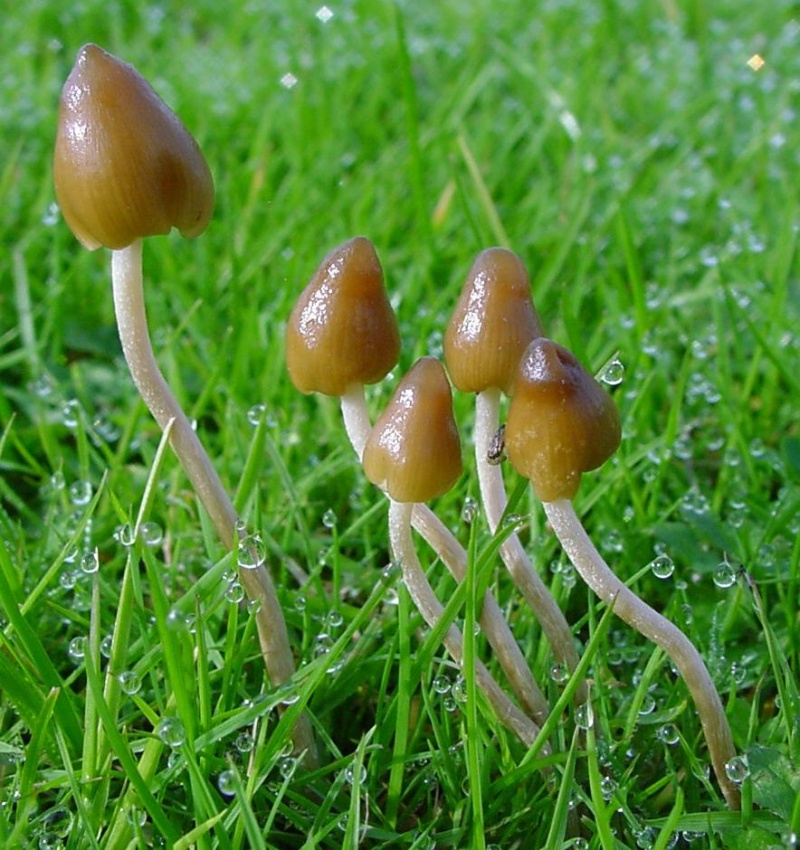
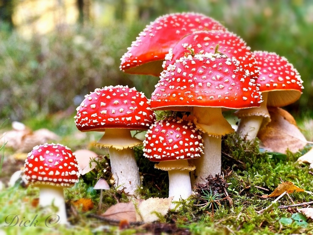
A mushroom no less! In John Bourke’s curious (1891) analysis of early mushroom use, he repeats Mr Black’s derivation. If this ‘weed’ was indeed use of mushrooms that made the local folk “go mad” or “wrang in the head” (and if not – what was it?), it’s an early literary account of magic mushroom intoxication! If this interpretation is correct, the likelihood is that the Borgie Well was a site used for ritual or social use of such intoxicants. Many sites across the world were used by indigenous people for ritual intoxication, and this could be one of the last folk remnants of such usage here. We know that Scotland has its own version of cocaine, used extensively by our ancestors (even the Romans described it) and which was still being used by working Highlanders in the 20th century—but early descriptions of mind-affecting mushrooms are rare indeed!
Psilocybe semilanceataAmanita muscaria
Mr Black gives no further folklore, nor the source of his information, other than to suggest that the madness incurred by the Well typified the people of Cambuslang! “Weedy fungi” may have been ergot (Claviceps purpurea), but the incidence of the grasses upon which it primarily grows, rye, here seems unlikely—and the folklore would certainly have included the ‘death’ aspects which that fungus brings! Fly agarics (Amanita muscaria) however, may have grown here. Old birches are close by, which produce nice quantities of those beautiful fellas. On the fields above the gorge, where now houses grow, Liberty Caps (Psilocybe semilanceata) may have profused—as they do in the field edges further out of town—but this species has no local cultural history known about from the early period. We must, however, maintain a healthy scepticism about this interpretation—but at the same time we have to take into account the ‘intoxicating’ madness which the combination of the “waters and the weed” elicited.
One final note I have to make before closing this site entry: despite the beautiful location, this small gorge is in a fucking disgraceful state. Some of the people who live in the houses above the gorge should be fucking ashamed of themselves, dumping masses of their household rubbish and tons of broken glass into the glen. If these people are Scottish, WTF are you doing polluting your own landscape like this? This almost forgotten sacred site needs renewing and maintaining as an important part of your ancient heritage. Have you no respect for your own land?!?
References:
Armitage, Paul, The Ancient and Holy Wells of Glasgow, TNA 2017.
Black, William George, Folk Medicine: A Chapter in the History of Culture, Folk-lore Society: London 1883.
Walker, J.R., ‘”Holy Wells” in Scotland”, in Proceedings of the Society of Antiquaries, Scotland, volume 17, 1883.
Wilson, James A., AHistory of Cambuslang, Jackson Wylie 1925.
Wright, Joseph, The English Dialect Dictionary – volume 6, Henry Frowde: Oxford 1905.
Acknowledgements: Huge thanks again, in various ways, to Nina Harris for getting us here; and Paul Hornby, for reminding me of my literary sources when I needed them! Thanks too to Travis Brodick and his beautiful photo of the Amanita muscaria cluster.
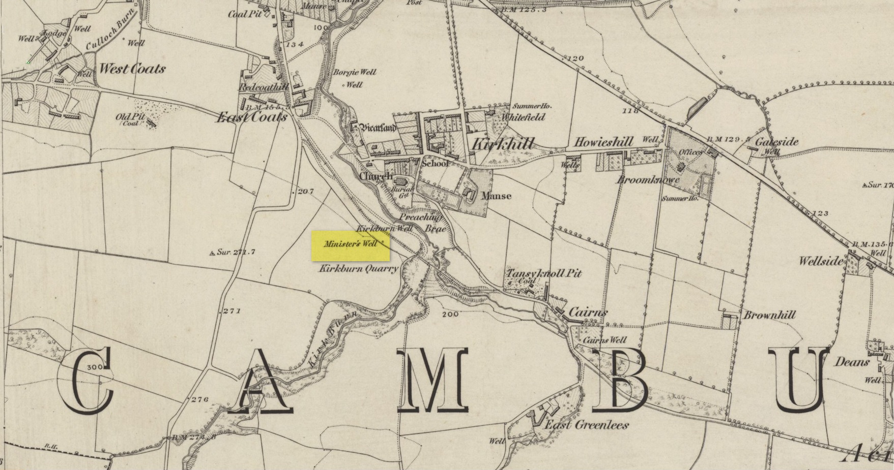
Holy Well (destroyed): OS Grid Reference – NS 6451 5981
Archaeology & History
Site shown on 1864 map
Illustrated on the earliest OS-map of the region, this is one of four holy and healing wells within half-a-mile of each other—including the legendary Borgie Well in the Borgie Glen. The waters from here emerged above the rise, close to the end of Mansefield Avenue, from where you look down onto the wooded burn. When it was visited by the Ordnance Survey chaps in the 19th century, they told simply that water here “is taken from pipes being laid from it to the Manse to supply the Minister.”
Acknowledgements:Huge thanks for use of the Ordnance Survey map in this site profile, reproduced with the kind permission of the National Library of Scotland.
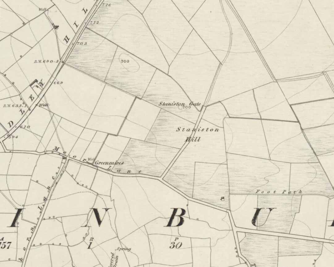
Standing Stone (lost): OS Grid Reference – SE 2522 5010
Archaeology & History
Staniston Hill on 1851 map
This long-lost standing stone gave its name to the small hill between the geological giants of Little Almscliffe and Almscliffe Crags, ‘Staniston Hill.’ Described as early as the 13th century in the Cartulary of Fountains Abbey as ‘Standandestan’, its precise whereabouts is unknown—but it’s damn close to the grid-reference cited here. As the early OS-map shows, a small rounded hill occurs a short distance northwest of the small copse of trees now growing. The monolith may have been felled by some grumpy christian, or it could be standing in some nearby walling. Local antiquarians, dowsers or archaeologists may or may not find a search for it worthwhile…
Its position between the two Almscliffe Crags makes it very close to marking the midway point of a natural solstice marker: the Winter sunrise from Little Almscliffe and summer sunset from the greater Almscliffe.
References:
Bennett, Paul, The Old Stones of Elmet, Capall Bann: Milverton 2001.
Smith, A.H., The Place-Names of the West Riding of Yorkshire – volume 5, Cambridge University Press 1961.
The name of this site alone insisted that I bring it to people’s attention! If it was a healing well relating to its name, I wonder what it was used for! It’s described just once in the New Statistical Account (1845) for Lanarkshire, where Pete Brown said briefly:
“On the south side of the road from Auchinloch to Glasgow, there is still the Cockplay Well, over which many proprietors and feuars have a servitude.”
Two roads came out of the village at the time of the NSA notes: one to the immediate west and the other to the south. None of the maps cite the place-name ‘Cockplay’, but two ‘wells’ occur on the outgoing western road. One is in the village itself, behind some cottages; this is not likely to be the site in question, as the description would surely have stated that the well was in the village. However, “on the south side of the road” one mile west of the village, roughly halfway between Wallace’s Well and Cardyke there is a ‘Well’ shown on the early OS-maps. This has to be the most likely contender.
The etymology may revolve around variants on the word old english word cocc, which in this instance is likely to be ‘bird/s’ or a cock, as a in the male domestic fowl; effectively making it the ‘well where the birds played.’ More help and information on it would be good.