Hill Chapel Cross, Goosnargh, Lancashire

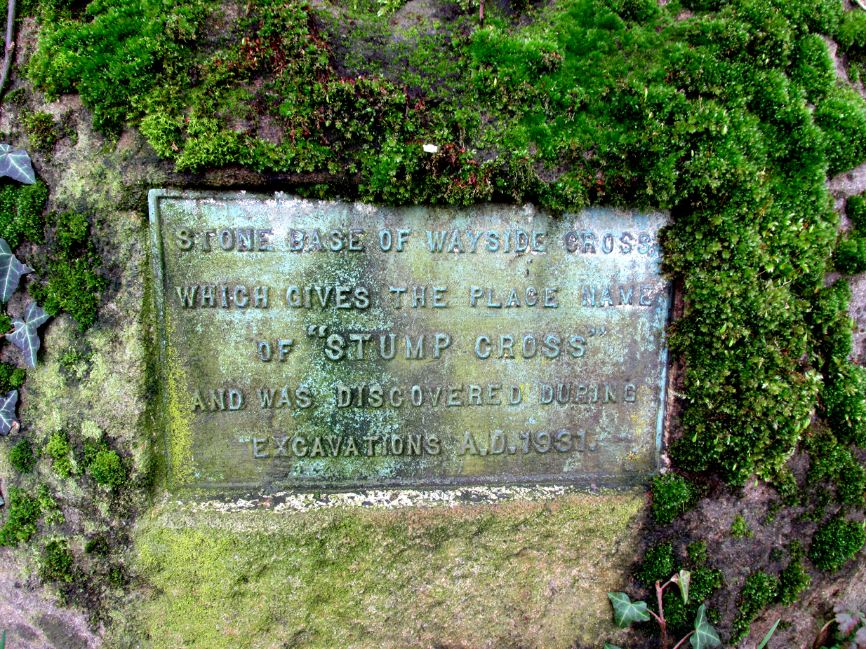
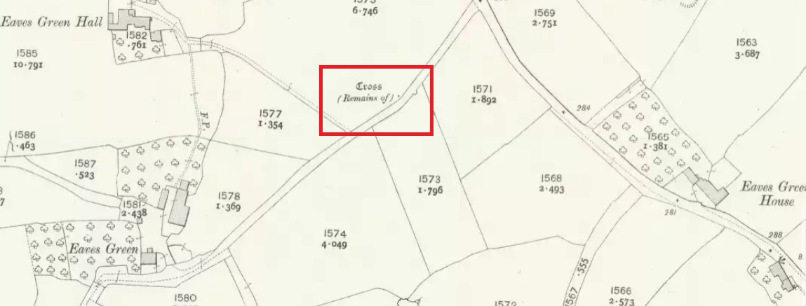
Wayside Cross : OS Grid Reference – SD 57273 38505

Also Known as:

  1. Historic England Monument No. 42648

Getting Here

Cross shown on 1912 OS-map

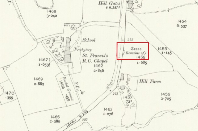
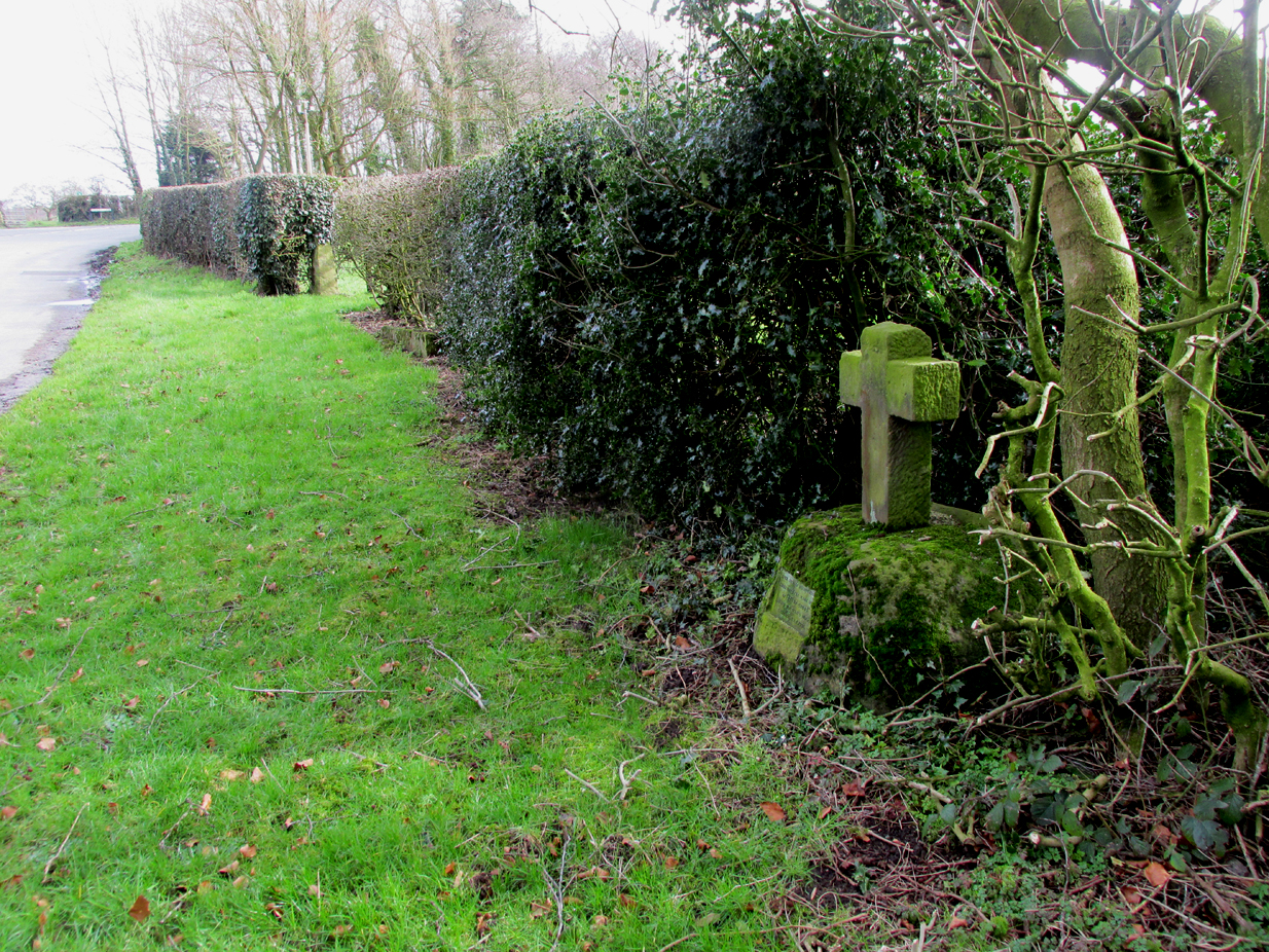
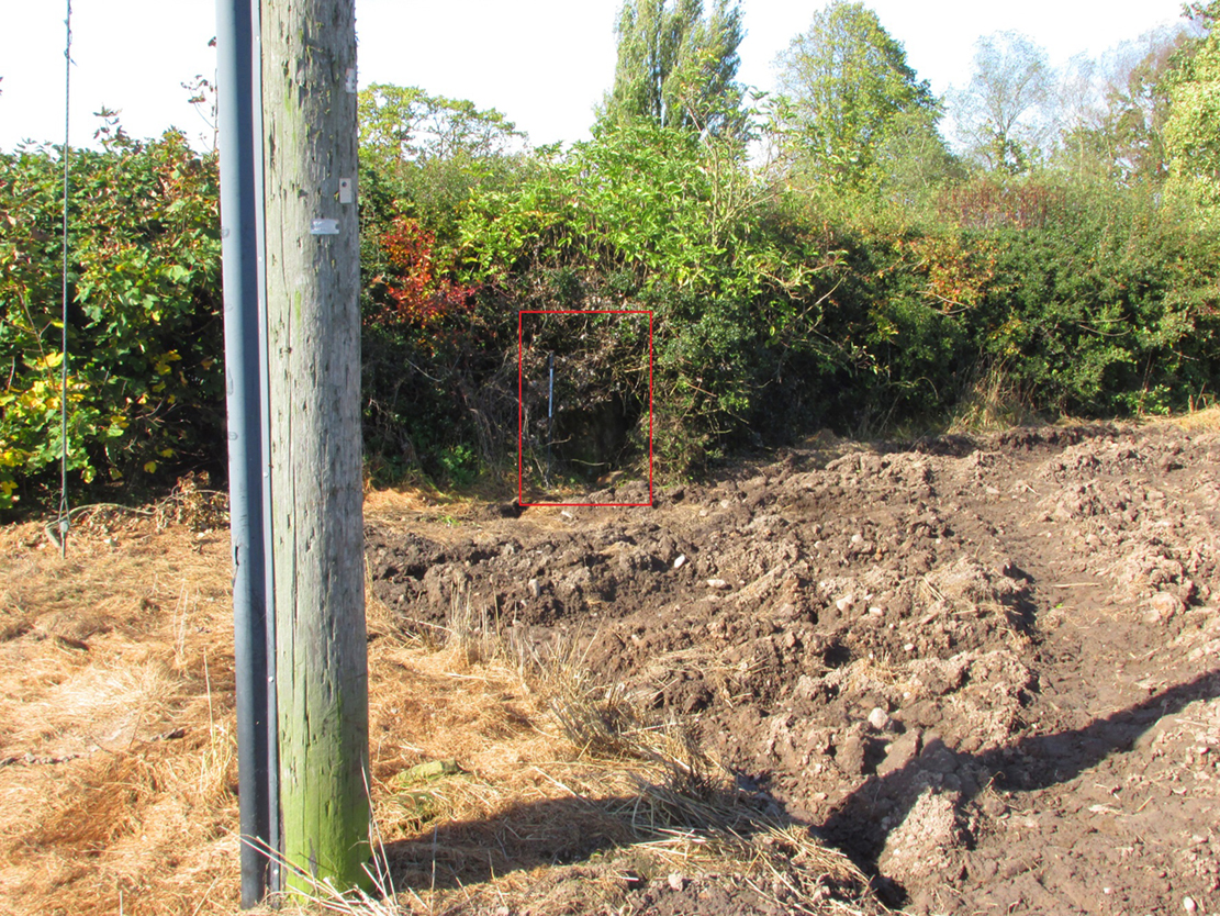
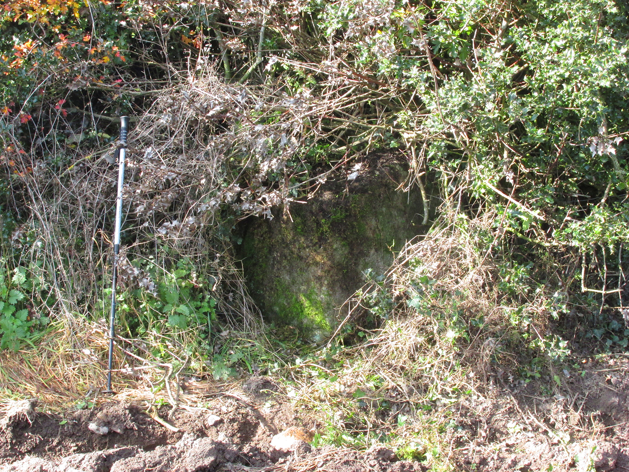
The Cross base is situated in a thick hedgerow on the east side of Horns Lane, opposite St Francis’ Hill Chapel, just to the north of and on the field side of the electricity transmission line that crosses the road at this point. It can be accessed from the field to the north by crossing the stream. In winter the Cross base is just visible from the road side through the hedge.

Archaeology & History

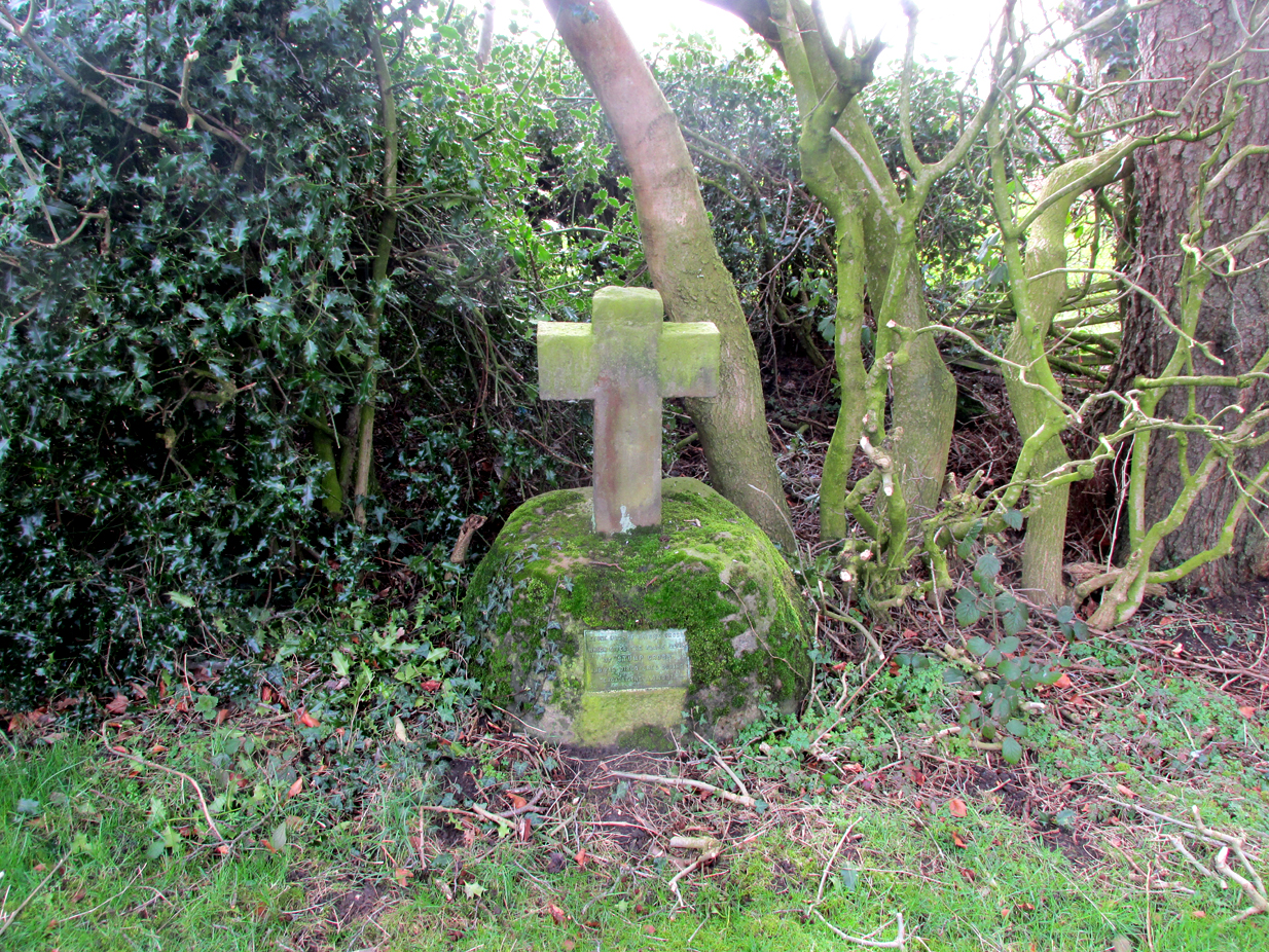
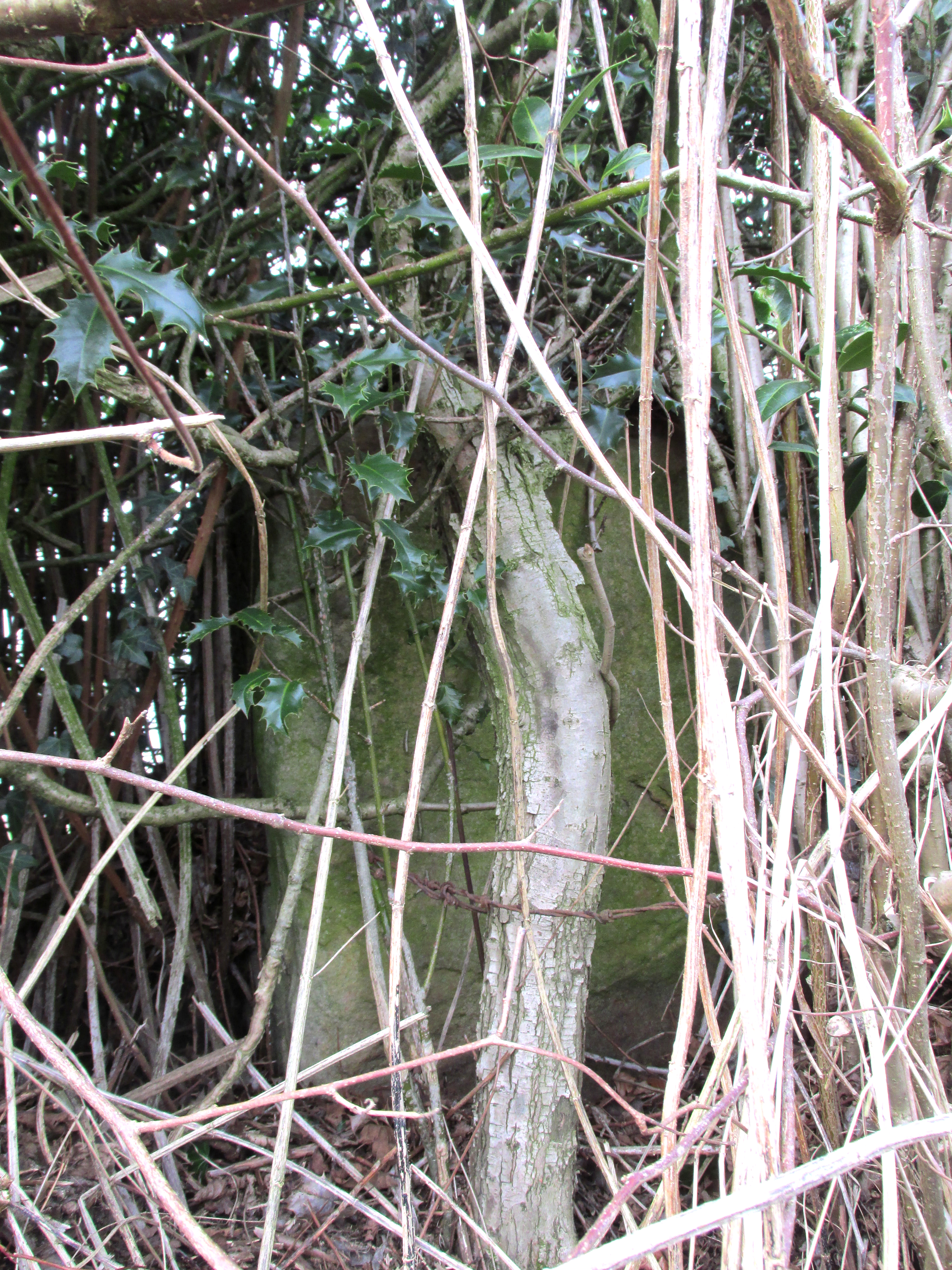
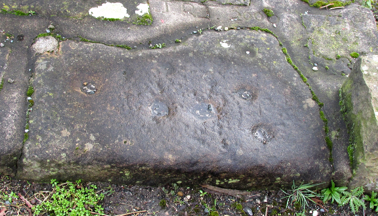
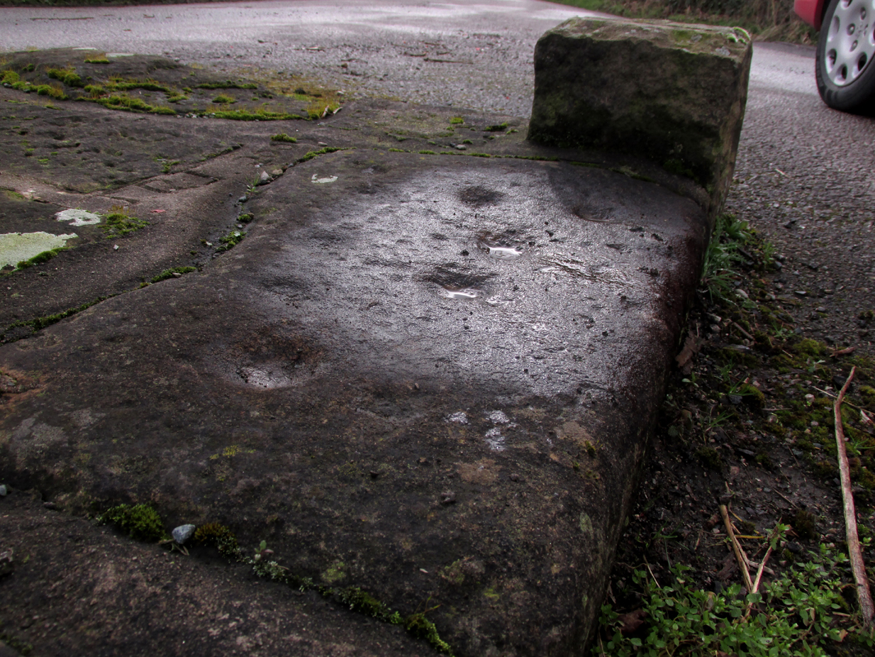
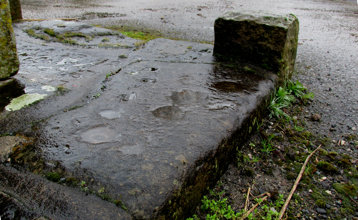
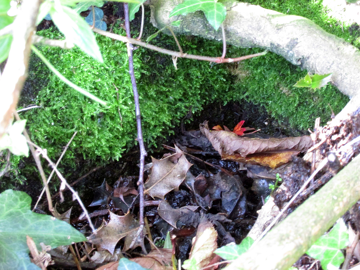
This cross is not described or noted by Henry Taylor in the 1906 edition of his Ancient Crosses and Holy Wells of Lancashire. All that survives is the substantial socketed base of what is likely to have been a mediaeval cross. It is almost completely hidden in the hedge, and is only accessible for ‘hands-on’ inspection from the field side of the road.

It was described by Historic England as:

‘The socket-stone of a probable wayside cross 1.0m square and 1.5m high…. Its present position in a pasture field suggests that it is not in situ.’

Cross position highlighted
Hidden in the boscage

Despite this description, the substantial nature of the base leads me to query why anyone would wish to move it from elsewhere. It is more likely that past land-owners have encroached on to the ancient highway, and fenced it accordingly. Maybe the Hill Chapel congregation will at some consider exposing the base on its hill crest position and insert a replica cross?

There is no record of what happened to the original Cross.  According to a pamphlet describing Hill Chapel, “this house appears to have always been in Catholic hands”, but no mention is made of the Cross.  A likely culprit for its destruction is the early nineteenth century Protestant fundamentalist the Reverend Richard Wilkinson.

The leaf-filled cross-base

In view of the continuity of Catholic ownership and worship at the Hill Chapel site over the road since before the Reformation, and the sustained persecution suffered by local Catholics in the centuries following the Reformation, it is very unlikely that they would have drawn attention to themselves by erecting the Cross, making it almost certainly of pre-Reformation construction.

Reference:

  1. Anonymous, Hill Chapel Goosnargh, privately published pamphlet available from Hill Chapel, n.d..

© Paul T Hornby, The Northern Antiquarian, 2018


Stump Cross, Goosnargh, Lancashire

Wayside Cross:  OS Grid Reference – SD 57287 37421

Also Known as:

  1. Historic England Grade II Listed Building No. 1165108

Getting Here

The Position of the Cross near the road junction.

The cross is situated on the verge at the west side of the B5269 road near its junction with Ashley Lane at Stump Cross, north-east of Goosnargh.

Archaeology & History

All that survives is the socketed base of the mediaeval cross, into which a small modern carved stone cross has been inserted. A bronze plaque attached to the base informs the reader that the cross gives its name to the locality, and that the base was discovered during excavations in 1931.

Richard Cookson (1888), in his Goosnargh Past & Present, writes:

“We have the remains of several upright crosses in this township called “cross stones” all being placed near to some public road or path. The corpses of the Roman Catholics are rested at those stones on their way to internment, and those funeral attendants who are of that persuasion kneel down and offer up a short prayer for the repose of the soul of the departed individual whose body they are conveying to the grave.”

Further to the destruction of crosses in the township, Cookson writes:

“…the Reverend Richard Wilkinson, late minister, of anti-Romanistic notoriety, in his frenzied hostility to the Roman Catholics, caused [the cross] to be broken up and removed…”

The site is listed by Henry Taylor, in his 1906 magnum opus on Lancashire crosses, and speaking generally on the destruction of wayside crosses in the Hundred of Amounderness, he writes:-

The bronze plaque
Modern cross inserted into the Mediaeval socket

“The destruction of so many crosses, which at one time existed in this part of the Hundred, is due to the vandalism early in the nineteenth century of a vicar of Goosnargh, named Wilkinson. He was a vehement Protestant, and owing to his notoriety as a Prophet, was allowed to do much as he liked with these ancient monuments. Many crosses, indeed, it is said, were pulled down with his own hands. His prophesies foretelling the deaths of various persons often unfortunately came true, and he was thus, in this superstitious part of England, dreaded as a wizard. As this work of demolition took place before the date of the Ordnance Survey, there were in all probability many more crosses erected in Mediaeval times in this district than we have now any knowledge of, and it is quite possible that some of the crosses so recklessly destroyed may have been, like those at Halton and Heysham, of pre-Norman date and of great historical value. Fragments of them might even now be found were a diligent search be made.”

Further to this speculation as to the antiquity of these destroyed crosses, it is interesting to note the approximately parallel orientation of roads and field boundaries to the east of the Stump Cross. This may point to the area having been subjected to Roman survey, and the site of the Stump Cross having once been a shrine to the gods of the agrimensores (Roman surveyors) that had been Christianised.

References:

  1. Cookson, Richard, Goosnargh: Past and Present, Preston, H.Oakey, 1888.
  2. Taylor, Henry, The Ancient Crosses and Holy Wells of Lancashire, Manchester, Sherratt and Hughes, 1906.
  3. Richardson, Alan, The Roman Surveyors in Cumberland, P3 Publications: Carlisle 2008.

© Paul T Hornby, The Northern Antiquarian 2017


Eaves Green Cross, near Goosnargh, Lancashire

Cross (ruins):  OS Grid Reference – SD 56770 37765

Also Known as:

  1. Historic England Monument No. 42651
Just visible in the hedge…

Getting Here

Travelling east out of Goosnargh on the B5269, go straight ahead onto Camforth Hall Lane, follow it northwards and take the left fork at Stump Cross onto Eaves Green Lane, and a lane will be seen on the left signposted Eaves Green. Walk along this lane and a white Snowcemmed house, ‘Bridle Mount’ will be seen on the left. The cross base will be found deep in the holly hedge opposite the driveway to the house.

Archaeology & History

This cross was not mentioned in the 1906 edition of Henry Taylor’s Ancient Crosses and Holy Wells of Lancashire, but was nevertheless marked on the 1910 25″ OS map (the earliest at my disposal) as “Cross (Remains of)”

The 1910 25″ OS Map

In 1958, the Ministry of Works Field Investigator commented: “The socket stone of a probable way-side cross situated on rising ground in a pasture field adjoining a lane. It measures 0.8m by 0.7m and is 0.9m high with a socket 0.2m by 0.15m and 0.2m deep. There are no traces of a cross or shaft.”

To locate the Cross, turn round 180º from this spot.

The current official description describes the remains as “Now missing”…

Well, no! – the intrepid TNA investigator has located it, buried deep in the boscage of a holly and ivy hedge, but he was lucky that the hedge had been very recently trimmed and he made his visit in late winter…

The Cross is registered on the Milestone Society Repository under reference: LAPR_GOO02.

©Paul T. Hornby 2017 The Northern Antiquarian


Barton Cross Stone, Barton, Lancashire

Cup Marked Stone:  OS Grid Reference – SD 53500 37332  —  NEW FIND

In this view, the carving is right of the Cross surround

Getting Here

At the roadside, on the south side of Barton Lane, where it crosses the minor road joining Cross House Farm and Barton House, you’ll see the Barton Cross standing upright. You can’t miss it!.

Archaeology & History

Carved stone cut to shape

Apparently never before described, this stone has very likely been removed from another locality and cut to shape to form part of the surrounding platform base to Barton Cross, where it is at the southwest corner.  It has ten cup marks.

Until or unless more such stones are located, it is a unique example of rock art in this part of Lancashire.

Nine cups visible here
10th cup nr camera, after rain

Henry Taylor, in his 1906 work The Ancient Crosses and Holy Wells of Lancashire writes inter alia about the Barton Cross that it had been demolished sometime after 1848, and that the base and part of of the Cross shaft had been ‘lately restored to the old site‘.  Thus the cup-marked stone may or not be in its original position as part of the Cross surround, and may have just been a conveniently available slab of stone that was used, rather than a deliberate use of a pre-existing sacred stone.

References:

  1. Taylor, Henry, The Ancient Crosses and Holy Wells of Lancashire, Sherratt & Hughes, Manchester, 1906.

© Paul T. Hornby 2017, The Northern Antiquarian