Lambeth Wells, Lambeth, London, Surrey

Healing Wells (destroyed):  OS Grid Reference – TQ 3094 7889

Also Known as:

  1. Lambeth Spa
  2. Near Well and Far Well

Archaeology & History

This once famous healing or spa well has long gone.  It was located where the buildings that now constitute 104-105 Lambeth Walk presently stand: an area which the great London historian William Thornbury (1878) told was already “a favourite resort of Londoners, and celebrated for the variety of sweet-smelling flowers and medicinal herbs growing there,” complementing the healing waters before and during the spa craze.  The great herbalist John Gerard did his collections here.

I can find no information regarding its early use by our peasant ancestors, so its written history simply begins when it had been appropriated by those well-to-do up-market types who took this medicinal spring for their commercial gain in the early days of the trendy spas.  Supplied by two separate springs known as the Nearer and Farther Wells respectively, the Well House built here was “formally opened in April 1696” and subsequently had almost daily accompaniments of music, including French and country dancing!  But as the popularity of the Lambeth Spa increased, so did its problems.  Phyllis Hembry (1990) told that by July 1715, one visitor to the spa,

“was so depressed to find that the many people there were mostly rakes, whores and drunkards, idlers such as Guard officers, or young pleasure-seeker like attorneys’ clerks, mingling with loose women of the the meanest sort.  The Lambeth Wells also became a public nuisance, so a dancing license was refused in 1755.”

The so-called Great Room which had been the place of great occasions by spa users ended up being the meeting place “for Methodist meetings.” Oh how the winter nights must have flown by…..

There was a decided improvement in the years that followed and social events at the spa increased again.  It became what Thornbury said “was another place of amusement.”  The Lambeth Wells, he wrote,

“were held for a time in high repute, on account of their mineral waters, which were advertised as to be sold, according to John Timbs, at “a penny a quart, the same price paid by St. Thomas’s Hospital.” About 1750, we learn from the same authority, there was a musical society held here, and lectures, with experiments in natural philosophy, were delivered by Dr. Erasmus King and others. Malcolm tells us that the Wells opened for the season regularly on Easter Monday, being closed during the winter. They had “public days” on Mondays, Thursdays, and Saturdays, with “music from seven in the morning till sunset; on other days till two!” The price of admission was threepence. The water was sold at a penny a quart to the “quality” and to those who could pay for it; being given gratis to the poor.  We incidentally learn that there were grand gala and dancing days here in 1747 and 1752, when “a penny wedding, in the Scotch manner, was celebrated for the benefit of a young couple.”

By this time, a rival St. George’s Spa of had been created a short distance away on the parish boundary and with it, the popularity and attendance at Lambeth Wells began to decline.  By the end of the 18th century, the rot had truly set in and its days were finally numbered.

As for the medicinal properties of these wells, little seems to have been recorded.  Aside from repeating the common description of them being mineral waters, William Addison (1951) simply added that they were also purgative.

References:

  1. Addison, William, English Spas, Batsford: London 1951.
  2. Allen, Thomas, The History and Antiquities of the Parish of Lambeth, J. Allen: London 1827.
  3. Allen, Thomas, A History of the County of Surrey – volume 1, Isaac Taylor: London 1831.
  4. Foord, Alfred Stanley, Springs, Streams and Spas of London: History and Association, T. Fisher Unwin: London 1910.
  5. Hembry, Phyllis, The English Spa 1560-1815, Athlone Press: London 1990.
  6. Nichols, John, The History and Antiquities of the Parish of Lambeth, J. Nichols: London 1786.
  7. Rattue, James, The Holy Wells of Surrey, Umbra: Weybridge 2008.
  8. Sunderland, Septimus, Old London Spas, Baths and Wells, John Bale: London 1915.
  9. Thornbury, William, History of Old and New London – volume 6, Cassell: London 1878.

Links:

  1. Lambeth Wells on the Vauxhall History website

© Paul BennettThe Northern Antiquarian

Newmarket Heath (3), Newmarket, Suffolk

Tumulus (destroyed):  OS Grid Reference – TL 6122 6358

Archaeology & History

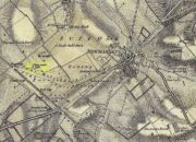
Tumulus ‘3’ on 1834 map

This is one of at least five prehistoric tombs that were known to have existed in and around the Newmarket race-course—all long gone.  It stood some 50-60 yards northeast of the Newmarket Heath (2) tumulus and was one in the cluster highlighted as ‘tumuli’ on the 1834 OS-map (right).  Despite its destruction sometime in 1883, a scar of the monument was seen from the air in the 1940s by J.K.S. St Joseph as a ploughed-out ring ditch, showing it to have been some seventy feet across.  Sadly, no ground trace of the monument exists.

References:

  1. Fox, Cyril, The Archaeology of the Cambridge Region, Cambridge University Press 1923.
  2. Royal Commission Ancient Historical Monuments, Inventory of Historical Monuments in the County of Cambridgeshire – Volume 2: North-East Cambridgeshire, HMSO: London 1972.

© Paul BennettThe Northern Antiquarian


Newmarket Heath (2), Newmarket, Suffolk

Tumulus (destroyed):  OS Grid Reference – TL 6116 6352

Archaeology & History 

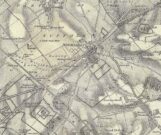
Tumulus 2, centre-left

This is one of at least five prehistoric tombs that were known to have existed in and around the Newmarket race-course.  Found some 600 yards NNE of the Ninescore Hill tumulus, and some 40 yards from its nearest companion, it was shown as one in a group of ‘Tumuli’ on the 1834 OS-map (right) but, along with the rest, was subsequently destroyed sometime around 1883.  A landscape scar of the monument was seen from the air in the 1940s by J.K.S. St Joseph as a ploughed-out ring ditch some 75 feet across.  This was reported as still visible by the Royal Commission doods in the 1970s, but no ground trace whatsoever exists.

References:

  1. Fox, Cyril, The Archaeology of the Cambridge Region, Cambridge University Press 1923.
  2. Royal Commission Ancient Historical Monuments, Inventory of Historical Monuments in the County of Cambridgeshire – Volume 2: North-East Cambridgeshire, HMSO: London 1972.

© Paul BennettThe Northern Antiquarian


Newmarket Heath (5), Swaffam Prior, Cambridgeshire

Tumulus (destroyed):  OS Grid Reference – TL 60 62

Archaeology & History

This is one of many long lost prehistoric tombs that were known to have existed in and around the Newmarket race-course, but unlike the Newmarket tumuli 1 – 4 which were all on the first OS-map of the area, this one had been destroyed before the Ordnance Survey lads came here.  As a result we don’t know its exact whereabouts.

Described in both the Cambridge Chronicle and Gentleman’s Magazine in 1827, the accounts even then were talking about it in the past tense, albeit pretty recently.   The race-course at Newmarket was being modified, leading to the destruction of our ancient landscape—and with it, this tumulus.  In those days however, such destruction was deemed as an ‘improvement’, as Sylvanus Urban (1827) tells at the start of his account:

“The improvements making in the exercise ground at Newmarket, Cambridgeshire, have led to some discoveries which may, perhaps, tend to the elucidation of the hitherto obscure origin of the entrenchment commonly called “The Devil’s Ditch.”  In removing one of the monumental remains denominated barrows, or tumuli, which are numerous in this neighbourhood, the skeleton of a person was found deposited near the surface, whose remains were too recent to be associated with the area of its place of interment; but, upon clearing away the earth to the centre of the mound, a discovery was made of an urn, of rude construction and materials, containing ashes, together with some beads, which, it is presumed, formed the ornaments of the person to whose honour the barrow was dedicated.  There were also found two coins, supposed to be Roman, and a fragment of a cup, of far superior manufacture to the urn, lying promiscuously at the depth of about two feet.”

A summary of this was included in Babbington’s (1883) archaeological survey.  But in Cyril Fox’s (1932) list of barrows near Cambridge he seemed to confuse this “tumulus on Exercise Ground” (no.16) with what he thought was another tumulus (no.17), which he described as, “Exact site unknown. Contained a cremation interment. Burnt bones and sherds of Bronze Age type, also Roman sherds.” The two are the same thing.

References:

  1. Babbington, Charles C., Ancient Cambridgeshire, Cambridge Antiquarian Society 1883.
  2. Fox, Cyril, The Archaeology of the Cambridge Region, Cambridge University Press 1923.
  3. Royal Commission Ancient Historical Monuments, Inventory of Historical Monuments in the County of Cambridgeshire – Volume 2: North-East Cambridgeshire, HMSO: London 1972.
  4. Urban, Sylvanus, “Domestic Occurrences,” in Gentleman’s Magazine, September 1827.

© Paul BennettThe Northern Antiquarian


Newmarket Heath (4), Newmarket, Suffolk

Tumulus (destroyed):  OS Grid Reference – TL 613 633

Archaeology & History

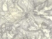
Tumulus 4, centre-left

This is one of at least five prehistoric tombs that were known to have existed in and around the Newmarket race-course.  It could be seen five-hundred-and-odd yards northeast of the Ninescore Hill tumulus and about 280 yards southeast of its Newmarket Heath 2 companion. The site was shown as one of the “tumuli” on the 1834 OS-map (right) but, along with its friends, was destroyed sometime around 1883.  Unlike its companions, no scar of its remains are visible from the air so we don’t know how big it was, but I’d assume the olde fella to be of a similar size and style to its close neighbours.

References:

  1. Fox, Cyril, The Archaeology of the Cambridge Region, Cambridge University Press 1923.
  2. Royal Commission Ancient Historical Monuments, Inventory of Historical Monuments in the County of Cambridgeshire – Volume 2: North-East Cambridgeshire, HMSO: London 1972.

© Paul BennettThe Northern Antiquarian


Ninescore Hill, Newmarket, Suffolk

Tumulus (destroyed):  OS Grid Reference – TL 6091 6304

Also Known as:

  1. Newmarket Heath 1
  2. Ninescore Hill Barrow

Archaeology & History

Ninescore Hill on 1834 map

Upon the small and curiously-named Ninescore Hill on the edge of Newmarket’s race-course, the old-school archaeologist Cyril  Fox (1923) told that “800 yards due east of Running Gap”, was a prehistoric burial mound that was destroyed in 1885.  Highlighted on the 1834 OS-map, a 19th century excavation found that the tomb “contained two inhumation interments associated with beakers,” along with some “flint arrowheads, and a secondary interment, probably Saxon.” In more recent times, the doods from the Royal Commission (1972) added the site to their inventory and noted that a faint outline—known as as ring ditch—is visible from the air when conditions are just right.  But there’s bugger all left of it at ground level.

References:

  1. Fox, Cyril, The Archaeology of the Cambridge Region, Cambridge University Press 1923.
  2. Royal Commission Ancient Historical Monuments, Inventory of Historical Monuments in the County of Cambridgeshire – Volume 2: North-East Cambridgeshire, HMSO: London 1972.

© Paul BennettThe Northern Antiquarian

Lady’s Well, Blythborough, Suffolk

Healing Well:  OS Grid Reference – TM 450 762

Also Known as:

  1. Wishing Well
  2. Queen Ann’s Well
  3. Lady’s Fountain

Getting Here

The site is found down Spring Lane at the south end of Henham Park. The current A145 meeting the A12.

Archaeology & History

A large structure is a brick and stone arch and which has two low seats inside, giving the alternative name of Tramp’s or Traveller’s Rest having also brass cups attached to the structure for anyone wishing to drink there. The age of the fabric has said to be mainly 1780, although one view was that it was erected by the first Countess of Stradbrooke in the 19th century and may be that recorded in 1833 in the poem ‘Lady’s Fountain’ poem by Agnes Strickland (the alternative name Lady coming from the Lady Strickland).  Another view is that some of the fabric is 13th century in origin.   The structure is now dry and overgrown, apparently last having water in the 1900s.

ladyswell1

Folklore

The spring is said to be near the reputed to be the place of King Onna’s death (654 AD). This was the battle of Bulcamp where Onna was chased by the Pagan Penda along Kings Lane, a lane which cuts through nearby parishes of Sotherton, Henham and Blyford to here were they stood their ground and he and his son Firminus were killed and buried. The well being erected where the king’s body fell. The legend clearly explains the site’s other alternative name of Queen Anne’s well…Anne being close enough to Onna to be semantically changed over time, and misrepresented as a Queen rather than a King!

References:

  1. R.B. Parish, Holy wells and healing springs of Suffolk (in publication)

Links:

  1. Holy & Healing Wells – A Suffolk Field Trip


Stratford St. Mary Cursus, Suffolk

Cursus Monument:  OS Grid Reference – TM 0486 3433

Archaeology & History

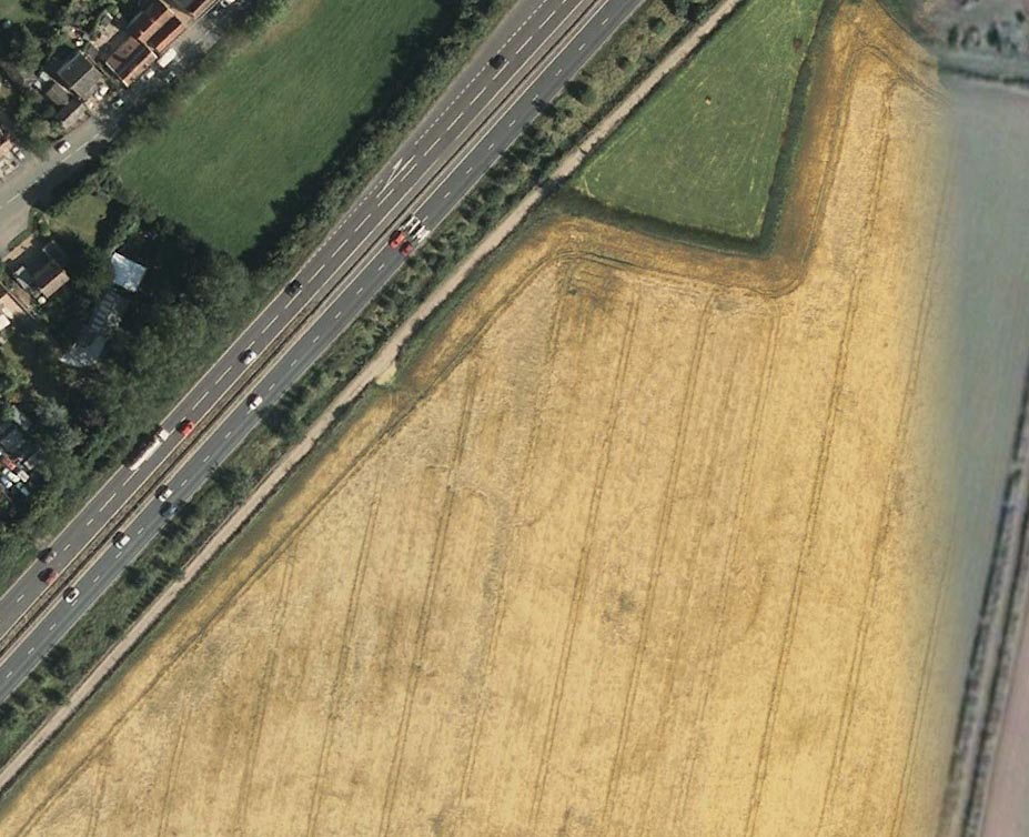
Faint flat outline of SE end + ancient circular enclosure

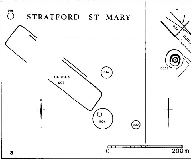
This short and dead straight cursus monument was first described in John Hedges’ (1981) survey, and later mentioned in Harding & Lee’s (1987) corpus on British henges as being in conjunction with a series of circular prehistoric monuments (three circular enclosures existed beyond its southeast and one to its northeast edges, one of which is visible in the aerial image, right).

Cursus ground-plan (courtesy Suffolk Institute Archaeology)

Most of the monument has been completely destroyed by roads and housing, but when complete was said to be 317 yards (290m) long, running from the southeast to the northwest.  The flattened southeastern edge measures nearly 63 yards (57.3m) across, and its northernmost width was close to 65 yards (60m) wide.

In Patrick Taylor’s (2015) assessment of this (and other monuments) he thought that the cursus may have served an astronomical function.  He may be right.  It’s alignment, he told,

“has a very clear orientation 38.5º north of grid west.  This represents an amplitude from true west of 40.9º.  Allowing for a latitude of 51.97º and altitude of 0.95º, adjusted downwards for refraction to 0.50º, we get from (Alexander) Thom’s table a declination for a body setting to the northwest of 24.15.º  This is only 0.23º, just less than half the width of the sun’s disc, more than the sun’s maximum declination in Neolithic times of 23.92º.  The alignment thus points rather accurately towards the upper limb or last setting point of the sun.”

Faint remnants of a second cursus monument have been discovered 400 yards to the east.

References:

  1. Harding, A.F. & Lee, G.E.,, Henge Monuments and Related Sites of Great Britain, BAR 175: Oxford 1987.
  2. Hedges, John D. & Buckley, David, Springfield Cursus and the Cursus Problem, ECC 1981.
  3. Last, Jonathan, “Out of Line: Cursuses and Monument Typology in Eastern England,” in Barclay & Harding’s Pathways & Ceremonies, Oxbow: Oxford 1999.
  4. Martin, Edward A., “When is a Henge not a Henge?” in Proceedings of the Suffolk Institute for Archaeology & History, volume 35, 1981.
  5. Taylor, Patrick, Timber Circles in the East, Polystar: Ipswich 2015.

AcknowledgementsMany thanks to the Suffolk Institute of Archaeology and History, for use of their ground-plan diagram from Edward Armstrong’s article, ‘When is a Henge Not a Henge?’ 

© Paul BennettThe Northern Antiquarian


Druid’s Stone, Bungay, Suffolk

Legendary Rock:  OS Grid Reference – TM 337 898

Folklore

Described in 1926 by local antiquarian and early ley-hunter, W.A.  (1926), as “a fallen monolith” — this old stone is probably just a glacial erratic.  Found in the churchyard of St. Mary’s, tradition tells that in ages past young girls danced twelve times around this old stone, then placed their ears upon it to hear the answers to their questions and wishes. A similar legend tells how children danced around the stone seven times on a certain day of the year to conjure up the devil.  Mr Dutt thought the great rock may have been “a ley or direction stone.”

References:

  1. Dutt, W.A., The Ancient Mark-Stones of East Anglia, Flood & Sons: Lowestoft 1926.

© Paul Bennett, The Northern Antiquarian


Fornham All Saints, Bury St. Edmunds, Suffolk

Cursus:  OS Grid Reference – TL 8406 6732 to TL 8291 6876

Also known as:

  1. All Saints Cursus
The Forham All Saints Cursus (image courtesy, Paul Devereux)

Archaeology & History

The remains of this cursus can be found in the valley of the Lark.  In Paul Devereux’s (1989) survey of these gigantic neolithic features he described how today we can only see it as crop-markings, stretching in a

“roughly northwest to southeast direction for about a mile; its width approximately 140 feet (42.5 metres). It is comprised of three straight lengths, each at slightly different orientations – there is no way of telling at present (c.1988) whether or not these segments were built at different times, as is believed to be the case at certain other cursuses where changes of direction occur. The northmost terminus has not been located, but the southern one is visible from the air and is next to a circular crop-mark.”

Some 350 yards further on from the end of the cursus is the village church of All Saints, whose old festival date centred around Halloween, or the old pre-christian New Year.

Central section of cursus

Starting at the southern end of the cursus (A), it headed northwest for more than 650 yards (0.6km) before it took its first slight change of direction.  Almost all of this first section has been built over by the village; but we can see it in aerial views again on the north side of the village at the edge of the field, at TL 8365 6774 (B).  Changing direction slightly, it moves more NNW for another 590 yards (539m) and then kinks again slightly more NNW at TL 8325 6809 (C), before heading onto its final change in direction 464 yards (424m) away at TL 8299 6843 (D).  From this point, more recent surveys have shown it to continue further onwards, with another minor alteration in its direction to the north.  It goes in a dead straight line for another 336 yards (334.5m), seemingly terminating a short distance before the old Mill Farm at Hengrave, at TL 8291 6876.  Just as at the start of the cursus at point ‘A’, where the terminus is curved in a slight arc, so the northern terminus was also curved.  The total length of this monument is 1.2 miles (1.9km).

As can be seen in the aerial view (above), a faded double-line of earthworks exists immediately west (left) of the cursus, intersecting and going across the monument.  This is the Fornham All Saints causewayed enclosure: another early neolithic monument which may or may not be earlier than the cursus itself.

A curious architectural coincidence (?) can be seen roughly 500 yards west of the central section of the cursus. Running roughly parallel with the prehistoric earthwork is another dead straight avenue leading out, southeast, from Hengrave Hall and, near its terminus, kinks slightly left, just as the cursus monument does about 550 yards away. Fascinating…

References:

  1. Loveday, Roy, Inscribed Across the Landscape, Tempus: Stroud 2006.
  2. Oswald, A., Dyer, C. & Barber, M., The Creation of Monuments, English Heritage: Swindon 2001.
  3. Pennick, N. & Devereux, P., Lines on the Landscape, Robert Hale: London 1989.

© Paul BennettThe Northern Antiquarian