Cup-and-Ring Stone (lost): OS Grid Reference – NU 053 128
Archaeology & History
This lost carving may have been brought to light as a result of field ploughing which, quite fortunately, uncovered a Bronze Age burial site with a cup-and-ring stone therein. It was reported by the regional historian David Dixon (1895) in his classic work on this area, although his description was brief and he made no sketch of the design. He told us:
“A stone-lined grave or cist, similar to that discovered at Mile, was found several years ago on Mountain Farm, in or near to which was a sandstone slab, covered with a fine example of the incised circles, such as are found in the rocks at Routin Lynn, Bewick Hill, Chatton Law and Lordenshaws Camp.”
These other petroglyphs he mentions are bloody impressive! Sadly they’re not yet on TNA. (site profiles required of them are considerable in size – if anyone would like to write them 😉 )
References:
Beckensall, Stan, Northumberland’s Prehistoric Rock Carvings – A Mystery Explained, Pendulum: Rothbury 1983.
Dixon, David D., Whittingham Vale, Northumberland, Robert Redpath: Newcastle-upon-Tyne 1895.
References to this site seem very scarce. A well is highlighted on the 1866 OS-map of the region close to the spot which D.D. Dixon (1895) said it was found, “near to the Howbalk Lane end, where is also the Hawklemass Stile and Hawklemass Well.” A stone trough could once be seen here, but its presence today needs to be confirmed by local researchers. The site is listed in Binnall & Dodds (1943) survey, but with no additional comments to those made by Mr Dixon.
Folklore
The historian D.D. Dixon (1895) told that the village of Whittingham only had one ghost, but it was known as the “Hawklemass Ghost” and was occasionally encountered at the Hawklemass Well:
“This was a place never passed after nightfall by the youth of the village without feeling an eerie, creepy sensation, and with many a furtive glance on either side. This unearthly visitant, in its gambols and uncanny pranks, was said to rattle the chain by which it was supposed to be bound in a fearsome manner. It was usually seen or heard by persons who, having lingered long at the village inn, could say with Tam o’ Shanter,
“While we sit bousing at the nappy,
An gettin’ fou and unco happy,
We think na on the lang Scots miles,
The mosses, waters, slaps and styles,
That lie between us and our hame.”
One Saturday night many years ago—perhaps fifty—a poor fellow on his way from Whittingham to Glanton fel into the roadside at Hawklemass, where he was found, quite dead, the next morning by some persons on their way to Glanton meeting. This sad affair may have given rise to the tradition of the Hawklemass Ghost.”
The name of the old lane at whose junction the Hawklemass Well once flowed, ‘Howbalk Lane’, may derive from a lost tumulus, as the word how (and its variants) regularly relate to prehistoric mounds in our more northern climes. Such an ancient tomb, close to the well, may be the origin of the ghost story.
References:
Binnall, P.B.G. & Dodds, M.H., “Holy Wells in Northumberland and Durham – part 2”, in Proceedings of the Society of Antiquaries Newcastle-upon-Tyne, 10:2, 1943.
Dixon, David Dippie, Whittingham Vale, Northumberland, Robert Redpath: Newcastle 1895.
Acknowledgements: With thanks to Gill Rutherford for prompting me to finish this; and to Claire Heron for the OS-map reference.
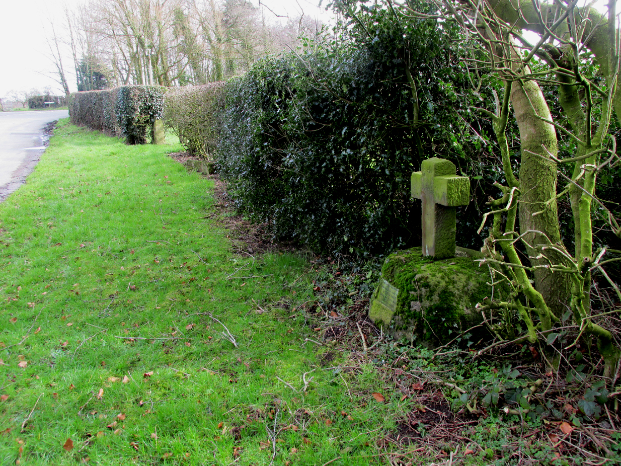
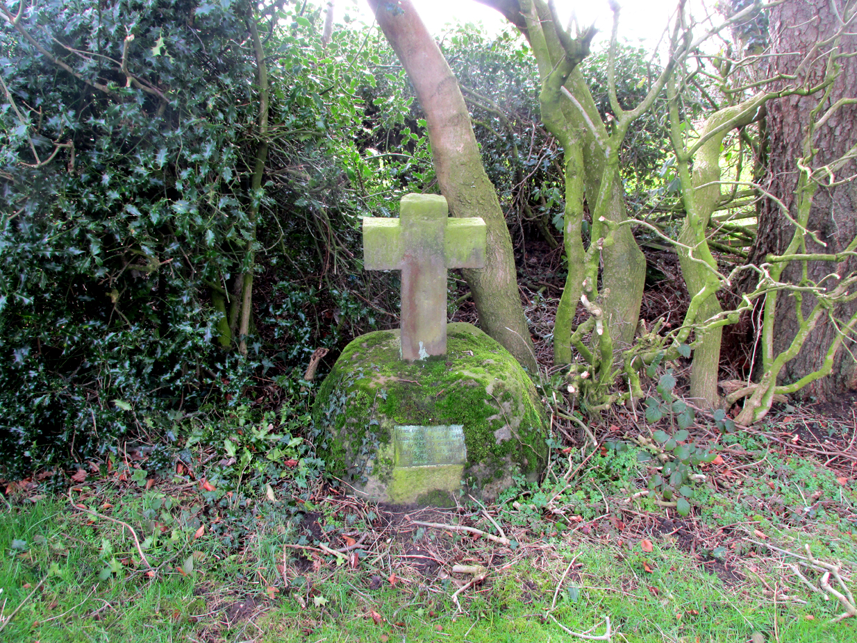
The cross is situated on the verge at the west side of the B5269 road near its junction with Ashley Lane at Stump Cross, north-east of Goosnargh.
Archaeology & History
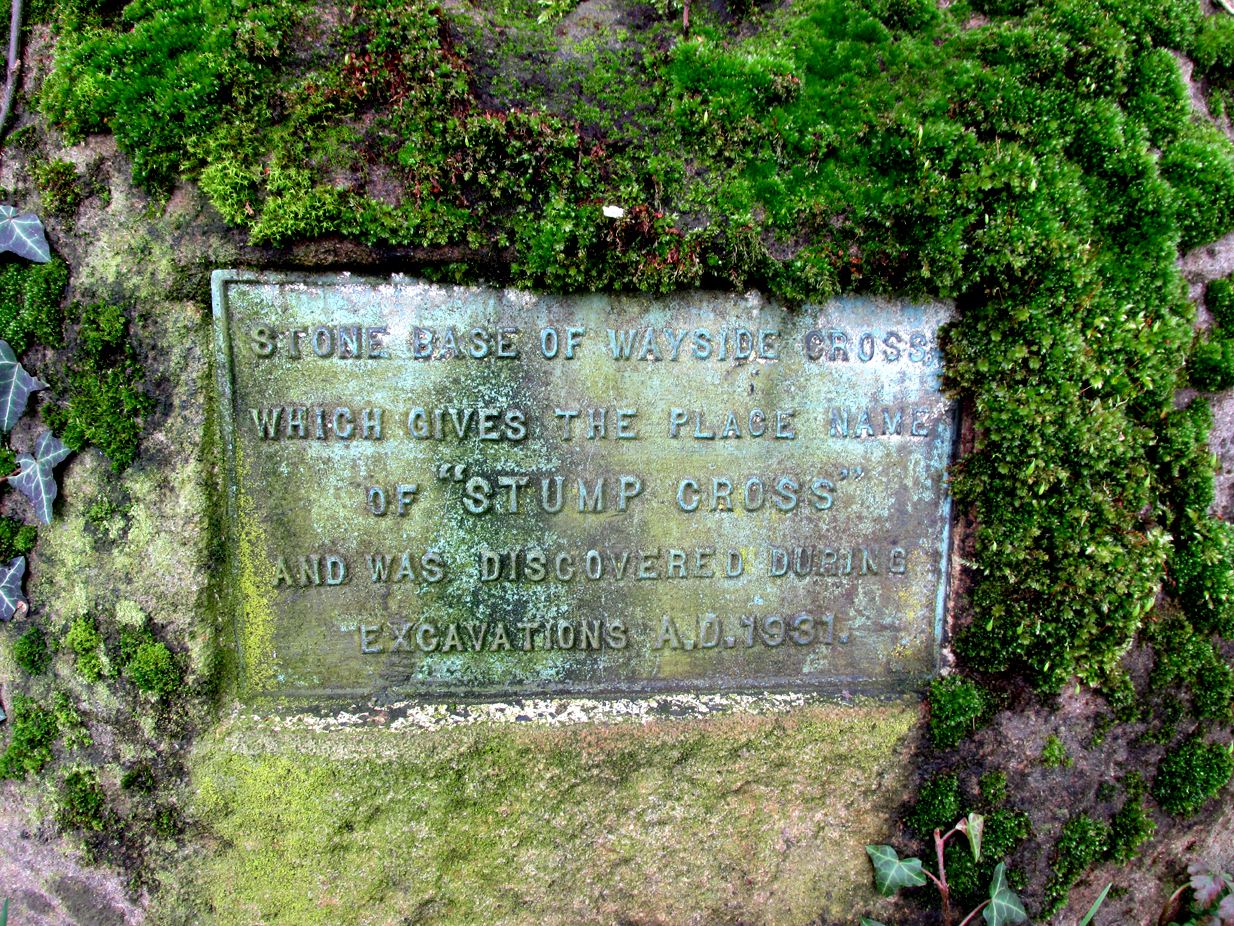
All that survives is the socketed base of the mediaeval cross, into which a small modern carved stone cross has been inserted. A bronze plaque attached to the base informs the reader that the cross gives its name to the locality, and that the base was discovered during excavations in 1931.
Richard Cookson (1888), in his Goosnargh Past & Present, writes:
“We have the remains of several upright crosses in this township called “cross stones” all being placed near to some public road or path. The corpses of the Roman Catholics are rested at those stones on their way to internment, and those funeral attendants who are of that persuasion kneel down and offer up a short prayer for the repose of the soul of the departed individual whose body they are conveying to the grave.”
Further to the destruction of crosses in the township, Cookson writes:
“…the Reverend Richard Wilkinson, late minister, of anti-Romanistic notoriety, in his frenzied hostility to the Roman Catholics, caused [the cross] to be broken up and removed…”
The site is listed by Henry Taylor, in his 1906 magnum opus on Lancashire crosses, and speaking generally on the destruction of wayside crosses in the Hundred of Amounderness, he writes:-
The bronze plaqueModern cross inserted into the Mediaeval socket
“The destruction of so many crosses, which at one time existed in this part of the Hundred, is due to the vandalism early in the nineteenth century of a vicar of Goosnargh, named Wilkinson. He was a vehement Protestant, and owing to his notoriety as a Prophet, was allowed to do much as he liked with these ancient monuments. Many crosses, indeed, it is said, were pulled down with his own hands. His prophesies foretelling the deaths of various persons often unfortunately came true, and he was thus, in this superstitious part of England, dreaded as a wizard. As this work of demolition took place before the date of the Ordnance Survey, there were in all probability many more crosses erected in Mediaeval times in this district than we have now any knowledge of, and it is quite possible that some of the crosses so recklessly destroyed may have been, like those at Halton and Heysham, of pre-Norman date and of great historical value. Fragments of them might even now be found were a diligent search be made.”
Further to this speculation as to the antiquity of these destroyed crosses, it is interesting to note the approximately parallel orientation of roads and field boundaries to the east of the Stump Cross. This may point to the area having been subjected to Roman survey, and the site of the Stump Cross having once been a shrine to the gods of the agrimensores (Roman surveyors) that had been Christianised.
References:
Cookson, Richard, Goosnargh: Past and Present, Preston, H.Oakey, 1888.
Taylor, Henry, The Ancient Crosses and Holy Wells of Lancashire, Manchester, Sherratt and Hughes, 1906.
Richardson, Alan, The Roman Surveyors in Cumberland, P3 Publications: Carlisle 2008.