Grinnan Hill, Braco, Perthshire

Hillfort:  OS Grid Reference – NN 8338 0936

Also Known as:

  1. Grianan Hill
  2. Grinan Hill
  3. Grinnon Hill

Getting Here

Grinnan Hill on 1866 map

If you’re coming by car, Braco’s an easy place to park.  Once here, walk up the main road, past the terrace houses until, on your left, you reach the B8033 Feddal Road.  About 500 yards on, where the houses end and you reach the small river bridge, you’ll notice a footpath immediately on your left with a small table where you can have a cuppa.  Walk past this, into the trees and along the riverside for barely 100 yards, and walk up the hillside on your left.  On your way up are a couple of large humps, a bit like a small roller-coaster.  You’re here!

Archaeology & History

Antiquarians amongst you are gonna love this.  It’s huge!  Hiding away and all but forgotten in the little village of Braco, overgrown with trees and brambles, this steep wooded defensive structure has a series of large ramparts—three in all—that you’ll walk up and down before hitting a slightly undulating summit.

William Roy’s 1793 plan
Christison’s 1900 plan

The site was shown as an unnamed triple-ringed hill on William Roy’s 1747-52 survey of Scotland, with the lines representing the ramparts of this ‘fortress’.  Some years later, Roy (1793) briefly mentioned the site when he was comparing indigenous fortifications with those of the Roman invaders, saying that “the small camp at Ardoch” probably “contained more than a Roman legion, with their auxiliaries.”  His sketch and layout of the hillfort (right) is interesting in that it shows the more compete fortified ramparts on the north-eastern sides, which have today been covered by the modern houses.  The ramparts in this part of the hillfort were still visible when the brilliant Miss Christian MacLagan (1875) came here; and in a subsequent visit by Mr Christison (1900) they could still be seen, as we can see in in his sketch (left).  When we visited recently, it looked as if the lads who’d landscaped the large gardens most probably, unknowingly, used the soil of the ramparts to create them!

Apart from the missing northeastern ramparts, the site today is little different from when our antiquarians wrote of it more than a hundred years back.  Read Miss MacLagan for example, who said:

“Near the parish church is an eminence called Grianan Hill, on which are still to be traced the remains of a British fort.  The hill is a beautifully wooded knoll to the west of the village of Braco.  It appears to be about 100 feet in height above the level of the surrounding land; on three of its sides the ground is perfectly flat, and we could suppose that in the amply days of the fort above, it had been environed on three sides by a lake, which would of course contribute to its strength.  The fourth side of the hill, having but little natural strength, has been strongly fortified by three great walls.  This is the side which connects the knoll with the neighbouring rising ground which is nearly as high as itself.

“The area enclosed by the innermost circular wall has a diameter of 130 feet.  The space between this wall and the second is 37 feet, and the space between the second and third walls 47 feet.  Almost every stone of this fort has been removed, but the lines and trenches which mark their former presence are still very distinct.”

Christison (1900) subsequently gave us much the same, with just some additional points here and there:

Looking up at SW side
Looking up at S side

“The site is less than ½-mile SW of Ardoch camp, 420 ft above the sea, on the edge of a steep descent, 40 to 50 ft high, to Keir Burn, but only slightly elevated above the field towards Braco village.  It has apparently been an earthwork with a semi-oval triple line of defence…partly ramparted and trenched, partly terraced, the broad oval being rudely completed by the unfortified edge of the steep bank.   The entrance, a, is along the narrow crest of a ridge, i, from the E, and it is likewise approached by a rude roadway, c, from the burnside below.  Roy’s plan makes the work nearly complete, but the middle half of the lines no longer exists.  He says that it may have been a work of the natives before the arrival of the Romans, but calls it a (Roman?) ‘post.’   There can be no doubt that it belongs to a common type of native fortresses.  Its extreme length is about 320 ft, and the interior may have been about 200 by 170.”

Southern line of walling
Footpath along rampart

What he failed to point out—and contrary to Canmore’s comment that “the interior is featureless”—is the length of internal walling running nearly halfway through the top of the hillfort, cutting it in half so to speak, roughly southeast to northwest: the eastern area slightly larger than the west, which is a little higher.  A ‘gate’ or passage between these two sides seems apparent halfway along this line of walling.  This wall, like the long one running along its southern edge, is a couple of feet high and more than a yard across.  In the western section a small pit has been dug, about eight feet across and a yard or so deep.  Local lore tells that this was an old Roman fire-pit!

Around the very bottom mainly on the west-side of the hill, remains of old walling can be seen for a couple of hundred feet beneath the vegetation, but I’m unsure about the date of this structure.  It may well be a 19th century construction, but without an excavation—and none has ever been done here—we will never know for sure.

Undulating ramparts

One final thought on this place is how is may have related with the large Roman forts that are just a few hundred yards away to the northeast.  When the invaders came here, local tribal folk no doubt watched them with caution.  One wonders whether or not some sort of ‘agreement’ was made between our local folk and the aggressive incomers, with them coming to some sort of nervous truce between them which allowed the Romans to build their camp to the east, as long as they kept their distance from the folk in this hillfort.  Just a thought…..

References:

  1. Christison, D., “The Forts, Camps and other Field-Works of Perth, Forfar and Kincardine,” in Proceedings Society Antiquaries, Scotland, volume 34, 1900.
  2. Hogg, A.H.A., British Hill-Forts: An Index, BAR: Oxford 1979.
  3. MacLagan, Christian, The Hill Forts, Stone Circles and other Structural Remains of Ancient Scotland, Edmonston & Douglas: Edinburgh 1875.
  4. Roy, William, Military Antiquities of the Romans in North Britain, W. Bulmer: London 1793.

Links:

  1. Canmore notes

Acknowledgements:  Huge thanks for use of the 1st edition OS-map in this site profile, Reproduced with the kind permission of the National Library of Scotland

© Paul BennettThe Northern Antiquarian


Abbey Craig, Stirling, Stirlingshire

Hillfort:  OS Grid Reference – NS 8094 9566

Also Known as:

  1. Canmore ID 47113
  2. Wallace Monument Fort

Getting Here

Abbey Craig on 1866 map

Most folk visiting here are coming from Stirling city.  There are various buses to get here, which head out over Stirling Bridge along Causewayhead Road (the A9) for half-a-mile where, at the roundabout and the William Wallace pub, go straight across up the minor road, zigzagging back on itself, until you reach the signs for the Wallace Monument.  Follow the well-defined footpath and, once on top of the hill, walk round the back of the mightily impressive tower.

Archaeology & History

Located right where the impressive Wallace Monument proudly stands, this prehistoric precursor to Sir William Wallace’s memory was where Scotland’s legendary hero and his men cast a clear and easy view over Bannockburn, where the halfwit english came for a fight—and deservedly lost!   The structures that used to be inside the now denuded hillfort would, no doubt, have been used by Wallace’s men; but much of those prehistoric remains have now been destroyed.  The visible remains of the fort can be seen round the back of the Wallace Monument: elongated rises of overgrown walling that run almost all the way round, getting slightly higher as you approach the more northern edges, like a semi-circular enclosure.

Royal Commission plan
Abbey Craig – and the great Wallace Monument

The site was described very briefly in William Nimmo’s (1880) early survey of the area, where he told that in 1784, “eleven brazen spears were found on the Abbey Craig, by a Mr Harley”, which he thought came from the time when the earlier ‘castle’ stood here.  He was probably right.  Many years later, the prehistoric remains were included in the county survey of archaeological sites by the Royal Commission lads (1963), who told that, near the north end of the summit of Abbey Craig,

“there is a fort which has been damaged by the construction within it of the Wallace Monument.  All that remains is a substantial turf-covered bank, cresentic on plan and 260ft in length, the ends of which lie close to the brink of the precipice that forms the west face of the hill.  The bank stands to a maximum height of 5ft above the level of the interior and presumably represents a ruined timber-laced wall, since numerous pieces of vitrified stone have been found on the slopes immediately below it.

The entrance to the fort presumably lay between one end of the bank and the lip of the precipice, but both the areas concerned have been disturbed by the construction of the modern approaches.  The interior of the fort measures about 175ft from north to south, by about 125ft transversely and the interior is featureless.”

The fort was probably built sometime in the early Iron Age; so the next time you visit this fine spot, check the remains out round the back of the tower—and remember that our ancestors were living up here 2500 years ago!

References:

  1. Aitchison, N.B., “Abbey Craig Rampart’, in Discovery & Excavation, Scotland, 1981.
  2. Feacham, Richard W., Guide to Prehistoric Scotland, Batsford: London 1977.
  3. Hogg, A.H.A., British Hill-Forts: An Index, BAR: Oxford 1979.
  4. Nimmo, William, The History of Stirlingshire – volume 1 (3rd edition), T.D. Morison: London 1880.
  5. Royal Commission on the Ancient & Historical Monuments Scotland, Stirling –  volume 1, HMSO: Edinburgh 1963.
  6. Royal Commission on the Ancient & Historical Monuments of Scotland, Archaeological Sites and Monuments of Stirling District, Central Region, Society of Antiquaries of Scotland 1979.

© Paul Bennett, The Northern Antiquarian


Ball Cross Carving 02, Bakewell, Derbyshire

Cup-and-Ring Stone:  OS Grid Reference – SK 231 691

Archaeology & History

Ball Cross 2 Carving (after Beckensall)

One of three carvings that were located inside the walling of the Ball Cross hillfort during excavations here in the early 1950s by J. Stanley. (1954)  Each carving is distinctly unlike the other in design (see Ball Cross 1 and Ball Cross 3) and it’s highly probable that they were incorporated into the Iron Age structure with their original mythic functions—of neolithic or Bronze Age origin—disused. It is not unlikely that this and its compatriots were originally found in association with the nearby prehistoric tombs.

Ball Cross 2 Carving (photo by Dean Thom)

The broken piece of rock consists of a broken section of an almost archetypal ‘cup-and-ring’—although with this design, no central ‘cup’ occurs: a pattern found at several other multiple-ring stones, like the Grey Stone near Leeds.  Although Stan Beckensall (1999) described this to have “8 concentric rings”, his drawing and the photo here by Dean Thom, clearly show only seven such ‘rings’.  The carving presently lives in a protective box in Sheffield Museum (though beware the listing they give of the designs, as some are incorrect).

References:

  1. Barnatt, John & Reeder, Phil, “Prehistoric Rock Art in the Peak District,” in Derbyshire Archaeological Journal, 102, 1982.
  2. Beckensall, Stan, British Prehistoric Rock Art, Tempus: Stroud 1999.
  3. Beckensall, Stan, Circles in Stone: A British Prehistoric Mystery, Tempus: Stroud 2006.
  4. Cooper, Ali, Archaeology Walks in the Peak District, Sigma: Wilmslow 2010.
  5. Morgan, Victorian & Paul, Rock Around the Peak, Sigma: Wilmslow 2001.
  6. Stanley, J., “An Iron Age fort at Ball Cross Farm, Bakewell,” in Derbyshire Archaeological Journal, volume 74, 1954.

Acknowledgements:  HUGE thanks to Dean Thom for the use of his photo, plus helpful references on this site.

© Paul Bennett, The Northern Antiquarian


Ball Cross Carving 01, Bakewell, Derbyshire

Cup-and-Ring Stone:  OS Grid Reference – SK 2310 6911

Archaeology & History

Ball Cross 01 Carving (photo © Dean Thom)

This is another carving (one of three here) that was removed from its landscape setting when found during excavations of the Iron Age hillfort of Ball Cross in the 1950s, and then placed into a box in Sheffield Museum, decontextualizing it and leaving future researchers slightly in the dark as to its possible nature.  In removing the carving from its site, the stone was left with additional scratches and grooves slightly damaging the stone.  Not good!

Ball Cross Carving (after Beckensall)
Ball Cross Carving (after A. Cooper)

Although unlike the Ball Cross 2 and 3 carvings, the design here is structurally very similar to that found east of Gardoms Edge, with this one comprising of a large unbroken carved oval, with at least twelve cup-marks inside.  Or as Beckensall (1999) described, it “has 12 cups inside a flattened ring.”  Again, like the Gardoms Edge carving, a single cup-mark was etched outside of the enclosed ring. It was found with its companion carvings built into the main walled structure of the hillfort.  It’s unlikely that the stones date from the same age as the hillfort: more probable that they were re-used in the structure, with their mythic nature perhaps already long forgotten…

References:

  1. Barnatt, John & Reeder, Phil, “Prehistoric Rock Art in the Peak District,” in Derbyshire Archaeological Journal, 102, 1982.
  2. Beckensall, Stan, British Prehistoric Rock Art, Tempus: Stroud 1999.
  3. Beckensall, Stan, Circles in Stone: A British Prehistoric Mystery, Tempus: Stroud 2006.
  4. Cooper, Ali, Archaeology Walks in the Peak District, Sigma: Wilmslow 2010.
  5. Morgan, Victorian & Paul, Rock Around the Peak, Sigma: Wilmslow 2001.
  6. Stanley, J., “An Iron Age fort at Ball Cross Farm, Bakewell,” in Derbyshire Archaeological Journal, volume 74, 1954.

Acknowledgements:  HUGE thanks to Dean Thom for the use of his photo, plus helpful data on this site.

© Paul Bennett, The Northern Antiquarian


Knock Hill, Dunblane, Stirlingshire

Hillfort:  OS Grid Reference – NS 7825 9845

Also Known as:

  1. Canmore ID 45987
  2. Gallow Hill

Getting Here

The snow-covered old fort

You can come here from either Dunblane to the north, or Bridge of Allan immediately south: either way you reach the site by going along the A9 road until you reach the Lecropt Church, a half-mile north of Bridge of Allan.  On the other side of the road is a somewhat battered wooden gate.  Go through here and up towards the tree-covered hill, following its edges to the right for a few hundred yards, until you come to another very large mound covered in trees.  That’s what you’re looking for!

Archaeology & History

Described on early OS-maps as a “Supposed Roman Camp,” this large fortified stone hillock has more recently been considered a creation of indigenous Scots.  Hemmed in and hidden on most sides, by the rises of Knock Hill to the west and Gallows Hill to the east, the only lines of visibility out of the fortress is along a northwest to southeast corridor, keeping the site quite secret to outsiders.  It would have been a fine place for a small community in ages not-so-long-ago, keeping the people hidden from the pestilent invasions of both Romans and english in bygone times.

The tree-clad fort, through blizzard

The large raised oval enclosure was walled around its sloping sides and edges, with remains of a walled embankment still visible running around the top of the slopes.  What may have been traces of hut circles were on top of the hillock until recent times, but these have been much reduced by some digging near the middle of the site.  It would appear that an ‘entrance’ was once visible on the southeastern side of the fort, but when we came here the other day, a lovely blizzard covered the place in snow, so this was difficult to see.

When the Royal Commission chaps came to visit the place in 1979, they didn’t really say much about the place, merely telling of its dimensions, saying:

“This fort measures 48m by 32m within the remains of a single rampart 4.5m thick and 1m high.”

I’m sure there must be much to be said of this lovely old site by local antiquarians, but I haven’t found much as yet.  But if you’re wanting a nice quiet spot to sit for a while on the outskirts of Stirling and Dunblane, I’d heartily recommend visiting this place.  Badgers and deer also seem to like the place!

References:

  1. Royal Commission on the Ancient & Historical Monuments of Scotland, Archaeological Sites and Monuments of Stirling District, Central Region, Society of Antiquaries of Scotland 1979.

© Paul Bennett, The Northern Antiquarian 


Dun Toiseach, Ford, Kilmartin, Argyll

Dun:  OS Grid Reference – NM 880 047

Getting Here

Dun Toiseach plan (after RCAHMS 1988)

You can see the rocky hillock ‘pon which this old dun sits from the roadside – and can approach it by either climbing up the slope, or go round t’ back and approach it from t’ track. Either way, it’s easy to get to.

Archaeology & History

The old dun was rather ramshackled when I used to sit here, sometimes on mi way home from working at the Inverliever Nursery, a bit further up the lochside — but it was a good spot to sit and daydream into Loch Awe and beyond…

Described as a vitrified fort, the structure is oval in shape.  Thought to have been constructed in the Iron Age, Dun Toiseach was originally about 50 feet across and its walls averaged 10 feet thick, with an entrance at its northeastern side.  The Royal Commission lads (1988) described it thus:

“Situated on a prominent rocky knoll overlooking the S end of Loch Awe 250m ESE of Torran farmsteading, there is a severely ruined dun measuring about 16m by 13m within a wall which has been some 4m thick. Two stretches of outer facing-stones are visible, as well as a few possible stones of the inner face, but, particularly on the NE, the wall has been severely robbed and the core material scattered. The entrance lies on the NE, the innermost portion of the SE passage-wall and what may be a door-jamb on the opposite side still being visible.  The knoll has acted as a focus for recent field-walls, but there is no indication that it was additionally defended by outworks. A small modern cairn…surmounts the dun wall on the SE.”

References:

  1. Royal Commission on the Ancient & Historical Monuments of Scotland, Argyll – Volume 6: Mid-Argyll and Cowal, HMSO: Edinburgh 1988.

© Paul Bennett, The Northern Antiquarian


Castle Hill, Little Wittenham, Oxfordshire

Hillfort:  OS Grid Reference – SU 5696 9244

Also Known as:

  1. Sinodun Camp
  2. Wittenham Clumps

Getting Here

Either reach this from Dorchester’s Dyke Hills by crossing the bridge over the Thames at its southwestern side and walk thru the village and up the fields to the wooded rise on your left; or simply get take the road between Brightwell-cum-Sotwell to the delightful village of Little Wittenham and, on your right-hand side, notes the unmissable clump of trees and rise in the fields on your right.  That’s the place!

Archaeology & History

Major Allen’s 1932 photo

To be found on the southern side of the River Thames, across from the huge Dyke Hills camp, this prominent enclosed hillfort was thought to be a place where the tribal peoples of differing groups converged — the Dubonni, the Catuvellauni, and Atrebates peoples.  And to this day it remains impressive.  Long thought to have been merely the province of Iron Age settlers, in more recent years it has shown to have had a longer and richer history than academics previously dare write about.  In Jean Cook’s (1985) fine work on the archaeology of the region, she described the typical narrative Castle Hill elicited from professionals until only a few years back, saying:

“The hillfort on Wittenham Clumps covers approximately 4 hectares (c. 10 acres) and comprises a single ditch and rampart.  It commands superb views northwards up the Thames valley and to the south and west across the Vale of White Horse to the Berkshire Downs, where a series of similar hillforts follows the line of an ancient route — the Ridgeway.  The fort has never been excavated, although frequent past ploughings have produced Iron Age and early Saxon sherds as well as Romano-British pottery.  However, to the south of the hillfort…a well-stratified Iron Age settlement was found.  It seems probable on the basis of other excavated sites that the fort was permanently occupied.  It would have developed as  a regional administrative and political centre, with specialist craftsmen and traders and would have performed some of the same functions as a medieval market town.”

Although Cook’s latter remarks should be addressed with caution (market economics was far from the mythic perspectives of Iron Age people), this great site was of obvious importance.  But later excavations at the site in 2002-03 showed that the site had in fact been used by neolithic people and, around the tops, flints and other remains were found that took human activity here back into mesolithic times, with some finds dated around 6000 BC!  More surprisingly (to archaeologists anyway) was that Castle Hill continued to be used way into medieval times!

Thankfully much of this place is still pretty well-preserved and is well worth exploring to historians, pagans and walkers.

…to be continued…

References:

  1. Cook, Jean, “Before the Roman Conquest,” in Dorchester through the Ages, Oxford University 1985.
  2. Cook, Jean & Rowley, Trevor (eds.), Dorchester through the Ages, Oxford University 1985.

Links:

  1. An Interim Summary Report on Excavations at Castle Hill, Wittenham Clumps

© Paul Bennett, The Northern Antiquarian


Rathgall Hillfort, Coolkenna, County Wicklow

Hillfort:  OS Grid Reference – S 9020 7315

Archaeology & History

Early aerial photo of Rathgall hillfort

A prehistoric ‘fort’ with a long history behind it, with recent excavations finding burial and settlement remains from the Bronze- and Iron Ages.  The following article about this impressive archaeological site was written by Barry Raftery’s in an early edition of Antiquity journal (1970), following excavation work here.  He wrote:

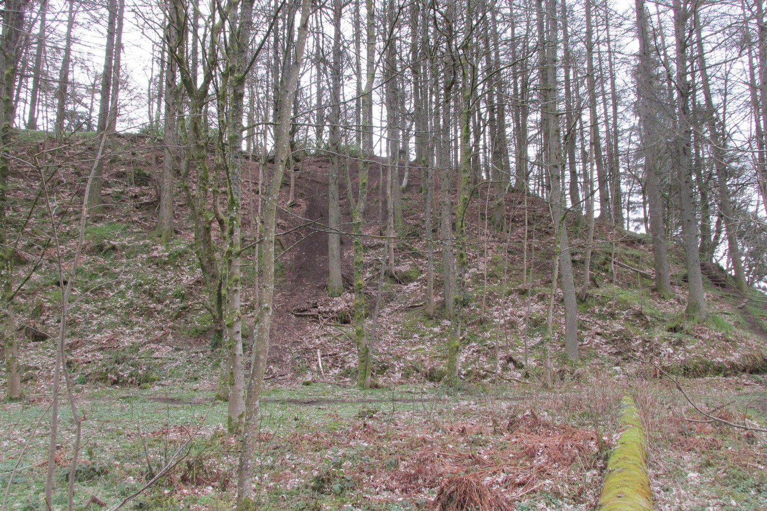
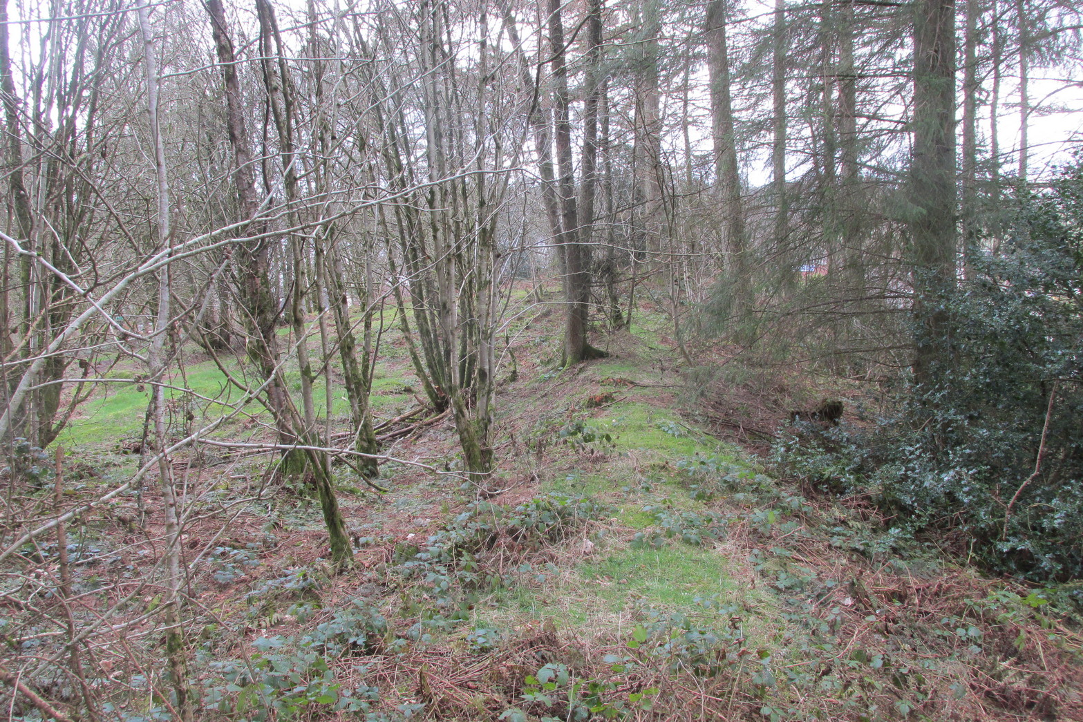
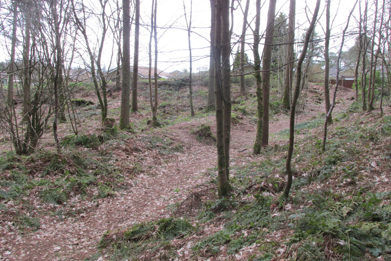
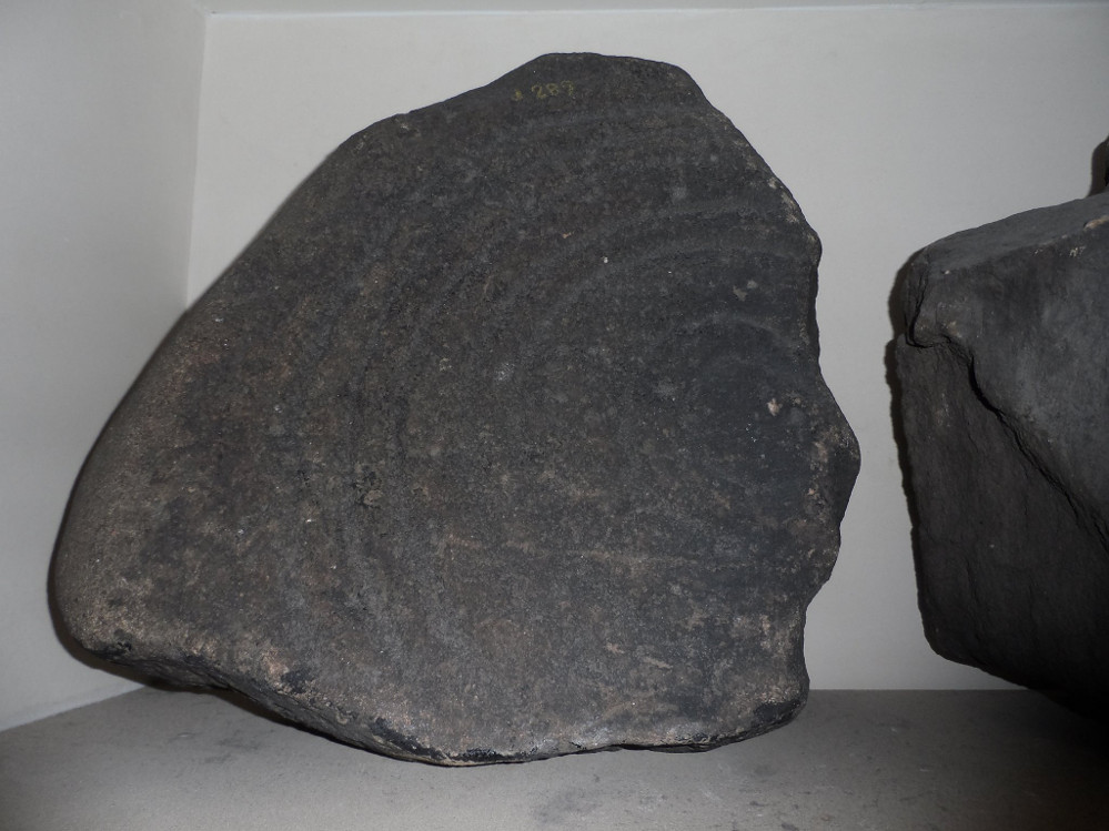
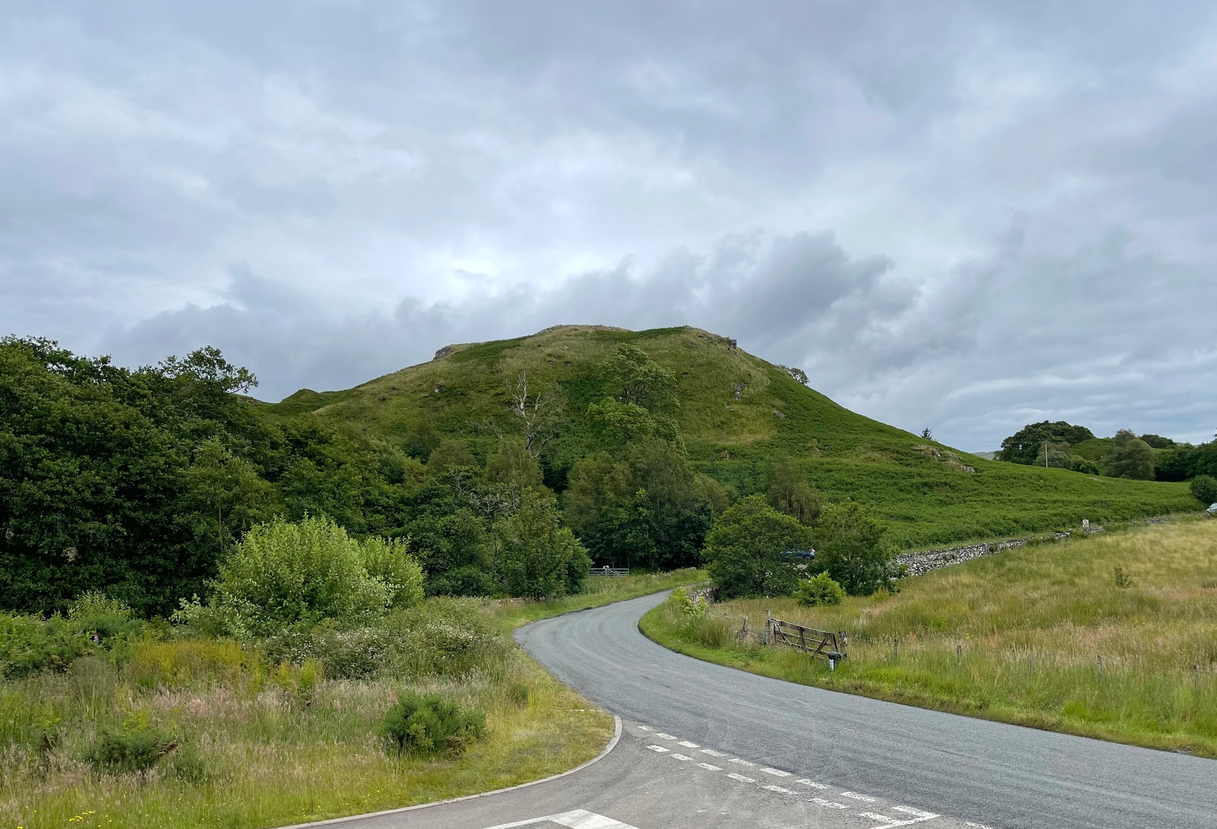
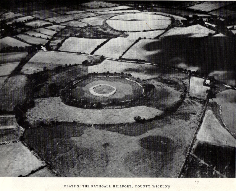
“Rathgall is a large and imposing hillfort situated on the end of a long ridge some 6km east of Tullow, Co. Carlow.  It is sited impressively and commands a fine view on all sides.  The defences of the fort comprise four roughly circular, concentric ramparts.  The three outer banks, though largely overgrown, appear to be of earth faced with stone; the inner one is built entirely of granite boulders, many of considerable size.  The fort covers some 18 acres (c. 7 hectares); its overall diameter is about 310m. (Orpen 1911; 1913)

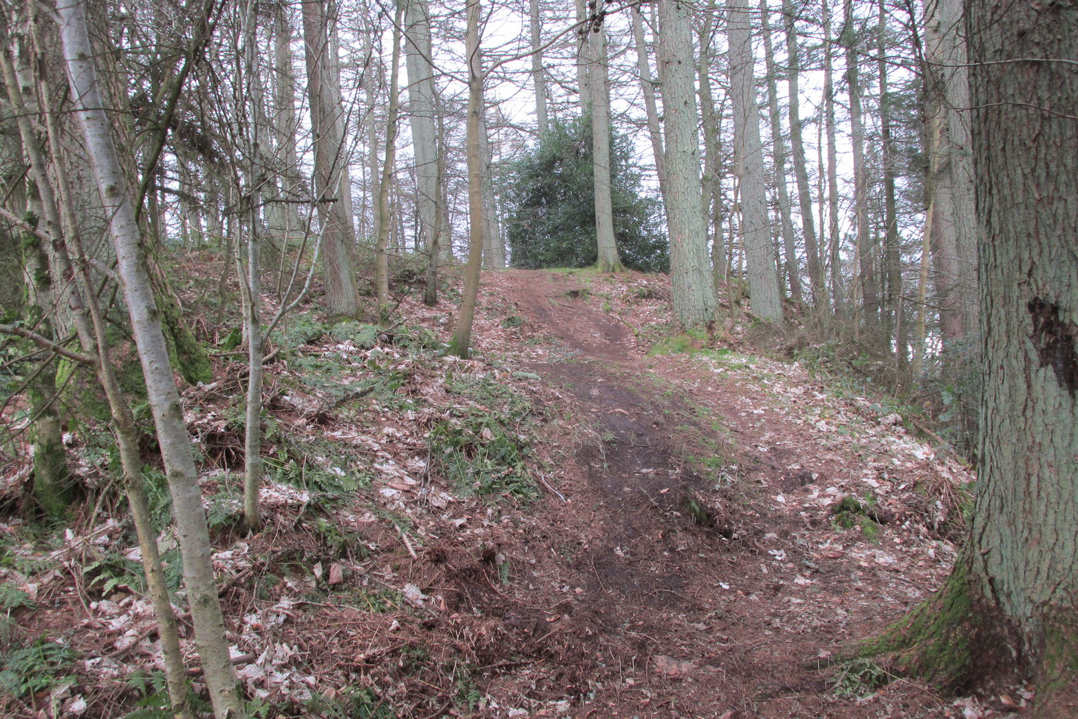
“Excavation in 1969 was confined, with the exception of one short trench, to the inner enclosure.  This is surrounded by the granite wall, dry-built and of poor quality.  It is made up of a series of straight lengths so that, though superficially the enclosure appears to be circular, it is in fact polygonal.  The entrance is a simple break on the western side.  The wall varies in thickness from 7m in the southeast, to 1.5m in the north, though the reason is not immediately clear.  In height the wall varies from 2m to 2.5m.  The minimum internal dimensions of the enclosure are 44m and 46m.

“About one-quarter of the enclosure was excavated in the northeastern quadrant.  A trench 2m wide and 20m long outside the wall and running into the interior was begun and this demonstrated the existence of occupation outside the wall.

“The first season’s excavation suggests the presence of at least three main phases of occupation on the site — Late Bronze Age, early Iron Age and Medieval.  The relatively thin soil covering on the site does not as yet allow the periods to be clearly defined stratigraphically.

“About 1500 objects came to light, over 1000 of them being pot-sherds.  The great majority belong to the Early Iron Age phase of occupation, apparently the period of densest settlement on the site.  As well as the remains of circular and rectangular structures, the excavation also revealed a number of very large hearths and a bank-and-ditch enclosure hitherto quite unsuspected.

“This latter feature partly underlay the granite wall.  The ditch had been filled in and the bank denuded before the construction of the wall.  The latter averaged about 50cm high and lay outside the ditch, which was dug carefully to a V-shaped section.  In width it varied from 1.5 to 3.5m at its edge and in depth from 75cm to 1.1m

“Bank and ditch enclosed an area about 35m in diameter.  So far no entrance to this enclosure has been distinguished, though there appears to be a gap in the south-east which may be an original opening.  It is noticeable that the bank runs, without a break, straight across the entrance to the stone enclosure, further emphasizing the lack of structural connection between the two features.

“The relationship of either of these enclosures to the outer lines of defence is not clear and so elucidation of this problem must await further excavation.  It seems, however, that the granite wall is a late feature and is probably of medieval date.  The massive outer ramparts, on the other hand, are more likely to belong to the Early Iron Age occupation of Rathgall.

“Over the whole area so far excavated indications of rectangular houses were frequent.  The walls of these houses were formed of timber posts, generally of no great size; they were set usually singly but sometimes in paris, in bedding trenches 30 to 40cm wide.  The upright posts presumably formed the framework of wattle-and-daub constructions.  There appears to have been extensive rebuilding, so that the plans are greatly confused and not always easy to interpret.  The houses were quite large: one of them was as much as 7.5m in length.

“These houses belong to the latest phase of occupation on the site and appear to be contemporary with the construction of the granite wall.  They were built on top of the fill of the ditch and were confined by the wall: there is no indication anywhere of house foundations running underneath the wall.  Green-glazed sherd from the fill of the bedding trenches suggests a 13th-century date for these houses and a late 13th-century silver coin points in the same direction.

“A circular bedding trench, apparently concentric with the large V-shaped ditch, was found in the centre of the stone-walled enclosure.  One-quarter of the bedding trench was exposed in the 1969 excavations.  In section it is roughly U-shaped and is 25cm wide and 30-35cm deep.  It encloses a space about 18m in diameter.  Its outer edge is for the most part lined with packing stones of medium size.  One metre inside this bedding trench and running concentrically with it for about one-third of the excavated arc there is a second bedding trench of similar type.  Whether these bedding trenches represent the remains of a large timber house of whether they were for a timber stockade is uncertain; further excavation may provide the answer to this problem.  As regards relative dating, however, it is clear that the circular structure, whatever it was, was earlier than the rectangular houses, for the bedding trenches of the latter lay above the trench for the former.  As well, some sherds of coarse ware of a date appreciably earlier than medieval times were found in the fill of the circular trenches.

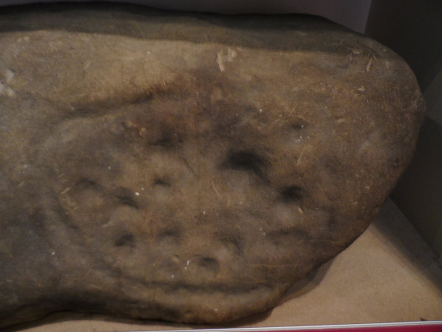
“In turn, a huge oval hearth was found beneath the circular structure.  The hearth consisted of a steep-sided, flat-bottomed pit, 3.1m long and 1.5m wide, dug into the yellow subsoil.  A large quantity of black, burnt material came from the hearth and there appeared to be three main phases of use, each separated from the other by a layer of rough cobbling.  The hearth also produced sherds of coarse pottery, including two decorated fragments.  The decoration takes the form of one sherd of a row of finger-nail impressions and on the other a row of simple nicks in the edge of the rim.

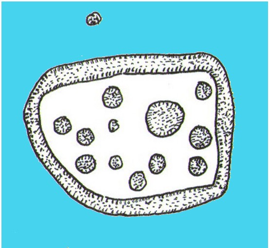
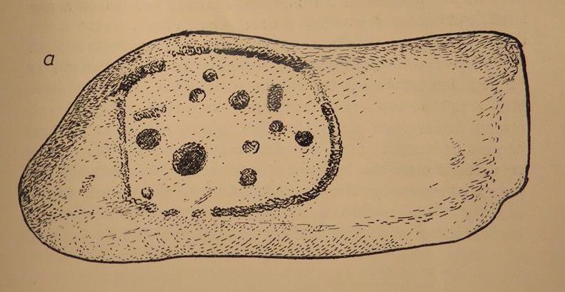
“Large hearths of this type are, indeed, a feature of the site as a whole.  Five in all have so far come to light: one, especially elaborate, consisted of a large rectangular pit, 2.85m by 1.2m, dug 40cm into the subsoil.  At each corner there was a circular pit; two of these pits look like post-holes, the other two appear to be much too large to have served such a purpose.  All the hearths have produced coarse pottery and can thus be placed in their relative chronological position, though as yet none appears to be related specifically to any single structure on the site.  It may be that these were open-air hearths, covered by some sort of canopy.

“In addition to the hearths, the rectangular houses, the circular structure and the ditch and bank, a large number of post-holes were found.  Some of these were large, some small, but in no case could any positive pattern be established.

“The importance of the structural remains on the site is equalled by the significance of the material recovered.  The finds from the medieval period have already been referred to and the rectangular houses with which they were associated.  Before this there appears to have been a lengthy period when the site was not occupied.  The occupation before the beginning of this break appears to have been intensive.  It is characterized by large quantities of very coarse pottery.  This distinctive ware may be termed Freestone Hill Ware after the importance of the hillfort site of that name in County Kilkenny where the pottery was first isolated.  At this site it was associated with Roman bronzes of the 4th century AD and with a coin of Constantine II (Raftery, 1969).

“The sherds represent coarse, flat-bottomed, bucket-shaped pots, usually of a reddish, crumbly ware with very large grits.  Distinctive rims are characteristic: they are rounded, flat, T-shaped or internally bevelled.  At Freestone Hill a striking feature was the presence on many of the rim sherds of a row of small perforations; similar perforated rims are included in the Rathgall material.  In addition to the pottery, blue glass beads, bones, spindle whorls, portions of a lignite bracelet and many other objects of normal domestic refuse came to light.  A complete saddle quern was also found.  The most interesting of the Early Iron Age finds, however, was a small tinned strap-mount, beautifully decorated with a combination of openwork and incised curvilinear ornament of sub-La Tene type.  The art on this object has much in common with that on a bronze mount found at Freestone Hill and both appear to have a vital bearing on the transition from the true La Tene art of pre-christian times to the great flowering of art in Early Historic Ireland.

“Both at Freestone Hill and at Rathgall these decorated bronzes were associated with coarse pottery of identical type.  The pottery at the former site was dated to the mid-4th century and there, at least, the date is hardly in doubt.  It is possible to suggest a similar dating for the Wicklow material.  Coarse pottery of this type may, however, have had a fairly long life and indeed Freestone Hill may give but a central date for the group.

“Several points of some significance in relation to this pottery must be stressed.  Firstly, no excavated ring fort (rath) has ever produced this kind of ware — indeed, it is absent from any excavated site of the Early Historic Period in Ireland.  On the other hand, it is found increasingly in hillforts — to such an extent in fact, that it appears more and more to be basically a hillfort phenomenon.  Apart from the two sites referred to above, similar coarse sherds come from the hillforts at Clogher, Co. Tyrone, Emain Macaha, Co. Armagh, Downpatrick, Co. Down, and possibly also from Dunbeg in the same county.  In the present state of our knowledge therefore, it seems that Freestone Hill Ware may be regarded as characteristic of Irish hillforts: there is as yet no evidence for its continuation beyond the middle of the 1st millenium AD.

“The origins and ancestry of Freestone Hill Ware are matters which can hardly be discussed here, but pottery of this type without the perforated rims, may go back to pre-christian centuries.  Indeed, the indications at Emain Macha tend to confirm this possibility and Freestone Hill Ware may well have had its origins in the so-called Flat-rimmed wares of the Late Bronze Age in Ireland.

“This problem seems very real at Rathgall, since here are strong indications of Late Bronze Age activity.  This is the third of the three phases of occupation of the site.  Mould fragments of clay were recovered which were used in the manufacture of objects of Late Bronze Age type — swords, possibly spears and socketed implements with a rope moulding round the mouth of the socket.  The relationship of these fragments to any of the structures which were uncovered during the excavation is not clear.  In fact, apart from the mould fragments (and possibly the saddle quern) there is nothing else which can with certainty be assigned to a late Bronze Age context.  Some of the mould fragments came from the immediate vicinity of one of the large hearth, some from the fill of the ditch, and from the ditch also came the saddle quern.

“The presence of the mould fragments in the ditch is complicated by the discovery, in the very bottom, of fragments of pottery which seem to belong to that class known as Cordoned Ware which occurs in southwestern Britain and northwestern France in the centuries before and just after the birth of Christ.  It would seem then either that the mould fragments found their way into the ditch during an in-filling operation which took place at a time subsequent to the original Late Bronze Age occupation of the site, or alternatively that the pieces are contemporary with the Cordoned Ware, thereby suggesting a remarkable continuity of Late Bronze Age types in Ireland.

“At all events the construction of the ditch can be dated with reasonable certainty to the period of the Cordoned pottery.  Pottery of this type has never before been found in Ireland and its implications regarding Irish/British and Irish/Continental connections in the Early Iron Age — as well as having an important bearing on the development of the Irish hillfort — are considerable.

“The question of the date of the hearths is as yet a matter of some doubt.  It has already been pointed out that in one area  a hearth was overlain by both the circular enclosure and the much later rectangular structures.  This hearth at least belongs to any early phase of the occupation of the site and since all the five hearths so far revealed by excavation are not apparently associated with specific structures and have several points in common, such as size and details of construction, it seems reasonable to suggest that they may be broadly contemporary.

“All the hearths produced coarse ware and it therefore seems to be of prime importance to be able to distinguish between the Freestone Hill type of pottery of the Early Iron Age and the pottery to which the name Flat-rimmed Ware has been given and which is dated to the Late Bronze Age.  It may be that both are in the same developmental tradition and it is hoped that further work on the hillfort at Rathgall will help to elucidate the problem involved.”

References:

  1. Harbison, Peter, Pre-Christian Ireland, Thames & Hudson: London 1989.
  2. Raftery, Barry, “The Rathgall Hillfort, County Wicklow,” in Antiquity journal, volume 44 (no.173), March 1970.

Links:

  1. Rathgall Hill Fort on Irish Antiquities
  2. Rathgall Hillfort on Megalithic Portal

© Paul Bennett, The Northern Antiquarian


Castercliff, Nelson, Lancashire

Enclosure:  OS Grid Reference – SD 8850 3840

Also Known as:

  1. Caster Cliff

Getting Here

Castercliff hillfort plan (after D.G. Coombs)

From Colne train station, cross the road and go along Bridge Street and where it meets Knotts Street follow it all the way up into the countryside and, bending to the right, uphill again until it levels out.  The farmhouse a few hundred yards ahead of you (just off Southfield Lane) at the bend in the road is where you’re heading.  There’s a track on your right, just before the farm.  Go on this and look into the field immediately right.  The undulations and earthworks are the remains of this old hillfort!

Archaeology & History

This old site was constructed some 850 feet above sea level, overlooking the valley of Colne immediately west and giving commanding views of the outstretched landscape towards the sacred Pendle Hill and beyond for many miles.  The place was described as early as Castell Clif in 1515, and then again as Castyclyff in 1533, meaning simply the “castle on a cliff” or high verge as it is here.  Yet despite its early appearances in literary studies, the first real work to explore this monument doesn’t appear to have been done until one J.A. Plummer carried out work on the site between 1958-60.  However, Plummer died before being able to publish his findings in full.   Ascribed variously as a settlement, an enclosure, and generally in the archaeological fraternity as a hillfort, the first detailed published description of the site was done by Forde-Johnston (1965), where he told:

Forde-Johnston’s early plan

“The hillfort is a very regular oval in shape and encloses an area about 350ft long and 250ft wide.  The overall dimensions are 550ft by 450ft.  The site has been affected by quarrying on the south and east and there are a number of gaps in the defences on the northern and western sides.  The character of the remains differs in various parts of the site, but the general pattern appears to be as follows.  The innermost line of defence is represented by a very slight bank or, in many places, only a very shallow scarp which can be traced round the whole circuit of the site… The second or middle bank is the most prominent or substantial of the three.  It has considerable gaps in its length, but the various portions are all of much the same character — it rises between 3 and 5ft above the interior and falls about 9ft to the ditch bottom.  On the south side the middle rampart takes the form of a scarp about 10ft high, immediately below the scarp of the inner rampart.  The third, outermost bank is, in fact, a counterscarp bank to the second ditch.  It does not exist as a continuous bank around the whole of the site, but there are sections of it on the northern and eastern sides.  On the eastern and northeastern sides, from which approach was easiest, there appear to have been additional outer defences, situated about 70ft forward of the counterscarp bank.  These outer defences now take the form of a scarp about 4ft high curving round the eastern and northeastern sides for about 250ft.  At the southern end there is an inner scarp, forming a bank, and a little to the south, is a detached portion of bank.  There are other short detached sections of bank on the northern side which are presumably to be connected with these outer defences.”

When Mr Plummer did his excavation here a few years before, one section of the site was examined and, thanks to the survival of an interim report he did — described by D.G. Coombs (1971) — we know the following of what he did:

“His work was concentrated in the northwest corner of the site where he cut a trench through the defences.  Outside the counterscarp bank, which was not continuous, there was a bedding trench, packed with stones and containing charcoal.  The ditch, which was rock-cut and flat-bottomed, had a homogenous fill.  The rampart itself showed timber supports at the front and back with traces of stone revetting at the front and some distance from the timber uprights.  The rear of the rampart was marked by a line of stones.  Behind this rampart the site had been extensively disturbed and here he claimed to have found traces of primitive iron-smelting furnaces constructed from stones packed and sealed with loose black earth.  A single post-hole beneath the rampart was suggested to belong to an earlier phase.”

Though we have to note here that Mr Plummer believed that the iron furnace remains were actually medieval in date, but that the embanked settlement itself was Iron Age and “that the collapse of the fort could be dated between 60-90 AD.”  When Mr Coombs and his team came back here in 1970 to re-examine the works of both Plummer and Forde-Johnston, they confirmed some of their earlier finds, but uncovered additional finds at what they called this “once great fortress.”

Folklore

In Robert Lord’s (1976) superb imaginary piece on what he calls the Pendle Zodiac (a zodiac allegedly forged into the landscape in ancient times, in the manner of the famous and equally imaginary Glastonbury zodiac), a section of the deity Diana is made up of this prehistoric earthwork:

“The lower edge of the cap (on her head) coincides with a minor road between Colne, skirting the Iron Age Castercliffe hill-fort, above Nelson, as far as Catlow.”

…to be continued…

References:

  1. Coombs, D.G., Interim Report: Excavation at Castercliff, Nelson, Lancs., Unpublished Report 1971.
  2. Ekwall, Eilert, The Place-Names of Lancashire, Manchester University Press 1922.
  3. Forde-Johnston, The Hill-Forts of Lancashire and Cheshire, Lancashire & Cheshire Antiquarian Society 1962.
  4. Pennick, Nigel & Lord, Robert, Terrestrial Zodiacs in Britain, Institute for Geomantic Research: Bar Hill 1986.

© Paul Bennett, The Northern Antiquarian


South Kirkby, South Yorkshire

Hillfort / Settlement:  OS Grid Reference – SE 435 104

Getting Here

From the South Kirkby library, go west along Hague Lane and take the left turn up Homsley Lane on your left after  a few hundred yards (keep your eyes peeled!).  Go up here, past the housing estate, and where the trees begin on your left at the top of the Hilltop Estate, go thru them and as you emerge out the other side, the earthworks are all around you.  In fact you’re just about in  the middle of this hillfort-cum-settlement!

Archaeology & History

W.S. Banks (1871) gives an early description of this site, although he thought it to be Saxon in nature.  He told that,

“About half-a-mile east of Ringston Hill, in a field between Quarry-road and Hornsley-road, is the site of a supposed Saxon camp, as it is called on the ordnance map — a large enclosure containing above three acres of land.  It slopes to the north, and is now rough and uneven, and has been cast into ‘lands.’  The mound on the east, west and south is still very distinct.  The northern side is much lower than the other and a ditch is cut across at that part…”

And in Banks’ day, as he told, “the history of it is not known.”  But this site was later declared as a hillfort – a Brigantian one at that – for the first time by the director of Wakefield Museum, Mr F. Atkinson, following some excavation work here in 1949.  Nothing much was found apart from,

“pieces of decayed and burnt sandstone and medieval pottery sherds,” though he still concluded the site to be Iron Age. Although little of its original form can now be seen due to extensive damage, infra-red aerial photography showed “traces of a five-sided annexe to the northwest, the line of the ploughed-out rampart to the south-southwest, and a possible defended entrance to the south.”

The same aerial survey also found another enclosure to the east of the hillfort.

…to be continued…

References:

  1. Banks, W.S., Walks in Yorkshire: Wakefield and its Neighbourhood, Longmans Green & Co.: London 1871.
  2. Keighley, J.J., ‘The Prehistoric Period,’ in Faull & Moorhouse’s, West Yorkshire: An Archaeological Survey, I, WYMCC: 1981.

© Paul Bennett, The Northern Antiquarian