Holy Well, Carburton, Nottinghamshire

Holy Well (lost):  OS Grid Reference – SK 613 746

Also Known as:

  1. Allen Well

Archaeology & History

The sacred holy woodland on the 1885 OS-map

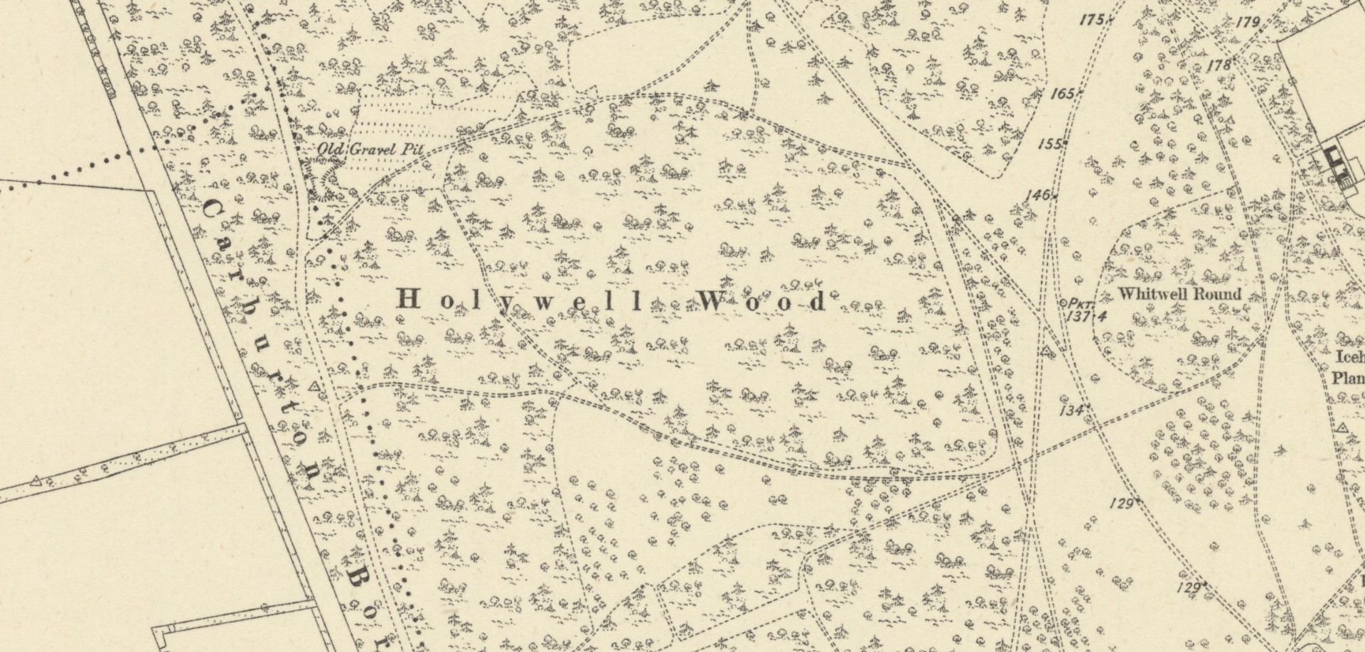
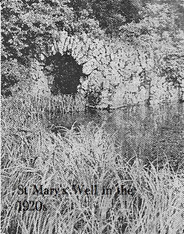
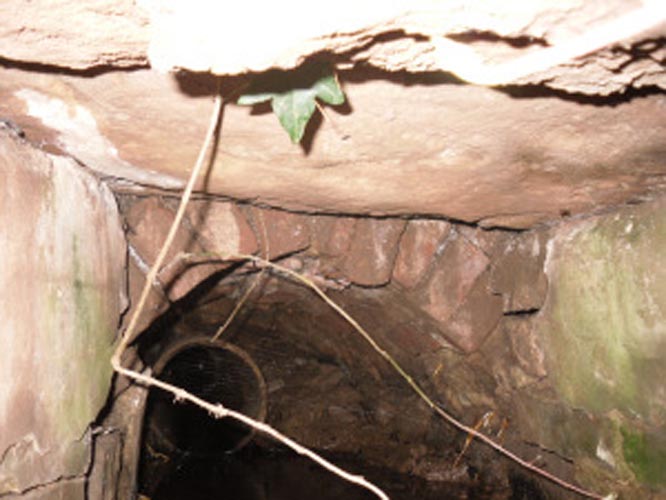
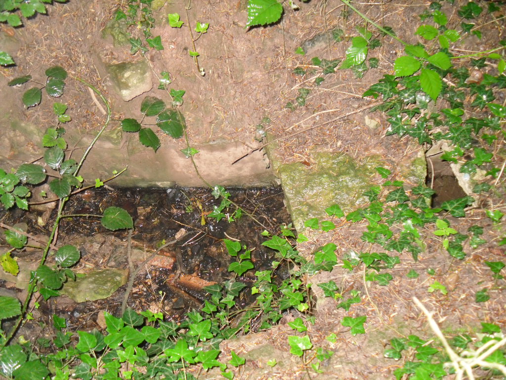
The precise whereabouts of this holy well—in the aptly-named Holywell Wood—is hard to pin down.  It was first recorded in the Dukery Records of 1232 as Holywell Dale and the woodland that owes its name to the site was recorded on the 19th Century Ordnance Survey maps (right).  Bob Morrell (1988) added the site to his survey of Nottinghamshire holy wells, but he was unable to locate it and its position remains elusive.  One account suggested that it marked the line of an ancient boundary—which would place it on the western side of the present woodland.  It’s alternative name, the Allenwell, may suggest a dedication to St. Helen.  I add the site here in the hope that a local antiquarian might be able to locate it.  Please let us know if you re-discover it!

References:

  1. Gover, J.E.B., Mawer, Allen & Stenton, F.M., The Place-Names of Nottinghamshire, Cambridge University Press 1940.
  2. Harte, Jeremy, English Holy Wells – 3 volumes, Heart of Albion press: Wymeswold 2008
  3. Morrell, Robert, Nottinghamshire Holy Wells and Springs, Nottingham 1988.

Acknowledgements:  Huge thanks for use of the Ordnance Survey map in this site profile, reproduced with the kind permission of the National Library of Scotland

© Paul BennettThe Northern Antiquarian

Prior’s Well, Worksop, Nottinghamshire

Holy Well (destroyed):  OS Grid Reference – SK 589 789

Also Known as:

  1. Prior Well

Archaeology & History

Once to be seen in the ancient landscape immediately northwest of Worksop Priory by the old Mill Pond, this sacred well has sadly been built over, but memory of it is still retained in Priorswell street-name and, previously, the Priorwell Brewery.  Not much has been written about it, but thankfully the historian John Holland (1826) gave us a short account, saying:

“There is a spring, now enclosed, called the “Priorwell,” and a meadow, of four acres, denominated from the same; and from which, it might be presumed, that the canons would draw their supplies of water, was it not for the convenient proximity of the river, which they must have had to ford for that purpose.  It was “formerly”, says Parkyns, in his Monastic and Baronial Remains, “celebrated for miraculous cures; but since monastic deceptions have unveiled themselves, votaries no longer offer, and consequently cures are no longer performed.”  This may have been the case: more recently the well has been resorted to by persons having sore eyes, in the cure of which, it is said to be efficacious, and has probably the common virtue of fresh cool spring-water.”

References:

  1. Holland, John, The History, Antiquities and Description of the Town and Parish of Worksop, J. Blackwell: Sheffield 1826.
  2. Parkyns, George I., Monastic and Baronial Remains – volume 1, Longmans Hurst: London 1816.
  3. White, Robert, Worksop, The Dukery and Sherwood Forest, Simpkin Marshall: London 1875.

© Paul BennettThe Northern Antiquarian

St. Mary’s Well, Wallingwells, Nottinghamshire

Holy Well:  OS Grid Reference – SK 572 840

Archaeology & History

Old photo of St Mary's Well

Old photo of St Mary’s Well

First mentioned in Pipe Rolls and referred to by the founder of Wallingwells Benedictine Priory (founded around 1150 CE) as ‘juxta fonts et rivum fontium’, the site Wallingwell or originally Waldon-by-the-Wells, may be significant.  The name refers to ‘bubbling wells’, but whether these wells were dedicated appears to be unknown, although it does seem likely.  Indeed, an anonymous article from the Worksop Guardian dated 1929 on the Wallingwell Estate, shows the well arising under a rough stone work arch beside the site of a lake.  Close by, appears to be a grotto of a similar construction. The article states that the grotto was built 250 years (from 1929 this suggests a date of 1679 which appears a little too early for this folly, a date in the 18th century being more likely). This was done by Thomas White using stone from petrified springs in Derbyshire. No reference is made of the well, but one assumes that it was built at the same time, but whether White was constructing a folly around an existing traditional site again is unknown.

Baker (2000) refers to the castle folly but fails to reference these sites suggesting that it had vanished. However, grotto and well still exist in the overgrown and forlorn garden to the back of the house.  The grotto is well-preserved, although signs of ruination are evident and the urn within has gone.

The internal brickwork

The internal brickwork

The overgrown well

The overgrown well

St. Mary’s Well is the most ruined. The archway appears to have fallen or been knocked down but the channel or basin the spring flows into still exists. Observation underneath a flattened stone covering the channel show that the spring flows from a pipe further up and under a series of neat brick arches. It is clear that the well structure was never accessible as it abutts onto the Lake, but was designed to be seen from the other side of the Lake. This view now is difficult due to the considerable plant growth obscuring the sites. It is good to see that the well still exists and hopefully the garden could be restored.

Extracted from R. B. Parish (2009) Holy Wells and Healing Springs of Nottinghamshire

Links:

  1. Holy & Healing Wells

© R.B. Parish, The Northern Antiquarian