Beinn na Cailleach, Broadford, Skye

Sacred Mountain:  OS Grid Reference – NG 601 232

Getting Here

Seems rather daft giving directions for a mountain, but… For incomers, cross the bridge onto the island and keep on the A87 road to Broadford.  A couple of mile the other side of the village westwards, take the small left turn in the trees and go to the dead-end.  The hill reaching up above you (west) is the legendary mountain to walk up!

Folklore

Beinn na Cailleach

This giant old mountain has been associated with the primal female creation figure, the cailleach, for many a moon. And strangely – for me anyway – I’ve not ventured to sleep with this old place in my passings here as I usually do wherever the cailleach resides.

It doubtless has many more tales than the one A.A. MacGregor (1937) mentions in his superb Peat-Fire Flame.  Here he tells the story of,

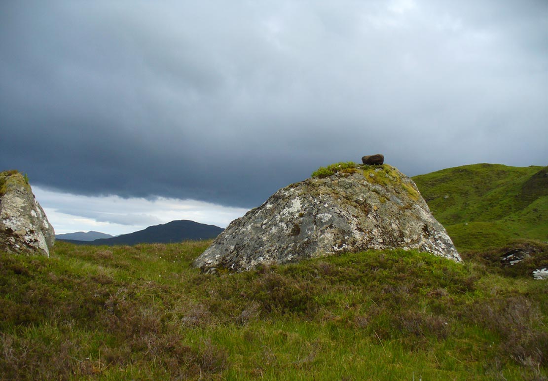
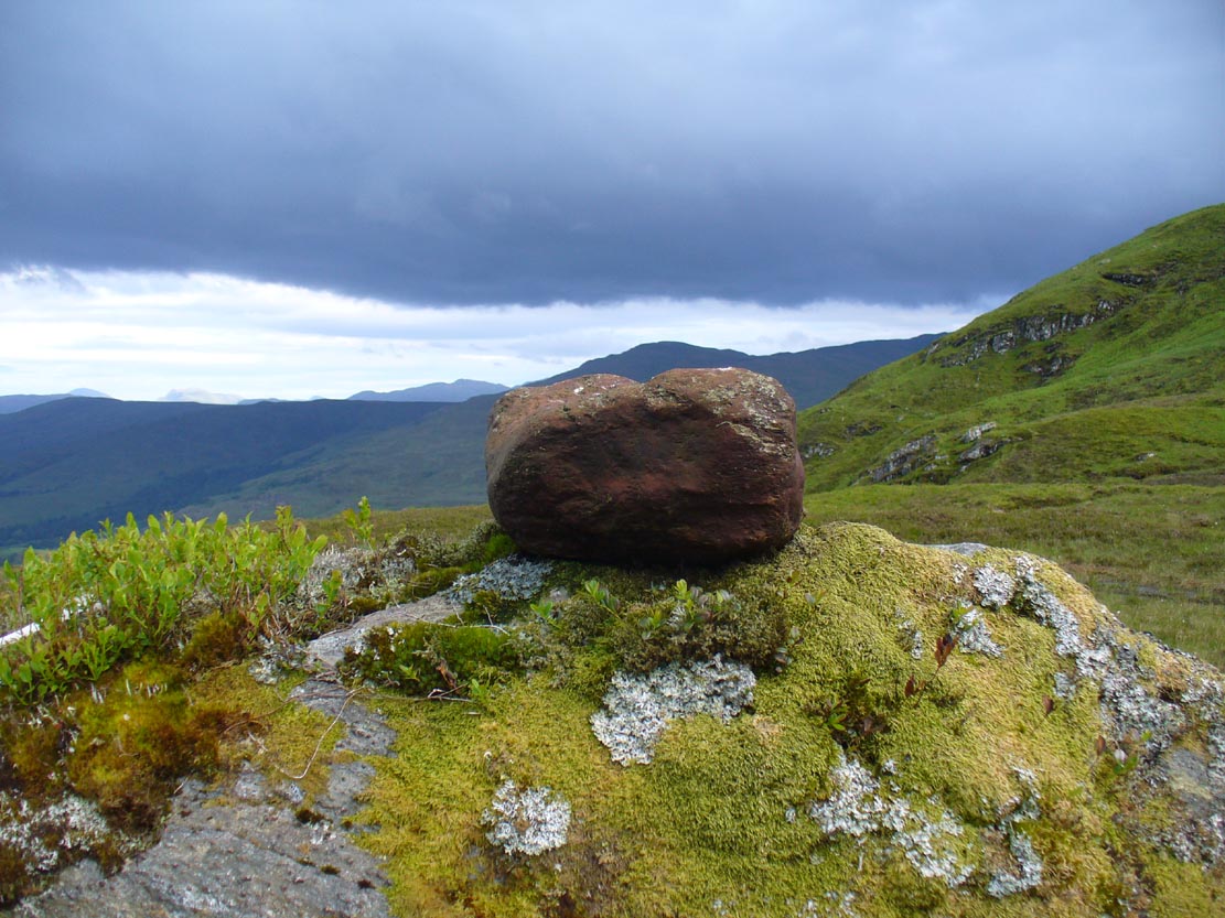
“the cairn situated on the summit of Beinn na Cailleach, not far from Broadford… This cairn is believed to mark the site of burial of a Norse princess who died at Ord. On her deathbed this princess commanded her attendants to convey her, when dead to the top of Beinn na Cailleach, and to bury her there, in order that she might lie in the wake of the winds from Norway.”

MacGregor then follows the tale with a lovely note on some boring old dood he obviously had little respect for, saying:

“It is the traditions associated with this cairn that MacCulloch, the geologist, in his Description of the Western Isles of Scotland, asks to be excused from repeating, since he considers them, one and all, to be unworthy of regard. But, then, MacCulloch was a most tiresome fellow; and he seems to have imbued most of his writings with something of the same tiresomeness”!

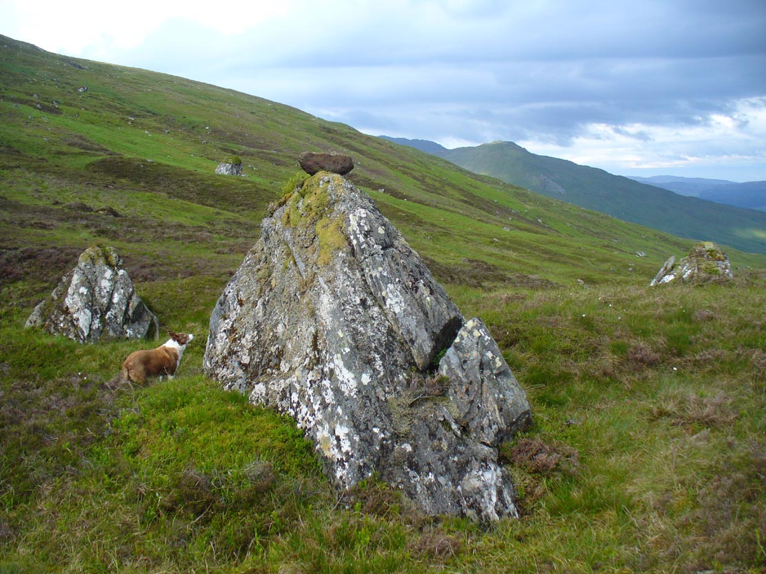
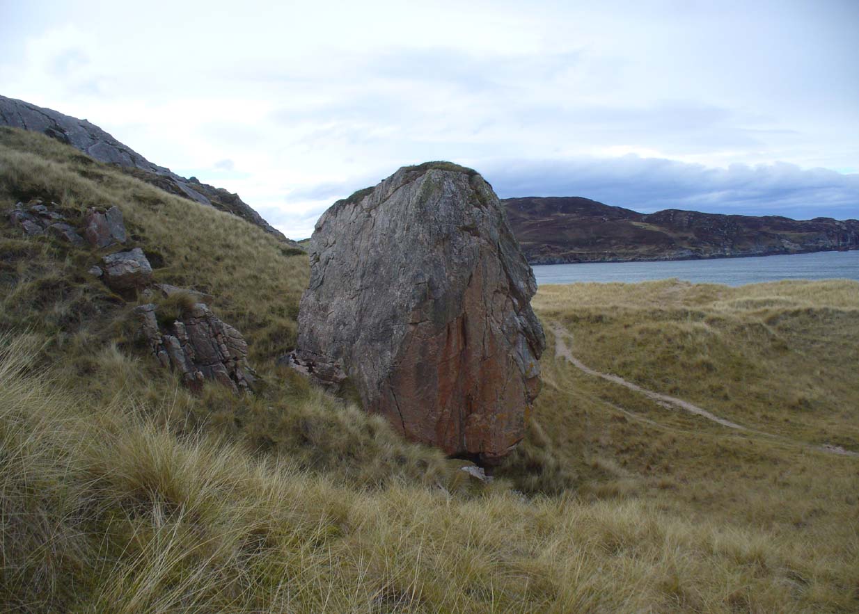
On the lower northeastern slopes of this great mountain we find another of the old woman’s abodes, the ‘Lochain Beinn na Cailleach’, where this great hag would no doubt wash her linen, as many old myths tell she did at other pools of the same name.

A slightly different version of the folktale was told by Archibald Geikie in his Note-book of a Field Geologist from 1858:

“The top of Beinn na Cailleaich is flat and smooth, surmounted in the centre by a cairn. Tradition tells that beneath these stones there rest the bones of the nurse of a Norwegian princess. She had accompanied her mistress to “the misty hills of Skye,” and eventually died there. But the love of home continued strong with her to the end, for it was her last request that she might be buried on the top of Beinn na Cailleaich, that the clear northern breezes, coming fresh from the land of her childhood, might blow over her grave.”

An early essay in the Gentleman’s Magazine in 1841 tells the grave atop of the mountain to have been the resting place of the Norwegian King Haco’s wife or his nurse. Derek Cooper (1970) meanwhile told us that whilst the cairn was “erected as a memorial to a Skye chieftain,” the cailleach of the mountain, or “the old woman is reputedly Saucy Mary, who laid a chain between Kyle and Kyleakin to exact toll from passing ships.”

There are other mythic place-names scattered around the edges of this mountain with hints of ancient female deities, or pagan goddesses — whichever way one cares to see them.

References:

  1. Cooper, Roy, Skye, Routledge: London 1970.
  2. Geikie, Archibald, The Story of a Boulder, MacMillan: London 1858.
  3. MacGregor, Alisdair Alpin, The Peat-Fire Flame: Folk-Tales and Traditions of the Highlands and Islands, Ettrick Press: Edinburgh 1937.
  4. o’ Crualaoich, Gearoid, The Book of the Cailleach, Cork University Press 2003.
  5. Swire, Otta F., Skye: The Island and its Legends, Blackie & Sons: London 1961.

© Paul BennettThe Northern Antiquarian


Stone of Mannan, Clackmannan, Clackmannanshire

Legendary Stone:  OD Grid Reference – NS 91114 91891

Also Known as:

  1. Canmore ID 48321
  2. Clackmannan Stone
  3. King Robert’s Stone

Getting Here

The Stone of Mannan

The Stone of Mannan

Take the A907 road between Alloa and Kincardine, and up the B910 into Clackmannan.  To get into the village, depending on which route you’re coming in, go up the Kirk Wynd or the Cattle Market—both of which lead you to the Main Street where, beneath the old clock tower, you’ll see the Market Cross and its companion erection just to the side. You can’t really miss it!

Archaeology & History

The phallic upright!

The phallic upright!

The history of this curious-looking giant phallic stone, sat quietly on the Main Street of sleepy Clackmannan village, isn’t as heathen as you’d expect when first seeing the huge upright—but there are mysteries and myths gathered about it.  The county of Clackmannan itself takes its name from this stone—but not the entire stone that we see today; merely the rounded, smaller element on top.  For it’s this that’s the real Mannan Stone. The rest of it, the tall upright pillar, was only attached to the smaller rounded stone—the Stone of Mannan— in the first-half of the 19th century.

First mentioned as a place-name in 12th century writings, the story of the stone was best told by Peter Miller (1889), who wrote:

“The old ‘clack’ or stone that forms the prefix to the name-word Clackmananmust be of considerable antiquity.  Its form and appearance have nothing to excite remark. The two larger portions of the stone are battened together with iron, and the portion forming the cleft appears to be detached from the larger one.  It is only the legend or tradition respecting its history and its association with the name-word Clackmanan that makes it interesting to the antiquary. Its dimensions are as follows: —It is over 3 feet in length, 2 in breadth, and about the same in thickness.  Its form is oval, and it has a deep cleft on its upper side.  The stone has nothing peculiar about it to indicate what it may have been originally, or the uses it was made to serve in early times.  There is no appearance of its ever having had an inscription or any ornamentation upon it.  It is simply a boulder-stone stone of whinstone, such as are found in abundance at the Abbey Craig near Cambuskenneth.  It was placed on the tall boulder slab on which it now stands, brought from the Abbey Craig in the year 1833 by the late Robert Bruce of Kennet, and the late Professor Fleming, who was then minister of the parish.  Previous to that time it lay on the ground alongside of the old jail and court-house of Clackmannan, close by the old cross of the town…”

Clackmannan Stone (after Miller)

Clackmannan Stone (after Miller)

The old stone & its upright

The old stone & its upright

Mr Miller then went on at some length to show the derivation of ‘Clackmannan’ to be from the old Irish, meaning “the stone of the monks.”  It seems a plausible theory too.  Despite this, Watson (1926) deemed it to be the ‘Stone of Manau’, being deemed vaguely as the people of the land north of the Forth.  The great Celtic scholar John Rhys (1888) declared Clackmannan to derive from the Irish deity or hero-figure, Manannan, as have other academic authorities since then.  But it’s all just a bit vague if we’re wanting ‘certainty’…

When T.C. Crouther (1936) wrote about this, he said how the Stone of Mannan had originally come from a position only a few hundred yards south of its present spot, at a place known as Lookabootye Brae  (NS 912 911), just above where the land begins to drop down closer to sea level.  This doesn’t seems too improbable.  Close to this spot could once be seen the sacred site of the Lady Well.

At the turn of the 21st century the stone was caged by the local council as it was beginning to crumble and was in danger of collapse; and so, the local council repaired the great upright and its sacred top-stone—albeit at the staggering cost of £160,000!!!  As the local people and other masons know to this day, the job could have been done for a fraction of that cost with equal efficiency.

Folklore

Said by T.C. Crouther (1936), the local council, and others to have got its name from the sea god Mannan, other legends have grown around this fascinating old rock.  When Edwin Adams (1863) wrote about it, these were the tales that local people gave him:

“Its legendary history is curious. When King Robert Bruce was residing in Clackmannan tower, and before there was a town attached to that regal mansion, he happened, in passing one day near this way on a journey, to stop awhile at the stone and, on going away, left his glove upon it.  Not discovering his loss till he had proceeded about half-a-mile towards the south, he desired his servant to go back to the clack (for King Robert seems to have usually spoken his native Carrick Gaelic), and bring his mannan, or glove. The servant said, ‘If ye’ll just look about ye here, I’ll be back wi’t directly,’ and accordingly soon returned with the missing article.

£From this trivial circumstance arose the name of the town which was subsequently reared about the stone, as also that of a farm at which the King stopped, about half-a-mile from the south, on the way to Kincardine, which took its name from what the servant said, namely, ‘Look about ye,’ and is so called to this day.”

But as the various dates in this tale simply don’t add up, it seems that the writer had been easily fooled.

References:

  1. Adams, Edwin, Geography Classified, Chapman Hall: London 1863.
  2. Drummond, James, Scottish Market-Crosses, Neill & Co.: Edinburgh 1861.
  3. Drummond, James,”Notice of Some Stone Crosses, with Especial Reference to the Market Crosses of Scotland,” in Proceedings Society of Antiquaries, Scotland, volume 4, 1862.
  4. Gordon, T Crouther, The History of Clackmannan, Civic Press: Glasgow 1936.
  5. Miller, Peter, “Notices of the Standing Stones of Alloa and Clackmannan,” in Proceedings of the Society of Antiquaries, Scotland, volume 23, 1889.
  6. Rhys, John, Lectures on the Origin and Growth of Religion as Illustrated by Celtic Heathendom, Williams & Norgate London 1888.
  7. Royal Commission on the Ancient & Historical Monuments, Scotland, Inventory of Monuments and Constructions in the Counties of Fife, Kinross and Clackmannan, HMSO: Edinburgh 1933.
  8. Royal Commission on the Ancient & Historical Monuments, Scotland, The Archaeological Sites and Monuments of Clackmannan District and Falkirk District, Society of Antiquaries of Scotland 1978.
  9. Simpkins, John Ewart, County Folklore – volume VII: Examples of Printed Folk-Lore Concerning Fife, with some Notes on Clackmannan and Kinross-Shires, Folk-Lore Society: London 1914.
  10. Small, John W., Scottish Market Crosses, Eneas Mackay: Stirling 1900.
  11. Watson, W.J., The History of the Celtic Place-names of Scotland, Edinburgh 1926.

Links:

  1. Nataraja’s Foot – Skullduggery

Acknowledgements:  Big thanks to author Marion Grace Woolley for use of her photo in this site profile. 🙂

© Paul BennettThe Northern Antiquarian


Witch’s Stane, Craigie, Ayrshire

Legendary Rock (destroyed):  OS Grid Reference – NS 4268 3231

Also Known as:

  1. Canmore ID 42851
  2. White Stane
  3. Witches’ Stone

Archaeology & History

It is difficult to assess the precise nature of this megalithic site, sadly destroyed some two hundred years ago.  The Royal Commission thinks it may have been a rocking stone, but the legend said of it indicates it to have been associated with a giant prehistoric cairn, although nothing remains nowadays.  The site was mentioned briefly in James Patterson’s (1863) huge work on the townships of Ayrshire, where he described the site as “standing upright” and “being in a field on Lodgehouse Farm,” near the village church.

“It stood on three stones, so high that a man could crawl under. It was blasted in 1819 to build houses.  The farmer’s wife, it is said, took some antipathy to it, and would not give her husband rest until he consented to have it removed.  A person of the name of Jamieson, and an assistant, were employed to blast it, which was accordingly done.  When broken up, it filled twenty-four carts.  Such was the feeling of sacrilege occasioned by the removal of the stone, that it was observed the farmer’s wife became blind, and continued so for eight years, when she died. Jamieson, who blasted it, never did well afterwards.  He drank and went to ruin.”

Serves them right!  Additional lore gained from a local lady in the 1870s has one of those all-too-familiar elements to it, speaking of something more substantive.

Folklore

When Archibald Adamson (1875) wrote his fine work on the history of Kilmarnock and district, folklore elements more typical of the Cailleach—whose legends abound in our more northern climes—seemed to have been attached to this missing site.  It is worth telling in full:

“After partaking of refreshments in the village inn, and indulging in a chat with the landlord, I retraced my steps to the highway, and in doing so got into conversation with an old lady who was very loquacious and well versed in the lore of the district. Amongst other things, she informed me that once on a time the church of Craigie had a narrow escape of being destroyed by a witch who had taken umbrage at it. It seems that the hag selected a large stone, and having placed it in her apron, flew with it in the direction of the building with the intention of dropping it upon its roof.  Her design, however, was frustrated by the breaking of her apron strings, for, upon nearing the object of her spleen, they gave way, and the stone fell with a crash that shook the earth. This accident seemingly so disheartened the carlin that she abandoned the destructive idea and allowed her burden to lie where it fell. The boulder lay in a field near the churchyard wall, and was known as “The White Stane.” It was long regarded with superstitious awe by many; but the farmer on whose ground it lay being of a practical turn of mind, looked upon  it with an eye to utility, and had it blasted for building purposes. Strange to relate, when broken up the debris filled twenty-five carts–a circumstance that would lead one to suppose that the witch must have been very muscular, and must have worn a very large apron.”

It is most likely that the witch in this legend originally set off from the Witch’s Knowe, more than 500 yards to the west of the church (and still untouched, despite the mess of the quarrying immediately adjacent).  Any further information on this missing site would be greatly appreciated.

References:

  1.  Adamson, Archibald S., Rambles round Kilmarnock, T. Stevenson: Kilmarnock 1875.
  2. Paterson, James, History of the Counties of Ayr and Wigton – volume 1, James Stillie: Edinburgh 1863.

© Paul BennettThe Northern Antiquarian


Kirk Stones, Morton Moor, West Yorkshire

Legendary Rocks (destroyed):  OS Grid Reference – SE 0886 4479

Archaeology & History

Kirk Stones on 1851 map

Kirk Stones on 1851 map

A place-name that is still recognised on modern Ordnance Survey maps, even though the original site giving rise to it was all but destroyed some one hundred-and-fifty years ago.  Derived from the old word kirk, meaning a church or sacred site, no christian remains of any kind have ever existed here and so we must presume an earlier, more heathen site of sanctity (an abundance of prehistoric petroglyphs exist very close by).  The singular reference detailing the nature of these Kirk Stones is in J.A. Busfield’s (1875) rare tract on the history of Upwood, in the parish of Bingley.  Upwood Hall was built by the Busfield family and, as the author tells,

“one of the most striking features in the vicinity at this age [c.1800, PB] was the fine range of magnificent rocks called Kirkstones, which had existed for countless ages. These grand rocks, towering one above another, extended along the whole southern boundary of the [Whetstone] Allotment on the left of the road to Ilkley, and were really a fine object, but alas!, through the ignorance or stupidity of the agent Colonel Bence, the “Crags of Kirkstone” were broken up and disposed of in the construction of the Bradford Water Works about the year 1854.”

Sadly we have neither illustrations nor other references to these fine sounding sentinels.
Undoubtedly the Kirkstones were a natural feature, despite their venerated title. It would have been their very appearance that gave rise to their revered title, as in the great and contorted rock masses seen at Brimham Rocks which, from Bensons’s description, these Kirk Stones seem reminiscent. The only piece of extant lore to these stones is that the uprights that went into making the recently destroyed Bradup stone circle a short distance south of here, came from this sacred outcrop.  It seems reasonable to assume that they played an important role in the magickal history of these hills when they were scattered with forest.

The Kirk Stones aligned along the equinox axis to the Black Knoll standing stone less than a mile [1.4km] due east.

References:

  1. Bennett, Paul, The Old Stones of Elmet, Capall Bann: Milverton 2001.
  2. Busfield, Johnson Atkinson, Fragments Relating to a History of Bingley Parish, Bradford 1875.
  3. Smith, A.H., English Place-Name Elements – Part 2, Cambridge University Press 1956.

© Paul BennettThe Northern Antiquarian


Gray Stone, Burley, Leeds, West Yorkshire

Legendary Rock:  OS Grid Reference – SE 28659 34229

Also Known as:

  1. Giant’s Stone

Getting Here

Originally located at SE 28449 34364, the site is now to be found halfway along Westfield Road, where it meets up with Hollis Place, along the footpath at the back of the school, set back against the walling.  A plaque by the rock kinda gives the game away!

Archaeology & History

Gray Stone on 1852 map

Gray Stone on 1852 map

The large vandalised stone you see here—sprayed-painted quite eloquently it has to be said!—is apparently a replica of the old stone which could once be found about 300 yards northwest of here.  Typifying stones of this name—graygrey and variants thereof—the original Gray Stone was an old boundary marker (Smith 1956), and the last reference to it as an archaeological site was by James Wardell (1853), who even in his day said that it was “almost buried in the ground, on the Burley Road.” It is shown on the first OS-map by the roadside, close to the junction of Woodside View and Burley Road, but was said to have been removed at the beginning of the 20th century and moved to its new and present position.  However, somewhere along the line, the original stone has been destroyed and the thing that we see today has taken its place.

The original Gray Stone may have been a standing stone, but we cannot be certain about this.  The present boulder stands about four feet tall and is a rather fat-looking standing stone. You can just about squeeze round the back of it, around which is an incised line which cuts around the stone – but this obviously quite modern. A plaque stands in front of the stone, telling its brief history.  (if anyone can send us some photos of the site that would be great – I’ve gone and lost mine, somehow!)

Folklore

A creation myth of this site tells it to have been made by a giant, who threw the Gray Stone from the appropriately named Giant’s Hill (a supposed old camp, now destroyed), less than a mile southeast of here: an alignment which corresponds closely to the midsummer sunrise. In throwing it, he was said to have left the indentations of his finger-marks in the rock – thought to have been cup-markings.  Examples of other cup-and-ring stones occur a short distance west, at Kirkstall.

References:

  1. Bennett, Paul, The Old Stones of Elmet, Capall Bann: Milverton 2001.
  2. Smith, A.H., English Place-Name Elements – 2 volumes, Cambridge University Press 1956.
  3. Wardell, James, The Antiquities of the Borough of Leeds, John Russell Smith: London 1853.

© Paul BennettThe Northern Antiquarian


Clach na Foinne, Glen Lochay, Perthshire

Legendary Stone:  OS Grid Reference – NN 50 38

Also Known as:

  1. Clach an Dlogh
  2. Wart Stone

Archaeology & History

Wart Stone, looking south

There is no written history of this site; only the quiet murmurings of a few locals whose families go back to when the English came and destroyed the people and their lives in the 18th and 19th century in the ethnic cleansing we known as The Clearances.  As with the Darach nan Sith (the Oak of the Fairies) a few miles away, the local traditions were lost, and ancient monuments destroyed.  Thankfully, due to the remote location of this site, its status remains….

It is found 2000 feet up, near an old derelict village (english academic romancers term it as ‘sheilings’).  An ancient track and stone bridge runs over the burn nearby, place-names evidence tells of a prehistoric tomb a few hundred yards west, and there’s a dispersal of forgotten human evidences scattering the south-side of the mountain all along here.  The clach (stone) sits on the very top of a large earthfast rock; is an elongated loaf-sized smooth red-coloured stone, about 14 inches long and 8 inches wide, and of a different type and much heavier than the local rock hereby.  It is said to have been a healing stone, used in earlier times to cure warts and other ailments.

Folklore

The Wart Stone itself

My first venture here was, like many in this area, amidst a dreaming.  Those who amble the hills properly, know what I mean.  I cut across the mountain slopes diagonally, zigzagging as usual, always off-path, resting by mossy stones and drinking the waters here and there.  My nose took me to the mass of giant rocks hedging into the higher regions of Allt Ghaordaidh: a pass betwixt the rounded giants of Meall Ghoaordie and Meall Cnap Laraich, where only eagles and Taoist romancers might roam.

The great rock comes upon you pretty easily.  Approaching it for the first time I wondered whether there might be petroglyphs on or around it, but the rich depth of lichens and its curious crowning elongated stone stopped any further thought on the matter.  The setting, the eagles, the colour of day and the fast waters close by, stole all such thoughts away.  In truth I must have walked back and forth and near-slept below the place for an hour or two before I gave way to rational focus!  And then my  curiosity got even more curious.

“This must be the place,” I mused, several times.

As you can see in the photo, a large natural earthfast boulder, six feet high or more, like a giant Badger Stone covered in centuries of primal lichens, has a large deep red-coloured stone on its very crown.  The stone is unlike any of the local rock and is very heavy.  I found this out when trying to prize it from its rocky mount, dislodging it slightly from the seeming aeons of vegetation that held it there.  But the moment I moved it, just an inch or so above its parent boulder, a quiet voice inside me rose sharply into focus.

“You shouldn’t have done that!”

The Wart Stone. looking east

Quickly I set it back into place, shaking my head at what I’d done.  One of those curious feelings you get at these places sometimes wouldn’t leave me, however much I tried to shake it off.  …Silly though it may sound, the echoes inside kept saying over and over to me, “you’re gonna get warts now you’ve done that!” Logically, of course, that made no sense whatsoever.  I’d only ever had one wart in my life, a couple of decades ago.  And yet, a few days later, one of the little blighters emerged on my finger!  So there was only one thing for it!  If this was a Wart Stone, I should revisit it again and place my afflicted finger back onto the wart and ask it to be taken back into the stone.

A week or so later, I clambered all the way up the mountainside again and asked the place to forgive my stupidity and take back the wart.  Apologising to the spirit of the stone, I rubbed my finger on the curious coloured rock and, I have to be honest, didn’t know what to expect.

I spent the next few hours meandering here and there over the hills and cast the thought of the Wart Stone back into my unconscious.  But a few days later it had started shrinking – and within a week, had completely gone!  This faint relic of an older culture, this Clach na Foinne had performed its old ways again, as in animistic ages past…

© Paul BennettThe Northern Antiquarian 


An Sithean, Lawers, Kenmore, Perthshire

Legendary Hill:  OS Grid Reference – NN 6806 3976

Getting Here

An Sithean on 1862 OS-map

Take the A827 road on the north-side of Loch Tay between Killin and Kenmore, and roughly halfway along you’ll find the tiny hamlet of Lawers.  Go down into the hamlet itself and, amidst the remains of the old trees where now are houses, nestled on a rise in the land with burns (streams) on either side, remains of the fairy mound of An Sithean still lives…

Folklore

Remnants of the legends of little people are legion in the Scottish mountains.  Sadly, many of them died when the English arrived and culled the population in ‘The Clearances’ of the 19th century – none moreso than in the area surrounding Loch Tay.  But thankfully, in the latter-half of the 19th century, a local man called James MacDiarmid (1910), took it upon himself to write down many of the old stories told by the remaining locals – as well as narrate those he remembered as a boy, as told by the elders around him.  Whilst tales of ‘fairies’ and other such creatures are thought by city-minds to be little other than fantasies, mountain-folk cosmologies differ greatly to those who are disconnected from the natural world.  Genius loci abound, and animism is the basic plinth integral to communities in the hills, where the world is much much more real.  This is one such tale…

“Not many years ago there lived in the neighbourhood of Killin a man who was in the habit of recounting his wonderful adventures with the white horse of the fairies.  When coming home one night from Kenmore market, and just as he was passing Sithean, Lawers, he heard most enchanting music proceeding from the knoll.  Unable to resist the temptation, he gradually went nearer and nearer the fairies’ place of abode, till at last he was fairly among them.  They received him most kindly, and on parting gave him one of their white horses to carry him home.  His steed went through the air at a speed almost equalling that of lightning, and in a few minutes he found himself above a house at Clifton, Tyndrum, some twenty-five miles westward from Lawers.  Happening to shout “ho!” when he was right above the chimney, the fairy horse threw him off its back, and down he dropped feet foremost through the wide, old-fashioned chimney, and alighted in the midst of a wedding party, much to their surprise and alarm. He continued in their pleasant company till daylight, when he returned home at his leisure, thanking the fairies for the pleasure they had so unexpectedly given him!”

Usually, tales such as this relate to the existence of prehistoric cairns or tumuli (burial sites), but no such archaeological remains have ever been known to live here.  Equally curious is how the man in this tale wasn’t kept in the timeless realms, beloved of faerie-land, where reveries with them would take decades from a man’s life, even though it only felt like one night.  This would imply

I’ve come across old locals who still speak, not just of the little-folk, but of other hauntings in this beautiful part of Loch Tay.  May the land not be cursed by the fools who put their idea of ‘development’ in front of the genius loci here; lest madness and ill-fortune will prevail…

References:

  1. MacDiarmid, James, “More Fragments of Breadalbane Folklore,” in Transactions of the Gaelic Society Inverness, volume 26, 1910.

© Paul Bennett, The Northern Antiquarian


Ringstone, Torrisdale Bay, Farr, Sutherland

Legendary Rock:  OS Grid Reference – NC 69128 61741

Getting Here

The Ringstone, Torrisdale Bay

Along the A836 road between Tongue and Bettyhill, turn down towards Skerray at Borgie Bridge for 1.8 miles (2.87km) until you reach the little information sign at the roadside. Walk downhill and cross the little bridge and wander onto the west side of the beach.  You’re likely to end up daydreaming… so once you’ve re-focussed, head into the middle of the beach and walk up the steep-ish sand-banks to your right (south).  Once at the top, you’ll see a gigantic rock—the Ringstone—nearly as big as a house.

Folklore

This gigantic boulder is part of one of Sutherland’s archaic Creation Myths as they’re known: ancient stories recounted by archaic societies about the nature and origins of the world.  Such tales tend to be peopled by giants, gods, huge supernatural creatures, borne of chaos, eggs, darkness and primal oceans.  Thankfully we still find some examples of these tales in the northern and northwestern mountainous regions of Britain, as the Church and Industrialism never quite destroyed the hardcore communities—despite what they might like to tell you…

The face of the Ringstone
The Ringstone, gazing east

The following folktale was written by the local headmaster, Alan Temperley (1977), who wrote down many of the oral traditions in Scotland’s far north before they disappeared forever from the tongues of local people (as is sadly happening in these mountains) as they’re slowly, sadly, being erased by the influx of incomers with no connection nor sincere love of old tales and ways.  It is typical of stories found other large geological formations from aboriginal Australia, to Skye, to everywhere on Earth where people have settled.  Mr Temperley wrote:

“Many years ago there were two giants, the Naver giant from the river at Bettyhill, and the Aird giant from the hill above Skerray.  Normally they got on quite well, but one afternoon they became involved in a heated argument about some sheep and cattle, and both grew very angry.  The Aird giant was standing on top of the hill above Torrisdale bay with the animals grazing around him, and the Naver giant stormed across the river to the beach below.

“Those are my sheep,” he roared up the hill.

“No they’re not,” the Aird giant said. “At least not all of them.”

“You stole them. You’re a thief!”

“No I didn’t. They came up here themselves. Anyway, you owe me fifty sheep from last year.”

“You’re not only as thief, you’re a liar!” shouted the Naver giant.  If you don’t send them down this minute, I’ll come up and see to it myself.”

At this the Aird giant gave a disparaging laugh and made a rude face, and picking up a great boulder flung it down the hill at his friend.

The Naver giant was speechless with fury, and picking the stone up himself, hurled it back up the hillside, making a great hole in the ground.

The Aird giant saw things had gone far enough.

“I’ll send them back if you give me that silver ring you’re always wearing,” he said.

“Never!” roared his friend, his face all red and angry.

“Suit yourself then,” said the Aird giant, and picking the stone up again he tossed it back down the hill.

For long enough the rock kept flying between them, and in time the giant from Naver grew tired, because he was throwing it uphill all the time.

“Will you give me the ring now?” said the Aird giant.

For answer the Naver giant tried one more time to throw the stone up the hill, but it only got halfway, and rolled back down to the shore.

“Come on,” said the giant from Aird, for he wanted to be friends again. “Give me the ring, and I’ll let you have it back later.”

“No!” said the Naver giant from the bottom of the hill.  “I’ll never give it to you!” His eyes began to fill with tears.

“Oh, come on, please!” coaxed the Aird giant. “Just for a week.”

“Never, never, never!” shouted the giant from Naver, and pulling the ring from his finger he threw it on the ground and jammed the great boulder down on top of it.  Then he sat down on top of the stone and stared out to sea.  Every so often he sniffed, and his friend, looking down at his broad back, saw him lift the back of a hand to his eyes.

They never made friends again, and after a long time they both died.

The ring is still buried under the stone, and so far nobody has ever been able to shift it.”

The giant’s face, in profile

When I got back from visiting this immense rock a few weeks ago, a local lady Donna Murray asked me if I’d seen the face of the giant in the rock.  I hadn’t—as I was looking to see if the name ‘Ringstone’ related to any possible cup-and-rings on its surface, which it didn’t (although I didn’t clamber onto the top).  But in the many photos I took from all angles, Donna pointed out the blatant simulacra of the giant’s face when looking at it from the east.

However, on top of the slope above the Ringstone (not the Aird side), I did find a faint but distinct ‘Ringstone’ carving (without a central cupmark).  Whether this ever had any mythic relationship to the tale or the stone, we might never know.  The rocky terrain above Aird now needs to be looked at…

References:

  1. Eliade, Mircea, Patterns in Comparative Religion, Sheed & Ward: London 1958.
  2. Long, Charles H., “Cosmogony,” in Eliade, M., Encyclopedia of Religion – volume 4, MacMillan: New York 1987.
  3. MacLagan, David, Creation Myths: Man’s Introduction to the World, Thames & Hudson: London 1977.
  4. Temperley, Alan, Tales of the North Coast, Research Publishing Company: London 1977.

Acknowledgments:  Massive thanks again to Donna Murray, for her help and for putting up with me amidst my wanderings up in Torrisdale and district.

© Paul BennettThe Northern Antiquarian 2017

Clach na Ba, St Fillans, Comrie, Perthshire

Legendary Rock:  OS Grid Reference – NN 70318 24159

Clach na Ba, from roadside

Also Known as:

  1. Stone of the Cattle

Getting Here

Along the A85 road at the east-end of Lochearnhead, head out of the village east towards Comrie. Just above the main-road, maybe 50 yards after passing the small road to St Fillan’s Golf Club, on the north side of the road you’ll see a huge boulder resting in the edge of the garden of the large detached house that was known as The Oaks.  That’s the fella!

Archaeology & History

Clach na Ba, from the rear

Almost fallen out of history, oral tradition has thankfully kept the name and brief history of this huge boulder alive.  Found in association with the prehistoric standing stones just yards away, the Clach na Ba lives beside the ancient drover’s road (and probable prehistoric route before that) just yards east of the old cottage known as Casetta.  This occupies a site where an old toll-house stood, and the drovers would have to stop and pay a toll before continuing onwards past the Clach na Ba, or Stone of the Cattle.

Folklore

When the drovers passed their highland cattle here, the animals rubbed themselves against the stone to ensure good health and fertility (as well as just having a good scratch, no doubt).

References:

  1. Porteous, Alexander, Annals of St Fillans, David Philips: Crieff 1912.

Acknowledgements:  With huge thanks to Nina Harris and Paul Hornby for the day out and for use of their photos in this site-profile; and to the lovely couple (we didn’t get their names – soz) who live in the house behind the Clach na Ba, for their help with the fascinating local history .

© Paul Bennett, The Northern Antiquarian


The Maypole Tree, Little Paxton, Huntingdonshire

Maypole & Ritual Tree (destroyed):  OS Grid Reference TL 18831 62757

Getting Here

Imposing trunk of The Maypole Tree, right background

The road layout of the village has changed since the destruction of the Tree, but its approximate position was on the north side of the present High Street, at the junction with the east side of St James’ Road.

Archaeology & History

The Little Paxton Maypole Tree was a very late survival of a tradition where Mayday revellers danced around an actual tree rather than a symbolic tree in the form of a maypole.  It was described as “a tall straight elm tree” that stood in front of what was then the village Post Office, and from what may be the only surviving photograph, it appears that only the very substantial trunk survived of what was clearly a very old tree.

The 1887 6" OS Map, showing the Maypole Tree outlined in red
1887 6″ OS Map, showing the Maypole Tree outlined in red

A Miss Ethel Ladds, who had been born in Little Paxton, recalled in the early 1940s:

I remember the old tree very well, it was always called ‘the Maypole’, but I don’t know any more about it, except that they used to dance round it“.

The St Neots Advertiser recorded that the Maypole Tree was blown down in a great gale on 24th March 1895.

Folklore

While this writer has been unable to find direct folklore relating to the Little Paxton Maypole Tree, it may be worth remarking that botanically the Elm tree is a cousin of the Stinging Nettle, the Hop and Cannabis.  Another Elm Tree used for May revels was the Tubney Elm, near Fyfield in Berkshire and recorded by Matthew Arnold, in his ‘Scholar Gipsy’.

References:

  1. C.F. Tebbutt, “Huntingdonshire Folk And Their Folklore”, in Transactions of the Cambridgeshire & Huntingdonshire Archaeological Society, Volume VI, Part V, 1942
  2. C.F. Tebbutt, “Huntingdonshire Folk And Their Folklore”, in Transactions of the Cambridgeshire & Huntingdonshire Archaeological Society, Volume VII, Part III, 1950
  3. Gerald Wilkinson, Epitaph For The Elm, Arrow Books, London, 1979

© Paul T. Hornby 2016 The Northern Antiquarian