Cup-and-Ring Stone: OS Grid Reference – NN 58727 24527
Getting Here
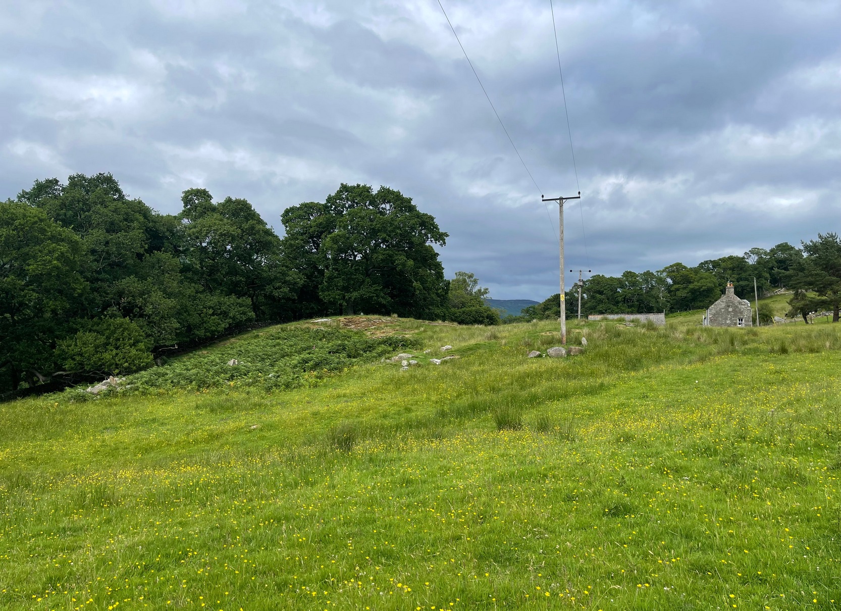
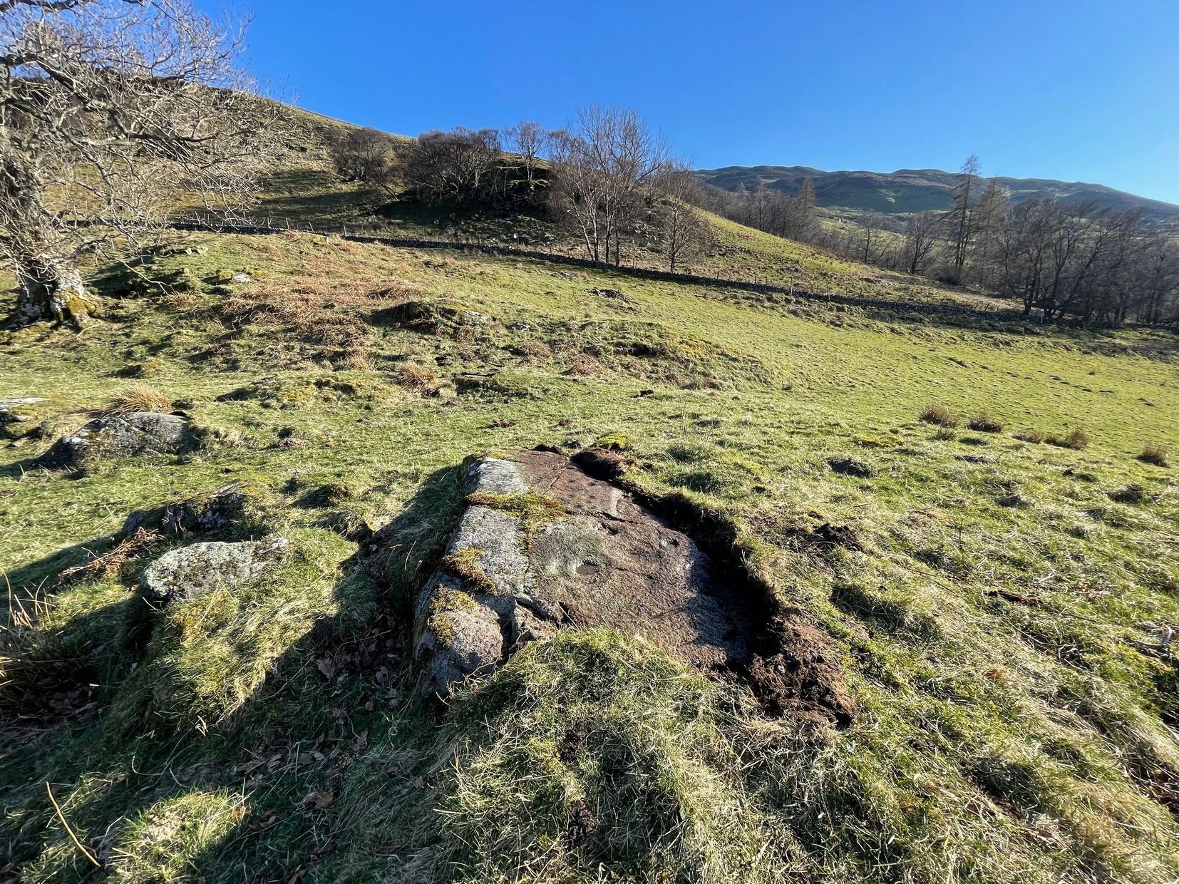
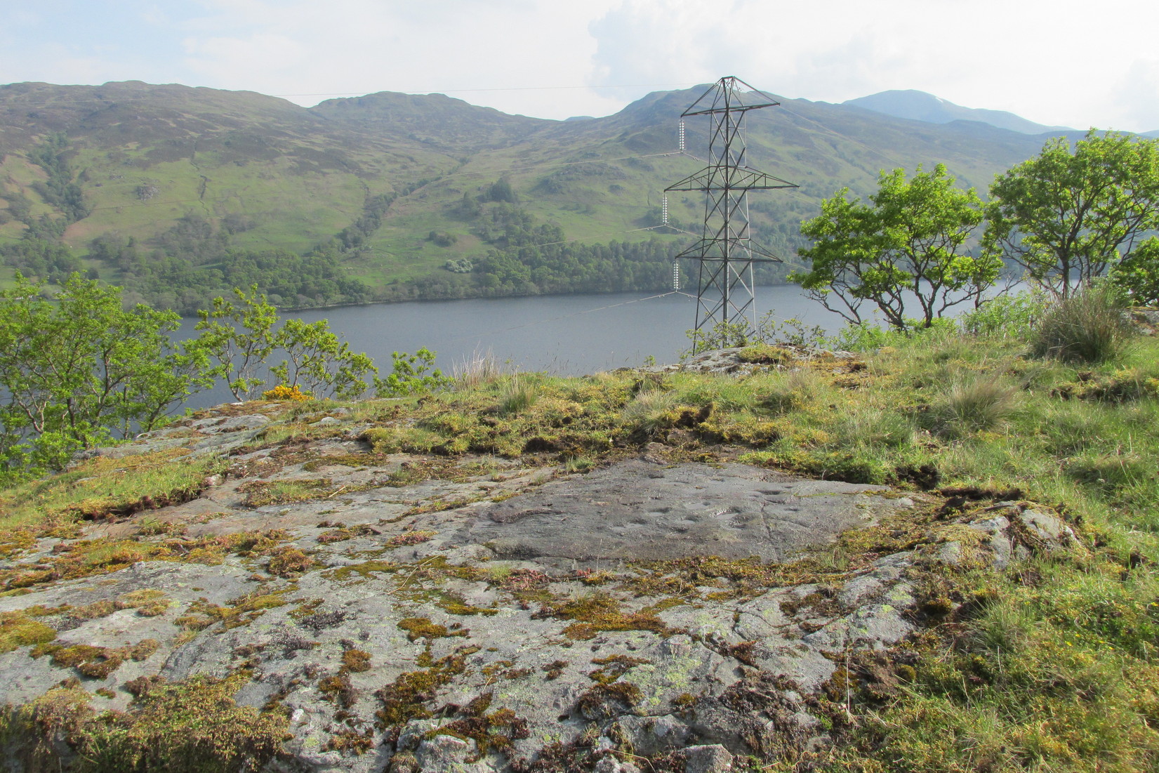
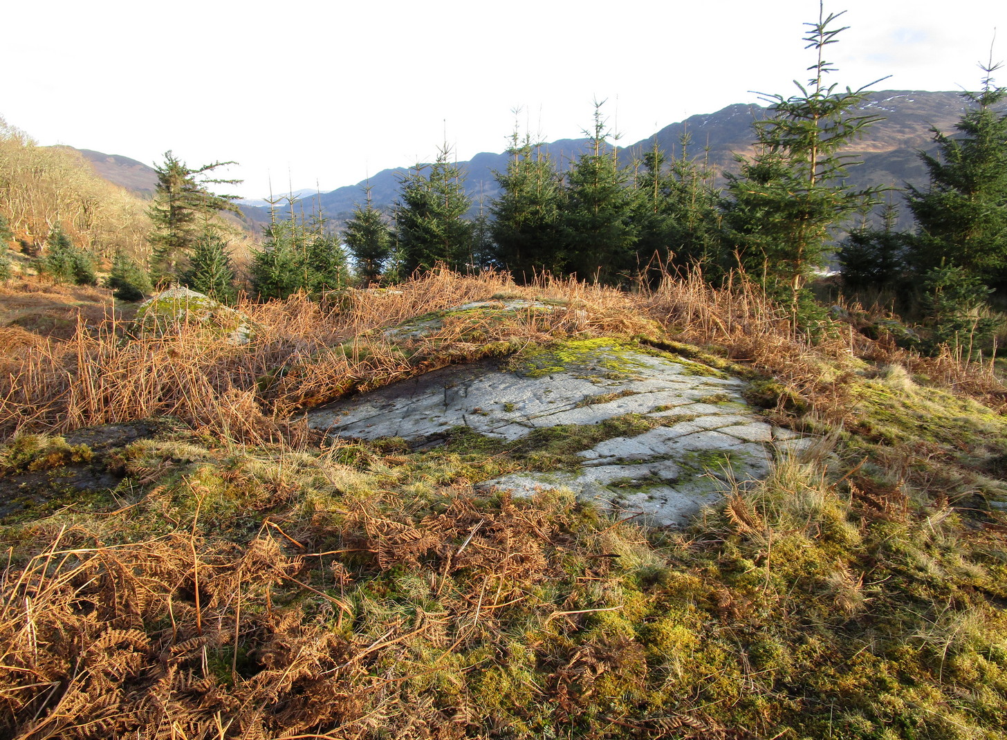
In Lochearnhead village start walking up the Glen Ogle road and, just past the last house on the right, a dirt-track bends down to an old building. Just before the building, keep your eyes peeled for the small footpath that runs down to the river. Walk along here and cross the river-bridge, then bear diagonally to your left and walk up the singular footpath. It snakes through the trees for a few hundred yards then opens out into a field. About 75 yards along the path in the field the land levels out. From here, walk through the grasses to your right about 20 yards. Zigzag about – you’ll find it.
Archaeology & History
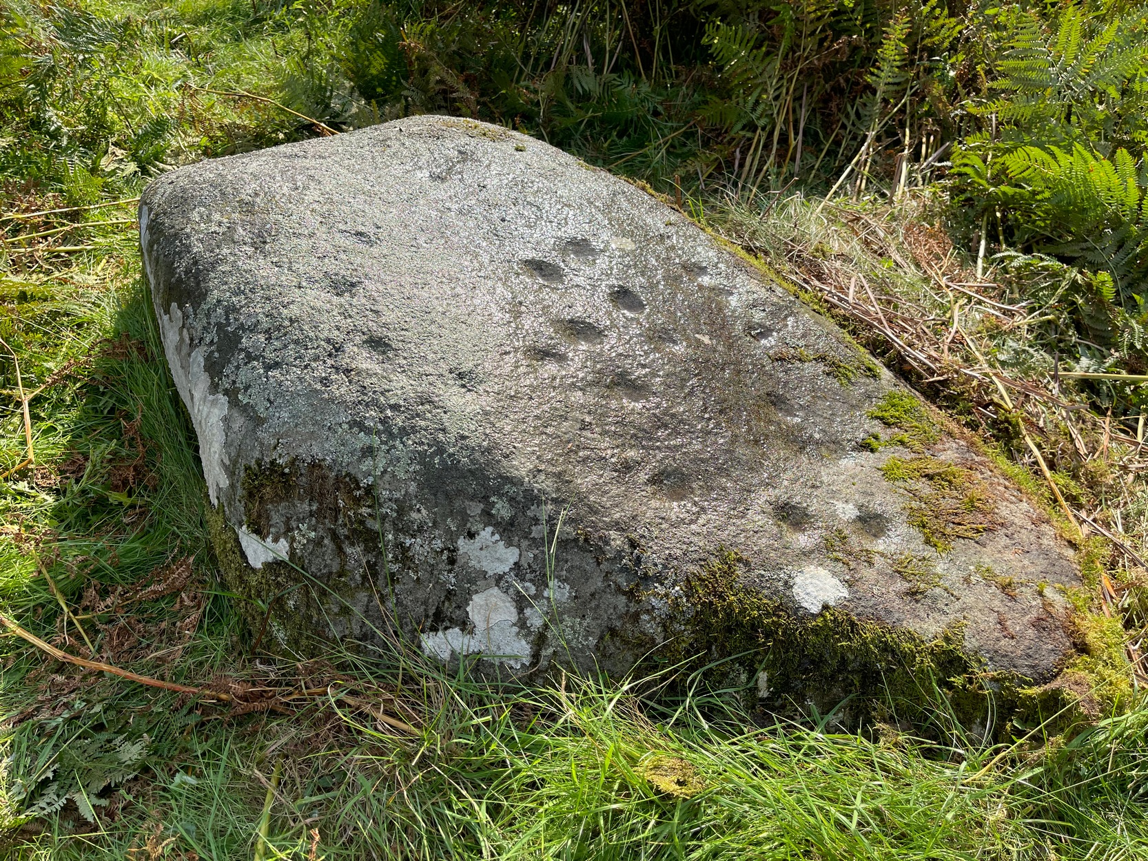
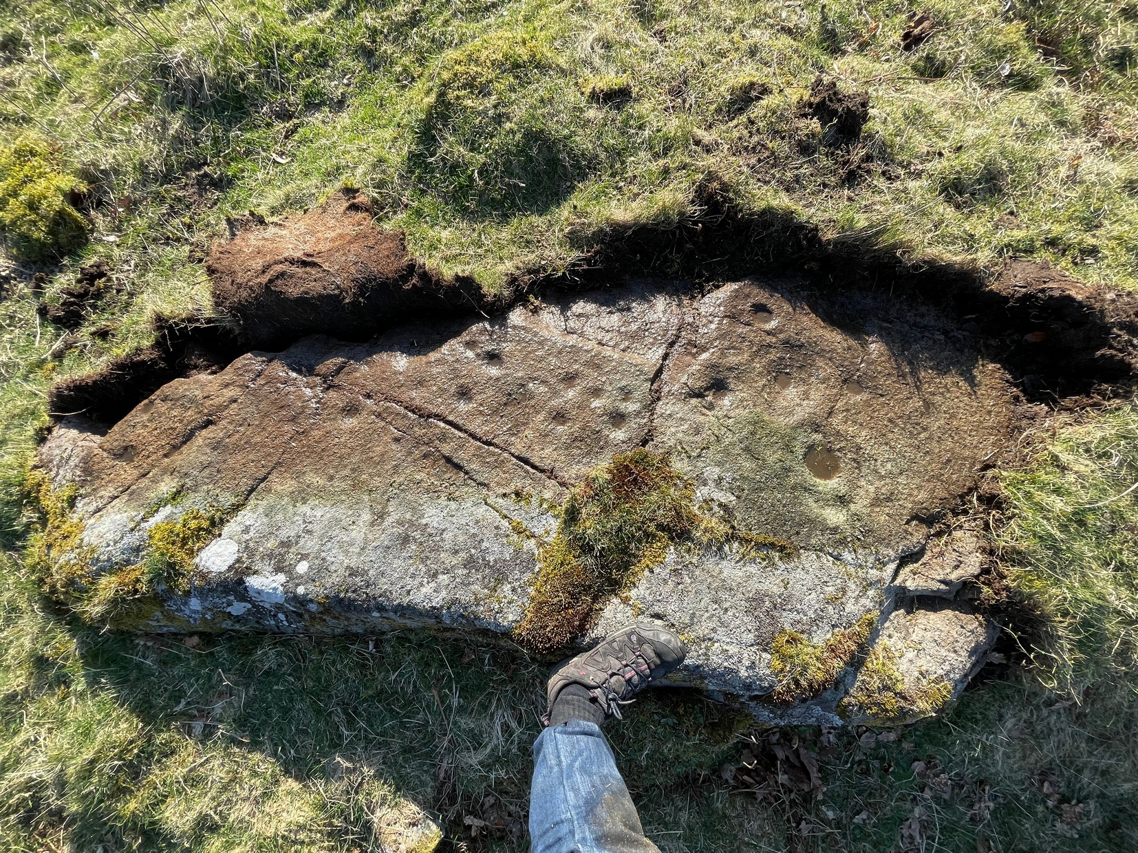
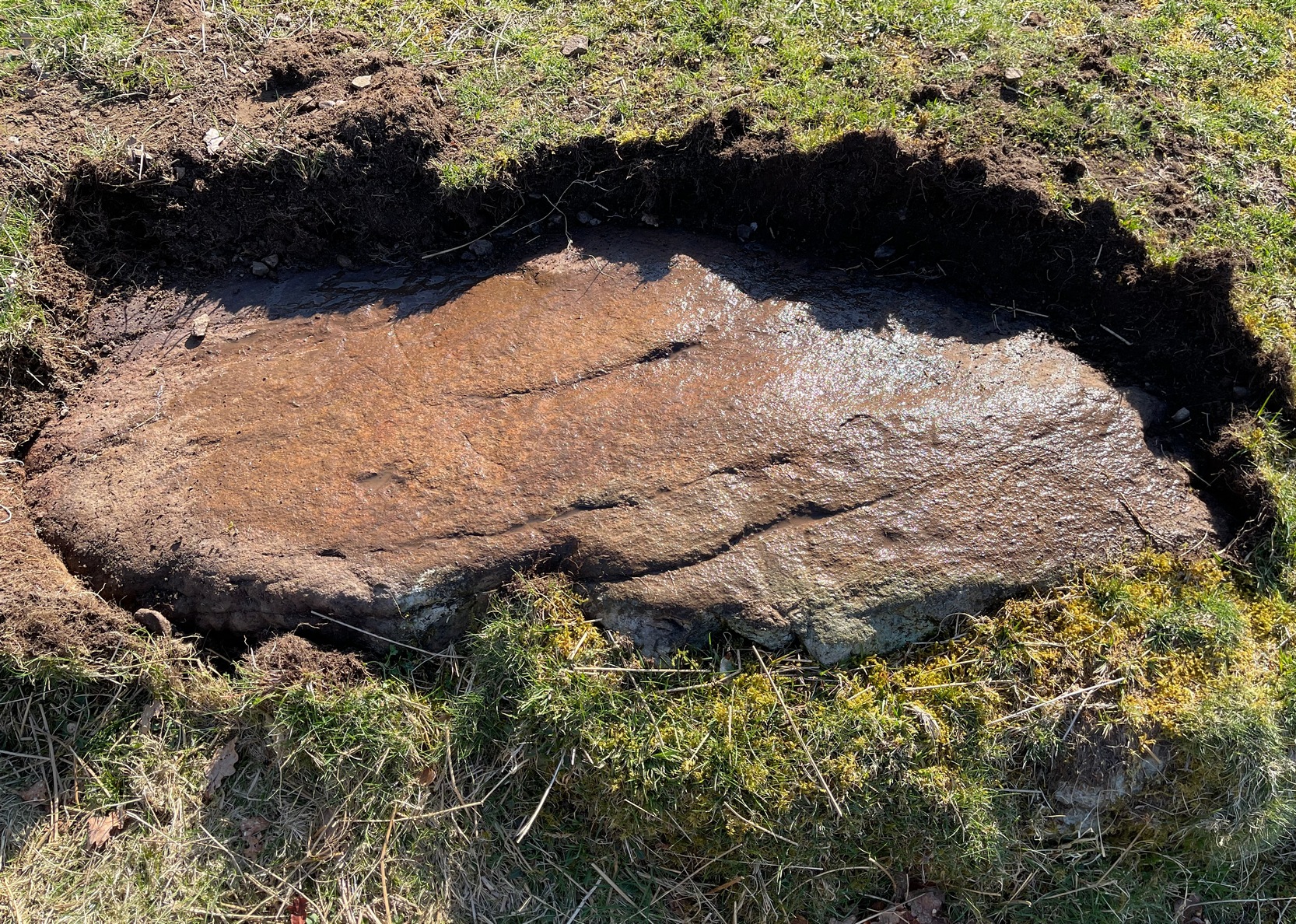
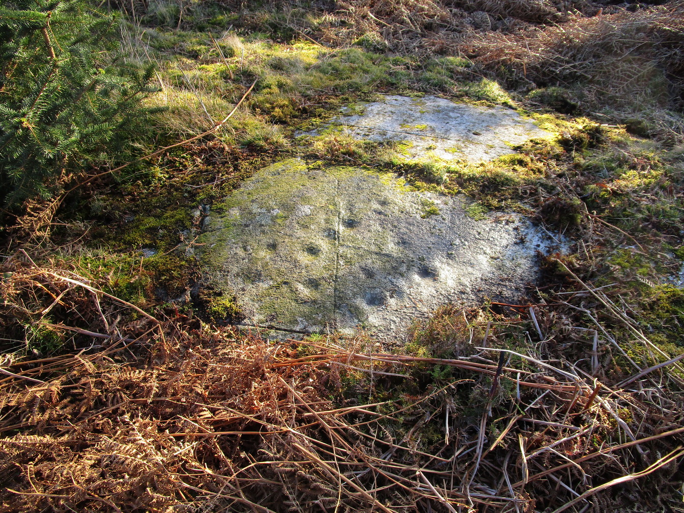
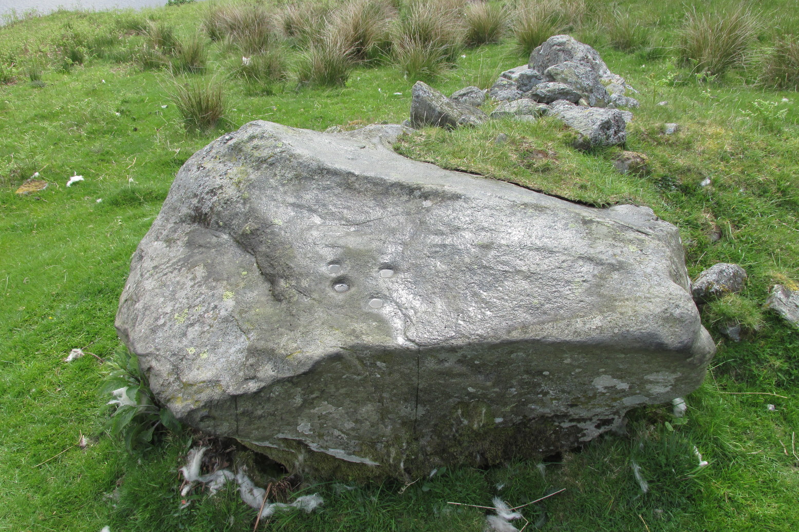
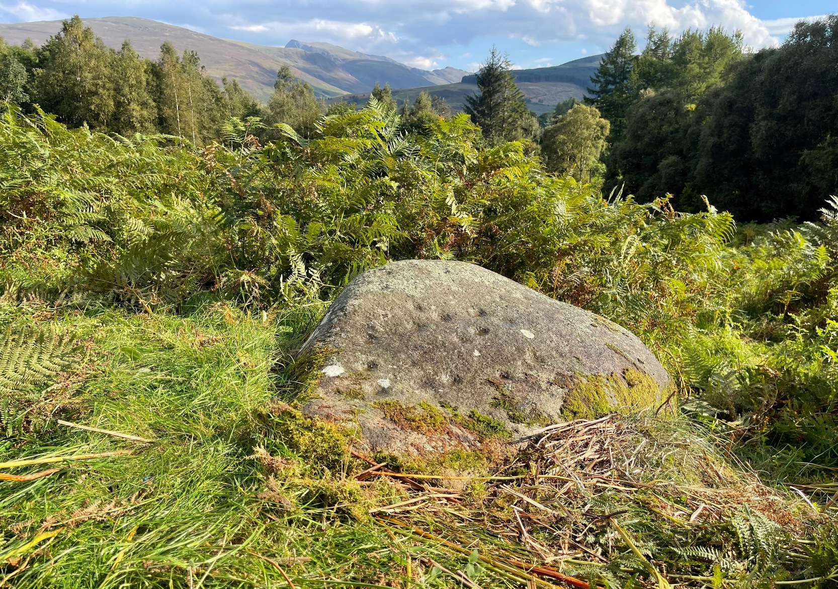
The setting of this carving is, like many of Perthshire’s petroglyphs, quite beautiful. It was made when the ‘artist’ carving the stone was crouched or sat on the ground, gazing at the southern landscape and heights around Ben Vorlich, whose mythic nature may have been part of the design.
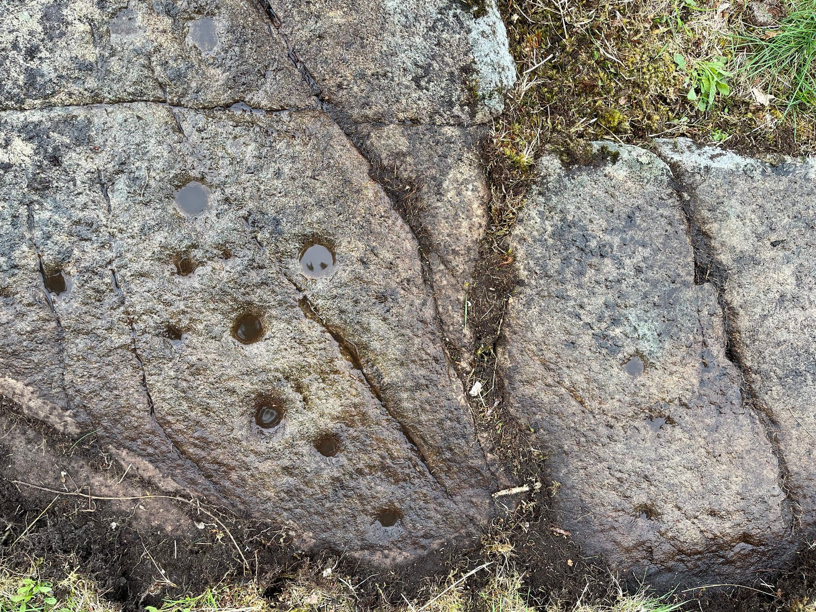
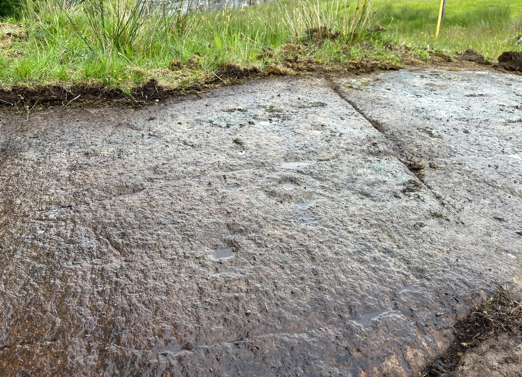
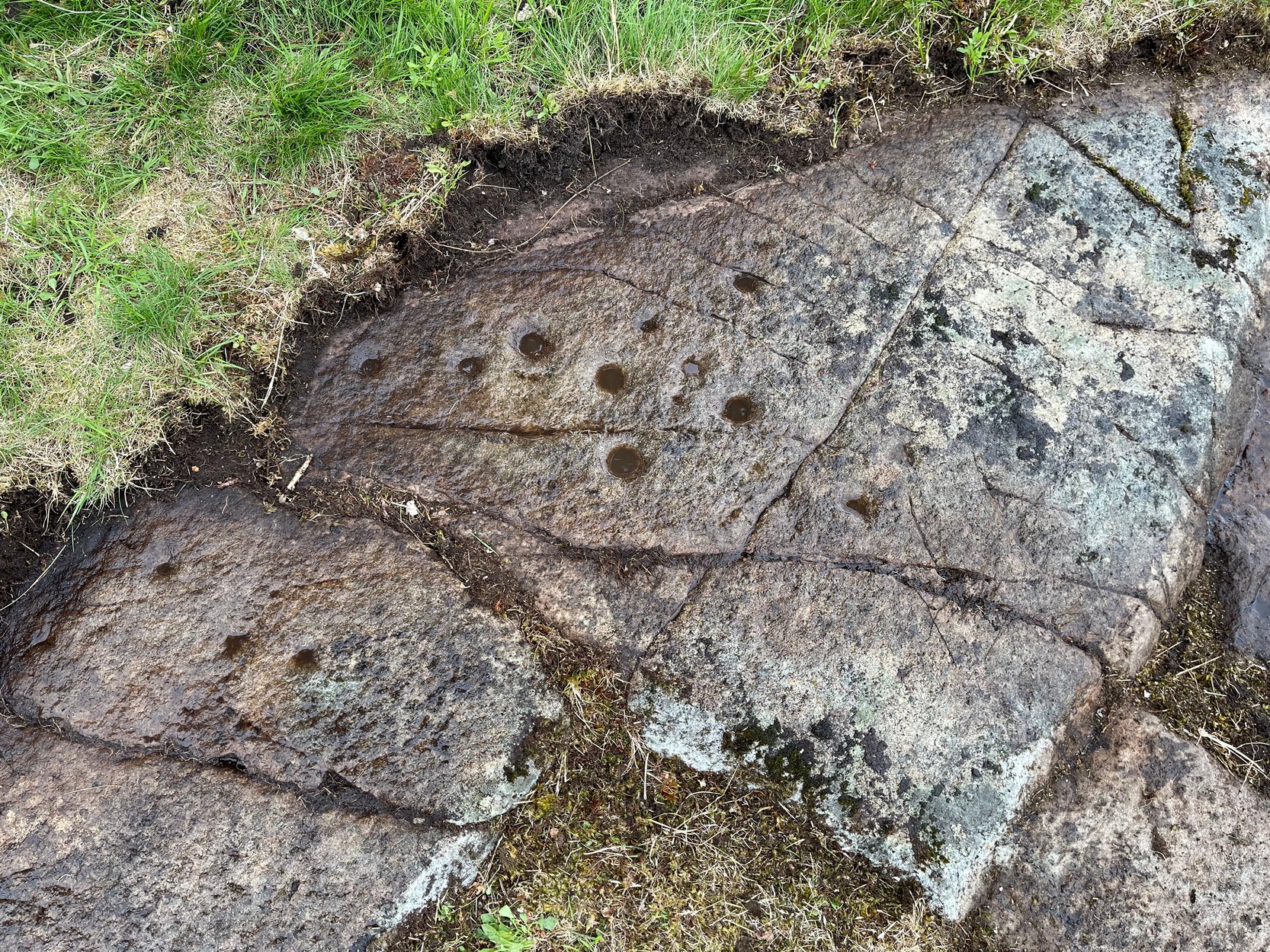
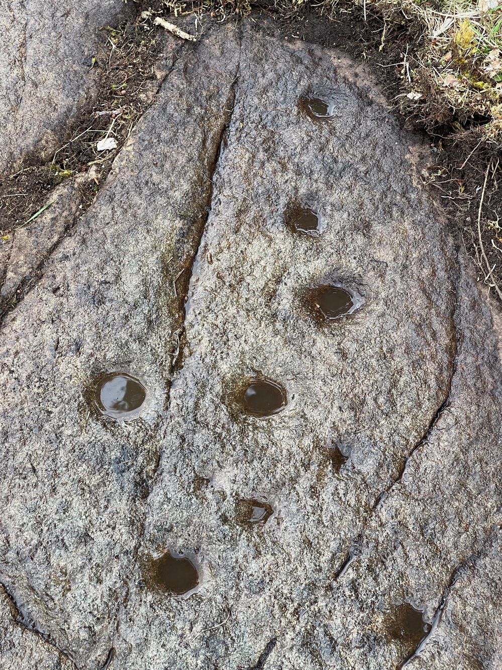
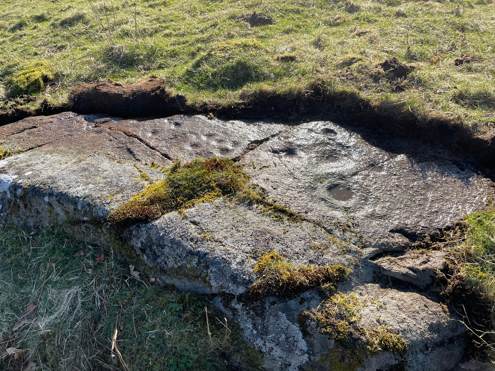
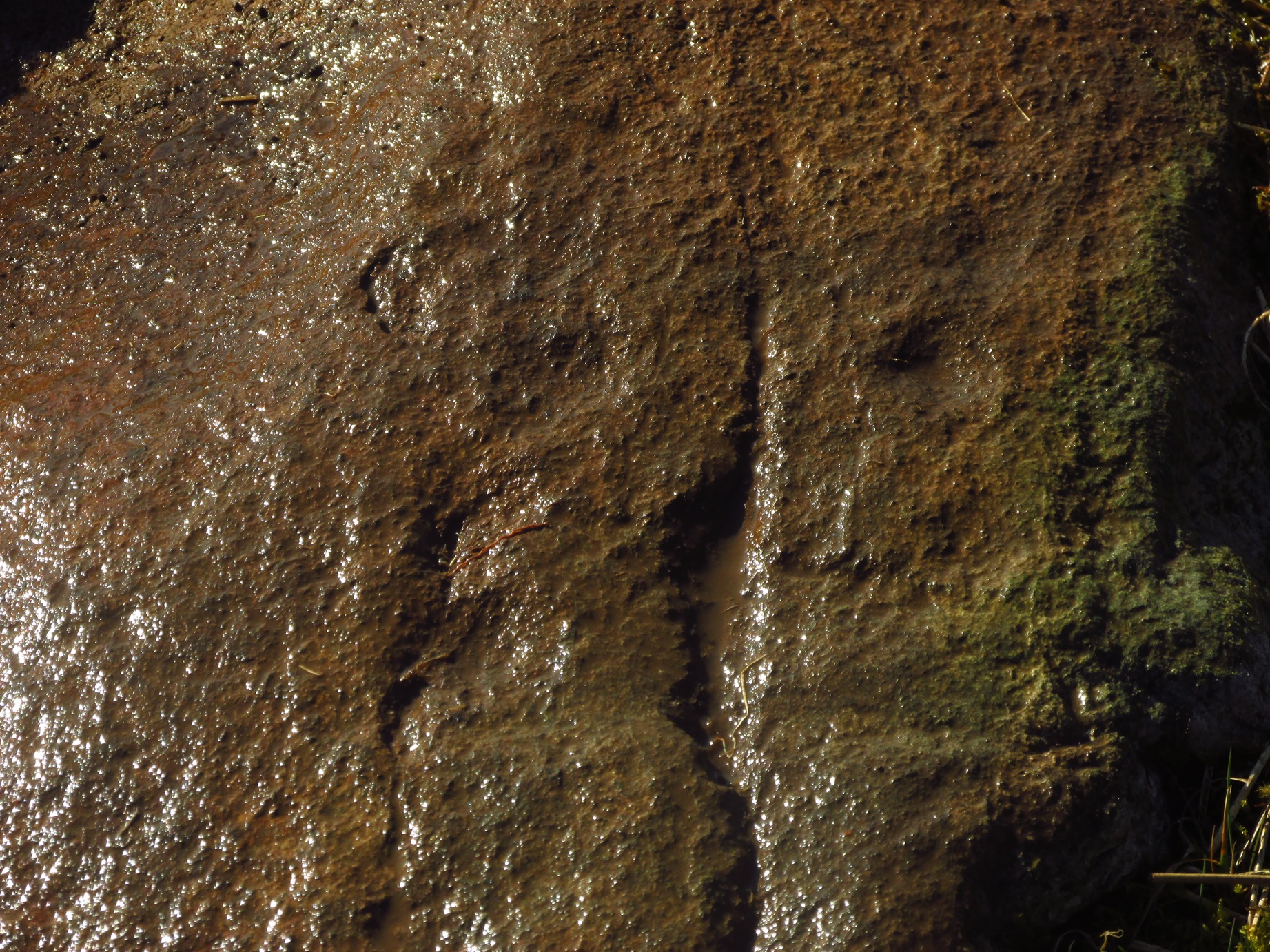
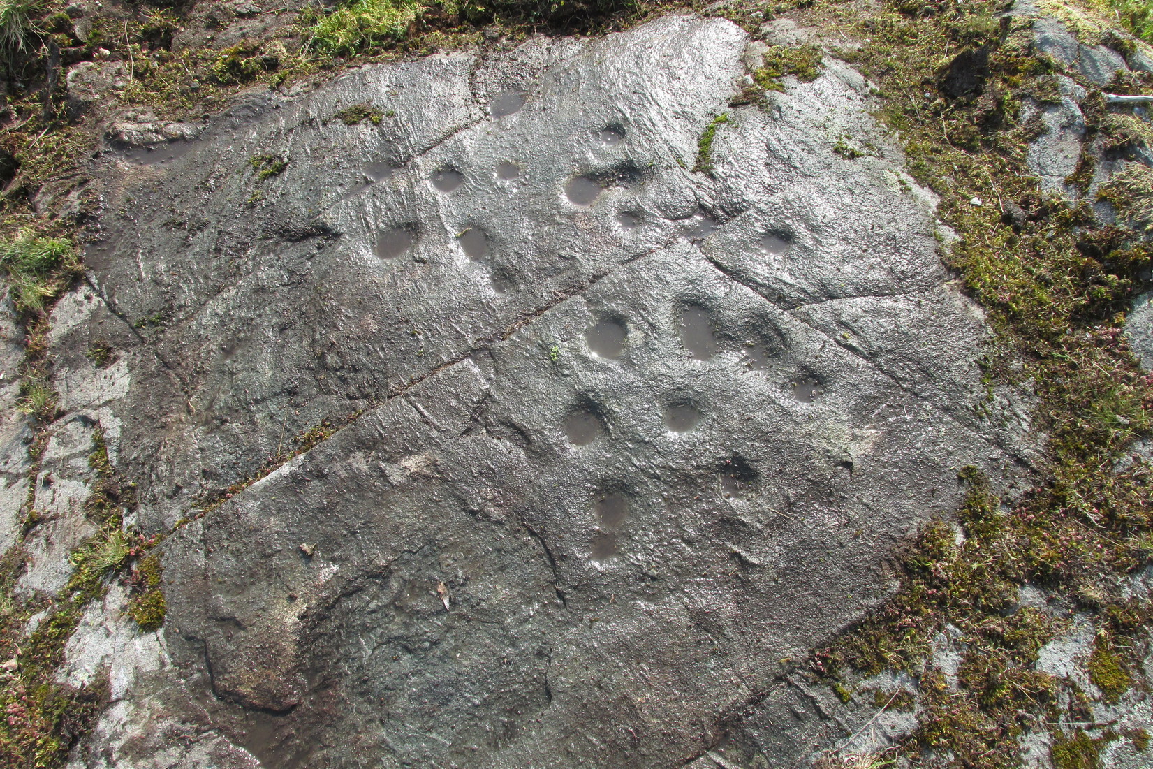
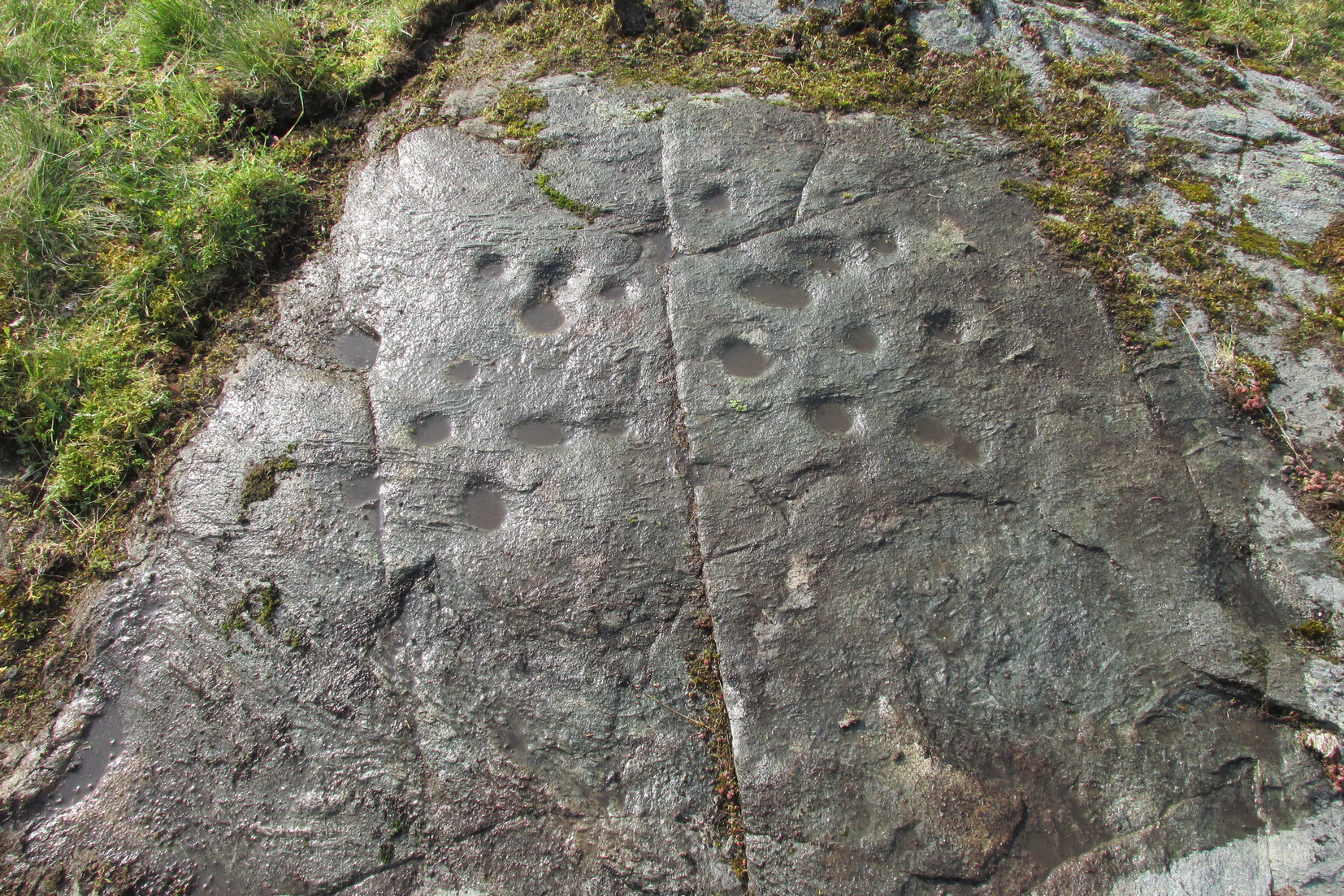
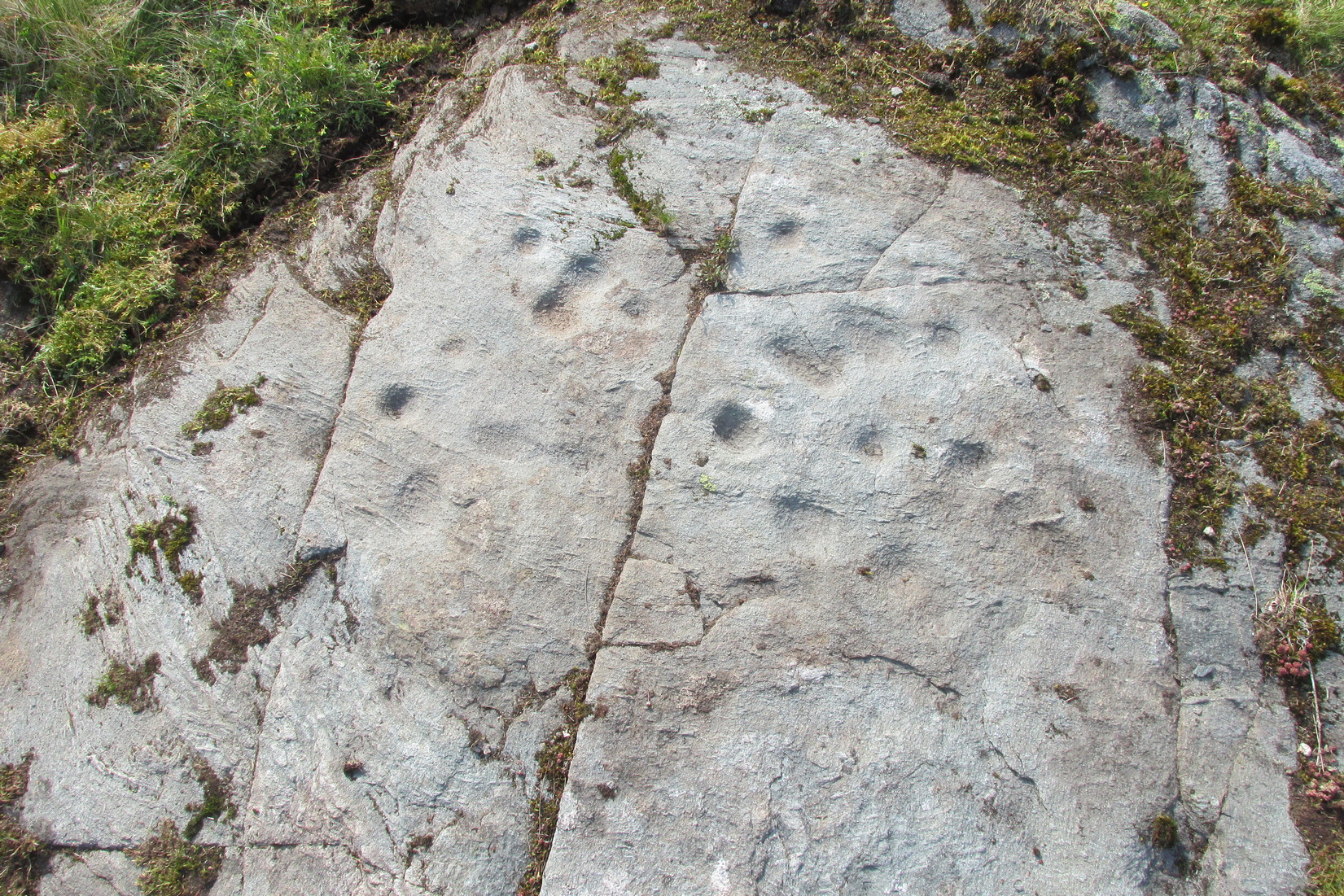
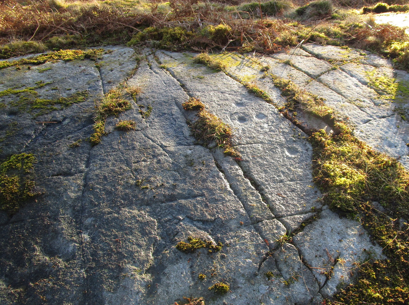
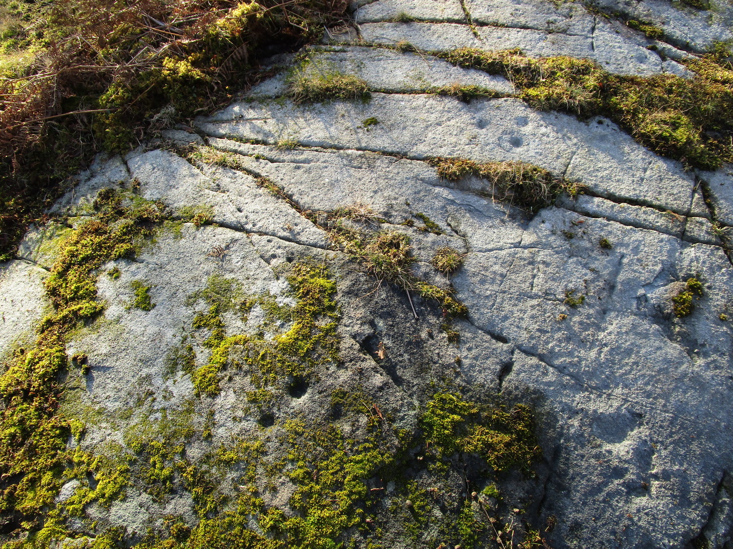
Comprising of a cluster of typical cup-marks, there are two, perhaps three very faint rings in the design, which seems to have been described for the first time in George Currie’s (2012) typically short minimalist way. He told that in the field,
“50m E of the Ogle Burn is a boulder 2.1 x 0.9 x 0.5m, which bears 21 cup marks, 2 of which have single rings.”
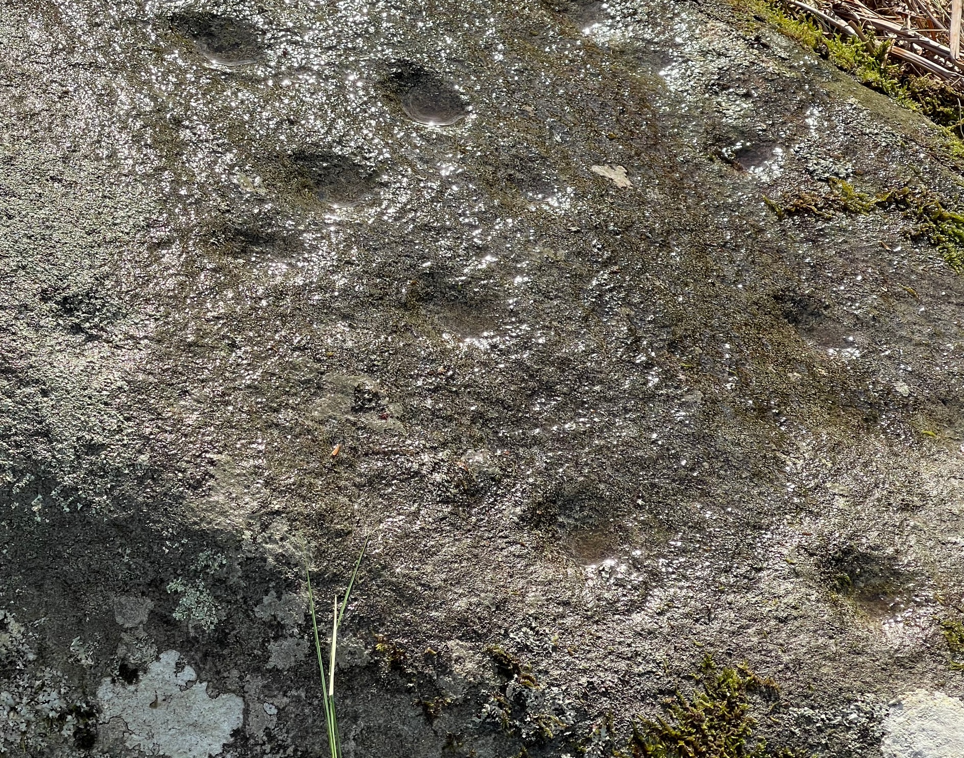
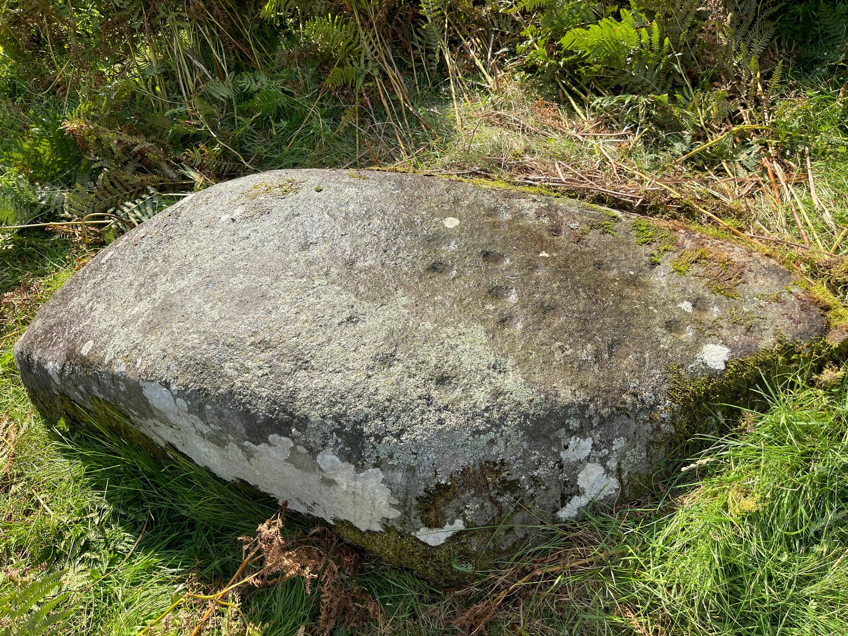
Much of the original design is difficult to see in full unless the lighting is good. We spent several hours here and counted 25 cup-marks and found rings around three of them—but these proved difficult to photograph and some more visits are needed to capture them. “Officially” at least, there are no other carvings close to this one. But that’s obviously not going to be the case. Well worth checking out when you’re in the area.

References:
- Currie, George, “Stirling: Balquhidder, Glen Ogle – Cup-and ring-marked rock”, in Discovery & Excavation Scotland, volume 13 (New Series), 2012.
© Paul Bennett, The Northern Antiquarian