Beinn na Cailleach, Broadford, Skye

Sacred Mountain:  OS Grid Reference – NG 601 232

Getting Here

Seems rather daft giving directions for a mountain, but… For incomers, cross the bridge onto the island and keep on the A87 road to Broadford.  A couple of mile the other side of the village westwards, take the small left turn in the trees and go to the dead-end.  The hill reaching up above you (west) is the legendary mountain to walk up!

Folklore

Beinn na Cailleach

This giant old mountain has been associated with the primal female creation figure, the cailleach, for many a moon. And strangely – for me anyway – I’ve not ventured to sleep with this old place in my passings here as I usually do wherever the cailleach resides.

It doubtless has many more tales than the one A.A. MacGregor (1937) mentions in his superb Peat-Fire Flame.  Here he tells the story of,

“the cairn situated on the summit of Beinn na Cailleach, not far from Broadford… This cairn is believed to mark the site of burial of a Norse princess who died at Ord. On her deathbed this princess commanded her attendants to convey her, when dead to the top of Beinn na Cailleach, and to bury her there, in order that she might lie in the wake of the winds from Norway.”

MacGregor then follows the tale with a lovely note on some boring old dood he obviously had little respect for, saying:

“It is the traditions associated with this cairn that MacCulloch, the geologist, in his Description of the Western Isles of Scotland, asks to be excused from repeating, since he considers them, one and all, to be unworthy of regard. But, then, MacCulloch was a most tiresome fellow; and he seems to have imbued most of his writings with something of the same tiresomeness”!

On the lower northeastern slopes of this great mountain we find another of the old woman’s abodes, the ‘Lochain Beinn na Cailleach’, where this great hag would no doubt wash her linen, as many old myths tell she did at other pools of the same name.

A slightly different version of the folktale was told by Archibald Geikie in his Note-book of a Field Geologist from 1858:

“The top of Beinn na Cailleaich is flat and smooth, surmounted in the centre by a cairn. Tradition tells that beneath these stones there rest the bones of the nurse of a Norwegian princess. She had accompanied her mistress to “the misty hills of Skye,” and eventually died there. But the love of home continued strong with her to the end, for it was her last request that she might be buried on the top of Beinn na Cailleaich, that the clear northern breezes, coming fresh from the land of her childhood, might blow over her grave.”

An early essay in the Gentleman’s Magazine in 1841 tells the grave atop of the mountain to have been the resting place of the Norwegian King Haco’s wife or his nurse. Derek Cooper (1970) meanwhile told us that whilst the cairn was “erected as a memorial to a Skye chieftain,” the cailleach of the mountain, or “the old woman is reputedly Saucy Mary, who laid a chain between Kyle and Kyleakin to exact toll from passing ships.”

There are other mythic place-names scattered around the edges of this mountain with hints of ancient female deities, or pagan goddesses — whichever way one cares to see them.

References:

  1. Cooper, Roy, Skye, Routledge: London 1970.
  2. Geikie, Archibald, The Story of a Boulder, MacMillan: London 1858.
  3. MacGregor, Alisdair Alpin, The Peat-Fire Flame: Folk-Tales and Traditions of the Highlands and Islands, Ettrick Press: Edinburgh 1937.
  4. o’ Crualaoich, Gearoid, The Book of the Cailleach, Cork University Press 2003.
  5. Swire, Otta F., Skye: The Island and its Legends, Blackie & Sons: London 1961.

© Paul BennettThe Northern Antiquarian


Holy Well, Longthorpe, Peterborough, Northamptonshire

Holy Well:  OS Grid-Reference – TL 1678 9815

Also known as:

  1. St. Cloud’s Well

Getting Here

From Thorpe Green, Longthorpe, then take the Larklands road.  Once a copse of trees appears at the front near a T-junction, the well can be accessed to the side of this wood.

Archaeology & History

The well was enclosed in grounds belonging to St John family, an estate laid out in a style similar to the pleasure gardens of Vauxhall. Within these grounds was an 18th century summerhouse, which has now vanished. A distillery was established here by a Doctor Skirmshire, who lived at Longthorpe, for making ‘considerable quantities of lavender and peppermint, cultivated in adjacent fields..’ (Arrowsmith n.d.).

Sadly, there appear to be no ancient records which justify ascribing an ancient date to the Holy Well complex. Indeed, it would appear to be contemporary with the summerhouse. Perhaps it was built to provide a folly-hermitage to support the legend? It is said that the summerhouse was demolished in the mid-ninteenth century because of the disorderly proceedings undertaken in it by visitors from Peterborough! According to Thompson (1913), the dressed stone was used for the kitchen floor of the nearby Manor House.

Thompson gives a plan of the well along with an accurate description, which luckily does not differ from the sight which greets the visitor today (although there is now an ugly metal gate on the structure):

‘The subterranean chambers constitute a medley of design and structure; they are not caves, although now underground, but were apparently first built….

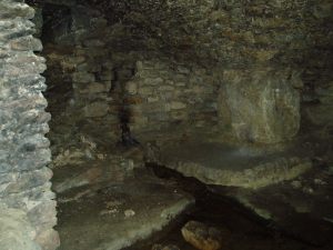
The walls and domed roofs consist of undressed stone. The passage from the pool runs in a direction of N 60 W, and is some six feet long. The entrance being two feet four inches wide by five feet high. The first chamber or antechamber is mostly to the left and nearly at right angles to the passage; it is approximately ten feet by eight feet. In this there is a window high up, evidently a more recent introduction, for the frame is of dressed stone, and the rough stone roof cuts across it, so that external appearance rather than internal use would appear to have been the dominating factor in its design. On the opposite wall of the window is a doorway, and at one time evidently a door, for one stone jamb of dressed stone is left. This doorway opens into the very irregular second or main chamber, roughly twenty feet long, by fifteen feet wide near the widest part. Immediately within the doorway is a well, with dressed stone curb, of three feet internal diameter, and exactly above, in the roof is another smaller circular opening lined with dressed stone as though arranged to draw water from the well from the mound above without going into the chamber, but this is not now open. The well is now choked with stones, but the water used to overflow from the well and run down the passage way to the pool outside, it now flows out oat a lower level leaving the passage way dry. Immediately on the right, after entering the large chamber is am opening leading to a third chamber, smaller, crudely oval, but an indescribable shape, approximately eight to nine feet one way by twelve feet another.

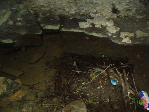
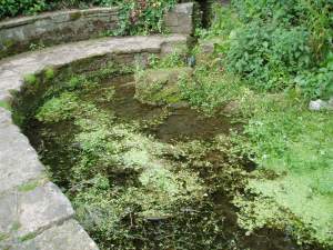
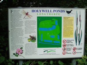
Comparing Thompson’s description and the photograph, one can note a few differences, the main one being that the site in general has become noticeably overgrown. The wall which appears to run along one side has become overgrown and derelict, the pool overgrown, and rubbish-strewn. Within the structure, the curbed well has gone and now one can see the water bubbling from the rock.

Folklore

One side of this is the opening, now blocked up, to a supposed underground passage to Peterborough Cathedral, by which the monks of the Abbey of Burgh, were said to come and bathe in the pool….

To the left of this large chamber, on entering the latter, is a recess some fifteen feet wide and nine feet deep, with a floor consisting essentially of two steps, both apparently of ‘live’ rock, i.e. rock in situ; the upper step being the wider and more like a dais. There is a rather small opening high up on the outer wall of this recess, some five feet from the dais, and is about seventeen inches wide by twenty two feet high, but goes four feet or more in the thickness of the wall or mound without providing an external opening.’
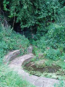
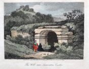
OLYMPUS DIGITAL CAMERAThe site’s greatest fame stems from the tunnel mentioned above by Thompson, which is said to run from the Holy Well to the Abbey at Peterborough. A blocked-up doorway in the third chamber is described as the entrance to this tunnel, although one can imagine that the nature of the whole edifice would lend to such a belief. Certainly records show that the Abbey was supplied by a conduit at the Infirmary end of the Chapel of St Lawrence. However, it is more likely that this took its waters from the St Leonard’s Well at Spital, whose water also filled the Boroughbury Pools and Swan’s Pool.

Yet records show that the Abbey was interested in the site. During Abbot Godfreys tenure, in 1130s the following document states:

Amos ejus viii inclusat porceum Burgi Sumptus iiij I lb: xv sol. Item feat fossutum salveunium inter Thorpe fen et le Dom Sumptus xx sol‘.

Anon 1904-6
OLYMPUS DIGITAL CAMERA OLYMPUS DIGITAL CAMERA OLYMPUS DIGITAL CAMERA


This enclosure cost four pounds and fifteen shillings. Under Abbot Gyerge another document notes the extent of this land (Halywelle), of four acres, three rood and twenty pearches, which until the building of the estate remained the same (Anon 1904-1906). Yet neither of these documents explicitly refers to the laying of a conduit.

The only possible justification for this belief came in November 6th 1964, when workmen, excavating to set up telephone kiosks beside the old Guildhall on Cathedral square, unearthed an underground passage. This continued for twenty five feet under church street, and ran parallel to land belonging to the Almoner’s Garden that was exchanged in the 1194-1200 agreement between the Abbot and the Vicar of Burgh and Longthorpe.  Unfortunately, the underground passage turned out to be some kind of eighteenth century fire precautions.
OLYMPUS DIGITAL CAMERA OLYMPUS DIGITAL CAMERA OLYMPUS DIGITAL CAMERA

Much of the site’s folklore and history derives from a story entitled The Knight of the Red Cross, a story based in the twelfth century, in Richard I’s reign. There is some confusion about the place where this work is published. Thompson (1913)  in his Peculiarities of water and wells states that it is contained within a work called Wild flowers gathered: original pieces in prose and rhyme, printed by J. S. Clarke, with no author or date; whereas  Arrowsmith (n.d) states it comes from a similarly titled, A list of wild flowers found in the neighbourhood of Peterborough, by F. A. Paley. Arrowsmith further notes that the work is advertised on the back of the same author’s Notes on twenty Parish churches round Peterborough, published in 1859. Unfortunately, I have been unable to trace either of these to confirm which is the right source. How much the story is based on any ancient account is unclear. It may be ‘faction’ or fiction, a problem of course with many sites. The applicable parts are produced below as Thompson (1913) notes:

“There is a beautiful spot, called Holywell, in the neighbourhood of Peterborough, well known, and much frequented by the inhabitants. The road lies through a pleasant park, where stands an ancient edifice belonging to the Fitzwilliam family, called Thorpe Hall… After passing the front of this mansion, turn to the left, by the stables and outer buildings will lead, through a white gate, to a small green field from whence this picturesque little spot is seen, with its ivy clad walls, and its dark cypress and yew trees, casting their gloomy shadows around. Passing some broken steps which form the entrance, a shady path conducts to a modern niche, supported by two pilasters, over a slab pavement to a stone basin about six feet in depth and thirty in circumference. This is constantly supplied with clear water, running from the mouth of a subterraneous passage which connects Holywell with the cathedral of Peterborough. An artificial mound of earth is thrown up above this cavity, which is covered with creepers, ground-ivy and a few wild flowers.

Contiguous to the basin are some small fish ponds, partially shaded by beautiful trees; and the green rushes which grow at their bank form undisturbed retreat in which the moor-hen builds her solitary nest. A little further on is a piece of an old pillar, which is gracefully overhung with a wreath of ivy… An old wall surrounding Holywell on two sides, in which traces of windows and doorways are still discernible, is the last feature we shall mention.”

Arrowsmith (n.d) states that these pools have been called ‘Monk’s Stew Ponds’ or ‘Paradise Ponds’, although Arrowsmith considers that the long distance from the Abbey makes it unlikely, as the Abbey was close to good fishing waters  He continues, ‘The waters of this well were formerly in high repute, and were much frequented by those who came on pilgrimages’

Its waters, according to Thompson (1913), are said to be slightly ferruginous, though he detected no sign of it, and nor did I. It was also thought to be efficacious for gout, rheumatism, skin diseases, and good for eyes.

It was believed that a Hermit, called St Cloud, lived at the site. Thompson (1913) continues, quoting J. S. Clarke, that he was ‘of great celebrity, whose pious councils and paternosters were generally in request amongst all pilgrims who visited the spot.’

Some authorities, such as Arrowsmith, have identified this hermit as St Botolph, who is said to have lived within a mile of his chapel during its construction on the Thorpe Avenue site. He is associated with other wells, such as that at Hadstock, Essex, so it is not impossible.

References:

  1. Anonymous, “Holywell,” in Fenland Notes and Queries6, pp.22-4, 1904-6
  2. Arrowsmith, A. L., Longthorpe and its Environs: Microcosm of a Village, privately published: no date.
  3. Bord, J. and C., Sacred Waters, Granada: London 1985.
  4. Thompson, B., “The Peculiarities of Water and Wells,” in Journal of Northants Natural History Society and Field Club18(135), 1913.

Extracted and edited from the original post – Holy & Healing Wells

© R.B. Parish, The Northern Antiquarian


St Francis’ Well, Conisborough, South Yorkshire

Holy Well:  OS-Grid Reference – SK 5112 9880

Also known as:

  1. Town Well

Getting Here

From Church street turn down into Wellgate, the well is on the right hand site at 18 Wellgate surrounded by railings near some new properties, on a little island.

Archaeology & History

Near the castle, and although dry it is a substantial site variously called the Town well or the Well of St Francis.  This is as C.F. Innocent (1914) described it:

“Covered by a curious little building very medieval-looking  with it a chamfered plinth and steeply slanted roof”

Little is recorded of its history, but the structure more a conduit house probably dates from the 1500s at the earliest and was used as source of domestic water until the 1900s.

Folklore

Which St Francis it is, is unclear, but Alport (1898) records the local tradition which states that he was a local holy man and probably not a true saint and it is interesting that a number of churches are dedicated to a St. Francis in Yorkshire. Interestingly though, the date of creation of the well is recorded and is quite late compared to other local saints.

It is said that in 1320 -1321 the village was suffering from a particularly terrible drought and this St. Francis, said to be an old and wise man was sought for his advice. He suggested that the local people cut a willow tree from Willow Vale and then as the people sang psalms and hymns he lead them through the church and priory grounds to the site of the well. At the spot St Francis then struck is and not only did a spring arise and followed for the next 582 years (for its sadly dry now) but the tree took root.

Sadly this tree has either died or was dug up. Clark (1986) believes the story recalls a Pagan priest and that the legend was a legacy of Conisbrough’s pre-Christian past; certainly the reference to a willow indicates a water diviner.

Extracted and amended (where both sites of the town are discussed) from http://insearchofholywellsandhealingsprings.wordpress.com/2011/12/11/a-yorkshire-field-trip-conisboroughs-two-holy-wells/

References:

    1. Allport, C.H., (1898) History of Conisborough.
    2. Clark, S., (1986) “The Holy well of Conisborough,” in Source, Old Series no.5.
    3. Innocent, C.F (1914-18) “Conisborough and its Castle,” in Trans of Hunter Archaeology Society.

© Ross Parish


Holy Well, Hildenley, North Yorkshire

Holy Well:  OS Grid Reference – SE 7408 7106

Archaeology & History

Found to the southwest edge of Hildenley Wood, on the west side of the track between Malton and Coneythorpe Road, the waters from the initial source of the well runs into a small well-house, and from here Nature’s blood runs into a small pool.  The first reference I’ve found of the place is in T. Whellan’s (1859) huge survey, where he said,

“There is on the verge of Easthorpe Wood a copious and pure spring of water known by the name of Holy Well, which tradition affirms to have been much resorted to by the monks of Kirkham Abbey…and even to this day healing virtues are attributed to it.”

In Whelan & Taylor’s (1989) survey of the site, they noted the existence of another well a short distance away, but did “not know of any sacred associations connected with this site, but its proximity to the Holy Well may suggest the recognition of this area as a sacred spot.”

References:

  1. Whelan, Edna & Taylor, Ian, Yorkshire Holy Wells & Sacred Springs, Northern Lights: Pocklington 1989.
  2. Whellan, T., History and Topography of the City of York – volume 2, Whellan & Co: Beverley 1857.

© Paul Bennett, The Northern Antiquarian

Counter Hill, Addingham, West Yorkshire

Enclosure:  OS Grid Reference – SE 051 501

Getting Here

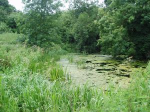
Counter Hill, looking north

You can come from various angles to approach this site, but I reckon the best is from along the old trackway of Parson’s Lane, between Addingham and Marchup.  From Silsden go up the long hill (A6034) towards Addingham until the hill levels out, then turn left on Cringles Lane (keep your eyes peeled!) for about 500 yards until you reach the Millenium Way or Parson’s Lane track, to your right.  As you walk along this usually boggy old track, the rounded green hill ahead, to the left, if where you’re heading.  Less than 100 yards past the little tumulus of High Marchup there’s a stile on your left that takes you into the field.  You’ll notice the depression that runs across near the top, at an angle.  That’s part of the earthworks!

Archaeology & History

The Counter Hill earthworks just over the far western edge of Rombald’s Moor – thought to be Iron Age – are truly gigantic.   More than ¾-mile across along its longest NW-SE axis, and a half-mile from north-south at its widest point, this huge ellipse-shaped earthwork surrounds the rounded peaked hill that gives the site its name: Counter Hill.  And although Harry Speight (1900) thought the hill got its name from the old Celtic conaltradh, or Irish conaltra, as in the ‘hill of debate or conversation’ — a possibility — the place-name master Mr Smith (1961) reckoned its name comes from little other than ‘cow turd hill’!  We may never know for sure…

Earthworks south of Counter Hill
Cowling’s 1946 plan

The Lancashire historian Thomas Dunham Whitaker (1878) appears to have been one of the first people to describe the Counter Hill remains, though due to the sheer size of the encampment he thought that it was Roman in nature.  Within the huge enclosure we also find two large inner enclosures, known as the Round Dikes and the Marchup earthworks.  Whitaker’s description of Counter Hill told:

“There are two encampments, on different sides of the hill, about half a mile from each other: one in the township of Addingham, the other in the parish of Kildwick; the first commanding a direct view of Wharfedale, the second an oblique one of Airedale; but though invisible to each other, both look down aslant upon Castleburg (Nesfield) and Ilkley.  Within the camp on Addingham Moor are a tumulus and a perennial spring; but by a position very unusual in such encampments, it is commanded on the west by a higher ground, rising immediately from the foss.  The inconvenience, however, is remedied by an expedient altogether new, so far as I have observed, in Roman castramentation, which is a line of circumvallation, enclosing both camps, and surround the whole hill: an area, probably, of 200 acres.  A garrison calculated for the defence of such an outline must have been nothing less than an army.  But it would be of great use in confining the horses and other cattle necessary for the soldiers’ use, which, in the unenclosed state of the country at the time, might otherwise have wandered many miles without interruption.  The outlines of these remains is very irregular; it is well known, however, that in their summer encampments the Romans were far from confining themselves to a quadrangular figure, and when we consider their situation near the Street, and the anxious attention with which they have been placed, so as to be in view of Ilkley or Castleburg, there can be little danger of a mistake in ascribing them to that people.”

Counter Hill earthworks, looking west

And though Whitaker’s sincerity and carefully worded logic for the period is quite erudite (much moreso than the greater majority of historians in modern times), his proclamation of the Counter Hill earthworks as Roman is very probably wrong (soz Tom).  The embankments are much more probably Iron Age in nature and are very probably the result of indigenous tribal-folk than that of the incoming Romans.  Most modern archaeologists and historians tend to see the entrenchments as being from such a period and I have to concur.

Folklore

The old antiquarian Edmund Bogg (1904) wrote that the Counter Hill earthworks were built as a result “of the struggle between the Anglians and the Celt,” long ago.  The great Yorkshire historian Harry Speight (1900) narrated similar lore just a few years earlier, but told that the tradition was  “of how the Romans drove the natives from this commanding site of Counter Hill.”

References:

  1. Bogg, Edmund, Higher Wharfeland: The Dale of Romance, James Miles: Leeds 1904.
  2. Cowling, Eric T., Rombald’s Way, William Walker: Otley 1946.
  3. Fletcher, J.S., A Pictureseque History of Yorkshire – Part IX, J.M. Dent: London 1901.
  4. Smith, A.H., The Place-Names of the West Riding of Yorkshire – volume 6, Cambridge University Press 1961.
  5. Speight, Harry, Upper Wharfedale, Elliott Stock: London 1900.
  6. Whitaker, T.D., The History and Antiquities of the Deanery of Craven, 3rd edition, Joseph Dodgson: Leeds 1878.

© Paul Bennett, The Northern Antiquarian


White Wells, Ilkley, West Yorkshire

Sacred Well:  OS Grid Reference – SE 1181 4677

Also Known as:

  1. Ilkley Spaw
  2. Mountain Spa
  3. Spa Well

Getting Here

White Wells (as Spa Well) on 1851 map

This place is one of the first things you see when roving the northern edge of Ilkley Moor.  Tis the small white house, perched on the hillside, which you can reach via the old track bending round to it on the west side, or the steep footpath which goes roughly straight uphill from the road, just above Ilkley Town centre, up (both) Wells Walk or Wells Road.  If you go just a few hundred yards up these roads, as the road bends and the moor opens up ahead, you’ll see the white building above you.  But if you’re truly useless at finding your way about, ask anyone of them there locals…

Archaeology & History

The White Wells, Ilkley Moor

The White Wells have been described by countless writers over the centuries and attested as one of the great healing wells of the region. It was, without doubt, one of the most important water supplies to the indigenous Britons living on the moors here. One of their settlement sites is above the cliffs behind the modern position of the wells — though archaeological work has yet to be undertaken been.  Cup-and-ring marked stones scatter the edge of the ridge right above where the waters originally appeared (a few hundred yards further up the slope on the hillside, just below the trees); and the folk-memory of our ancestors living here is found in several adjacent sites known by ‘fairy’ place-names.

But today it looks nothing like it would have done when the ancient people of the moors drank these waters, nor even when the Romans came here.  For the white building which today houses the well was built around 1760 by the local Squire Middleton and originally contained three plunge baths in which folk would take the ‘cold water cure.’ (These were looked after by William Butler and his wife and were typically used by the gentry of the period, who it seems didn’t mind too much having to walk up the hillside to bathe in the “mellifluent, diaphanous, luminous waters.”)

Carved 'celtic' head, from which the water now emerges
Carved ‘celtic’ head, from which the water now emerges

The water in the house (you can go in and have a look), which now empties into a plunge pool, pours gently from the open mouth of a ‘celtic head’ – thought by some modern pagans to be ancient, but in fact is barely 200 years old.  The water at White Wells originally emerged from the Earth several hundred yards further up the slope, above the present position of the house, much closer to the moor edge near the bottom of the steep slope where the pine trees cling, amidst rocks, moss and lichen. Here is where the original waters were first borne.

Long held as being curative, the first detailed description of the place was in Thomas Short’s (1734) magnum opus, where he said:

“Ichley-spaw springs out of the middle of a mountain, a mile high, and consists chiefly of lime stone and freestone. The water is very clear, brisk and sparkling; has no taste, colour nor smell different from the common water, is of the same weight. Its bason and course are of no other dye than that of a common spring. About thirty-five years ago, there were a house and a bath built, about a furlong below the original spring, which spring was brought down in stone-pipes. The first spring, near the top of the hill was very weak and small; this, very large and strong; whereby there appears to be a large mixture of other springs with this; since which time, it has fallen much sort of its former great success. Twenty yard above the drinking well (over which is built a small house of a yard square on the inside) they have cut thro’ an original spring of common water. There are several old lime-kilns a little above this. The water is first whitish, then blackish purple with solution of silver; it’s very clear, and has a purplish pellicle, with solution of sublimate; it was first white, then clear in the middle, and a white mucus at the sides and bottom of the glass, with solution of Sugar of Lead; very clear, with Oil of Tartar; whitish, with Spirit of Hartshorn; and the same as common water, with all the other trials. Five pints of this liquor exhaled left seven grains of sediment, the salt whereof dissolved in distilled water, turned solution of silver purple; was white with Spirit of Hartshorn: therefore tho’ this water is of the greatest esteem and repute of any in the north of England, in the King’s Evil and other old ulcers; yet it derives these effects neither from its fixt nor volatile parts; but wholly from the coldness and purity of the element, its drying nature from the lime-stone it washes, tho’ a great part of it comes from blue clay.”

In 1830, one Thomas Shaw said of the place,

“The water is, perhaps, for its purity, tenuity and coldness, the best qualified to be of utility for relaxed and sedantry habits of any water in this part of the country. It has frequently been analysed, but the decomposition always proved that it contains no medicinal quality. In my opinion, it is its purity and softness only, which makes if more efficacious, by passing sooner and to the utmost and finest limits of the circulation than any water known.”

But although many cures were claimed of the waters here, as Kathleen Denbigh (1981) wrote:

“According to a 1977 analysis, it is simply a clear, colourless spring water of moderate hardness, organically pure and free from metallic contamination and coliform organisms.” — i.e., it’s good clean water!

When the place gained a reputation as a spa, it was frequented by such notaries as Charles Darwin, Frederick Delius and Prof. David Baldwin. But even before this, in 1709, Dr Richard Richardson of Bradford—a reputable naturalist but also with considerable interest in ancient and occult matters—wrote that the site “has done very remarkable cures in scrofulous cases by bathing and drinking of it.”

Folklore

Rare photo of William Butterfield (the old keeper of White Wells), who reported seeing 'little-people' here
Old photo of Mr Butterfield, who saw fairies here

Popularly believed in local lore to have been a place held as sacred to the Romans, I’m of the opinion that the local ‘goddess’ Verbeia was resident here. A thought also mentioned by G.T. Oakley (1999) in his book on the subject.

Legend tells that the medicinal properties of the waters were first discovered hundreds of years ago when an old shepherd, walking over the moors, damaged his leg. Upon bathing it in the waters here, it soon healed.

In the Folklore Record of 1878 we find a fascinating tale about these waters, alleged to have happened to the old keeper of the place, told by a local man John Dobson, and which cannot go untold:

“William Butterfield…always opened the door first thing in the morning, and he did this without ever noticing anything out of the common until one beautiful, quiet, midsummer morning. As he ascended the brow of the hill he noticed rather particularly how the birds sang so sweetly, and cheerily, and vociferously, making the valley echo with the music of their voices. And in thinking it over afterwards he remembered noticing them, and considered this sign attributable to the after incident. As he drew near the wells he took out of his pocket the massive iron key, and placed it in the lock; but there was something “canny’ about it, and instead of the key lifting the lever it only turned round and round in the lock. He drew the key back to see that it was alright.and declared, “It was the same that he had on the previous night hung up behind his own door down at home.” Then he endeavored to push the door open, and no sooner did he push it slightly ajar than it was as quickly pushed back again. At last, with one supreme effort, he forced it perfectly open, and back it flew with a great bang! Then ‘whirr, whirr, whirr’, such a noise and sight! All over the water and dipping into it was a lot of little creatures, all dressed in green from head to foot, none of them more than eighteen inches high, and making a chatter and jabber thoroughly unintelligible. They seemed to be taking a bath, only they bathed with all their clothes on. Soon, however, one or two of them began to make off, bounding over the walls like squirrels. Finding they were all making ready for decamping, and wanting to have a word with them, he shouted at the top of his voice—indeed, he declared afterwards, he couldn’t find anything else to say or do—”Hallo there!” Then away the whole tribe went, helter skelter, toppling and tumbling, heads over heels, heels over heads, and all the while making a noise not unlike a disturbed nest of young partridges. The sight was so unusual that he declared he either couldn’t or daren’t attempt to rush after them. He stood as still and confounded, he said, as old Jeremiah Lister down there at Wheatley did, half a century previous, when a witch from Ilkley put an ash riddle upon the side of the River Wharfe, and sailed across in it to where he was standing.1 When the well had got quite clear of these strange beings he ran to the door and looked to see where they had fled, but nothing was to be seen. He ran back into the bath to see if they had left anything behind; but there was nothing; the water lay still and clear as he had left it on the previous night. He thought they might perhaps have left some of their clothing behind in their haste, but he could find none, and so he gave up looking, and commenced his usual routine of preparing the baths; not, however, without trotting to the door once or twice to see if they might be coming back; but he saw them no more.”

Along with sightings of ‘little people’, ghosts have been seen at the White Wells.  It is thought that the strange apparition which presented itself to a householder here in 1982—the ghostly figure of a young girl, weeping at the water’s edge—was that of little Ann Harper who, in August 1793, at the age of nine, drowned in the well when bathing.

Earthlight (UFO) phenomena have also been reported here over the years—the most dramatic of which was alleged to have taken place at the top of the slope above the original source of the wells in 1989, when a police officer reported and photographed a “little green man” on the geological prominence just behind the wells. He went on to narrate a typical UFO ‘abduction’ event, but much of this was psychogenic and the mythic undertones echo precisely the medieval lore of abduction by faerie.

The Fortean researcher David Barclay found in his dowsing investigations here that there were spiral patterns all round the place. “At first these were in no order,” he wrote, “but through a period of over twenty visits to the place, I established markers which indicated the spiralling patterns of the energy” within the Earth immediately adjacent to the White Wells. These spirals were nearly always in a clockwise direction. In further studies here, he and I came to know a Mrs Elsie Hill, who had done some quite striking automatic drawings of the place. “In her pictures,” he wrote, “appear a prominence of spiral-forms and faerie creatures which, she believes, inhabit White Wells.”

Hmmmm…..

…to be continued…

References:

  1. Bennett, Paul, The White Wells, Ilkley Moor, Heathen Earth: Keighley 2009.
  2. Bogg, Edmund, Upper Wharfeland, James Miles: Leeds 1904.
  3. Collyer, Robert & Turner, J. Horsfall, Ilkley, Ancient and Modern, William Walker: Otley 1885.
  4. Denbigh, Kathleen, A Hundred British Spas, Spa Publications: London 1981.
  5. Granville, A.B., Spas of England, Henry Colburn: London 1841.
  6. Oakley, G.T., Verbeia: The Goddess ofWharfedale, Rooted Media: Leeds 1999.
  7. Shaw, Thomas, The History of Wharfedale, Otley 1830.
  8. Short, Thomas, The Natural, Experimental and Medicinal History of the Mineral Waters of Derbyshire, Lincolnshire and Yorkshire, privately printed: London 1724.
  9. Speight, Harry, Upper Wharfedale, Elliott Stock: London 1900.
  10. Whelan, Edna and Taylor, Ian, Yorkshire Holy Wells and Sacred Springs, Northern Lights: York 1989.

© Paul Bennett, The Northern Antiquarian 


St. Osyth’s Well, St. Osyth, Essex

Holy Well:  OS Grid Reference – TM 116 166

Archaeology & History

This spring of water is in the edge of Nun’s Wood on the north side of the Dolphin Pond pool and is covered by a small stone building, from which issues a small stream into the lake.  Remains of an old nunnery in the woods are said to be the oldest such monastic remains in England.

Folklore

This holy well, the woods in which it’s found, and the old straight road leading to the chapel,* are all said to be haunted by the headless ghost of old St. Osyth, beheaded — in one legend — by the Danes who came here in the 7th century.  At the spot where she’s said to have received her final fatal blow, the waters from this now bricked-up old well gushed forth from the Earth. (Prior to this, folklore tells how St. Osyth was ‘killed’ several times, and each time came back to life – just as in shamanic lore, from which such early christian tales were glossed onto.)

Of it medicinal virtues, Robert Charles Hope (1893) told us that St. Osyth’s Well had been blessed by many a sufferer who found there a medicine for his ills, and at that time, “continues to this day as a sovereign remedy for many diseases.”

References:

  1. Hope, R.C., Legendary Lore of the Holy Wells of England, Elliott Stock: London 1893.

* I’m presuming that the old road to the chapel here is the long straight grove of trees which ran from St. Osyth’s Chapel and up towards the well. Anyone know for sure?

© Paul Bennett, The Northern Antiquarian


Beinn na Cailleach, Islay, Argyll

Sacred Mountain:  OS Grid Reference – NR 450 596

Also Known as:

  1. Beinn na Caillich

Folklore

Another great mountain of the ‘Old Woman’: primal creation deity of these hills. Whether she holds sway over the land here for many months, as she does on Mull and Skye, I cannot find.  One creation legend here tells that one of the furrows down the side of the mountain – called Sgrìoh na Caillich – was said to be made by her as she slid down it in a sitting position. The small loch on the way up to her summit – Lochan na Caillich – was one of her washing places; and the Beinn na Caillich Beag, immediately east, speaks of other legends, now seemingly lost to us.  It’s highly likely that some of the megalithic remains nearby had some mythic relationship with this old hill, though I aint found any studies along these lines…yet!

© Paul Bennett, The Northern Antiquarian