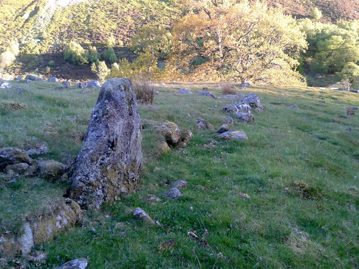
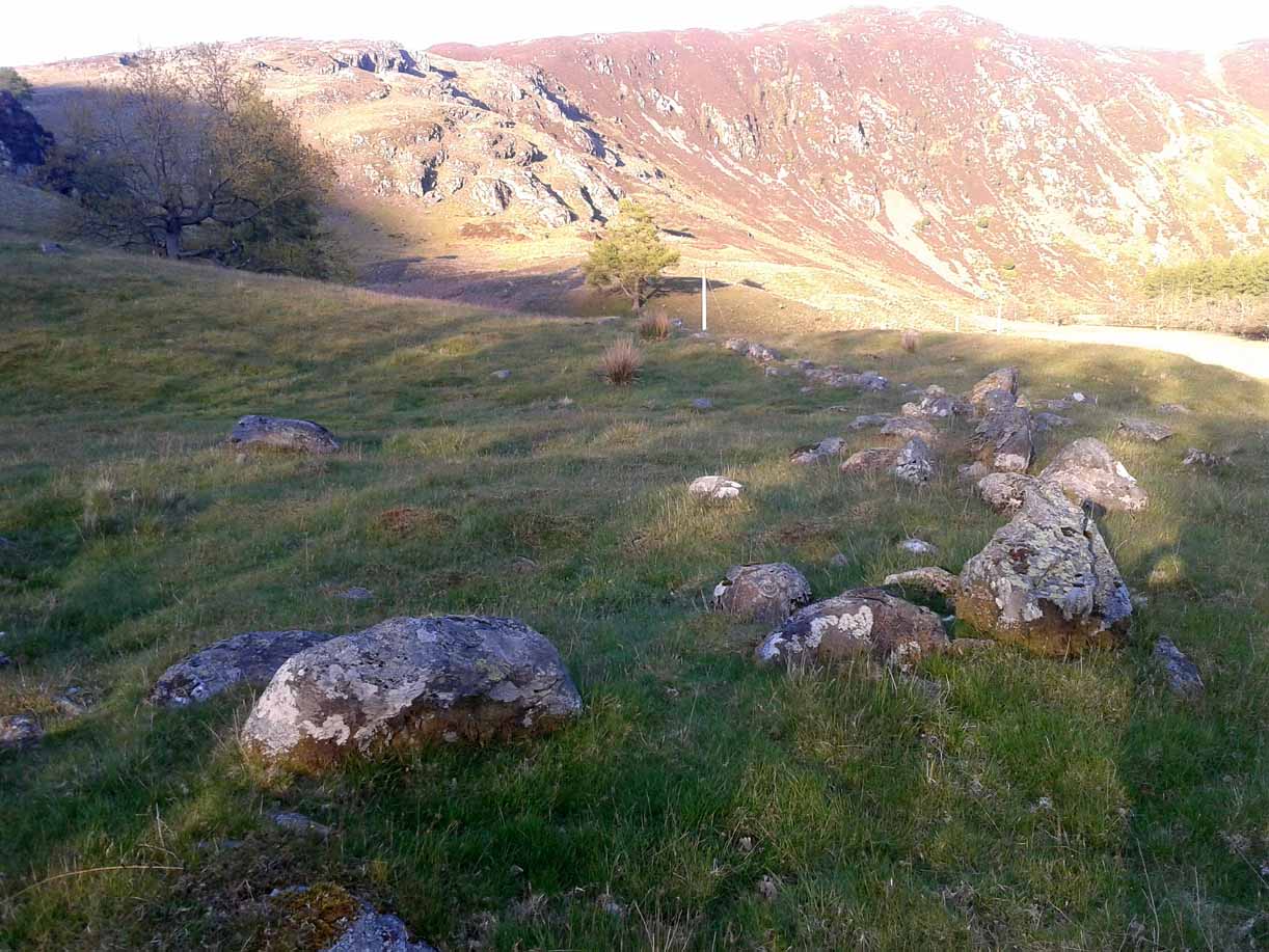
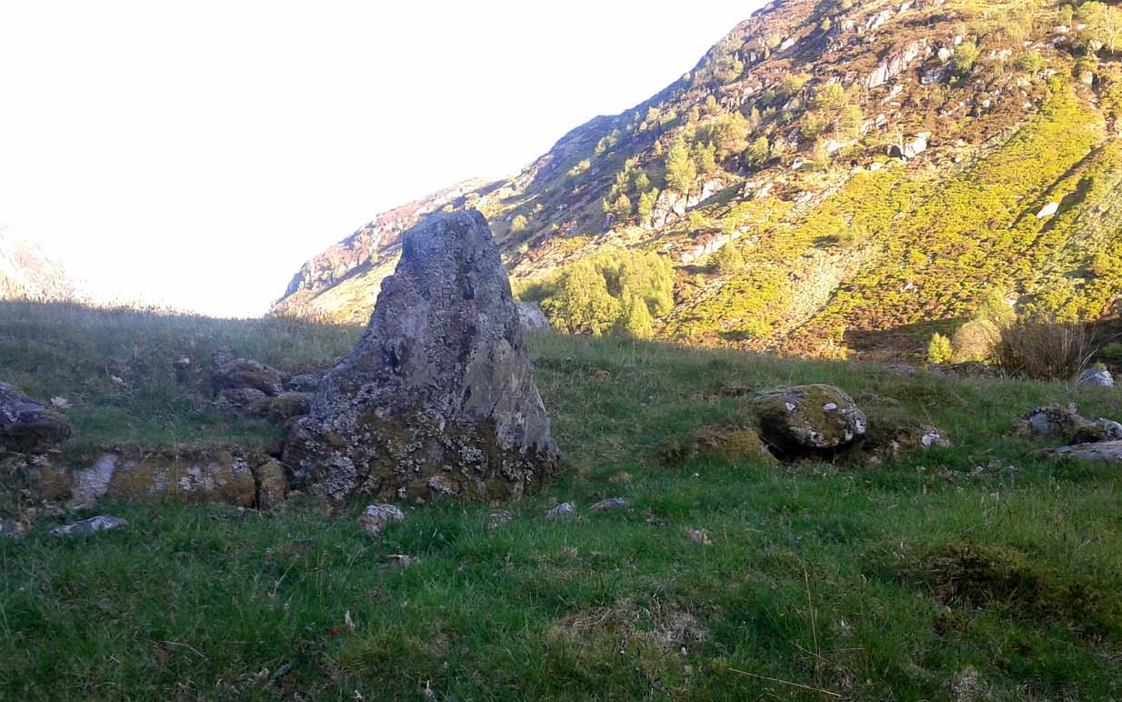
From Bettyhill village, take the A836 road as if you’re going to visit Tongue, crossing the metal bridge across the River Naver a mile south of Bettyhill. Keep going past here for nearly a mile, beyond the houses and then into the small trees, making sure that you keep your eyes peeled to the right where a small but notable bracken-covered mound rises 10-20 yards in the rough field. Go through the gate and you’re there!
Archaeology & History
Low stone wall along S side
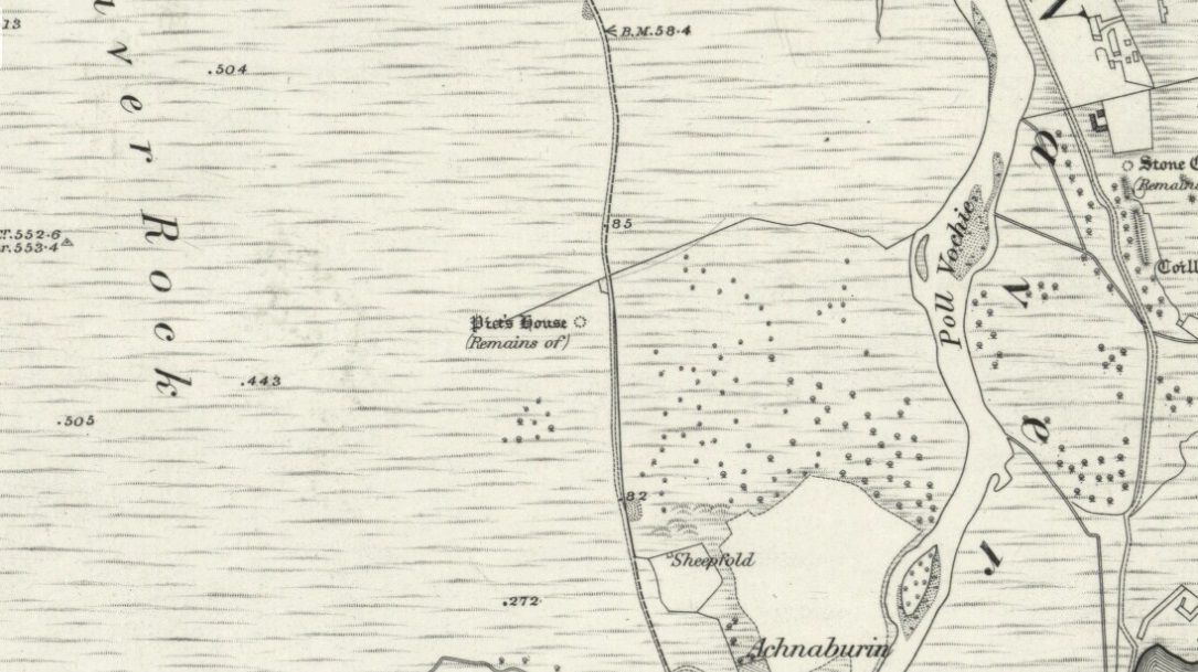
A site which, from the nearby roadside, has all the hallmarks of being yet another Sutherland broch (there are tons of them up here!)—but apparently it isn’t! Despite being shown on the earliest OS-map of the region as a ‘Pict’s House’ (which are usually brochs), the site has subsequently been designated by modern archaeologists as a simple ‘hut circle’. I have my doubts over this, as it’s a most unusual one with little logic over its positioning—unless it was either a look-out point, or an odd ritual spot.
South side of the mound
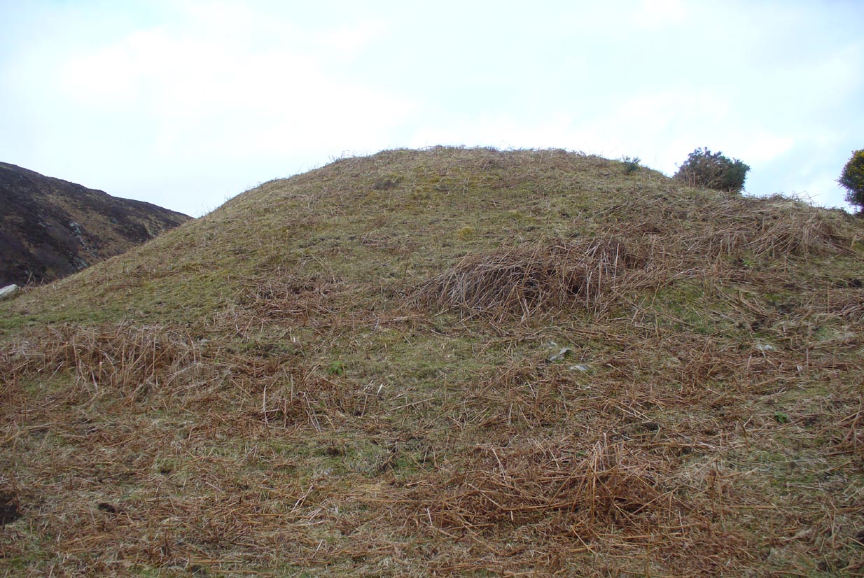
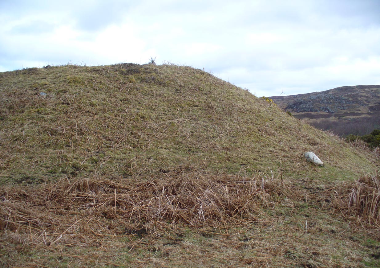
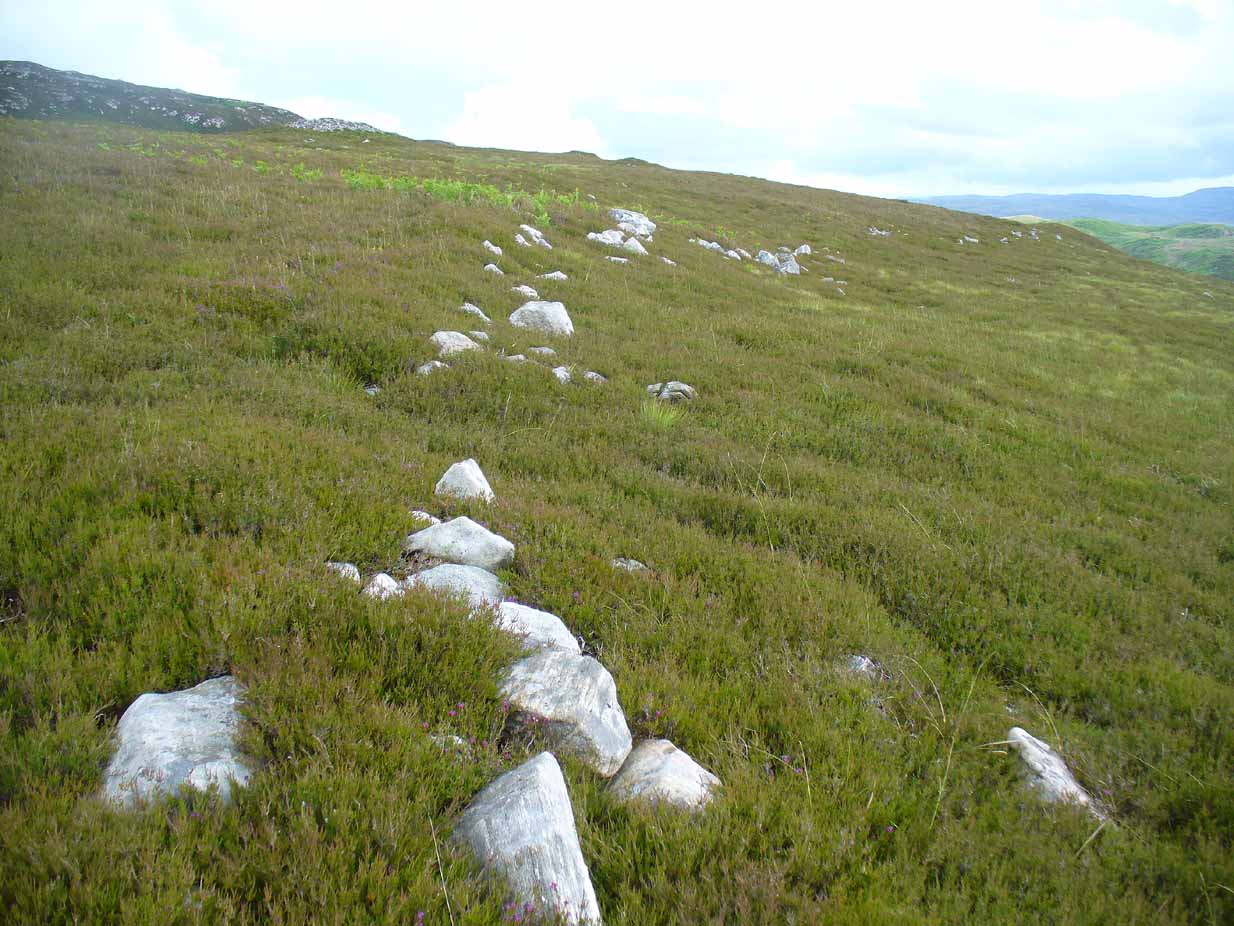
As you can see from the poor photos I got of the place, a large angled tumulus-like hillock (it’s akin to a mini-Silbury Hill at first sight) rises up from the ground with a reasonably uniform angle around much of it, to a height of between 16-20 feet. Scattered rocks and stones adorn the mound as you walk up its embankments and onto the top where, around the edges, a notable man-made ring of walling shows it to have been artificially created. Unfortunately most of the top of the mound was completely covered in thick decayed bracken when I visited, so it was difficult to get any good photos of this topmost walling.
The SE side of the mound
From the top of the mound, the walling is between 1-3 feet high, in a roughly circular setting, measuring 36-40 feet across. The most distinct section of it was visible on the west-to-south-to-east section; with the lowest and depleted section occurring on its northern edges. The entrance to the ‘hut circle’ is apparently on its eastern side. Although it is assumed to be Iron Age in nature, its real age is unknown.
References:
Mercer, R.J. & Howell, J.M., Archaeological Field Survey in Northern Scotland – volume 2, University of Edinburgh 1976-1983.
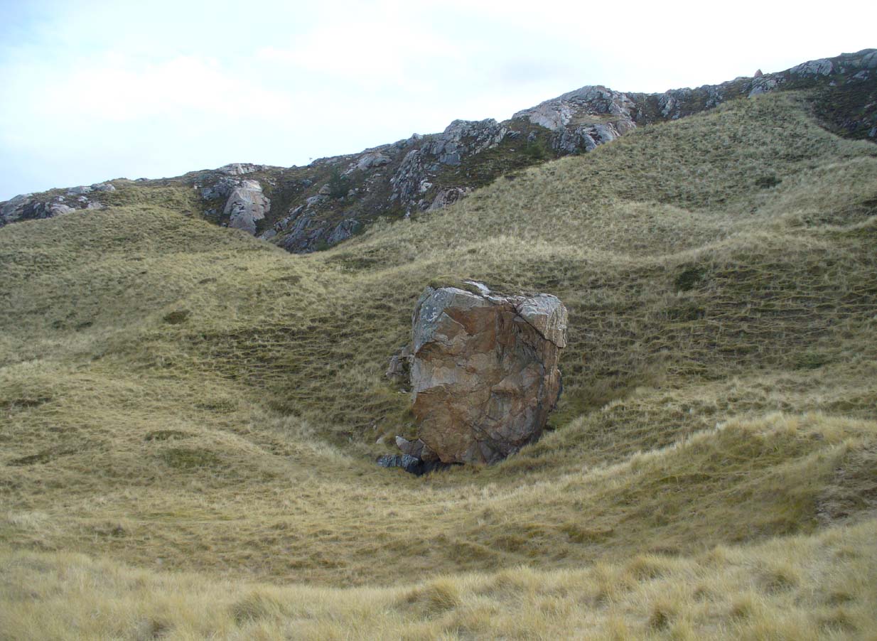
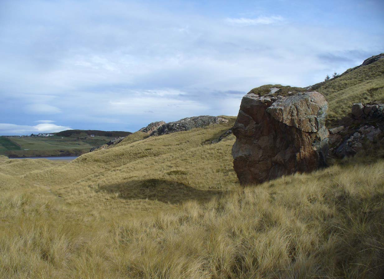
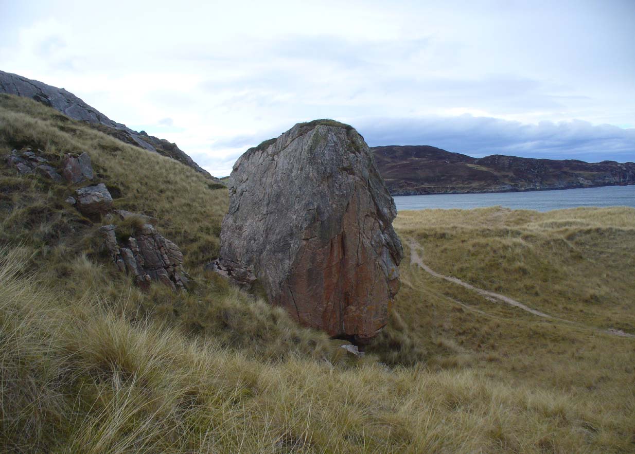
Along the A836 road between Tongue and Bettyhill, turn down towards Skerray at Borgie Bridge for 1.8 miles (2.87km) until you reach the little information sign at the roadside. Walk downhill and cross the little bridge and wander onto the west side of the beach. You’re likely to end up daydreaming… so once you’ve re-focussed, head into the middle of the beach and walk up the steep-ish sand-banks to your right (south). Once at the top, you’ll see a gigantic rock—the Ringstone—nearly as big as a house.
Folklore
This gigantic boulder is part of one of Sutherland’s archaic Creation Myths as they’re known: ancient stories recounted by archaic societies about the nature and origins of the world. Such tales tend to be peopled by giants, gods, huge supernatural creatures, borne of chaos, eggs, darkness and primal oceans. Thankfully we still find some examples of these tales in the northern and northwestern mountainous regions of Britain, as the Church and Industrialism never quite destroyed the hardcore communities—despite what they might like to tell you…
The face of the RingstoneThe Ringstone, gazing east
The following folktale was written by the local headmaster, Alan Temperley (1977), who wrote down many of the oral traditions in Scotland’s far north before they disappeared forever from the tongues of local people (as is sadly happening in these mountains) as they’re slowly, sadly, being erased by the influx of incomers with no connection nor sincere love of old tales and ways. It is typical of stories found other large geological formations from aboriginal Australia, to Skye, to everywhere on Earth where people have settled. Mr Temperley wrote:
“Many years ago there were two giants, the Naver giant from the river at Bettyhill, and the Aird giant from the hill above Skerray. Normally they got on quite well, but one afternoon they became involved in a heated argument about some sheep and cattle, and both grew very angry. The Aird giant was standing on top of the hill above Torrisdale bay with the animals grazing around him, and the Naver giant stormed across the river to the beach below.
“Those are my sheep,” he roared up the hill.
“No they’re not,” the Aird giant said. “At least not all of them.”
“You stole them. You’re a thief!”
“No I didn’t. They came up here themselves. Anyway, you owe me fifty sheep from last year.”
“You’re not only as thief, you’re a liar!” shouted the Naver giant. If you don’t send them down this minute, I’ll come up and see to it myself.”
At this the Aird giant gave a disparaging laugh and made a rude face, and picking up a great boulder flung it down the hill at his friend.
The Naver giant was speechless with fury, and picking the stone up himself, hurled it back up the hillside, making a great hole in the ground.
The Aird giant saw things had gone far enough.
“I’ll send them back if you give me that silver ring you’re always wearing,” he said.
“Never!” roared his friend, his face all red and angry.
“Suit yourself then,” said the Aird giant, and picking the stone up again he tossed it back down the hill.
For long enough the rock kept flying between them, and in time the giant from Naver grew tired, because he was throwing it uphill all the time.
“Will you give me the ring now?” said the Aird giant.
For answer the Naver giant tried one more time to throw the stone up the hill, but it only got halfway, and rolled back down to the shore.
“Come on,” said the giant from Aird, for he wanted to be friends again. “Give me the ring, and I’ll let you have it back later.”
“No!” said the Naver giant from the bottom of the hill. “I’ll never give it to you!” His eyes began to fill with tears.
“Oh, come on, please!” coaxed the Aird giant. “Just for a week.”
“Never, never, never!” shouted the giant from Naver, and pulling the ring from his finger he threw it on the ground and jammed the great boulder down on top of it. Then he sat down on top of the stone and stared out to sea. Every so often he sniffed, and his friend, looking down at his broad back, saw him lift the back of a hand to his eyes.
They never made friends again, and after a long time they both died.
The ring is still buried under the stone, and so far nobody has ever been able to shift it.”
The giant’s face, in profile
When I got back from visiting this immense rock a few weeks ago, a local lady Donna Murray asked me if I’d seen the face of the giant in the rock. I hadn’t—as I was looking to see if the name ‘Ringstone’ related to any possible cup-and-rings on its surface, which it didn’t (although I didn’t clamber onto the top). But in the many photos I took from all angles, Donna pointed out the blatant simulacra of the giant’s face when looking at it from the east.
However, on top of the slope above the Ringstone (not the Aird side), I did find a faint but distinct ‘Ringstone’ carving (without a central cupmark). Whether this ever had any mythic relationship to the tale or the stone, we might never know. The rocky terrain above Aird now needs to be looked at…
References:
Eliade, Mircea, Patterns in Comparative Religion, Sheed & Ward: London 1958.
Long, Charles H., “Cosmogony,” in Eliade, M., Encyclopedia of Religion – volume 4, MacMillan: New York 1987.
MacLagan, David, Creation Myths: Man’s Introduction to the World, Thames & Hudson: London 1977.
Temperley, Alan, Tales of the North Coast, Research Publishing Company: London 1977.
Acknowledgments: Massive thanks again to Donna Murray, for her help and for putting up with me amidst my wanderings up in Torrisdale and district.
Take the A836 road between Tongue and Bettyhill, turning down at Borgie Bridge for 1.8 miles (2.87km) until you reach the little information sign at the roadside. Walk downhill and cross the little bridge and wander onto the west side of the beach. You’re likely to end up daydreaming… so once you’ve re-focused, head into the middle of the beach and walk up the steep-ish sand-banks to your right (south). Once at the top, you’ll see a gigantic rock—the Ringstone—bigger than a house. Walk up the hill above this until your reach the rocky plateau where things roughly level out. Look around!
Archaeology & History
This previously unrecognised carving on the edge of the rocky promontory that drops down to the stunning Torrisdale Bay—above the gigantic and legendary Ringstone boulder—is very much like the curious ‘C’-shaped motif on the Fyfield Down petroglyph, a couple of miles east of Avebury, literally 499 miles (803km) to the south. Indeed, that’s all I kept thinking about when I found it!
Ringstone carving, looking S
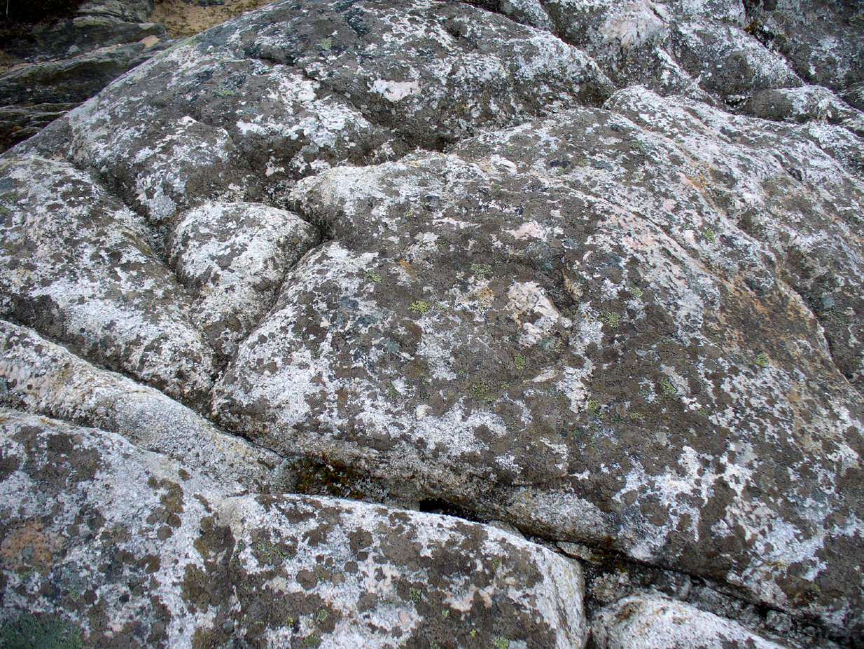
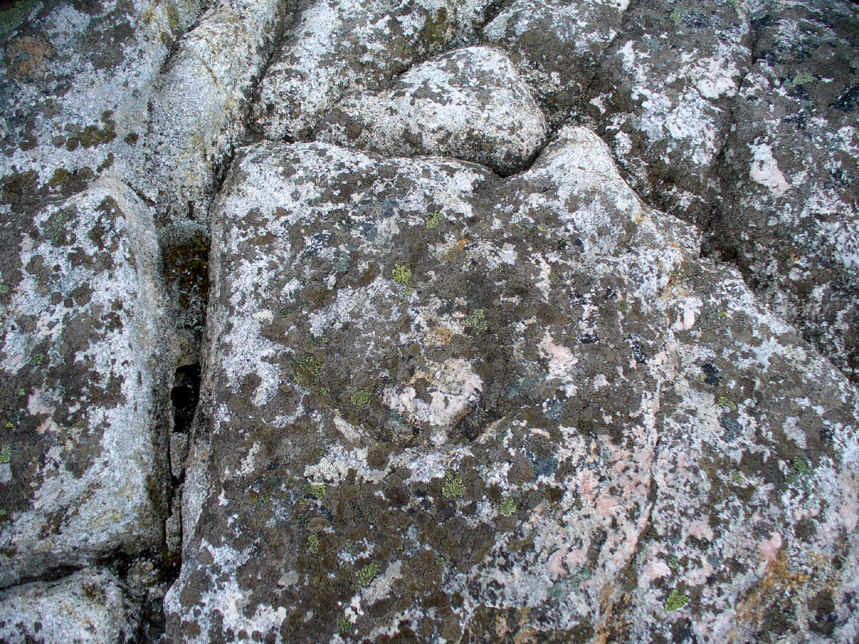
The carving’s nowt special—apart from the fact that it’s seemingly isolated and has no apparent companions nearby. It’s an incomplete circle, perhaps more like a bell-shape than a circle, about six inches across and seems to have no inner cup-mark. Its general appearance on the rock surface seems to indicate it was carved by a metal tool, instead of being ‘pecked’—but it’s still very old. Initially, I wondered whether it was an ichnological fossil or stromatolite—but it isn’t.
(Note that the OS-grid-ref is just a 6-figure one. I was ambling about and didn’t make an exact note of the place, but it won’t take much finding on the rocky levels above the giant Ringstone if you zigzag about. Apologies for the poor photos too, but She was cloudy most of the day.)
Acknowledgments: Huge thanks to Donna Murray, for putting me up in this part of Paradise. Cheers Donna.
Lochan Hakel’s cup & ring (photo by Sarah MacLean)
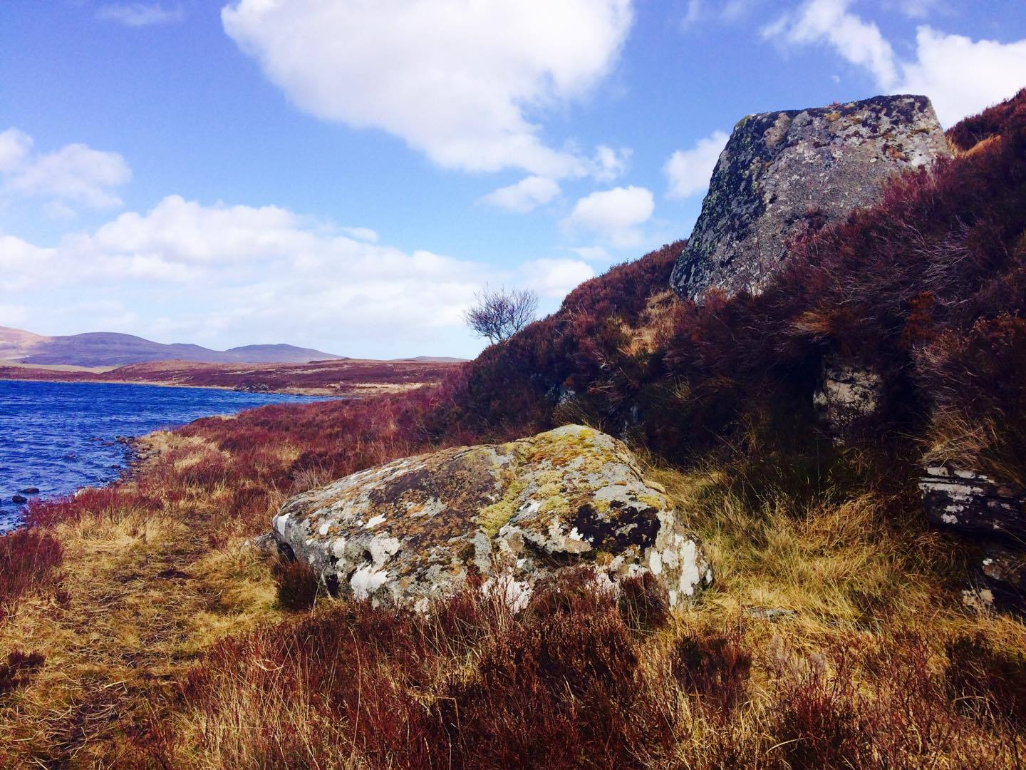
Whether you take the A836 or A838 into Tongue (through truly beautiful wilderness), make sure you go into the village itself—and then keep going, south, along the tiny country road. Nearly 2½ miles along, note the small loch of Lochan na Cuilce on your right. A few hundred yards past this, on the other side of the road (barely visible at first) is Lochan Hakel. Walk around to the south-side of the loch and, across from where the small island of Grianan lives, you’ll see this large rounded boulder by the loch-side.
Archaeology & History
Stuck in a veritably stunning middle-o’-nowhere landscape below the outstretched northern moors beneath Ben Loyal & co, there is no previous literary account of this faded petroglyph, rediscovered in early April 2017 when Sarah MacLean took us on a visit to the more renowned multiple cup-and-ringer of Lochan Hakel 2, just yards away above the moorland rise (which is unmissable from here). It’s not too special in comparison with its neighbour and many others—but try telling Sarah that!
Cup & ring atop of stone (photo by Sarah MacLean)
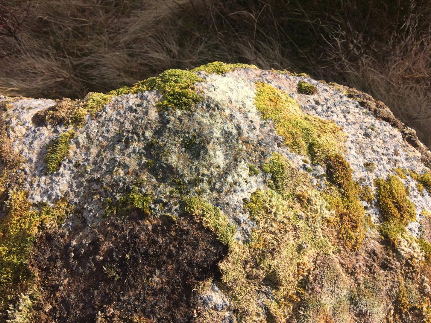
This large rounded lichen-covered boulder has, at its height, a carved ring around a natural rise—known as a ‘boss’—at the very top of the rock. On its southern side, Sarah found a single cup-mark, along with a couple of others on the more northeasterly sloping face. At the bottom of this face is another seemingly isolated small cup-marking. There may well be other carved elements beneath the mass of ancient lichens, but we thought it best to leave them for the time being. It’s also quite likely that other unrecorded carvings exist in the area.
Acknowledgments: Huge thanks to Sarah MacLean, not only for helping to locate this carving, but for use of her photos in this site profile. Cheers Sarah! And to Donna Murray, for putting up with me whilst in the area! …Now, let’s find some more of them!
Along the A84 road betweeen Callander and Lochearnhead, take the small road west when you reach Balquhidder Station, towards Balquhidder village. Go along here for 1½ miles (2.5km) as if you’re gonna visit the Puidrac Stone; but 200 yards past this, go through the gate on the south-side of the road into the boggy field for about 150 yards towards the River Balvag. You’re looking for several stones, as in the photos. You’ll find ’em. (you may get soaked though!)
Archaeology & History
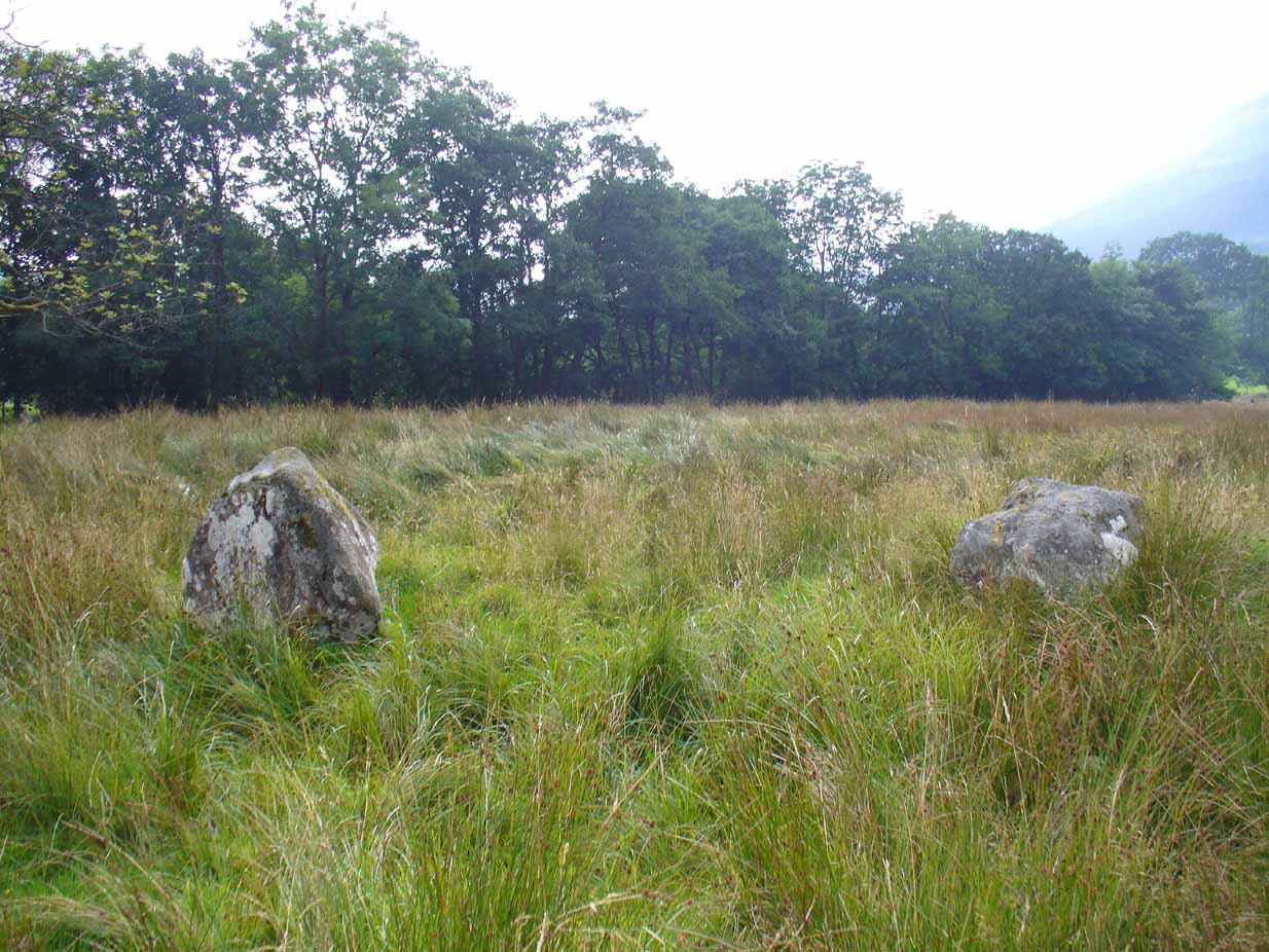
The stones, looking NW
After many thousands of years, this innocuous-looking group of small stones found in the very boggy field immediately west of the Puidrac Stone looks nothing like it once did. Some modern academics would have you think there was nothing here of prehistoric interest, but oral tradition and earlier writings tell otherwise. Although not shown on the early OS-maps, it was first described in James Gow’s (1887) articulation on the antiquities of the area, in which he told:
“A short distance east from the present (Balquhidder) parish church, in the haugh below the manse, there are seven stones remaining of a circle which appears to have been about 30 feet in diameter; only one stone is in its original upright position, but there are fragments of others lying about; as usual, they are known as “Clachan-Aoraidh,” or worshipping stones, and are not likely to be disturbed during the lease of the present tenant.”
Looking E, with Puidrac Stone just visible left of telegraph post
A few years later when Thomas Ross (1919) visited the area with a Prof Cooper and others, they reported the single standing stone still in position and the anglicized name of the Worshipping Stones was still in evidence amongst locals.
Arc of fallen stones by the trees
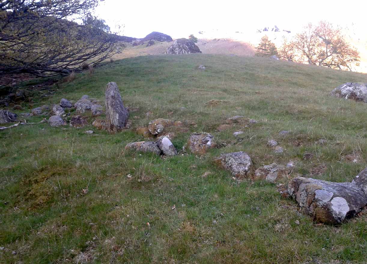
Nowadays the site is in ruin. Two of the stones stand out when the rushes aren’t too high, with one earthfast and its companion prostrate; but as you can see in the photo (right), there remains a sunken arc of two other stones laid down, running away from the larger ones, with a fifth overgrown and nearly covered by vegetation and the young trees. In all probability, tradition is probably right here: this is the remains of a stone circle.
Folklore
The field in which these denuded megalithic remains are found, was, wrote Thomas Ross (1919),
“the site of a long-popular market called ‘Feill Aonghais’, i.e., St Angus’ Fair. It was held, according to Mr Campbell, in May; according to Mr Gow, on “the Saint’s Day, the 6th of April.” It was quite the custom…to hold a fair after divine service on the Patronal Feast. The folks came to “kirk and market” on the same day, and mixed good fellowship and manly sport with their worship and their business.”
If you were to hold a fair there nowadays, likelihood is it would get flooded! Christian myths tell of a “St. Angus” taking over whatever the heathen traditions were in this domain, more than a thousand years back.
Venture along the A822 Crieff to Dunkeld road, turning down into the gorgeous Sma’ Glen. Nearly 1 mile past Ossian’s Stone, just past where the road crosses the River Almond, walk along the track on your right where the big boulder sits. Past the boulder, walk up the grassy slope to the left. A standing stone will catch your attention, which sits in the walling. Y’ can’t really miss it!
Archaeology & History
Rediscovered by Paul Hornby in 2015 at the end of a day’s excursion to the neolithic sites a few miles west of here, I can find no references at all to the denuded remains of what seems to be a typical prehistoric enclosure.
Looking down the west wallThe southwestern walls
Constructed around a natural rise in the land 60-70 yards above the River Almond, the enclosure has that ‘Iron Age’ look about it (it may be earlier). Shaped like a giant ‘D’ (and clearly visible on GoogleEarth), the extensive walling that makes up the site—about a yard wide all the way round—is far from small, measuring some 60 yards (54.8m) at its greater longer axis roughly north-south, by 54 yards (49.5m) east to west, with a circumference of about 170 yards (155.5m). The much-denuded walling that defines the perimeter is comprised of a number of large stones with thousands of smaller packing stones that are mainly overgrown. A large ‘standing stone’ about 3 feet tall is the most notable feature nearly halfway along the western wall.
Small standing stone in wall
In all probability this enclosure would have been in use since its construction in the Iron Age period all the way through to the coming of Fuadach nan Gàidheal (the Highland Clearances) in the 19th century, as the people here were pragmatists who made best use of what was around them. It is likely to have ended its days as an area where cattle was contained.
Acknowledgements: Huge thanks to Paul Hornby for his assistance with site inspection, and additional use of his photos.
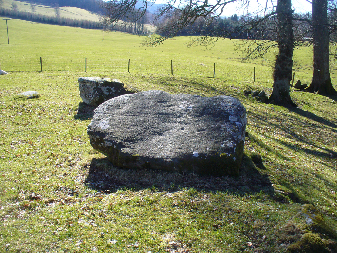
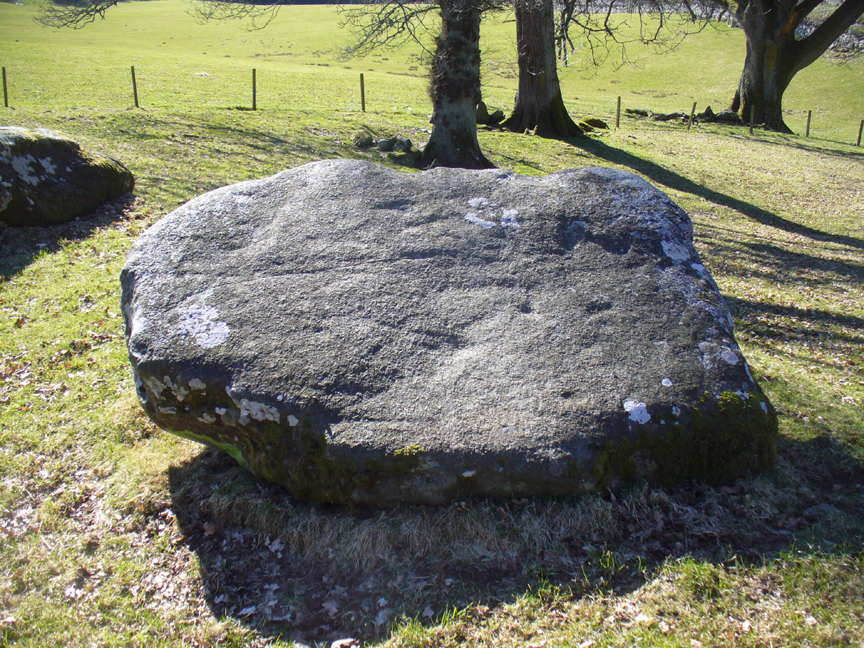
Follow the same directions for the Croft Moraig stone Circle. Then check out the largest of the fallen or elongated stones on the northwest side of the ring, with a smoothed sloping surface, just at the side of the overgrown stone platform on which it rests. Y’ can’t really miss it.
Archaeology & History
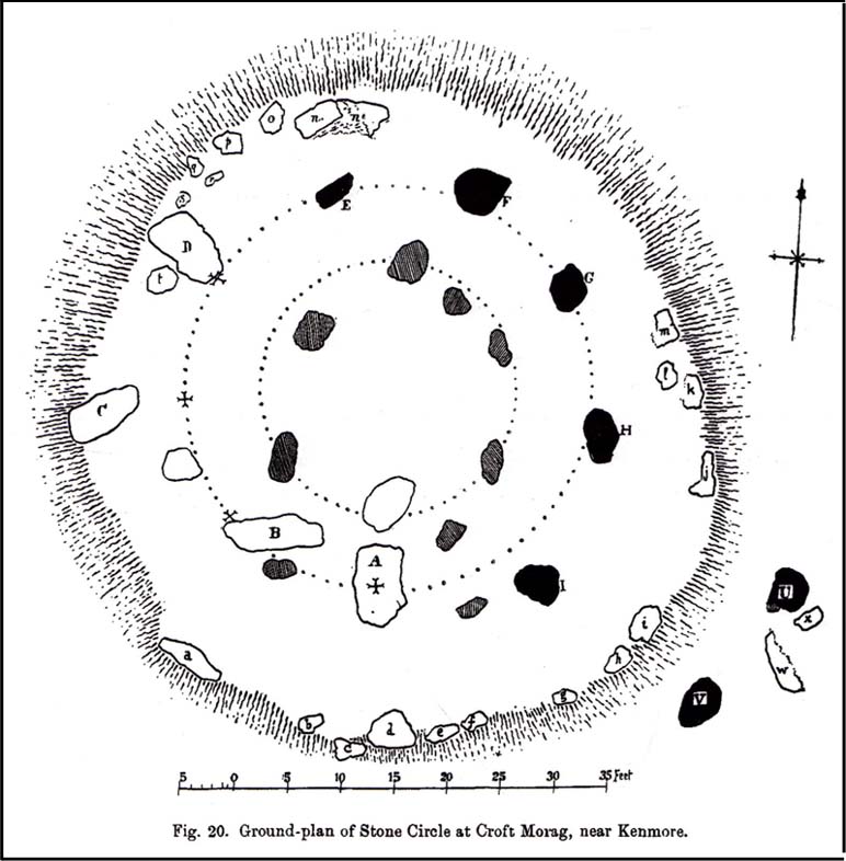
When William Gillies (1938) wrote about the carvings at the Croft Moraig stone circle, he told how, previously, Fred Coles,
“noticed that several of the upright stones…show cup-markings on their perpendicular surfaces. Some of these are quite distinct, but others are so worn through weathering that they can only be traced with the fingers.”
Stone D, with faint cupsClose-up of the cupmarks
This is one of them. Barely visible at the best of times, the cup-markings are faded and very hard to see unless daylight conditions are just right. As you can see in the photos, several distinct cup-like impressions are visible, but it only appears that two of them are cup-marks. The others seem to be more geophysical in nature – but I’d love to be wrong!
The great northern Antiquarian Fred Coles (1910) noted that this particular stone (stone D in his ground-plan of the circle) had “been polished by the sliding of generations of children”. This playful action on stones elsewhere in the UK and around the world sometimes relates to fertility rites (i.e., the spirit of the stone could imbue increased fertility upon the practitioner), but Mr Coles made no mention of such rituals here.
Gillies, William A., In Famed Breadalbane, Munro Press: Perth 1938.
Yellowlees, Sonia, Cupmarked Stones in Strathtay, Scotland Magazine: Edinburgh 2004.
Acknowledgements: Many thanks to hardcore crew for our various visits here: to Paul Hornby, Lisa Samson, Fraser Harrick, James Elkington, Penny & Thea Sinclair.
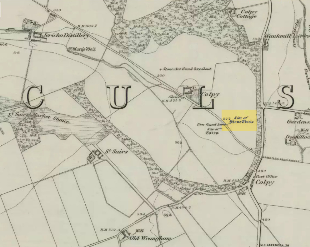
Just like the stone circle a half-mile east at Kirkton of Culsalmond, nothing now remains of this megalithic ring. It was first described very briefly by Rev. F. Ellis (1845) in the New Statistical Account as a “druidical temple”: one of two hereby, “on the farm of Colpie, although now almost obliterated. Several urns were dug up in making a road near one of them”—implying that one of them was a cairn circle or funerary monument of some kind. This was subsequently affirmed on the early OS-map and then described in Fred Coles’ (1902) survey, where he wrote:
“Site of a stone circle, the road going to Jericho Distillery having been made through it, and, on the south side of this road, the site of a cairn. Within the possible diameter of the circle an urn was found.”
Folklore
A few hundred yards west of the circle an ancient fair used to be held, known as St Sair’s Fair, named after St Serf. Although St Serf’s Day is July 1, early records show that the fair—held in a long field with the curious name of ‘St Sairs Market Stance’—was to be held on the Wednesday after the last Tuesday in June. For a stone circle, this is too close to Midsummer to be a coincidence! Early records show that the fair was granted in 1591 and subsequent years thereafter.
St Serf is a very peculiar mythological figure with quite shamanistic traits and tales around him. In truth, many of these early saints were little more than lapsed shamans, utilising natural magick and medicine in the olde traditions, but which became grafted onto the incoming christian mythos. The evidence for this is quite overwhelming!
References:
Barnatt, John, Stone Circles of Britain – volume 2, BAR: Oxford 1989.
Browne, G.F., On Some Antiquities in the Neighbourhood of Dunecht House, Aberdeenshire, Cambridge University Press 1921.
Burl, Aubrey, “The Recumbent Stone Circles of North-East Scotland”, in Proceedings Society of Antiquaries, Scotland, volume 102, 1973.
Burl, Aubrey, The Stone Circles of the British Isles, Yale University Press 1976.
Burl, Aubrey, The Stone Circles of Britain, Ireland and Brittany, Yale University Press 2000.
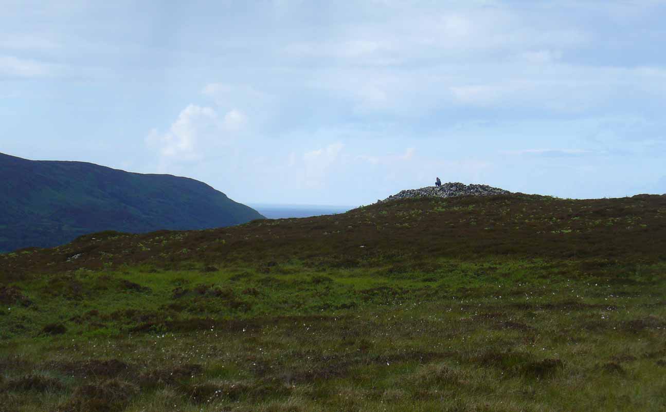
From Bettyhill village, take the road east towards Tongue and Durness. A half-mile out of the village, at the bottom of the hill, just before you cross the small metal bridge across the River Naver, a very minor road, left, takes you to Skelpick. Go down here and follow the directions to reach the giant long cairn of Skelpick Long. Once there, walk east up the moorland hill (there are no footpaths) for about 150 yards. Once on top of the rise, the moorland levels out a little and there, before you, amidst the small overgrown undulations of many old cairns, a giant one rises up to greet you about 100 yards away. Y’ can’t really miss it!
Archaeology & History
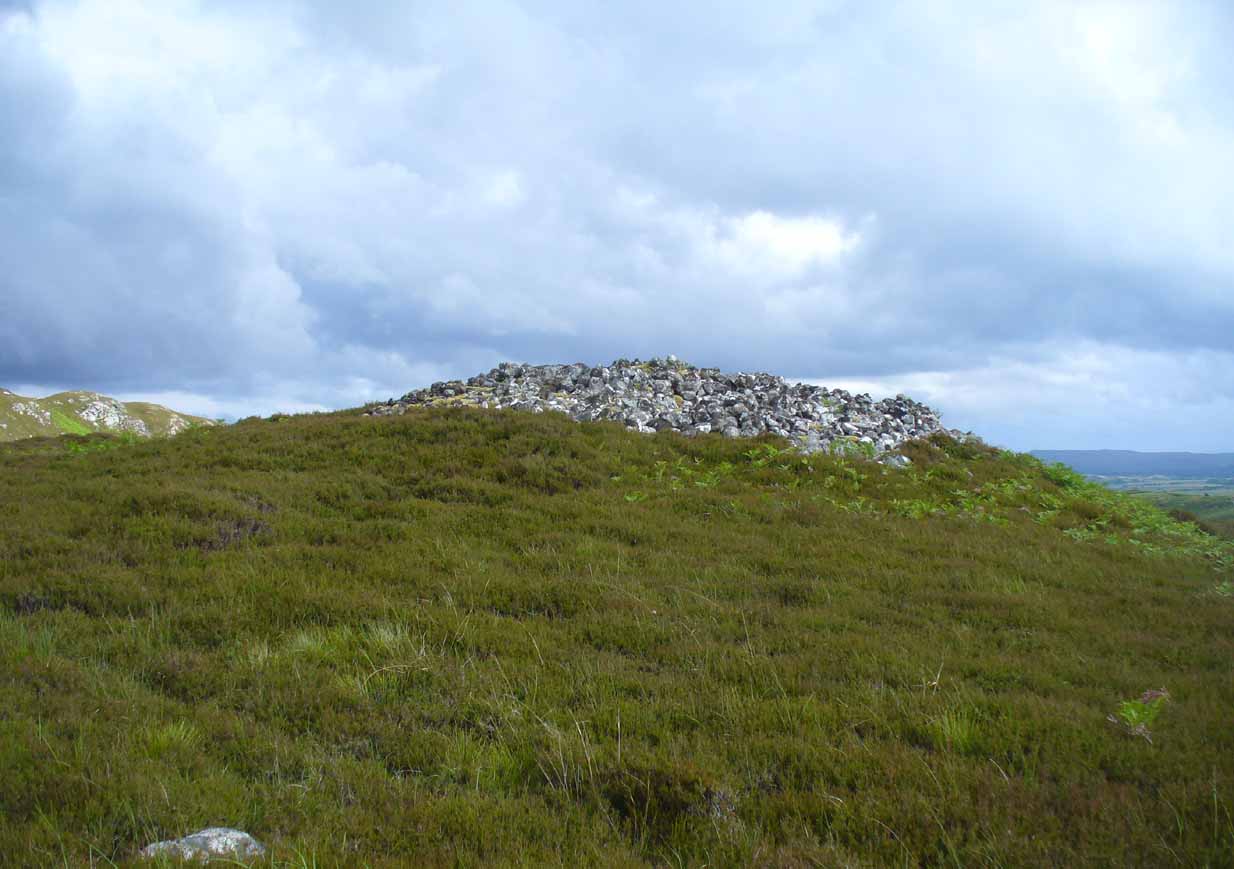
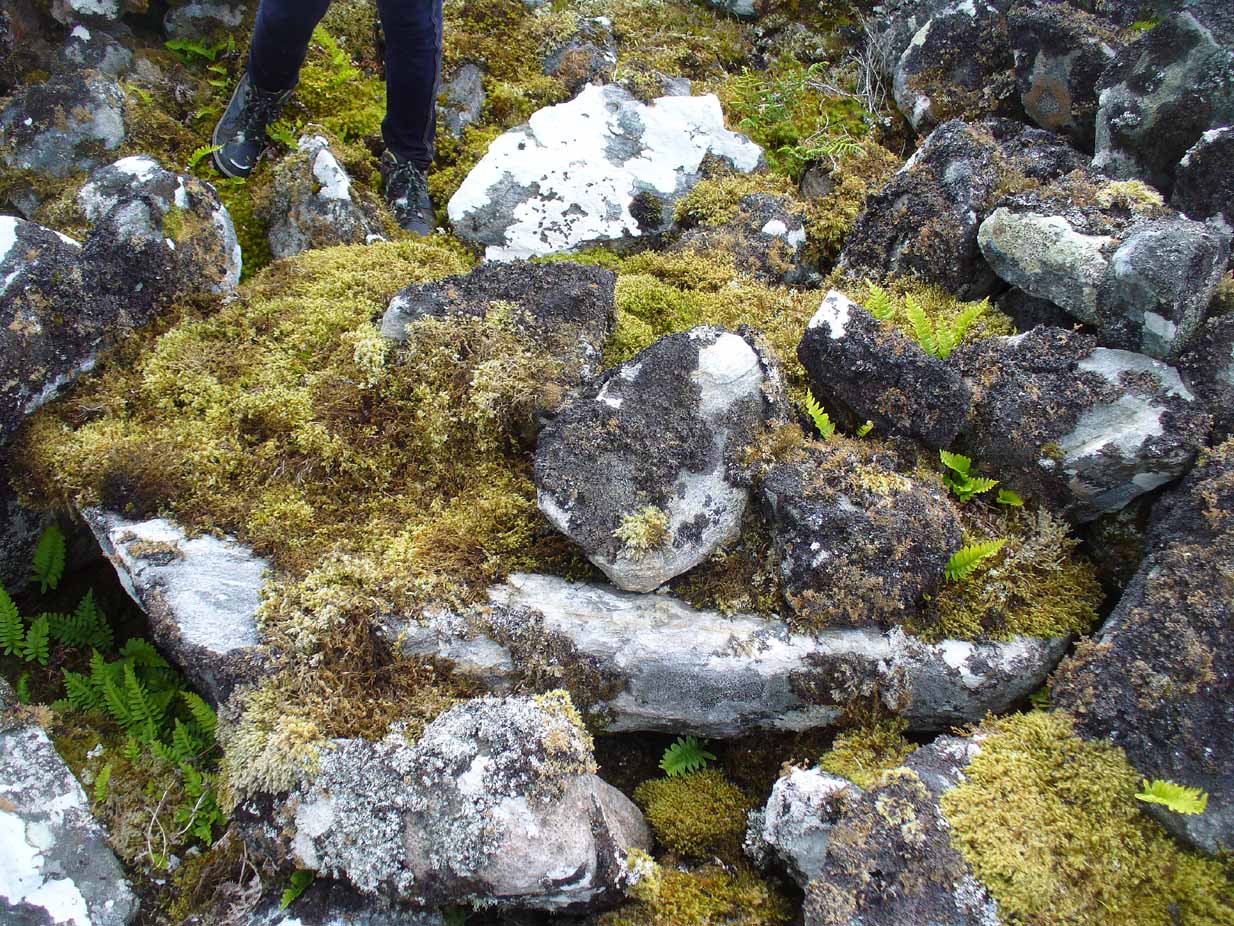
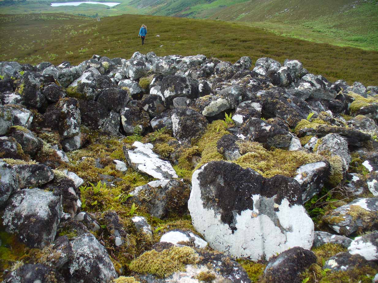
Neolithic in nature, this giant circular cairn, standing on the ridge above the hugely impressive chambered long cairn of Long Skelpick, isn’t quite as grandiose as its neighbour below, but it’s still an impressive feature in this beautiful moorland landscape. Comprised of tens of thousands of small stones raised to a height of 10 feet above the moorland peat, several ‘pits’ have been dug into the top of this undoubted tomb of regal nature; but whether it was originally the burial-place of a single person, to which were later added members of the same family, is simply unknown.
Moss-covered capstoneDepression atop of cairn
On the top of the cairn, at least one of the so-called ‘pits’ that drop into the centre is covered by a large heavy tombstone with a small upright monolith at its side. Although the late great Miss Henshall (2005) thought no ‘chamber’ was here, it is quite possible that a chamber might be found beneath this large moss-covered flat rock (see photo). When we visited here, it looked as if there was a hollow beneath it, but only an excavation would tell us for sure.
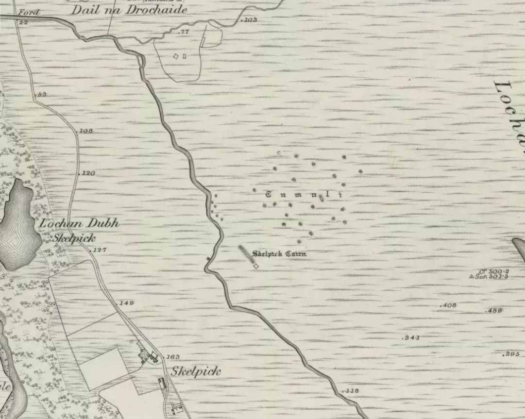
Mass of sites on 1878 map
Highlighted on the earliest Ordnance Survey map, it was shown to be just one cairn amidst the mass of other smaller surrounding tombs—most of which were probably built for people from the same tribal group. None of these small cairns have been excavated, but they were probably built after the construction of the major Queen’s Cairn.
The Royal Commission lads visited the site in 1909, but said very little of the place (probably over-awed by Long Skelpick, Coillie na Borgie and other nearby giants!), merely that this large circular cairn has
“a diameter of about 54′. It is about 8′ high, and though the stones have been pulled about here and there on the top, it does not appear to have been excavated.”
Queen’s Cairn, looking N
And so it remains to this day—although the cairn is slightly larger than the dimensions given by the Commission boys. Beneath the encroaching heather, the cairn is closer to 67 feet (10.23m) across, with a circumference of 210 feet (64.25m).
Line of ancient wall nearby
The monument sits on a plateau immediately above the giant Long Skelpick cairn—although neither can be seen from each other. But if you walk only a short distance from the Queen’s Cairn towards the long cairn below, a very notable and extensive line of ancient walling runs along the edge of the geological ridge separating the two tombs, as if deliberately keeping them apart. Other lines of ancient walling run closer to the cairn, seeming to indicate that a settlement of some form was also apparent on this ridge, in close connection with the group of smaller burial cairns.
It’s a gorgeous arena with many prehistoric sites and puzzles to behold, and plenty of unrecorded ones nestling quietly in the heather. It’s bloody superb to be honest!
References:
Gourlay, Robert, Sutherland: An Archaeological Guide, Birlinn: Edinburgh 1996.
Henshall, Audrey S. & Ritchie, J.N.G., The Chambered Cairns of Sutherland, Edinburgh University Press 2005.
Royal Commission Ancient & Historical Monuments, Scotland, Inventory of Monuments and Constructions in the County of Sutherland, HMSO: Edinburgh 1911.
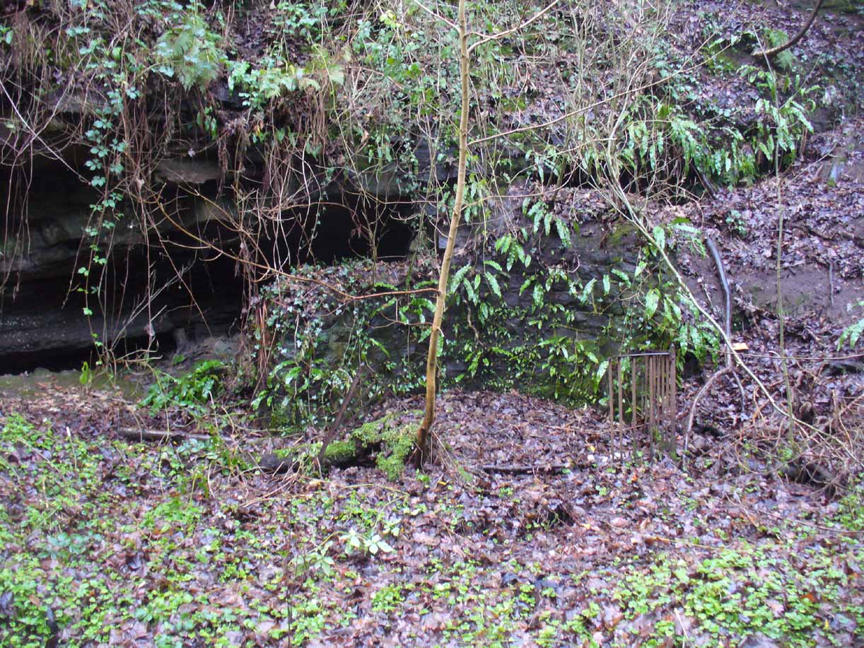
There must be an easier way to visit this site than the method I used. Which was: along Cambuslang’s Main Street (A724), turn up the B759 Greenlees Road for nearly 500 yards, turning left onto Vicarlands Road. Notice the grass verge and steep slope immediately to your left. Walk into the tree-lined gorge, following the left-side along the edges of the fencing. About 150 yards down the steep glen, note the very denuded arc of stone-walling and rickety fencing on the other side of the burn. That’s it! (broken glass and an excess of people’s domestic waste are all the way down; very difficult to reach, to say the least!)
Archaeology & History
Found in a dreadful state down the once-beautiful Borgie Glen, this is one of the most curious entries relating to sacred and healing springs of water anywhere in the British Isles. Indeed, the traditions and folklore told of it seem to make the site unique, thanks to one fascinating factor…..which we’ll get to, shortly…..
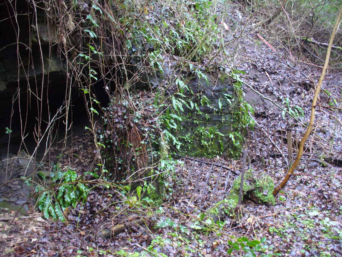
Remains of the Borgie Well
The name ‘Borgie’ is an oddity. Local historians J.T.T. Brown (1884) and James Wilson (1925) wondered whether it had Gaelic, Saxon or Norse origins, with Brown thinking it may have been either a multiple of a simple bore-well, or else a title given it by a travelling minister from Borgue, in Kirkcudbright. Mr Wilson took his etymology from the very far north where “there is a stream called the Borgie” (just below the Borgie souterrain). This is said to be Nordic in origin, with
“borg, a fort or shelter, and -ie, a terminal denoting a stream. It is almost certain that our Borgie has the same origin; that is, ‘the fort or shelter by the stream.’”
The Borgie Well was described by a number of authors, each of whom spoke of its renown in the 19th century and earlier. One of my favourite Glasgow writers, Hugh MacDonald (1860), had this to say about the place:
“There are several fine springs in the glen, at which groups of girls from the village, with their water pitchers, are generally congregated, lending an additional charm to the landscape, which is altogether of the most picturesque nature. One of these springs, called “the Borgie well,” is famous for the quality of its water, which, it is jocularly said, has a deteriorating influence on the wits of those who habitually use it. Those who drink of the “Borgie,” we were informed by a gash old fellow who once helped us to a draught of it, are sure to turn “half daft,” and will never leave Cambuslang if they can help it. However this may be, we can assure such of our readers as may venture to taste it that they will find a bicker of it a treat of no ordinary kind, more especially if they have threaded the mazes of the glen, as we have been doing, under the vertical radiance of a July sun.”
Borgie Well, looking south
It’s somewhat troublesome to reach, but a beautiful landscape indeed is where, today, only remnants of the Borgie Well exist. A very eroded semi-circle of walling and iron bars protects what was once the waters of the well—which have long since fallen back to Earth. Behind it, right behind it, overhangs the cliff and a small cave: a recess into the Earth with its very own feeling. It has the look and feel of a witch’s or hermit’s den with distinct oracular properties. This geomancy would not have gone unnoticed by our ancestors. In this enclaved silence, the once bubbling waters beneath the cliffs give a feel of ancient genius loci—a memory still there, despite modernity. Whether this crack in the Earth and its pure spring waters was some sort of Delphic Oracle in days gone by, only transpersonal ventures may retrieve… Perhaps…
In the 19th century a path took you into the glen from the north, and a commemorative plaque was erected here by a Dr Muirhead, where now lie ruins. It read:
The Borgie Well here
Ran many a year.
Then comes the main verse :_
Wells wane away,
Brief, too, man’s stay,
Our race alone abides.
A s burns purl on
With mirth or moan,
Old Ocean with its tides,
Each longest day
Join hands and say
(Here where once flowed the well)
We hold the grip
Friends don’t let slip
The Bonny Borgie Dell.
1879.
At the base was carved an appeal to the local folk:
Boys, guard this well, and guard this stone,
Because, because, both are your own.
The plaque has long since gone; and according to the local historian J.T.T. Brown (1884), the waters went with it due to local mining operations around the same time. But there was an additional rhyme sang of the Borgie Well which thankfully keeps the feel of its memory truly awake (to folk like me anyway!). It is somewhat of a puzzle to interpret. Spoken of from several centuries ago, it thankfully still prevails:
A drink 0′ the Borgie, a taste 0′ the weed,
Sets a’ the Cam’slang folks wrang in the heid.
Meaning simply, if you drink the waters of this well, you’ll get inebriated! It’s the derivation of the word ‘weed’ that is intriguing here. In Grant’s (1975) massive Scottish dialect work we are given several meanings. The most obvious is that the weed in the poem is, literally, a weed as we all know it. But it also means ‘a fever’; also ‘to cut away’ or ‘thin out’; to carry off or remove (especially by death); as well as a shroud or sheet of cloth. These meanings are found echoed, with slight variants, in the english dialect equivalent of Joseph Wright. (1905) Hugh MacDonald told that the Enchanter’s Nightshade (Circaea lutetiana) grew hereby—which, initially, one might think could account for this curious rhyme. But the Enchanter’s Nightshade has nothing to do with the psychoactive Nightshade family, well-known in the shamanistic practices of our forefathers. However, in the old pages of one Folklore Society text, William Black (1883), in repeating the curious rhyme, told us:
“The Borgie well, at Cambuslang, near Glasgow, is credited with making mad those who drink from it; according to the local rhyme —
A drink of the Borgie, a bite of the weed,
Sets a’ the Cam’slang folk wrang in the head.”
The weed is the weedy fungi.”
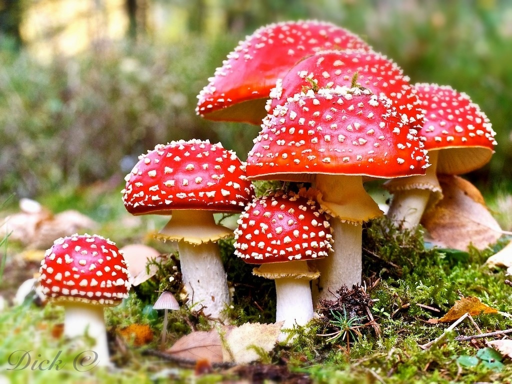
A mushroom no less! In John Bourke’s curious (1891) analysis of early mushroom use, he repeats Mr Black’s derivation. If this ‘weed’ was indeed use of mushrooms that made the local folk “go mad” or “wrang in the head” (and if not – what was it?), it’s an early literary account of magic mushroom intoxication! If this interpretation is correct, the likelihood is that the Borgie Well was a site used for ritual or social use of such intoxicants. Many sites across the world were used by indigenous people for ritual intoxication, and this could be one of the last folk remnants of such usage here. We know that Scotland has its own version of cocaine, used extensively by our ancestors (even the Romans described it) and which was still being used by working Highlanders in the 20th century—but early descriptions of mind-affecting mushrooms are rare indeed!
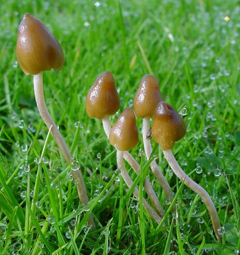
Psilocybe semilanceataAmanita muscaria
Mr Black gives no further folklore, nor the source of his information, other than to suggest that the madness incurred by the Well typified the people of Cambuslang! “Weedy fungi” may have been ergot (Claviceps purpurea), but the incidence of the grasses upon which it primarily grows, rye, here seems unlikely—and the folklore would certainly have included the ‘death’ aspects which that fungus brings! Fly agarics (Amanita muscaria) however, may have grown here. Old birches are close by, which produce nice quantities of those beautiful fellas. On the fields above the gorge, where now houses grow, Liberty Caps (Psilocybe semilanceata) may have profused—as they do in the field edges further out of town—but this species has no local cultural history known about from the early period. We must, however, maintain a healthy scepticism about this interpretation—but at the same time we have to take into account the ‘intoxicating’ madness which the combination of the “waters and the weed” elicited.
One final note I have to make before closing this site entry: despite the beautiful location, this small gorge is in a fucking disgraceful state. Some of the people who live in the houses above the gorge should be fucking ashamed of themselves, dumping masses of their household rubbish and tons of broken glass into the glen. If these people are Scottish, WTF are you doing polluting your own landscape like this? This almost forgotten sacred site needs renewing and maintaining as an important part of your ancient heritage. Have you no respect for your own land?!?
References:
Armitage, Paul, The Ancient and Holy Wells of Glasgow, TNA 2017.
Black, William George, Folk Medicine: A Chapter in the History of Culture, Folk-lore Society: London 1883.
Walker, J.R., ‘”Holy Wells” in Scotland”, in Proceedings of the Society of Antiquaries, Scotland, volume 17, 1883.
Wilson, James A., AHistory of Cambuslang, Jackson Wylie 1925.
Wright, Joseph, The English Dialect Dictionary – volume 6, Henry Frowde: Oxford 1905.
Acknowledgements: Huge thanks again, in various ways, to Nina Harris for getting us here; and Paul Hornby, for reminding me of my literary sources when I needed them! Thanks too to Travis Brodick and his beautiful photo of the Amanita muscaria cluster.