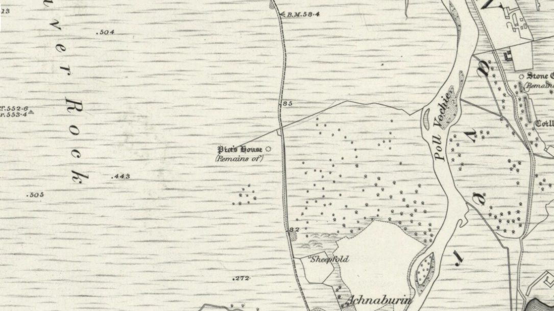
‘Hut Circle’: OS Grid Reference – NC 7082 5891
Also Known as:
- Achnabourin
- Canmore ID 6210
Getting Here
From Bettyhill village, take the A836 road as if you’re going to visit Tongue, crossing the metal bridge across the River Naver a mile south of Bettyhill. Keep going past here for nearly a mile, beyond the houses and then into the small trees, making sure that you keep your eyes peeled to the right where a small but notable bracken-covered mound rises 10-20 yards in the rough field. Go through the gate and you’re there!
Archaeology & History

A site which, from the nearby roadside, has all the hallmarks of being yet another Sutherland broch (there are tons of them up here!)—but apparently it isn’t! Despite being shown on the earliest OS-map of the region as a ‘Pict’s House’ (which are usually brochs), the site has subsequently been designated by modern archaeologists as a simple ‘hut circle’. I have my doubts over this, as it’s a most unusual one with little logic over its positioning—unless it was either a look-out point, or an odd ritual spot.
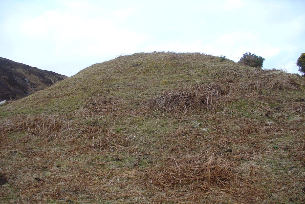
As you can see from the poor photos I got of the place, a large angled tumulus-like hillock (it’s akin to a mini-Silbury Hill at first sight) rises up from the ground with a reasonably uniform angle around much of it, to a height of between 16-20 feet. Scattered rocks and stones adorn the mound as you walk up its embankments and onto the top where, around the edges, a notable man-made ring of walling shows it to have been artificially created. Unfortunately most of the top of the mound was completely covered in thick decayed bracken when I visited, so it was difficult to get any good photos of this topmost walling.
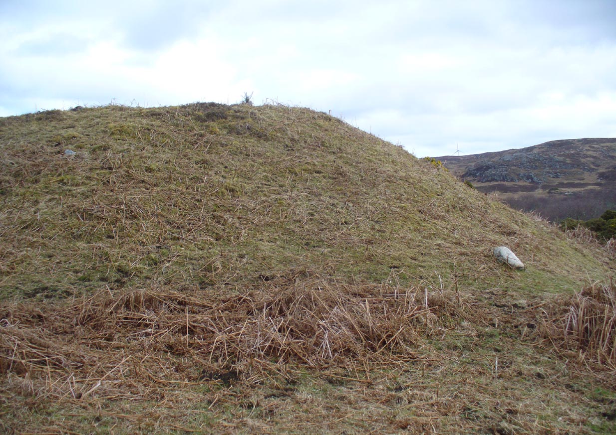
From the top of the mound, the walling is between 1-3 feet high, in a roughly circular setting, measuring 36-40 feet across. The most distinct section of it was visible on the west-to-south-to-east section; with the lowest and depleted section occurring on its northern edges. The entrance to the ‘hut circle’ is apparently on its eastern side. Although it is assumed to be Iron Age in nature, its real age is unknown.
References:
- Mercer, R.J. & Howell, J.M., Archaeological Field Survey in Northern Scotland – volume 2, University of Edinburgh 1976-1983.
© Paul Bennett, The Northern Antiquarian