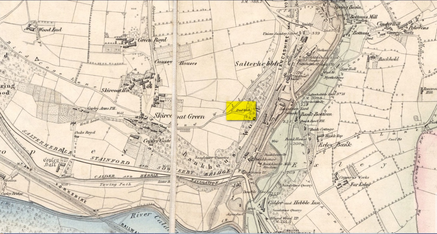
This curiously-named old water source may have an equally curious history behind it – albeit forgotten. Shown on the 1854 OS-map of the area and giving its s name to Dudwell Lane, we can see how an old path led from the road to the well and nowhere else.
It’s the word “dud” that holds our attention here; for if we hasten to the immensely erudite Joseph Wright (1900) in his gigantic survey of northern dialect, we find that the word relates to “a rag, piece of cloth; pl. clothes, esp. shabby, ragged, or dirty clothing.” This is echoed in another Yorkshire dialect work by Morris (1892) who told that the word meant “clothes (or) rags.” Several other Victorian writers tell us variations on this meaning (one adds old shoes to the list!), but in all instances it relates to dud being a rag, whereas the plural duds are rags or scruffy clothes. Naathen (to use another old dialect word), those of us who know a thing or two abaat olde wells are very very familiar with their association to old rags that were hanged on the surrounding trees as offerings to the spirits of the water—the genius loci—to aid in the hope or desire of something, or merely as respect to the waters for their beneficient properties. (this sometimes occurred ritually at set times in the calendar)
Dud Well on 1854 OS-map
The Dud Well was obviously of considerable local repute, for just a couple of years after it was shown on the earliest OS-map, a local bailiff called Samuel Rhodes built The Dudwell house close to the waters, which he named “in honour of the magnificent and never-failing spring of pure, bright, sparkling water in the wells close by.”
There is a possible alternative meaning to the word dud, which is that some dood called ‘Duda’ left his name here! This seems much more speculative and unlikely than the use of a local dialect term. Hopefully a local historian amongst you might perhaps be able to find out more.
References:
Morris, M.C.F., Yorkshire Folk-Talk, Henry Frowde: London 1892.
Wright, Joseph, English Dialect Dictionary – volume 2, Henry Frowde: London 1900.
Sacred Well (destroyed): OS Grid Reference – SE 1589 3132
Archaeology & History
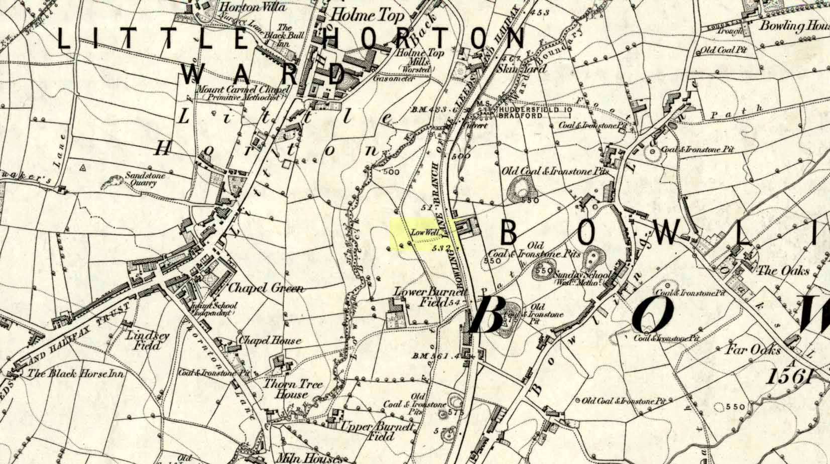
Low Well on 1852 map
Along the now-lost Low Well Road between Little Horton and West Bowling, could once be found this innocuous-sounding water source. Shown on the 1st OS-map of the area in 1852, the site was deemed to be little other than a ‘public well’. At the end of the 19th century, a small well-house was built over the waters; and the years following that saw its complete demise. Its name you would think relates to a position in the land, but the dialect word low, or lowe can mean “a flame, blaze, light, glow”, it can also refer to a prehistoric tomb. However in this case it most likely derives from “a pond or standing pool”.
…And if some of you wonder why I have given this so-called Public Well the provenance of being a “sacred well”, please keep reading…
Folklore
Although it was deemed a simple ‘public well’ by historians and the public water authority, local folk knew there was much more to it than that! In the Bradford area, this innocuously-named Well is the most promiscuously supernatural of all water sources, with a hidden history of magickians, ghosts and black dogs haunting its once ancient flow. It was a site remembered as having oracular powers, where local people used it in scrying the future. For such powers to work here, one had to gaze into the waters as they stilled at 6 o’ clock in the morning – a common time used by ritual magickians for the invocations of spirits.
The Bradford historian William Scrotum (1889) told us that in the 1860s, local people reported that the phantom black dog—or Bharguest as it was known—with its glowing red eyes, was seen coming out of the well after dark and scaring people half out of their wits. Very soon people would not even venture out after dark for fear of encountering this great harbinger of Death. Several years passed before local people called upon the abilities of a ritual magickian in the hope that he could lay the ghostly hound and bring peace and stability back to the hearts and minds of those living hereabouts. Eventually, after much work, the magickian exorcised the waters and cast the black dog back into the depths of the Earth from whence it had come and, to this day, sightings of the spectral hound have stopped.
Water sources that possess ingredients of hauntings, magic and oracular properties are universally ascribed as ‘sacred’ in one way or the other. In pre-industrial times I have little doubt that, amongst the animistic pantheon of local Bradfordians, this was no exception.
References:
Scruton, William, Pen and Pencil Pictures of Old Bradford, Thomas Brear: Bradford 1889.
Wright, Joseph, The English Dialect Dictionary – volume 3, Henry Frowde: London 1902.
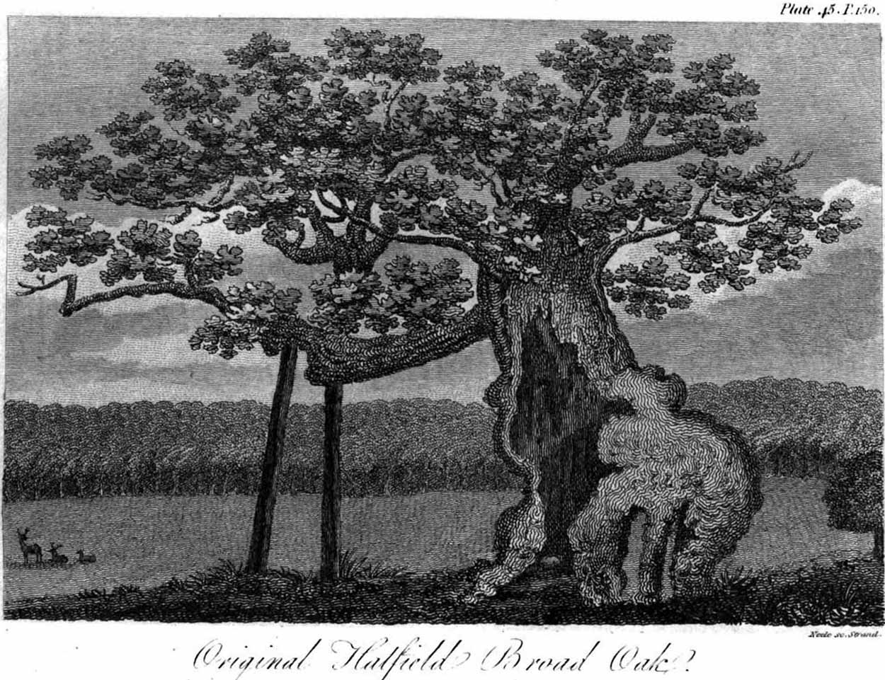
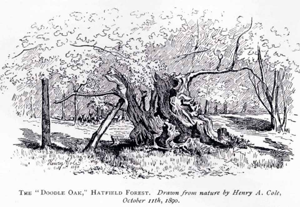
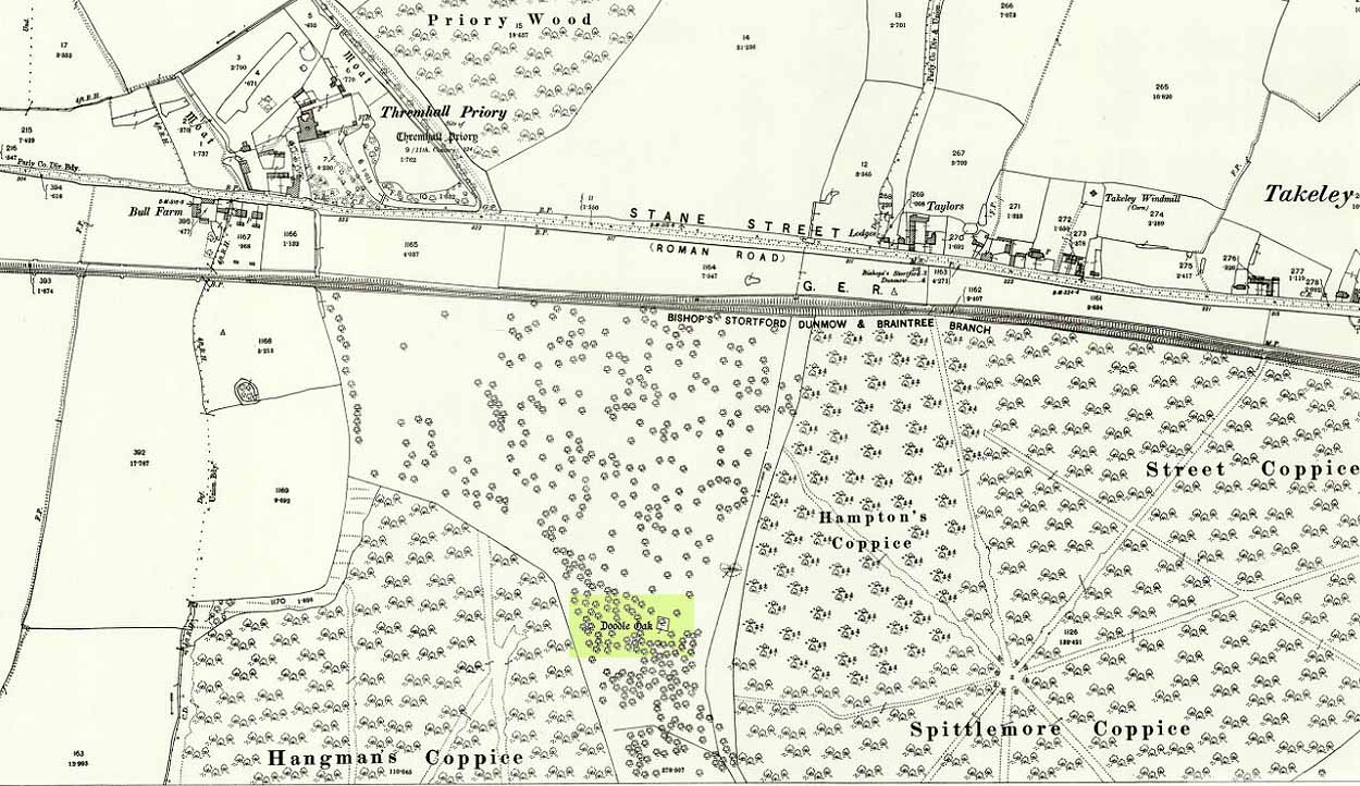
Erroneously ascribed by the reverend Winsland (1952) as being the ‘Doodle Oak’, the ancient and giant tree called the Broad Oak was, as records show, always known by this name, but was subsequently replaced by another after its demise. It was this second tree that became known as the Doodle Oak. Winsland described it as “an immense and famous oak tree”, under whose “spreading branches in olden days the Lord of the Manor probably held his court and dispensed justice.”
The tree was described as early as 1136 AD and was probably an early tribal meeting site, or moot spot. In Philip Morant’s (1763) work, he described it as,
“A tree of extraordinary bigness. There has been another since…called Doodle Oak.”
The old Oak in 1890
The Doodle Oak was thought to date from around 10-11th century and its predecessor may have been upwards of a thousand years old before this one took its place. In 1949, one patient botanist, Maynard Greville, investigated the Doodle Oak tree-rings and found it to be 850 years old. Other estimates suggest it was a hundred years older than that! Whichever was the correct one, a measurement of its trunk found it to be some 19 yards in circumference – one of the largest trees ever recorded in Britain!
Sketches of its dying body were thankfully made near the beginning and the end of the 19th century: one in Mr Vancouver’s (1807) Agriculture of Essex, and the other by Henry Cole of the Essex Naturalist journal.
Doodle Oak on 1896 map
Some speculate that the Broad Oak of ancient times and the subsequent Doodle Oak were at very different places in the parish, but without hard evidence this idea is purely hypothetical. And whilst the name ‘broad’ oak is easily explained, the name ‘doodle’ is slightly more troublesome. However, a seemingly likely etymology is found in the Essex dialect word dool, which Edward Gepp (1920) told,
“seems to mean, (1) a landmark; (2) a path between plots in a common field.”
The former of the two would seem to be the most likely. This is echoed to a greater degree in Wright’s (1900) magnum opus, where he found the dialect word dool all over the southeast, meaning,
“a boundary mark in an unenclosed field.”
Giant trees on ancient boundaries, like the Broad Oak of earlier times, would seem to be the most probable reason for its name. Today, all that’s left of the site is a small plaque on a small tree-stump, telling us what once stood here…
Whichever route you take to reach this lovely hamlet, hiding away in deep greenery, when you get to the one and only road junction, where it goes downhill (towards the old church), look just above you just below the first tree. All but covered in vegetation, the ruined stone lays down there. Climb up and see!
Archaeology & History
Tis up on the verge here
An exploration of this site was prompted when fellow antiquarian, Paul Hornby, came across the curious place-name of ‘Ghaist Stane’ when he was looking over some old Ordnance Survey maps of the region. So we met up and took a venture over there! Last highlighted on the 1865 map (when the old village was known as Fearn, not the modern spelling), even the Canmore lads had missed this one. But it’s not easy to find….
After meandering back and forth by the village roadside, on the tops of the walls, into the field above, Paul eventually said, “Is that it?!” just above the roadside, almost buried in vegetation below the roots of a tree. So I clambered back up and brushed some of the vegetation away – and there it was – in just the place that the old OS-map showed it to be (give or take a few yards).
The remains of the stone measure roughly 3 feet by 3 feet; with the present upper portion of the stone being of a lighter colour than the lower portion, indicating that this section of the stone was the portion that was underground when it was standing upright. Its history is fragmentary, but we know that it was almost completely destroyed in the middle of the 19th century. Notes from the Object Name Book of the region in 1861 told,
“The “Ghaist Stane”…formerly well known, is becoming little known from the stone having been recently blasted in making the Dike it now forms a part of, but it may be observed in the wall as a huge stone much larger than those beside it in the Dike. It does not project now from the side of the Road.”
Now the stone is almost entirely forgotten and lays covered, ignored, even by local people. It could do with being resurrected and its heritage preserved before it disappears forever.
Folklore
The uncovered Ghaist Stane
The word “ghaist” is a regional dialect word meaning “a ghost or goblin”, inferring that the site was haunted. And, considering the inherent animistic cultural psychology of the people here in earlier centuries, we must also consider the distinct possibility that the stone itself was the abode of a resident spirit, perhaps an ancestral one of a local chief, or queen, or elder of some sort.
In James Guthrie’s (1875) analysis of the folklore of Fern township, he told of the peculiarly odd violent brownies of the district and thought that they and the spirit of the Ghaist Stane were one and the same.
“In addition to the leading characteristics of Brownies in general the more prominent of these being, that they forded the rivers when their waters were at their highest, and that the sage femme always landed safely at the door of the sick wife—the brownies of Ferne are connected with scenes of cruelty and bloodshed. This peculiarity would seem to indicate that the brownie and the ghaist of Feme, were one and the same. The Ghaist Stane is in the vicinity of the church. To this piece of isolated rock, it is said this disturber of the peace was often chained as a fitting punishment for his misdeeds, but tradition is silent as to the brownie being similarly dealt with, which strengthens the supposition that they were, in this quarter at least, generally regarded as one being.”
The spirit of the Ghaist Stane roamed far and wide in the district it seemed, and a long rhyme telling a tale of the ghaist was once well-known in the area which, thankfully, Mr Guthrie gave us in full:
THE GHAIST O’ FERNE-DEN
There liv’d a farmer in the North,
(I canna tell you when),
But just he had a famous farm
Nae far frae Feme-den.
I doubtna, sirs, ye a’ hae heard,
Baith women folks an’ men,
About a muckle, fearfu’ ghaist —
The ghaist o’ Ferne-den!
The muckle ghaist, the fearfu’ ghaist,
The ghaist o’ Ferne-den;
He wad hae wrought as muckle wark
As four-au’-twenty men!
Gin there was ony strae to thrash,
Or ony byres to clean,
He never thocht it muckle fash
0′ workin’ late at e’en!
Although the nicht was ne’er sae dark,
He scuddit through the glen,
An’ ran an errand in a crack —
The ghaist o’ Ferne-den!
Ane nicht the mistress o’the house
Fell sick an’ like to dee,—
“O! for a oanny wily wife!”
Wi’ micht an’ main, cried she!
The nicht was dark, an’ no a spark
Wad venture through the glen,
For fear that they micht meet the ghaist —
The ghaist o’ Ferne-den!
But ghaistie stood ahint the door,
An’ hearin’ a’ the strife,
He saw though they had men a score,
They soon wad tyne the wife!
Aff to the stable then he goes,
An’ saddles the auld mare,
An’ through the splash an’ slash he ran
As fast as ony hare!
He chappit at the Mammy’s door—
Says he — “mak’ haste an’ rise;
Put on your claise an’ come wi’ me,
An’ take ye nae surprise!”
“Where am I gaun?” quo’ the wife,
“Nae far, but through the glen —
Ye’re wantit to a farmer’s wife,
No far frae Ferne-den!”
He’s taen the Mammy by the hand
An’ set her on the pad,
Got on afore her an’ set aff
As though they baith were mad!
They climb’d the braes—they lap the burns—
An’ through the glush did plash:
They never minded stock nor stane,
Nor ony kind o’ trash!
As they were near their journey’s end
An’ scudden through the glen:
“Oh!” says the Mammy to the ghaist,
“Are we come near the den!
For oh! I’m feared we meet the ghaist!”
“Tush, weesht, ye fool! “quo’ he;
“For waur than ye ha’e i’ your arms,
This nicht ye winna see!”
When they cam to the farmer’s door
He set the Mammy down:—
“I’ve left the house but ae half hour—
I am a clever loon!
But step ye in an’ mind the wife
An’ see that a’ gae richt,
An’ I will tak ye hame again
At twal’ o’ clock at nicht!”
“What maks yer feet sae braid?” quo’ she,
“What maks yer een sae sair?”
Said he, — “I’ve wander’d mony a road
Without a horse or mare!
But gin they speir, wha’ brought ye here,
‘Cause they were scarce o’ men;
Just tell them that ye rade ahint
The ghaist o’ Ferne-den!”
References:
Guthrie, James C., The Vale of Strathmore – Its Scenes and Legends, William Paterson: Edinburgh 1875.
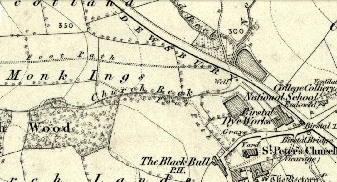
Seemingly built over in recent years, the Pickel Well was one of the main water supplies to the people of Gomersal and Birstall in earlier times. Getting its name, probably, from the northern dialect word pikel or pickel, meaning “very heavy rain” (Joseph Wright [1903] associates it with the expression “raining cats and dogs”), this may be a description of the heavy flow of water which helped feed the large man-made ponds either side of the road.
The Monk Ings Field in which it was found, derives its name from the monks from Nostell Priory who lived here, centuries ago. They would, no doubt, have drunk the water from this well.
Folklore
A very curious legend relates to this place. H.A. Cadman (1930) told,
“that whenever a birth was expected in Great Gomersal, a pad-foot came out at night from the Monk Ing fields and shouted out, ‘Thee first or me first!’ This was said to be a warning to people not to go out.”
Padfoots were phantom black dogs, stories of which occur all over northern England and beyond. They were ostensibly interpreted as omens of doom and bringers of Death. This example at Gomersal is peculiar in that it is equated with birth, as well as giving warnings for local people to stay indoors, as is more usual.
Incidences of black dogs at wells are not uncommon. In West Yorkshire alone we find them haunting the waters at Low Moor, Idle, Thorp Arch, Eccleshill, Heaton and others. Their nature is quite complex, but ostensibly derives from animistic cyclical notions of death and rebirth—hence their emergence sometimes from wells; and in this instance, presaging a local birth.
References:
Cadman, H. Ashwell, Gomersal, Past and Present, Hunters Armley: Leeds 1930.
Eliade, Mircea, Zalmoxis – The Vanishing God, University of Chicago Press 1972.
Wright, Joseph (ed.), English Dialect Dictionary – volume 4, Henry Frowde: London 1903.
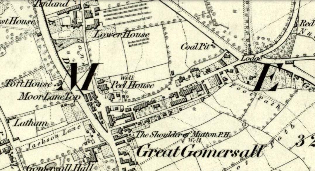
Not far from the old maypole, the Moor Lane Well was the innocuous-sounding site where legend told that a phantom horse was once seen running up and down the lane—said by old locals to be a “very ancient highway”. It was also a place where we find an intriguing tale of local disrepute, that brought humiliation to the culprit from the entire village.
There used to be a custom called ‘Riding the Stang’ which persisted in Yorkshire until the end of the 19th century. Thought to be of Scandinavian origin, it involved the culprit being hoisted onto a platform, held up by poles, then carried around the village where the person lived in a most ignominious procession. It was invariably described as being a public punishment and humiliation for faults made by one’s wife. Anyway, in the early 1840s, said H.A. Cadman (1930),
“there were two families who lived at Brecks Farm. I will not of course divulge their true names, so will describe one of them as the Jones family and the other as the Smith family. Jones’ wife accused Smith’s wife of having polluted the drinking water and the Smith family left the farm and removed to the top of Moor Lane. The Jones family wishing to make the most of the affair resolved that Mrs Smith’s effigy should ride the stang. A long pole was obtained and the effigy was affixed to the centre. Two men then took hold, one at each end, and walked up Moor Lane, folowed by a huge concourse of people. The procession stopped opposite Mrs Smith’s house and repeated the nominee. My informant, a dear old lady, would not tell me the whole of the verse, but it commenced thus:
“It’s neither your fault nor my fault that I ride this stang.”
“After all the verses had been repeated, the stang was taken round Gomersal, when ultimately the effigy was burned with the usual solemnities.
“The other instance of riding the stang occurred also in thge early ‘forties and I believe this was the last occasion of the stang being ridden. On this occasion a man…was in the habit of beating his wife harder than his neighbours thoughts proper with the result that he had to be punished. Now Jim was a most religious man, but the same rites had to be observed as in the other instance,
“It was for Jim Vasey that religious man
He paid her, he paid her indeed and
If Jim doesn’t alter his manners
We will take his skin “…….” to the tanners.
And if the tanner doesn’t tan it well,
We’ll send it to…”
“One must regret that the old custom of riding the stang has died out, as it must have had its good points.”
Local people could, of course, simply bring it back again! The Moor Lane Well was one of the main water supplies for the old villagers in bygone times, but seems to have disappeared under the modern houses. There is, however, a small narrow band of trees where the old waters once ran, amidst which it might still be found—if luck is on our side…
References:
Cadman, H. Ashwell, Gomersal, Past and Present, Hunters Armley: Leeds 1930.
Originally called the ‘Manor Lea Well’ because it could be found on the far west of the land belonging to the Manor House, the name later became corrupted to ‘Mannerly’ by local folk. It was one of the four prime water supplies for this part of the old village, but it had other important social and festive rites attached that undoubtedly went back centuries. H.A. Cadman (1930) told that:
“On Palm Sundays it was the custom for boys to take bottles containing Spanish juice, treacle, and any other sweet thing they could, for the purpose of having them filled with the water from the well. The boys then exchanged bottles with each other and each sampled the others. It was said that no better water existed for this purpose.”
This particular ritual was integral to virtually every Spa Well from Wakefield through to the source of the River Calder.
A Mr G.W. Parker said that the well was to be found at the “extreme Western side” of Manor Lea and was “still in existence” when Cadman wrote about it in 1930, “behind Company Mill” not far from the Moravian Burial Ground. Do any local historians know if the well is still there, or has it since been destroyed?
References:
Cadman, H. Ashwell, Gomersal, Past and Present, Hunters Armley: Leeds 1930.
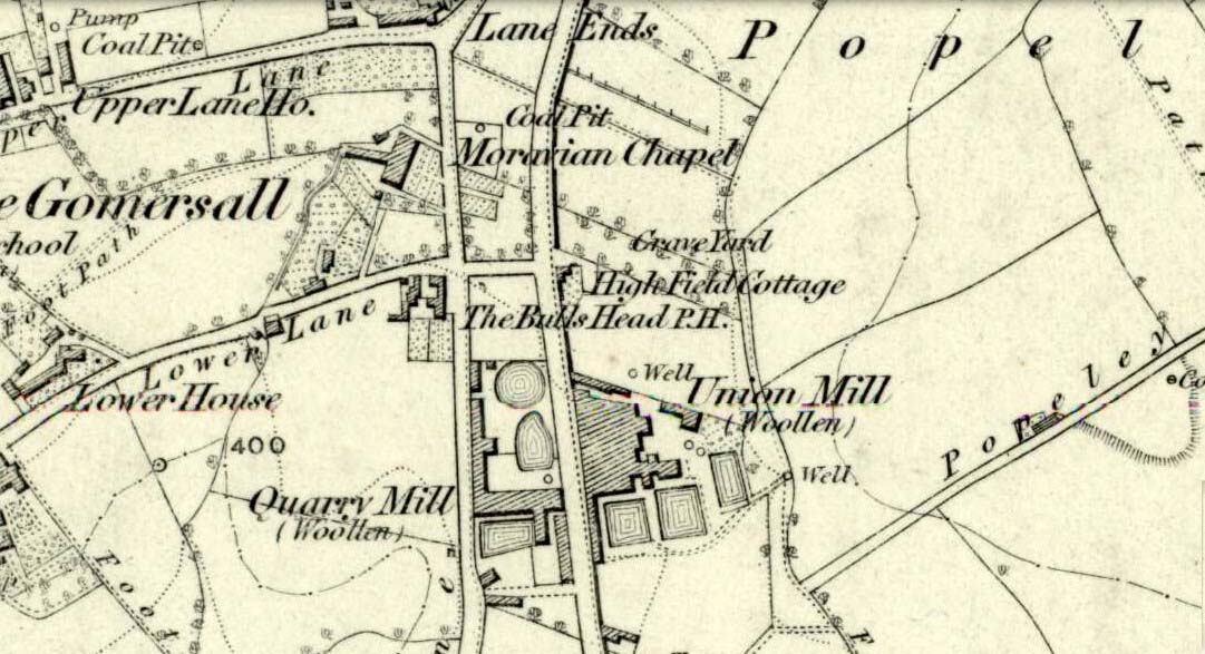
Healing Well (lost): OS Grid Reference – SE 209 260?
Archaeology & History
This bizarre-sounding well owed its name—if we are to accept H.A. Cadman’s (1930) version of history—to the local land-owner,
“Joseph Mortimer and it was so-called because Mortimer’s christian name was Doidy Poidy.”
But this seems unlikely. The term ‘doidy’ is a local dialect word, seemingly found only in West Yorkshire, meaning ‘an overdressed person, especially female,’ (Haigh 1928), with doidy-poidy being rhyming slang for the same thing. The english dialect magus, Joseph Wright (1900), proclaimed the same derivative, “a badly dressed woman, a dowdy.” So it may have been that this title was endowed upon Mortimer’s wife.
Cadman told that the Doidy Poidy Well was one of the “chief wells” of Gomersal, implying that its waters were good and strong. Its existence on what was known as “the old feasting grounds” may have played a part in the “public rejoicings which last for days… The feast was on the Monday on or before Lady Day.” (March 25th, around spring equinox) However, Cadman assures us that the celebrations were started “when the Gomersal Cloth Hall was opened,” telling us that “this feast or fair is not therefore an ecclesiastical one.”
The exact whereabouts of the Doidy Poidy Well remains a mystery (the map-link, above, shows an approximation from the middle of Gomersal).
References:
Cadman, H. Ashwell, Gomersal, Past and Present, Hunters Armley: Leeds 1930.
Haigh, W.E., A New Glossary on the Dialect of the Huddersfield District, Oxford University Press 1928.
Wright, Joseph (ed.), English Dialect Dictionary – volume 2, Henry Frowde: London 1900.
Holy Well (destroyed): OS Grid-Reference – NT 3452 7264
Archaeology & History
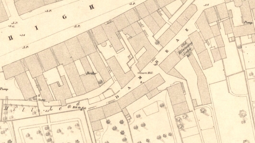
Vicars Well on 1853 map
First mentioned in the Scottish Statistical Account of 1845, its name originates from being attached to the vicarage of nearby St. Michael’s church. Highlighted on the 1853 township map of Musselburgh, this forgotten holy well was described in the middle of the 19th century by local historian James Paterson (1857). It was located near the middle of town, along a back-street south of the High Street. Mr Paterson told us that:
“At the Dam Brae there is still a well, celebrated for the excellence of its water, called ‘the vicar’s well’, from which it is believed the present manse occupies the site of the ancient vicarage. It lies to the southeast of the Brae, and the wall of the ground approaches pretty close to the mill lead, or damn, as it is called. It is well surrounded with old trees.”
When it was described by Mr Beveridge in the 1845 Statistical Account, the spring had been covered by a pump. Local lore told how the waters of this ancient Well was said by housewives to be excellent in the infusion of tea; and although its name was spoke in local dialect as the ‘Bickers Well’, Beveridge told it to mean the “Vicars Well.” There is the obvious possibility that the ‘bickers’—as in chit-chat and gossip—related to it being where local folk simply met and chatted.
When Mr Stirling (1894) wrote his account of the adjacent Inveresk parish, he told how water from the Vicar’s Well,
“was in much request till a few years ago, when its use was forbidden and its site enclosed (for) sanitary considerations.”
There must be an easier way to visit this site than the method I used. Which was: along Cambuslang’s Main Street (A724), turn up the B759 Greenlees Road for nearly 500 yards, turning left onto Vicarlands Road. Notice the grass verge and steep slope immediately to your left. Walk into the tree-lined gorge, following the left-side along the edges of the fencing. About 150 yards down the steep glen, note the very denuded arc of stone-walling and rickety fencing on the other side of the burn. That’s it! (broken glass and an excess of people’s domestic waste are all the way down; very difficult to reach, to say the least!)
Archaeology & History
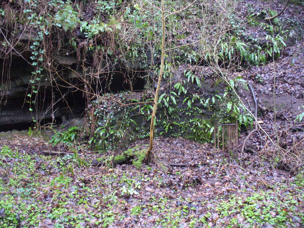
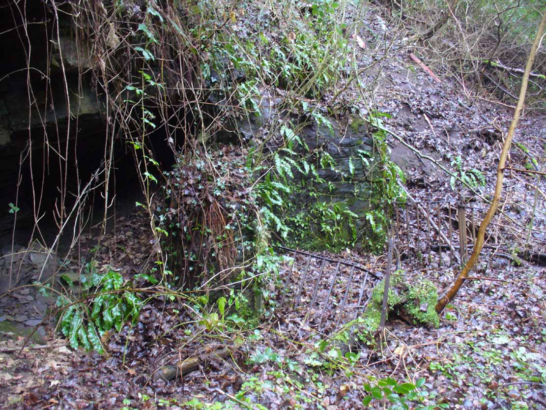
Found in a dreadful state down the once-beautiful Borgie Glen, this is one of the most curious entries relating to sacred and healing springs of water anywhere in the British Isles. Indeed, the traditions and folklore told of it seem to make the site unique, thanks to one fascinating factor…..which we’ll get to, shortly…..
Remains of the Borgie Well
The name ‘Borgie’ is an oddity. Local historians J.T.T. Brown (1884) and James Wilson (1925) wondered whether it had Gaelic, Saxon or Norse origins, with Brown thinking it may have been either a multiple of a simple bore-well, or else a title given it by a travelling minister from Borgue, in Kirkcudbright. Mr Wilson took his etymology from the very far north where “there is a stream called the Borgie” (just below the Borgie souterrain). This is said to be Nordic in origin, with
“borg, a fort or shelter, and -ie, a terminal denoting a stream. It is almost certain that our Borgie has the same origin; that is, ‘the fort or shelter by the stream.’”
The Borgie Well was described by a number of authors, each of whom spoke of its renown in the 19th century and earlier. One of my favourite Glasgow writers, Hugh MacDonald (1860), had this to say about the place:
“There are several fine springs in the glen, at which groups of girls from the village, with their water pitchers, are generally congregated, lending an additional charm to the landscape, which is altogether of the most picturesque nature. One of these springs, called “the Borgie well,” is famous for the quality of its water, which, it is jocularly said, has a deteriorating influence on the wits of those who habitually use it. Those who drink of the “Borgie,” we were informed by a gash old fellow who once helped us to a draught of it, are sure to turn “half daft,” and will never leave Cambuslang if they can help it. However this may be, we can assure such of our readers as may venture to taste it that they will find a bicker of it a treat of no ordinary kind, more especially if they have threaded the mazes of the glen, as we have been doing, under the vertical radiance of a July sun.”
Borgie Well, looking south
It’s somewhat troublesome to reach, but a beautiful landscape indeed is where, today, only remnants of the Borgie Well exist. A very eroded semi-circle of walling and iron bars protects what was once the waters of the well—which have long since fallen back to Earth. Behind it, right behind it, overhangs the cliff and a small cave: a recess into the Earth with its very own feeling. It has the look and feel of a witch’s or hermit’s den with distinct oracular properties. This geomancy would not have gone unnoticed by our ancestors. In this enclaved silence, the once bubbling waters beneath the cliffs give a feel of ancient genius loci—a memory still there, despite modernity. Whether this crack in the Earth and its pure spring waters was some sort of Delphic Oracle in days gone by, only transpersonal ventures may retrieve… Perhaps…
In the 19th century a path took you into the glen from the north, and a commemorative plaque was erected here by a Dr Muirhead, where now lie ruins. It read:
The Borgie Well here
Ran many a year.
Then comes the main verse :_
Wells wane away,
Brief, too, man’s stay,
Our race alone abides.
A s burns purl on
With mirth or moan,
Old Ocean with its tides,
Each longest day
Join hands and say
(Here where once flowed the well)
We hold the grip
Friends don’t let slip
The Bonny Borgie Dell.
1879.
At the base was carved an appeal to the local folk:
Boys, guard this well, and guard this stone,
Because, because, both are your own.
The plaque has long since gone; and according to the local historian J.T.T. Brown (1884), the waters went with it due to local mining operations around the same time. But there was an additional rhyme sang of the Borgie Well which thankfully keeps the feel of its memory truly awake (to folk like me anyway!). It is somewhat of a puzzle to interpret. Spoken of from several centuries ago, it thankfully still prevails:
A drink 0′ the Borgie, a taste 0′ the weed,
Sets a’ the Cam’slang folks wrang in the heid.
Meaning simply, if you drink the waters of this well, you’ll get inebriated! It’s the derivation of the word ‘weed’ that is intriguing here. In Grant’s (1975) massive Scottish dialect work we are given several meanings. The most obvious is that the weed in the poem is, literally, a weed as we all know it. But it also means ‘a fever’; also ‘to cut away’ or ‘thin out’; to carry off or remove (especially by death); as well as a shroud or sheet of cloth. These meanings are found echoed, with slight variants, in the english dialect equivalent of Joseph Wright. (1905) Hugh MacDonald told that the Enchanter’s Nightshade (Circaea lutetiana) grew hereby—which, initially, one might think could account for this curious rhyme. But the Enchanter’s Nightshade has nothing to do with the psychoactive Nightshade family, well-known in the shamanistic practices of our forefathers. However, in the old pages of one Folklore Society text, William Black (1883), in repeating the curious rhyme, told us:
“The Borgie well, at Cambuslang, near Glasgow, is credited with making mad those who drink from it; according to the local rhyme —
A drink of the Borgie, a bite of the weed,
Sets a’ the Cam’slang folk wrang in the head.”
The weed is the weedy fungi.”
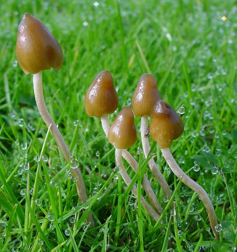
A mushroom no less! In John Bourke’s curious (1891) analysis of early mushroom use, he repeats Mr Black’s derivation. If this ‘weed’ was indeed use of mushrooms that made the local folk “go mad” or “wrang in the head” (and if not – what was it?), it’s an early literary account of magic mushroom intoxication! If this interpretation is correct, the likelihood is that the Borgie Well was a site used for ritual or social use of such intoxicants. Many sites across the world were used by indigenous people for ritual intoxication, and this could be one of the last folk remnants of such usage here. We know that Scotland has its own version of cocaine, used extensively by our ancestors (even the Romans described it) and which was still being used by working Highlanders in the 20th century—but early descriptions of mind-affecting mushrooms are rare indeed!
Psilocybe semilanceataAmanita muscaria
Mr Black gives no further folklore, nor the source of his information, other than to suggest that the madness incurred by the Well typified the people of Cambuslang! “Weedy fungi” may have been ergot (Claviceps purpurea), but the incidence of the grasses upon which it primarily grows, rye, here seems unlikely—and the folklore would certainly have included the ‘death’ aspects which that fungus brings! Fly agarics (Amanita muscaria) however, may have grown here. Old birches are close by, which produce nice quantities of those beautiful fellas. On the fields above the gorge, where now houses grow, Liberty Caps (Psilocybe semilanceata) may have profused—as they do in the field edges further out of town—but this species has no local cultural history known about from the early period. We must, however, maintain a healthy scepticism about this interpretation—but at the same time we have to take into account the ‘intoxicating’ madness which the combination of the “waters and the weed” elicited.
One final note I have to make before closing this site entry: despite the beautiful location, this small gorge is in a fucking disgraceful state. Some of the people who live in the houses above the gorge should be fucking ashamed of themselves, dumping masses of their household rubbish and tons of broken glass into the glen. If these people are Scottish, WTF are you doing polluting your own landscape like this? This almost forgotten sacred site needs renewing and maintaining as an important part of your ancient heritage. Have you no respect for your own land?!?
References:
Armitage, Paul, The Ancient and Holy Wells of Glasgow, TNA 2017.
Black, William George, Folk Medicine: A Chapter in the History of Culture, Folk-lore Society: London 1883.
Walker, J.R., ‘”Holy Wells” in Scotland”, in Proceedings of the Society of Antiquaries, Scotland, volume 17, 1883.
Wilson, James A., AHistory of Cambuslang, Jackson Wylie 1925.
Wright, Joseph, The English Dialect Dictionary – volume 6, Henry Frowde: Oxford 1905.
Acknowledgements: Huge thanks again, in various ways, to Nina Harris for getting us here; and Paul Hornby, for reminding me of my literary sources when I needed them! Thanks too to Travis Brodick and his beautiful photo of the Amanita muscaria cluster.