Holy Well, Glen Prosen, Angus

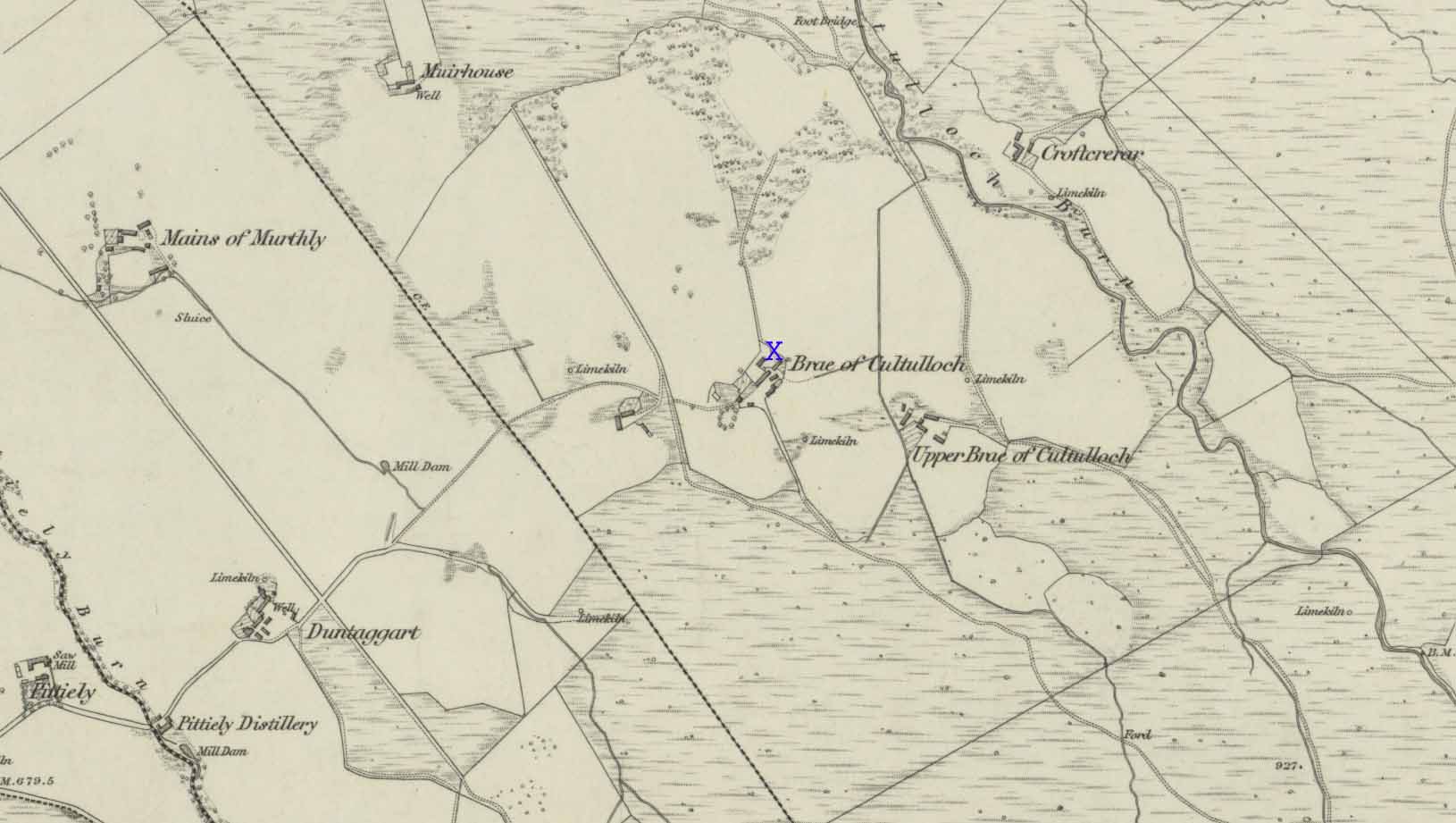
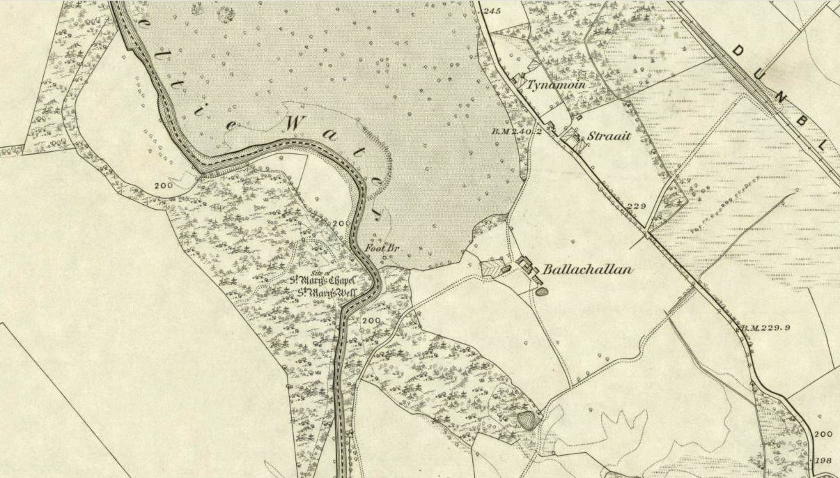
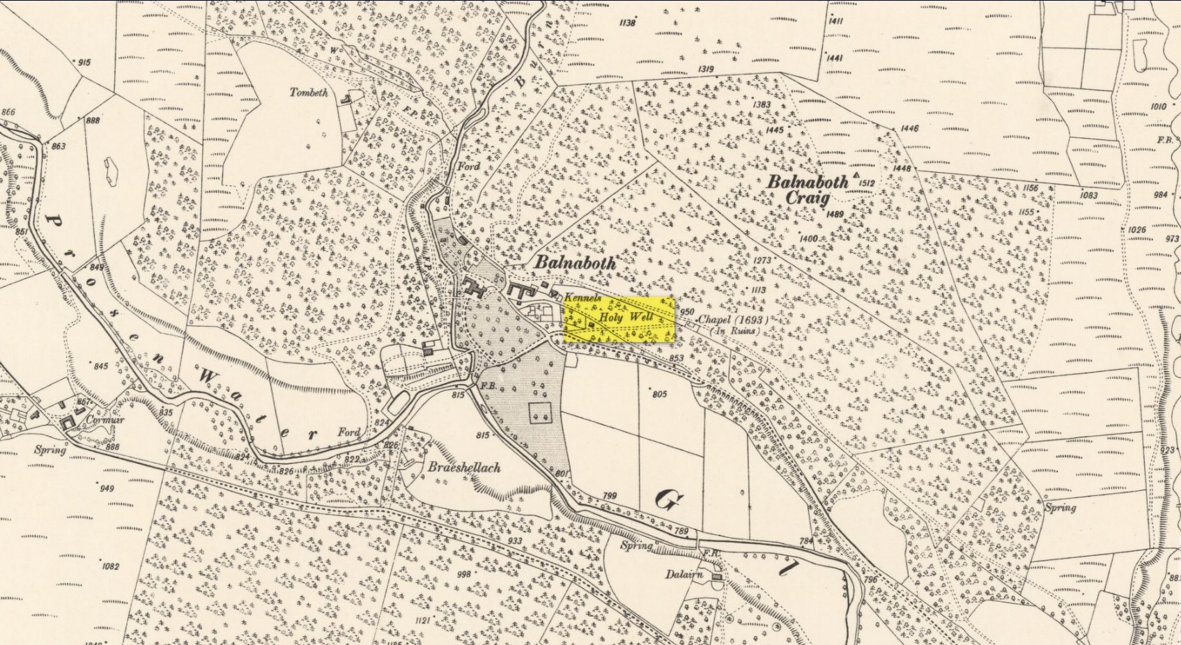
Holy Well:  OS Grid Reference – NO 3172 6681

Getting Here

Glenprosen Holy Well

A long long way for a single little spring, go from Kirriemuir town centre up the B956 Kinnordy Road, going straight across at the crossroads up the countryside lane towards Lednathie (signposted 8 miles): dead straight, long-and-winding, up-and-over…. Stick to this single road, all along, ignoring all turn-off junctions until, once reaching the hamlet of Easter Lednathie, stay awake for the turn up to Glenprosen, 2 miles along, over the bridge. Turn left until and a few hundred yards along go over the next little bridge until you reach the “Private Road” sign, then walk up the track past Katy’s Cottage.  ¾-mile along just before Balnaboth, keep your eyes peeled for a splatter of quartz rocks with a spring of water thereby.  At long long last, you’ve reached your destination!

Archaeology & History

A “splatter of quartz rocks”

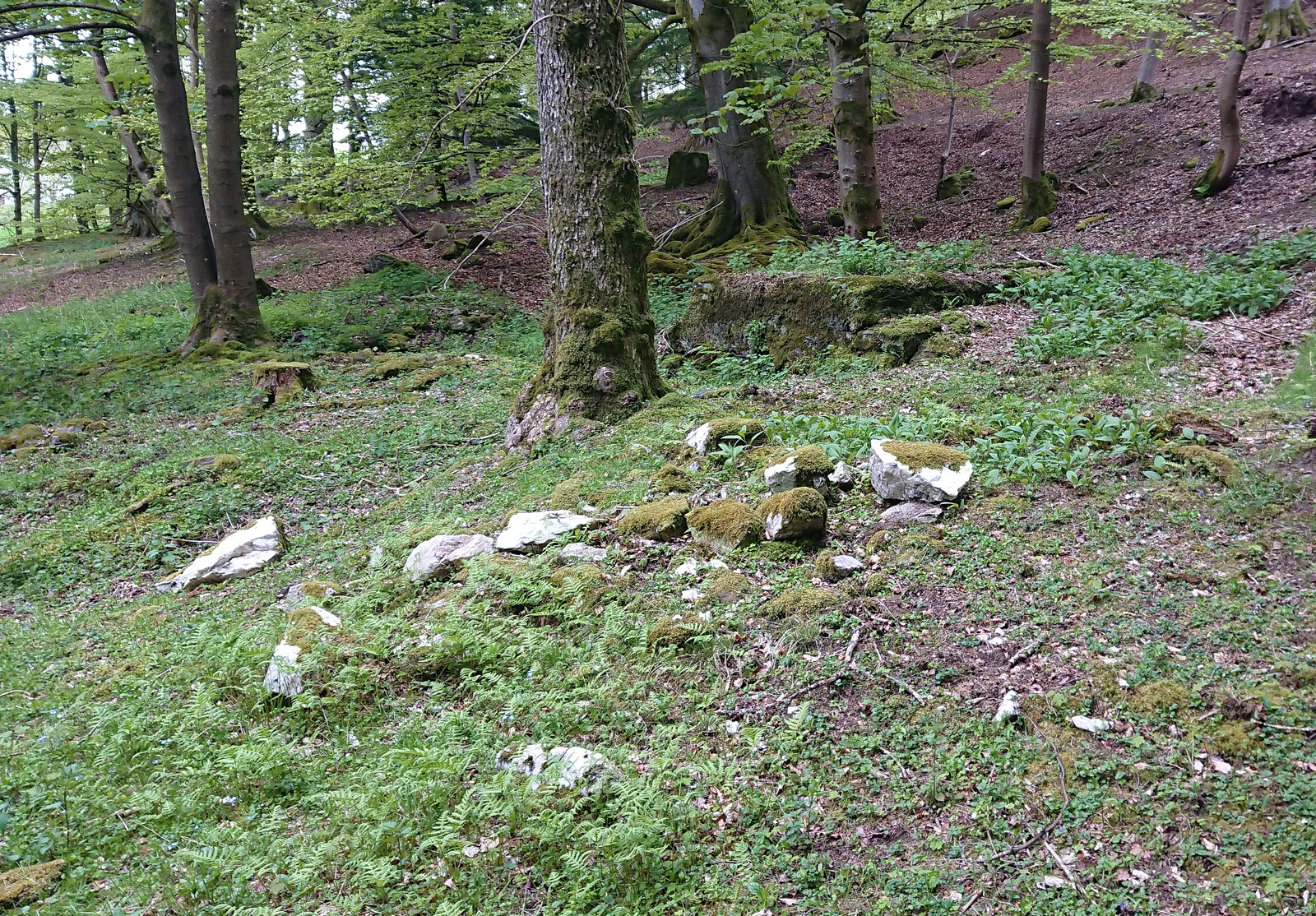
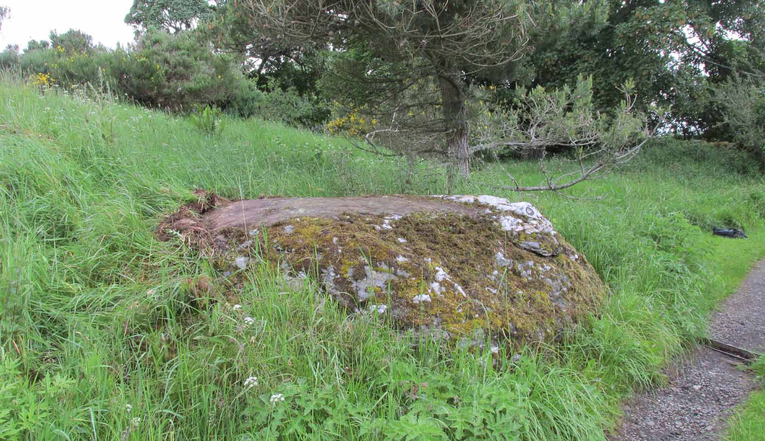
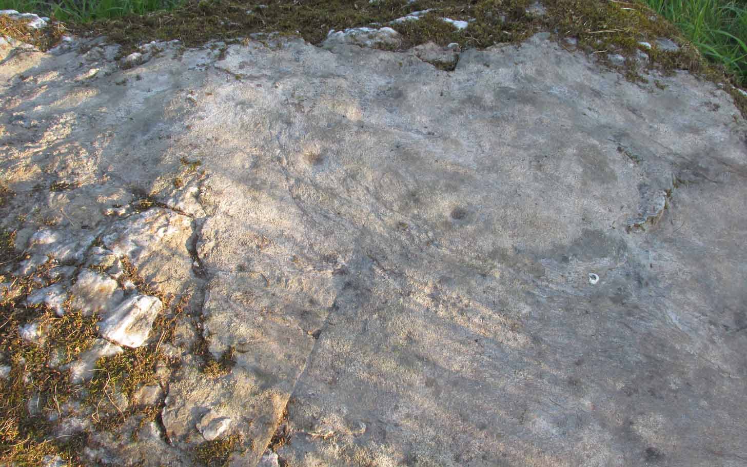
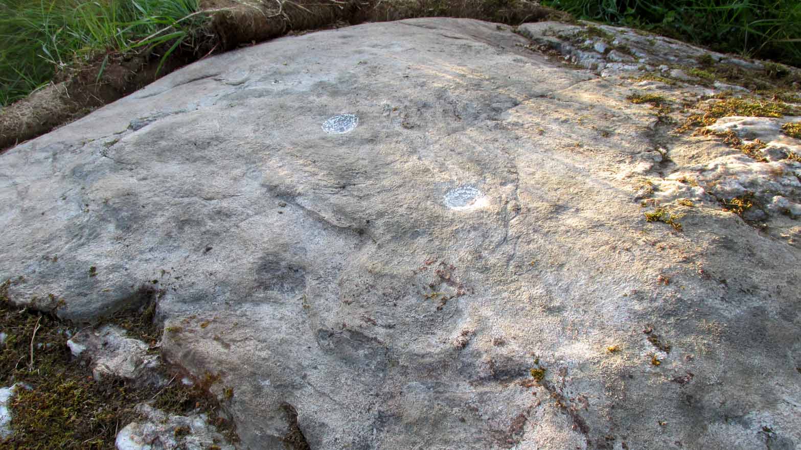
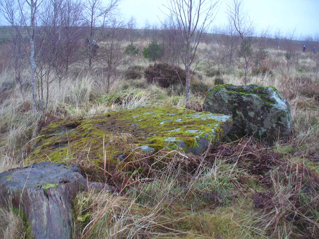
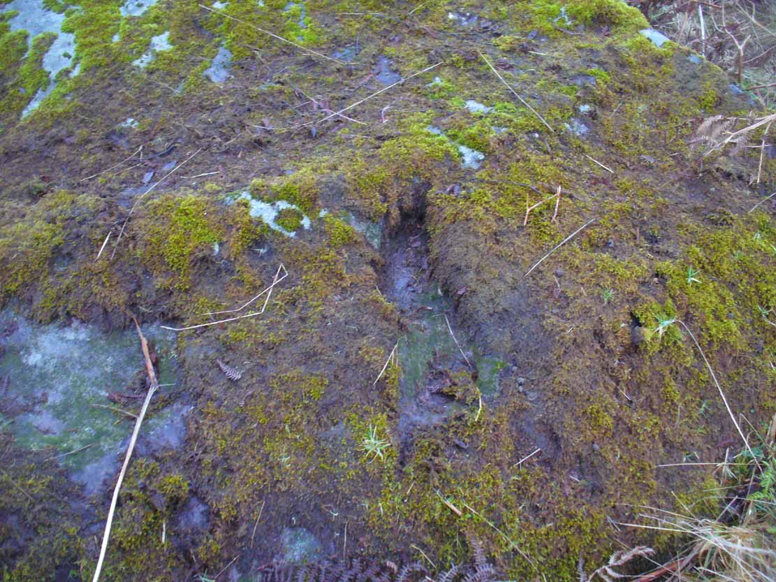
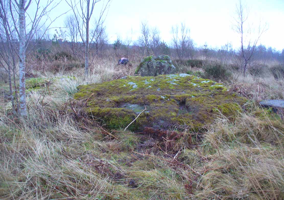
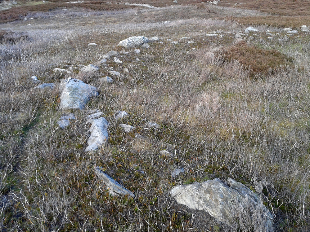
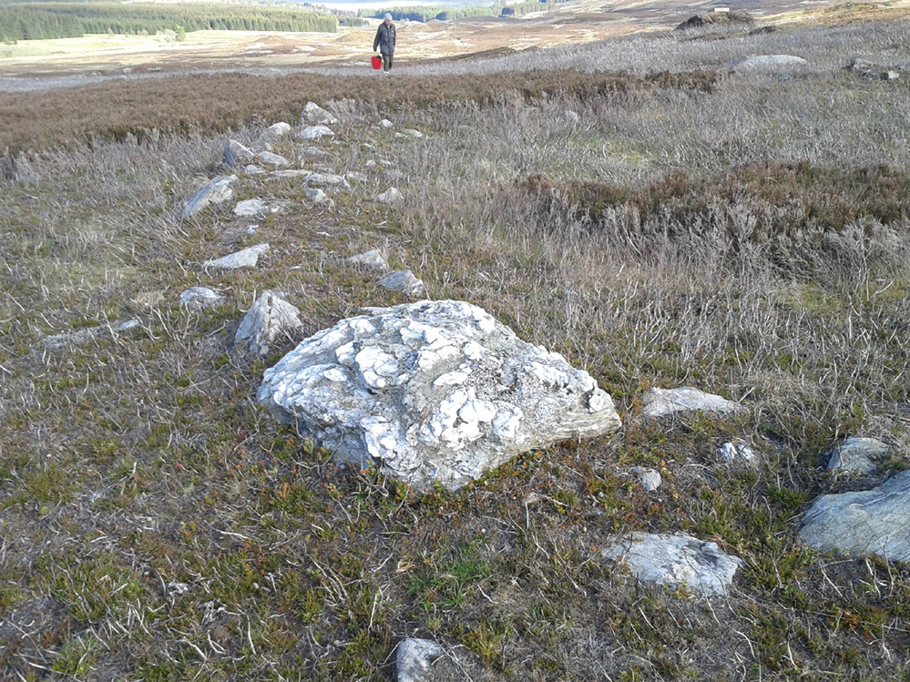
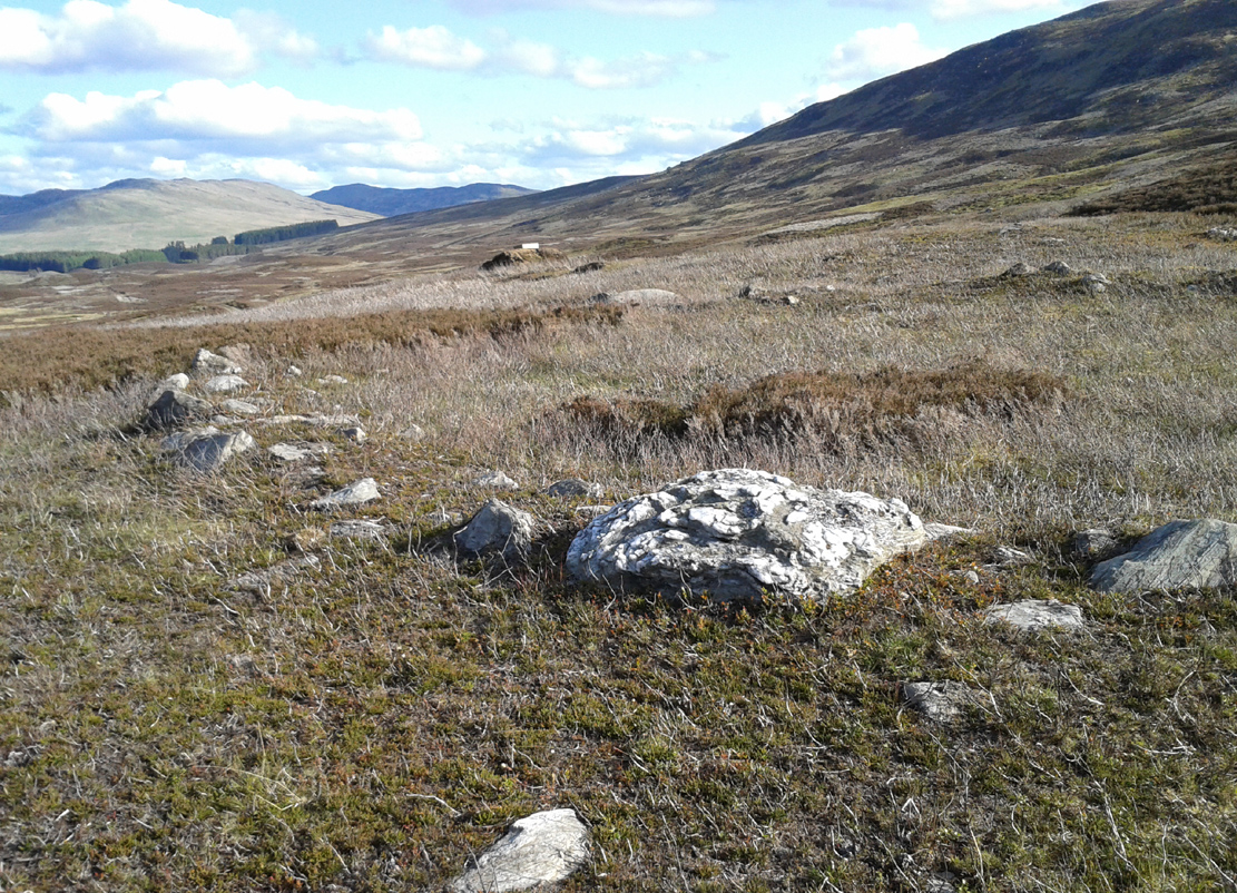
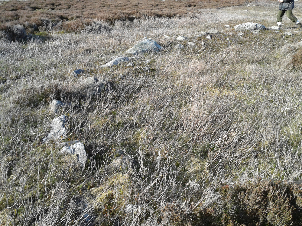
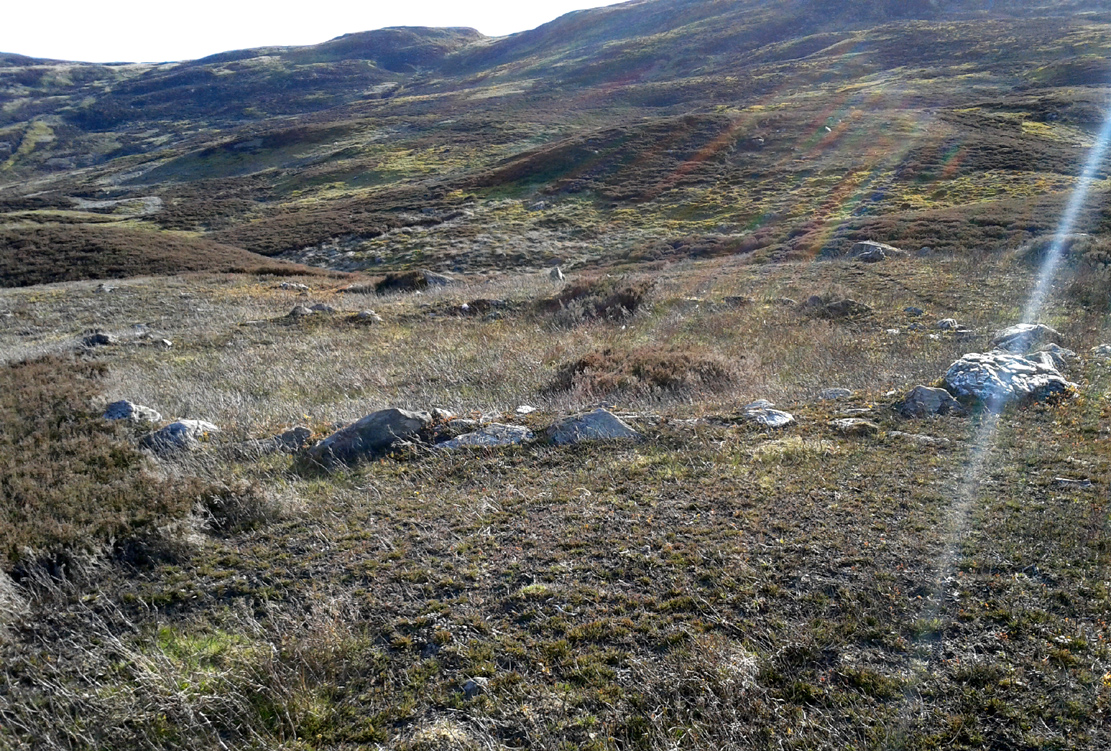
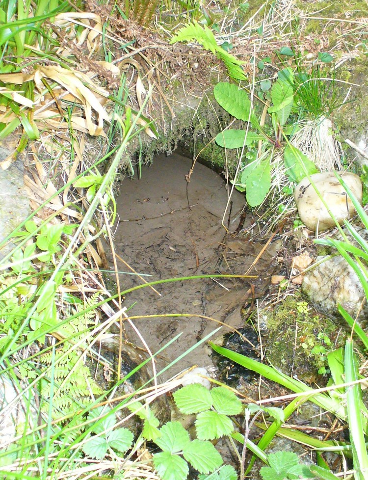
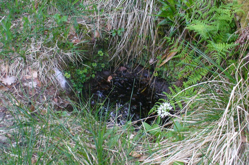
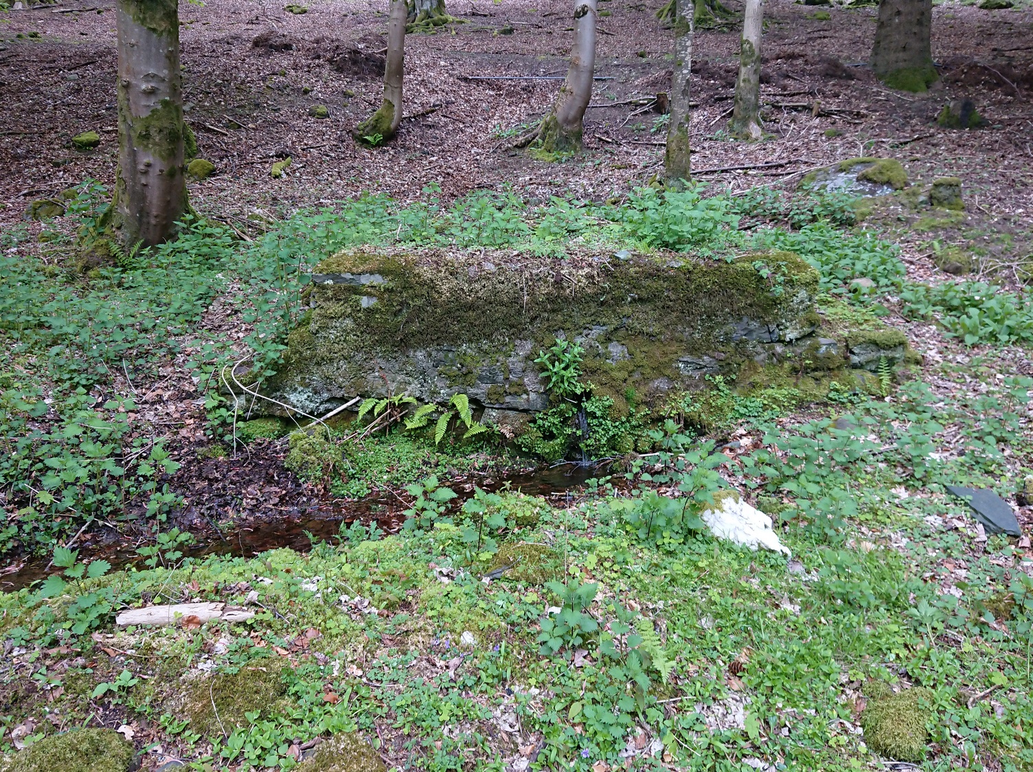
Miles to the winding north of Kirriemuir, in the depth of the olde mountains, this clear spring of iron-bearing water (still fresh and drinkable) was, earlier in the 20th century, covered over by someone-or-other and surrounded by straight slabs of stone.  The waters were maintained however, by the builders who cut a small hole into the moss-embolded rock allowing this pure water to still run freely for all to use…

Shown on the early OS-maps, its sacrality or holy association would seem to be lost from the tongues of the older folk, most of whom seem long gone from this beautiful glen-to-nowhere.  The only remaining religious connection we might have relating to the place comes from the ruined 17th century chapel less than 250 yards away to the west on the slope above the track, from where a singular stone-lined footpath runs dead straight to the well.

Site shown on 1900 OS-map

But another important feature found here is the large scatter of quartz rocks a few yards away from the water source.  They are in disarray but would seem to have once been built around the spring where it first emerged from beneath the ground, then being cast aside to their present positions when the more modern stone structure was built above it.  We can’t prove this with any certainty, but there are a number of other holy wells with this quartz-defining feature elsewhere in Scotland: the St Mary’s Well at Callander and Beltane Well of Kenmore to name just two.

References:

  1. Robertson, D.O., Long-Ago Legends of Clova, Edinburgh 1872.

Acknowledgements:  Huge thanks for use of the Ordnance Survey map in this site profile, reproduced with the kind permission of the National Library of Scotland

© Paul BennettThe Northern Antiquarian

Brae of Cultullich (6), Aberfeldy, Perthshire

Cup-and-Ring Stone:  OS Grid Reference – NN 8818 4906

Getting Here

X supposedly marks the spot

Out of Aberfeldy, take the A826 road as if you’re going up Glen Cochill.  Not far up, just where the housing of Aberfeldy itself ends and the green fields open up either side of you, keep on the road for a half-mile where you meet a small copse of trees on your left, with a dirt-track that runs down the slope.  Go along the track for 0.8 miles (1.3km), past the Ursa Major Stone and where the track splits, go left past the Quartz Stone and follow the track through the farmyard.  It’s somewhere there – or is supposed to be!

Archaeology & History

On our visit here, we couldn’t locate the cup-and-ring stone that’s described in Sonia Yellowlee’s (2004) regional rock art survey.  She described it, as archaeologists always do, in the briefest manner, telling us simply:

“Leaning against a pile of rubble in the farmyard there is a split boulder bearing eighteen cupmarks, one of which is ringed.”

It may have been destroyed, as we were told by a couple of locals that there used to be “a real miserable sod” living there.  When we visited the place and tried to ask the present farm owner, sadly he wasn’t to be found.  If any rock art explorer manages to locate this seemingly lost cup-and-ring, please let us know – and mebbe send us some photos so that we can add them to this site profile. 😉

References:

  1. Yellowlees, Sonia, Cupmarked Stones in Strathtay, RCHAMS 2004.

Acknowledgements:  Big thanks to the crew – this time being Neens Harris, Paul Hornby & Frank Mercer.  And the stunning resource of Scotland’s 1st edition OS-maps is Reproduced with the kind permission of the National Library of Scotland

© Paul BennettThe Northern Antiquarian


Quartz Stone, Brae of Cultullich, Aberfeldy, Perthshire

Cup-Marked Stone:  OS Grid Reference – NN 88104 49001

Also Known as:

  1. Brae of Cultullich (4)

Getting Here

The cupmarked Quartz Stone

Out of Aberfeldy, take the A826 road as if you’re going up Glen Cochill.  Not far up, just where the housing of Aberfeldy itself ends and the green fields open up either side of you, keep on the road for a half-mile where you meet a small copse of trees on your left, with a dirt-track that runs down the slope.  Go down here and follow the slightly meandering track for 0.8 miles (1.3km), a short distance past the Ursa Major Stone where the track splits.  Take the track to the left and there, less than 100 yards on you’ll hit a large boulder on your left.  That’s it!

Archaeology & History

Not previously recorded, this simple cup-marked stone will probably only be of interest to petroglyph aficionados, or those folk who are into  ‘energies’ at sites.  This latter aspect is due entirely to the carving being etched onto a huge rock, much of which is composed of quartz—which isn’t too unusual in this part of the world.  But that aside…

Looking down at the cups
The cupmarks highlighted

It is one in a group of carvings within a few hundred yards of each other, with its nearest neighbour 20 yards to the north.  That one’s covered in cups—but on this large Quartz Stone, only two of them exist, on the top near the centre.  Just a couple of inches across and half-an-inch deep, they’re pretty clear once you see them.  The raised piece of ground behind the stone is artificial and has variously been described by antiquarians and archaeologist alike, as either a prehistoric dun, or a stone circle.  Whatever it may be, some of it is certainly man-made.  Check it out – and mebbe ask the friendly fat fella who lives nearby what he thinks.

© Paul BennettThe Northern Antiquarian


Garadh Ban Wood, Buchanan, Stirlingshire

Chambered Cairn:  OS Grid Reference – NS 45217 91907

Also Known as:

  1. Canmore ID 282019

Getting Here

The main stones in this ruined cairn

The main stones in this ruined cairn

On the B837 between Balmaha and Drymen at the hamlet called Milton of Buchanan, at the little road junction where the houses are on the right, go uphill for 1 mile (1.6km) until you reach the West Highland Way, where you need to go left (NW).  Keep walking for another half-mile (if you get to end of the forestry plantation, you’ve gone too far) where, on your left, a small widening valley appears.  Walk along the eastern edge of this, keeping your eyes peeled for a small upright stone and two large flat companions next to it.

Archaeology & History

This site is really only for the archaeological purists amongst you, as the forestry plantation has truly taken its toll on the site and very little of it remains.  It appears to have been described first of all in H.G. Smith’s (1896) masterful local history work—although popular tradition was not assigning the place as a prehistoric tomb of any sort.  Rather, it possessed a somewhat familiar folklore element, well-known to occult historians and antiquarians.  Smith told us:

“Not far off, in Garradh-ban Wood, is the ‘Deil’s foot mark stone‘.  It is a large flat stone, 7 feet long and 6 feet wide, with an impression on it not unlike a huge foot mark.  There is another stone close to it, 7 feet by 5 feet.  These stones were probably placed there for some purpose now unknown.”

Mr Smith’s dimensions of the stones correlate closely with the modern analysis taken up by the archaeologists who visited the site more than 100 years later.  Mainly comprising of two large stones on the ground with an accompanying upright monolith on the western side, the official Canmore account tells us:

“The cairn has been reduced to a low stony mound measuring 15m from N to S by 12m transversely and up to 0.5m in height. The chamber, which lies off-centre to the SW, comprises two upright stones and two displaced capstones. The overall plan of the chamber can no longer be determined, and the two upright stones are set splayed to one another; that on the W measures 0.53m by 0.25m and 0.15m in height, and that on the E is heavily laminated measuring 1m by 0.18m and 0.8m in height. The SE corner of one capstone rests on the smaller of the two uprights. It measures 2.1m by 2.03m and up to 0.3m in thickness, and has two fragments broken off at its NE corner. The second capstone lies immediately adjacent to the N, flush with the surface of the cairn, and measures 2.3m by 1.7m and 0.17m in thickness.”

When they assessed the site in 2006, archaeologists reported finding small pieces of quartz scattered over the surface of the cairn, but when we visited here last week, there was little trace of any.

The 'Deil's foot mark'

The ‘Deil’s foot mark’

Garadh Ban, looking west

Garadh Ban, looking west

I was hoping that the “Devil’s footmark” on the stone was going to be a cup-marking of some form, as found at some other sites (Kilneuair church, etc)—but it wasn’t to be.  Instead, it seems that the curvaceous indentation left by the ‘devil’ was simply a natural cavity.  The folktale behind the name, and its possible cultural function, seems to have been forgotten.

Although (perhaps) unrelated, H.G. Smith told us of other remains not too far from here, which remain elusive and not in any official record-books.  We had a quick meander over to see if there was anything to be seen, but daylight was fading fast and more searches are required.  It sounds intriguing:

“A little above these ruins (of Cul-an-Endainn farmhouse at NS 4453 9244 – PB), on the right of the burn, but considerably above it, is a curious structure built of turf.  It is quite round, and is 25 feet in diameter at the top and 15 feet at the bottom.  It has entrances at the south, east and west.  There are others of the same construction both above and below, but not so well defined.”

Recently, industrialists have gone onto this part of the countryside and have already began scarring the hillsides, perhaps even destroying these curious remains before we’ve had a chance to assess them.  Hopefully however, they will remain untouched and allow us site analysis before any real damage is done.

Folklore

Followers of the christian cult said this site was a place where the devil had been.

References:

  1. Smith, H. Guthrie, Strathendrick and its Inhabitants from Early Times, James Maclehose: Glasgow 1896.

Acknowledgements:  Many thanks to Aisha Domleo, Lara & Leo Domleo, Unabel Gordon, Nina Harris, Paul Hornby and Naomi Ross for their help and attendance in finding this ancient site. 

© Paul BennettThe Northern Antiquarian


Glen Cochill Circle (01), Little Dunkeld, Perthshire

Hut Circle:  OS Grid Reference – NN 90324 41487

Getting Here

Glen Cochill Circle - No.1

Glen Cochill Circle – No.1

Take the same directions to reach the impressive Carn Ban prehistoric tomb.  From here, walk along the winding track past the giant cairn onto the moors for about 350 yards, until the track goes dead straight and heads NNW uphill.  Walk up here for another 350 yards keeping your eyes peeled on the rounded pyramidal hill with the large rock on top.  The circle is 20 yards off the track as you head up to the pyramidal hill stone.

Archaeology & History

Although this site is mentioned in notes by the Scottish Royal Commission and highlighted by Ordnance Survey, information thereafter is pretty scarce.  Which is surprising when you check this place out first-hand.  It’s bloody impressive!  David Cowley (1997) describes the area, but not in much detail.

Northern arc of walling

Northern arc of walling

Eastern arc of walling

Eastern arc of walling

The circle seems to have been rediscovered first of all by the dowser J. Scott Elliott (1964), who thought it was a cairn circle – which is understandable.  However, it has been classified by the Royal Commission lads as a “hut circle”, so we’ll stick with that for the time being.

An entrance to the circle doesn’t stand out.  There may be one on the southeastern side, but this isn’t clear; and what looked like a possible entrance on its northern edge was discounted, as a larger stone blocked this on the outside.  There was no immediate evidence of any internal structure, no hearth, no tomb – merely a small stone at its centre, deeply embedded in the peat.  This may, however, cover a central cist – which would make this a cairn circle and not a large hut circle.  But that’s guesswork on my behalf!

Arc of ring from east to south
WNW arc of walling

Never excavated, what we’ve got here is a very well-preserved, large ring of stones, more typical of Pennine and Derbyshire ring cairns than any standard hut circles.  But this is Scotland we’re talking about!  This impressive ring measures outer-edge to outer-edge 12 yards in diameter (north-south), by 11 yards (east-west), with the stone walling that defines the ring being between 3 and 4 feet across all round, and between 1-2 feet high.  And it’s in damn good nick!  More similar in structure to the likes of Roms Law, a number of notably large stones define the edges, but many hundreds of smaller packing stones build up the ring walls.  Of the larger rocks in the ring, the most notable one is a large white quartz crystal stone on its NNE side.

Quartz rock reflects the sun, looking W

Quartz rock reflects the sun, looking W

It’s an impressive site whatever it may be! – in very good condition for its age (Bronze Age by the look of it) and, whilst still visible above the heather, well worth checking out if you like your stone circles and prehistoric rings.  The small prehistoric graveyard 30-40 yards south and east, plus the extensive settlement systems all over these moors are all worth exploring if you visit this place.

References:

  1. Cowley, David C., “Archaeological Landscapes in Strathbraan,” in Tayside & Fife Archaeological Journal, volume 3, 1997.
  2. Scott-Elliot, J., “Kinloch House, Amulree,” in Discovery & Excavation in Scotland, 1964.
  3. Scott-Elliot, J., Dowsing – One Man’s Way, Neville Spearman: London 1977.

Links:

  1. Canmore notes on Glen Cochill

Acknowledgements:  Many thanks to Mr Paul Hornby for his help, as usual.  Cheers fella!

© Paul BennettThe Northern Antiquarian


Beltane Well, Kenmore, Perthshire

Sacred Well:  OS Grid Reference – NN 7867 4725

Also Known as:

  1. An Tobar
  2. Holy Well of Inchadney

Getting Here

An Tobar, or Beltane Well, on the 1867 map

An Tobar, or Beltane Well, on the 1867 map

From Kenmore village on the north-side of the river, over the bridge, take the small road on your right towards Dull.  After a very short distance the road runs alongside the woodland for nearly 1½ miles until, on your left, you’ll reach Drummond Cottage.  Across from here a dirt-track takes you into the trees.  Barely 100 yards along, watch for the overgrown path that runs down the slope on your left.  At the bottom a small stream has several feeds – one of which is surrounded by a ring of bright quartz stones.

Archaeology & History

Shown on the early Ordnance Survey maps as An Tobar (meaing simply “a well”), this somewhat nondescript title betrays a much more colourful folk history, albeit dissolved by those common culprits of Church and disrespectful incomers (which shows little sign of diminishing).

Lara by the Well

Lara by the Well

Close-up of quartz surround

Close-up of quartz surround

In the field immediately south, back up the slope above the well and through the trees, was once an ancient church whose existence has all but vanished.  Hereby was held an ancient fair known as Feill nam Bann Naohm, or the Fair of the Holy Women, named after a group of nuns whose lived here, who William Gillies (1938) and others proclaim were the legendary Nine Maidens, whose dedications at wells, trees and other sites scatter Scotland. But the fair was ended in 1575 and moved to Kenmore; then, several years later in 1579, the church also moved onto Eilean nam Ban Naomh (NN 7664 4536) on Loch Tay.

The old well however, after being left by the descendants of the Holy Women or Nine Maidens, continued to be frequented by local people.  Gillies (1938) wrote:

“The Holy Well of Inchadney is situated at the foot of the terrace, about five hundred yards to the north of the churchyard… Up to the middle of last century the well used to be visited by great numbers of people on the morning of Bealtuinn, the first day of May.”

In Ruth & Frank Morris’ survey (1981) they told how the site had become much overgrown and,

“The well was cleaned out in 1914 and among articles found was a stone 21 inches by 16 inches, with a rude St Andrew’s cross scratched on it, a George III farthing among other copper coins, a rudely made stone cup 2½ inches high and 7 inches in diameter, three metal buttons, a glass bead and six pins.”

No such offerings seemed in evidence when we visited a few weeks ago; but we were told that people are still seen visiting the well.

Looking down into the pure waters

Looking into the pure waters

A small stone-laid footpath runs towards the adjacent burn from the circular well, which is almost completely surrounded by large quartz rocks.  In the well itself was a small fish, showing how clean the waters are—or as would be deemed in times of olde: a ‘guardian’ of the waters.

We must also make note of the fact that, just two fields away to the north, according to the antiquarian Fred Coles (1910), a stone circle was once in evidence.  This old well sat neatly between the sites of megalithic ring and church.

Folklore

In the field in front of the well, Hilary Wheather (1982) told that there once lived a legendary water bull, but she lamented on his passing.  With the coming of the modern-folks and their unnatural ways,

“and having great timber lorries rumbling past your home every day is no fun for a peace-loving waterbull living in Poll Tairbh, the Bull’s Pool opposite the Holy Well.  Gone are the days when he was the revered Spirit of the Meadow, passed with trembling and fear by all the young maids of the Parish lest he should jump out and carry them off to his watery lair. Half the calves of the area were sired by him and it was always easily seen which cow had the attentions of the Great Waterbull.  Her calf was always the biggest and the best.  But he hasn’t been seen by his pool for many a year…”

The waters are cited by Geoff Holder (2006) to be good for toothache.

References:

  1. Coles, Fred, “Report on Stone Circles Surveyed in Perthshire (Aberfeldy District),” in Proceedings of the Society of Antiquaries, Scotland, volume 44, 1910.
  2. Gillies, William A., In Famed Breadalbane, Munro Press: Perth 1938.
  3. Holder, Geoff, The Guide to Mysterious Perthshire, History Press 2006.
  4. McHardy, Stuart, The Quest for the Nine Maidens, Luath Press: Edinburgh 2003.
  5. Miller, Joyce, Magic and Witchcraft in Scotland, Goblinshead: Musselburgh 2010.
  6. Morris, Ruth & Frank, Scottish Healing Wells, Alethea: Sandy 1982.
  7. Wheater, Hilary, Kenmore and Loch Tay, Appin Publications: Aberfeldy 1982.

Acknowledgements:  Big thanks to the bunch who got us here:  to Paul Hornby, Nina Harris, Aisha Domleo & Lara Domleo (ooh – and Leo too!).

© Paul BennettThe Northern Antiquarian


Croft Moraig Carving (02), Kenmore, Perthshire

Cup-Marked Stone:  OS Grid Reference – NN 79744 47263

Also Known as:

  1. Croft Moraig – Stone D

Getting Here

Follow the same directions for the Croft Moraig stone Circle.  Then check out the largest of the fallen or elongated stones on the northwest side of the ring, with a smoothed sloping surface, just at the side of the overgrown stone platform on which it rests.  Y’ can’t really miss it.

Archaeology & History

When William Gillies (1938) wrote about the carvings at the Croft Moraig stone circle, he told how, previously, Fred Coles,

“noticed that several of the upright stones…show cup-markings on their perpendicular surfaces. Some of these are quite distinct, but others are so worn through weathering that they can only be traced with the fingers.”

Stone D, with cupmarks
Stone D, with faint cups
Close-up of the cupmarks

This is one of them. Barely visible at the best of times, the cup-markings are faded and very hard to see unless daylight conditions are just right. As you can see in the photos, several distinct cup-like impressions are visible, but it only appears that two of them are cup-marks.  The others seem to be more geophysical in nature – but I’d love to be wrong!

At the SSW edge of the circle, 13 yards (11.75m) away, is the Croft Moraig cup-and-ring stone.

Folklore

Stone D on Fred Coles' plan
Stone D on Coles’ plan

The great northern Antiquarian Fred Coles (1910) noted that this particular stone (stone D in his ground-plan of the circle) had “been polished by the sliding of generations of children”.  This playful action on stones elsewhere in the UK and around the world sometimes relates to fertility rites (i.e., the spirit of the stone could imbue increased fertility upon the practitioner), but Mr Coles made no mention of such rituals here.

References:

  1. Coles, Fred, “Report on Stone Circles Surveyed in Perthshire,” in Proceedings of the Society of Antiquaries, Scotland, volume 44, 1910.
  2. Gillies, William A., In Famed Breadalbane, Munro Press: Perth 1938.
  3. Yellowlees, Sonia, Cupmarked Stones in Strathtay, Scotland Magazine: Edinburgh 2004.

Acknowledgements:  Many thanks to hardcore crew for our various visits here: to Paul Hornby, Lisa Samson, Fraser Harrick, James Elkington, Penny & Thea Sinclair.

© Paul Bennett, The Northern Antiquarian


St. Mary’s Well, Callander, Perthshire

Holy Well:  OS Grid Reference – NN 6507 0556

Also Known as:

  1. Canmore ID 24322

Getting Here

St Marys Well on 1862 OS-map

You’ll need wellies or no shoes for this excursion! From the lovely town of Callander, take the A84 road southeast out towards Doune and Stirling for a mile or so. Keep your eyes peeled for Straid by the roadside on your left and the turning right down to Ballochallan quarries. About 200 yards down, notice the industrial works on your left. Walk about 50 paces past this, then turn right into the trees.  Less than 100 yards in, you’ll hit a shallow bend in the River Teith. Walk across and into the trees opposite…and if you amble just yards above the edge of the river, along the tree-line, you’ll find St. Mary’s Well…

Archaeology & History

Fresh waters of the quartz-lined spring

Highlighted on the 1862 Ordnance Survey map of Callander and cited in the Object Name Book of the same year, oddly there is no mention of this mythic site in the Scottish surveys on holy wells (MacKinlay 1894; Morris 1981) — which seems rather unusual considering the importance this legendary entity (St. Mary) possessed in the christian pantheon.

There is also some doubt about the precise position of this holy well.  According to the Royal Commission account, the well “is stone lined; it measures 0.9m in diameter, and is choked with fallen leaves.”  However, this appears to be the remains of a latrine (or “a bog,” as my northern tongue so eloquently exclaimed soon after finding it), now used more by frogs to lay their spawn in which their tadpoles thankfully emerge (as we found when visiting it last week).  The holy well itself is about 10 yards further along the edge of the river and has a most curious architectural feature to it.

Stone-lined "well" 10 yards west of the real one
Stone-lined “well” 10 yards west of the real one

When we found the place, much of it was very overgrown indeed and it took a while to recover its status.  But in doing so, we found that on all sides where the stone-lining marked the emergence of the waters, rocks large and small consisting almost entirely of quartz constituted the opening as it came out of the ground.  This was a very deliberate construction feature no less!  Also, the fine sandy silt which clogged up the waters were also found to have small pieces of quartz laying beneath it, seemingly as offerings that had been made here many years ago.  But on the whole there seemed little evidence that the well had been used ritually for many years.  So, once we’d cleaned up the debris and made the site more notable, I drank its waters and found them very fine and refreshing indeed!

In the trees behind the well you will find the overgrown remains of the old chapel, also dedicated to St. Mary.  The tranquility and spirit of this place would have been truly superb. Even today, it is an ideal retreat for meditation and spiritual practice.  It just seems such a curious mystery that nothing seems to be known of the place…

Folklore

The 1862 “Object Name Book” told that the waters here were renowned for having great healing properties.  St. Mary’s feast day was August 15 and great were the country fairs and rituals surrounding this period across Scotland and beyond — many of which may have supplanted the more arcane festival of Lammas.  However, local records are silent about any such events performed at Callander’s St. Mary’s Well.  Do any old locals know more about it…?

References:

  1. MacKinlay, James M., Folklore of Scottish Lochs and Springs, William Hodge: Glasgow 1893.
  2. Morris, Ruth & Frank, Scottish Healing Wells, Alethea: Sandy 1982.

© Paul BennettThe Northern Antiquarian


White Stane of Tam Baird, Dollar, Clackmannanshire

Legendary Rock: OS Grid Reference – NS 94135 99110

Also Known as:

  1. Canmore ID 48293
  2. Tom Baird’s Stone
  3. White Stone of Tombaird

Getting Here

The White Stane of Tam Baird

Very troublesome for so little a stone. But to the nutters or climbers who enjoy a good bimble: if you’re coming on the A91 from Tillycoultry take the dirt-track up to Harviestoun, but if you’re coming from Dollar, take the dirt-track up past Belmont House – either way, keep walking till you get to Kennel Cottage. Walk past here and into the woods, then follow the burn (stream) uphill. It’s a steep climb, with waterfalls and mossy rocks. Once out of the woodland, keep following the stream. Several hundred yards uphill, you’ll pass a large rounded hillock on your left. Keep walking up the stream for another 200 yards, then walk to the right of the stream for about 100 yards. You’re damn close!

Archaeology & History

White Stane on the 1819 map

An obscure and little known site outside of the Ochils region, this stone seems to have been described for the first time in 1769 – though local people would obviously have known of its presence and mythic history centuries before this. It was then shown on the 1819 Plan of The Estates of Harviestoun and Castle Campbell, as shown here.  The White Stane is a rounded quartz block about four feet long in the grasses, laid down and hard to find, it would have been impressive had it stood upright – which it may have done in ages not so long ago – in which case we would have had a shining standing stone on the edge of the steep slope halfway up the mountain. A curious ‘D’-shaped carving that seems to be etched on the top of the rock may simply be one of Nature’s simulacra.

The White Stane, looking south

When I arrived at the stone – after taking a typically circuitous bimble up the hillsides, and passing a variety of archaeological relics on the slopes east of the burn – the view was outstanding, looking some 60 miles south into the distant peaks of the Scottish Lowlands, with the sun casting itself over the entire landscape. The quartz rock by my side was gleaming brightly in the fresh daylight. Sitting down by its side, the cold wind cutting over us, a quietude befell the place and, and as I relaxed by its side, fell into a sleep for an hour or so. All was quiet and still in both mind and heart at the stone – then when I came round, I realised the sun was going down and thought it best to get off the mountains before dark!

In Angus Watson’s (1995) survey he told us,

“The 1860 OS Name Book says this is something of a mixture of whinstone and white marble, that the local tradition was that it had been erected to commemorate a battle between Wallace and the English, and that there was “no doubt whatsoever” that it was ‘druidical’!”

Watson also informs us that the name of the rock – Tom baird – is from the Gaelic, meaning the “bard’s knoll”. However, Bruce Baillie (1998) would have it that the The White Stone of Tam Baird,

“has possibly been derived from the Gaelic Tam a Bhaird, ‘the knoll of the enclosure.’”

And there is a large five-sided enclosure on the ridge of Dollar Hill, but that’s quite some distance away and would have little bearing on the naming of this quartz stone.

References:

  1. Baillie, Bruce, History of Dollar, DMT: Dollar 1998.
  2. Watson, Angus, The Ochils: Placenames, History, Tradition, PKDC: Perth 1995.

Acknowledgements: Huge thanks to Marion Woolley for directing us to the 1819 Estate map!

© Paul Bennett, The Northern Antiquarian


Boat Stone, Blackford, Perthshire

Standing Stone (fallen): OS Grid Reference – NN 87202 07286

Getting Here

Fallen monolith in the grass

From Blackford on the north side of the A9, cross over and take the small B-road which quietly runs up and over Sheriffmuir towards Dunblane.  After a mile, keep your eyes keen for the approaching woodland on your right-hand side; for in the field just before the woods, you’ll see a patch of grass near the corner of the field with a long stone poking out of it. That’s it!

Archaeology & History

It seems that very little has been written about this monolith in any of the archaeology texts, but it’s ascribed locally to be a fallen standing stone.  The site’s described in Finlayson’s (2010) fine local megalith guide where he points out how it’s in line with other nearby standing stones at Gleneagles and the White Stone – and the line is damn close!

…and from another angle…

With a quartz vein running through it, the stone lays some thirteen feet long and was, at some time in the not-too-distant past, readied to be quarried, as evidenced by the chisel-marks cut into it, prior to the usual destruction. But this time, for some reason, someone must have come to the rescue and prevented its demise…thankfully…

The farmer annually cuts around the fallen stone, shaped like a long boat (hence the name), near the top corner of the field. It would have looked damn good when stood upright, standing about ten feet in height and visible for a good distance. But today it’s quite forlorn laid here, seemingly alone, in this quiet part of the country, and is probably only one of interest to hardcore megalithomaniacs amongst you!

References:

  1. Finlayson, Andrew, The Stones of Strathearn, One Tree Island: Comrie 2010.

© Paul Bennett, The Northern Antiquarian