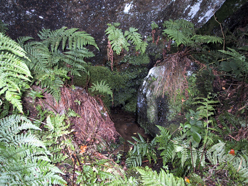
If you’re a bittova unhealthy dood, give this site a miss, as it takes a bitta getting to! Otherwise, get to the rocks at the very bottom of the Druid’s Altar and walk to the right (east) until you hit the walling a few hundred yards along. Near the bottom of the slope, where the land levels out, there are several lovely moss-strewn boulders in their music of graceful hues. One of them, you’ll see, has water emerging from it base. You’re here!
Archaeology & History
The Druid’s Well
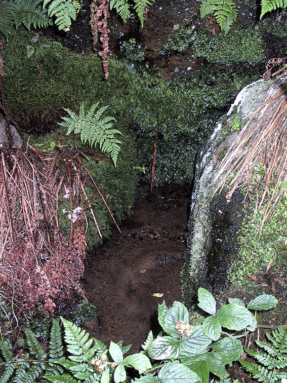
I first visited this old site with the holy wells writer Edna Whelan sometime in the early 1980s, when we went in search of the sacred spring of water known as the ‘Altar Well,’ shown on early maps to be just a short distance beneath the small cliffs called the Druid’s Altar. We didn’t find it! Another visit with Graeme Chappell and Edna (again) sometime later also proved fruitless – but something else was found which we didn’t know about on our first sojourn: the Druid’s Well, or more accurately the Druid’s Spring. (no stone trough y’ see) Not far from the spot that the Altar Well could once be seen, this beautiful spring of sweet water emerges beneath the rich lichen-encrusted boulder, painted with dappled mosses and an overhang of vivid ferns. Tis a fine oracular site, if ever there was one!
The waters run slowly from beneath the great old rock, upon which grows a fine specimen of a birch tree – a truly old thing! And if there was ever any truth about this regions association with the druids, one of their most important sacraments grows profusely here when the season is right: no, not mistletoe (though it can be found sparingly upon the old oaks), but a wealth of the sacred Amanita muscaria, to whose spirit visionary journeys were bestowed.
Close-up of the waters beneath the boulder
The name of the woodlands in which our Druid’s Spring emerges — the Hollin Wood — might also have had some associative relationship with this well, or the Altar above (modern maps call it the Hollin Plantation, as much of the old woods have been felled and copsed by modern man). Place-name texts ascribe this to be the ‘woodland of holly trees’, but during our wander through the woods a few weeks ago (when we got the photos of the Druid’s Well) holly trees were not common. It may be that the Hollin Wood originally derived from ‘holy wood’, as this old well and the Druid’s Altar above would have surely made the site sacred to the druids. Just a thought. We will probably never know (if someone finds out for sure, one way or t’other, lemme know and I’ll amend where necessary!).
References:
Greenbank, Sydney, The Druid’s Altar, Bingley, R.G. Preston: Bingley 1929.
Speight, Harry, Chronicles and Stories of Old Bingley, Elliott Stock: London 1898.
Whelan, Edna & Taylor, Ian, Yorkshire’s Holy Wells and Sacred Springs, Northern Lights: Dunnington 1989.
Various routes to this giant tomb, which happens to be a way off the roads (thankfully!). Probably the easiest way is from the Menston-side: up Moor Lane, turn left at the end, go 200 yards and take the track onto the moor. Just keep walking. If you hit the rock-outcrop nearly a mile on, you’ve gone past your target. Turn back for about 400 yards and walk (south) into the heather. You’re damn close!
Archaeology & History
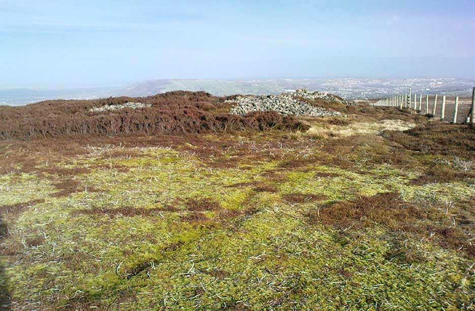
Great Skirtful of Stones cairn looking east to Otley Chevin
Due north of the Skirtful Spring water source, this is one of Ilkley Moor’s major prehistoric sites: ‘major’ for a number of reasons – not least of which is the size of the thing! Although getting somewhat overgrown these days as more of the heathlands encroach the mass of rocks that constitute the central ‘tomb’, it is still a formidable heap. Another reason this site is of importance is its position in the landscape: it can be seen as the peak or ‘nipple’ on the landscape from considerable distances north, south and east of here, rising up on the horizon and catching the eye from many miles away. This was obviously quite a deliberate function of the site when it was first constructed – thought to be in the Bronze or Iron Age period (sadly we have no decent excavation here to tell us just when it was made). Another reason for its importance is its position relative to a once huge prehistoric graveyard immediately east. And right next to it we also find a curious circular monument that has never been properly excavated, whose function is unknown. It is also the seeming focal point of at least one, though possibly three prehistoric trackways: one of which goes right past it, though swerves on its southern edge quite deliberately so as to not touch the monument. This trackway appears to have been a ceremonial ‘road of the dead,’ along which our ancestors were carried, resting for some reason at the nearby Roms Law, or Grubstones Circle, a few hundred yards to the west.
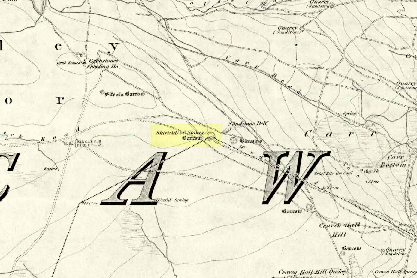
Wrongly ascribed as a “round barrow” by archaeologist Tim Darvill (1988), the Great Skirtful cairn was named in boundary changes made in 1733, where one Richard Barret of Hawksworth told that the site was “never heard go by any other name than Skirtfull of Stones.”
In 1901 there was an article in the local ‘Shipley Express‘ newspaper — and repeated in Mr Laurence’s (1991) fine History of Menston and Hawksworth — which gave the following details:
“Mr Turner led the way across Burley Moor to the Great Skirtful of Stones, a huge cairn of small boulders, nearly a hundred tons on a heap, although for centuries loads have been taken away to mend the trackways across the moor… The centre of the cairn is now hollow, as it was explored many years ago, and from the middle human bones were taken and submitted to Canon Greenwell and other archaeologists” – though I have found little in Greenwell’s works that adequately describe the finds here. Near the centre of the giant cairn is a large stone, of more recent centuries, which once stood upright and upon which is etched the words, “This is Rumbles Law.” The Shipley Express article goes on: “Mr Turner explained that ‘law’ was always used in the British sense for a hill, and Rumbles Hill, or cairn, was a conspicuous boundary mark for many centuries. He had found in the Burley Manor Rolls, two centuries back, that on Rogation Day, when the boundaries were beaten by the inhabitants, they met on this hill, and describing their boundaries, they concluded the nominy by joining in the words, “This is Rumbles Law.””
Great Skirtful on 1851 map
Several other giant cairns like this used to be visible on the moors, but over the years poor archaeological management has led to their gradual decline (and in editing this site profile in 2016, have to report that poor archaeological and moorland management is eating into and gradually diminishing this monument to this day). We still have the Great Skirtful’s little brother, the Little Skirtful of Stones, a half-mile north of here. The very depleted remains of the once-huge Nixon’s Station giant cairn can still be seen (just!) at the very top of Ilkley Moor 1½ miles (2.65km) west.* And we have the pairing of the giant round cairn and long cairn a few miles west on Bradley Moor, near Skipton. The tradition of such giant tombs on these hills was obviously an important one to our ancestors.
Folklore
We find a curious entry in the diaries of the Leeds historian Ralph Thoresby, in the year 1702, which seems to describe the Great Skirtful of Stones, adding a rather odd bit of folklore. (if it isn’t the Great Skirtful, we’re at a loss to account for the place described.) Mr Thoresby told how he and Sir Walter Hawksworth went for a walk on Hawksworth’s land and said how,
“he showed us a monumental heap of stones, in memory of three Scotch boys slain there by lightning, in his grandfather’s, Sir Richard Hawksworth’s time, as an old man attested to Sir Walter, who being then twelve years of age helped to lead the stones.”
As far as I’m aware, this old story of the three Scottish boys is described nowhere else.
Like many giant cairns, the Great Skirtful has a familiar creation myth to account for its appearance. In one version we hear that it was made when the local giant, Rombald (who lived on this moor) and his un-named wife were quarrelling and she dropped a few stones she was carrying in her apron. A variation swaps Rombald’s wife with the devil, who also, carelessly, let the mass of stones drop from his own apron to create the ancient cairn we still see today.
According to Jessica Lofthouse’s North Country Folklore (1976), a Norse giant by the name of Rawmr, “fell fighting against the Britons of Elmet and is buried, they say, on Hawksworth Moor” – i.e., the southeastern section of Rombald’s Moor, very probably at the Great Skirtful of Stones. I’ve yet to explore the history and etymology of the name Rawmr…
References:
Bennett, Paul, The Old Stones of Elmet, Capall Bann: Chieveley 2001.
Cowling, Eric T., Rombald’s Way, William Walker: Otley 1946.
Darvill, Timothy, Ancient Britain, AA: Basingstoke 1988.
Laurence, Alastair, A History of Menston and Hawksworth, Smith Settle: Otley 1991.
* Whoever is/was supposed to be responsible for the care of the Nixon’s Station giant cairn monument should be taken to task as it’s been virtually obliterated since when I first came here 30 years ago. Which useless local archaeologist and/or council official is responsible for its destruction? Who allowed it to happen? Why are Ilkley Moor’s prehistoric monument’s being so badly looked after by those who are paid to ensure their maintenance? Are their heads up their arses, in the sand, or—don’t tell me—the prawn sandwiches are to blame!?
On this curious, broken, basin-shaped rock — thought by some to have at one time played a part in an old cross whose remains are in the Abbey Museum — are two deep cup-shaped hollows, in which were once “three noble globes of white marble” that were used for oracular purposes and were said to have originated in druidical rites. In Miss McNeill’s (1954) survey of the island, she tells that:
“near the edge of the path leading to St. Oran’s Chapel, there lies a broad, flat stone, with a slit and a cavity on its surface. Here there used to lie some small round stones which pilgrims were wont to turn sunwise within the cavity; for it was commonly believed that the ‘brath’, or end of the world, would not arrive until this stone should be worn through.”
The small stones that were once in the Brath were ordered by the Church to be thrown into the sea; but local folk replaced them with three other small stones, maintaining the traditional rites of this stone until they eventually stopped sometime in the 19th century. But in Major-General James Forlong’s (1906) study, he tells of a somewhat earlier mythic origin to this old stone, saying:
“In Iona the Druids are said to have made the flat altar stone called Clachan-nan-Druidhean, or Druid’s Stone, the stone of fate or of the last day, with round stones fitted into cup hollows on the surface, which the pious pilgrim turns round. The world will end when the stone is worn through. The Culdee monks preserved this monument.”
And what little is left is still preserved to this day. The curious “end of the world” motif was something that was grafted onto an earlier mythos: what Mircea Eliade called the “myth of the eternal return”, wherein Nature’s annual cycle —from birth, life to death and subsequent renewal, endlessly, through the seasons—was the original status, later transmuted by the incoming judaeo-christian cult of linear time and milleniumism relating to a literal “end of the world” when their profane myth of Jesus returning to Earth occurs. We might also add that the stones which once rested into the hollows of the Clach Brath would likely have possessed divinatory and healing qualities, as comparatiove studies suggest.
References:
Eliade, Mircea, The Myth of the Eternal Return,
Forlong, J.G.S., Faiths of Man – volume 1, Bernard Quarithc: London 1906.
Holder, Geoff, The Guide to Mysterious Iona and Staffa, Tempus: Stroud 2001.
McNeill, F. Marion, Iona: A History of the Island, Blackie & Son: Glasgow 1954 (4th edition).
A decent-sized cairn, around 50 feet across (even though much of the stone has been nicked) and about 3 feet high, with a singular large cist near its centre. When the Scottish Royal Commission lads checked the place out in 1967, at least four of the kerb stones were still in situ (on its north, west and southwest sides) – the tallest being its northern stone, more than 6 feet high. The northern stone also had a peculiar deposit of white quartz and pebbles laid at the base, placed there quite deliberately – unlike the others which rested on a level of sand and gravel.
The Scottish Royal Commission (1971) also reported the former existence of two cists not far from here, “uncovered by the plough during the 19th century on the farm of Ardlamey”: one at NR 637 484, and the other at NR 635 484.
References:
Royal Commission on the Ancient & Historical Monuments of Scotland, Argyll – Volume 1: Kintyre, Glasgow 1971.
Not too difficult – and its size makes it pretty easy to spot! About 100 yards across the river bridge from Llangynidr, there’s a small path heading into the trees by the riverside. Walk along it, or whichever way you find easiest to walk along the riverbank. Then as you reach the third field along, look up into the hedgerow-cum-fence above you and you’ll notice the old stone sticking up! Head for it!
Archaeology & History
A 14 foot tall standing stone with a most peculiar ‘modern’ history to it. Some of you will like this, others may have palpitations – but… In recent times, since the notion of “energy at megaliths” have been in vogue, this was one of the first monoliths found to possess magnetic anomalies. Described by the writer Francis Hitching (1976), he asked the Welsh dowser Bill Lewis to dowse at this stone and checked the results. Lewis dowsed a spiral of ‘energy’ rising up the stone as he did at many standing stones, and urged Hitching to see if he could bring his findings to the attention of any scientists. So Hitching contacted the physicist professor John Taylor — he of Black Holes fame, of Kings College, London — who felt that Lewis’ dowsing finds were probably due to him sensing subtle changes in the magnetic field of the stone. And so with this in mind, he sent a young Argentinian physicist called Eduardo Balanovski, armed with a gaussmeter, to see what they could find. As Hitching later wrote:
“What Balanovski found surprised him very much. After checking the background levels and setting the meter at zero, he pointed the measuring probe at the stone. The needle on the dial shot up, showing an anomaly far greater than the few thousandths or hundredths of a gauss that would have been normal…
“Balanovski has no doubt that the basic anomaly…is significant: ‘The point is that a water-diviner told us about it, and we went there and found something measurable. It may be the stone contains, geologically, the reason for the anomaly. Or it may be caused by something we don’t yet understand. But I do not personally believe that the stone was accidentally chosen or accidentally placed. The people who put it there knew about its power, even if they didn’t know about electromagnetism.'”
This initial finding brought Taylor himself to the place, where he, Balanovski and Lewis set to work.
“Lewis was filmed marking with chalk the places on the stone where he dowsed ‘energy nodes.’ When the gaussmeter probe was passed down the stone, it did register increases of magnetism at the marked points – there seemed to be ‘a very strong field on and around the stone, which seemed to fall in bands,’ as Hitching put it. It was a very impressive demonstration. Taylor urged caution, pointing out that much more work would need to be done to be sure of such reactions.”
Further work was eventually carried out by the Dragon Project, where no anomalous readings were found. Hmmm….
References:
Devereux, Paul, Places of Power, Blandford: London 1990.
Hitching, Francis, Earth Magic, Cassell: London 1976.
To find this, head for the line of old grouse-butts which run north-south, a few hundred yards west of the Askwith Moor Road. Just before y’ get to the one nearest the bottom of the line, frobble about a bit. If by any chance you end up at the Woman Stone carving, walk back up the slope until you’re on the level. Not far ahead of you are the upright stone remains of a grouse-butt. This carving is just a few yards away. You’ll find it.
This was another carving found on one of the many forays of Mr Chappell and I when we were young, sometime in 1993. A short while after, Graeme wrote to Edward Vickerman to inform him of the find, which ended up in their rock art survey a decade later.
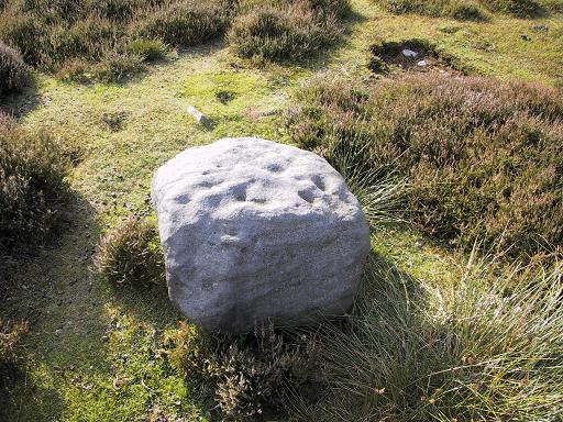
It’s another one of those simple designs: what seems like at least 5 cup-markings on a small rounded rock, with two of them linked together by a groove — possibly natural, possibly man-made — though there may in fact be seven or more cups etched onto its upper surface. It’s difficult to tell. It gives you the impression that its present position isn’t its original one and is suggested by Boughey & Vickerman (2003) to have been “moved from pipeline?” close by. It may even have been dug out and cast here, possibly once being a part of a cairn. In the Boughey & Vickerman survey they give its OS-coordinate as SE 17163 50527 – and describe it as a “medium-sized, free-standing rock of fine grit. Five cups, some perhaps natural.” When Richard Stroud and I visited the site, he found the GPS coordinate was SE 17162 50530; and we have to say that instead of describing it as a free-standing rock, it’s a movable stone (though it’d take a bit of effort), that may once have been part of a larger monument.
References:
Bennett, Paul & Chappell, Graeme, Personal Communication, 1993.
Boughey, Keith & Vickerman, E.A., Prehistoric Rock Art of the West Riding, WYAS: Wakefield 2003.
The place-name burwain is an early Old English word meaning “a cairn or tumulus”. It has variants such as borrans, borwen and borwans. In the developing survey by Parsons & Styles (2000), other linguistic examples are given, all of which point to the same thing, i.e., a prehistoric burial of one form or another. Also, in 19th century northern English dialect, Wright (1898) told that borrans is “a cairn, a heap of loose stones”—which is what used to exist hereby.
The fact that there is a place-name telling of its existence implies that it was a cairn of some size, but sadly all remains of it have long since gone. All that we’ve got left is the name of Burwains house on the early Ordnance Survey maps. Built on a hilltop rise, which is a common construction spot for such sites up and down the country, it’s possible that the cairn was destroyed when the Foulridge Lower Reservoir was built in 1793, with the mass of stone used in its construction (the reservoir also kept the name of Burwains lake for sometime).
References:
Clayton, John A., Valley of the Drawn Sword, Barrowford Press 2006.
Parsons, D.N. & Styles, T., Vocabulary of English Place-Names – volume 2, EPNS: Nottingham 2000.
Smith, A.H., English Place-Name Elements – volume 1, Cambridge University Press 1954.
Wright, Joseph, English Dialect Dictionary – volume 1, Henry Frowde: London 1898.
From Foulridge go west up the long windy road (B6251) till you hit the old crossroads near the top. Turn right and go on till you hit the modernised farmhouse on your right, where you’ll notice a modern upright stone in the entrance. You need to go back about 70 yards and you’ll see this old stone in the wall.
Archaeology & History
“Standing Stone Road’ stone!
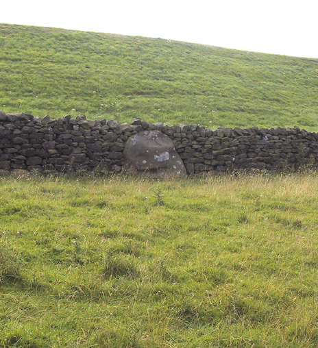
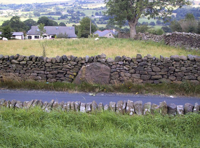
Less than a mile northwest of Foulridge along the southern stretch of the Whitemoor Reservoir, on the northern outskirts of Colne, we find the intriguingly-named ‘Standing Stone Lane’ — which seems to indicate that at some time in the not-too-distant past, an old monolith could be found hereabouts. The old maps show the boundary line turning at right angles just near the crossroads, which is where I thought we might locate some remains of an old standing stone. But it wasn’t to be. Instead, we need to travel about 100 yards west along the single-track road, just below the reservoir — and there, in the walling, plain for all to see, is what may be the old standing stone which gave the road its name. I found this site in early July 2008, and although we can’t be 100% certain, it’s not too bad a good contender as the monolith which first gave the road its name. Does anyone know anymore about it?
More probably though (and this is what ‘feels’ right): the original stone which gave the road its name was much bigger than this little thing, but was probably destroyed when the reservoir here was constructed. How much d’ y’ wanna bet!?
Aerial photo of the cursus (courtesy Antiquity journal)
Once to be seen running from the edges of Weston Grange northeast by the canal around Acrelane Bridge, this important mile-long neolithic monument beyond the southern outskirts of Derby has been damaged along much of its length due to the carefree approach of modern industrialists. Found just over 6 miles east of the Potlock or Twyford Cursus, this site was described by J.K. St. Joseph (1964; 1966) in Antiquity journal following an aerial survey of the region on August 7, 1962 — from whence the photograph here was taken, which shows the dead straight monument stretching southwest across the fields. The photo also gives a good idea as to how massive this prehistoric monument actually was! In Mr St. Joseph’s second short essay on this aligned site he told:
Aston Cursus (from Antiquity, 1966)
“The cursus at Aston upon Trent lies at a distance of half a mile from the left bank of the Trent, on gravel overlying New Red Sandstone, at a height of about 120ft O.D., some five miles southeast of Derby. No traces are visible on the surface, but photographs taken over the last few years enable the side-ditches of the cursus to be traced for a length of some 4500ft on a north-east to south-west alignment across six fields: the ditches are parallel and some 325ft apart. Though the entire length has not yet been recorded, the south-west end must lie near the farm of Weston Grange, while the north-east end is a little to the east of the road from Aston upon Trent to Shardlow. The north-western side ditch is interrupted towards the south-west end by two narrow gaps, 500ft apart.
“…Two ring-ditches lying within the cursus perhaps mark ploughed-out barrows. In diameter they measure some 120ft; one of them is defined by a double ditch. There are at least three small ring-ditches, of which one is intersected by the north-west ditch of the cursus. Five small square enclosures lying within the cursus towards its north-east end are less easy to explain. They are not unlike the square ditched enclosures recorded on the Yorkshire Wolds, and there identified as square barrows. About halfway along the length of the cursus a single ditch encloses an irregular area interrupted at two points for an entrance. One end of this area and the north-west ditch of the cursus overlap. Thereabouts, too, the cursus is crossed by elements of a system of linear ditches, which seem to be agricultural divisions of a kind often interpreted in the Middle Thames valley as of Iron Age or Roman date. A similar date is likely enough here, but the question is best left open until some examples have been tested by excavation. Lastly, the “pit-alignment” which extends for some distance towards the (River) Trent is seen to cross the whole width of the cursus, as does a double-line of pits nearer the north-east end…”
More than forty years later and the site is described on English Heritage’s website – at www.pastscape.org.uk, where a few additional aspects of the site are described:
“A cursus monument at Aston Upon Trent, orientated roughly southwest-northeast and located on the gravels of the trent valley, circa 1 kilometre northwest of the present course of the river. The cursus appears to be a regular rectangle, the long sides parallel and circa 100 metres apart. The southwest terminal is straight, and meets both sides at right angles. The northeast terminal has not been recorded as a cropmark, but may well have lain in an area which has been quarried away. If so, the cursus would have originally been a little over 1.5 kilometres in length.
“The cursus ditch was sectioned in the mid-1960s by D. Reaney, though no finds were made. The recorded stratigraphy suggested an internal bank. Further small-scale excavation occurred in 1986 at a point where the cursus ditch appeared to intersect with a ring ditch (SK 42 NW 59), towards the cursus’ south-western end. The cursus ditch appeared to run into and cut the ring ditch, and was therefore later in date. The slightness of the ring ditch and the nature of its fill suggests that there is unlikely to have been a mound of any substantial nature in its interior. Finds were few, and none from primary contexts. They comprised a thumb nail scraper, another worked flint, and a few sherds of pottery, identifiable as Grimston and Beaker ware.
“Adjacent to the ring ditch is another, not excavated, but also contained within the cursus. In 1995, an existing field drain alongside Acre Lane (in the area circa SK 4244 2968) was enlarged as part of work associated with construction of the Derby Southern Bypass.
“The sides of the drain were recorded archaeologically. The western cursus ditch was not present, suggesting the existence of a gap or causeway. The eastern cursus ditch, though not visible on air photographs at this point, was located. Pollen samples were collected, and a fragment of waterlogged wood is to be used for radiocarbon dating.”
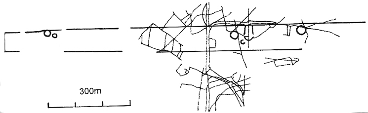
The site has since been found to be at least 1700 metres (5610 yards) long, with its northeastern end, or terminus, still undiscovered. It was described by Loveday (2006) as being, “overlain at its mid-point by a tangle of fields and trackways of presumed Iron Age date.” One prehistoric track crosses the cursus at a right-angle then turns 90° just as it crosses the dead straight alignment, running parallel with the cursus ditch for some 300 yards. (see illustration below)
References:
Gibson, A.M. & Loveday, Roy, ‘Excavations at the Cursus Monument on Aston-upon-Trent, Derbyshire,’ in A.M. Gibson’s Midlands Prehistory, BAR 204: Oxford 1989.
Loveday, Roy, Inscribed Across the Landscape, Tempus: Stroud 2006.
St. Joseph, J.K., “Air Reconnaissance: Recent Results, 6,” in Antiquity, volume XL, no.157, March 1966.
Aston Cursus, with overlying Iron Age tracks & fields (after Loveday 2003)
From Ilkley, head up the road towards White Wells and keep going along the road. Shortly before the road becomes a dirt-track, just over a small stone bridge with gorse all around, there’s a noticeable footpath that runs west onto the moors, going roughly parallel to the wealthy houses by the moorside. Keep going along this footpath and you’ll hit the recently unneeded modern creation of a large sandy trackway (and excessive litter that it’s created) that takes you straight to the curious railings stuck upon some rocks a quarter-mile away. That’s where you’re going!
Archaeology & History
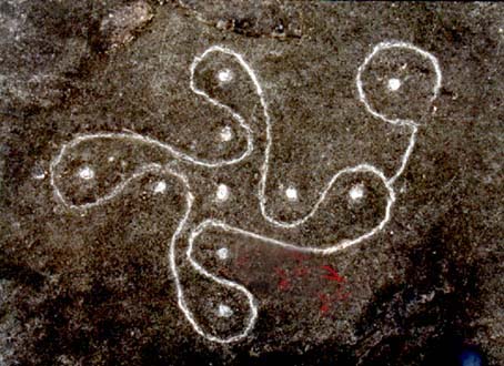
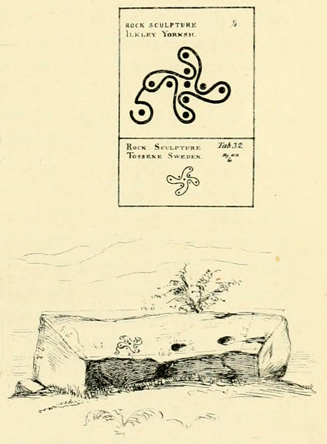
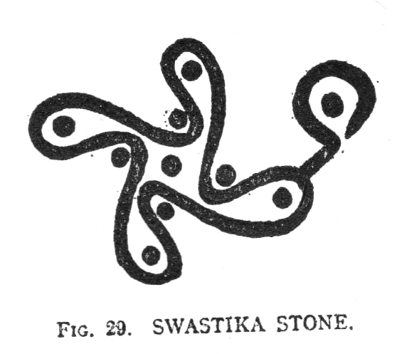
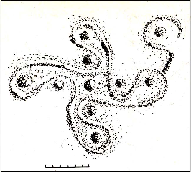
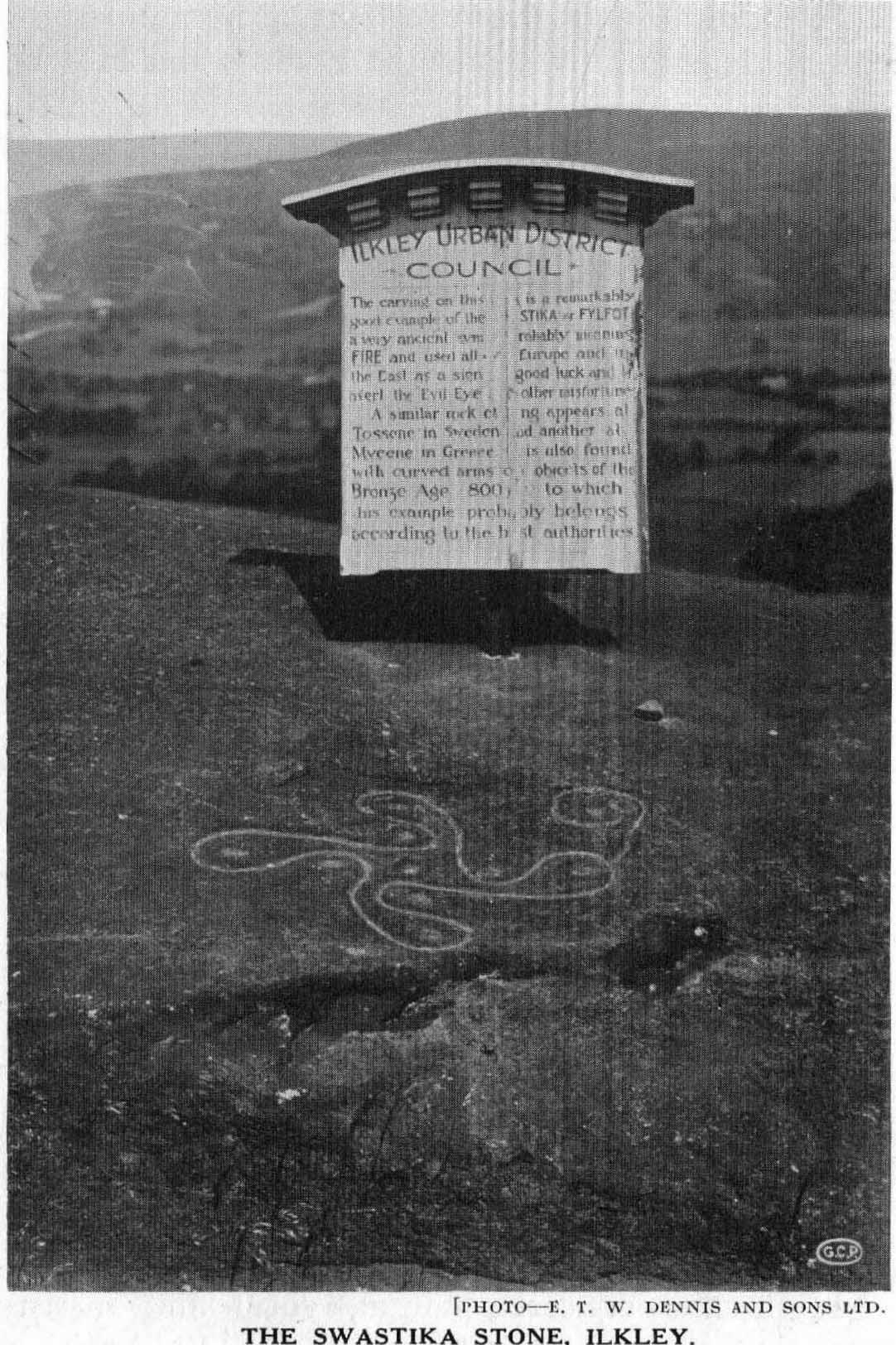
This famous carving was first described as a ‘swastika’ by a Mr J. Thornton Dale around 1880 – and the name seemed to catch on damn quick! The stone had become established with this title at the end of that decade, and seemed immortalized with the name when J. Horsfall Turner wrote about it in the very popular history book he co-authored with the reverend Collyer in Ilkley Ancient and Modern. (1885) By then, comparisons had already been drawn with the acknowledged swastika symbol in Tossene, Sweden, and by the time Harry Speight described it in his colossal Upper Wharfedale (1900), other near-identical European swastika carvings had been found in Valcamonica, northern Italy. (though these lacked the ‘tail’ found on Ilkley’s carving)
J.R. Allen’s drawing of Swastika StoneEric Cowling’s sketch of the carving
Earlier images of the swastika symbol can be found in most continents, but the earliest known example appears to be the paleolithic swastika carvings from the Ukraine, etched on pieces of ivory and dating from between 18,000-15,000 BC. Some swastikas have been found carved on mammoth tusks!
Invariably in modern history it is its mythic association of the swastika to certain political imbeciles which troubles many people, but this needs to be set into a much more ancient historical context. The symbol ostensibly relates to sacred notions of the cosmos in all the non-literate cultures where it appears. Numerous surveys by comparative religious scholars isolated the nature of the design many years ago. The Leeds Buddhist, Steve Hart, said that Ilkley’s Swastika Stone:
“to a Buddhist should be a sonorous gatha (a sutra or verse), a plenitude of transcendental boddhisattvic vision. The swirling wheel of the four arms suggests the four realms as experienced by Jains, upanishadic sages and ancient Buddists. They ARE samsara. The samsara is resolved into the nirvana at the hub. The four realms are the human realm, god realm, hell realm and the nature realm. There are no clear delineated demarcations between these realms. All interpenetrate.”
(Images of the popularised ‘modern’ swastika – a huge misnomer – can be found on several church bells in Yorkshire, where they were used as charms to protect against lightning, following in the mythic fashion of Thor. These swastikas date from the 15th century.)
Evan Hadingham’s rubbing of the carving
I first saw this carving when I was 10-years old and it had one helluvan effect on me! I stood and stared at it (or rather gazed, without thought…) for some length of time, knowing that I’d seen this somewhere before* and that it had some considerable importance – though about what, I knew not! The cups in the design align north-south and east-west. The northern line points directly at Simon’s Seat on the northern skyline. The eastern axis points directly at Almscliffe Crag, above which the equinox sun seems to rise from here.
For the real alignment fanatics, check out the alignment from Twelve Apostles to here: on the date of the last major lunar standstill (occurrent every 18.6 years), the moon set over the cairn at Lanshaw Lad. It wasn’t until I got home and checked the extension of this moonset line, that I realised if you follow it further along the course, you hit the Swastika Stone bang on! Though this is probably just a coincidence (we do have hundreds of cup-and-rings on these moors, so it’s bound to hit one or more of them).
The Swastika in 1930, with info-board
In this Swastika Stone, the curious single ‘outlying’ cup-and-ring at the edge of the four spiralling arms is very probably the point from which the four-arms originated and not the other way round. In traditional cultures and early cosmogenic patterns the world over, the cosmos itself emerged from the ’round’, the singular, the point, or uroboros — and this is what this Swastika Stone appears to represent here: the cosmos emerging from the singularity, giving birth to the world and the four cardinal points. Such an element is a simple one and is found in Creation myths the world over. (For those of you who aint into using psychedelics at sites, a good overview of this idea is in Erich Neumann’s Origins & History of Consciousness [although there’s no reference to this symbol] and which should be read by anyone pretending an interest in the nature of the archaic mind. It’s a good work on the psychology of the Dreamtime.)
As some local Ilkley folk are probably aware, a copy of the Swastika Stone carving was executed in the latter-half of the 19th century, probably by a local chap called Ambrose Collins, not far from the original swastika at the edge of the woodland. Some images and a brief history of this copied swastika and associated cup-markings will be published in due course on the Rombalds Moor Project website.
Other important cup-and-ring petroglyphs that are worth visiting on the moor with unique carved symbols in them include the Hanging Stones, the Idol Stone, Haystack Rock, Badger Stone and many many more.
Note:
A fella who used the pseudonym of ‘Pad’ suggests that the carving is only a few centuries old, and compares it to other much more recent etchings on these moors, where the erosion has been of no greater or lesser force. The suggestion has been made about other carvings on these moors and whilst I have an open mind about this, if this is the case, we would have to relate the same reasoning to countless other carving on these hills. In which case, a great deal of cup-and-ring art would have to be redesignated as medieval in nature.
References:
Bennett, Paul, The Old Stones of Elmet, Capall Bann: Milverton 2001.
Boughey, Keith & Vickerman, E.A., Prehistoric Rock Art of the West Riding, WYAS: Wakefield 2003.
Collyer, Robert & Turner, J. Horsfall, Ilkley, Ancient and Modern, William Walker: Otley 1885.
Cowling, Eric T., Rombald’s Way, William Walker: Otley 1946.
Hadingham, Evan, Ancient Carvings in Britain, Garnstone: London 1974.
Hedges, John, The Carved Rocks on Rombalds Moor, WYMCC: Wakefield 1986.
Pennick, Nigel, The Swastika, Bar Hill: Cambridge 1980.
Speight, Harry, Upper Wharfedale, Elliott Stock: London 1900.
Wilson, Thomas, The Swastika – The Earliest Known Symbol and its Migrations, Smithsonian: Washington 1896.
* although I’d never seen the carving before, I had of course seen its archetypal manifestation in the shapes in Nature: spiral galazies, polar rotation (I was a budding astronomer as a kid!), hair growth from the crown, petals, swirling clouds, etc, etc. The Swastika, as we know, is representative of the creative spark itself: the life-essence, emerging from the centre and manifesting itself in the four worlds, which are its emergent arms.
Links:
Reclaim the Swastika – A fine website which is into doing just what it says on the tin!