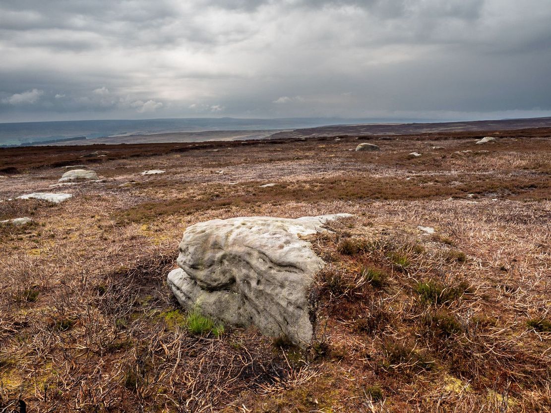
This one really takes some finding. Take the high moorland road running between Lofthouse and Healey villages, and at the very top by the cattle-grid, park up. Walk across the road and walk east. A mile or so on you’ll pass the Shooting Lodge house: keep walking for nearly another mile where another track goes left. Walk down here about ½-mile and you’ll see a crag down the the slope on your right. From here, walk uphill to your left; over the wall, and keep going about 500 yards until the moorland levels out. Hereby is a small outcrop of rocks. Look around!
Archaeology & History
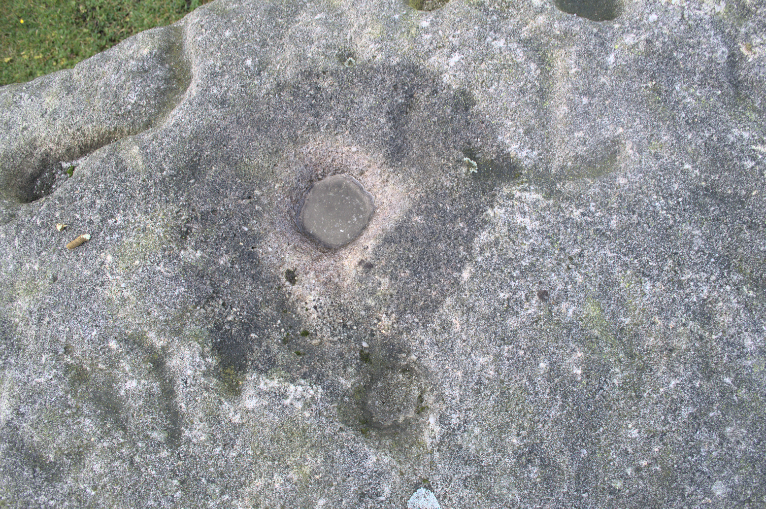
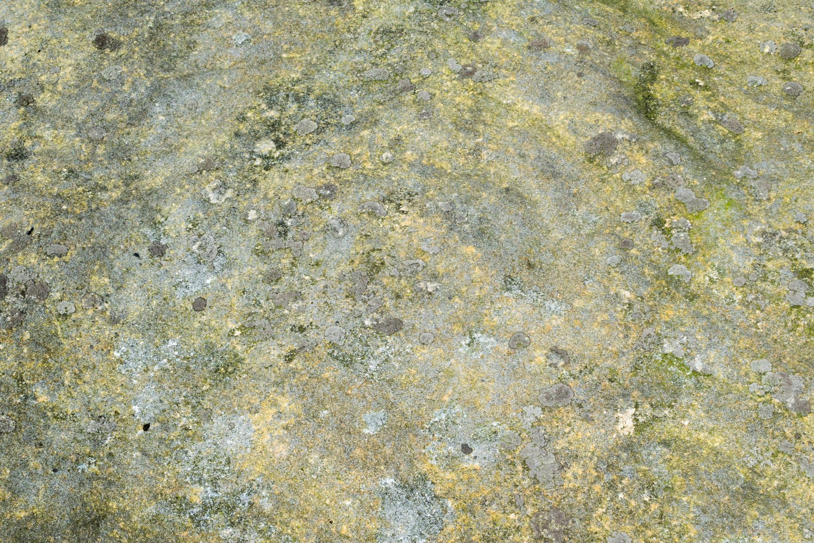
Recently rediscovered by young antiquarian Mackenzie Erichs in May 2021, this flat rock—roughly 5 feet by 3 feet— is one of many amidst the heather which, when fully grown, is gonna be hard to see. This is one of the many petroglyphs possessed with both natural and artificial elements roughly of the same number here.
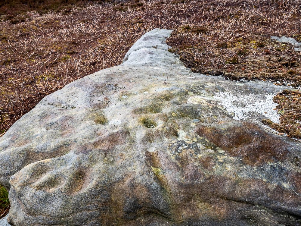
Upon the mainly southern-side of the stone is a cluster of cup-marks with several on the edges of the rock, most of which are probably natural, or naturally affected. The main cluster of cups—about eight in all—have differing levels of erosion, suggesting differing periods of execution. The most obvious cup is the deep one near the middle of the stone; a group of 3-4 very eroded ones are closer to the edge; and 2-3 three others of varying shallow depths can be seen. One of the cups at the edge of the rock may also have been partially worked.
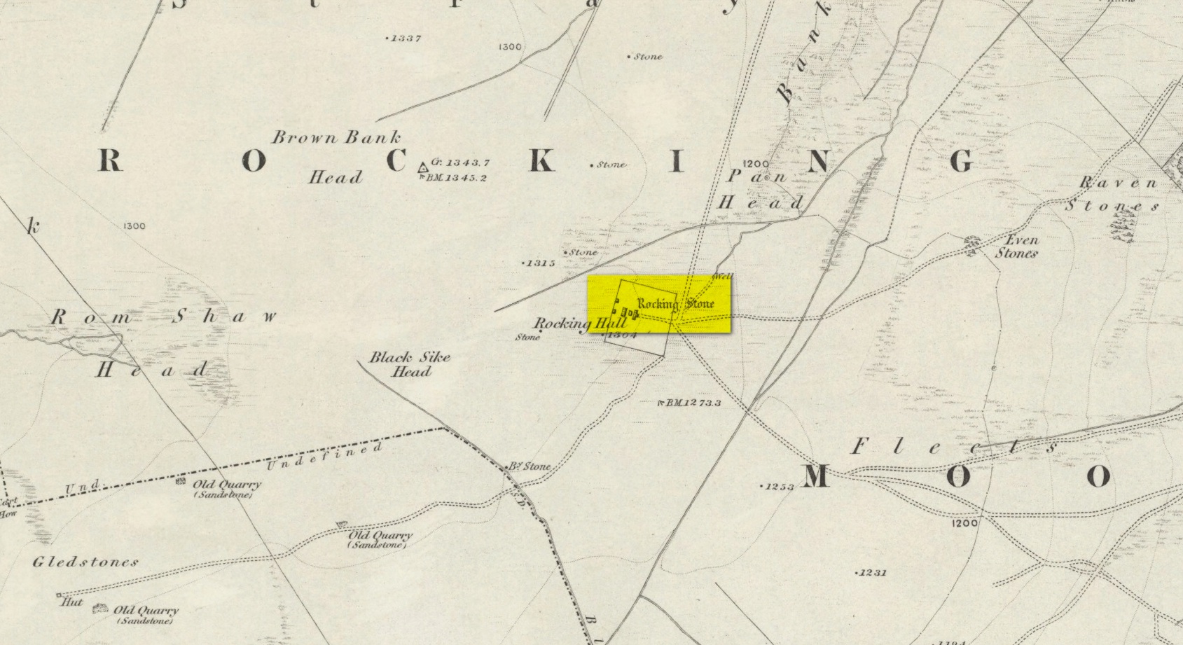
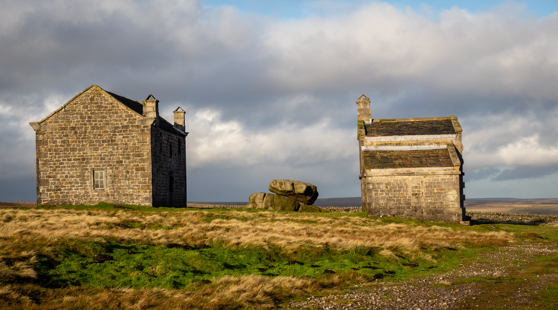
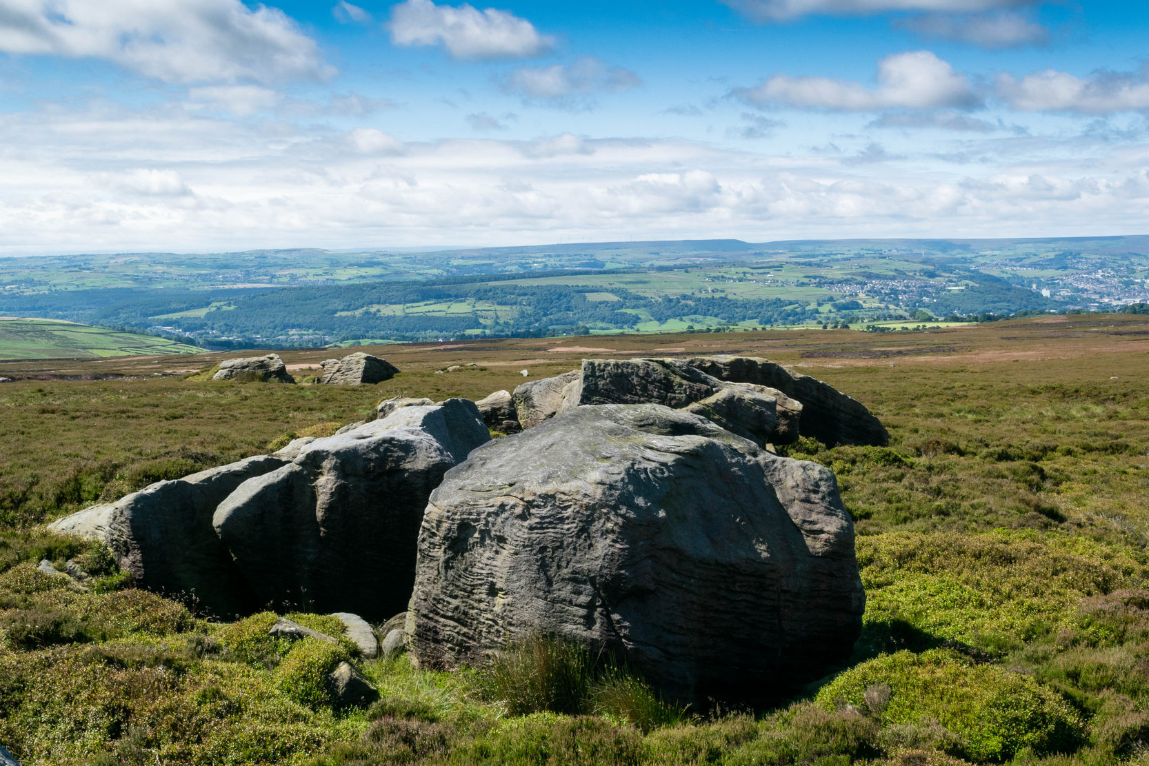
Visiting this site is a bittova walk across the moors, with probably the best route being along one of two footpaths from near the Outdoor Centre following (whichever is your preference) the moorland track or path westward onto the open landscape. Tis a 2½ mile walk before you reach two large buildings stuck high up in the middle of nowhere. Y’ can’t miss them. Equally unmissable is the large blatant rocking stone between the buildings. Gerron top of it!
Archaeology & History
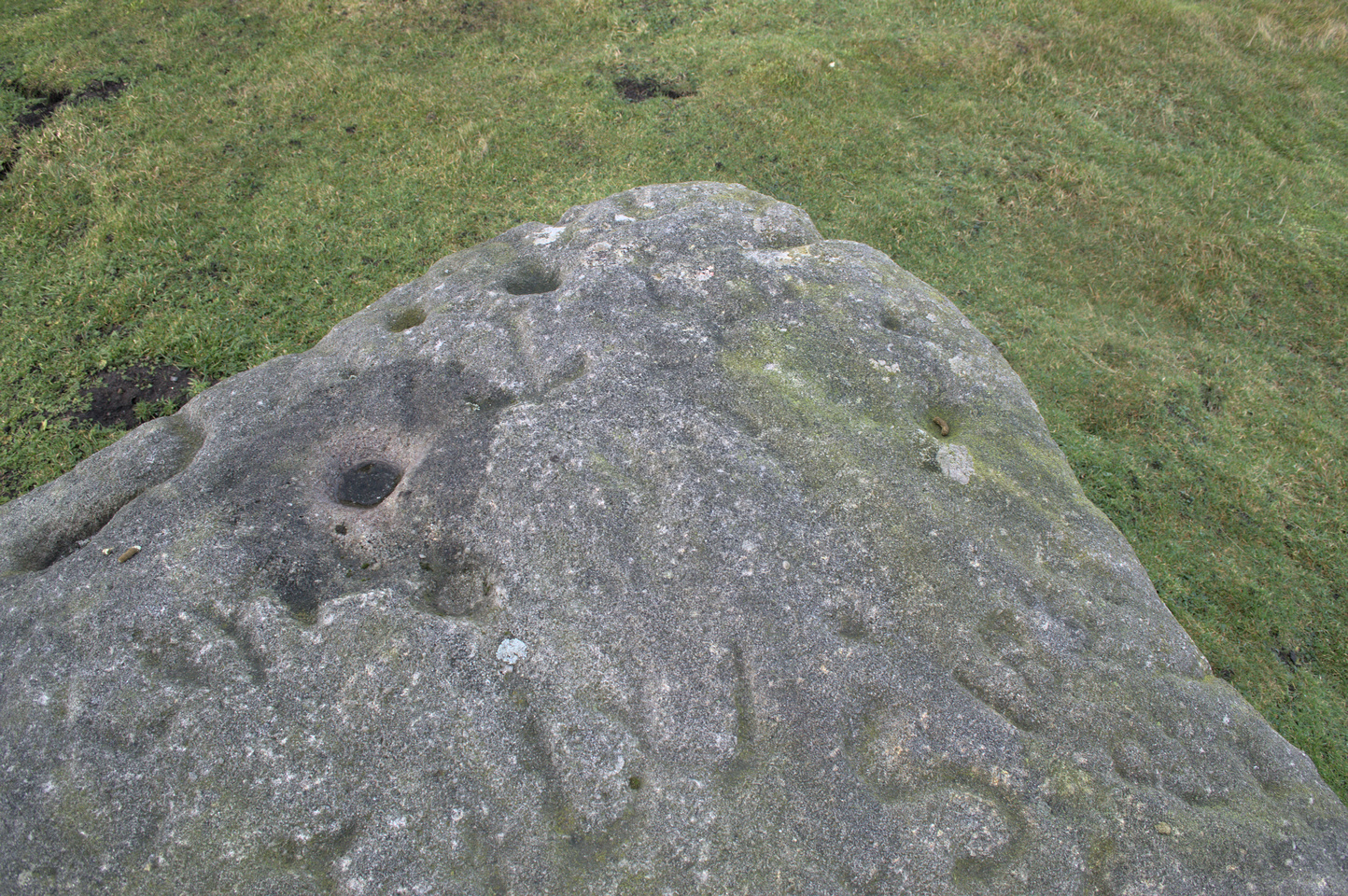
Rocking Stone, in situ
This impressive-looking rock that sits between the two buildings has a number of cup-markings of varying sizes across its topmost surface: some deep and some not-so-deep. There are perhaps as many as 20 of them on different parts of the stone, but some have been intruded on by more recent graffiti. On a recent visit to the site, photographer James Elkington and his young assistant MacKenzie, saw what looked like “a very faint ring around one of the cups” – which doesn’t surprise me. On one section of the stone we see a fascinating series of natural curves and geological undulations, some of which may have been modified a long time ago when the cupmarks were etched. But whether they were added to or not, it’s more than likely they’d have had some significance in the mythic nature of the rock.
The earliest description telling us that this possessed any prehistoric attributes seems to have been written by William Grainge (1871), in his huge work on the history of this region. He told that,
Faint ring highlightedSome of the many cups
“This rock…is eleven feet in length, seven feet six inches in breadth, and two feet six inches in thickness. The whole of the upper surface is thickly indented and grooved with cups and channels; the artificial character of which can be easily seen by anyone. This logan rests upon a lower rock, the upper surface of which is about three feet above the ground, fourteen feet in length, and nearly the same in breadth.”
Folklore
Curvaceous nature & cups
Although this yummy-looking geological sight no longer rocks, it wasn’t always that way. Indeed, according once more to the pen of Mr Grainge, although “it does not rock now, it has done so within living memory” – meaning that it would have been swaying at the beginning of the 19th century. We can only take his word for it. Also, as with many rocking stones the length and breadth of the land this, unsurprisingly it was adjudged to have been a place used by the druids.
References:
Grainge, William, The History and Topography of Harrogate and the Forest of Knaresborough, John Russell Smith: London 1871.
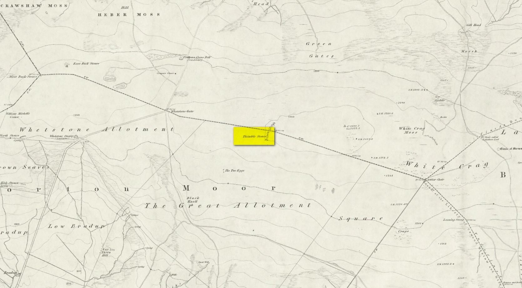
You can either head up to the Twelve Apostles stone circle, then a short distance west to the Ashlar Chair and head just head west along the moorland footpath that runs parallel with the old walling for ¾-mile (1.2km). This is the boggier route, beloved of real walkers! The other route is from the top of the Roman Road that bisects the moor at Whetstone Gate. From here, where the normal ‘road’ meets up with the dirt-track at the very top of the moors, take the footpath east for ½-mile (0.75km) until you reach the large cluster of rocks, just over the wall on your right-hand side. The carving is on top of one of them there stones.
Archaeology & History
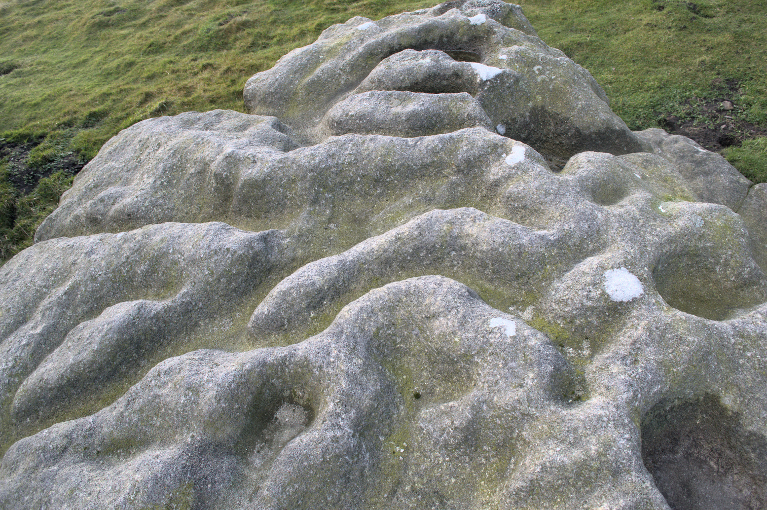
Without doubt there’s one helluva spirit to this cluster of large weather-worn rocks whose bodies gaze in every cardinal direction—and it’s a place where me and a number of earlier historians thought cup-and-rings could be found. The first petroglyphic context of the rocks was made in the 1860s by the grand 19th century historians Forrest & Grainge (2012) where they gave it the usual druidic associations, so beloved of academics and antiquarians alike at the time. They wrote:
Very faint cup-and-3-ringsThimble Stones gazing south
“The Thimble Stones are a ½-mile north of the Two Eggs, with which they are nearly in line. They are of the same outcrop of stratification and appear as though they had been pushed upwards by some force acting from beneath, breaking them up with a vertical fracture, and separating them so as to leave wide spaces between the blocks. They are about a furlong in length and in front about 10ft in height, diminishing eastward to the level of the ground. Two of them a few feet apart are 7ft high, and bear on their eastern angles the cups and channels which we designate the marks of Druidic consecration.”
Subsequently, in Collyer & Turner’s (1885) work they told that the rocks “bear cups on two margins”; and when the great Harry Speight (1900) came here, he found they were “bearing cups and grooves.” Yet no-one reported any rings. And in the countless visits I’ve made here—thinking that there must have been cup-and-rings!—no such symbols have ever cried out. The various large ‘bowls’ and lines that Nature has carved here—some of which may have been important in ancient days—are all that the casual eyes can see. Until now…
The local rambler and photographer James Elkington and James Turner were up here a couple of years ago. The light was falling through a clear bright sky and so, as James likes to do at such times, he clicked his camera a few times to catch the landscape. Clambering onto the rocks, Mr Turner unknowingly stood upon the carved rings, and when he moved his foot Mr Elkington spotted them! And as we can see on the image above, only just, there’s a single cup-mark surrounded by a concentric triple ring. Incredibly faint, it is without doubt the real McCoy—and the highest of all petroglyphs on these moors. In the photo it seems that there may be other elements to the carving, but until conditions allow for a further examination, we won’t know for sure.
James is hoping to get back up there when conditions are just right so he can get clearer photos. But if you hardcore antiquarians and petroglyph seekers wanna get up there y’selves to get some photos of your own, please send us whatever you might find.
Folklore
On the esoteric side, the Thimble Stones was a place favoured by the progenitors of the ritual magickal Order, the Illuminates of Thanateros, in years gone by.
References:
Allen, J. Romilly, ‘Cup and Ring Sculptures on Ilkley Moor,’ in Reliquary & Illustrated Archaeology, volume 2, 1896.
Bennett, Paul, The Old Stones of Elmet, Capall Bann: Milverton 2001.
Boughey, Keith & Vickerman, E.A., Prehistoric Rock Art of the West Riding, WYAS: Wakefield 2003.
Collyer, Robert & Turner, J. Horsfall, Ilkley, Ancient and Modern, William Walker: Otley 1885.
Feather, Stuart, “Mid-Wharfedale Cup-and-Ring Markings,” in Bradford Cartwright Hall Archaeology Group Bulletin, 6:3, 1961.
Forrest, Charles & Grainge, William, A Ramble on Rombald’s Moor, Northern Antiquarian: Bradford 2012 (1st published 1867-69).
Hedges, John (ed.), The Carved Rocks on Rombalds Moor, WYMCC: Wakefield 1986.
Speight, Harry, Upper Wharfedale, Elliott Stock: London 1900.
Acknowledgements: Huge thanks as always to James Elkington for use of his photos.
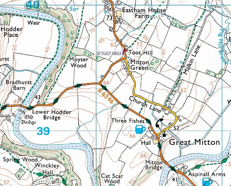
From Great Mitton village centre, take the B6246 road NW turning right up the B6243 road a quarter-mile past Great Mitton Hall. Same distance again, and just after where the road bends left, on the same side of the road you’ll see a wooden bus-stop. The site is just on the grass next to it.
Archaeology & History
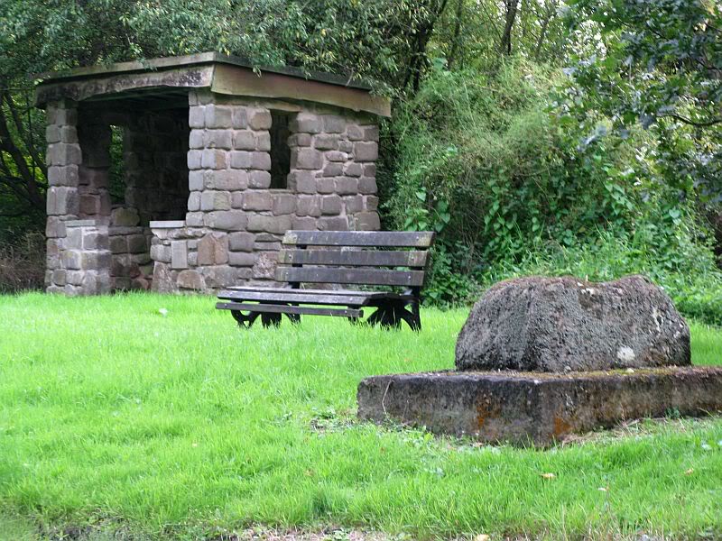
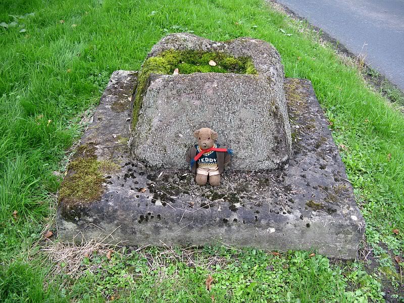
The old site by the road (after QDanT)
In a region with many old crosses hiding away in the landscape, we have very little history about this particular wayside cross and its stony base, found below the western edge of Toot Hill. It will no doubt have had something to do with the monks of the once-prestigious Whalley Abbey a few miles away, but we know not what! The great Lancastrian historian John Dixon would, no doubt, have known something of this place, but he is sadly no longer with us… The only thing I can presently find is a passing mention in Fred Ackerley’s (1947) local history work, who told:
“Continuing along the high road past Mitton Green one sees the base of a roadside cross and directly opposite this cross-base is Toot Hill, where in ancient times it is probable that village meetings were held.”
Close-up of the cross-base, with Teddy! (after QDanT)
Toot not being a just “a look-out hill” (Smith 1954), but in some cases places where ancient temples were built, “upon high totes” — though we have no record of such a temple, christian or heathen, upon this hill. So the reason for the stone cross at the bottom remains a mystery. Although, atop of the hill, we see marks very reminiscent of something much more archaic and heathen in nature, still visible in the crop-marks…
References:
Ackerley, Frederick George, A History of the Parish of Mitton in the West Riding of Yorkshire, Aberdeen University Press 1947.
Smith, A.H., English Place-Name Elements – volume 2, Cambridge University Press 1956.
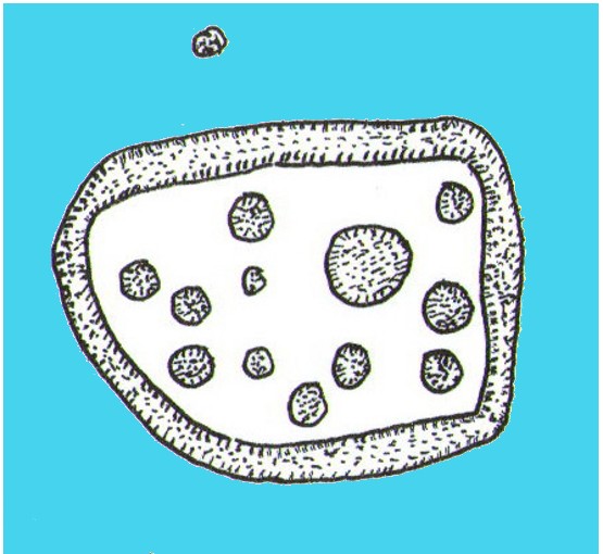
Cup-and-Ring Stone: OS Grid Reference – SK 231 691
Archaeology & History
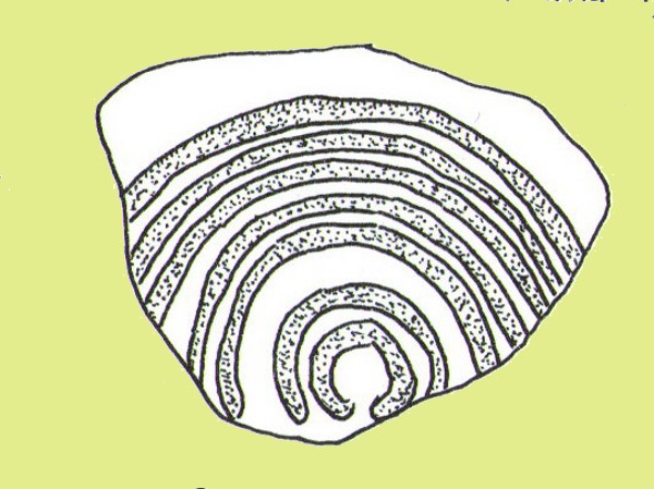
Ball Cross 2 Carving (after Beckensall)
One of three carvings that were located inside the walling of the Ball Cross hillfort during excavations here in the early 1950s by J. Stanley. (1954) Each carving is distinctly unlike the other in design (see Ball Cross 1 and Ball Cross 3) and it’s highly probable that they were incorporated into the Iron Age structure with their original mythic functions—of neolithic or Bronze Age origin—disused. It is not unlikely that this and its compatriots were originally found in association with the nearby prehistoric tombs.
Ball Cross 2 Carving (photo by Dean Thom)
The broken piece of rock consists of a broken section of an almost archetypal ‘cup-and-ring’—although with this design, no central ‘cup’ occurs: a pattern found at several other multiple-ring stones, like the Grey Stone near Leeds. Although Stan Beckensall (1999) described this to have “8 concentric rings”, his drawing and the photo here by Dean Thom, clearly show only seven such ‘rings’. The carving presently lives in a protective box in Sheffield Museum (though beware the listing they give of the designs, as some are incorrect).
References:
Barnatt, John & Reeder, Phil, “Prehistoric Rock Art in the Peak District,” in Derbyshire Archaeological Journal, 102, 1982.
Beckensall, Stan, British Prehistoric Rock Art, Tempus: Stroud 1999.
Beckensall, Stan, Circles in Stone: A British Prehistoric Mystery, Tempus: Stroud 2006.
Cooper, Ali, Archaeology Walks in the Peak District, Sigma: Wilmslow 2010.
Morgan, Victorian & Paul, Rock Around the Peak, Sigma: Wilmslow 2001.
Stanley, J., “An Iron Age fort at Ball Cross Farm, Bakewell,” in Derbyshire Archaeological Journal, volume 74, 1954.
Acknowledgements: HUGE thanks to Dean Thom for the use of his photo, plus helpful references on this site.
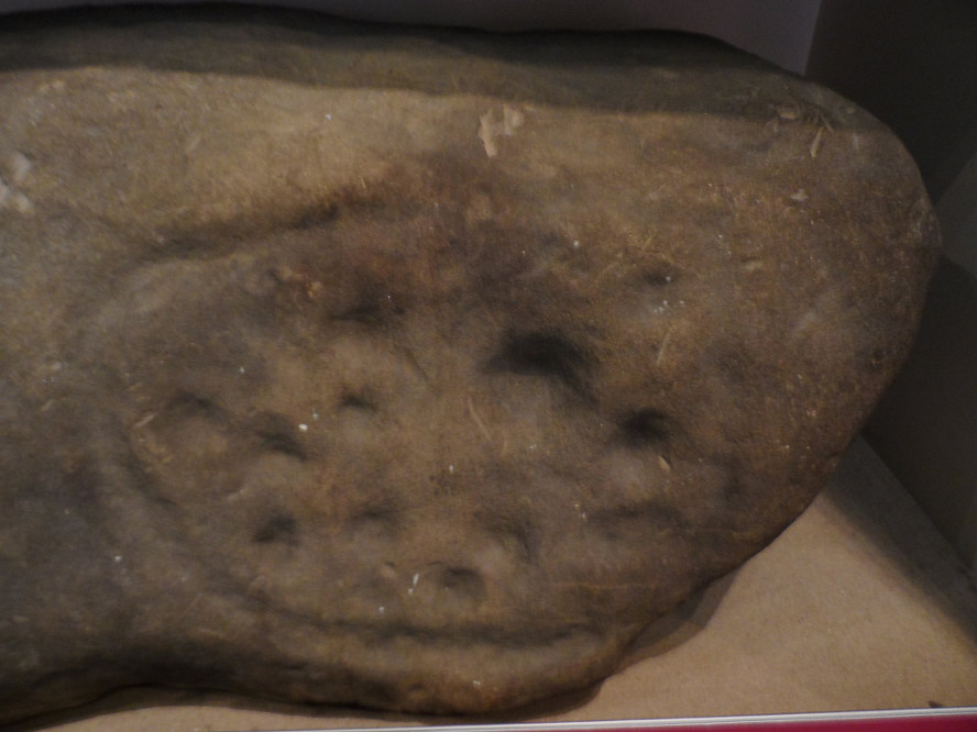
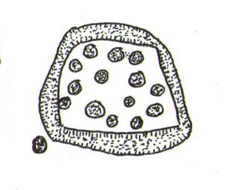
This is another carving (one of three here) that was removed from its landscape setting when found during excavations of the Iron Age hillfort of Ball Cross in the 1950s, and then placed into a box in Sheffield Museum, decontextualizing it and leaving future researchers slightly in the dark as to its possible nature. In removing the carving from its site, the stone was left with additional scratches and grooves slightly damaging the stone. Not good!
Ball Cross Carving (after Beckensall)Ball Cross Carving (after A. Cooper)
Although unlike the Ball Cross 2 and 3 carvings, the design here is structurally very similar to that found east of Gardoms Edge, with this one comprising of a large unbroken carved oval, with at least twelve cup-marks inside. Or as Beckensall (1999) described, it “has 12 cups inside a flattened ring.” Again, like the Gardoms Edge carving, a single cup-mark was etched outside of the enclosed ring. It was found with its companion carvings built into the main walled structure of the hillfort. It’s unlikely that the stones date from the same age as the hillfort: more probable that they were re-used in the structure, with their mythic nature perhaps already long forgotten…
References:
Barnatt, John & Reeder, Phil, “Prehistoric Rock Art in the Peak District,” in Derbyshire Archaeological Journal, 102, 1982.
Beckensall, Stan, British Prehistoric Rock Art, Tempus: Stroud 1999.
Beckensall, Stan, Circles in Stone: A British Prehistoric Mystery, Tempus: Stroud 2006.
Cooper, Ali, Archaeology Walks in the Peak District, Sigma: Wilmslow 2010.
Morgan, Victorian & Paul, Rock Around the Peak, Sigma: Wilmslow 2001.
Stanley, J., “An Iron Age fort at Ball Cross Farm, Bakewell,” in Derbyshire Archaeological Journal, volume 74, 1954.
Acknowledgements: HUGE thanks to Dean Thom for the use of his photo, plus helpful data on this site.
Cup-and-Ring Stone: OS Grid Reference – SK 2752 7328
Archaeology & History
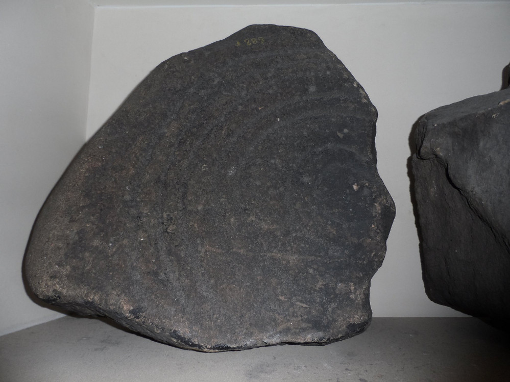
Gardoms Edge 2 carving, in Sheffield Museum (photo – Dean Thom)
This carving is one of two cup-and-ring stones that were removed from this area and transported to Sheffield Museum, decontextualizing them from their landscape presence (this should not be done unless very severe damage is happening, or their destruction is imminent). It’s quite an intriguing carving, similar in design to one found not far away at Great Hucklow, the Middleton Moor 479 carving, etc. Like many Pennine cup-and-ring stones, it was located in a prehistoric cairn field (or necropolis), with hut circles not far away too, and really should have remained in situ for the benefit of future researchers.
Gardoms Edge carving (after Beckensall 1999)
The carving was cut into one end of a small rock and comprises of a singular unbroken, large oval, within which are enclosed thirteen or fourteen cups, plus a single cup on the outside of the ring. Lunar associations may be invoked by the 13 cups, enclosed within one cycle of the year. But I’m speculating of course. It’s probable that other carvings in the area remained undiscovered.
References:
Barnatt, John & Reeder, Phil, “Prehistoric Rock Art in the Peak District,” in Derbyshire Archaeological Journal, 102, 1982.
Barnatt, John & Robinson, F., “Prehistoric Rock Art in Ashover School and Further New Discoveries Elsewhere in the Peak District,” in Derbyshire Archaeological Journal, 123, 2003.
Beckensall, Stan, British Prehistoric Rock Art, Tempus: Stroud 1999.
Beckensall, Stan, Circles in Stone: A British Prehistoric Mystery, Tempus: Stroud 2006.
Acknowledgements: HUGE thanks to Dean Thom for the use of his photo here.
The low hill called Beadle Hill is located about half a mile north of Swinden Reservoir between Worsthorne and Haggate in the area called Extwistle. It is just a short distance south of Monk Hall and a little east of Monk Hall farm. The earthworks are a long rectangular feature on a low hill (more of a mound really).
The earthworks are more noticeable on the south and west sides but less so at the eastern and northern edges of the mound. They can’t be said to be in any way defensive. The thinking is that this was a Romano-British farmstead or settlement from the late 4th century AD and, not as often thought a Roman camp. The name Beadle is apparently from the Anglo-Saxon/Old English word ‘Beado‘ or ‘Beadlo‘, meaning ‘battle.’ So could the hill be the site of some long forgotten skirmish from the time when the Romans were leaving the north of England? Or could it refer to the legendary ‘Battle of Brunanburh’ which was fought close by in 937 AD? In that battle King Athelstan fought against, and defeated, the Danes and Scots who were moving south from Northumbria.
At the south side of Beadle Hill there is an ancient spring, and to the east is Twist Castle—a circular earthwork that could date from the same period as Beadle Hill. Also, there are a number of tumuli and cairns in this area though these are prehistoric in date, probably Neolithic or Bronze-Age. I do not know whether the site has been excavated. If it has, please let us know!
References:
Cockburn, John Henry, The Battle of Brunanburh and its Period, Elucidated by Place-Names, Sir W.C. Leng: Sheffield 1931.
Frost, Roger, A Lancashire Township – The History of Briercliffe-with-Extwistle, Rieve Edge Press: Briercliffe 1982.
Take the B6246 road northwest out of Whalley, or else east from Hurst Green, until you hit the little village of Great Mitton, with its churchyard in the middle. Go into the churchyard and you’ll find this weird-looking cross!
Archaeology & History
The curious-looking upright in the churchyard here has a mixed history by all accounts. The oldest portion of the cross is universally ascribed to be the top section, rediscovered when it was dug up “shortly before 1801.” (Ackerley 1947) It possesses a carving of the crucifixion on one side, and some curious figures carved on the other, which some ascribe to being Jesus, but could well be the triple female element which would still have been prevalent in peasant culture at the time it’s thought to have been carved. The original shaft carrying the ‘cross’ had long since been destroyed and so, according to Jessica Lofthouse (1946),
“In 1897 it was ‘re-erected to commemorate the 1300th anniversary of the reintroduction of christianity into Britain,’ with the new shaft we see today. This is the oldest relic in Mitton.”
In J. Buckler’s early 1841 drawing of both sides of the carved cross-head we can see in greater detail the nature of the medieval rock art and this was described in Aymer Vallance’s (1920) decorative analysis of carved crosses in England. He told that
“the cross-head at Mitton, Yorkshire…is peculiar inasmuch as the crucifixion is sculptured on both faces, but in totally different fashions. That on the west face has the arms stretched horizontally, within a sexfoil frame, and might well be of the thirteenth century. Whereas the sculpture on the east face, though much more weatherworn, is of a style that could not have been designed before the fourteenth, or perhaps even the fifteenth century. The arms of the Christ in this instance are drawn upwards in an unusually oblique direction. It is impossible that these two representations could have been executed at one and the same date. The circular outline of the head, too, is peculiar, and suggestive rather of a gable-cross than of a standing cross. Possibly the west face only was sculptured in the first instance, for a gable-cross, the sculpture on the east face being added later in order to adapt the stone for the head of a churchyard cross.”
Although I’ve gotta say that the three carved figures with the upright arms strikes me more as three females than any crucified character and may be an early depiction of the three Mary’s.
One of the early ministers at Mitton church was none other than John Webster, who wrote the highly influential work, Displaying of Supposed Witchcraft, which denounced much of the Church’s obsession and murder of countless people under the auspice of some spurious devil and demonological bollocks which, even today, some still suffer to endure. Webster was only at Mitton for a few years, before moving into deeper Yorkshire and setting up at Kildwick.
References:
Ackerley, Frederick George, A History of the Parish of Mitton, Aberdeen University Press 1947.
Lofthouse, Jessica, Three Rivers, Robert Hale: London 1946.
Vallance, Aymer, Old Crosses and Lychgates, Batsford: London 1920.
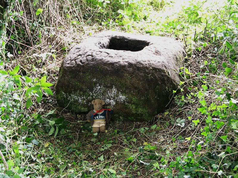
From Great Mitton village, go up (north) the slightly winding B6243 road for a mile, then take the left turn up the minor country lane, for about 300 yards, till you reach a tiny crossroad of tracks, one leading down to Scott House and the other up to Withgill Farm. Stop here! You’re damn close. From what our man ‘QDanT’ says, this is now to be found behind the hedge by the roadside, on the side of the road where the track runs up to Withgill Farm, tucked low and overgrown close to the ground. Good luck!
Archaeology & History
Described by Mr Ackerley (1947) as being found
“in the coppice beside the gate to Withgill is the base of another road-side cross,”
Cross-base (after QDanT)
all but overgrown by ivy and lost to the causal eye. Thankfully our man Danny got on his bike and found the remains of the little fella, all-but invisible beneath the vegetative growth! Beneath the vegetation, John Dixon told there to be “some interesting 17th century graffiti,” but there’s not much that remains of the old cross.
Folklore
There is a curious story about a legendary church that was once supposed to have been up the track on the hill just above here at the farm. The story goes,
“that when Mitton church was built, it ought to have been built on Withgill Knowle: that there was a church somewhere about there, and that the stones from it were carted down to Mitton in one night and used in building the present church.”
This bitta folklore is a motif found commonly at prehistoric sites, where stones from our ancient places were uprooted and moved (destroyed) to give way to the new christian mythos. To my knowledge, no such prehistoric sites are known hereby. Mr Dixon – over to you dear sir!
References:
Ackerley, Frederick George, A History of the Parish of Mitton in the West Riding of Yorkshire, Aberdeen University Press 1947.