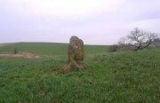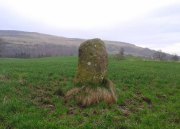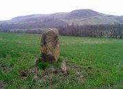
Mixing Stone, Low Snowden, Askwith, North Yorkshire

Cup-and-Bowl Stone:  OS Grid Reference – SE 18074 51241

Getting Here

Follow the directions to reach the Ancestors’ Stone and the Sunrise Stone; and there, roughly halfway between them, right by the edge of the old collapsed walling, you’ll see this rise of a stone with a large ‘bowl’ on top.  That’s it!

Archaeology & History
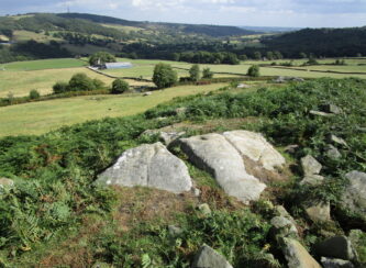
Mixing Stone, looking E

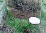
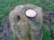
Laid upon the same geological ridge as our Ancestors’ and Sunrise carvings, there are one, possibly two faint cup-marks visible on the low flat surface near the edge of this rock, barely visible unless the light’s right.  But the important element here, perhaps regardless of the cup-marks, is the ‘bowl’ or rock basin on top of the stone.  Internally, it’s smoothed equally on all sides and, due to being in-between the two impressive petroglyphs, may well have had a practical function to it.  Bear with me on this one…
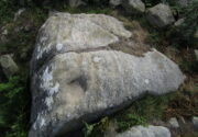
The Mixing Stone’s bowl

Stone ‘bowls’ or cavities—natural and otherwise—have been made use of in many cultures for simple functional purposes, such as grinding flour, herbal mixes, etc.  We find such traditions in some of the bullauns of Ireland and Scotland; whereas in similar stone bowls known as cat troughs in nearby Haworth, milk was poured to appease the spirits of the land (this tradition was still being maintained in 2001!).  Folklore and traditions of such rock basins spread far and wide beyond the UK: one of the German terms for rock basins is Opferkessel, meaning ‘sacrificial basin’ and suggests ritualistic usage by early societies.  Elsewhere on Earth there are numerous accounts of the ritual use of petroglyphs in which indigenous peoples tell of their use of plant- or rock-based paints (in many cases red ochre) to decorate the carvings.  And it’s this element that I’m interested in here.
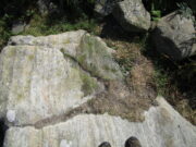
Water-painted cupmarks

The Sunrise and Ancestors’ Stones 10-15 yards either side of this Mixing Stone are ideal candidates for such petroglyphic paintings using early ochre and other stone or plant-based agents.  Such activities would always have been ritualised, either in honour of ancestors, genius loci, calendrical rites, or whatever the pertinent ingredient was at that place and time.  I’m suggesting simply that the rock basin on the Mixing Stone was used for just such purposes.  This is no spurious suggestion, but at the same time it’s important to recognise that my thoughts here represent merely an idea, nothing more—not a fact.  Whilst we know full well that these carvings were imbued fundamentally with animistic properties—a simple ‘fact’—this functional idea is just that—an idea.  Students and petroglyph-nuts need to understand this.  And the faded cup-marks at its edge are perhaps merely incidental…. though I don’t buy that misself!

© Paul BennettThe Northern Antiquarian 

St. Columba’s Stone, Shantallow, Derry, Co. Derry

Petroglyph:  OS Grid Reference – C 4386 1934

Also Known as:

  1. Chieftain’s Installation Stone
  2. Inauguration Stone
  3. St Columb’s Footprints
  4. St Columb’s Stone

Archaeology & History

St Columb’s feet carving

To be found in the grounds of Belmont House School, just 1¾ miles (2.8km) north of Derry’s other Columba’s Stone, this is one of the many petroglyphic “footprints” that folklore ascribes to Ireland’s saint Columb/Columba/Columbkille (and other variants).  Said to have originally been carved at the great fortress of Grianan of Aileach, 4½ miles (7.2km) to the west, this great block of stone—roughly 6 feet square on top—has the distinct sculpturings of two feet, each about 10 inches long, etched into its sloping surface.  Archaeologically speaking, there’s little more to say about the stone; but its traditions are another thing altogether and are of considerably greater importance…

Folklore

Like the carved footprint on top of Dunadd in Argyll with its association of tribal initiations, the traditions relating to this footprint follows the same path, so to speak.  It was H.P. Swan (1938) who gave us a good summary of the olde lore here, telling that,

“It is almost absolutely certain that it was brought from the Grianan of Aileach after its destruction, probably by an O’Doherty for his own installation.  If so, the task of removal was no joke, for the stone weighs some seven tons.  It was the “crowning stone” of the Kinel-Owen, or, in other words, the stone upon which the chieftains of the great O’Neill clan were inaugurated.  They reigned in Aileach for many centuries.

“At his installation, as supreme head of the clan, the newly-chosen chief was placed upon this stone, his bare feet in the footmarks; a peeled willow wand was put into his hand, as an emblem of the pure and gentle sway he should exercise over his tribe; an oath was administered to him by the chief ecclesiastic in the neighbourhood, that he should preserve inviolable the ancient custom of his country, and deliver the succession peaceably to his tanist (successor); after which, descending from the stone, he turned himself thrice backwards and thrice forwards, to signify that he was ready to meet all foes, from whatever quarter they might come; and was then, with wild acclamations, hailed as their chief by his assembled clan.

“At the time of Ireland’s conversion to christianity by St Patrick, that holy man visited the Grianan (about AD 443), where this stone had been so used for centuries before; Owen was then King; he was converted from Paganism to the new faith and baptised by Patrick; at the same time, the saint consecrated this stone, and blessed it as the crowning-stone of the Kinel-Owen for ever.  Time, however, has proved his blessing futile, as may be read in the account of the Grianan, which was deserted by the Kinel-Owen after its destruction by the O’Briens in 1101.”

The ritual described here cannot be taken lightly, nor seen as a presentation of fiction, for its ingredients are found echoed in kingship rites in many cultures.

References:

  1. Swan, Harry Percival, The Book of Inishowen, William Doherty: Buncrana 1938.

© Paul BennettThe Northern Antiquarian


Knockraich, Fintry, Stirlingshire

Standing Stone:  OS Grid Reference – NS 60889 87739

Also Known as:

  1. Canmore ID 45305
  2. Knockcraich

Getting Here

Knockraich standing stone

Knockraich standing stone

From Fintry village take the B822 road towards Kippen.  Only half-a-mile (0.8km) along, take the track on your left to Knockraich Farm and cafe.  Go all the way through the farm along the track and out the other side then follow the fence downhill across the field. At the bottom, go through the gate towards the stone which you’ll already be able to see ahead of you, in the next field. Y’ can’t miss it!

Archaeology & History

This little-known four-foot tall monolith standing alone in the fields northwest of Fintry, just above the River Endrick, is a fascinating little fella!  It stands at the western end of an elongated rise in the land, almost as if mimicking an ancient long barrow.  But more intriguingly (for me at least) are the cup-markings that adorn each of its four sides.

Cup-mark at base of the north side

Cup-mark at base of the north side

Cup-mark near top of west face

Cup-mark near top of west face

Upon first glance it seems that there are a number of such cup marks on the stone, but further inspection shows that only one occurs on each of the four faces.  Near the very bottom of the stone on its north and south sides a single large cup-mark has been etched; and on its east and western faces, the cup-mark has been carved further up towards the middle of the stone, with the east-facing side having a groove running from near the top and stopping at the cup-mark.  On top of the stone is a large ‘bowl’ (possibly natural, possibly man-made—it is difficult to say with any certainty) and a single cup-mark next to it.  When Nina, Paul and I visited here a few days ago, a palm-sized smooth stone was resting in the large bowl on top, akin to the healing and divination stones found placed in bullauns in Ireland and other parts of the world.

The first description of any length was cited in A.F. Hutchinson’s (1893) paper on the standing stones of Stirlingshire in which he wrote:

“This stone…is placed on the bank rising up from the river.  In shape it is approximately square—the two sides facing nearly east and west, measuring each 1ft 7in, the north face 1ft 6in, and the south 1ft 3in.  These dimensions are uniform from top to bottom.  The total girth is therefore 5ft 11in, while the height is 3ft 8 in.  Orientation 225º.  There are a number of cupmarks both on the top and side, as well as having several incised lines and other markings, some of which, however, give evidence of recent sculpture.”

Knockraich stone, looking south at Dunmore hillfort

Knockraich stone, looking south at Dunmore hillfort

Cupmark, hollow & stone on top

Cupmark, hollow & stone on top

The more modern or “recent sculpture” was that of a human figure, now very faint, etched onto the most western face of the stone, beneath a large solitary cup-mark.  When the site was visited and described by the Royal Commission (1963) lads, they gave a lengthier description of the carved elements on the stone, telling us that:

“On the top, which has been brought to an irregularly rounded point, there is an almost circular hollow measuring 5½in to 6in across and 2½in in depth; it is difficult to suppose that this is other than artificial, although its bottom shows differential weathering.  The SE side of the stone shows several natural cavities, and a deep and wide vertical groove which is also presumably natural.  The NW face seems to have been flattened to a certain extent, a slight ridge which is visible along part of either margin probably representing a survival of the original surface.  On this face, 12in above the ground, a human figure has been outlined in pocked technique.  It is in full-face, the features being indicated by pocked marks; the arms are extended jut below the level of the shoulders and the legs are widely spread with the feet turned outwards.  The lower edge of a tunic or short kilt seems to be indicated by a single line between the legs.  The figure is 8in heigh and measures 7in in breadth between the hands and 7½in between the feet.  This face of the stone also shows a number of small natural cavities, together with a shallow cup which has a somewhat artificial appearance; this cup is in the centre of the face and 2ft 4½in above ground level, apparently at the upper margin of the flattened area.  The figure lacks any distinctive characteristics which might afford evidence of date, but it may be relatively modern…”

Folklore

Mr Hutchinson (1893) told that,

“The stone seems to have brought down through the ages a tradition of sanctity in connection with it, as there is a legend to the effect that any attempt to move it is attended by convulsions of Nature and evil consequences to the rash disturber.”

Whether the position of the water-worn smooth rock found in the bowl on top of this standing stone has any ancient tradition, records seem silent on the matter.

References:

  1. Hutchinson, A.F., “The Standing Stones of Stirling District,” in The Stirling Antiquary, volume 1, 1893.
  2. Royal Commission on the Ancient & Historical Monuments Scotland, Stirling – 2 volumes, HMSO: Edinburgh 1963.
  3. Royal Commission on the Ancient & Historical Monuments of Scotland, Archaeological Sites and Monuments of Stirling District, Central Region, Society of Antiquaries of Scotland 1979.
  4. Smith, H. Guthrie, Strathendrick and its Inhabitants from Early Times, James Maclehose: Glasgow 1896.

Acknowledgements:  Many thanks to Nina Harris and Paul Hornby for their help and attendance at this old stone.

© Paul BennettThe Northern Antiquarian

Clach-na-Cruich, Fearnan, Perthshire

Cup-Marked Rock:  OS grid reference – NN 71868 44743

Also known as:

  1. Canmore ID 25037
  2. Clach-na-Gruich
  3. St. Ciaran’s Seat
  4. Measles Stone

Getting Here

Pretty easy to get to.  It’s in one of the fields above the old farmhouse of Boreland on the western edge of Fearnan, a couple of hundred yards away on the other side of the road from the Clach an Tuirc.

Archaeology & History

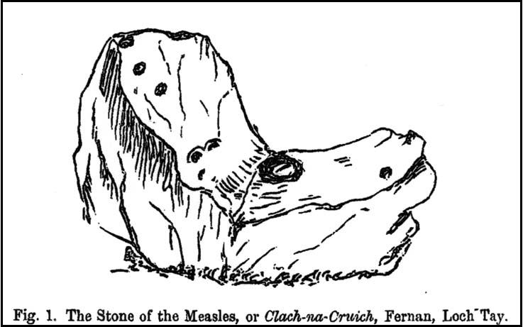
Clach-na-Cruich in 1884

In the field we find this great chair-shaped boulder with a great ‘bowl’ on it where the seating section is, and on its top and sides are a few cup-markings — MacMillan (1884) noted seven of them, two of which had half-rings around them, “associated together in a singular manner, and forming a figure like the eyes of a pair of spectacles.”

Folklore

Regarded in local legends to be an ancient initiation seat, this was taken over and ordained as being the seat of St. Ciaran at some time when the Celtic church started having influence up here.

The ‘seat’ of this great stone regularly fills up with rainwater and was, wrote William A. Gillies, “regarded as an effectual cure for measles, and there are persons still residing at Fearnan who were taken as children to drink from the water in the hollow of Clach-na-Gruich, the Measles Stone.”  His lengthy account of the site told:

“In the district of Breadalbane, Perthshire – which has in it the Pool of St Fillans, famous for its supposed power of curing mentally afflicted persons – there are two boulders with water-filled cavities, which have a local reputation for their healing virtues. One is at Fernan, situated on the north side of Loch Tay, about three miles from Kenmore. It is a large rough stone with an irregular outline, somewhat like a rude chair, in the middle of a field immediately below the farmhouse of Mr Campbell, Borland. The rest of the field is ploughed; but the spot on which it stands is carefully preserved as an oasis amid the furrows. The material of which it is composed is a coarse clay slate; and the stone has evidently been a boulder transported to the spot from a considerable distance.

“In the centre on one side there is a deep square cavity capable of holding about two quarts of water. I found it nearly full, although the weather had been unusually dry for several weeks previously. There were some clods of earth around it, and a few small stones and a quantity of rubbish in the cavity itself, which defiled the water. This I carefully scooped out, and found the cavity showing unmistakeable evidence of being artificial. On the upper surface of the stone I also discovered seven faint cup-marks, very much weather-worn; two of them associated together in a singular manner, and forming a figure like the eyes of a pair of spectacles.

“The boulder goes in the locality by the name of Clach-na-Cruich, or the Stone of the Measles; and the rain-water contained in its cavity, when drunk by the patient, was supposed to be a sovereign remedy for that disease. At one time it had a wide reputation, and persons afflicted with the disease came from all parts of the district to drink its water. Indeed, there are many persons still alive who were taken in their youth, when suffering from this infantile disease, to the stone at Fernan; and I have met a man not much past forty, who remembers distinctly having drunk the water in the cavity when suffering from measles.

“It is is only within the lifetime of the present generation that the Clach-na-Cruich has fallen into disuse. I am not sure, indeed, whether any one has resorted to it within the last thirty years. Its neglected state would seem to indicate that all faith in it had for many years been abandoned.”

References:

  1. Gillies, William A., In Famed Breadalbane, Munro Press: Perth 1938.
  2. MacMillan, Hugh, ‘Notice of Two Boulders having Rain-Filled Cavities on the Shores of Loch Tay, Formerly Associated with the Cure of Disease,’ in PSAS 18, 1884.

© Paul Bennett, The Northern Antiquarian 

Clach Brath, Baile Mor, Iona

Bullaun Stone:  OS Grid Reference – NM 286 244

Also known as:

  1. Clacha Brath
  2. Clachan-nan-Druidhean
  3. Day of Judgement Stone
  4. Druid’s Stone
  5. World’s End Stone

Folklore

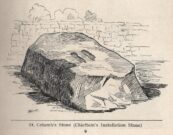
On this curious, broken, basin-shaped rock — thought by some to have at one time played a part in an old cross whose remains are in the Abbey Museum — are two deep cup-shaped hollows, in which were once “three noble globes of white marble” that were used for oracular purposes and were said to have originated in druidical rites.  In Miss McNeill’s (1954) survey of the island, she tells that:

“near the edge of the path leading to St. Oran’s Chapel, there lies a broad, flat stone, with a slit and a cavity on its surface. Here there used to lie some small round stones which pilgrims were wont to turn sunwise within the cavity; for it was commonly believed that the ‘brath’, or end of the world, would not arrive until this stone should be worn through.”

The small stones that were once in the Brath were ordered by the Church to be thrown into the sea; but local folk replaced them with three other small stones, maintaining the traditional rites of this stone until they eventually stopped sometime in the 19th century.  But in Major-General James Forlong’s (1906) study, he tells of a somewhat earlier mythic origin to this old stone, saying:

“In Iona the Druids are said to have made the flat altar stone called Clachan-nan-Druidhean, or Druid’s Stone, the stone of fate or of the last day, with round stones fitted into cup hollows on the surface, which the pious pilgrim turns round.  The world will end when the stone is worn through.  The Culdee monks preserved this monument.”

And what little is left is still preserved to this day.  The curious “end of the world” motif was something that was grafted onto an earlier mythos: what Mircea Eliade called the “myth of the eternal return”, wherein Nature’s annual cycle —from birth, life to death and subsequent renewal, endlessly, through the seasons—was the original status, later transmuted by the incoming judaeo-christian cult of linear time and milleniumism relating to a literal “end of the world” when their profane myth of Jesus returning to Earth occurs.  We might also add that the stones which once rested into the hollows of the Clach Brath would likely have possessed divinatory and healing qualities, as comparatiove studies suggest.

References:

  1. Eliade, Mircea, The Myth of the Eternal Return,
  2. Forlong, J.G.S., Faiths of Man – volume 1, Bernard Quarithc: London 1906.
  3. Holder, Geoff, The Guide to Mysterious Iona and Staffa, Tempus: Stroud 2001.
  4. McNeill, F. Marion, Iona: A History of the Island, Blackie & Son: Glasgow 1954 (4th edition).

© Paul Bennett, The Northern Antiquarian