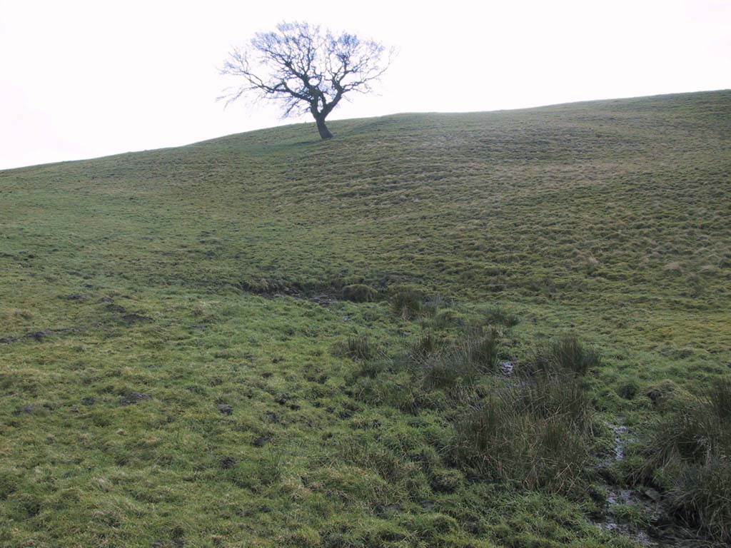
Carse Farm (south), Dull, Perthshire

Stone Circle:  OS Grid Reference – NN 8026 4847

Also Known as:

  1. Carse Farm II
  2. Tegarmuchd

Getting Here

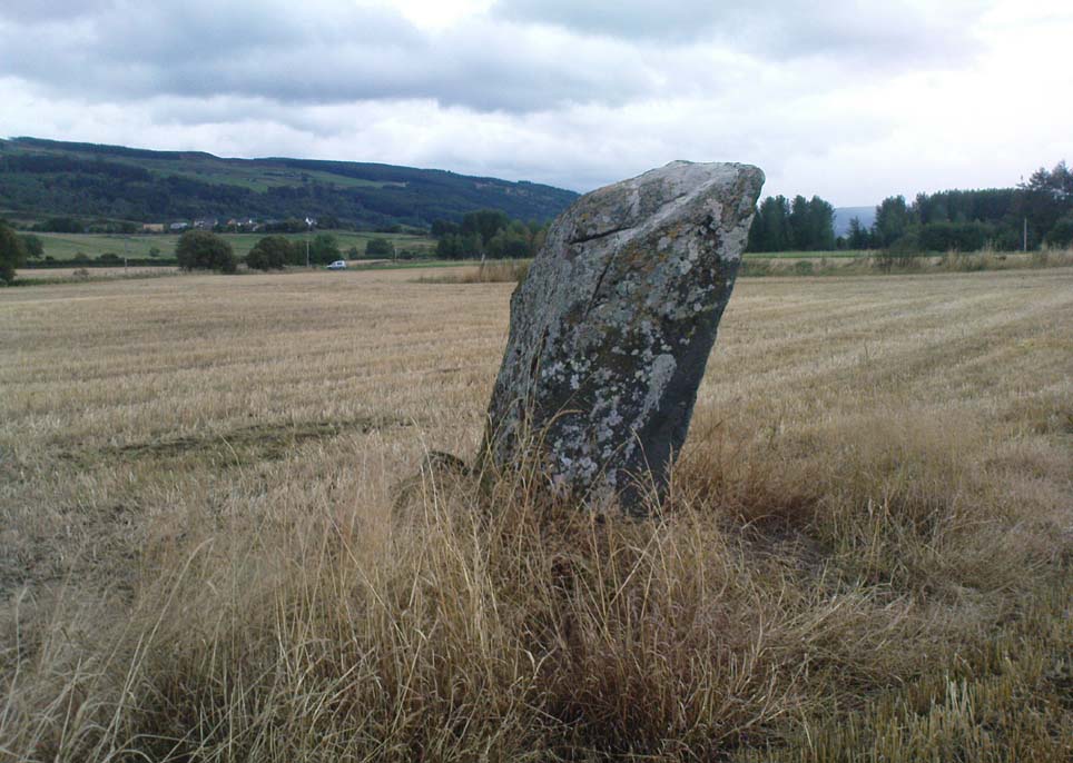
Carse Farm Standing Stone

Pretty easy to find – assuming it aint at the height of summer and the crops are approaching maturity, otherwise you’re only gonna see its head!  But, this aside: from Aberfeldy, take the B846 road over the river bridge that bends you along the valley of the River Tay towards Appin of Dull.  After some 2 miles you’ll pass the right-turn up to Dull.  Go past this for another coupla hundred yards or so, watching out for the left-turn down towards the farmhouse of Carse and park up where you can (if you go past it, there’s the second turn up to Dull, again on your right, where you can turn round). As you walk down the track towards Carse Farm, watch out on your right in the field below Carse I, in the second field down.  You can’t really miss it. (and the farmer here is spot on if you ask to check the stone – as long as the crops aint growing)

Archaeology & History

Although all that’s left of what is thought to have been a once proud stone circle is the singular upright standing stone in the middle of the field.  Aubrey Burl (1988) thought that this was one of the typical “four poster”rings that scatter our isles, but I’m not so sure misself.  There were other stones associated with the site when Burl described it, but these were covered over in our visit here a few months back — which is a pity, as two of the stones are reported as possessing cup-markings (if/when we revisit the site, I’ll try get some images of the respective stones and add them on TNA as individual carved stones).  The site gives the distinct impression of it having a funerary character of some sort and not a true stone circle — and this was strongly suggested by some of the finds inside the “ring”, described below.
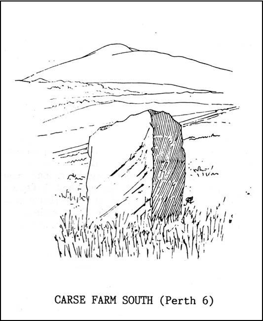
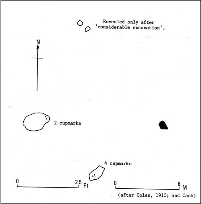
Fred Cole’s old drawing
Aubrey Burl’s groundplan

Both this and its associated “circle” a few hundred yards away — known as Carse Farm north — sit on a flat level of ground in the Tay valley, with rounded hills all most sides.  This landscape setting was obviously of some importance to the people who put the circle here in the first place but, not living in the region, it’s difficult to assess the mythic relevance some of the hills will have obviously played in the siting of these stones.

In bygone days, it was reported that the much of the site was ploughed away due to agricultural excesses, so there was obviously much more to it in earlier centuries.  Describing the solitary stone that’s left today, along with the earlier excavation results, Mr Burl (1988) wrote:

“The stone still standing, of quartziferous schist, is 6ft 3in (1.9m) high.  Its longer faces are aligned NW-SE.  32ft 6in (9.9m) to its SW is a large prostate block, sub-elliptical and about 8ft long and 4ft 3in wide (2.4 x 1.3m).  It has probably fallen outwards. (my italics, PB)  If so, when standing near the top of its inner face were four cupmarks in a cross pattern.

“About 32ft ((9.8m) to its NW is a fallen and enormous schist slab, 11ft long and 5ft wide (3.4 x 1.5m).  It also appears to have toppled outwards.  Near the bottom of its inner face are two cupmarks.  The situation of these three stones suggests that they once stood at the corners of a rectangle some 32ft (9.8m) square, the pillars of a huge four-poster nearly six-times the national average and with an internal area ten times bigger than the small 4-poster (Carse Farm north, PB) just to its north.

“Excavation  in 1964 found the socket from which the great prostrate slab had been dragged… Cash (1911) had noted the presence of a small stone inside the ring about 20ft (6.1m) west of the standing stone.  It proved to be 4ft (1.2m) square with a carefull-dressed face.  It had been set upright, standing about 1ft 4in (41cm) above the ground.  Three sides of the worked face ‘had been carefully chiselled away to a straight edge.’ It may have been a slab lining the inner central space of a destroyed ring-cairn.  Burnt bone was found near it. There was also a rounded river pebble with a worked hollow on one side…”

Folklore
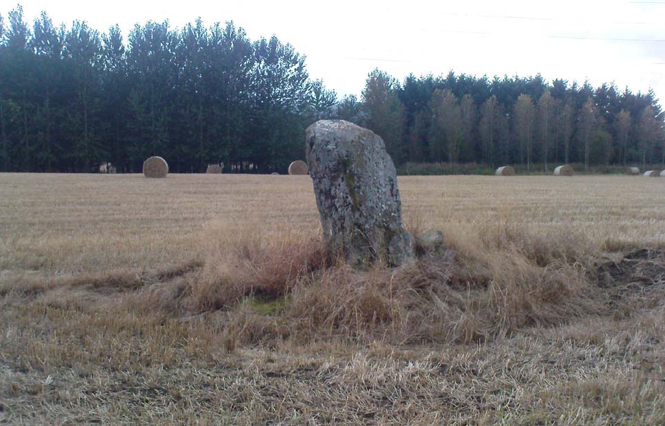
Carse Farm stone

Stewart (1964) described the site as having been “christianized” not long ago, by having the northernmost standing stone in the ring removed.  This is intriguing inasmuch as “north” is the place of greatest symbolic darkness in the pre-christian mythos, and represented death and illumination in magickal terms.  North was also the point taken by witches and shamans in their excursions into Underworlds, usually via the North Star, which tethered the Earth to the heavens (see Godwin’s Arktos [1993], and Grant, The Magical Revival [1973])  In the removal of this northern stone for the reasons given, that implies some magickal events or folklore were in evidence here when this took place.  Anyone got any further information along these lines, or has it long since been subsumed?

References:

  1. Burl, Aubrey, Four Posters: Bronze Age Stone Circles of Western Europe, BAR 195: Oxford 1988.
  2. Coles, Fred, “Report on Stone Circles Surveyed in Perthshire (Aberfeldy District),” in Proceedings of the Society of Antiquaries of Scotland, volume 44, 1910.
  3. Stewart, M.E.C., “Carse Farm 1 and 2,” in Discovery & Excavation, Scotland, 1964.

© Paul Bennett, The Northern Antiquarian


Torlery Edge, Malham Moor, North Yorkshire

Settlement:  OS Grid Reference – SD 898 653

Getting Here

Torlery Edge from above

From Malham village, take the winding uphill road up Malham Rakes (not the Malham Cove road).  If you aint sure, ask a local.  Get to the top of the long winding road and,  a mile on, you meet with another single-track road on the top level known as Street Gate.  Stop here, then head across the grasslands on the left-side of the road, southwest.  There are a couple of footpaths running over the land here: I wouldn’t say it makes much difference which one you take as they take you in the right direction.  You’ll eventually meet the old craggy hilltop with the drystone walling down t’other side of it.  You’re here!

Archaeology & History

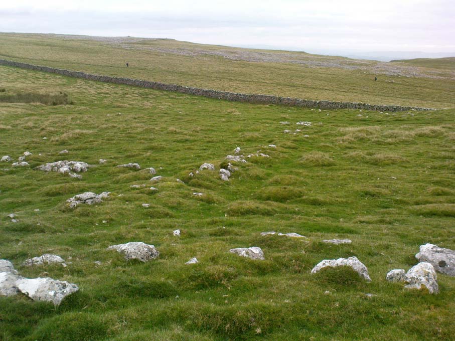
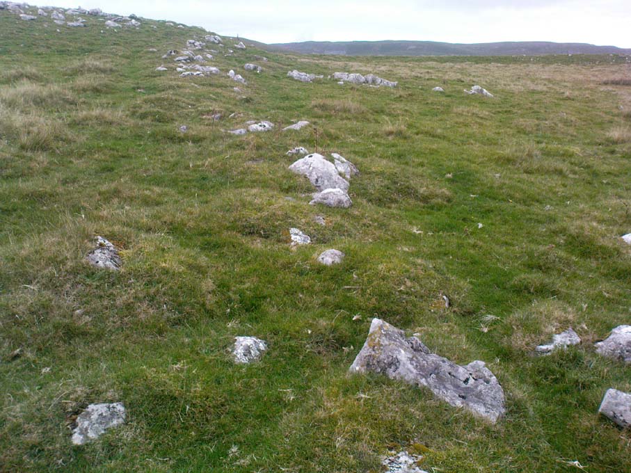
The history of this region seems to have been covered to a great deal by the likes of Arthur Raistrick and his mates, though I can’t find a specific entry in mi library about the remains we’re looking at here.  Surrounding the edges of the small hill, as can be seen in the aerial photo here, walling has clearly been built up around it, with considerable remains still visible at ground level, as indicated in the photos aswell.

Eastern edges of enclosure
Eastern walls, looking north

A settlement or large stone-walled enclosure, lying primarily on the north side of the drystone wall, measures approximately 82 yards north-to-south, and roughly 78 yards (72m) east-to-west, with a rough circumference around the outer edges of its rough elliptical outlines of more than 270 yards (250m).  Along the walled edges can clearly be seen several ‘hut circle’ remains: one in particular at the northeastern side and, more prominently, at the southeastern side, are in reasonably good states of preservation.  The northeasterly hut circle measures approximately six yards across.  The stone walls of this circle are more than a yard wide.  The ‘hut circle’ on the southeastern corner are more prominent and is in a better state of preservation, but much of the structure has of course been ruined to build the adjacent, more modern, drystone walls.  This circular structure is larger than its counterpart on the northeast, measuring some 13 yards across.

The southern edge of the main settlement walling has been built up against and onto a large length of bedrock running roughly east-to-west.  This inclusion of local geological features within man-made settlements and houses is a feature found all over Malham Moor and adjacent areas, for many miles around here. (see the Hammond Close settlement, for example)  The southernmost section of the Torlery Edge settlement is in a reasonable state of preservation, as is the length of walling along its eastern edge.  Along the northern section of the settlement it seems that an internal enclosure feature has been built (“perhaps for cattle?” would be the archaeologists usual query); whilst the western edges are the least visible part of this monument.

Hut circle on southern edges
Hut circle, looking north

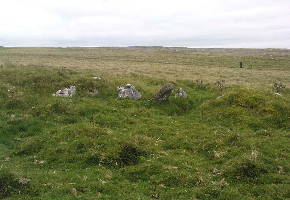
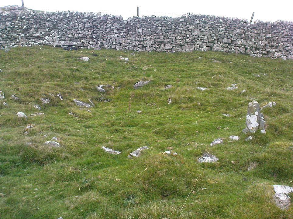
If we now jump over the drystone wall running along the southern edges (and visible in the aerial photo above), we can see a series of six, perhaps seven, hut circles, all adjoining each other and running along the line of the wall.  Some of these are in a very good state of preservation and an excavation of these sites might prove fruitful. (unless it’s already been done – does anyone know?) Two of these hut circles have entrances clearly visible.  They are all roughly the same size and structure, with average diameters (from outer wall to outer wall) of 7 yards.  They consist of a rough ring of small upright stones, packed with smaller rocks and (in bygone times) peat and wood.  Sheltered from the north winds by the ridge above it and the extensive ancient enclosure walling (not the drystone, which in itself is very old), this row of prehistoric buildings were probably for members of the same tribal group.

Without excavation it’s difficult to date these hut circles, but they would probably have been used between the Bronze Age and Romano-British period.  There is every likelihood they were also used up to the medieval period, as this land was acquired (i.e. stolen) from local people by the Church and their law-bringers.  We know that much of the landscape hereabouts was possessed by Fountains Abbey in the 12th century, who made extensive use of the area for their cattle; and we find considerable evidence scattering these hills of medieval archaeological remains.

Although the site is catalogued as a separate site from, say, the settlement remains and enclosures we find at Combe Hill, Prior Rakes, New Close, and other field areas close by, this individual archaeological site must be assessed as part of a greater collective series of settlement remains hereby.  Instead of looking at this as an individual settlement, its relationship with the others in the vicinity needs re-evaluating and contextualizing and set within a wider and more realistic vision.  Whilst appreciating that detailed modern excavations have yet to be done in this region on a scale that is required (as with many of our northern archaeological landscapes), it is probable that this singular settlement was part and parcel of what was once a prehistoric city.

If you visit this particular site, spend a few days looking round at the many other settlements and prehistoric religious sites in the area.  And don’t forget to look and enquire as to why the Romans came and built a huge monument near the centre-edges of this domain of our prehistoric ancestors.  Tis a fascinating arena indeed…

References:

  1. Dixon, John & Phillip, Journeys through Brigantia – volume 2: Walks in Ribblesdale, Malhamdale and Central Wharfedale, Aussteiger: Barnoldswick 1990.
  2. Raistrick, Arthur & Holmes, Paul F., Archaeology of Malham Moor, Headley Bros: London 1961.

© Paul Bennett, The Northern Antiquarian

Ratten Clough Cross, Emmott Moor, Lancashire

Cross Base:  OS Grid Reference – SD 93997 39746

Getting Here

Ratten Clough Cross stone

Follow the directions to reach the Herder’s Cross, not far away.  Standing on the Herder’s Cross stone, look across the fields to the north (away from the farmhouse on the hill below) and you’ll see a nice-looking stream a coupla hundred yards ahead of you.  Crossing this stream you see the large boulder, which you can see clearly if you’re stood on the Herder’s Cross.  That’s where you’re heading!

Archaeology & History

A curious entry inasmuch as I’ve found no other references to the place.  It’s an obvious cross-base, albeit very worn, cut onto the top of this large boulder, as you can see in the photo.  What may be a singular cup-marking (if you’re a New-ager, or work for English Heritage that is!) is on the western side of the rock — but without additional markings on the rock, this has gotta be questionable.

Dodgy cup-marking on top!
Shallow cross-base

The cut ‘square’ measures eight-inches both sides, but it seems that the cutting on the north-eastern sides of the base was never finished.  The depth of the cross-base is also very shallow, only an inch deep.  There seems to be a distinct possibility that this particular stone was initially chosen as a wayside cross marker, then for some reason perhaps moved to the position of the Herder’s Cross in the fields 420 yards (383m) to the south of here.

Clifford Byrne (1974) suggested that the pathway hereby was an ancient routeway that led towards the Emmot Holy Well, three-quarters of a half-mile down the hillside from here.  Any further info or thoughts on this side would be most welcome.

References:

  1. Byrne, Clifford, A Survey of the Wayside Crosses in North East Lancashire, unpublished manuscript, 1974.

© Paul Bennett, The Northern Antiquarian

Rocking Stone, Meltham Moor, West Yorkshire

Legendary Rock (destroyed):  OS Grid Reference – SE 0728 0944

Archaeology & History

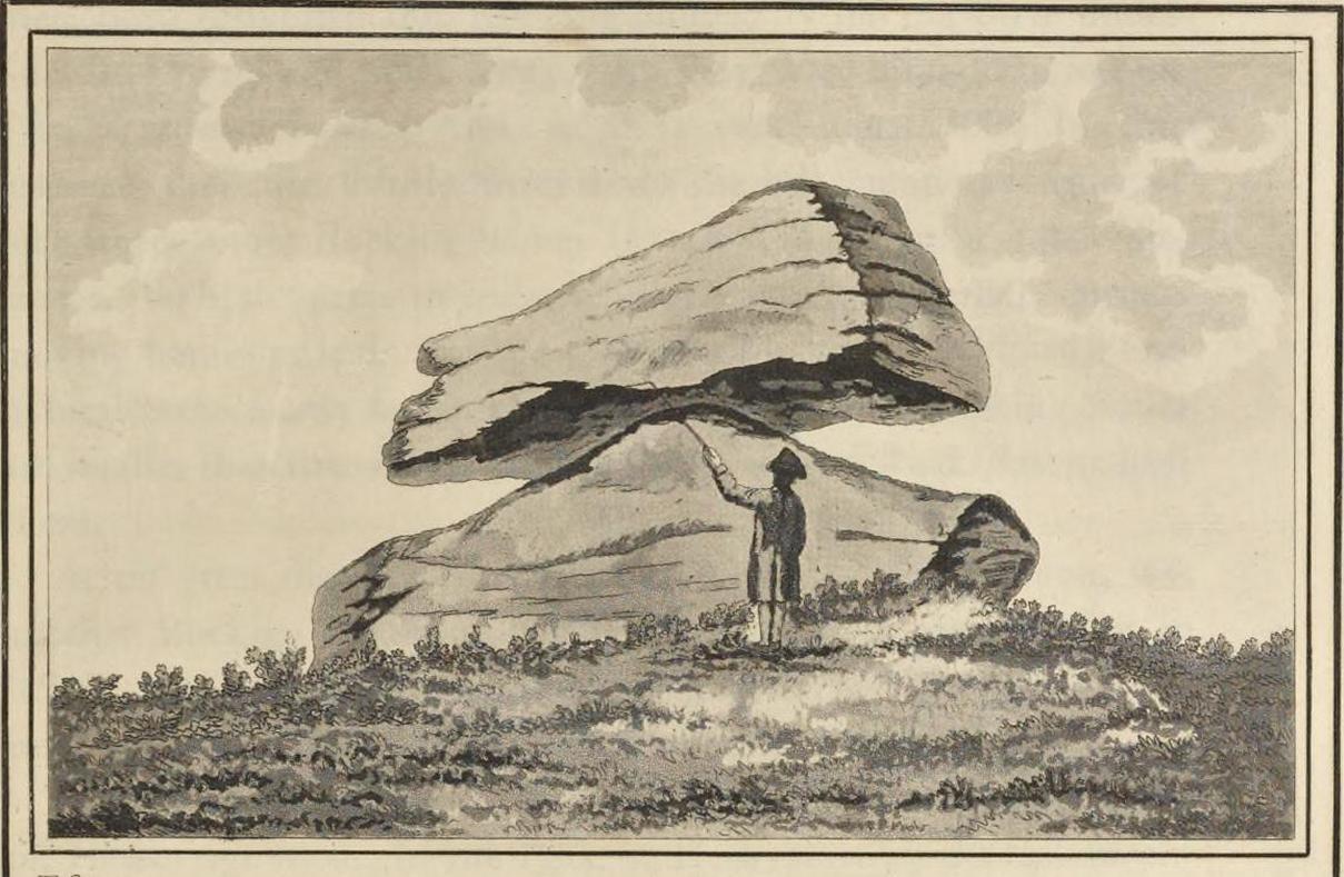
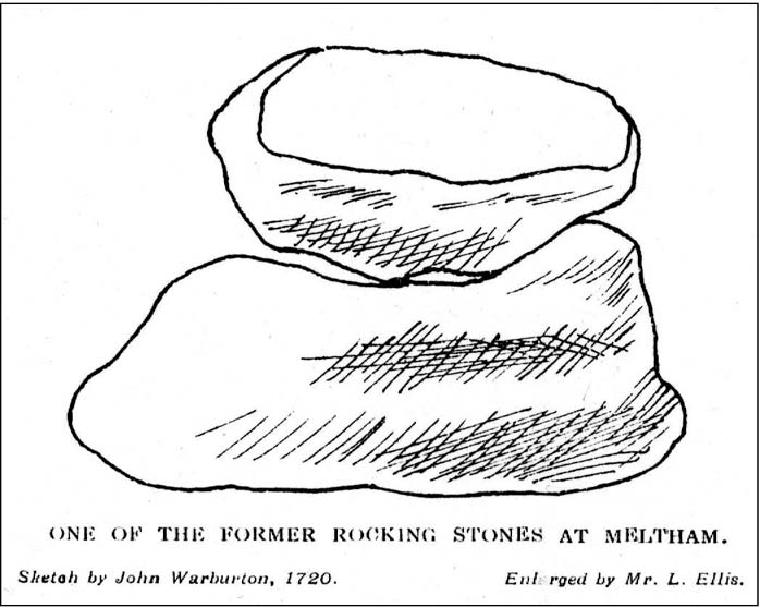
The Rocking Stone in 1720

Here we have the case of yet another rocking stone destroyed by a bunch of morons in bygone days.  Although marked on the first Ordnance Survey of the region around 1850, the site had already been destroyed by then — but at least the surveyors had recorded its position in the landscape. And a dramatic and barren landscape it sat within!

It could be found high up in the middle of the moors above Brow Grains by the Wicken Stones, nearly 1400 feet above sea level, heading towards West Nab, and had lived here, safely, for untold thousands of years.  But then, on Whitsun Monday morning in either 1827 or 1828, there came, wrote Joseph Hughes (1866),

“some half-dozen masons (who) planned and executed the work of destruction for a frolic.  They first endeavoured to accomplish it by blasting it with gunpowder and, on the failure of this scheme, they fetched tools from Deer Hill, with which they drilled a hole and then wedged it, when the stone fell with a tremendous crash, hardly allowing the man on its summit who was drawing in the wedge to escape without injury.”

It’s a huge pity that the boulder didn’t crush him to death for his actions.  At least it would have taught the halfwits a lesson (forgive me if I sound a bit harsh – but I have an increasingly lower opinion of selfish humans the older I get).  Thankfully though, one hundred years before the stone was destroyed, Mr John Warburton of the Somerset Herald visited the region in 1720 and on one of the days here, took a long walk up to the Rocking Stone, from where we have this rare old drawing of the site.  As Mr Ahier (1942) told us,

“His sketch plainly shows one stone superimposed upon another, and it is conceivable that the uppermost stone could be rocked on the lower one.”

There was also another Rocking Stone in the locale, it too destroyed, this time “by a former gamekeeper” no less, using the time-honoured excuse:

“because persons going to see it crossed the moor, and, in doing so during the nesting season, were liable to tread on eggs or upon young birds.”

This excuse is an even poorer one these days (as any honest ranger will tell you – which includes me in my former capacity as an assistant moorland ranger), as walking the moors causes much less damage than the moorland “management” of draining the bogs, dyke cutting, grouse-shooting, bracken control, letting the Snoots drive their vehicles over the heathlands, upgrading modern footpaths, etc.  (God – I’m on a rant!)

References:

  1. Ahier, Philip, The Legends and Traditions of Huddersfield and District, Advertiser Press: Huddersfield 1942.
  2. Hughes, Joesph, The History of the Township of Meltham, John Russell Smith: London 1866.

© Paul Bennett, The Northern Antiquarian

Rocking Stone, Golcar, West Yorkshire

Legendary Rock (destroyed):  OS Grid Reference – SE 076 163

Also Known as:

  1. Holed Stone
  2. Holy Stone
  3. Whole Stone

Archaeology & History

Golcar rocking stone, 1799

Like many old rocking stones, this was destroyed due to quarrying operations many years ago and sadly, I believe, we have no illustrations of the place to show the site.  This legendary site—also known as the ‘Holed’ or ‘Holy Stone’—is preserved in the place-name of Rocking Stone Hill and, unlike many other alleged rocking stones, actually swayed to and fro if the old records are owt to go by.  Not far away (and also destroyed some 200 years back) were two stone circles which probably had some mythic relationship to this legendary rock.

The stone was first described by John Watson in his monumental History of Halifax (1775), where he told that is was,

“so situated as to be a boundary mark, dividing the two townships of Golcar and Slaightwait in the Parish of Huddersfield, adjoining to the Parish of Halifax on Wholestone Moor.  The stone as measured by the late Thomas Perceval, or Royton…is 10½ feet long, 9ft 4in or 5in broad, and 5ft 3in thick.  Its weight…is 18 tons, 190lbs.  It rests on so small a centre, that at one particular point, a man may cause it to rock; though some years ago it was damaged a little, in this respect, by some masons, who endeavoured, but in vain, to throw it off its centre, in order to discover the principle on which so large a weight was made to move.”

Mr John Crabtree (1836) included it in his survey, and it was illustrated on the very first Ordnance Survey map in the 1840s where it was described as ‘Supposed Druidical’.  But the old stone sadly didn’t last much longer.  Once the self-righteous Industrialists got here, round about the year 1886, the Rocking Stone was destroyed by quarrying operations.  All that remains of the place today is a small cluster of place-names..

Folklore

Thought by Watson (1775) and his contemporaries to have had druidic associations (without evidence), when Philip Ahier (1942) came exploring this area in 1936, he came upon “an old resident (who) informed me that he had sat upon the stone when a youth and had caused it to rock.”

References:

  1. Ahier, Philip, The Legends and Traditions of Huddersfield and District, Advertiser Press: Huddersfield 1942.
  2. Bennett, Paul, The Old Stones of Elmet, Capall Bann: Milverton 2001.
  3. Crabtree, John, Concise History of the Parish & Vicarage of Halifax, Hartley & Walker: Halifax 1836.
  4. Watson, John, The History and Antiquities of the Parish of Halifax, T. Lowndes: London 1775.

© Paul Bennett, The Northern Antiquarian 

Duel Cross Hill, Grafton, North Yorkshire

Tumulus (destroyed):  OS Grid Reference – SE 426 634

Also Known as:

  1. Deuill Cross Hill
  2. Devil’s Cross
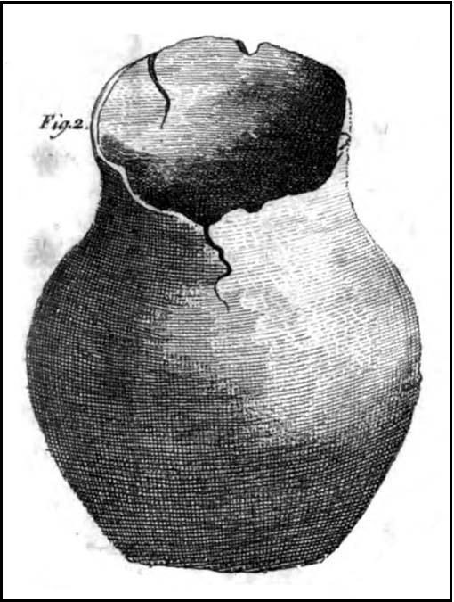
Urn from Devil’s Cross tumulus

Archaeology & History

In Henry Smith’s wonderful Reliquiae (1852) on the history of Aldborough and district, this intriguingly named but forgotten site is given the greatest literary attention extant.  Assumed by a couple of modern academics – without evidence – to have been little more than a natural hillock, this once great mound was undoubtedly an important burial place for some ancestral characters.  Although its exact location is unknown (anyone out there know for certain?), it was said to have been located about 100 yards from where the old tracks crossed at Duel Cross.

First described by a Mr Urban in the Gentleman’s Magazine of June, 1787.  He told it to be known as the Devil’s Cross and was a tumulus,

“whose elevation is about 18 feet, and circumference at the base 370 feet.  It was broken into some time since to supply materials for the repair of the high road leading from Aldborough to York. The soil consists, first, of a black earth, and under that a red sandy gravel, human bones, some of which are entire, and urns of various sizes.  The urns are composed of blue clay and sand, some ornamented and others quite plain; several Roman coins have also been found here.”

There were a great number of old urns found in the mound when it was dug into in 1756, leading Mr Urban to believe the site was used an ancient cemetery.  Intriguingly he told that all of the urns and their ashes were found to have been placed on one side of the mound, with many human bones being deposited in another section, away from the urns.  This, the finding of Roman coins next to the mound and the proximity of the Roman road led Mr Urban to believe the site was a Roman tumulus, though this seems unlikely.  Years later, Henry Smith’s (1852) commentary on the Devil’s Cross hill led him to believe the mound was from a much earlier period:

“From a sketch of one of these, which is stated to have been nine inches high, there can be little doubt of these cinerary urns bring of the ancient British period, but from the great number of bones discovered, this tumulus was probably used as a cemetery during the Romano-British period, if not still later.  Of its use in Roman times, evidence is unequivocally supplied in the numerous coins found here…”

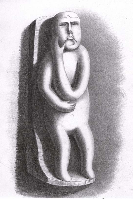
Carved stone figure (from Smith’s ‘Reliquiae’)

Not far from this long lost tumulus,  a curious carved stone figure was located “among ancient foundations” in a cellar!  Thought to be a local deity, it may have been a carved representation of whichever figure or spirit ancestor was buried in Duel Cross Hill — though we’ll never know for sure.

Folklore

Although archaeologically, etymologically and geomantically related to the nearby Devil’s Arrows at Boroughbridge a couple of miles up the road, there is nothing specific I can find of this once important tumulus.  However the place-name in both forms, Deul and Deuill, refers to the pre-christian devil (from deofol, Old English, “devil”).  This name may relate to the stone figure shown in the illustration, or of long lost heathen rites enacted here in bygone times.  Any further info on this place is very welcome.

References:

  1. Hargrove, E., The History of the Castle, Town and Forest of Knaresbrough, Hargrove & Sons: Knaresbrough 1809.
  2. Smith, Henry E., Reliquiae Isurianae, J.R. Smith: London 1852.

© Paul Bennett, The Northern Antiquarian

Intake Lodge, Yearsley, North Yorkshire

‘Tumulus’ (destroyed):  OS Grid Reference – SE 592 737

Archaeology & History

Bronze Age pottery (after YAJ 1963)

A curious entry inasmuch as it’s difficult to categorize the site correctly.  Added to this is the fact that the place has been built over!  But despite these misgivings (if that’s the right word!), the site’s deserving of a posthumous entry…

There used to be a curious-looking mound here, immediately east of Intake Lodge, that “was due to be bulldozed so that a field of rough pasture could be brought under cultivation”, killing the indigenous wildlife that was living here.  However, before this was done, some inspectorate dood who worked for the Ancient Monuments Commission and the Ministry of Works “decided to excavate”, as he believed that an ancient burial mound was in the field.  Mr I.M. Stead (1963) takes up the story, telling:

“”This mound was about 75ft by 90ft diameter and 6ft high, on ground sloping away to the south-east.  It had every appearance of being a barrow.

“The excavation, in October 1961, was supervised by the writer (and) assisted by Mr A.L. Pacitto.  A trench on the east side revealed layers of sand which appeared to be natural, and a second trench, on the west side, uncovered a capping of stone which confirmed that this was not a barrow.  However, it seems that the writer was not the first person to mistake it for an artificial burial mound.  A disturbed area in the centre, some 15ft diameter, where there had been an old water-tank, produced a fragment of Bronze Age pottery and a sherd from another Bronze Age vessel was found in a disturbance on the side of the mound.  A small area near the centre was cleared in the hope of finding an undisturbed burial, but shortage of funds did not permit more extensive stripping.  Judging from the type of pottery (see image) and its situation on the mound, there can be little doubt that one two occasions Bronze Age people placed secondary burials in the natural mound.”

This tells us that although the mound wasn’t a tomb or burial mound in a traditional religious sense, it was instead a sacred hill of the dead for the local people at one time or another in ancient days.   And, if Mr Stead had been a decent archaeologist and continued to excavate here without pay (as he should do if he loves his subject), we may have found more beneath this now-lost sacred mound.  Unfortunately this didn’t happen and we lost vital clues and information.

References:

  1. Stead, I.M., “An Excavation at Yearsley, North Riding, 1961,” in Yorkshire Archaeological Journal, part 161 (volume 41), 1963.

© Paul Bennett, The Northern Antiquarian


Castle Dykes, Aysgarth, North Yorkshire

Henge Monument:  OS Grid Reference – SD 9822 8728

Also Known as:

  1. Castle Dyke

Getting Here

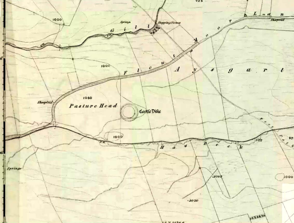
Castle Dyke on 1856 map

Go west through Aysgarth village along the A684 road and, just as you’re coming out of the town, take the left turn on the Thornton Rust road, past Town Head Farm, and turn left up the track (called Folly Lane).  Go past the house where the track veers to your right and follow it straight on (don’t turn up the track on your left a short distance along).  Keep walking on here for nearly a mile (about 10 mins), keeping your eyes peeled for the embanked rise in the field on your left, which is where the henge can be found!  You’re damn close!

Archaeology & History

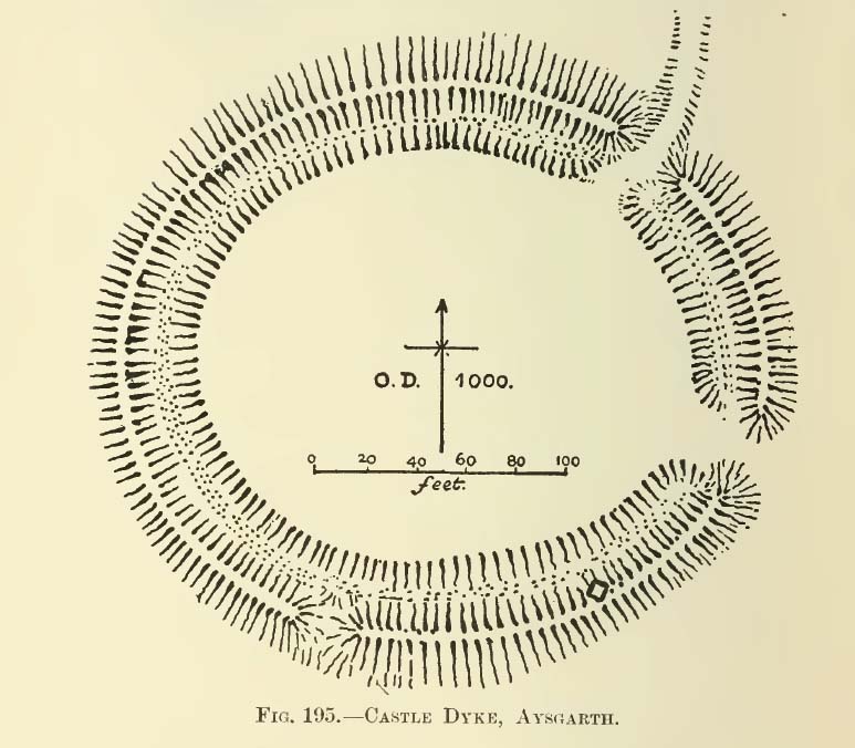
A.H. Allcroft's 1908 plan
A.H. Allcroft’s 1908 plan

One of the earliest accounts I’ve found describing the Castle Dykes henge is in Mr Barker’s (1854) lovely literary exploration of Wensleydale, where he describes, “on Aysgarth Moor, which is now enclosed, may be seen a circular encampment, probably Danish” in origin.  But he tells no more.  When Edmund Bogg (c.1906) came here fifty years later, he added little extra, simply telling of, “the earthworks known as ‘Castle Dykes’, probably Angle or Danish, although Roman relics have been found here.”  However, the brilliant Mr Speight (1897) gave what seems to be the earliest real description of the site when he described “the Celts” and the earliest settlers of the region, saying how:

“The so-called ‘Castle Dykes’ at Aysgarth betrays a probable connection with the same settlers.  It is an irregular circular rampart, measuring about forty yards across its longest diameter, and not unlike the earthwork on Harkaside called ‘Maiden Castle’… A ditch completely encloses the mound, which, it should be noted, is unusually low, being little higher than the outer bank or upcast from the trench.  It is totally different from the elaborate burh at Middleham; indeed, from its low and simply form, as well as from its situation in Celtic territory, there seems little doubt that it was the work of these early people.”

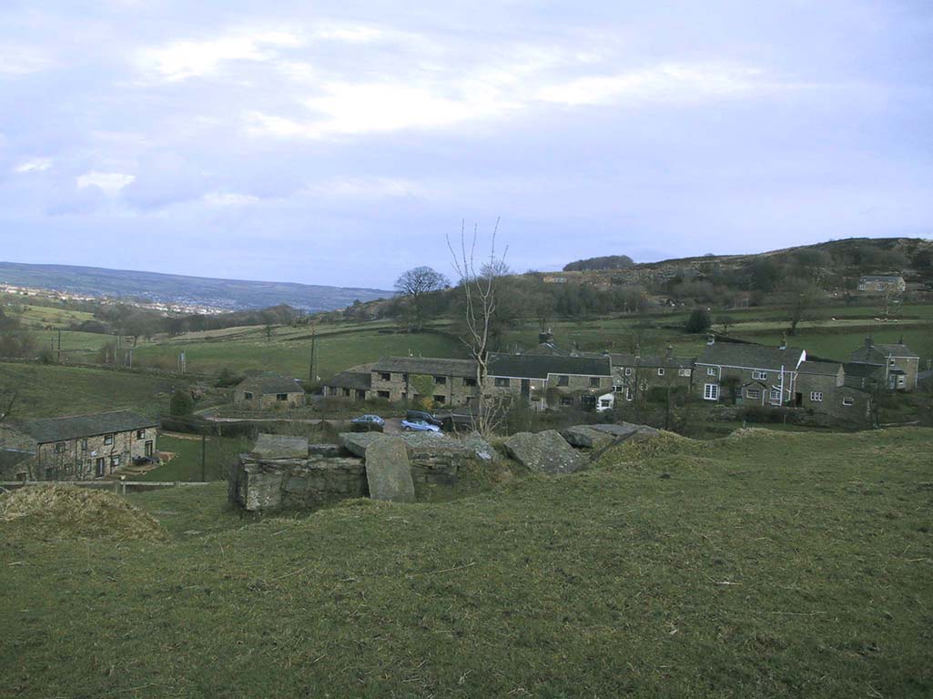
Ditch of Castle Dykes henge, looking east (photo credit – Richard Stroud)

Speight also made a suggestion that the place-name of Aysgarth itself may derive from this monument.  He may have a point.  A.H. Smith (1928) and other place-name authorities tell the name to derive from “an open space” either surrounded by, or — in some way — defined by oak trees.  We might never know for sure…

Not long after the works of Speight and Bogg came the first real survey of British prehistoric earthworks by A.H. Allcroft (1908) — and amidst the mass of archaeological curiosities (as many were at the time) was another description of this great ceremonial monument.  Allcroft told that here,

“a weak vallum of earth encloses a perfectly regular oval area measuring from crest to crest of the vallum 257 feet (east to west) by 217 feet (north to south).  Immediately within the vallum is a broad fosse varying from 25 to 32 feet in width.  The vallum at its highest (east) rises not more than seven feet above the floor of the fosse.  The “island” measures 196 by 160 feet and is perfectly flat.  There is no berm and no outer fosse.  The vallum is broken by three gaps, of which that to the southeast is apparently original, as the fosse has never been excavated across it.  The other gaps point respectively northeast and south-southwest, the latter being a mere depression like that to be seen at the eastern side of the northern ring at Thornborough.  At one point in the vallum, on the southeast, a single large stone rises slightly above the turf which otherwise covers the whole work, and certain depressions observable at other points suggest that other such blocks have been removed —that, in fact, it originally had a peristalith standing upon the vallum.  The principal entrance looks towards Pen Hill…”

Around the same time, the early scientific discipline of astroarchaeology was taking root and in Sir Norman Lockyer’s Nature journal, the reverend J. Griffith (1908) explored the potential astronomical orientation of Aysgarth’s Castle Dykes, thinking that the main entrance to the site gave indications of an alignment towards either Alpha Centauri or Capella.  Y’ never know…

Although many visitors and local people knew of Castle Dykes, it was pretty late before the site gained status as a henge monument.  This happened following a visit here by the pedantic archaeologist R.J.C. Atkinson (1951) in September of 1948.  Following his visit, Atkinson described the place, saying:

“It consists of an oval enclosure bounded by a well-preserved ditch and external bank, with an entrance on the East side.  Two small gaps in the bank, without corresponding causeways across the ditch, were probably made in recent times to allow the escape downhill of the surface water which collects in the ditch.  The dimensions in H. Allcroft’s plan are incorrect.  The markedly oval shape is probably in part dictated by the situation, in order that as much as possible of the enclosed area should lie on the level ground topping the ridge.  There is no sign of any stone structure in the central area, but the district abounds in stone walls, for which the site may have been robbed in the past.”

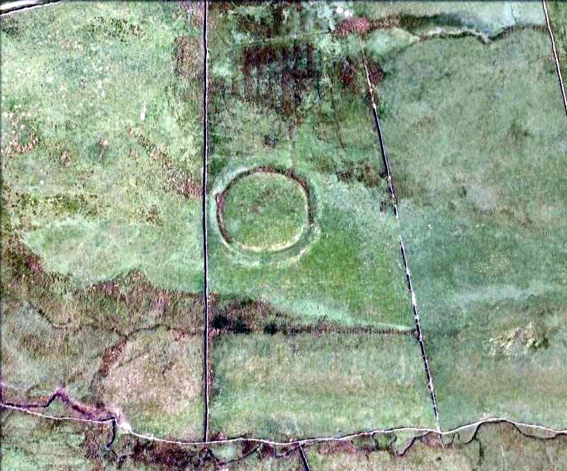
Aerial image

In more recent years, archaeologists have speculated that the site was a sacred site or meeting place, aswell as a site where trade occurred, particularly a place where axes were traded; but this latter idea is  more due to the projection of a modern religious notion, of ‘The Market’ with little veracity in terms of the site’s function.  This increasing imposition of ‘economics’ and ‘trade’ (see Brown 2008:44-6)  as vital ingredients to this and other sites has little relevance outside of a simple epiphenomenalistic adjunct to magical and tribal exchanges.  But such notions are outside of archaeological frameworks, so we shouldn’t be surprised at so prevalent an error.

But this place is damn impressive — though with the exception of Mr Griffith, one notable ingredient archaeologists seem to have forgotten about was the position of this site in the landscape.  The views surrounding the henge are excellent, giving a 360° arena all round.  If the monument once had a ring of stones around it, as Allcroft suggested, the views would still have been the same.  A modern excavation here might prove worthwhile and, as a result, open up once again, the potential for further astronomical investigations with the many hills and notches along the living horizon.  This site, whilst requiring analysis of it as a ‘specimen’, must also be placed in the context of the wider living environment which, to all early traditional cultures, were such important and integral ingredients.

We have also found some previously unrecorded prehistoric remains nearby which, hopefully, we’ll be able to explore a little more in 2011 and report here.

…to be continued…

References:

  1. Allcroft, A. Hadrian, Earthwork of England, MacMillan: London 1908.
  2. Atkinson, R.J.C., “The Henge Monuments of Great Britain,” in Atkinson, Piggott & Sandars’ Excavations at Dorchester, Oxon (Department of Antiquities: Oxford 1951).
  3. Barker, W.G.M.J., The Three Days of Wensleydale, Charles Dolman: London 1854.
  4. Bogg, Edmund, Wensleydale and the Lower Vale of Yore, E. Bogg: Leeds (c.1906).
  5. Brown, Paul & Barbara, Prehistoric Rock Art in the Northern Dales, Tempus: Stroud 2008.
  6. Griffith, Rev. J., “English Earthworks and their Orientation,” in Nature, volume 80, 18 March 1909.
  7. Harding, A.F., Henge Monuments and Related Sites of Great Britain, BAR 175: Oxford 1987.
  8. Smith, A.H., The Place-Names of the North Riding of Yorkshire,Cambridge University Press 1928.
  9. Speight, Harry, Romantic Richmondshire, Elliot Stock: London 1897.

Acknowledgements:  Many thanks to Richard Stroud for use of his photo of the henge.

© Paul Bennett, The Northern Antiquarian


True Well, Oakworth, West Yorkshire

Healing Well:  OS Grid Reference – SE 0272 4017

Getting Here

Modern True Well troughs

Take the Oakworth Road outta Keighley, turning right after a quarter-mile up Fell Lane.  Go all the way up the very end (a mile or so), turning right at the end.  After 100 yards or so, go up the track to the True Well Hall equestrian centre.  As you approach the farmhouse, look on the grassy slope to the left and you’ll see a small run-down stone structure in the field above you.  That’s it! 

Archaeology & History

This is a curious site by virtue of so little being said of it, despite some modern proclamations of it having pagan values.  Even the local historians say little on the place, with William Keighley (1858) being our notable exception.  In his notes on the erroneous dedication of the Jennet’s Well to a fictitious saint of the same name, he mentions this once important water supply, writing:

“Westwards of Jennet’s Well there was another fountain, emphatically styled the ‘true well’, and probably from its once boasted efficacy intended as a rival to the former.  This spring though no longer remembered for its healing qualities, evidently gave name to the farmhouse denominated ‘True Well Hole.'”

In Wright’s Dialect Dictionary (1898) we find the word ‘trew’ — also written as ‘true’ or ‘trow’ — could mean “to trust, believe, feel sure”, which may be applicable in terms of the value of the waters that once flowed here.  We may never know.  Though note should be made of the error at a recent exhibition in Cliffe Castle museum, where the 1842 Tithe Awards map of the region was copied and the field-names listed, showing the old True Well erroneously displayed as the ‘Time Well’.  I assume they must have had a long day when they were copying the notes…!

Spring behind True Well Hall

A little further along the track running beyond True Well Farm we find another spring of water emerging from the grassy hill and which, perhaps, relates to the True Well.  On the 1852 OS-map, we see a ‘trough’ shown in front of the farmhouse and not in the position where the modern map shows the True Well to be — and where the recent stone-worked trough in the photo is shown.  In fact, on the 1852 map, no such well nor stonework is shown in the position presently deemed to be where the True Well is supposed to be, so the original position of the well is unclear.  Is it possible that the spring of water which runs from the hillside behind True Well Farm may have been the site which gave this spot its name.  Certainly the water from this spring is quite fresh and drinkable.  If anyone knows owt more about the history of this curious site, it would be good to hear from you.

References:

  1. Keighley, William, Keighley Past and Present, Arthur Hall: London 1858.

© Paul Bennett, The Northern Antiquarian

Potlock Cursus, Willington, Derbyshire

Cursus (destroyed):  OS Grid Reference – SK 314 287 to SK 321 289

Also known as:

  1. Findern Cursus
  2. Findern-Willington Cursus
  3. Potlocks Cursus
  4. Twyford Cursus

Archaeology & History

Destroyed by the usual mixture of intensive farming practices and the self-righteous advance of industrialism, this cursus of many names was discovered thanks to aerial survey photographs taken in the early 1960s.  Found only 6½ miles west of the Aston Cursus and constructed on level ground on the north side of the River Trent next to B5009 road between Twyford village and Willington.  I think the site was first described by J.K. St. Joseph (1966) in his notes on air reconnaissance finds, in which he described the site,

“So far the parallel ditches, some 220ft apart, defining the cursus have been identified on an east to west alignment across three fields for a length of some 1800ft.  This may well be only fraction of the total length of the monument, which probably extended westwards towards the new power station at Willington.  Three ring-ditches, one lying within the cursus, and two to the north, as well as a rectangular enclosure, have also been recorded.”

There was probably more to be discovered here, he thought.  And so the following year the first dig into one section of the site was made, and again in 1969.  A synopsis of this and subsequent excavation work have been reported on the PastScape website which tells:

“The cursus has been traced for a distance of at least 1560 metres, lying near the edge of the flood-plain of the Trent. Excavations in 1994-5 in advance of work on a bypass recovered Peterborough Ware sherds close to the bottom of the southern cursus ditch. Charred organic remains were also present, from which radiocarbon dates are to be sought. The excavations also uncovered a causeway between 10.5 and 19 metres in length through the northern ditch. Within this causeway were a cluster of short linear features and a post hole, all presumably evidence for controlling access into the monument. Another break in the northern ditch was shown to have been created to accommodate the course of a stream, which still runs through it. The 1994-5 excavations also confirmed that the 1969 excavations had in fact found a series of natural features which were mistakenly interpreted as representing the cursus ditches… At the south-western limit of the cursus cropmarks the southern ditch appears to have been recut and possibly reused at a later stage as a double ditched trackway…”

References:

  1. St. Joseph, J.K., “Air Reconnaissance: Recent Result, 6,” in Antiquity journal, volume 40, no.157, March 1966.
  2. Wheeler, Hazel, “The Findern Cursus,” in Derbyshire Archaeological Journal, volume 90, 1970.

© Paul Bennett, The Northern Antiquarian