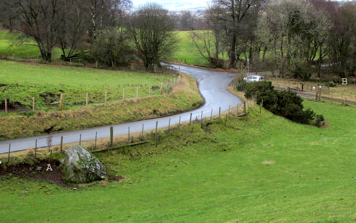
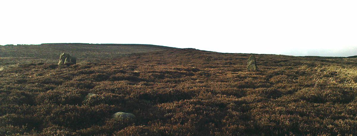
Travelling north from Perth on the A94, take the right turning for Murrayshall just before entering Scone, then take the first right and continue up to the road junction, and park up at the trackway opposite. You’ll see the big stone in the field to the right, up against the road embankment; and the small stone is in the paddock to the left of the trackway at the edge of the trees.
Archaeology & History
Two large glacial erratics which have acquired mythic status and picked up a Christian triumphalist message on the way.
Folklore
In Lawrence Melville’s (1939) excellent local history work, he thankfully put to pen an all-but-forgotten tale of oral tradition:
“Where the road from the Muir of Durdie leaves Kilspindie parish, a grass grown road leads north to Boglebee….. A few yards from the highway lie two large stones, said to have been flung from the Giant’s Hill in Collace parish – the flat topped eminence lying due north from the stones, about two or three miles away, better known as “Macbeth’s Hill”, or “Dunsinane Hill”.
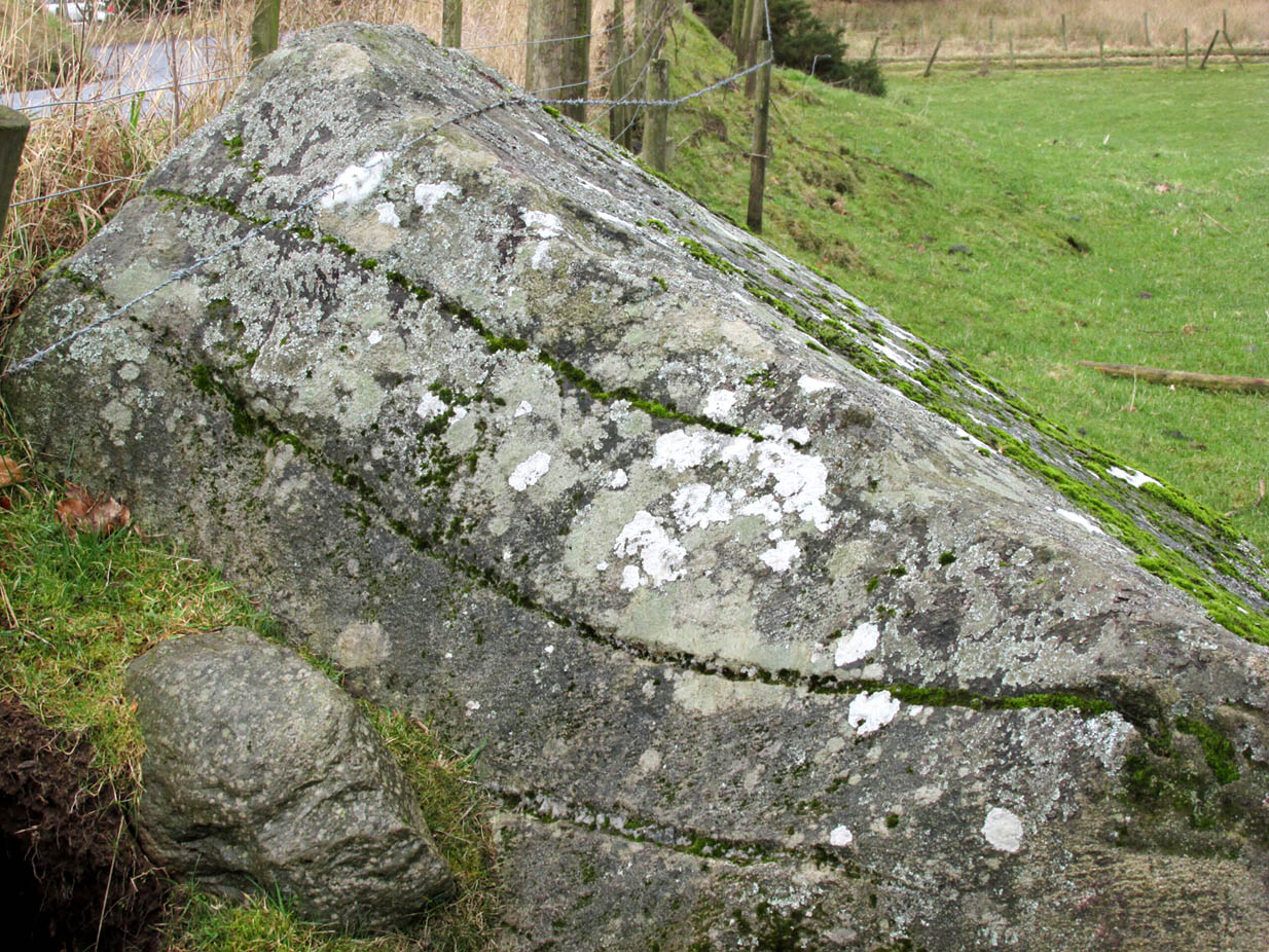
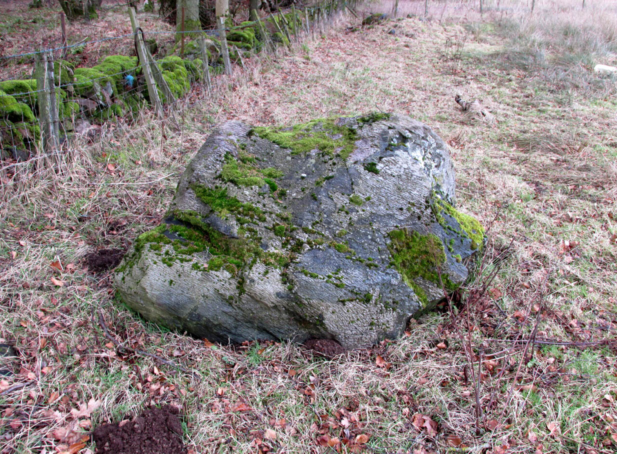
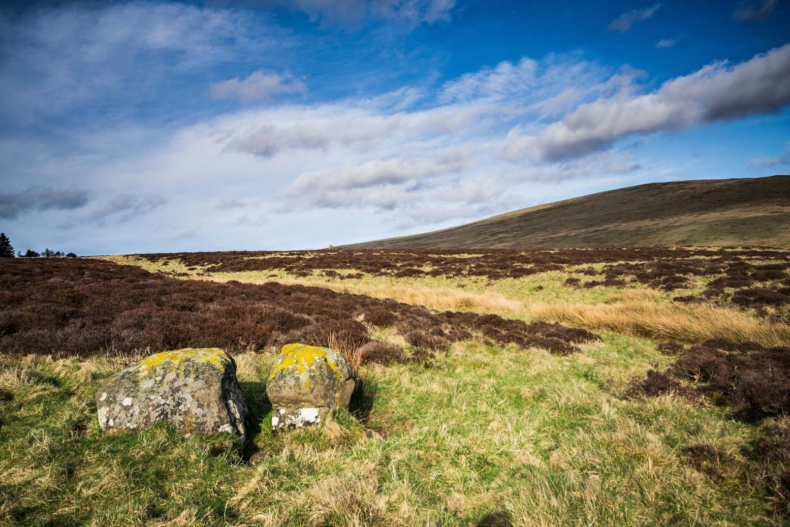
The ‘string’ marks of legendThe smaller stone with its ‘string’ marks
“When the church dedicated to St John in Perth was being built and its tower began to appear, a witch living in Collace was enraged to see this proof of the approach of Christianity and determined to destroy it. She had a son, a giant (after whom the hill receives one of its names), whom she sent to the top of the hill, giving him two huge stones with which to destroy the rising church.
“By her incantations she had supernatural power and knew that when Christianity came her power would be destroyed. She gave him her mutch from her head to be used as sling and in it the giant put the two huge stones. Whirling it around his head, he aimed them in a line with the tower, but, just as he let them fly, the string of his mother’s cap broke and the stones only went the length of Boglebee. The marks on the stones are said to be the marks of the witch’s mutch strings.”
Another view of the larger stone
A familiar folkloric message is remembered the length of Britain: a giant, a devil or other supernatural being throwing stones that either spill out of an apron or otherwise miss their mark. And in this case an unsubtle message to anyone trying to take on the might of the church. But what was the original story of these stones as told by the old time oral storytellers before Christian missionaries stalked the land?
If the string hadn’t broken and the stones had followed their original trajectory they would have fallen south of St John’s Kirk, but it was the thought that counted….
Reference:
Melville, Lawrence, The Fair Land of Gowrie, William Culross: Coupar Angus, 1939.
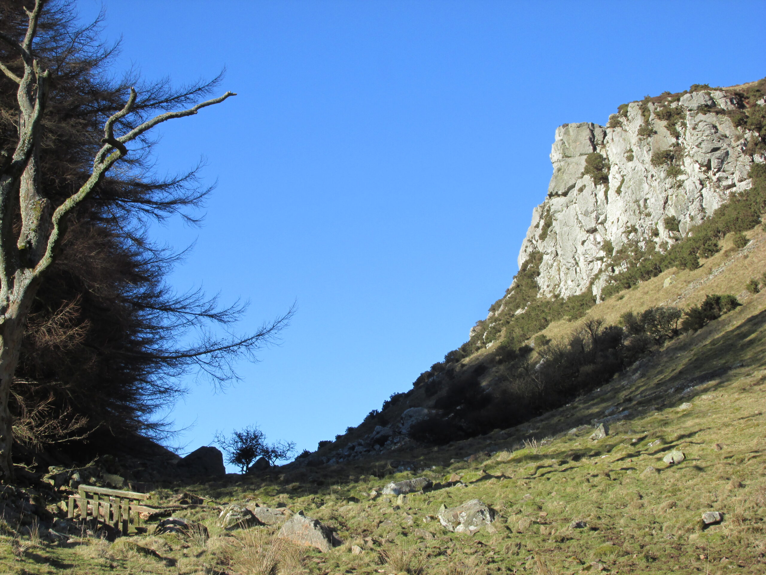
The Rock and Leap may be seen from the B953 Bandirran to Abernyte road. Approach across the fields.
Archaeology & History
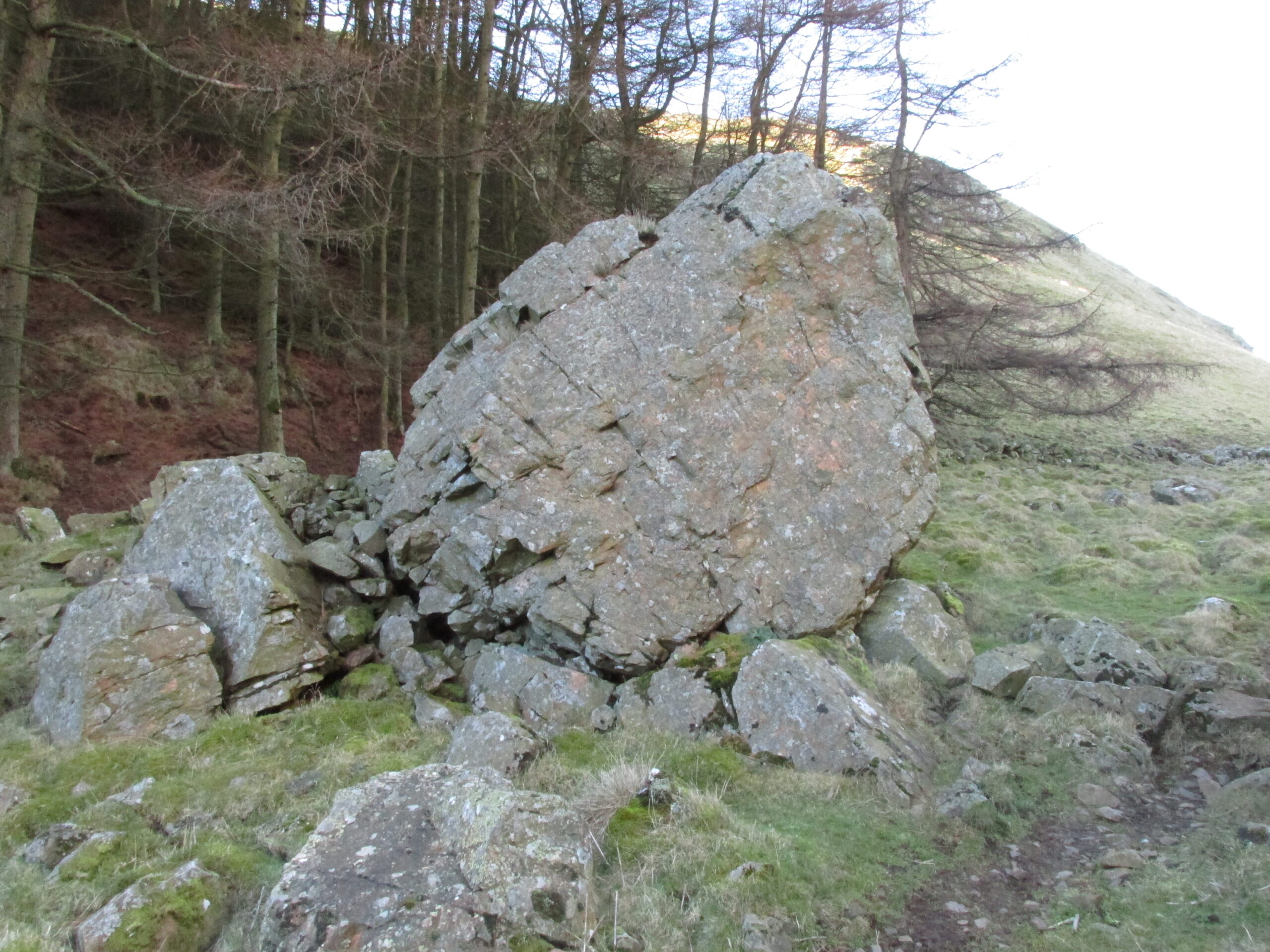
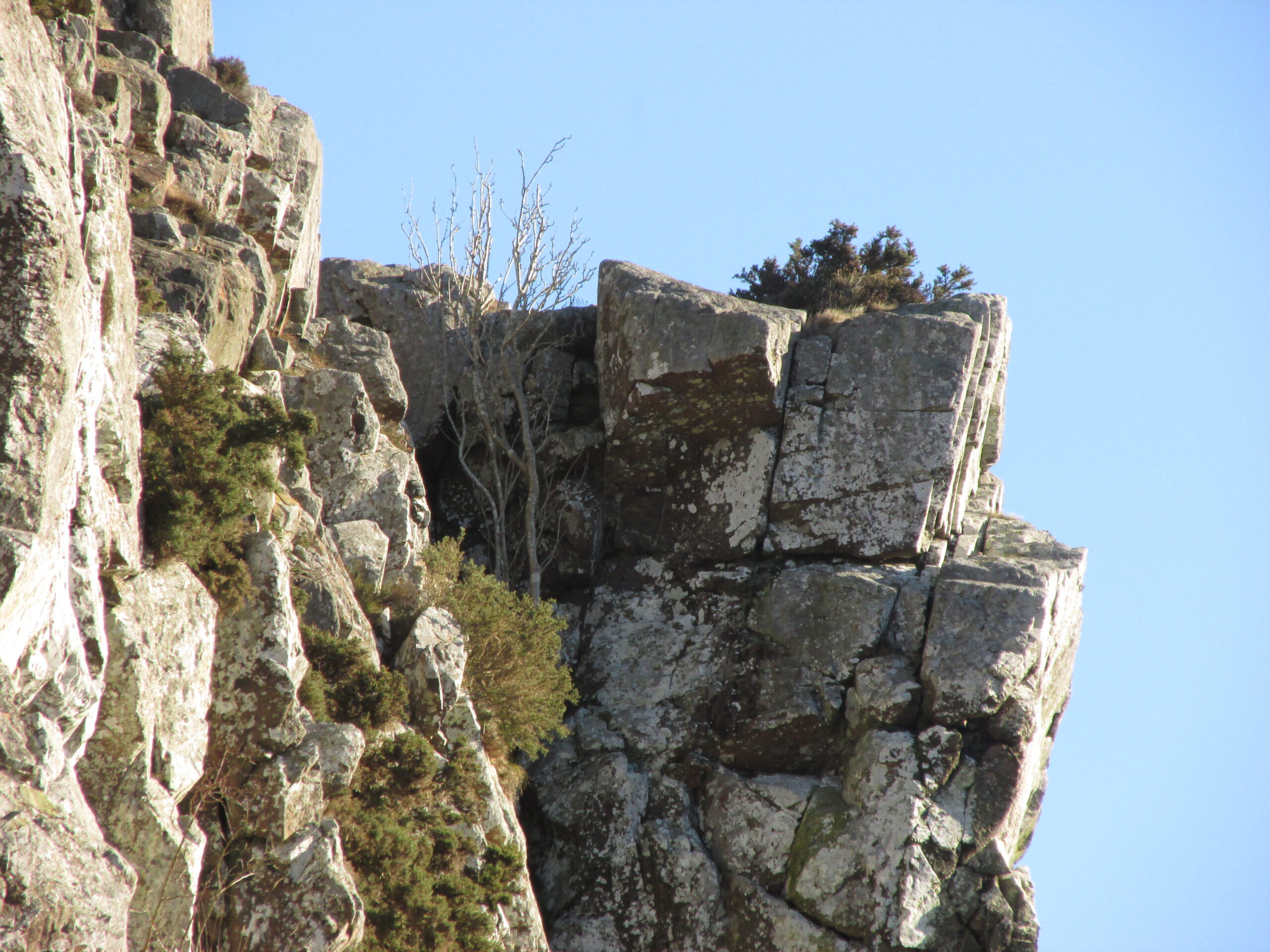
A large boulder perhaps 40 tons in weight lies in a ravine between Dunsinane and Black Hill. The ‘Leap’ is a flat topped ledge jutting out from the west side of Black Hill facing Dunsinane.
Folklore
Melville (1939) in his The Fair Land of Gowrie writes of the simple pleasures of the giant:
“From the farther side of the ravine [between Dunsinane and Black Hill], a precipitous rock juts out, which is called the “Giant’s Leap”. According to the lore of the Sidlaws, a giant, who once lived in these parts, leaped from this rock right on to the top of Dunsinane Hill. The giant also amused himself by tossing about a huge boulder which can be seen lying at the bottom of the ravine.”
And adds:
The Big Fellow’s toyGiant’s Leap from the north
“Fairies haunted the hills here and on summer nights they descended to the meadows, where they danced at a spot called “Fairygreen”. The Black Hill gets its name from the dark heath which covers it. Weird and bleak looking for most of the year, the lower slopes are brightened by glowing patches of purple flowers in late summer.”
Fairygreen Farm lies a mile almost due north of Dunsinane.
Reference:
Melville, Lawrence, The Fair Land of Gowrie, William Culross & Son, Coupar Angus, 1939.
Pretty easy to find – assuming it aint at the height of summer and the crops are approaching maturity, otherwise you’re only gonna see its head! But, this aside: from Aberfeldy, take the B846 road over the river bridge that bends you along the valley of the River Tay towards Appin of Dull. After some 2 miles you’ll pass the right-turn up to Dull. Go past this for another coupla hundred yards or so, watching out for the left-turn down towards the farmhouse of Carse and park up where you can (if you go past it, there’s the second turn up to Dull, again on your right, where you can turn round). As you walk down the track towards Carse Farm, watch out on your right in the field below Carse I, in the second field down. You can’t really miss it. (and the farmer here is spot on if you ask to check the stone – as long as the crops aint growing)
Archaeology & History
Although all that’s left of what is thought to have been a once proud stone circle is the singular upright standing stone in the middle of the field. Aubrey Burl (1988) thought that this was one of the typical “four poster”rings that scatter our isles, but I’m not so sure misself. There were other stones associated with the site when Burl described it, but these were covered over in our visit here a few months back — which is a pity, as two of the stones are reported as possessing cup-markings (if/when we revisit the site, I’ll try get some images of the respective stones and add them on TNA as individual carved stones). The site gives the distinct impression of it having a funerary character of some sort and not a true stone circle — and this was strongly suggested by some of the finds inside the “ring”, described below.
Fred Cole’s old drawingAubrey Burl’s groundplan
Both this and its associated “circle” a few hundred yards away — known as Carse Farm north — sit on a flat level of ground in the Tay valley, with rounded hills all most sides. This landscape setting was obviously of some importance to the people who put the circle here in the first place but, not living in the region, it’s difficult to assess the mythic relevance some of the hills will have obviously played in the siting of these stones.
In bygone days, it was reported that the much of the site was ploughed away due to agricultural excesses, so there was obviously much more to it in earlier centuries. Describing the solitary stone that’s left today, along with the earlier excavation results, Mr Burl (1988) wrote:
“The stone still standing, of quartziferous schist, is 6ft 3in (1.9m) high. Its longer faces are aligned NW-SE. 32ft 6in (9.9m) to its SW is a large prostate block, sub-elliptical and about 8ft long and 4ft 3in wide (2.4 x 1.3m). It has probably fallen outwards. (my italics, PB) If so, when standing near the top of its inner face were four cupmarks in a cross pattern.
“About 32ft ((9.8m) to its NW is a fallen and enormous schist slab, 11ft long and 5ft wide (3.4 x 1.5m). It also appears to have toppled outwards. Near the bottom of its inner face are two cupmarks. The situation of these three stones suggests that they once stood at the corners of a rectangle some 32ft (9.8m) square, the pillars of a huge four-poster nearly six-times the national average and with an internal area ten times bigger than the small 4-poster (Carse Farm north, PB) just to its north.
“Excavation in 1964 found the socket from which the great prostrate slab had been dragged… Cash (1911) had noted the presence of a small stone inside the ring about 20ft (6.1m) west of the standing stone. It proved to be 4ft (1.2m) square with a carefull-dressed face. It had been set upright, standing about 1ft 4in (41cm) above the ground. Three sides of the worked face ‘had been carefully chiselled away to a straight edge.’ It may have been a slab lining the inner central space of a destroyed ring-cairn. Burnt bone was found near it. There was also a rounded river pebble with a worked hollow on one side…”
Folklore
Carse Farm stone
Stewart (1964) described the site as having been “christianized” not long ago, by having the northernmost standing stone in the ring removed. This is intriguing inasmuch as “north” is the place of greatest symbolic darkness in the pre-christian mythos, and represented death and illumination in magickal terms. North was also the point taken by witches and shamans in their excursions into Underworlds, usually via the North Star, which tethered the Earth to the heavens (see Godwin’s Arktos [1993], and Grant, The Magical Revival [1973]) In the removal of this northern stone for the reasons given, that implies some magickal events or folklore were in evidence here when this took place. Anyone got any further information along these lines, or has it long since been subsumed?
References:
Burl, Aubrey, Four Posters: Bronze Age Stone Circles of Western Europe, BAR 195: Oxford 1988.
Follow the same directions as to reach the cup-marked Sheriffmuir Carving, which is just a coupla hundred yards away to the southwest. On a clear day you can see this standing stone from the pub by the roadside, a few hundred yards away!
This is alleged to be just one standing stone in a straight line of five once-upright monoliths. Starting at the southwestern end of this row we have the 7ft-long cup-marked Sheriffmuir Carved stone — which certainly looks as if it stood upright in the not-too-distant past — and as we move up the line we pass another that’s been split in half. Another earthfast-looking rock is the next contender, before we reach our famous Wallace Stone, standing upright and proud on this moorland ridge. It’s about 6ft tall and 3ft across at its widest and certainly acts as a marker for the line of stones that allegedly stood upright here. And if we walk just a bit further up we have another big stone laid on the ground which is alleged to be a part of the same alignment.
If it is an authentic megalithic row, it’s not included in either the Thoms’ (1990) two-volume work on the subject, nor Aubrey Burl’s (1996) compendium a few years later. And though the alignment looks good, I’ve found ones just like this in the Pennines where we have just one upright left and then a line of other seemingly prostrate stones running dead straight either side of the singular upright (and have kept mi gob shut about ’em for sensible reasons), so I’m not too sure what to think.
But, alignment aside, the Wallace Stone itself is a damn good standing stone and well worth checking out. It’s highly probable that other prehistoric remains still lurk, undiscovered, amidst these heaths…like the lost stone circle to be found nearby…
Folklore
A slight variation on a theme about this spot: in both accounts the stone was named after the legendary Scottish independence fighter, Sir William Wallace. The folklore tells that he and his fighting clans gathered here in 1297 preceeding the Battle of Stirling Bridge; whilst the variation tells that the stone here was actually erected around that time to commemorate the event. This tale was first narrated by a local story-teller called Blind Harry and was found by local historian A.F. Hutchinson (1893) to be a case of mistaken identity!
References:
Burl, Aubrey, From Carnac to Callanish: The Prehistoric Stone Rows and Avenues of Britain, Ireland and Brittany, Yale University Press 1993.
Heggie, Douglas C., Megalithic science: ancient mathematics and astronomy in north-west Europe, Thames & Hudson: London 1981.
Hutchinson, A.F., “The Standing Stones and other Rude Monuments of Stirling District,” in Transactions of the Stirling Natural History and Antiquarian Society, 1893.
Royal Commission on the Ancient & Historical Monuments of Scotland, Archaeological Sites and Monuments of Stirling District, Central Region, Society of Antiquaries of Scotland 1979.
Thom, A., Thom, A.S. & Burl, Aubrey, Stone Rows and Standing Stones – 2 volumes, B.A.R.: Oxford 1990.
Best approached from Haworth and then walking along the Bronte Way footpath onto the moors (ask at the local Tourist Info if you aint sure). A few hundred yards along, cross the ‘Bronte Bridge’ and keep following the footpath up until you get past the trees and get onto the moors. Once on the heathland, a few hundred yards along keep your eyes to the right and at least one of the two stones here will appear!
Archaeology & History
The original Cuckoo Stone
This is a fascinating little site that has been mentioned in a few old local history guides, including John Lock’s Guide to Haworth (c.1965). First described in 1852 and only briefly noted in passing by Horsfall Turner (1879), the place was previously thought to have comprised just one standing stone, but in recent years explorations by Mark Davey and I found there to be two standing stones close to each other. They are not marked on any maps and are unknown even to many local people. However, the place once had a bit of a reputation (see folklore) and seemed to be well known in the region when the cult of the Church was at its height!
Both of the stones are between three and four feet tall, but the westernmost of the two was probably much taller in bygone days – that’s because the top of the stone was vandalised in centuries past, presumably by some christians if the folktale is anything to go by! On the north-facing side of the western stone is the faint carved outline of an old cross, first described by local historians in the 1960s. It’s faint, but you can work it out if your eyes work properly! The newly-recovered (July 2005) easternmost stone is in two sections, with the very top of it having been hacked off in centuries gone by, as seen in the photos.
The second Cuckoo Stone, resurrected!
When we unearthed the previously unknown Cuckoo Stone (which was laid in the earth and covered with heather and peat), a small deposit of quartz crystals was found in the original socket beneath it when we came to stand the stone back in position. Question is: who put the quartz there? The original builders, or the nutters who knocked it down? And then we might ask: what was the reason behind placing a large handful of quartz beneath the standing stone?
In the heather beyond, about thirty yards to the north, we also find what looks like the remains of an old prehistoric tomb. If we make sense of the Cuckoo Stone’s folklore, we can safely assert that these monoliths were the spirit-home of the old dood/s buried in the tomb behind…
Tis a lovely little place…
There’s also something from that strange electromagnetic-anomaly region attached to this site, well-known to students exploring the physics of megalithic sites. When my lovely friend Mark – “grope me baby! grope me!” – Davey and I rediscovered the second Cuckoo Stone, Mark brought with him a device that measures fluctuations in electromagnetic radiation. The readings taken were fine just about everywhere (background, with minor fluctuations), apart from two very curious straight lines which ran either side of the burial mound down towards the two Cuckoo Stones, with radiation readings being between 10 and more than 60 times above background! The highest readings came from those closest to the burial mound, with levels dropping as we approached the standing stones. Such magnetic anomalies have been found at a number of megalithic sites in the UK, as described in Paul Devereux’s Place of Power (1989) and other books. But the fact that the anomaly lines here seemed to run in lines would be something that those ley enthusiasts would no doubt be intrigued by!
Folklore
The creation myth of this site tells that once, long ago, a great giant lived upon these old moors. He wasn’t a good giant though, from all acounts: robbing and persecuting those who would venture onto the hills hereabouts. The local people wouldn’t dare venture onto the moors and they long sought for a hero who’d be able to sort him out! This eventually happened and in a great fight, our unnamed hero caught and killed the old giant. But just as the giant was about to die, he used his ancient magick powers and, “with a magical groan, he did transform before them and became the Cuckoo Stone.”
But that wasn’t the end of the matter because, as our unnamed hero realised, knowing that the head was the seat of the soul, even in his petrified stoney state the giant may one day recover his life, and so he chopped off the top of the Cuckoo Stone and rolled it into the valley below, dismembering the ‘head’ from the giant, seemingly forever…
It is said that the winnings of this old giant, stolen from his countless victims, are hidden somewhere high upon these hills, awaiting the shovel of some fortunate treasure hunter!
The motif of this tale is universal and archaic, echoing traditional or aboriginal lore from elsewhere in the world. The tale is a simple one: originally the ‘giant’ was a local hero, chief or medicine man who lived on these hills and the Cuckoo Stones his petrified body, and with the incoming christian cult, the giant became demonised. It seems that the ingredient of the giant’s death may infer a burial of sorts and, a hundred yards behind the Cuckoo Stones (both of whom have had their ‘heads’ hacked off), is a mound of earth which, when seen after all the heather’s been burnt away, has all the hallmarks of a prehistoric tomb (it is seen in the top photo above, as the mound in the background behind the standing stones).
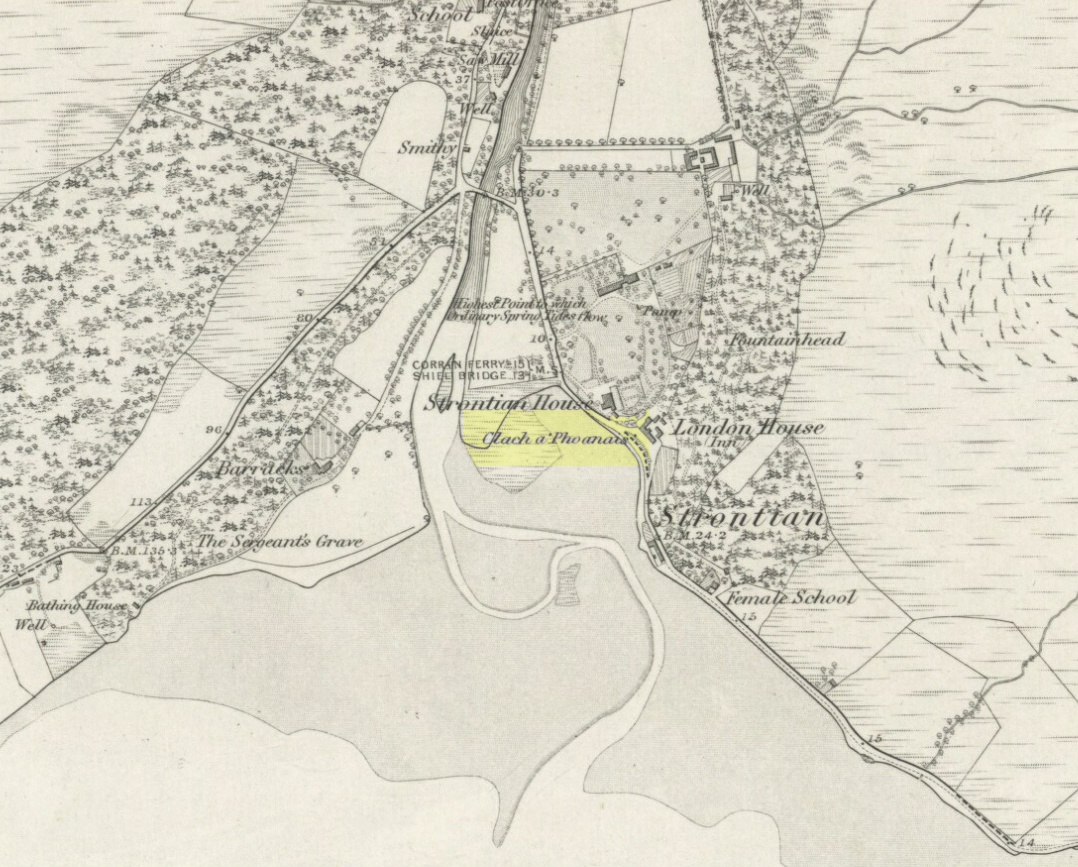
As you enter the village from the east, onto the A861 road, the Strontian Hotel is on the right-hand side of the road and you can’t fail to notice. Stop!
Archaeology & History
Clach a’ Phaonais on 1872 map
Shown on the first edition OS-map of the region in 1875, this old worn standing stone, more than six-feet tall, can be seen at the edge of the drive. There’s an iron ring is attached to it, which I thought might have made it an old Bull Stone in bygone days, but no such lore is remembered. Also known as the Branks Stone, it’s Gaelic name probably means the ‘stone of penance,’ and folk were chained to it in eaelier days for bad behaviour. It was widespread across the Highlands to tie criminals to stones and wooden poles, naked, for 24 hours and let the midges get to them. Crime was down to a minimum up here!
Folklore
As the locals at Strontian Hotel told me (thanks Finlay), “several stories have emerged locally. It marks a clan chief’s grave, a sighting stone for the equinox but the most plausible one is based on the fact that there is an iron ring on the side of the stone facing the loch and it was used to tie up barges taking lead from the local lead mine. It supplied the raw material for shot during the Napoleonic and Crimean wars.”
Aknowledgements: Big thanks to Anne and the Megalithic Portal for additional help on this one.