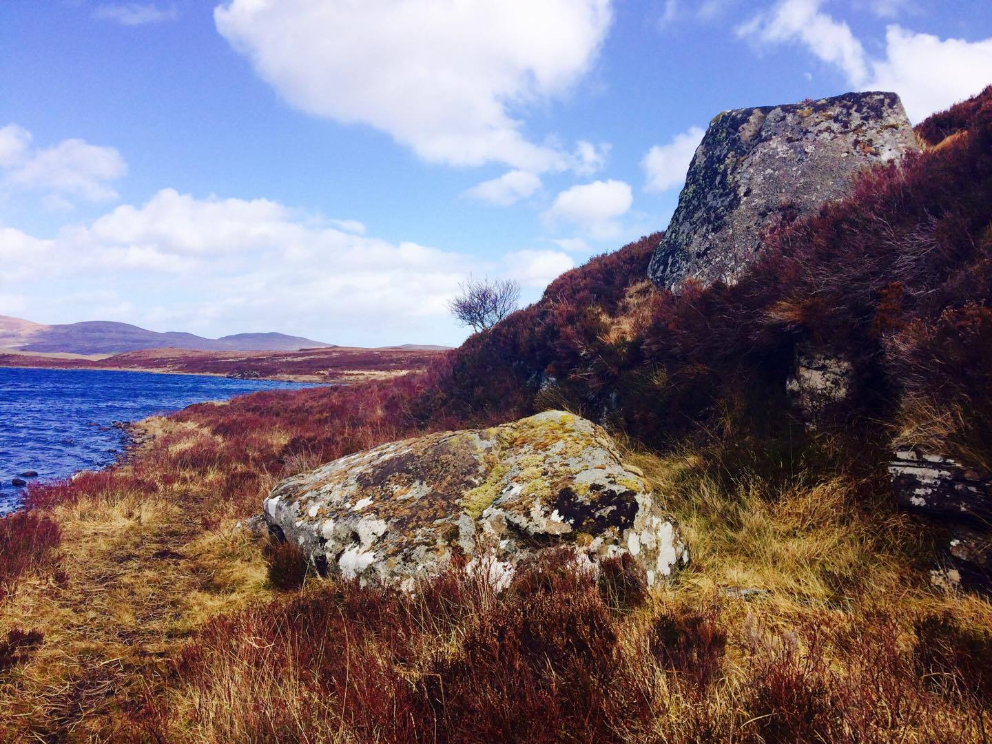
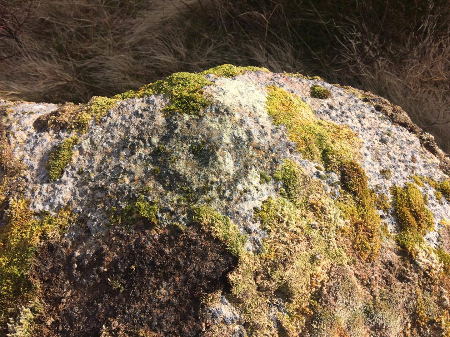
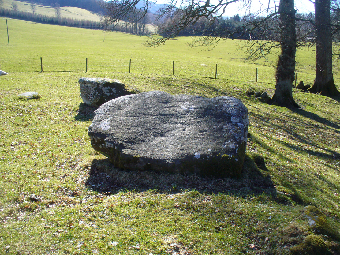
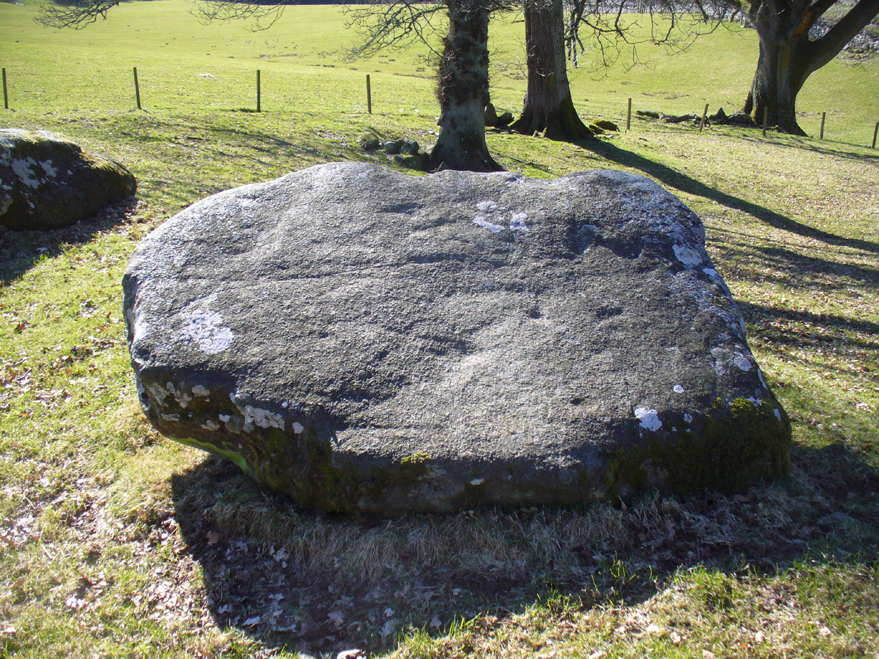
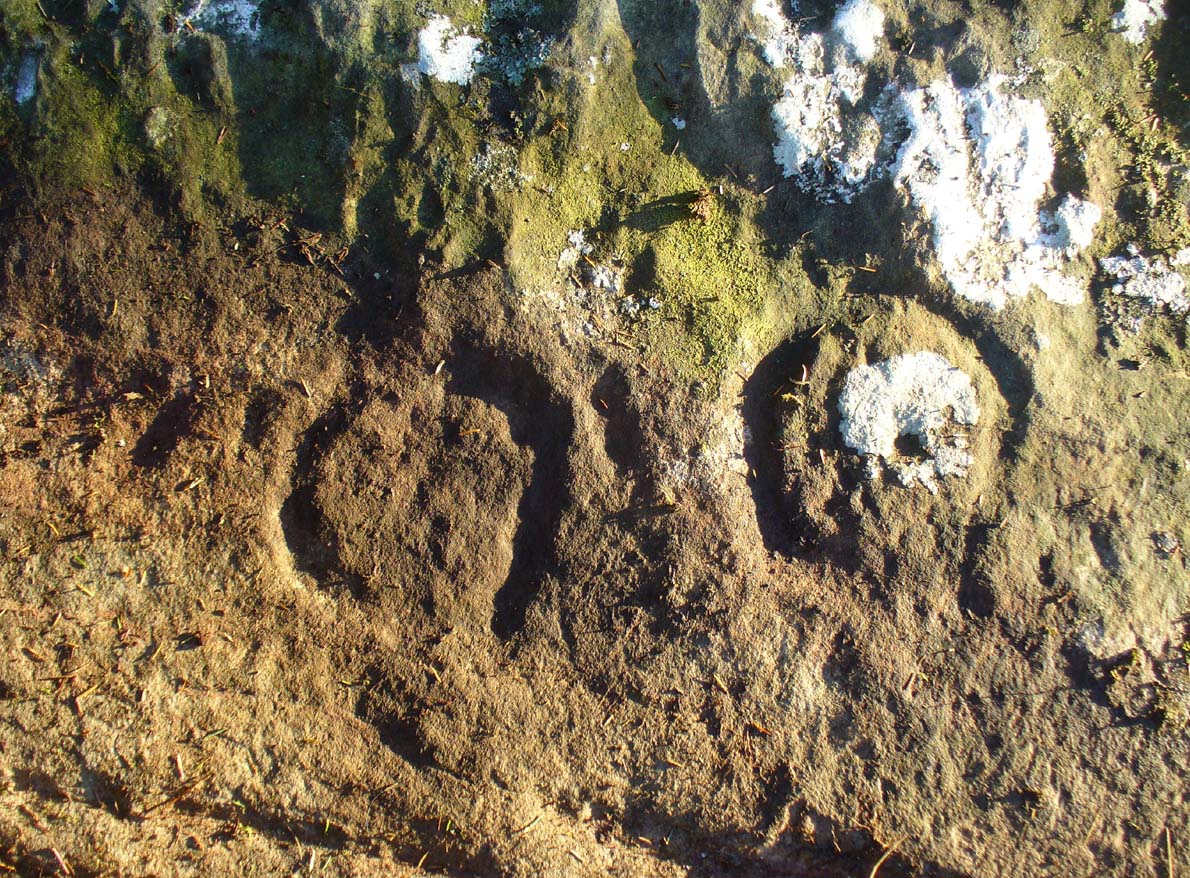
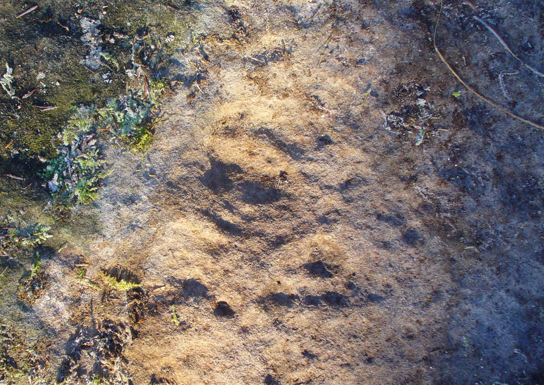
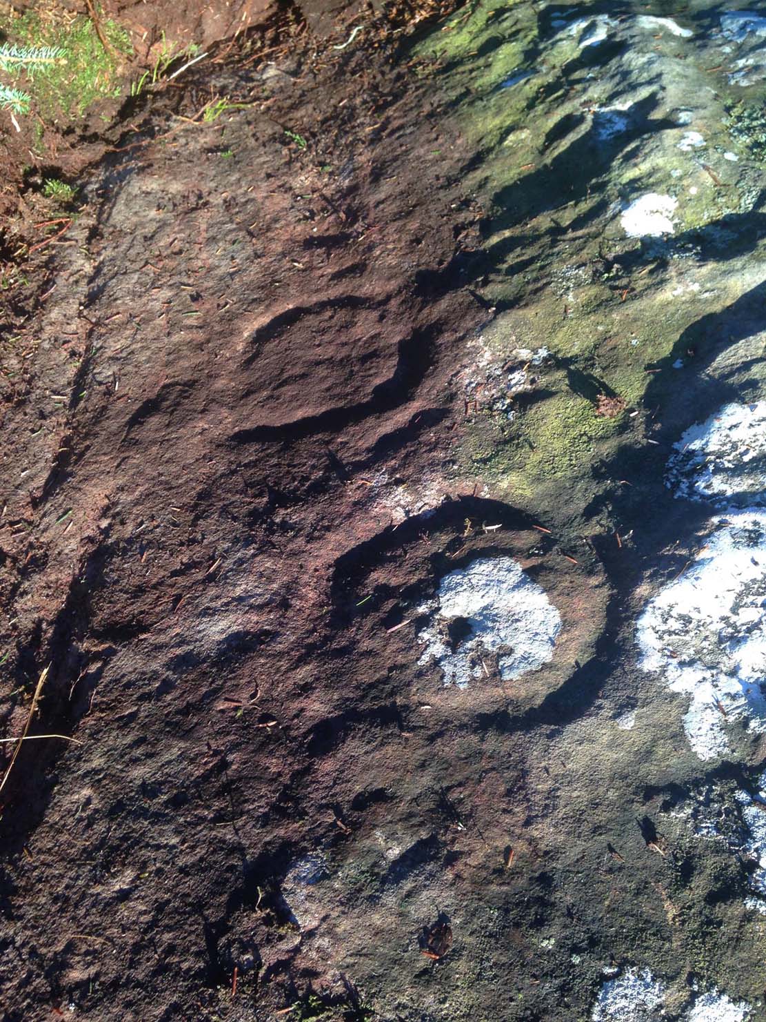
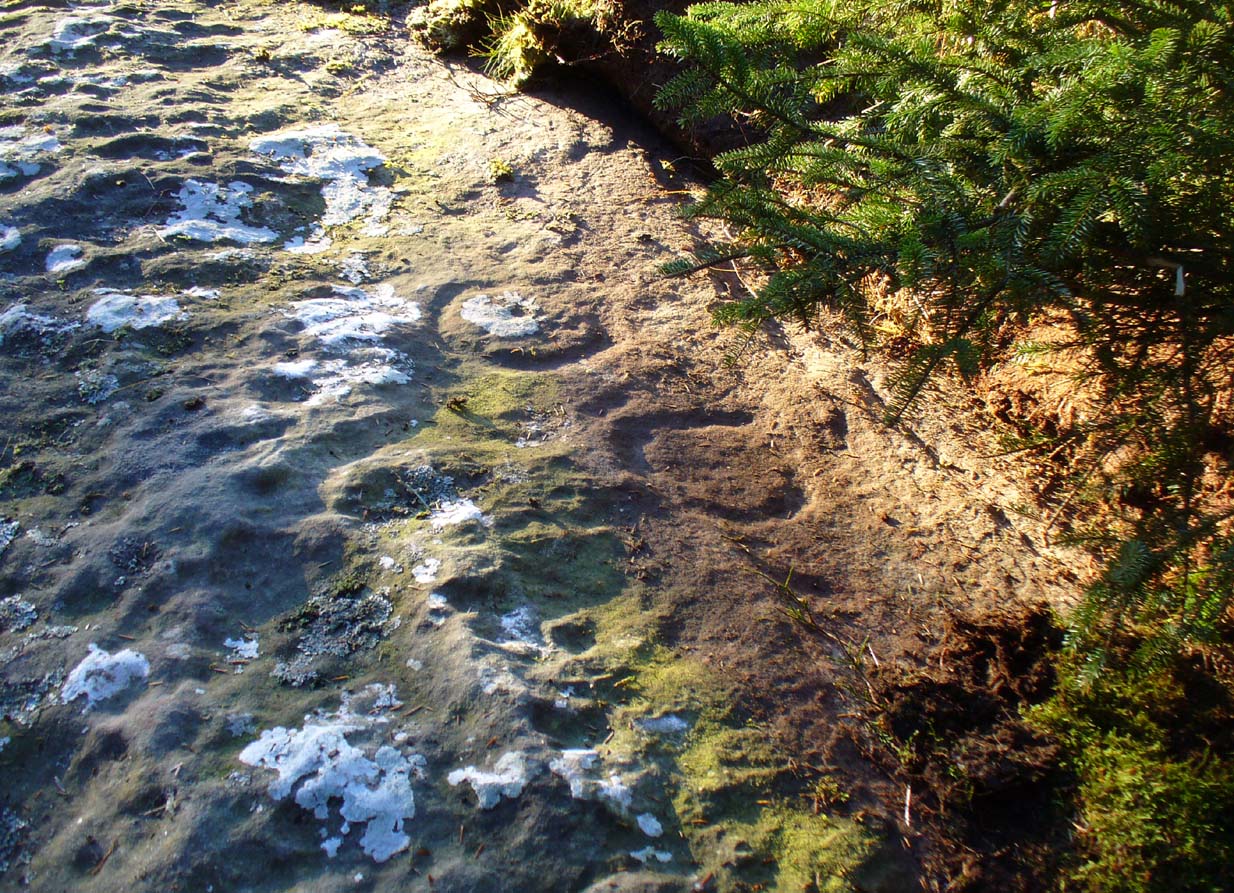
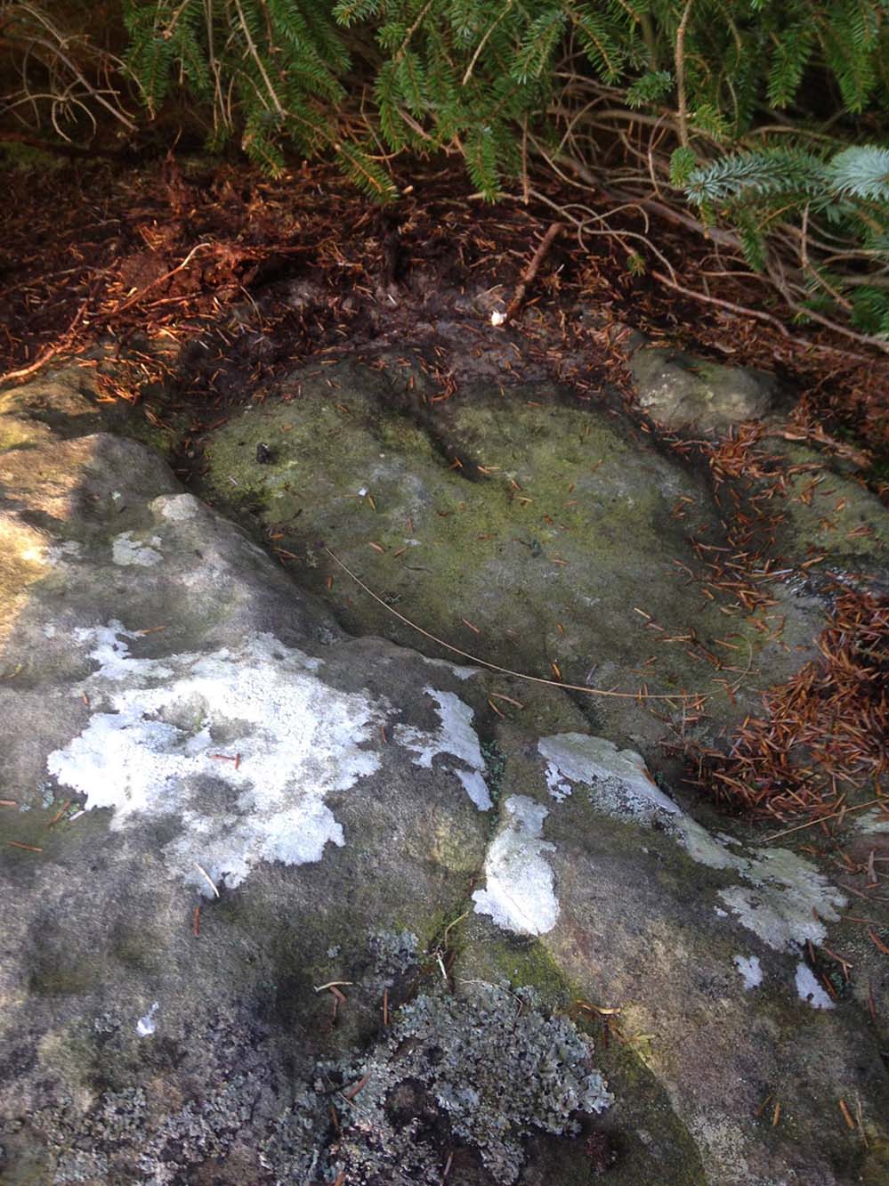
Lochan Hakel’s cup & ring (photo by Sarah MacLean)
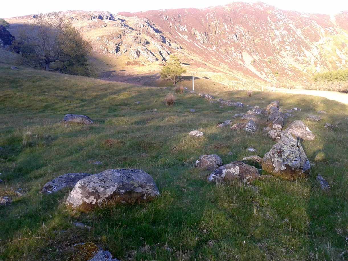
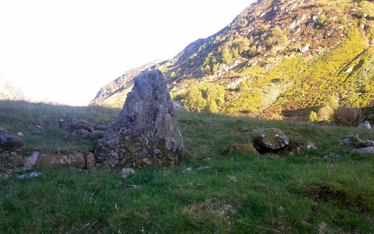
Whether you take the A836 or A838 into Tongue (through truly beautiful wilderness), make sure you go into the village itself—and then keep going, south, along the tiny country road. Nearly 2½ miles along, note the small loch of Lochan na Cuilce on your right. A few hundred yards past this, on the other side of the road (barely visible at first) is Lochan Hakel. Walk around to the south-side of the loch and, across from where the small island of Grianan lives, you’ll see this large rounded boulder by the loch-side.
Archaeology & History
Stuck in a veritably stunning middle-o’-nowhere landscape below the outstretched northern moors beneath Ben Loyal & co, there is no previous literary account of this faded petroglyph, rediscovered in early April 2017 when Sarah MacLean took us on a visit to the more renowned multiple cup-and-ringer of Lochan Hakel 2, just yards away above the moorland rise (which is unmissable from here). It’s not too special in comparison with its neighbour and many others—but try telling Sarah that!
Cup & ring atop of stone (photo by Sarah MacLean)
This large rounded lichen-covered boulder has, at its height, a carved ring around a natural rise—known as a ‘boss’—at the very top of the rock. On its southern side, Sarah found a single cup-mark, along with a couple of others on the more northeasterly sloping face. At the bottom of this face is another seemingly isolated small cup-marking. There may well be other carved elements beneath the mass of ancient lichens, but we thought it best to leave them for the time being. It’s also quite likely that other unrecorded carvings exist in the area.
Acknowledgments: Huge thanks to Sarah MacLean, not only for helping to locate this carving, but for use of her photos in this site profile. Cheers Sarah! And to Donna Murray, for putting up with me whilst in the area! …Now, let’s find some more of them!
At the roadside, on the south side of Barton Lane, where it crosses the minor road joining Cross House Farm and Barton House, you’ll see the Barton Cross standing upright. You can’t miss it!.
Archaeology & History
Carved stone cut to shape
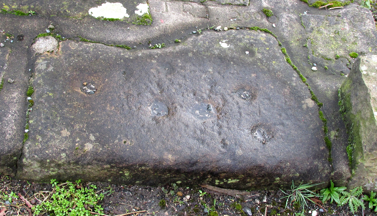
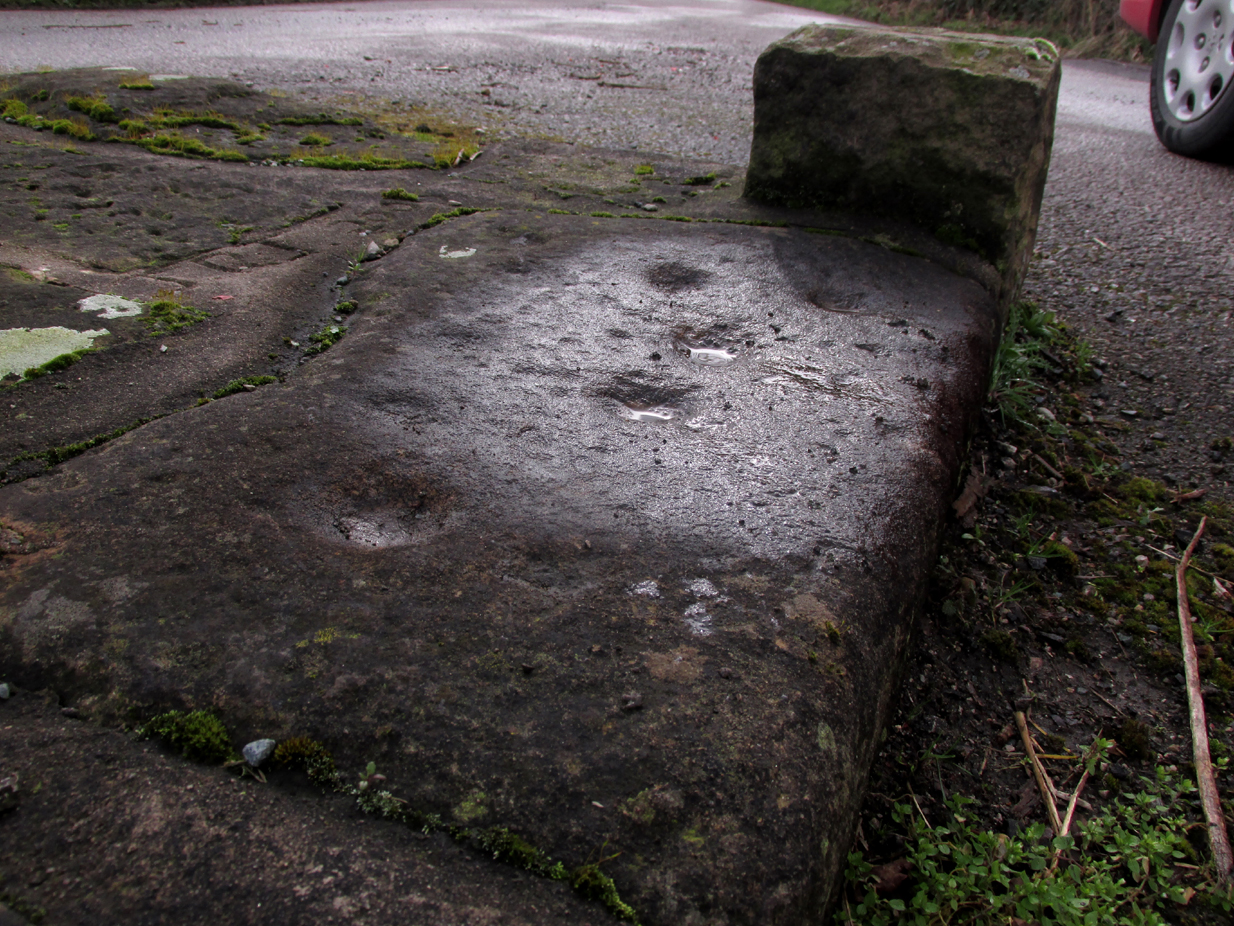
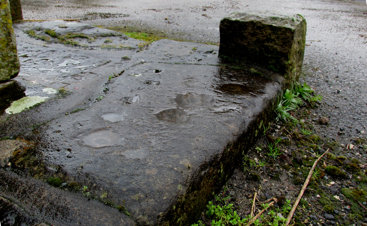
Apparently never before described, this stone has very likely been removed from another locality and cut to shape to form part of the surrounding platform base to Barton Cross, where it is at the southwest corner. It has ten cup marks.
Until or unless more such stones are located, it is a unique example of rock art in this part of Lancashire.
Nine cups visible here10th cup nr camera, after rain
Henry Taylor, in his 1906 work The Ancient Crosses and Holy Wells of Lancashire writes inter alia about the Barton Cross that it had been demolished sometime after 1848, and that the base and part of of the Cross shaft had been ‘lately restored to the old site‘. Thus the cup-marked stone may or not be in its original position as part of the Cross surround, and may have just been a conveniently available slab of stone that was used, rather than a deliberate use of a pre-existing sacred stone.
References:
Taylor, Henry, The Ancient Crosses and Holy Wells of Lancashire, Sherratt & Hughes, Manchester, 1906.
Along the A84 road betweeen Callander and Lochearnhead, take the small road west when you reach Balquhidder Station, towards Balquhidder village. Go along here for 1½ miles (2.5km) as if you’re gonna visit the Puidrac Stone; but 200 yards past this, go through the gate on the south-side of the road into the boggy field for about 150 yards towards the River Balvag. You’re looking for several stones, as in the photos. You’ll find ’em. (you may get soaked though!)
Archaeology & History
The stones, looking NW
After many thousands of years, this innocuous-looking group of small stones found in the very boggy field immediately west of the Puidrac Stone looks nothing like it once did. Some modern academics would have you think there was nothing here of prehistoric interest, but oral tradition and earlier writings tell otherwise. Although not shown on the early OS-maps, it was first described in James Gow’s (1887) articulation on the antiquities of the area, in which he told:
“A short distance east from the present (Balquhidder) parish church, in the haugh below the manse, there are seven stones remaining of a circle which appears to have been about 30 feet in diameter; only one stone is in its original upright position, but there are fragments of others lying about; as usual, they are known as “Clachan-Aoraidh,” or worshipping stones, and are not likely to be disturbed during the lease of the present tenant.”
Looking E, with Puidrac Stone just visible left of telegraph post
A few years later when Thomas Ross (1919) visited the area with a Prof Cooper and others, they reported the single standing stone still in position and the anglicized name of the Worshipping Stones was still in evidence amongst locals.
Arc of fallen stones by the trees
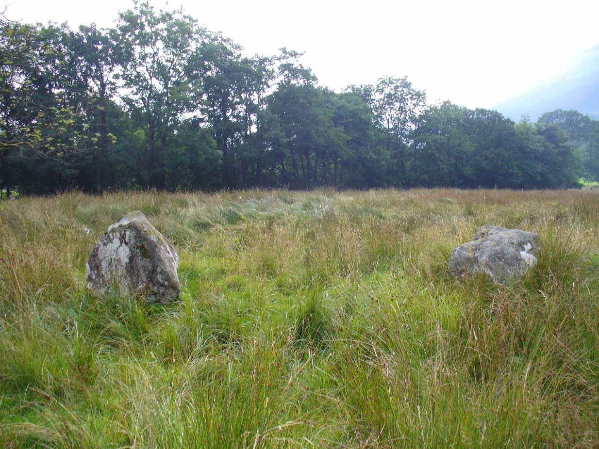
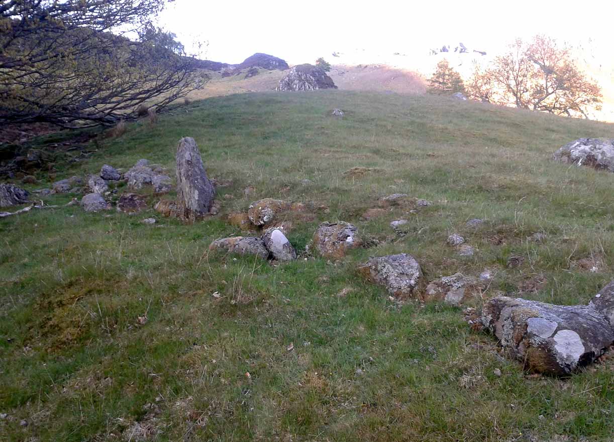
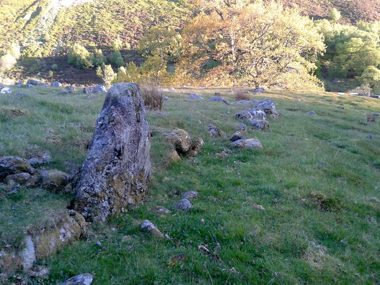
Nowadays the site is in ruin. Two of the stones stand out when the rushes aren’t too high, with one earthfast and its companion prostrate; but as you can see in the photo (right), there remains a sunken arc of two other stones laid down, running away from the larger ones, with a fifth overgrown and nearly covered by vegetation and the young trees. In all probability, tradition is probably right here: this is the remains of a stone circle.
Folklore
The field in which these denuded megalithic remains are found, was, wrote Thomas Ross (1919),
“the site of a long-popular market called ‘Feill Aonghais’, i.e., St Angus’ Fair. It was held, according to Mr Campbell, in May; according to Mr Gow, on “the Saint’s Day, the 6th of April.” It was quite the custom…to hold a fair after divine service on the Patronal Feast. The folks came to “kirk and market” on the same day, and mixed good fellowship and manly sport with their worship and their business.”
If you were to hold a fair there nowadays, likelihood is it would get flooded! Christian myths tell of a “St. Angus” taking over whatever the heathen traditions were in this domain, more than a thousand years back.
Venture along the A822 Crieff to Dunkeld road, turning down into the gorgeous Sma’ Glen. Nearly 1 mile past Ossian’s Stone, just past where the road crosses the River Almond, walk along the track on your right where the big boulder sits. Past the boulder, walk up the grassy slope to the left. A standing stone will catch your attention, which sits in the walling. Y’ can’t really miss it!
Archaeology & History
Rediscovered by Paul Hornby in 2015 at the end of a day’s excursion to the neolithic sites a few miles west of here, I can find no references at all to the denuded remains of what seems to be a typical prehistoric enclosure.
Looking down the west wallThe southwestern walls
Constructed around a natural rise in the land 60-70 yards above the River Almond, the enclosure has that ‘Iron Age’ look about it (it may be earlier). Shaped like a giant ‘D’ (and clearly visible on GoogleEarth), the extensive walling that makes up the site—about a yard wide all the way round—is far from small, measuring some 60 yards (54.8m) at its greater longer axis roughly north-south, by 54 yards (49.5m) east to west, with a circumference of about 170 yards (155.5m). The much-denuded walling that defines the perimeter is comprised of a number of large stones with thousands of smaller packing stones that are mainly overgrown. A large ‘standing stone’ about 3 feet tall is the most notable feature nearly halfway along the western wall.
Small standing stone in wall
In all probability this enclosure would have been in use since its construction in the Iron Age period all the way through to the coming of Fuadach nan Gàidheal (the Highland Clearances) in the 19th century, as the people here were pragmatists who made best use of what was around them. It is likely to have ended its days as an area where cattle was contained.
Acknowledgements: Huge thanks to Paul Hornby for his assistance with site inspection, and additional use of his photos.
Tumulus (destroyed): OS Grid Reference – SP 8601 7510
Archaeology & History
According to a Mr Abner Brown (1846), this was one of two prehistoric cemeteries that once existed in Pytchley village, but very little seems to have been written about it. Found on the north side of the village in the field where an old limekiln once stood, this “apparently pagan” site was “about 350 yards northwards of the church.” From his brief description it seems that a large barrow here was accompanied by other smaller ones of the same period. They have all been destroyed.
Royal Commission Ancient & Historical Monuments, An Inventory of the Historic Monuments in the County of Northamptonshire – volume 2, HMSO: London 1979.
Follow the same directions for the Croft Moraig stone Circle. Then check out the largest of the fallen or elongated stones on the northwest side of the ring, with a smoothed sloping surface, just at the side of the overgrown stone platform on which it rests. Y’ can’t really miss it.
Archaeology & History
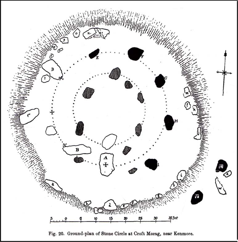
When William Gillies (1938) wrote about the carvings at the Croft Moraig stone circle, he told how, previously, Fred Coles,
“noticed that several of the upright stones…show cup-markings on their perpendicular surfaces. Some of these are quite distinct, but others are so worn through weathering that they can only be traced with the fingers.”
Stone D, with faint cupsClose-up of the cupmarks
This is one of them. Barely visible at the best of times, the cup-markings are faded and very hard to see unless daylight conditions are just right. As you can see in the photos, several distinct cup-like impressions are visible, but it only appears that two of them are cup-marks. The others seem to be more geophysical in nature – but I’d love to be wrong!
The great northern Antiquarian Fred Coles (1910) noted that this particular stone (stone D in his ground-plan of the circle) had “been polished by the sliding of generations of children”. This playful action on stones elsewhere in the UK and around the world sometimes relates to fertility rites (i.e., the spirit of the stone could imbue increased fertility upon the practitioner), but Mr Coles made no mention of such rituals here.
Gillies, William A., In Famed Breadalbane, Munro Press: Perth 1938.
Yellowlees, Sonia, Cupmarked Stones in Strathtay, Scotland Magazine: Edinburgh 2004.
Acknowledgements: Many thanks to hardcore crew for our various visits here: to Paul Hornby, Lisa Samson, Fraser Harrick, James Elkington, Penny & Thea Sinclair.
Enclosure (destroyed): OS Grid Reference – ST 6706 6307
Also Known as:
Windsbury Hill
Archaeology & History
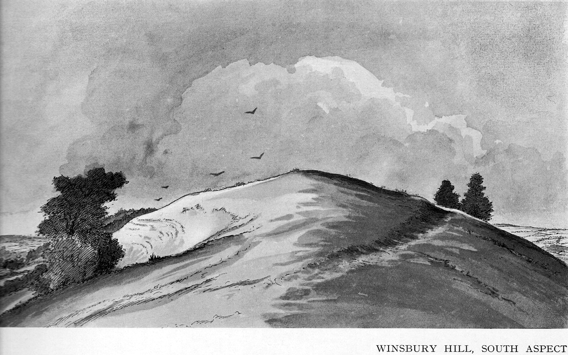
Winsbury Hill earthworks
Apparently, all traces of the possible prehistoric camp or enclosure that were located by Edward Burrow in the 1920s, seems to have vanished. Very little remained of it even then. Lower down the slopes are a distinct series of ancient lynchets (or cultivation terraces), which may date back to the Iron Age—these are clearly visible on the eastern and western sides. Mr Burrow’s (1924) account of the site was as follows:
“Just south of Stantonbury Camp, near Bath, on the adjoining height known as Winsbury Hill, I have traced the almost obliterated remains of a ditch running round the shoulder of the hill, which I have indicated on my drawing. (above)
“On the south and eastern slopes of this prominent hill there are various terraces and scarps, which would repay further investigation. Possibly Winsbury was fortified as an outlier of the more pronounced Stantonbury Camp, standing directly on the line of the Wansdyke, which runs across the valley towards English Combe.”
References:
Burrow, Edward J., Ancient Earthworks and Camps of Somerset, E.J. burrow: Cheltenham 1924.
From Bettyhill village, take the road east towards Tongue and Durness. A half-mile out of the village, at the bottom of the hill, just before you cross the small metal bridge across the River Naver, a very minor road, left, takes you to Skelpick. Go down here and follow the directions to reach the giant long cairn of Skelpick Long. Once there, walk east up the moorland hill (there are no footpaths) for about 150 yards. Once on top of the rise, the moorland levels out a little and there, before you, amidst the small overgrown undulations of many old cairns, a giant one rises up to greet you about 100 yards away. Y’ can’t really miss it!
Archaeology & History
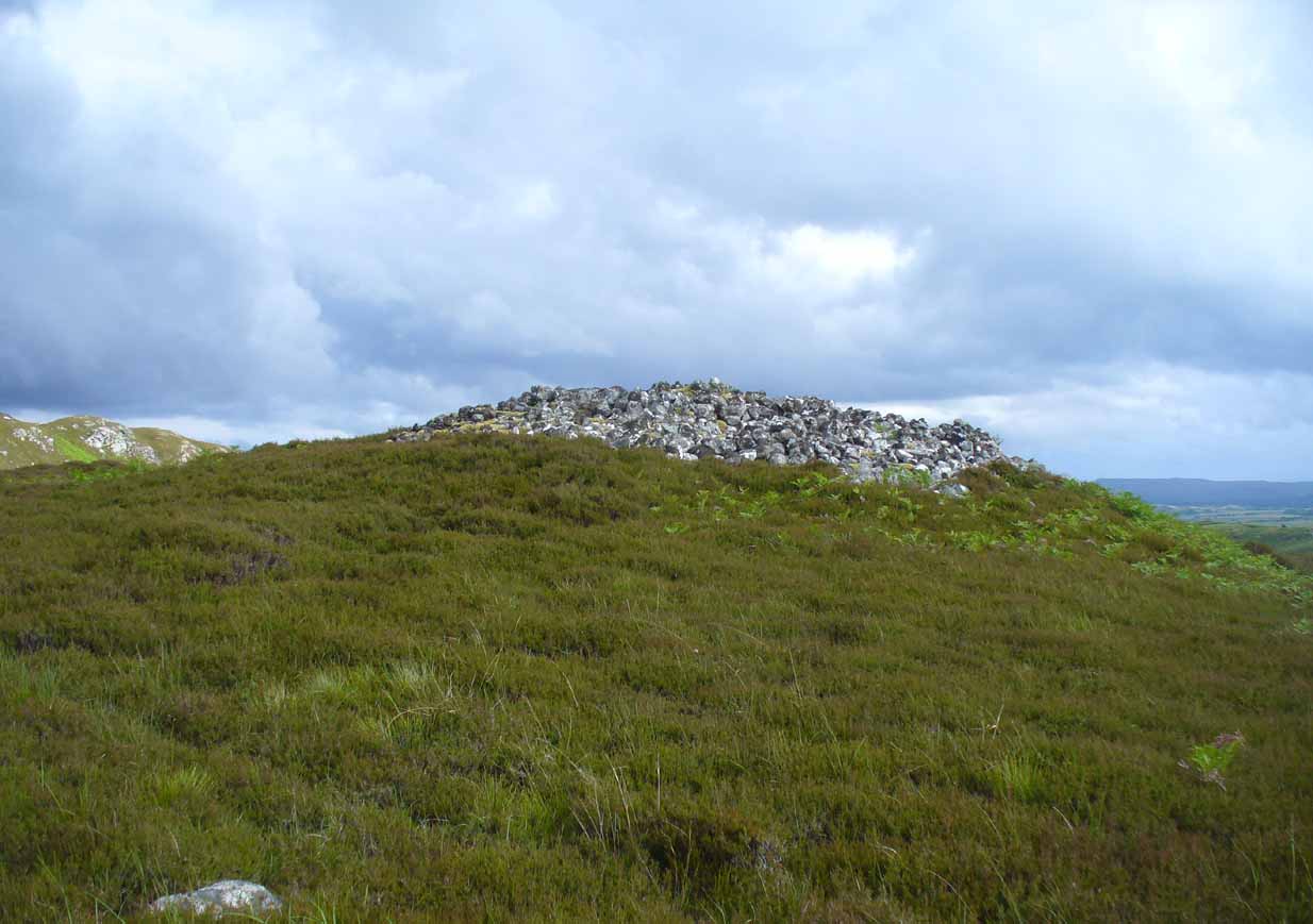
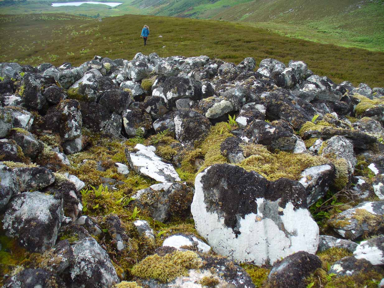
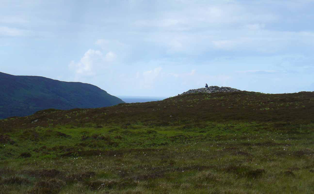
Neolithic in nature, this giant circular cairn, standing on the ridge above the hugely impressive chambered long cairn of Long Skelpick, isn’t quite as grandiose as its neighbour below, but it’s still an impressive feature in this beautiful moorland landscape. Comprised of tens of thousands of small stones raised to a height of 10 feet above the moorland peat, several ‘pits’ have been dug into the top of this undoubted tomb of regal nature; but whether it was originally the burial-place of a single person, to which were later added members of the same family, is simply unknown.
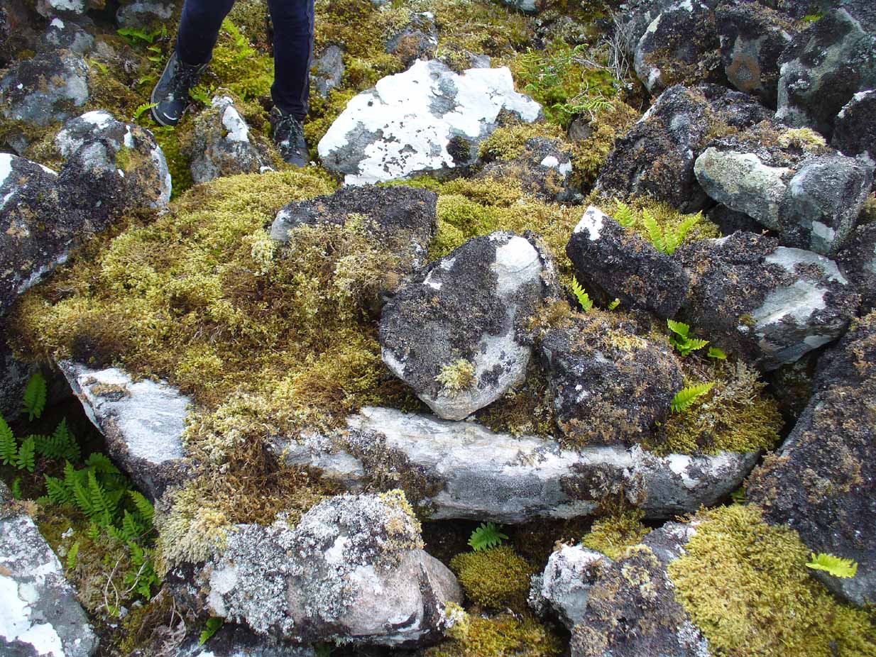
Moss-covered capstoneDepression atop of cairn
On the top of the cairn, at least one of the so-called ‘pits’ that drop into the centre is covered by a large heavy tombstone with a small upright monolith at its side. Although the late great Miss Henshall (2005) thought no ‘chamber’ was here, it is quite possible that a chamber might be found beneath this large moss-covered flat rock (see photo). When we visited here, it looked as if there was a hollow beneath it, but only an excavation would tell us for sure.
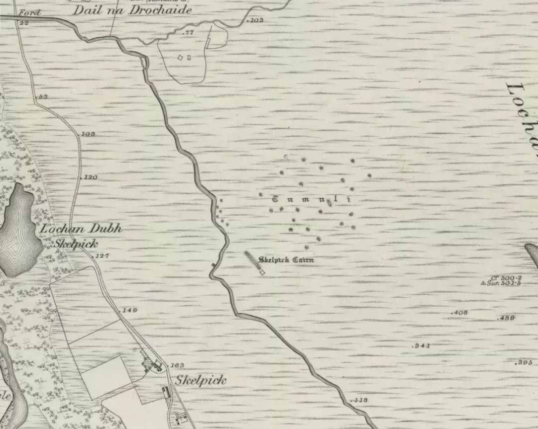
Mass of sites on 1878 map
Highlighted on the earliest Ordnance Survey map, it was shown to be just one cairn amidst the mass of other smaller surrounding tombs—most of which were probably built for people from the same tribal group. None of these small cairns have been excavated, but they were probably built after the construction of the major Queen’s Cairn.
The Royal Commission lads visited the site in 1909, but said very little of the place (probably over-awed by Long Skelpick, Coillie na Borgie and other nearby giants!), merely that this large circular cairn has
“a diameter of about 54′. It is about 8′ high, and though the stones have been pulled about here and there on the top, it does not appear to have been excavated.”
Queen’s Cairn, looking N
And so it remains to this day—although the cairn is slightly larger than the dimensions given by the Commission boys. Beneath the encroaching heather, the cairn is closer to 67 feet (10.23m) across, with a circumference of 210 feet (64.25m).
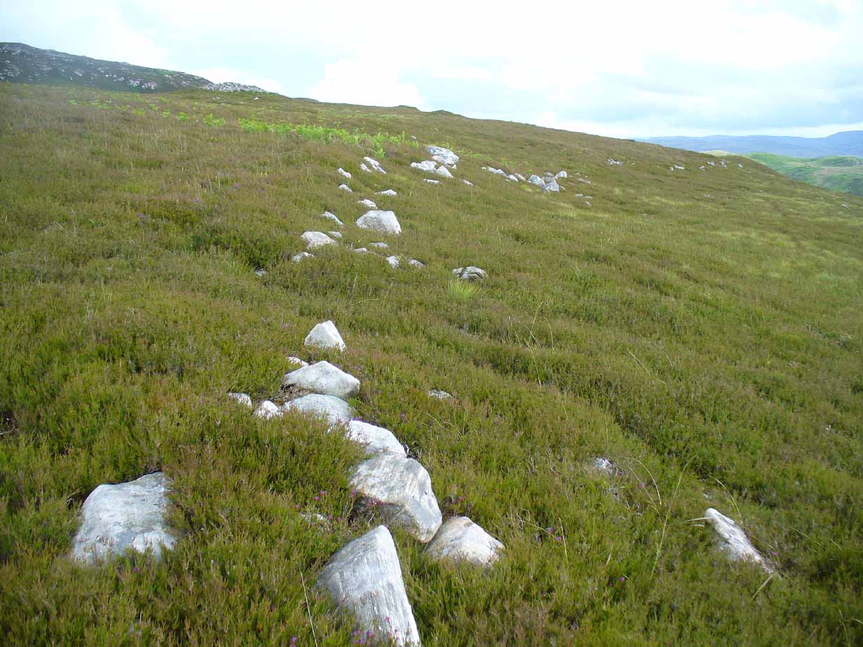
Line of ancient wall nearby
The monument sits on a plateau immediately above the giant Long Skelpick cairn—although neither can be seen from each other. But if you walk only a short distance from the Queen’s Cairn towards the long cairn below, a very notable and extensive line of ancient walling runs along the edge of the geological ridge separating the two tombs, as if deliberately keeping them apart. Other lines of ancient walling run closer to the cairn, seeming to indicate that a settlement of some form was also apparent on this ridge, in close connection with the group of smaller burial cairns.
It’s a gorgeous arena with many prehistoric sites and puzzles to behold, and plenty of unrecorded ones nestling quietly in the heather. It’s bloody superb to be honest!
References:
Gourlay, Robert, Sutherland: An Archaeological Guide, Birlinn: Edinburgh 1996.
Henshall, Audrey S. & Ritchie, J.N.G., The Chambered Cairns of Sutherland, Edinburgh University Press 2005.
Royal Commission Ancient & Historical Monuments, Scotland, Inventory of Monuments and Constructions in the County of Sutherland, HMSO: Edinburgh 1911.
Standing Stone (destroyed): OS Grid Reference – NT 2139 7001
Archaeology & History
Cloven Stone on 1855 map
Highlighted on the earliest OS-map of 1855 and the Knox Map of 1816 in non-antiquated lettering as a ‘Standing Stone’, the Edinburgh historian Stuart Harris (1996) thought it was an authentic site. He was probably right. First named in land rentals in 1631, it was known by local people as the Clovenstone and used to stand in a park of the same name, before quarrying works extended into the area and destroyed it in the 1870s. Mr Harris thought that it may have been a pair of uprights, but the term ‘cloven’ could just as well mean it was a stone that had a split in it.
References:
Harris, Stuart, The Place-Names of Edinburgh, Gordon Wright: Edinburgh 1996.
Take the B822 Fintry to Kippen road and just over 2 miles (3.3km) north of Kippen, take the small country lane on your left. Parking is truly troublesome along here, so: nearly half-a-mile along, a road/track on your right takes you into the huge forestry plantation (or ‘tree farm’ as Nina Harris calls them). Go up here and, when you reach the tree-line, walk along the outer perimeter fence to your left. Keep walking – and walking – through bog and over fence – keeping all along to the outside of the forest for more than a mile. You eventually reach a rise on the Balfron side with huge views to the west – and just here is an opening into the trees on your right where a long ridge of rock is obvious. You’re here!
Archaeology & History
Main feature of the carving
Not far from the recently rediscovered Footsteps Stone (coming soon…), this large cup-and-ring carving was found by Paul Hornby on an antiquarian rock art venture in November 2016 on a journey to the petroglyphs upon Balgair Muir, between Balfron and Fintry. It was a damn good day indeed! We’d been up here the previous week, but then the grey daylight gave little away. Upon revisiting the place on a brighter day, after a short while Paul called us over to where he’d been rummaging and, beneath a mass of fallen tree foliage, the long raised rock gave up some of its ancient symbols once again.
Very faint partial cup&rings?Main feature, looking ENE (photo by Nina Harris)
Along the main face of the stone are a variety of geophysical undulations and small natural hollows—lots of them!—some of which give the impression of being primitive cup-markings, but they’re more the result of erosion. However, amidst these are several very possible cup-markings, and some photo-images show that at least one of them has portions of a distinct faint ring around it, possibly two of them. On the whole however, we’d need a geological specialist to tell us with certainty about the other doubtful ‘cups’ here (TNA neeeeds an in-house crazy geologist into petroglyphs and things!).
Balgair Muir Woods designMain feature, looking west
As the rock face slopes down on its northern edges, away from the many natural pits and nodules, Paul uncovered two large incomplete ‘rings’, each with short outer ‘lines’, distinctly carved. The ‘rings’ are somewhat larger than the average cup-and-ring motifs — but it also appears that at least one of the ‘rings’ may be lacking an internal cup-mark.
Large semi-carved ‘bowl’ (photo by Nina Harris)
On the same piece of rock, several feet to the east and almost covered by an adjacent tree, we also found a large half-natural half-carved ‘bowl’ more than 12 inches (30cm) across with a possible cup-marking near its centre. Whoever carved this section of the petroglyph has definitely utilised the natural features in the rock and, it seems, may never have finished the work.
We need more visits to this area to find what more lies beneath the fallen forest debris.
Acknowledgements: Massive thanks to Paul Hornby for uncovering this carving. Huge thanks also to Nina Harris for her help and some of the photos; and also to Ann Rankin and Mick for all their relative help too. Until next time…