Healing Well (lost): OS Rid Reference – NS 579 884
Archaeology & History
One-and-a-half miles east of Balfron, this curiously-named well could once be seen – and indeed may still be there. Mentioned just once in D.S. Buchanan’s (1903) Guide as a well-known place, I’ve been unable to locate it and can find no other accounts of the place. He wrote:
“A little beyond Dailfoil there is a road to the right, down which, about 200 yards, there is a stile over the fence, only a few feet from the famous Gerchew Well, on the banks of the Endrick. Here the visitor can repose for a time under the shade of the trees, and quench his thirst in its pure, cool, and bubbling waters.”
His directions seem to indicate it as being just off the small road that runs to the ruins of Easter Gerchew, but there is nothing of note hereby. A half-mile away was Wester Gerchew house, which seems contrary to his directions —and there’s nothing in evidence there either. And so I enter it here in the hope that someone might be able to relocate this healing well. (the grid reference is an approximation based on Buchanan’s description)
References:
Buchanan, D.S., Buchanan’s Popular Illustrated Guide to Strathendrick, Aberfoyle and District, J. & C. Buchanan: Balfron 1903.
Go up the B822 road from Fintry for literally 2.5 miles (about 500 yards below the small copse of trees that almost hide Balafark Farm above you) and at a very small ‘parking’ spot are 2 farm-gates. Go through the lower of the two and head downhill, crossing the small burn and up the other side for just over 100 yards where you’ll meet a very low, old and very overgrown wall. Keep your eyes peeled for it! Walk left along this wall, uphill, for another 100 yards till you meet a a dried-up dyke that runs downhill. 10-15 yards down this, a small stone greets you…
Archaeology & History
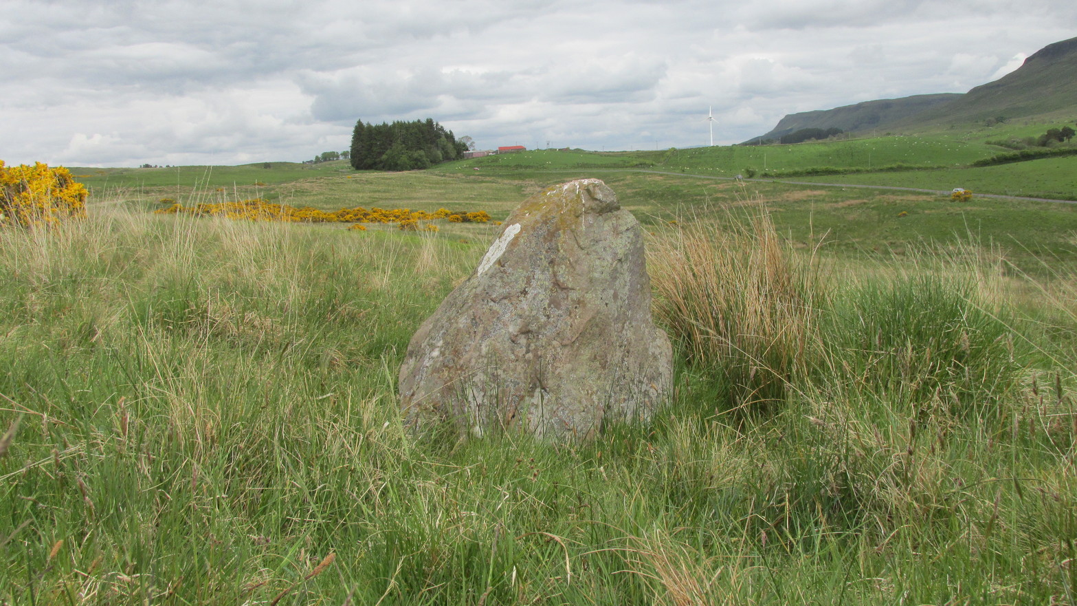
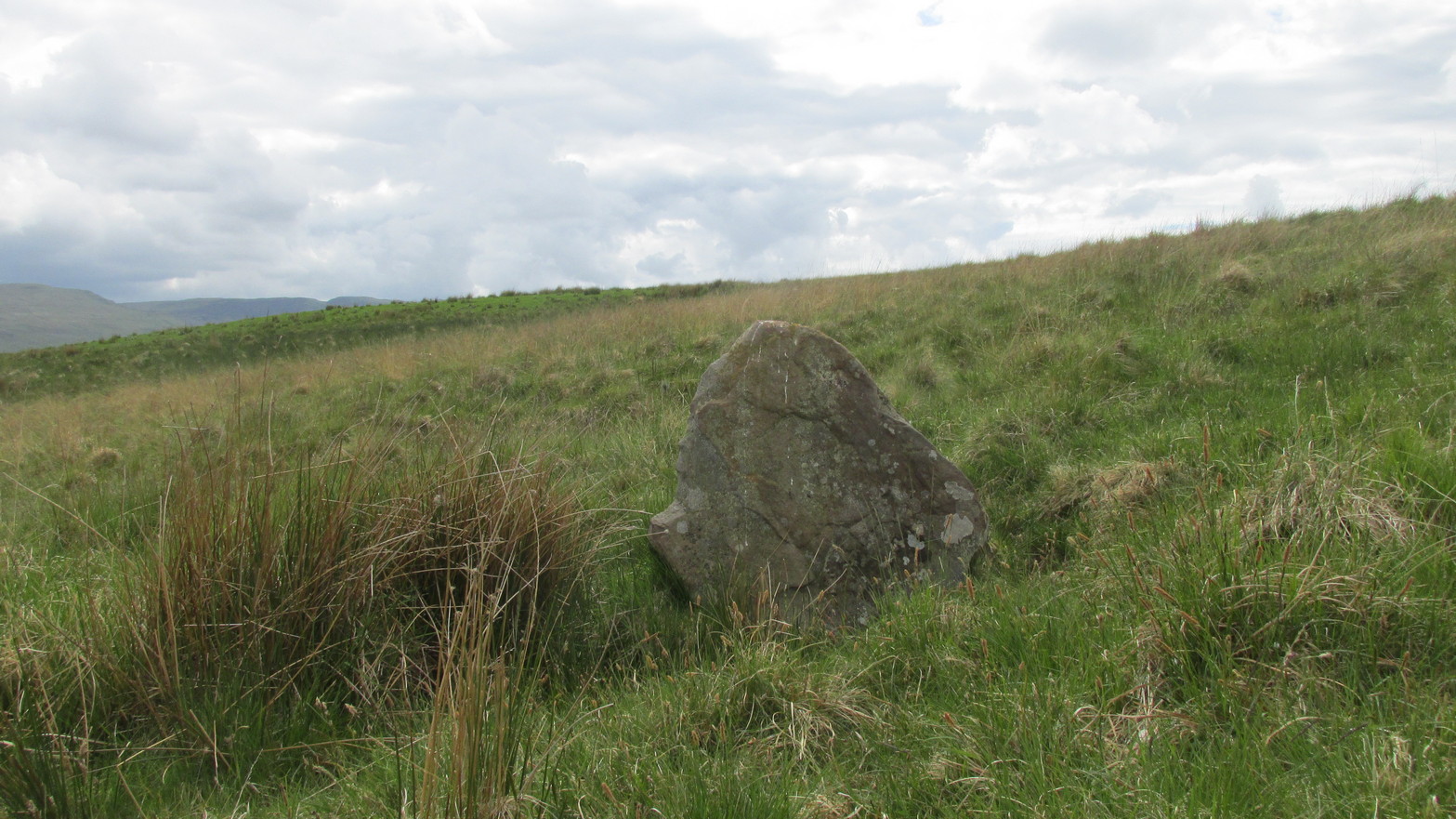
It’s difficult to call this a ‘standing stone’ and, as far as I’m concerned, is even more troublesome to cite it as a legitimate prehistoric monument. Nevertheless it is shown on the modern OS-maps as such and was listed by the Royal Commission (1963:1) lads in their standing stones inventory. But it’s really pushing it to be honest! They told us:
“This stone stands about 180 yds NW of a gate which opens off the Fintry-Kippen road, 340 yds N of its crossing of the Lernock Burn. It is triangular in profile and wedge-shaped in section, measuring 3’3″ both in height and breadth along its base, by 1’7″ in greatest thickness. It may well have been a boundary stone as it is near the corner of some ground which is enclosed by a turf dyke and has been cultivated.”
Looking southwestLooking up to the ancient cairn of Stronend
In truth, if we call this a standing stone, then there are hundreds of others that I’ve come across over the years—frobbling off-path across huge swathes of moorland—that must also be added to our prehistoric inventories, as the height of this isolated rock is echoed in countless others which are off the archaeological listings. One such stone ‘stands’ 100 yards northeast of here—although there are many others with much greater potential. …I think the only thing that may sway this as being a possible prehistoric upright is the fact that the top of the stone appears to have been broken off, albeit a few hundred years ago if the weathering is owt to go by. But a cursory look for any broken top-piece found nothing.
References:
Royal Commission on the Ancient & Historical Monuments Scotland, Stirling – volume 1, HMSO: Edinburgh 1963.
Take the same route as if you’re visiting the small Carlin Stone (a few hundred yards further along): along the B822 road between Kippen and Fintry, stop at Balafark farm and cross the road above the farm to take the track into the forest. 1km along, note the small green track, off the main central track, slightly up on the rise on your right, which bends round and then goes (eventually) to the other side of the forest. Once you reach the gate at its edge, walk left 285 yards (261m) along the fence.
Archaeology & History
The Wife and the Carlin on the 1865 OS-map
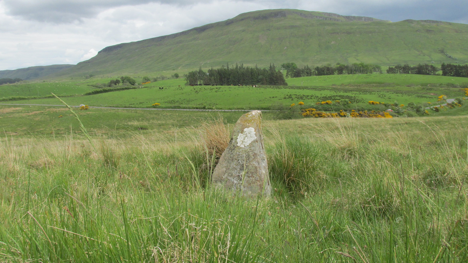
Described in the Ordnance Survey’s (1870) Book of Reference (volume 47) as “a flat rock on the boundary between Perth and Stirling,” the rock is certainly not flat—and any geographical relationship it had with Perth has long since gone. Instead, the stone in question here is an upright one—although it’s not much more than two feet tall. However, on the other side of the present-day fence there is a small flat stone in the ground; but it is the moss-covered upright that is our ‘Wife with the Bratty Plaid.’ A smaller curious-looking quartz-lined stone also lies next to this old Wife…
The Wife, looking east
The Wife, looking west
Marked on the ancient boundary line, this small but sturdy standing stone probably has a prehistoric pedigree, although we cannot be certain without an excavation. It is shown on the earliest OS-maps from the 1860s, but we have no notifications from any literary sources telling the tale behind the stone’s fascinating name: meaning simply, the ‘wife wearing the tartan shawl.’ When Marion Woolley and I came here the other day, we tried to see if a simulacrum of such a figure was hiding in the moss-covered upright—but unlike the notable simulacrum at MacBeth’s Stone, we struggled somewhat here. It was possible, from certain angles (if we didn’t stand on our heads and poke each other in the eyes!) to see this ‘wife in a shawl’, but twas a struggle…
There’s every likelihood that whatever the old tale once was about this petrified ancestral stone, it would have had some mythic relationship with the Old Wife known as the Carlin, or cailleach, a few hundred yards to the west, at the Carlin Stone. As yet however, their histories remain hidden in the sleep of the Earth…
Take the B822 road between Kippen and Fintry, stopping at Balafark farm. On the other side of the road, above the farm, take the track into the forest. Naathen…. 1120 yards (1.02km) along, note the small green track, off the main central track, slightly up on the rise on your right. It bends round and then goes (eventually) straight to the edge of the forest. Once you reach the edge, go left all along the fence until it meets the large gate 800 yards WSW. 20 yards past the gate, a small stone is along the fence-line. This is the Carlin!
Archaeology & History
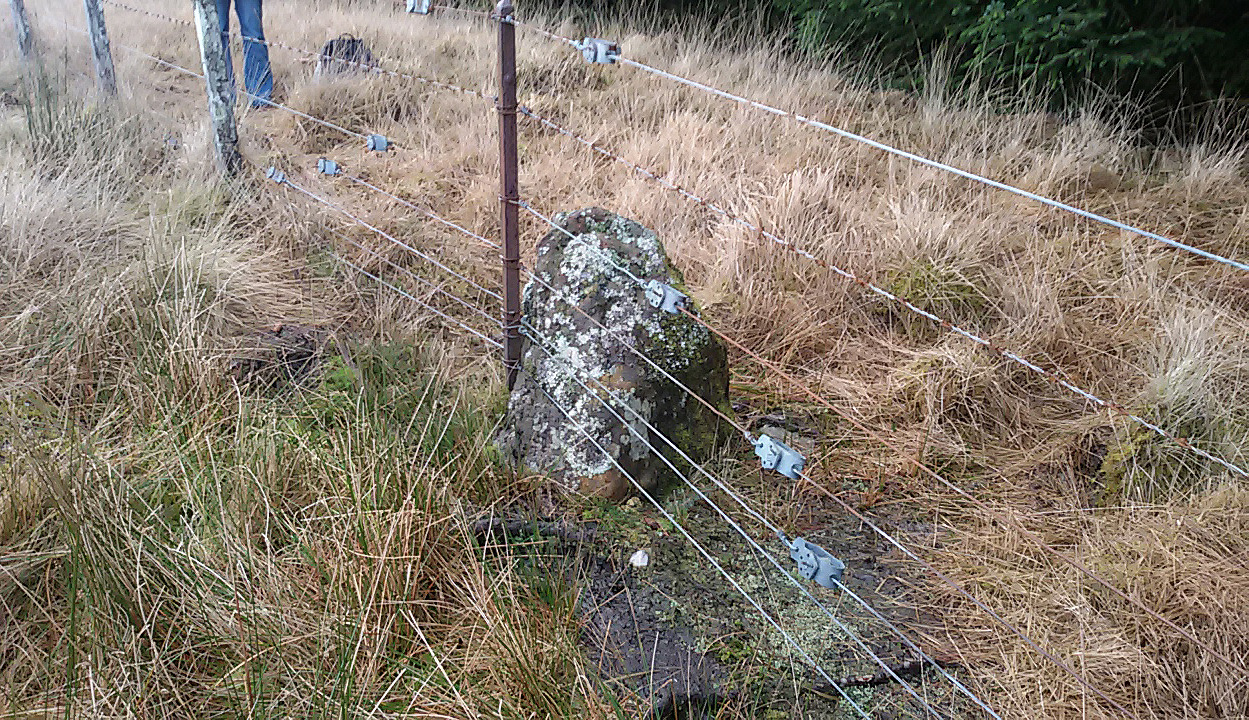
Carling Stone, looking east
Found along the same boundary line as another stone with similar mythic virtues (called the ‘Wife with the Bratty Plaid’), when Marion Grace Woolley and I visited the site earlier, we found only a small upright, barely a foot tall, right in line with the ancient boundary along a newly made fence. Thankfully, whoever built the fence, understood the nature of the stone, and left it in the ground where it belongs. We know not for sure exactly how old this stone might be, but it its name and position suggest very old – probably prehistoric.
The Carlin is another word for the Cailleach: the prima mater or great Earth goddess in Irish, Scottish and northern English animistic traditions. Her virtues are immense, representing the cycles of the natural world, a creation giant, healer and a whole host of other elements inherent to the natural world. Although She tends to be represented as the Winter hag, the Cailleach changes Her faces and attributes as the cloaks of the seasons go by, annually, cyclically, year after year after year. She’s as much the cloak of the Winter as She is the fertility of Spring, the warmth of the Summer and the fruits of Autumn.
Carling Stone, looking west
Whatever traditions there might have been at this small Carlin Stone are now long forgotten it seems. We find no bodach (Her husband) in immediate attendance. However, the existence of the small standing stone called the ‘Wife with the Bratty Plaid,’ several hundred yards to the east along the same ancient boundary line, implies there would have been a traditional perambulation along this boundary, and during such annual ritual walks, tales or words may have been said here. Does anyone know more…?
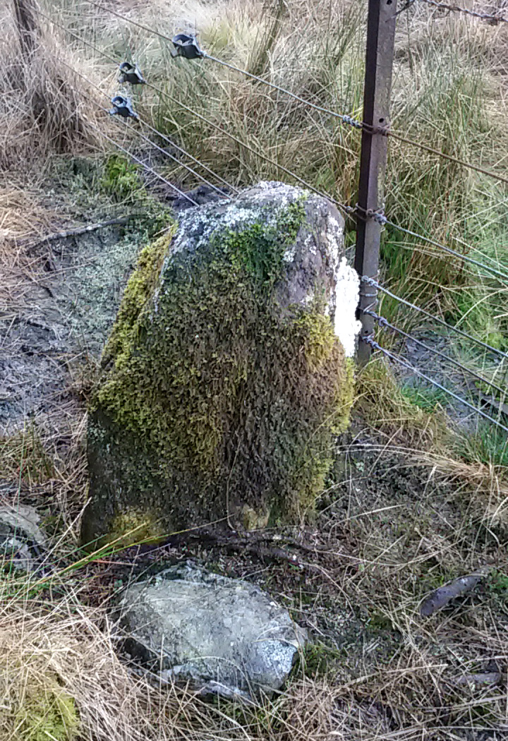
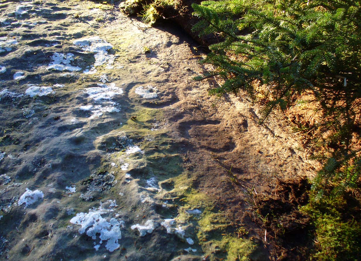
Take the B822 Fintry to Kippen road and just over 2 miles (3.3km) north of Kippen, take the small country lane on your left. Parking is truly troublesome along here, so: nearly half-a-mile along, a road/track on your right takes you into the huge forestry plantation (or ‘tree farm’ as Nina Harris calls them). Go up here and, when you reach the tree-line, walk along the outer perimeter fence to your left. Keep walking – and walking – through bog and over fence – keeping all along to the outside of the forest for more than a mile. You eventually reach a rise on the Balfron side with huge views to the west – and just here is an opening into the trees on your right where a long ridge of rock is obvious. You’re here!
Archaeology & History
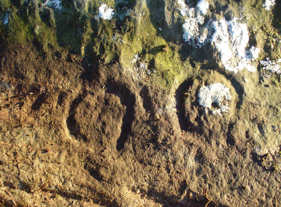
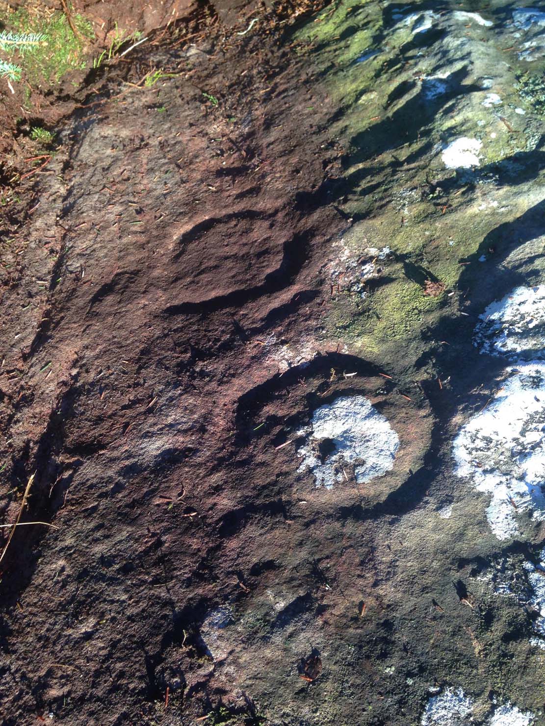
Main feature of the carving
Not far from the recently rediscovered Footsteps Stone (coming soon…), this large cup-and-ring carving was found by Paul Hornby on an antiquarian rock art venture in November 2016 on a journey to the petroglyphs upon Balgair Muir, between Balfron and Fintry. It was a damn good day indeed! We’d been up here the previous week, but then the grey daylight gave little away. Upon revisiting the place on a brighter day, after a short while Paul called us over to where he’d been rummaging and, beneath a mass of fallen tree foliage, the long raised rock gave up some of its ancient symbols once again.
Very faint partial cup&rings?Main feature, looking ENE (photo by Nina Harris)
Along the main face of the stone are a variety of geophysical undulations and small natural hollows—lots of them!—some of which give the impression of being primitive cup-markings, but they’re more the result of erosion. However, amidst these are several very possible cup-markings, and some photo-images show that at least one of them has portions of a distinct faint ring around it, possibly two of them. On the whole however, we’d need a geological specialist to tell us with certainty about the other doubtful ‘cups’ here (TNA neeeeds an in-house crazy geologist into petroglyphs and things!).
Balgair Muir Woods designMain feature, looking west
As the rock face slopes down on its northern edges, away from the many natural pits and nodules, Paul uncovered two large incomplete ‘rings’, each with short outer ‘lines’, distinctly carved. The ‘rings’ are somewhat larger than the average cup-and-ring motifs — but it also appears that at least one of the ‘rings’ may be lacking an internal cup-mark.
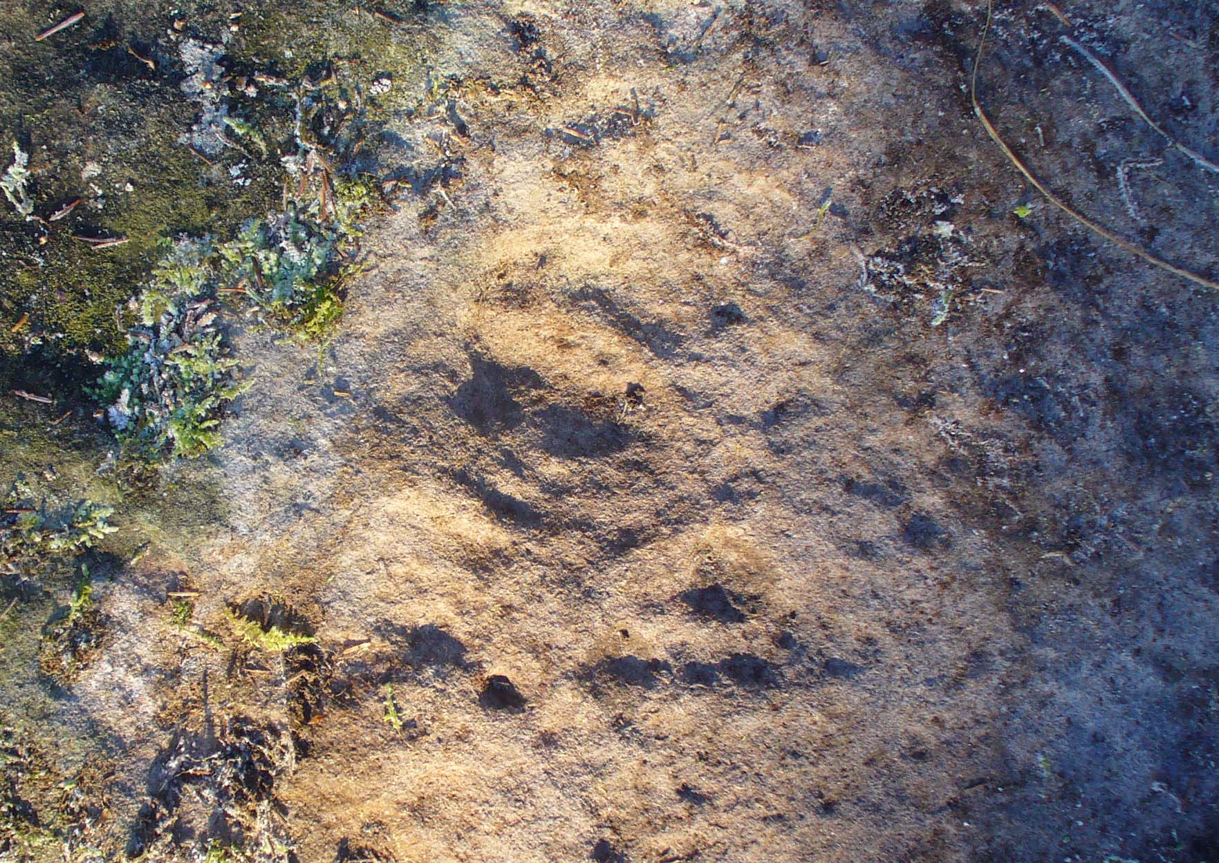
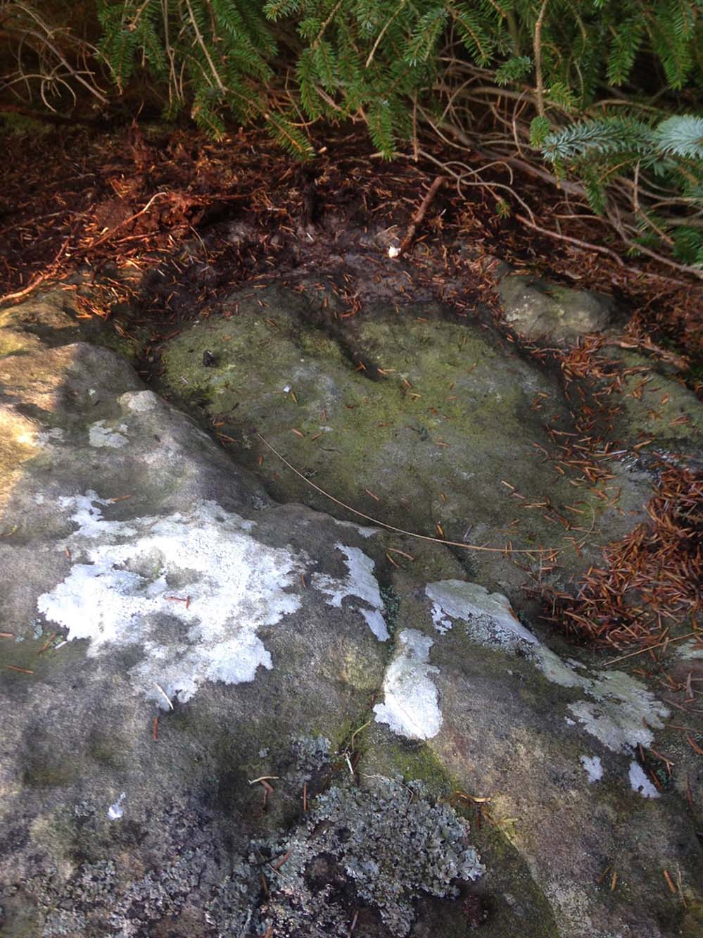
Large semi-carved ‘bowl’ (photo by Nina Harris)
On the same piece of rock, several feet to the east and almost covered by an adjacent tree, we also found a large half-natural half-carved ‘bowl’ more than 12 inches (30cm) across with a possible cup-marking near its centre. Whoever carved this section of the petroglyph has definitely utilised the natural features in the rock and, it seems, may never have finished the work.
We need more visits to this area to find what more lies beneath the fallen forest debris.
Acknowledgements: Massive thanks to Paul Hornby for uncovering this carving. Huge thanks also to Nina Harris for her help and some of the photos; and also to Ann Rankin and Mick for all their relative help too. Until next time…
 His directions seem to indicate it as being just off the small road that runs to the ruins of Easter Gerchew, but there is nothing of note hereby. A half-mile away was Wester Gerchew house, which seems contrary to his directions —and there’s nothing in evidence there either. And so I enter it here in the hope that someone might be able to relocate this healing well. (the grid reference is an approximation based on Buchanan’s description)