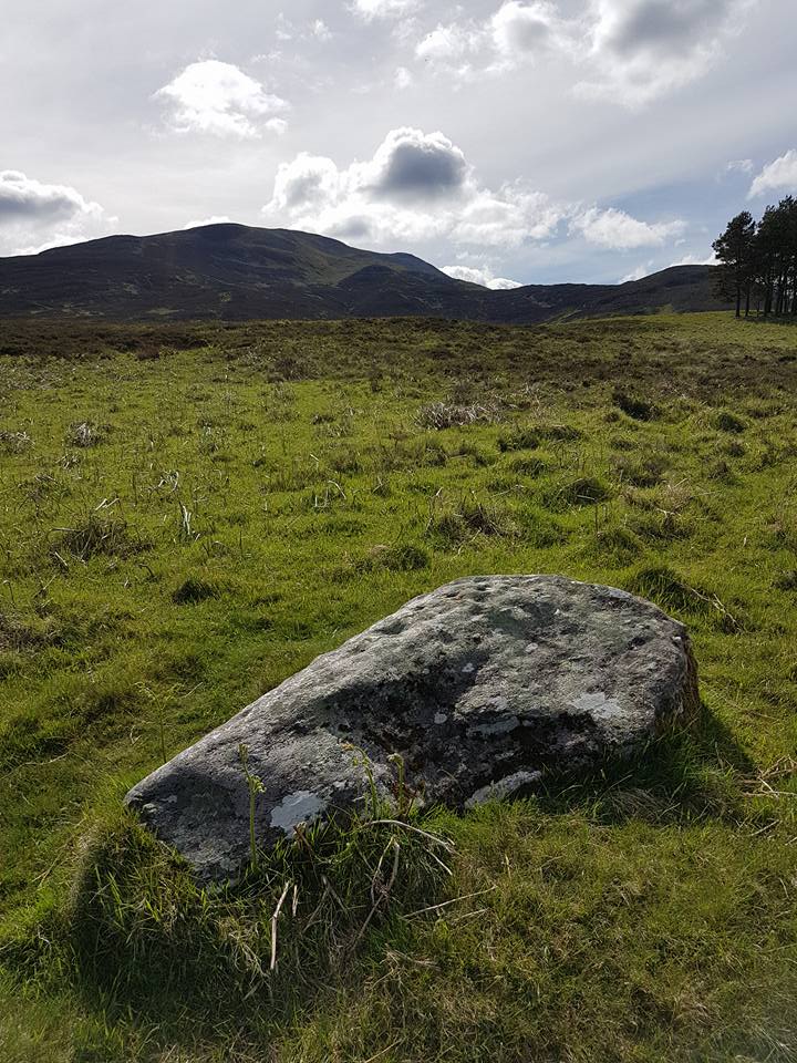
If you take the path up to Schiehallion (the great hill of the faeries) from the car park near the Braes of Foss, just a hundred yards or so past the first set of trees onto the moorland, keep your eyes peeled for the long stone on your right, a few yards off the path. Upon its upper elongated surface you’ll notice a series of cup-markings etched onto it, oh so long ago now…
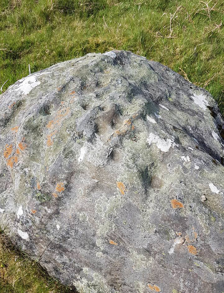
Close-up of cups (photo by Michelle Allan)
Located below the legendary Schiehallion, or Mountain of the Faeries, this carving is best visited over the winter and spring months (before the bracken encroaches). On its upper surface there are about 25 cup-marks, many of them pecked to about an inch deep, with one of them being more than 6 inches across and 2 inches deep. Weathering over the ages has effected them. It seems to have been rediscovered in the early 1970s and is, officially speaking, an isolated carving; this is most unlikely—and needs the keen eyes of fellow antiquarians to find others in this beautiful neighbourhood.
Acknowledgements: Massive thanks to Michelle Allan for allowing us to use her photos of the Leachd Nam Braoileag carving in this site profile.
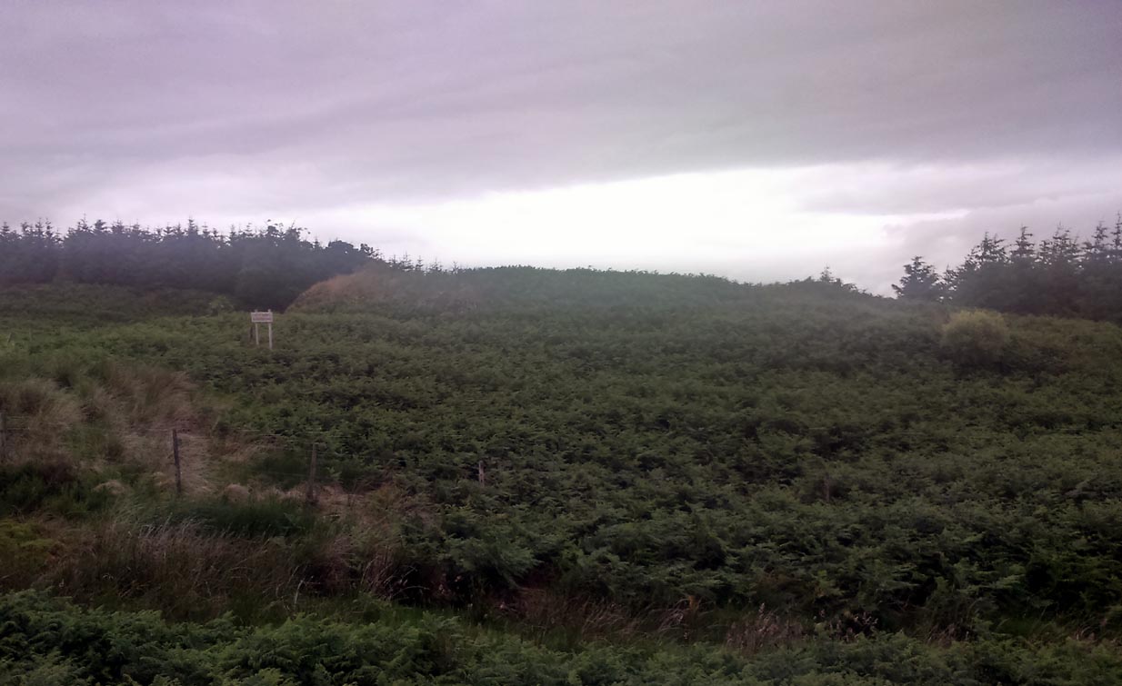
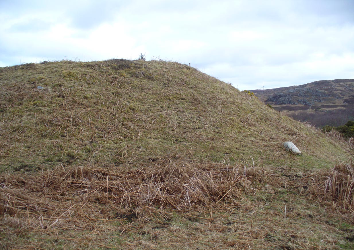
Take the Gateside Road from St Ninians or Polmaise Road out of Torbrex across the M9, heading out west onto the southern moors of Touch Hills, passing the Wallstale dun in the trees and then the Castlehill dun just off the road. Keep going uphill for just over half-a-mile, keeping your eyes peeled on the right for where the MOD lads play some of their war-games. Walk along the track here, following the line of the woods, until it gets to the spot where it doubles back on itself. Just here, about 30 yards in front of you, a rounded walled knoll gives the game away!
Archaeology & History
Artists impression of the reconstructed site (PSAS 1959)
An impressive-looking site, not too far off the moorland road, it is one of more than half a dozen hillforts and duns found to the west of Stirling, all of them relatively close to each other—showing that a lot of human activity was going on here in the Iron Age and, probably, much earlier. Looking like a cross between a broch and a traditional hillfort, the site is best visited in the Winter and Spring months before the bracken starts to encroach and cover it.
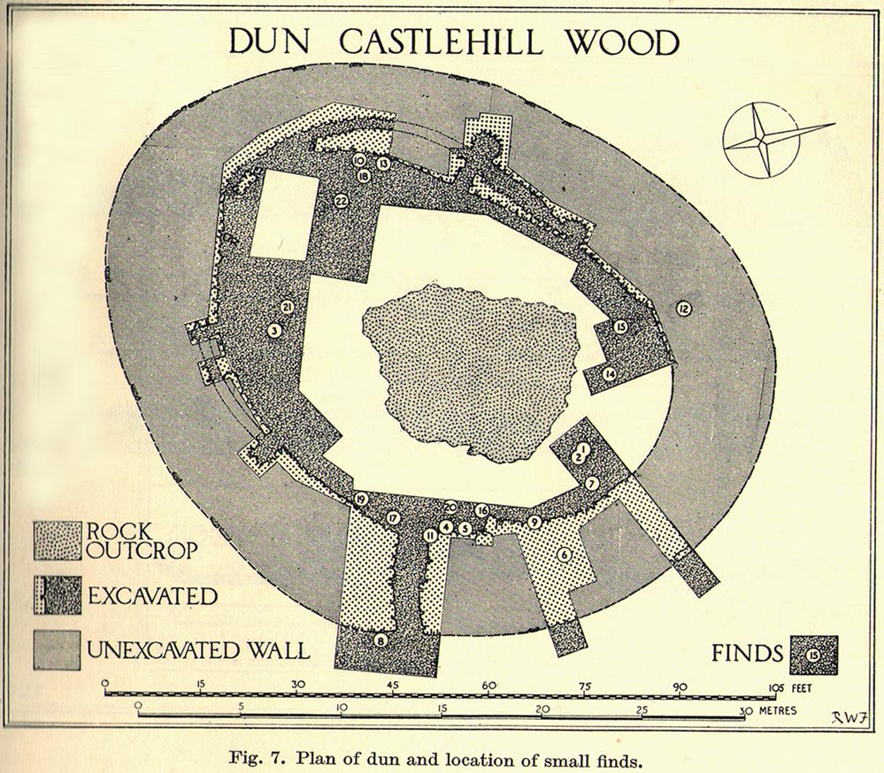
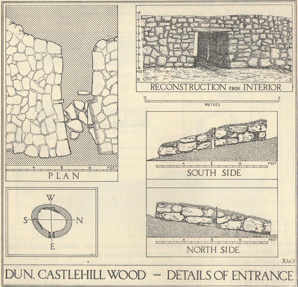
Officially rediscovered in 1952 and excavated three years later, it was thought to have been built in the 1st century AD and used for a few hundred years thereafter. As you walk up to the eastern edge of the monument, a large entrance, 4½ feet wide, allows you into the large open space within. From here, and walking around both the inner and outer walls, you get an idea of the huge amount of work it must have taken to build this structure. The walls alone which constitute the main of Castlewood Dun are, on average, 16 feet thick! The Royal Commission report for the area (summarizing the archaeological work of F.W. Feacham in the ’50s) gives the basic architectural features of the place:
“The dun is oval in plan…and measures 75ft from NE to SW, transversely within a drystone wall 16ft thick. The faces of the wall are composed of large, angular blocks, and the core of boulders, small rubble and earth. The entrance in the E arc, is provided with door-checks. Within these, the passage measures 4ft 6in in width, and outside them 3ft 9in. A few paving-stones were laid to level the rough rock surface of the passage-floor. Traces of what might have been the bottom step of a stair, rising up the inner face of the wall, were found at a point 8ft N of the entrance. The dun had no mural stair or galleries, but two sets of mural chambers were located, one in the W and the other in the S acr of the wall. The former consisted of an entrance-passage, 6ft in length, which varied in width from 2ft at the outer to 3ft at the inner end, where it opened into a circular chamber 4ft in diameter. From either side of the passage a narrow duct or flue, about 19ft in length and 1ft 6in in width, led off obliquely through the core of the wall to debouch into the interior of the dun. The construction in the S arc consisted of a similar passage, one flue and a smaller chamber. Ash and a clinker of very light weight were found in the form of deposits in both passages and all the flues. …The excavator suggested they might have been corn-drying installations.”
Groundplan of site (PSAS 1959)Entrance details (PSAS 1959)
Apart from a small piece of Roman glass, quern fragments, anvils stones and a pot lid, the excavators found very little inside the dun—not even any hearths. The walling on the southwest and western edges was built onto a small cliff, making access slightly difficult from that side.
From the site itself, views are excellent, particularly in an arc through the north, east and southeast, with the western skylines being only a short distance away. This enabled relatively easy tribal communication with people at the other brochs, duns and forts in the area, across an otherwise large but difficult landscape in prehistoric times. A few hundred yards to the northeast, on the other side of the recently planted tree-farm (forestry plantation), a large D-shaped structure—possibly Iron Age, possibly medieval— is accompanied by lines of ancient walling running down the slopes.
Somewhere in the woodland park, before the area was “ruined”, as Moray Mackay (1984) put it, by “sand and gravel workings”, and within 100 yards of the re-positioned Trysting Stone, there once remained the ruins of ancient tombs—probably neolithic or Bronze Age in nature. The ‘cists’ as they’re known (stone-lined graves), were described in several short articles at the beginning of the 20th century, shortly after their rediscovery. Drawing upon the initial article by Joseph Anderson (1902) in the Scottish Antiquaries journal, W.B. Cook (1904) wrote:
“The doubling of the (railway) line from Dunblane to Callander has necessitated the altering of a road at the Crofts, Doune, and on Tuesday, 8 May, while digging, the navvies came across two stone cists containing bones. The cists were made of stone slabs. On Thursday, the men came on another cist about five feet from the surface. It was 3 feet long and 2½ feet broad, composed of round stones, and a quantity of bones were found in it, and also an urn. Unfortunately a cart-wheel passed over the urn, smashing it. The pieces were, however, carefully collected and cemented and they are now in the possession of Mr Smith, Clerk of Works to the Caledonian Railway Company, Doune. One of the cists first found was quite empty, but the other contained a large number of human bones, the largest about 1½ inches long. The coffins were about 15 inches from the surface, and lay from east to west. They measured 2 feet 9 inches in length, and in breadth and depth about 18 inches. They are constructed of local stone, and near the spot there has been a dyke running from the burgh to the sand holes, as the foundation was visible when the soil was being removed. Some of the stones indicate that a house might have stood near the spot, but there had been no public burying-place nearer than at Kilmadock and at the little chapel of Inverardoch previous to 1784.”
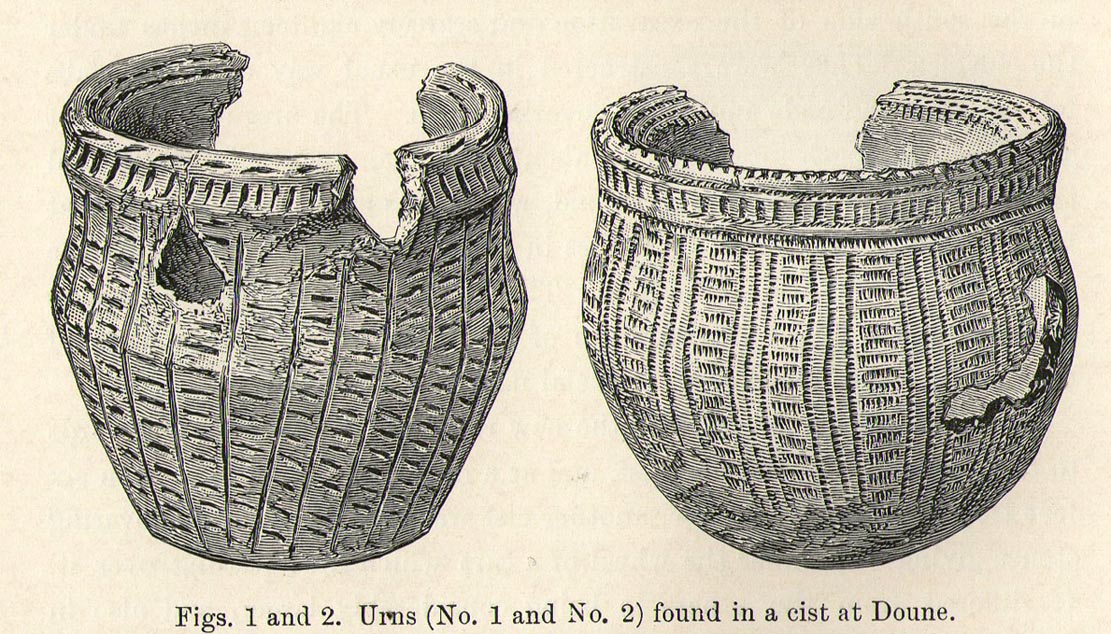
In Mr Joseph’s (1902) article, he told us there wasn’t one, but two urns which, after some considerable effort, were reconstructed. I’m not a great lover of urns misself, although when found in conjunction with the dead, we must ask, what was in them (if anything) when they were placed with the deceased? Food? Herbal beverages? Shamanic potions? In this case, we don’t know; and so all we are left with is Mr Anderson’s description of them:
“Urn No.1 is of the usual type of the so-called ‘food-vessel’, 4¾ inches in height by 5 inches in diameter at the mouth, the lip slightly bevelled inward, and the whole exterior surface ornamented. The ornamentation consists entirely of lines impressed into the soft clay with what seems to have been the roughly broken end of a small twig about ⅛-inch in diameter. On the level of the lip there are two parallel lines of short scorings going completely round the upper surface. On the exterior surface there is a kind of slightly concave collar half an inch in width immediately under the brim, which is ornamented with short perpendicular indentations about a quarter of an inch apart. Underneath the collar the vessel expands slightly to the shoulder and then contracts to a flattened base of three inches in diameter. The part above the shoulder is slightly concave externally, but the scheme of decoration above and below the shoulder is the same, consisting of a series of short impressed lines scarcely half an inch in length ranged round the circumference in horizontal rows about a quarter of an inch apart, and crossed perpendicularly by lines about half an inch apart, not impressed, but scored into the clay. The perpendicular lines above the shoulder are more divergent than those below the shoulder, which converge towards the bottom in consequence of the tapering form of the lower part of the vessel. The paste is coarse, and mixed with small stones; the wall of the vessel is about a quarter of an inch thick, and the colour a reddish brown on both the exterior and interior surfaces, but quite black in the fractures exposing a section of its thickness.
“Urn No.2 is of the same wide-mouthed, thick-lipped form of the so-called food vessel type, 5 inches high and 5½- inches in diameter at the mouth. The lip is bevelled inwards, and the general shape of the vessel somewhat resembles that of No. 1, except in the lower part, which, instead of tapering to a flat bottom, narrows from the shoulder in a much more gradual curvature to the bottom. The ornamentation also is much more elaborate, though partaking of the same general character, inasmuch as it is a scheme of impressed markings, in bands arranged alternately in vertical and horizontal directions and covering the whole exterior surface of the vessel. On the bevel of the rim is a horizontal band of three lines of impressed markings, surmounted on the upper verge of the rim by a row of shallow oval impressions less than ⅛ of an inch apart. Under this there is a horizontal band of impressed markings as with the teeth of a comb, and below that the general scheme of ornament is carried out in alternate bands of about half an inch in width, running vertically from collar to base. The one set of these bands consists of three parallel rows of impressions of about ⅛ of an inch in width, and ⅛ of an inch apart, which seem to have been produced in the surface of the soft clay by a comb-like instrument, while the other set of bands has been produced by marking the spaces between the triple bands in the same way with a similar instrument, but placing the lines horizontally and closer together.”
A short distance from here, more cists were found. It’s possible that a prehistoric graveyard this way lay, countless centuries ago…
Folklore
Moray Mackay (1984) reports that the Doune fairs used to be held here.
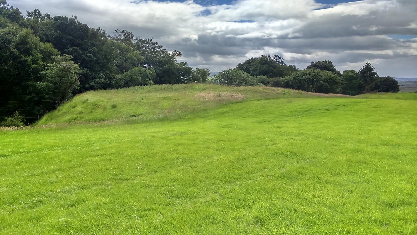
Take the A873 from Thornhill to Aberfoyle, and literally 1 mile west of Thornhill turn right up the track up and past Easter Borland farm (as if you’re heading up to Auchensalt). 250 yards past the farm, a large field opens up. Walk 100 yards east along the side of the wall towards the trees and follow the tree-line upstream 250 yards (don’t go into the lovely little glen) until, on your right, you’ll see a reasonably large area of grassland that rises up, with a steep-ish slope down to the burn below. This is the remains of the broch.
Archaeology & History
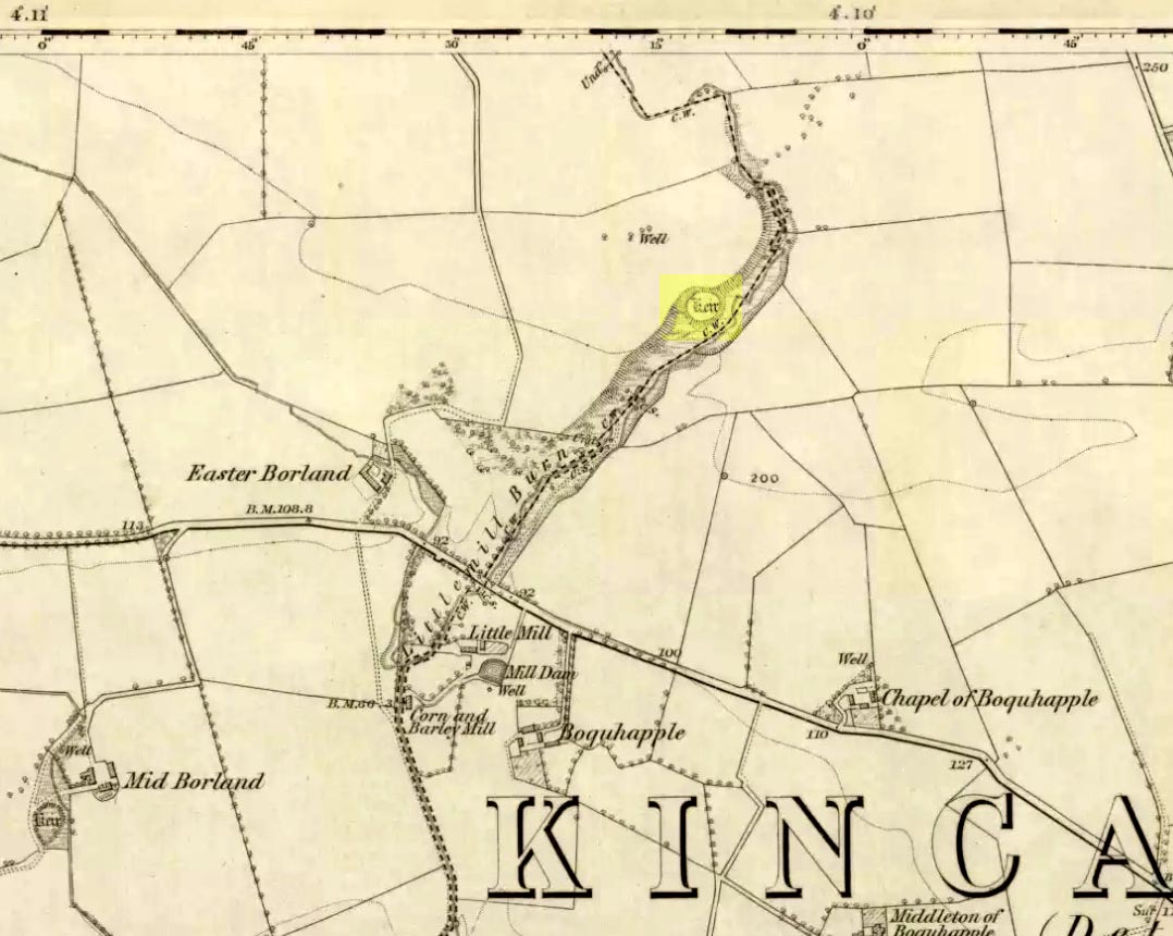
Shown as a ‘Keir’ on the 1866 OS-map, this is an old Scottish dialect word, barely used at all nowadays (folk need to start using it again!) which meant “an ancient fortification” or “rude forts”. The word is mentioned in early Statistical Accounts in 1795 and in the Second Account of 1845 the “Kiers at Auchinsalt” are mentioned specifically, albeit in passing….
Auchinsalt ‘Keir’ on 1866 map
When we visited the site yesterday, very little could be seen due mainly to the summer vegetation covering the area. A very small section of open walling was noted on its western side, and beneath the undergrowth a roughly oval structure was in evidence on the rise between the edge of the field and the drop into the small glen below. Something obviously man-made lies beneath the grasses, but in the last 100 years or so there has been debate as to whether it was a fort, a dun or a broch. The consensus at the mo, tells Euan Mackie (2007), is that it’s a broch!
Auchinsalt broch, looking east
Measuring some 25 yards across, the walling that makes up the broch was between 4-6 feet wide all round, and about 2 feet high. There seemed to be aggregates of large scattered stones inside and outside the main oval feature. If there was an entrance, it seemed to be at the western side, but I wasn’t sure about this. In truth, unless you’re a hardcore broch fanatic, you’d be truly disappointed with the dilapidated state of this monument. Much better ones can be seen just a few miles away…
References:
Chrystal, William, The Kingdom of Kippen, Munro & Jamieson: Stirling 1903.
Grant, William (ed.), The Scottish National Dictionary – volume 5, SNDA: Edinburgh 1960.
MacKie, Euan W., The Roundhouses, Brochs and Wheelhouses of Atlantic Scotland c.700 BC-AD 500, BAR: Oxford 2007.
Standing Stone (destroyed): OS Grid Reference – NT 2421 7317
Archaeology & History
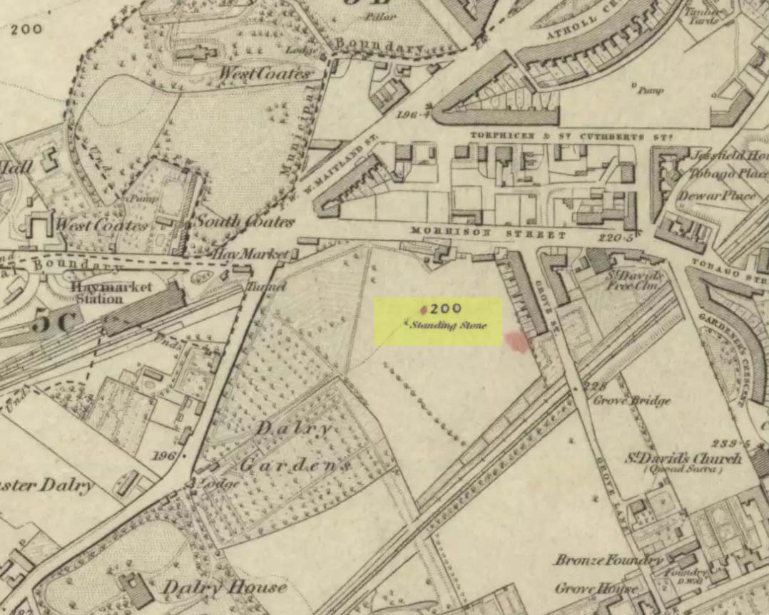
Standing Stone of Dalry, 1853
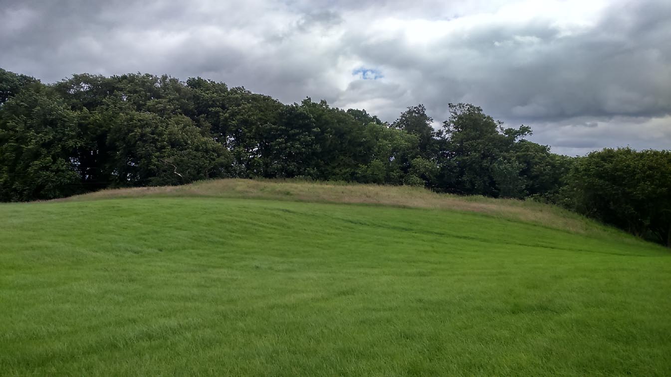
Not far from Edinburgh city centre, heading out towards Haymarket just off Morrison Street where the large car-park is, once stood a possible prehistoric standing stone. Not that long ago either… It was highlighted on the OS-map of 1853, but had been destroyed by the end of the 19th century when the Industrialists cut railway lines across its ground. The stone was shown in non-antiquated lettering, indicating there was no tradition of its prehistory. It may have been part of a folly, but I can find no account to indicate this. Do any Edinburgh historians or researchers know anything more about it? Help!
A fascinating site that was described in Johnston & Tullis (2003) local history work on the parish of Muckhart. Amidst an area bedevilled with faerie, boggarts, ghosts and historical shamanic moot sites we find more curious folklore pointing at a long forgotten site, whose age and precise nature remains a mystery. Adjacent to the old boundary line, close to the meeting of streams, the Muckhart authors told that,
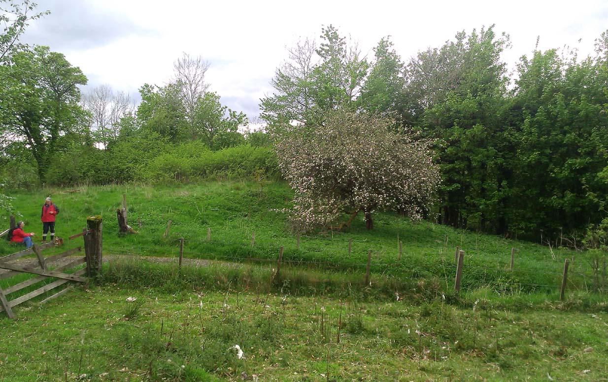
“an orchard above the old farmhouse to this day remains mainly untouched. It was the burial site of warlocks from the parish and it is thought some may have even been burned at the Mill. It has always been said that this ground should never be touched! There is an ancient rubble bridge over the Hole Burn which has a Masonic Eye painted on it to ward off any unwelcome spirits. Despite the eye, both the Farmhouse and the Millhouse have been home to many strange and ghostly manifestations.”
The folklore sounds to be a mix of archaic and medieval animistic traits: perhaps of a prehistoric cairn, visited and maintained by local people (as found throughout Britain) until the Burning Times, when christian fanatics arrived, debasing the cultural rites and murdering local innocent people. …Perhaps not.
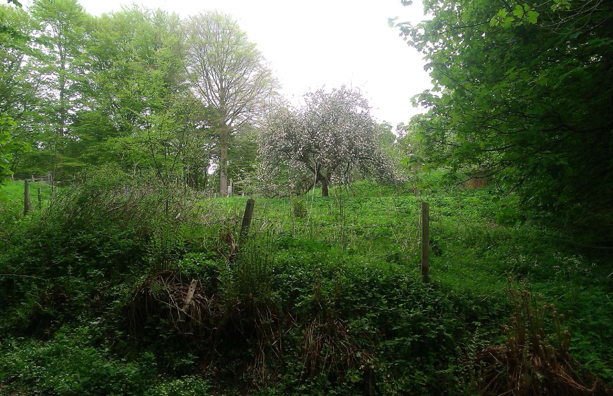
Looking down on the orchard
When Paul, Maggie and I explored the area a few days ago, we were greeted most cordially by the owner of Muckhart Mill, who knew of the folklore, but didn’t know the exact whereabout of the grave. We couldn’t find any clues as to its exact location either. Apart, perhaps, from the top of the hill immediately above the orchard where, alone and fenced off with an old covered (unnamed) well, a solitary Hawthorn tree stood. We each recalled the aged relationship that Hawthorn has in witch-lore… but that’s as far as it went. The grave remains hidden and may have been destroyed. If anyone discovers its whereabouts, please let us know so that a preservation order can be made to ensure its survival.
References:
Johnston, Tom & Tullis, Ramsay (eds.), Muckhart, Clackmannanshire: An Illustrated History of the Parish, MGAS 2003.
Very difficult to find under the herbage, but – along the A836 road between Tongue and Bettyhill, turn down at Borgie Bridge towards Skerray. A few hundred yards along, past the third house on y’ right, a path through the gate on the left takes you up the slope. Once you meet the deep-cut dike, follow it north-ish for 200 yards, over the fence; then walk 150 yards towards the eastern edges where the mass of gorse meets with the rocky escarpment. You’re damn close!
Archaeology & History
These days, much of the remains of this neolithic chambered cairn are inaccessible, as it is covered with the spindly-killer-bushes that are the yellow gorse (Ulex eurapæus). A pity. …Just like its fellow chambered tomb of Dun Riaskidh precisely 1½ miles NW, this was also built upon the edge of a natural rocky escarpment with some of the rocks making up the tomb falling to the edges (I nearly fell in and spined misself meandering around its edges!).
Little has been written about it in archaeo-tomes, despite it being first listed in 1947. Presumably neolithic in age, it was first classed as a ’round cairn’ and has subsequently been described by Canmore as,
“a severely robbed, chambered cairn. It is about 15.0m in diameter, with a maximum height of 0.6m in the centre; elsewhere the cairn is reduced to a stony rim and scattered stones. In the centre a chamber is indicated by two opposing earthfast boulders 1.1m apart and protruding up to 0.6m through the cairn material.”
References:
Gourley, Robert, Sutherland: An Archaeological Guide, Birlinn: Edinburgh 1996.
Acknowledgments: Huge thanks to Donna Murray, for putting me up in this part of Paradise. Cheers Donna.
From Blubberhouses church by the crossroads, walk up the slope (south) as if you’re going to Askwith, for 100 yards or so, taking the track and footpath past the Manor House and onto the moor. Once you hit the moorland proper, take the footpath that bears left going down into heather and keep going till you hit the dead straight Roman Road path running west onto Blubberhouses Moor. Carry along the Roman Road for about 200 yards as though you are going towards the Eagle Stone, and looking right (if you squint) you can just make out a small pimple on the top of the moors about a quarter of a mile away. That is where you are heading (be warned – it is boggy getting there).
Archaeology and History
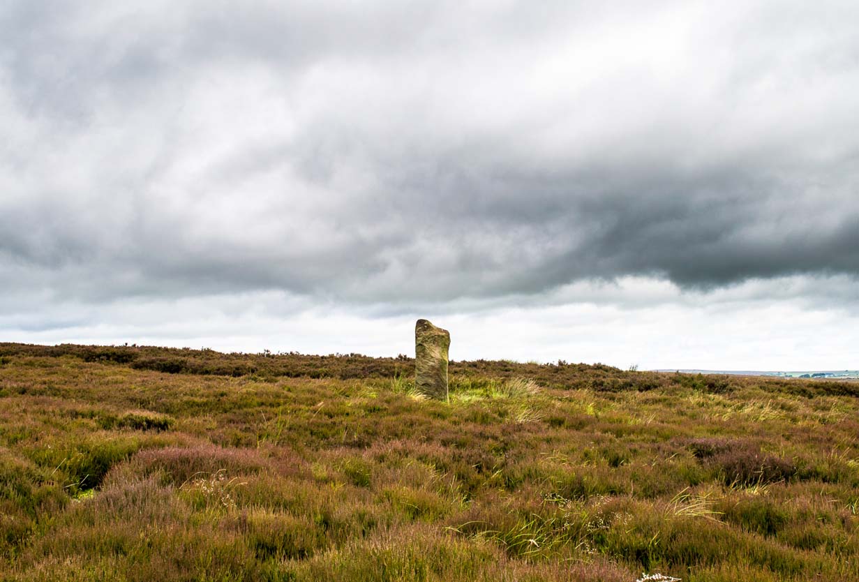
James Stone, looking NE
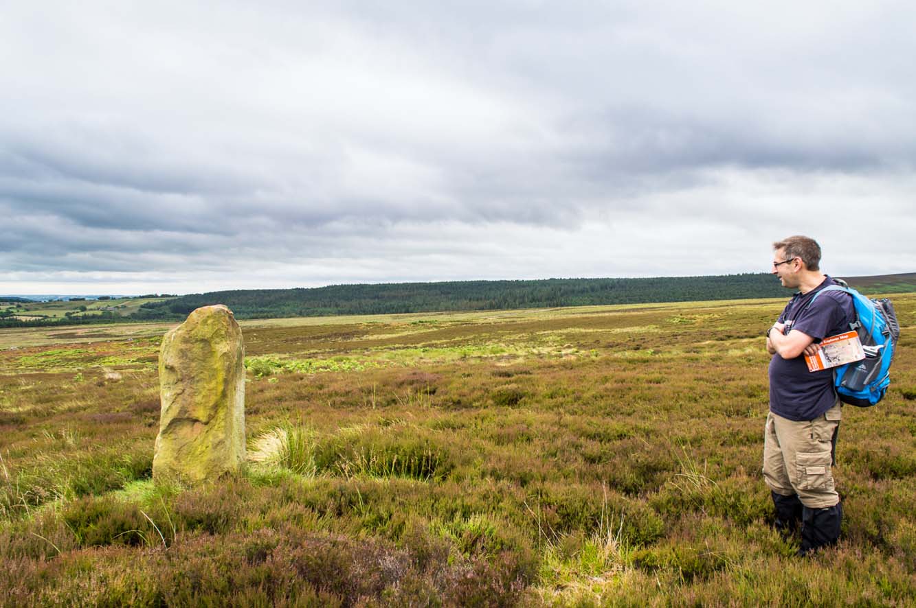
Discovered (or rather ‘noticed’) by James Turner and James Elkington in July 2016 (hence the name James Stone), this standing stone is of an indeterminable age – although it does look ancient. Standing more than 5 feet tall, and in the middle of nowhere, it is fairly difficult to get to unless you want to get wet feet. It is situated very close to a small and unexcavated prehistoric settlement and we could find no physical evidence of any tracks nearby (although Google Earth does show what looks like one or two very short, faint tracks near the stone, which is the old ‘Benty Gate’ track).
It could be a boundary stone, although doubtful – it has a feel to it that says it is prehistoric, although this is just guesswork on our part. I can find no reference to it in Cowlings Rombalds Way (1946) and there seems nothing about it in either of William Grainge’s (1871; 1895) detailed history works of the region.
Mr Turner gazing at the stone
At first we thought it unlikely to be a new find, however the stone is difficult to see from the Roman Road (I had been up here dozens of times before I noticed it) and seeing that people rarely go up here anyway, and it is relatively difficult terrain getting to it, it is not surprising that no one has bothered visiting it. It would take someone who is quite keen on megaliths to want to examine it and it is well off any tracks.
Having said that, it is a nice find and it could be linked in some way with the small unexcavated settlement nearby, or possibly the large Green Plain settlement nearly a mile away. Well worth a visit…bring your wellies!
References:
Cowling, Eric T., Rombald’s Way, William Walker: Otley 1946.
Grainge, William, The History and Topography of Harrogate and the Forest of Knaresborough, John Russell Smith: London 1871.
Grainge, William, The History and Topography of the Townships of Little Timble, Great Timble and the Hamlet of Snowden, William Walker: Otley 1895.
From Bettyhill village, take the A836 road as if you’re going to visit Tongue, crossing the metal bridge across the River Naver a mile south of Bettyhill. Keep going past here for nearly a mile, beyond the houses and then into the small trees, making sure that you keep your eyes peeled to the right where a small but notable bracken-covered mound rises 10-20 yards in the rough field. Go through the gate and you’re there!
Archaeology & History
Low stone wall along S side
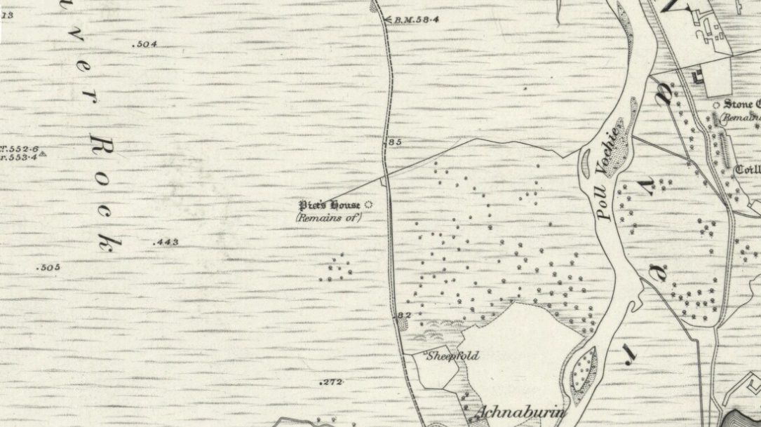
A site which, from the nearby roadside, has all the hallmarks of being yet another Sutherland broch (there are tons of them up here!)—but apparently it isn’t! Despite being shown on the earliest OS-map of the region as a ‘Pict’s House’ (which are usually brochs), the site has subsequently been designated by modern archaeologists as a simple ‘hut circle’. I have my doubts over this, as it’s a most unusual one with little logic over its positioning—unless it was either a look-out point, or an odd ritual spot.
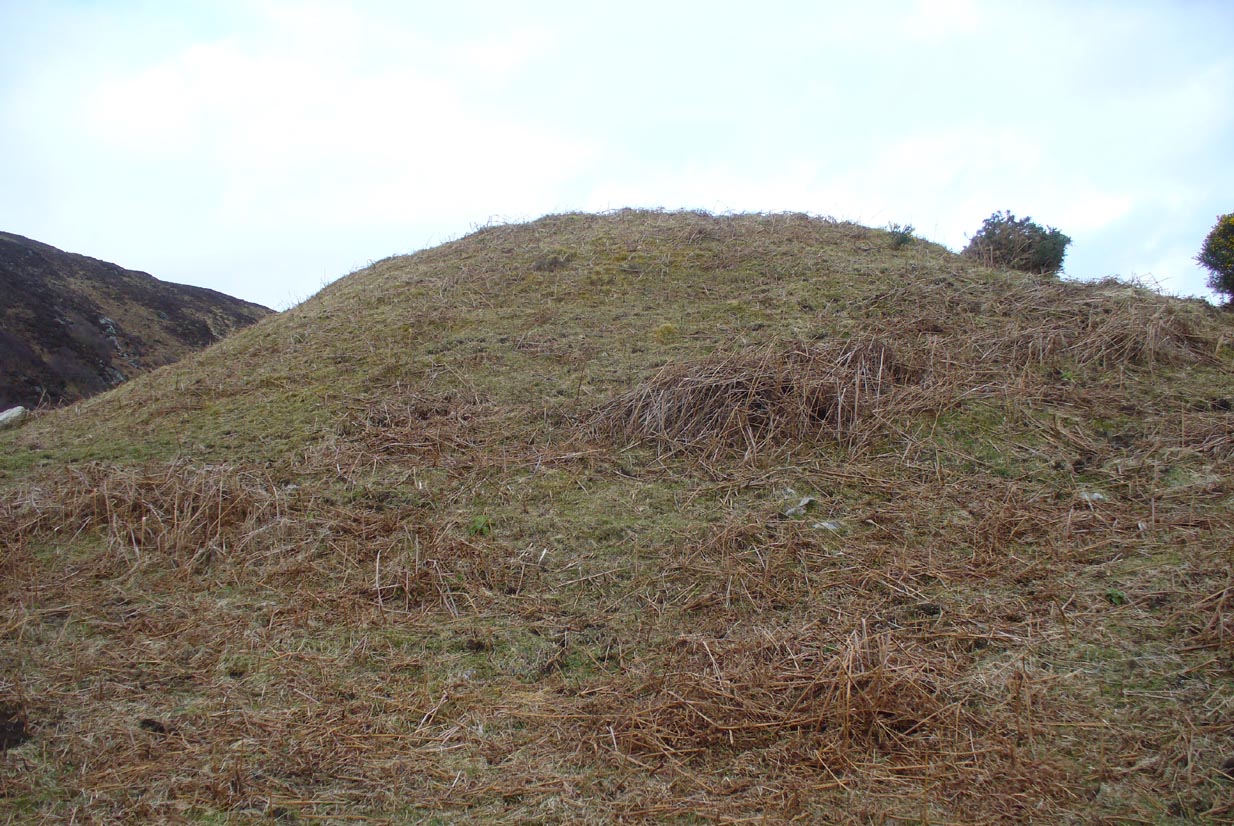
South side of the mound
As you can see from the poor photos I got of the place, a large angled tumulus-like hillock (it’s akin to a mini-Silbury Hill at first sight) rises up from the ground with a reasonably uniform angle around much of it, to a height of between 16-20 feet. Scattered rocks and stones adorn the mound as you walk up its embankments and onto the top where, around the edges, a notable man-made ring of walling shows it to have been artificially created. Unfortunately most of the top of the mound was completely covered in thick decayed bracken when I visited, so it was difficult to get any good photos of this topmost walling.
The SE side of the mound
From the top of the mound, the walling is between 1-3 feet high, in a roughly circular setting, measuring 36-40 feet across. The most distinct section of it was visible on the west-to-south-to-east section; with the lowest and depleted section occurring on its northern edges. The entrance to the ‘hut circle’ is apparently on its eastern side. Although it is assumed to be Iron Age in nature, its real age is unknown.
References:
Mercer, R.J. & Howell, J.M., Archaeological Field Survey in Northern Scotland – volume 2, University of Edinburgh 1976-1983.
Whether you take the A836 or A838 into Tongue (through truly beautiful wilderness), make sure you go into the village itself—and then keep going, south, along the tiny country road for 3 miles. Hereby, keep your eyes peeled for Lochan na Cuilce on your right; keep going past here, into and through the old trees where you’ll then see Lochan Hakel on your left. Keep going past here until your reach the next small copse on your right. Stop here. A small pool is yards into the trees and here you’ll see a single stone between that and the roadside. You can’t really miss it!
Archaeology & History
Close-up of some cups (by Donna Murray)
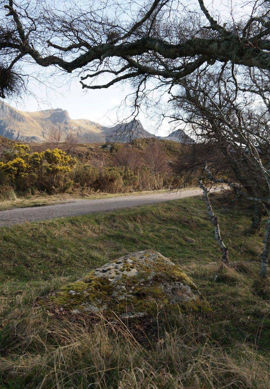
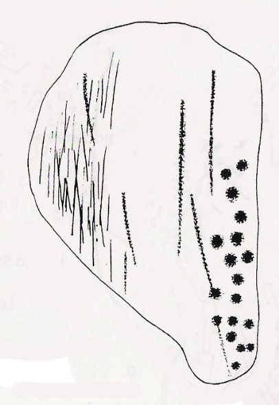
An apparently isolated cup-marked stone, some 3 feet by 5 feet, that was first described in Morrison’s (1883) meanderings amidst Sutherland’s awesome wilderness. It’s quite plain compared to Lochan Hakel 2 and many other carvings, simply consisting of 18 cups of various sizes, mainly on the eastern side of the rock. Sarah MacLean pointed out that a line running along the length of the stone seemed, in parts, to have been artificially enhanced by the hand of man, or woman. I have to agree with her.
The Royal Commission (1911) lads included this petroglyph in their superb survey of Sutherland, telling:
“On the W. side of the road to Kinloch, about ½ m. N of the bridge over the Kinloch River (Amhainn Ceann Locha), and on the N edge of a gravel pit close to the road, is a large earthfast boulder, 5′ in length as far as exposed, and 3′ 10″ in breadth, showing on its upper surface eighteen cup-marks of various depths, of which the most distinct is towards the N end of the stone, measuring about 3″ in diameter and 1″ in depth. The whole length of the stone is not visible, but the markings do not seem to extend to the portion covered…”
Carving in situ (by Donna Murray)by Kevin o’ Reilly
Simulacra lovers will love the form of this stone in relation to the background of the mountains, as its shape is echoed in that of the rising hills several miles to the south. …Of course, the depersonalizing ones amongst you lacking an understanding of animism would reject any such association due to your projection of disbelief. However—and equally—as we lack any ethnographic data on the carving we must also assume some caution…
A fascinating site – and one which is likely to have neighbours hidden in the surrounding moorlands…
References:
Gourlay, Robert, Sutherland: An Archaeological Guide, Birlinn: Edinburgh 1996.
Michell, John, Simulacra, Thames & Hudson: London 1979.
Morrison, Hew, Tourist’s Guide to Sutherland and Caithness, D.H. Edwards: Brechin 1883.
Royal Commission on Ancient & Historical Monuments, Scotland, Second report and inventory of monuments and constructions in the county of Sutherland, HMSO: Edinburgh 1911.
Acknowledgments: Huge thanks to Donna Murray for use of her photos in this site profile (aswell as for putting up with me whilst in the area); and also to Sarah MacLean for taking us to the carving in the first place. Many many thanks indeed. See y’ again soon, hopefully!