Witch Tree, Aberuthven, Perthshire

Sacred Tree:  OS Grid Reference – NN 9621 1587

Getting Here

Witch Tree on 1901 OS-map

Witch Tree on 1901 OS-map

Just off the A9 between Stirling and Perth is Aberuthven village.  Down the Main Street and just south of the village, turn west along Mennieburn Road.  A half-mile on, just past Ballielands farm, you reach the woods.  Keep along the road for another half-mile, close to where the trees end and go through the gate where all the rocks are piled. Walk up to the tree-line 50 yards away and follow it along the line of the fence east, til it turns down the slope.  Naathen – over the barbed fence here, close to the corner, about 10 yards in, is the tree in question…

Archaeology & History

Witch Tree03

Looking along the fallen trunk

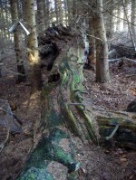
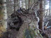
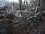
Laid down on the peaty earth, fallen perhaps fifty years ago or more, are the dying remains of this all-but forgotten Witch Tree.  To those of you who may strive to locate it—amidst the dense eye-poking branches of the surrounding Pinus monoculture—the curious feature on this dying tree are a number of old iron steps or pegs, from just above the large upturned roots.  About a dozen of them were hammered into the trunk some 100 years or more ago and, were it to stand upright again, reach perhaps 30 feet high or more.  These iron pegs give the impression of them being used to help someone climb the tree when it was upright; but their position on the trunk and the small distance between some of them shows that this was not their intention.  Their purpose on the tree is a puzzle to us (does anyone have any ideas?).

Embedded pieces or iron from roots...

Embedded iron from the roots

Embedded iron 30-40ft along

Embedded iron 30-40ft along

The fallen trunk has broken into two main sections, each with iron pegs in them.  The very top of the tree has almost completely been eaten back into the Earth.  Unfortunately too, all the bark has completely rotted away and so identifying the species of the tree is difficult (though I’m sure there are some hardcore botanists out there who’d be able to enlighten us).  The possibility that the early map-reference related to a Wych-elm (Ulmus glabra) cannot be discounted, although this would be most unusual for Ordnance officers to mistake such a tree species with a ‘witch’.  Local dialect, of course, may have been a contributing factor; but in Wilson’s (1915) detailed analysis of the regional dialect of this very area, “wych elm” for witches does not occur.  Added to this is the fact that the indigenous woodland that remains here is an almost glowing birchwood (Betula pendula) in which profusions of the shaman’s plant, Amanita muscaria, exceed.  There were no wych elms hereby.

The tree was noted by the Ordnance Survey team in 1899 and was published on their maps two years later, but we know nothing more about it.  Hence, we publish it here in the hope that someone might be able top throw some light on this historical site.

Folklore

Looking along the fallen trunk

Halfway along the fallen tree

We can find nothing specific to the tree; but all around the area there are a plethora of tales relating to witches (Hunter 1896; Reid 1899)—some with supposedly ‘factual’ written accounts (though much of them are make-believe projections of a very corrupt Church), whilst others are oral traditions with more realistic tendencies as they are rich in animistic content. One of them talks of the great mythical witch called Kate McNiven, generally of Monzie, nearly 8 miles northwest of here.  She came to possess a magickal ring which ended up being handed to the owners of Aberuthven House, not far from the Witch Tree, as their associates had tried to save her from the crazies in the Church.  This may have been one of the places where she and other witches met in bygone centuries, to avoid the psychiatric prying eyes of christendom.

Until the emergence of the Industrialists, trees possessed a truly fascinating and important history, integral to that of humans: not as ‘commodities’ in the modern depersonalized religion of Economics, but (amongst other things) as moot points—gathering places where tribal meetings, council meetings and courts were held. (Gomme 1880)  The practice occurred all over the world and trees were understood as living creatures, sacred and an integral part of society.  The Witch Tree of Aberuthven may have been just such a site—where the local farmers, peasants, wise women and village people held their traditional gatherings and rites.  It is now all but gone…

References:

  1. Gomme, Laurence, Primitive Folk-Moots, Sampson Lowe: London 1880.
  2. Hunter, John, Chronicles of Strathearn, David Philips: Crieff 1896.
  3. Reid, Alexander George, The Annals of Auchterarder and Memorials of Strathearn, Davdi Philips: Crieff 1899.
  4. Wilson, James, Lowland Scotch as Spoken in the Lower Strathearn District of Scotland, Oxford University Press 1915.

© Paul BennettThe Northern Antiquarian


Easthill, Auchterarder, Perthshire

Stone Circle (remains of):  OS Grid Reference – NN 9292 1246

Also Known as:

  1. Canmore ID 26104
  2. East Hill

Getting Here

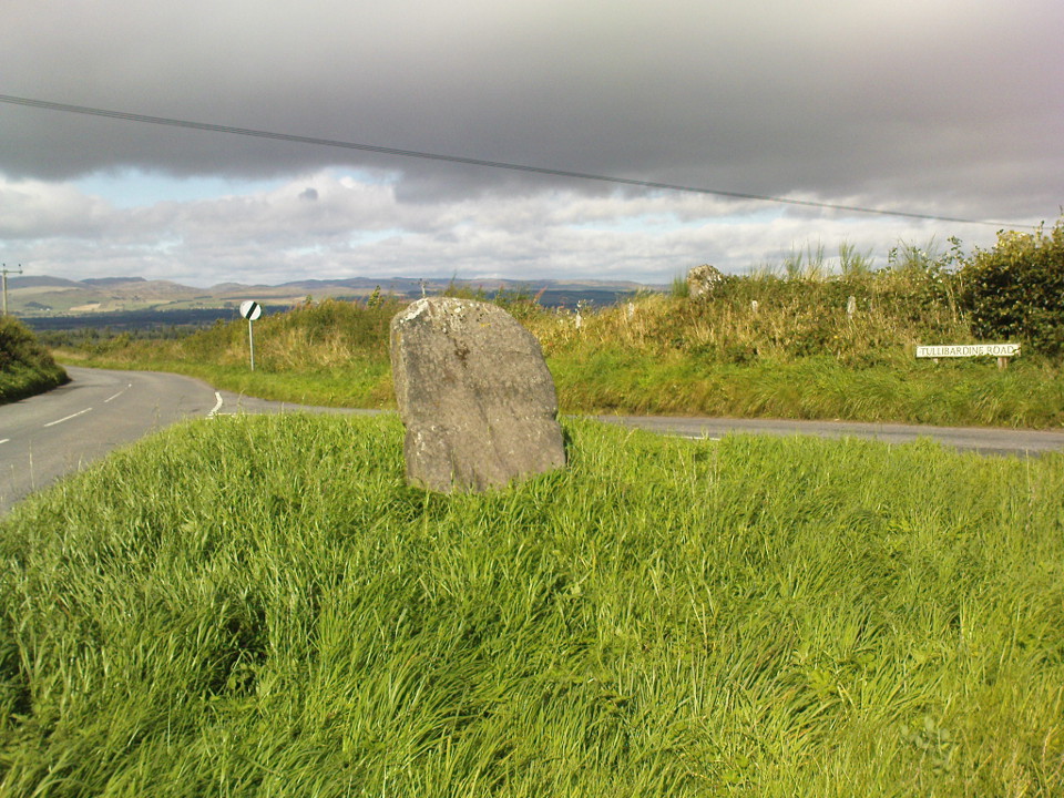
Easthill stone at the roadside

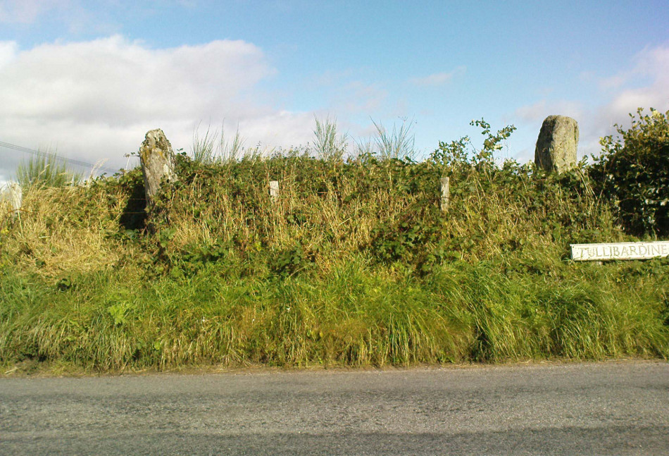
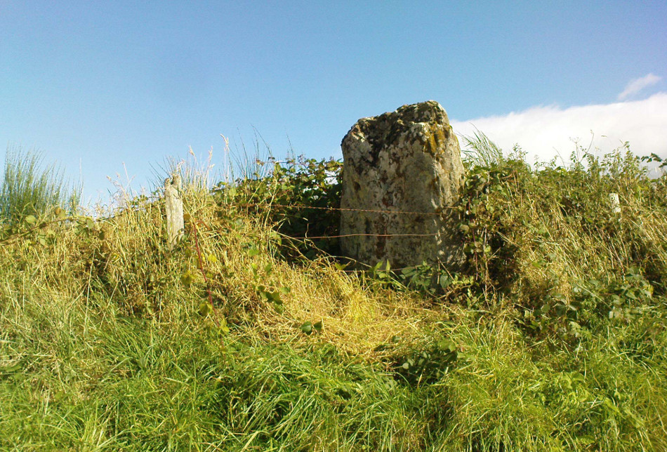
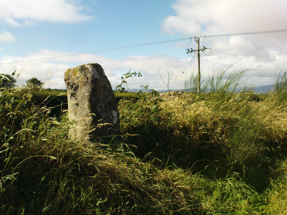
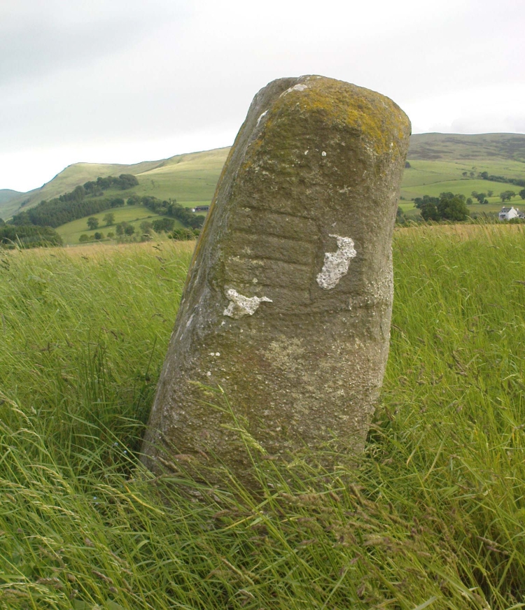
From Auchterarder’s A824 main street, going out towards the golf course take the Orchil Road on your right and about 50 yards along, right again up Tullibardine Road.  Park up somewhere 100 yards along, then just walk further down the road until you’ll see the standing stone right at the road junction. Look into the field on your right, above you, and another two hide in the brambles and grasses.

Archaeology & History

...and the 2 in the hedgerow
…and the 2 in the hedgerow

Included in Andy Finlayson’s (2010) fine local survey, this is an intriguing little group of three standing stones (and a fourth buried beneath the turf), all very close to each other.  They are shown on the modern Ordnance Survey maps as “standing stones”, but have been catalogued by archaeologists as the denuded remains of a ‘Four Poster’ stone circle.  Despite this, the circle wasn’t included in Aubrey Burl’s (1988) definitive work on the subject, nor his megalithic magnum opus. (Burl 2000)

Northern hedgerow stone

Of the two uprights above the roadside at the field edge, a faint carved hand can be found on the upright west-facing side of the southernmost of the two standing stones. Although faint, this doesn’t appear to be ancient.  Written accounts of these stones are few and far between it seems.  The earliest seems to be in the lengthy essay written by Mr Hutchison (1893), in which he gave an excellent account:

“Less than a mile to the west of (Auchterarder)…is a fine group of stones, two only of which are now standing. These stand on the summit of what has been a well-defined mound, and the stones now lying where the roads unite seem to have stood originally at the same height.  The road has been driven through the group at a lower level than the summit of the mound, and the stones have been thrown down and laid in the waste space at the point of junction. The small mercy to be thankful for is that they have not been broken up altogether and used for road metaL This has probably been due to the circumstances that one of these stones has a curious encircling groove running round it, which perhaps impressed even the vandal roadmakers with the idea that it might be worthy of preservation. It would be interesting to know whether, when the circle or group of stones was cut through, any cist or interment was found.  One would expect such to be the case, but I have not yet got any information on the point.  There are several stones lying on the spot which may or may not be pieces of the original standing stones. Two considerable bits of old red sandstone, at least, look as if they were fragments of an original whole.  Two great stones, however, are unmistakably prostrate standing-stones; and from the positions in which they lie, it seems to me as if the persons who had uprooted them had laid them down as nearly as possible on the sites they had occupied (at the original higher level, of course) when standing.

“The direction in which both of the standing stones point is 236º, and a line taken from each of the prostrate stones to the opposite standing one gives very nearly the same angle (240º).  The prostrate stones are of metamorphic schist. The northerly one measures 7 feet in length by 3 feet in width, and is from 12 to 18 inches thick.  A grove or furrow, 2 inches deep at its greatest depth, and from 2 to 4 inches wide, appears to run right round it, at a distance of 2 feet 10 inches from the end, which may have been about the middle height of the stone when erect. The lower side of the stone cannot be seen, but the appearance at the edges indicates that the furrow is carried all the way round. It looks just such a hollow as might be worn in stone by the long continued attrition of an iron chain. The more southerly prostrate stone is 6 feet in length, 4 feet wide, and has an average thickness of 18 inches. The two stones still standing are on the high bank above the road, just inside the hedge. These are both of old red sandstone, thinnish slabs, facing in the direction already mentioned. That to the south is 4 feet 10 inches in height, 2 feet 8 inch broad at the base, and 10 inches thick. The other is 5 ft. 3 in. at its greatest height, 3 feet 10 inches wide, and from 13 to 15 indies thick. On its northern face it shows a number of depressions or indentations curiously resembling prints of human feet. These Mr Kidston considers to be due to natural weathering.”

Southern carved stone

Yet the “prints of human feet” are very much man-made.  A closer examination of these carvings is obviously needed.

Whether these stones originally played a part in an old tumulus, a cairn circle, or a typical stone circle, is hard to say with any certainty now.  We are in a landscape where megalithic remains were once in great excess: with the standing stones of Blackford to the south; the lost circle of Gleneagles nearby; the megaliths near Muthill and many many more…

References:

  1. Burl, Aubrey, Four Posters: Bronze Age Stone Circles of Western Europe, BAR 195: Oxford 1988.
  2. Finlayson, Andrew, The Stones of Strathearn, One Tree Island: Comrie 2010.
  3. Hutchison, A.F., “The Standing Stones of Stirling District,” in The Stirling Antiquary, volume 1, 1893.
  4. Strachan, Favid (ed.), A History of Blackford, Blackford Historical Society 2010.

© Paul BennettThe Northern Antiquarian 


Gleneagles ‘B’, Blackford, Perthshire

Standing Stone:  OS Grid Reference – NN 92431 09804

Also Known as:

  1. Blackford
  2. Canmore ID 25924
  3. Loaninghead
  4. Peterhead Farm

Getting Here

19th century drawing of the old stone

Along the A9 dual carriageway between Blackford and Auchterarder, take the A823 road south, up Glen Eagles towards Pool of Muckhart and Dunfermline.  Less than 100 yards up the road, turn immediately right and park-up. On the overgrown grassy land on the right-hand side of the road, you’ll see this solid monolith calling for your attention.  You can’t really miss it!

Archaeology & History

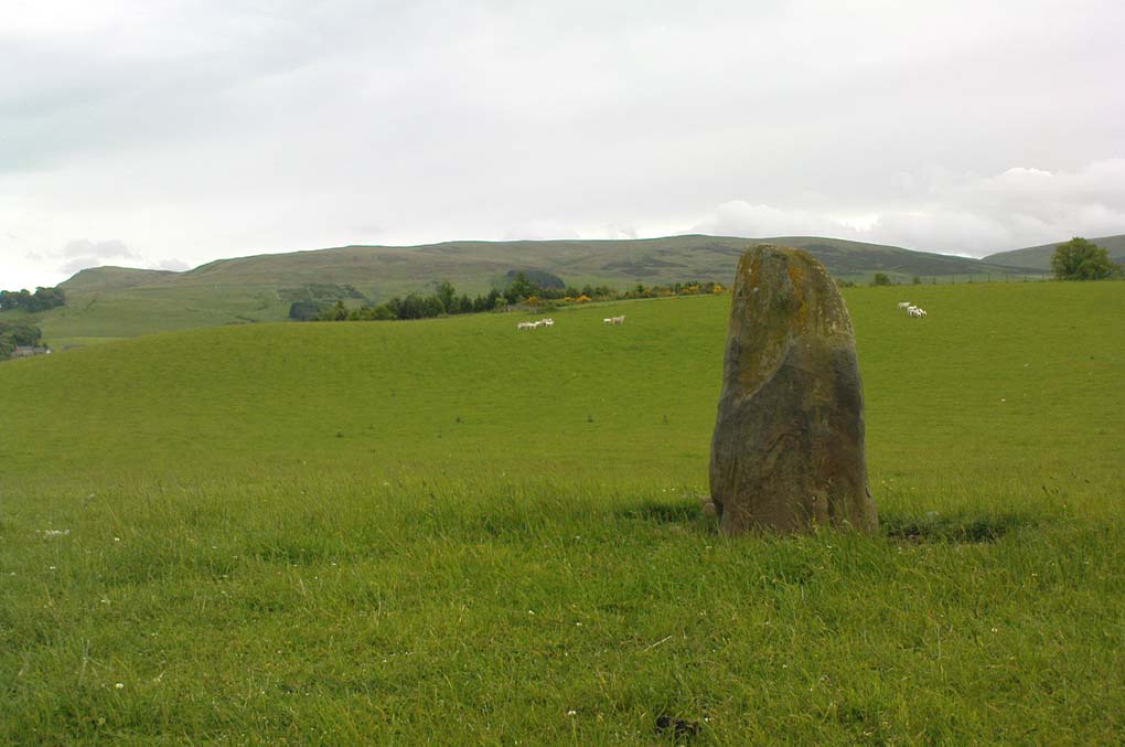
Looking south, to the fairy-haunted Ben Shee

Described by archaeologists as a Class 1 Pictish Symbol Stone (and shown on OS maps as such), this is a fine solid standing stone more than 5 feet tall, with a lovely view up Gleneagles to the fairy mountain of Ben Shee beckoning in the distance.  Immediately north on the other side of the dual carriageway, the tree-lined mound 100 yards away is an ancient fort (which we’ll deal with in another entry); and of course we have the nearby companion of the Gleneagles A standing stone a coupla hundred yards west.  Whether or not this stone and its western companion ever had anything to do with the lost stone circle of Gleneagles, we might never know.

Close-up of the carved designs
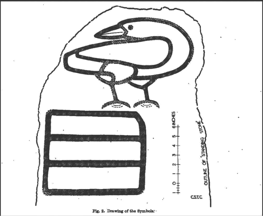
Charles Calders drawing of the carvings

Although it seems consensus opinion that the standing stone here is prehistoric, the monolith was of some venerable importance to the Pictish people of the Ochils, who, according to the Royal Commission lads (1999) carved on this stone “the faint symbols of a goose and rectangle.”  The rectangle, however, is in fact a parallelogram—as the images here clearly show.  Archaeologist Richard Feachem (1977) thought the design was in fact “a double-sided comb.”  I have my doubts (a much smaller and probably more recent parallelogram design was recently identified on the upright face of the large Dunruchan D standing stone, about 10 miles WNW of here).  The ‘goose’ is carved above this geometric form and is much fainter, which may imply it was carved much earlier.  In Elizabeth Sutherland’s (1997) survey, she suggests the bird may be an eagle.  It is equally possible that it is a swan.

The earliest detaied account of this stone and its companion is in Mr Hutchison’s (1893) fine essay, where he wrote:

“On the south side of the road from Blackford to Auchterarder, about 150 yards west from Loaninghead where the line of the road is crossed by that from Gleneagles to Crieff, stands a fine stone of Highland grit.  It measures 4ft. 10in. in height above ground, 10ft. in girth at the base, and 6ft. 9in. in circumference at top.  It shows four sides of nearly equal measurement:— that facing north being 2ft 4in., south 2ft. 8in., west 2ft 5in., and east 3ft.  On the north is an incised figure in the form of an parallelogram, 10in. broad by 9in. high, divided into three equal portions by two horizontal lines.”

References:

  1. Calder, Charles S.T., “Notice of Two Standing Stones (one with Pictish Symbols) on the Lands of Peterhead Farm, near Gleneagles, Perthshire,” in Proceedings of the Society of Antiquaries, Scotland, volume 81, 1947.
  2. Feachem, Richard, Guide to Prehistoric Scotland, Batsford 1977.
  3. Finlayson, Andrew, The Stones of Strathearn, One Tree Island: Comrie 2010.
  4. Hutchison, A.F., “The Standing Stones of Stirling District,” in The Stirling Antiquary, volume 1, 1893.
  5. Royal Commission on the Ancient & Historical Monuments of Scotland, Pictish Symbol Stones: A Gazetteer, Edinburgh 1999.
  6. Sutherland, Elizabeth, A Guide to Pictish Stones, Birlinn: Edinburgh 1997.

© The Northern Antiquarian

Gleneagles ‘A’, Blackford, Perthshire

Standing Stone:  OS Grid Reference – NN 9211 0962

Also Known as:

  1. Blackford
  2. Loaninghead
  3. Peterhead Farm

Getting Here

Standing Stone near Peterhead Farm

Along the A9 dual carriageway between Blackford and Auchterarder, take the A823 road south, up Glen Eagles towards Pool of Muckhart and Dunfermline.  Less than 100 yards up the road, turn immediately right and go past the standing stone of Gleneagles B for a coupla hundred yards or so, where there’s a left turn (down to Peterhead Farm). Stop here and look into the field in front of you.  You can’t really miss it!

Archaeology & History

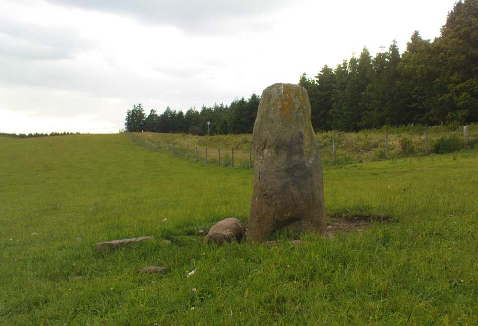
Gleneagles A stone, looking west

This short standing stone, more than 3ft tall, has an elegance about it which megalith lovers alone will understand!  Maybe it’s the setting; maybe the feel of the land; or maybe something else.  I dunno… On my first visit to the site, Nature was wearing a grey overcast cloak, but the site and I didn’t seem to care; and although the view from here doesn’t have the same grandeur of Glen Eagles to view as its companion stone a few hundred yards to the east might have, there felt a greater welcoming at this smaller stone.  Odd, considering this monolith had been knocked over and re-positioned by the farmer in the not-too-distant past.  Anyway…less of this subjective nonsense of feelings from the landscape and megaliths!  Utter drivel all of it!

The earliest measured account of the stone is to be found in Mr Hutchison’s (1893) essay, where he notes this and its companion close by, giving us the dimensions of this monolith:

“This (stone) is roughly columnar in shape, but wider at the base than above. Its height is 3ft above ground; circumference at base 6ft. 5in., diminishing to 4ft. 2in at the top. It is of metamorphic schist.  The line of direction between these two gives a horizontal angle of 260°.”

Since that day, in the mass of archaeology essays that have been scribed, this smoothed upright gets only a minimal description.  Charles Calder’s (1947) account is typical, saying simply that it is,

“Somewhat cylindrical in form with a girth of 7 feet at the base, it rises with a decided tilt towards the west to a height of 3 feet 10 inches above ground-level.”

The stone fares better in Andrew Finlayson’s (2010) fine local survey of megalithic ruins, where he points out that this and its compatriot stone Gleneagles B, are in an alignment with the fallen Boat Stone and the upright White Stone, a few miles to the southwest.  This line works on 1:50,000 map, but when transferred to larger-scale surveys, the alignment misses each outlying site by 20-30 yards here and there.

References:

  1. Calder, Charles S.T., “Notice of Two Standing Stones (one with Pictish Symbols) on the Lands of Peterhead Farm, near Gleneagles, Perthshire,” in Proceedings of the Society of Antiquaries, Scotland, volume 81, 1947.
  2. Feachem, Richard, Guide to Prehistoric Scotland, Batsford 1977.
  3. Finlayson, Andrew, The Stones of Strathearn, One Tree Island: Comrie 2010.
  4. Hutchison, A.F., “The Standing Stones of Stirling District,” in The Stirling Antiquary, volume 1, 1893.

© Paul Bennett, The Northern Antiquarian