Witch’s Stane, Craigie, Ayrshire

Legendary Rock (destroyed):  OS Grid Reference – NS 4268 3231

Also Known as:

  1. Canmore ID 42851
  2. White Stane
  3. Witches’ Stone

Archaeology & History

It is difficult to assess the precise nature of this megalithic site, sadly destroyed some two hundred years ago.  The Royal Commission thinks it may have been a rocking stone, but the legend said of it indicates it to have been associated with a giant prehistoric cairn, although nothing remains nowadays.  The site was mentioned briefly in James Patterson’s (1863) huge work on the townships of Ayrshire, where he described the site as “standing upright” and “being in a field on Lodgehouse Farm,” near the village church.

“It stood on three stones, so high that a man could crawl under. It was blasted in 1819 to build houses.  The farmer’s wife, it is said, took some antipathy to it, and would not give her husband rest until he consented to have it removed.  A person of the name of Jamieson, and an assistant, were employed to blast it, which was accordingly done.  When broken up, it filled twenty-four carts.  Such was the feeling of sacrilege occasioned by the removal of the stone, that it was observed the farmer’s wife became blind, and continued so for eight years, when she died. Jamieson, who blasted it, never did well afterwards.  He drank and went to ruin.”

Serves them right!  Additional lore gained from a local lady in the 1870s has one of those all-too-familiar elements to it, speaking of something more substantive.

Folklore

When Archibald Adamson (1875) wrote his fine work on the history of Kilmarnock and district, folklore elements more typical of the Cailleach—whose legends abound in our more northern climes—seemed to have been attached to this missing site.  It is worth telling in full:

“After partaking of refreshments in the village inn, and indulging in a chat with the landlord, I retraced my steps to the highway, and in doing so got into conversation with an old lady who was very loquacious and well versed in the lore of the district. Amongst other things, she informed me that once on a time the church of Craigie had a narrow escape of being destroyed by a witch who had taken umbrage at it. It seems that the hag selected a large stone, and having placed it in her apron, flew with it in the direction of the building with the intention of dropping it upon its roof.  Her design, however, was frustrated by the breaking of her apron strings, for, upon nearing the object of her spleen, they gave way, and the stone fell with a crash that shook the earth. This accident seemingly so disheartened the carlin that she abandoned the destructive idea and allowed her burden to lie where it fell. The boulder lay in a field near the churchyard wall, and was known as “The White Stane.” It was long regarded with superstitious awe by many; but the farmer on whose ground it lay being of a practical turn of mind, looked upon  it with an eye to utility, and had it blasted for building purposes. Strange to relate, when broken up the debris filled twenty-five carts–a circumstance that would lead one to suppose that the witch must have been very muscular, and must have worn a very large apron.”

It is most likely that the witch in this legend originally set off from the Witch’s Knowe, more than 500 yards to the west of the church (and still untouched, despite the mess of the quarrying immediately adjacent).  Any further information on this missing site would be greatly appreciated.

References:

  1.  Adamson, Archibald S., Rambles round Kilmarnock, T. Stevenson: Kilmarnock 1875.
  2. Paterson, James, History of the Counties of Ayr and Wigton – volume 1, James Stillie: Edinburgh 1863.

© Paul BennettThe Northern Antiquarian


Warlocks’ Tomb, Muckhart, Clackmannanshire

Tomb/s (lost):  OS Grid Reference – NS 9928 9865

Archaeology & History

Site of Warlock’s Tomb

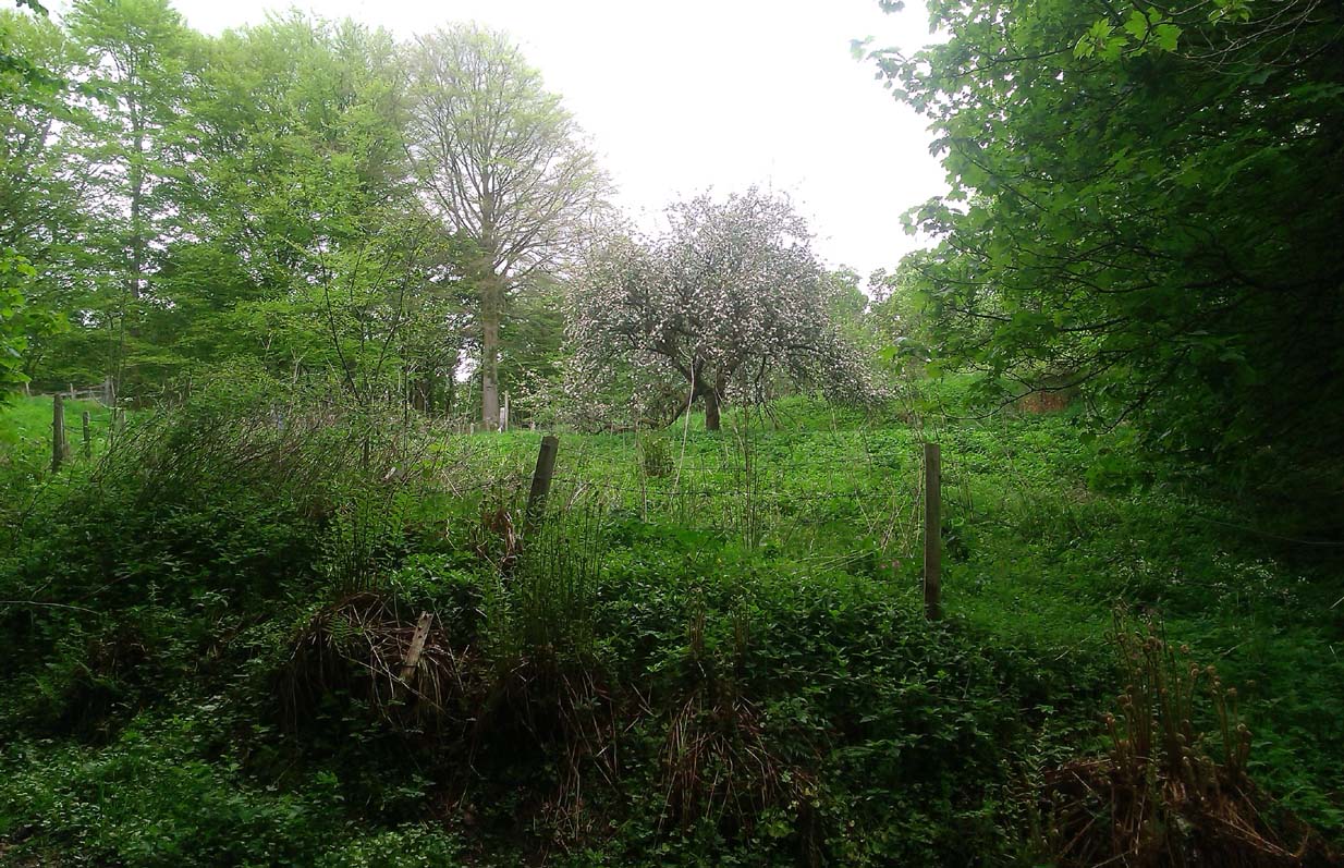
A fascinating site that was described in Johnston & Tullis (2003) local history work on the parish of Muckhart. Amidst an area bedevilled with faerie, boggarts, ghosts and historical shamanic moot sites we find more curious folklore pointing at a long forgotten site, whose age and precise nature remains a mystery.  Adjacent to the old boundary line, close to the meeting of streams, the Muckhart authors told that,

“an orchard above the old farmhouse to this day remains mainly untouched.  It was the burial site of warlocks from the parish and it is thought some may have even been burned at the Mill.  It has always been said that this ground should never be touched!  There is an ancient rubble bridge over the Hole Burn which has a Masonic Eye painted on it to ward off any unwelcome spirits.  Despite the eye, both the Farmhouse and the Millhouse have been home to many strange and ghostly manifestations.”

The folklore sounds to be a mix of archaic and medieval animistic traits: perhaps of a prehistoric cairn, visited and maintained by local people (as found throughout Britain) until the Burning Times, when christian fanatics arrived, debasing the cultural rites and murdering local innocent people.  …Perhaps not.

Looking down on the orchard

When Paul, Maggie and I explored the area a few days ago, we were greeted most cordially by the owner of Muckhart Mill, who knew of the folklore, but didn’t know the exact whereabout of the grave.  We couldn’t find any clues as to its exact location either.  Apart, perhaps, from the top of the hill immediately above the orchard where, alone and fenced off with an old covered (unnamed) well, a solitary Hawthorn tree stood.  We each recalled the aged relationship that Hawthorn has in witch-lore… but that’s as far as it went.  The grave remains hidden and may have been destroyed. If anyone discovers its whereabouts, please let us know so that a preservation order can be made to ensure its survival.

References:

  1. Johnston, Tom & Tullis, Ramsay (eds.), Muckhart, Clackmannanshire: An Illustrated History of the Parish, MGAS 2003.

© Paul Bennett, The Northern Antiquarian
Colpy, Culsalmond, Aberdeenshire

Stone Circle (destroyed): OS Grid Reference – NJ 6411 3261

Also Known as:

  1. Canmore ID 18272

Archaeology & History

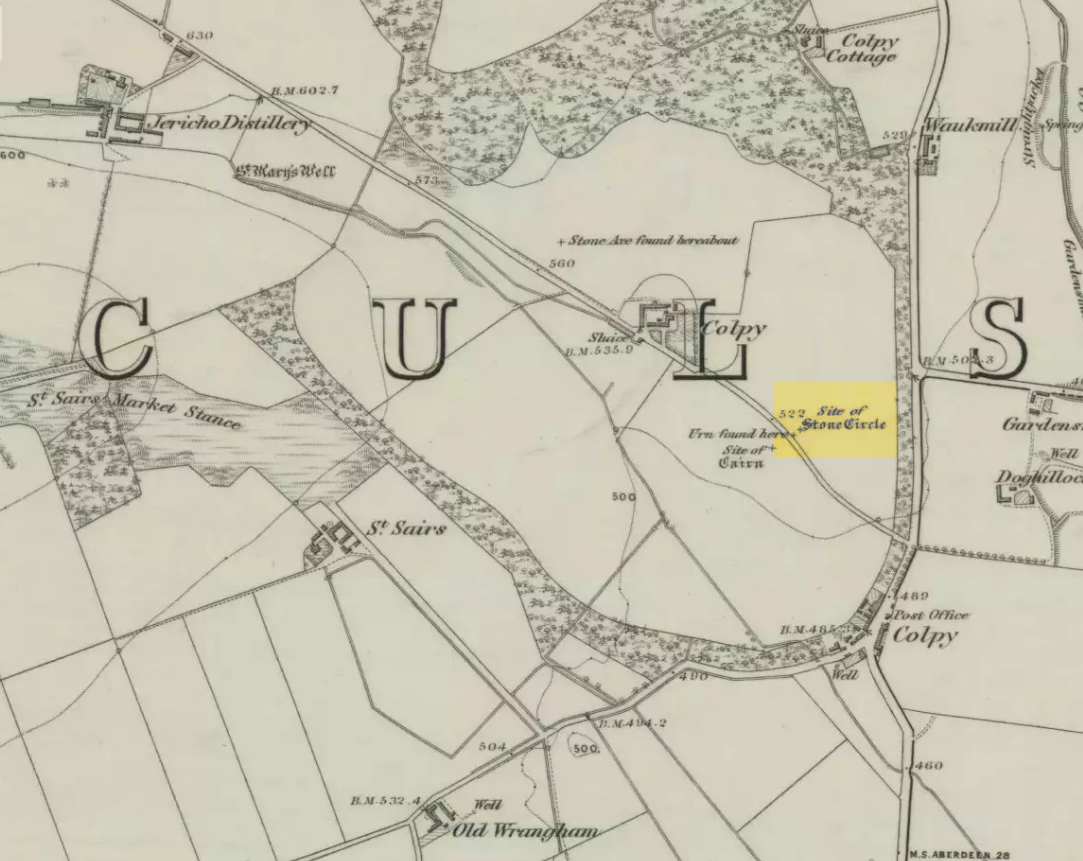
Colpy Circle site on 1868 map

Just like the stone circle a half-mile east at Kirkton of Culsalmond, nothing now remains of this megalithic ring.  It was first described very briefly by Rev. F. Ellis (1845) in the New Statistical Account as a “druidical temple”: one of two hereby, “on the farm of Colpie, although now almost obliterated. Several urns were dug up in making a road near one of them”—implying that one of them was a cairn circle or funerary monument of some kind.  This was subsequently affirmed on the early OS-map and then described in Fred Coles’ (1902) survey, where he wrote:

“Site of a stone circle, the road going to Jericho Distillery having been made through it, and, on the south side of this road, the site of a cairn. Within the possible diameter of the circle an urn was found.”

Folklore

A few hundred yards west of the circle an ancient fair used to be held, known as St Sair’s Fair, named after St Serf.  Although St Serf’s Day is July 1, early records show that the fair—held in a long field with the curious name of ‘St Sairs Market Stance’—was to be held on the Wednesday after the last Tuesday in June.  For a stone circle, this is too close to Midsummer to be a coincidence!  Early records show that the fair was granted in 1591 and subsequent years thereafter.

St Serf is a very peculiar mythological figure with quite shamanistic traits and tales around him.  In truth, many of these early saints were little more than lapsed shamans, utilising natural magick and medicine in the olde traditions, but which became grafted onto the incoming christian mythos.  The evidence for this is quite overwhelming!

References:

  1. Barnatt, John, Stone Circles of Britain – volume 2, BAR: Oxford 1989.
  2. Browne, G.F., On Some Antiquities in the Neighbourhood of Dunecht House, Aberdeenshire, Cambridge University Press 1921.
  3. Burl, Aubrey, “The Recumbent Stone Circles of North-East Scotland”, in Proceedings Society of Antiquaries, Scotland, volume 102, 1973.
  4. Burl, Aubrey, The Stone Circles of the British Isles, Yale University Press 1976.
  5. Burl, Aubrey, The Stone Circles of Britain, Ireland and Brittany, Yale University Press 2000.
  6. Coles, Fred, “Report on Stone Circles in Aberdeenshire (Inverurie, Eastern Parishes, and Insch Districts),” in Proceedings Society Antiquaries, Scotland, volume 36, 1902.
  7. Ellis, F., “Parish of Culsalmond,” in New Statistical Account of Scotland – volume 12: Aberdeen, William Blackwood: Edinburgh 1845.

© Paul Bennett, The Northern Antiquarian 


The Maypole Tree, Little Paxton, Huntingdonshire

Maypole & Ritual Tree (destroyed):  OS Grid Reference TL 18831 62757

Getting Here

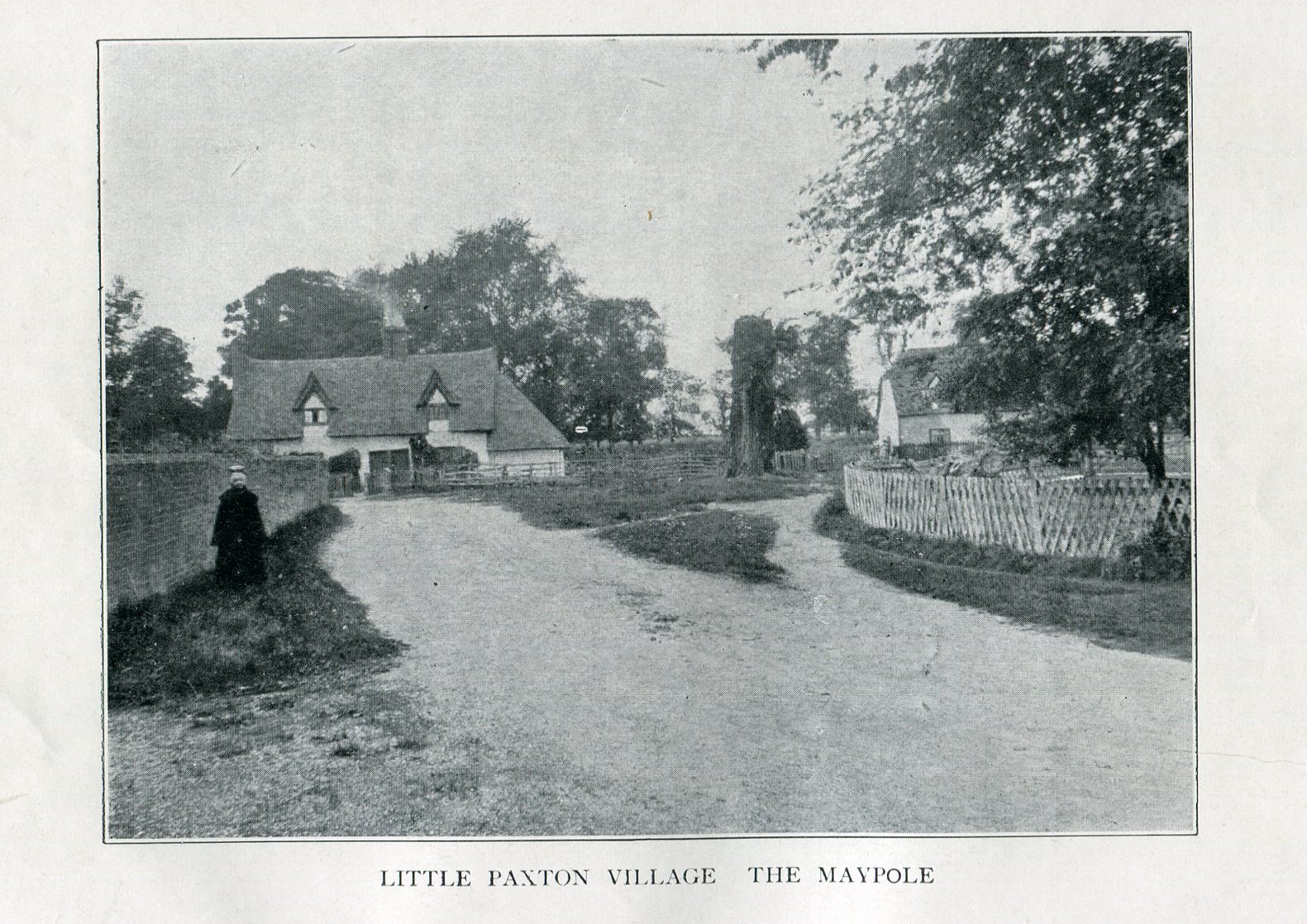
Imposing trunk of The Maypole Tree, right background

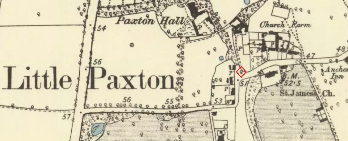
The road layout of the village has changed since the destruction of the Tree, but its approximate position was on the north side of the present High Street, at the junction with the east side of St James’ Road.

Archaeology & History

The Little Paxton Maypole Tree was a very late survival of a tradition where Mayday revellers danced around an actual tree rather than a symbolic tree in the form of a maypole.  It was described as “a tall straight elm tree” that stood in front of what was then the village Post Office, and from what may be the only surviving photograph, it appears that only the very substantial trunk survived of what was clearly a very old tree.

The 1887 6" OS Map, showing the Maypole Tree outlined in red
The 1887 6″ OS Map, showing the Maypole Tree outlined in red

A Miss Ethel Ladds, who had been born in Little Paxton, recalled in the early 1940s:

I remember the old tree very well, it was always called ‘the Maypole’, but I don’t know any more about it, except that they used to dance round it“.

The St Neots Advertiser recorded that the Maypole Tree was blown down in a great gale on 24th March 1895.

Folklore

While this writer has been unable to find direct folklore relating to the Little Paxton Maypole Tree, it may be worth remarking that botanically the Elm tree is a cousin of the Stinging Nettle, the Hop and Cannabis.  Another Elm Tree used for May revels was the Tubney Elm, near Fyfield in Berkshire and recorded by Matthew Arnold, in his ‘Scholar Gipsy’.

References:

  1. C.F. Tebbutt, “Huntingdonshire Folk And Their Folklore”, in Transactions of the Cambridgeshire & Huntingdonshire Archaeological Society, Volume VI, Part V, 1942
  2. C.F. Tebbutt, “Huntingdonshire Folk And Their Folklore”, in Transactions of the Cambridgeshire & Huntingdonshire Archaeological Society, Volume VII, Part III, 1950
  3. Gerald Wilkinson, Epitaph For The Elm, Arrow Books, London, 1979

© Paul T. Hornby 2016 The Northern Antiquarian 


St. Palladius’ Footprint, Camusvrachan, Glen Lyon, Perthshire

Legendary Stone:  OS Grid Reference – NN 62626 47685

Also Known as:

  1. Craig Dianaidh
  2. Rock of Safety

Getting Here

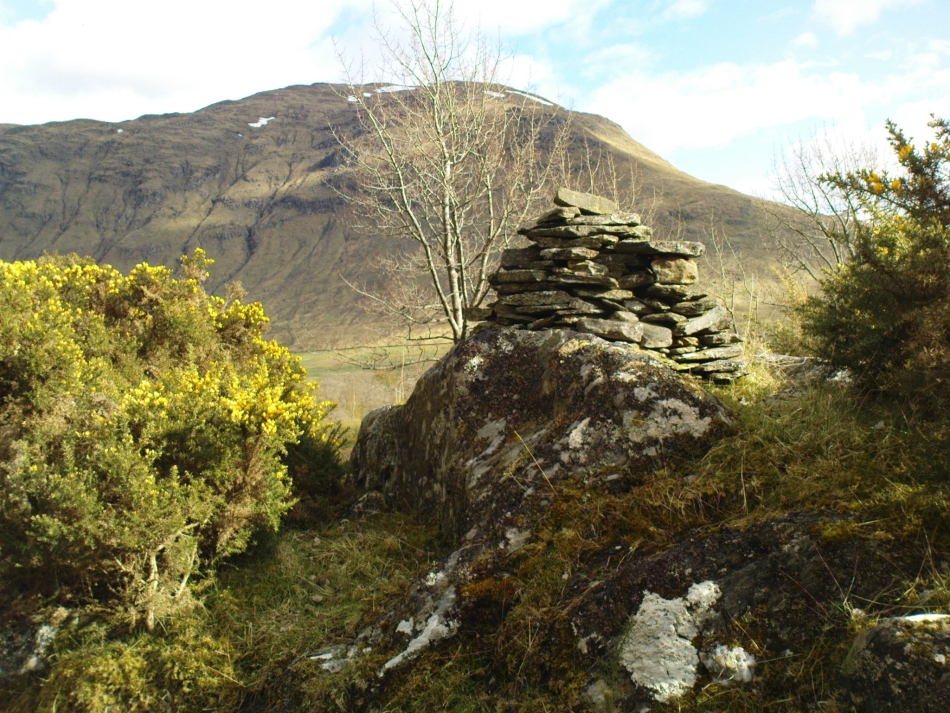
The rocky cairn of St. Palladius

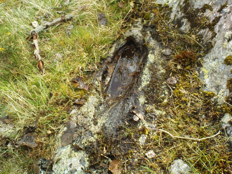
From Fortingall, get to the standing stone of Adamnan’s Cross a few miles down the stunning Glen Lyon.  Barely 100 yards before you reach the stone, notice the overgrown gorse-covered rocky rise across the road, just past Craigianie Farm.  As you climb to the top of this small rocky rise, you’ll see a cairn of stones on its top.  Just below it, into the solid rock, you’ll see a footprint-shaped hollow etched into the stone.  If it seems hidden, just keep looking – you’ll find it…

Archaeology & History

St. Palladius Stone, Glen Lyon

When Ratcliffe Barnatt (1944) visited Glen Lyon in the 1940s, this legendary rock was one of his stopping points.  “When we have passed by Ruskich and Slatich,” he wrote, “we come to that sacred spot, Craig Dianaidh, the Rock of Safety, where, until about 1480, solemn and judicial meetings were held.”  The old rock was known through recent ages, “as a preaching hill, a motehill and a justiciary court,” said Hilary Wheater (1981), and upon its top is the curious ‘footprint’ which Nature’s blood would fill on all but the hottest of summers.  It is this geological feature that gave the stone is name, long ago.

Of known historical events here, Wheater further told:

“It was on this rock…that the Baron Courts of Glenlyon were held.  Law and order was kept by regular courts held by the Chief or Landowner. The Baron-Bailiary of each area was appointed by Royal Charter.  Fifteen men were chosen as a jury and the laird or his baile presided.  To this court were brought all the problems and grievances of the people.  Here the miller accused several men of refusing to take part in the compulsory ‘hamganging’ of a new millstone; here a man was fined for brewing ale without a license; here a neighbour was accused of putting the ‘evil eye’ on the cow of the croft next door so it produced no milk; and here a man was prosecuted for ‘taking of ane sore horse of his to Rannoch in the summer of 1629 and putting on him ane great burder of timber, and letting him go through the wood where he stuck between two trees all night and the timber on his back.’  However, he was acquitted when he was able to prove that the horse was fit enough after this for another man to be able to take it to Edinburgh soon after.”

St Palladius Footprint

As well as being a moot site, it is more than probable that this footprint, like the one near the top of Dunadd in Argyll—and others scattering the Highlands and beyond—was an initiation stone, perhaps for local tribal elders or ancient kings.  Janet Bord (2004) writes about them as places of ritual inauguration in her survey of such places.

Folklore

The legendary site, looking south

This legendary rock would probably have had earlier mythic association than the one ascribing it to St. Palladius—but as yet I have found no written lore telling the nature of such a spirit, so would only perhaps discern the original genius loci by lengthy encounters with the rock in question, through mist and storm and wintry months, alone.  It is known in local folklore that Palladius was in fact an urisk: a solitary spirit of steep streams that few humans encounter due to their lonely habits amidst hidden abodes in dark and ancient gorges.  Such urisks dwelt in numbers amongst many of the steep falls in this landscape — and still do, if the words of old locals are to be believed. Here,

“St Palladius was a goblin saint, an urisk that dwelt in a mountain burn and was sanctified by the people.”

…and some rocks by the stream up the mountain immediately above this “footprint” was one of the places the urisk was known to dwell.

…to be continued…

References:

  1. Barnatt, T. Ratcliffe, The Road to Rannoch and the Summer Isles, John Grant: Edinburgh 1944.
  2. Bord, Janet, Footprints in Stone, Heart of Albion Press 2004.
  3. Fraser, Duncan, Highland Perthshire, Standard Press: Montrose 1969.
  4. Wheater, Hilary, Aberfeldy to Glenlyon, Appin Publications: Aberfeldy 1981.

© Paul Bennett, The Northern Antiquarian

Sithean Mor, Shian, Iona

Cairn Circle (destroyed):  OS Grid Reference – NM 2721 2371

Also Known as:

  1. Angel Hill
  2. Cnoc nar-aimgeal
  3. Sithean More

Archaeology & History

There have long been rumours of stone circles on the druid’s isle of Iona, but many are dismissed as little more than errors on behalf of antiquarians, or false descriptions of hut circles and settlement remains.  The stone circle of Sithean Mor however, does seem to have existed until only a century or two ago.  It was first mentioned by the great traveller, Thomas Pennant (1776), who visited Iona more than once.  He told us:

“On my return I saw, on the right hand, on a small hill, a small circle of stones, and a little cairn in the middle, evidently druidical, but called the hill of the angels, Cnoc nar-aimgeal; from a tradition that the holy man had there a conference with those celestial beings soon after his arrival.  Bishop Pocock informed me that the natives were accustomed to bring their horses to this circle at the feast of St. Michael, and to course round it.  I conjecture that this usage originated from the custom of blessing the horses in the days of superstition, when the priest and the holy-water pot were called in: but in latter times the horses are still assembled, but the reason forgotten.”

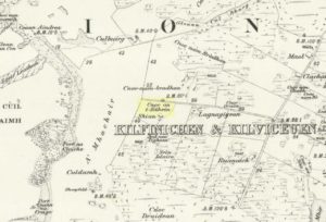
Site of the Sithean Mor on the 1881 OS-map

The day of the “feast of St. Michael” that Pennant mentioned was our indigenous heathen New Year, or Halloween, now usurped and misrepresented by countless plastic pagans and christians alike. It would appear from Pennant’s description that the circle in question was more likely a cairn circle.  The fact that the heathen islanders celebrated annual rites here at Samhain, strongly implies there was once a hero-myth and a creation myth in evidence, but I am unaware of any remaining tales that may help confirm this.  The coming of St. Columba may be responsible for this lack of oral tradition.

More than a century after Pennant’s visit here, the ring of stones had been destroyed.  We know this from the description given by Archie MacMillan (1898) in his fine text on the antiquities of Iona, where he said,

“Angel Hill, called in the vernacular Sithean More. There was, not so very long ago, a circle of standing stones on the top of this hillock. They have been used for other purposes.”

Folklore

The most commonly recited tale of this grassy rise is that when St. Columba brought christianity to the island, he communed here with the angels.  This is a simple displacement tale: of a new faith replacing an older one. The old name of the hill, Sithean Mor, tells that the littlepeople or fairy folk once held influence here.

References:

  1. Cumming, C.F.G., In the Hebrides, Chatto & Windus: London 1883.
  2. MacMillan, Archibald, Iona: Its History and Antiquities, Houlston & Sons: London 1898.
  3. Pennant, Thomas, A Tour in Scotland, 1772 – Part 1, Benjamin White: London 1776.

© Paul Bennett, The Northern Antiquarian

Witch’s Stone, Crossford, Dunfermline, Fife

Legendary Stone (destroyed):  OS Grid Reference – NT 058 865

Archaeology & History

Travelling along the old road between Crossford and towards Cairneyhill, on the right-hand (north) side, there was until recently a huge boulder, described by the folklorist J.E. Simpkins (1914),

“Its horizontal dimensions above ground are diagonally 18 feet by 21 feet; its vertical height above ground 5 feet…  I estimate its weight at nearly 200 tons.”

The stone was proclaimed by 19th century geologists to be a glacial deposit from the upper region of the Forth (the nearest mountain region possessed of this type of stone); although our old petroglyph writer, Sir James Simpson, postulated the Witch’s Stone to be “of meteoric origin.”

But like oh so many old sites with heathen tales attached, the stone was destroyed by a local farmer on 7 February, 1972.  The following interesting notes were made in a Crossford & Cairneyhill School log-book, describing its destruction:

“The local farmer blasted the “Witch’s Stone”, situated about 300m East of school at 2.30 this afternoon.  Children vacated both buildings and sheltered at West End of main building.  All windows were opened.  Police informed that further operations of this nature will be carried out at weekend.”

A week later on February 14, all “remains of “Witch’s Stone” removed by blasting at 3pm today.”

On the other side of the road from our Witch’s Stone was another boulder, this time known as the Cadger’s Stone, said by Beveridge (1888) to have got its name,

“from the circumstance of its having formed a landmark for the ‘cadgers’, or itinerant merchants, who were wont to rest themselves and their ponies whilst they deposited for a short while their burdens on the stone.”

The earliest OS-map of the region in 1856 shows neither of these stones, but does highlight a Capel Stane, or Stone of the Horse, very close by.

Folklore

The stone was obviously of some traditional importance to local people in pre-christian times.  David Beveridge (1888) described the position and creation myth of the Witch’s Stone as follows:

“On our right a singular-looking stone of blue limestone appears in a field, and is known as the Witch’s Stone, the popular legend being that a notable witch in this neighbourhood found it on the seashore, and that after she carried it some distance in her apron, the string of the latter broke, and the stone has since continued to lie in the place where it fell. “

A few years after this, the folklorist J.E. Simpkins (1914) wrote:

“The legend connected with this boulder is, that a witch wishing to bestow a valuable gift on the Pitfirrane family, resolved to present to them a cheese-press. With that view, she lifted this boulder and carried it some distance in her apron, but owing to its excessive weight the apron-strings broke and the stone fell to the ground, where it has remained ever since.”

If anyone knows anything more about this old stone, or has any old photos of the fella, please let us know!

References:

  1. Beveridge, David, Between the Ochils and Forth, William Blackwood: Edinburgh 1888.
  2. Simpkins, John Ewart, Examples of Printed Folk-lore Concerning Fife, with some Notes on Clackmannan and Kinross-shires, Sidgwick & Jackson: London 1914.

© Paul Bennett, The Northern Antiquarian

Redmire Maypole, North Yorkshire

Maypole (destroyed):  OS Grid Reference – SE 0458 9121

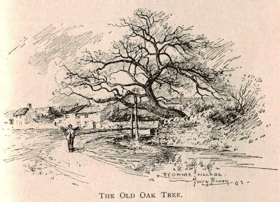
Redmire’s ancient Oak

Archaeology & History

As with many of Britain’s old maypoles, the one at Redmire has long since disappeared and no local in the 20th century appears to have had any memory of it.  However, it was mentioned in Victorian times and described in McGregor’s (1989) fine history work on the village:

“At one time, somewhere on the Green, stood a maypole which was destroyed by lightning.  I never heard the memory of it recalled during my early life, but it is mentioned in their books by both Barker and Bogg.  The remnants of it appear to have been there in 1850 or 1852, as Barker, writing at that time says, ‘A maypole, rare in Yorkshire, stands on the Green.  It was shivered to pieces by the electric fluid, during a thunderstorm, in the summer of 1849.  This poor maypoles catastrophe would have been regarded by the old Puritans as a direct and visible manifestation of the wrath of heaven at such a heathenish practice.’  Redmire, as we know, took pleasure in dancing in the 19th century, and continued to do so, especially after the building of the Town Hall…”

When Edmund Bogg came here at the end of th 19th century, he saw “the base of the ancient maypole…near to, a twisted and ancient oak” whose ancient branches were being held upright by large wooden posts.  This sacred oak itself was said to “still cast its shade over a small spring of water.”  Unfortunately I ‘ve found no more about this lost pagan relic…

References:

  1. Barker, W.G.M.J., The Three Days of Wensleydale, Charles Dolman: London 1854.
  2. Bogg, Edmund, Wensleydale and the Lower Vale of Yore, E. Bogg: Leeds n.d. (c.1900)
  3. McGregor, Isabelle, Redmire – A Patchwork of its History, privately printed: Redmire 1989.

© Paul Bennett, The Northern Antiquarian


Weeping Stone, Fladaigh Chuain, Skye

Legendary Rock: OS Grid Reference – NG 3638 8091

Getting Here

Unless you’ve got your own boat, forget it!  This one’s miles out on the isolated uninhabited island of Fladda-chuain about 5 miles off the northwest tip from Duntulm, Trotternish.  I wouldn’t mind a coupla weeks alone on the isle though – if anyone can get me there!

Archaeology & History

The little rocky island itself was allegedly another of the many visiting places of St. Columba in his many ventures to sell his religion to the peasants and displace the druids, who were alleged to practice pre-christian rites here and deemed it as sacred.  St. Columba’s chapel on this island was built to displace the heathen traditions.

Folklore

In Otta Swire’s (1961) excellent work on the folklore and history of the Isle of Skye, she wrote:

“In Duntulm Bay lies Tulm Island and beyond it, in clear weather, Fladdachuan, Fladda of the Ocean, can be seen. In olden times this was a sacred spot, held by many to be Tir-nan-Og, the Isle of Perpetual Youth, which lay in the west; here it is always summer and the sun never sets. The puffins recognized its sacred nature and never began any venture until they had circled the island three times sunwise; this they did also on arriving in Skye and before leaving it. It was held by some to be the reason why in Skye people used to turn three times sunwise before starting a new enterprise. The Druids held it in veneration and St. Columba caused a chapel to be built there. On its altar lay a black stone which some say was the original altar stone of the Druids and which was known as the Weeping Stone because it was always wet. Until fairly recently fishermen used to land on the island and pour three handfuls of seawater on the stone to procure favourable winds or to stop bad floods. The Weeping Stone no longer exists, or at least is no longer to be found where the altar once stood.”

I can’t find anything more about this place.  Does anyone know owt more about it?

References:

  1. Swire, Otta F., Skye: The Island and its Legends, Blackie & Son: Glasgow 1961.

© Paul Bennett, The Northern Antiquarian

Ben Ledi, Callander, Stirlingshire

Sacred Mountain:  OS Grid Reference – NN 562 097

Getting Here

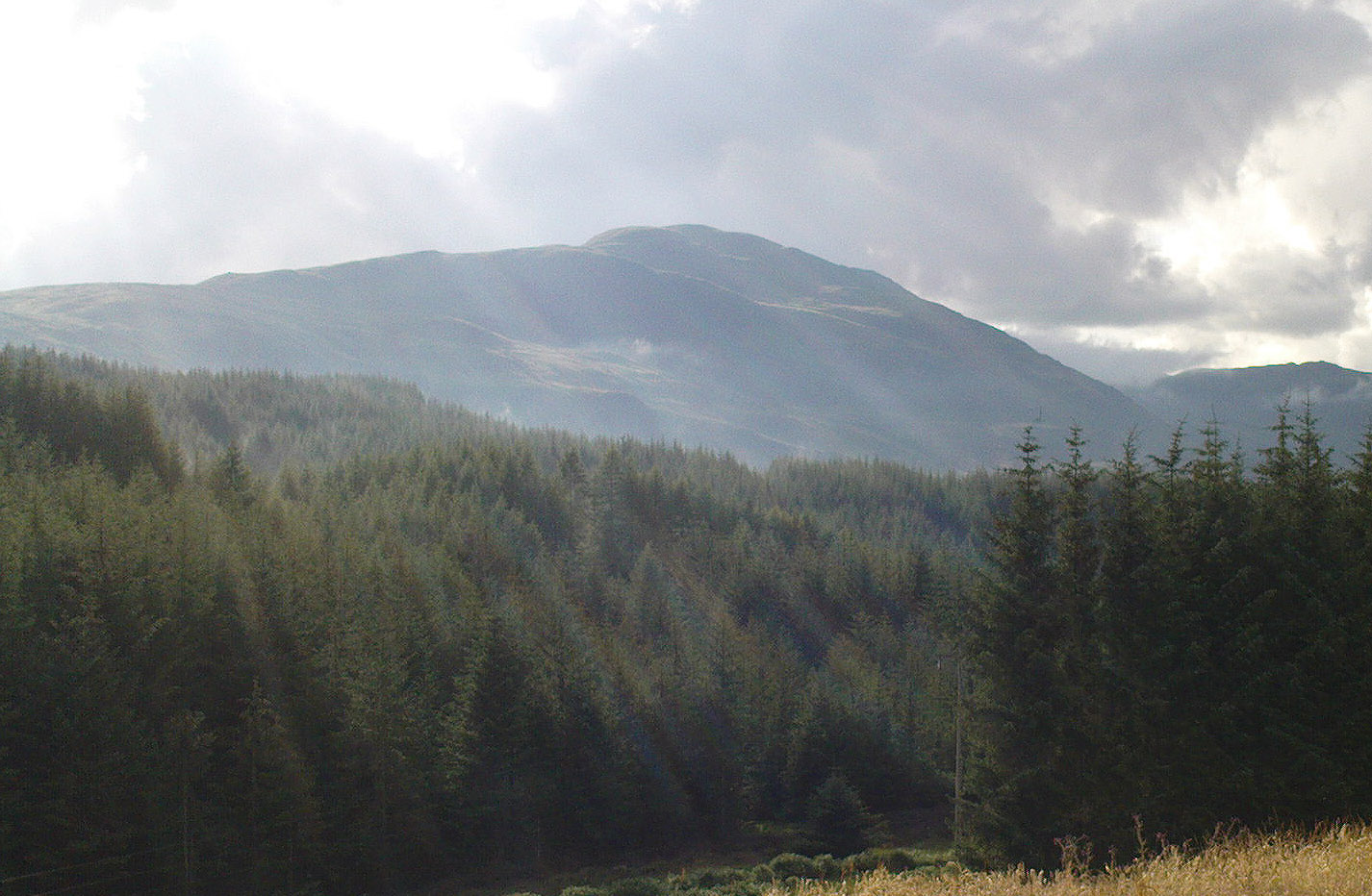
The hazy peak of Ben Ledi

From the tourist-infested (but lovely) town of Callander, look west to the largest of the nearby mountains — that’s where you’re heading!  You can keep along the A84 road out of the town for 4-5 miles (past the Falls and Pass of Leny) till you reach the parking spot on your left.  Cross the river and go up into the signposted woodland.  Keep walking up thru the trees until the rocky mass emerges above you.  You can either keep to the path and follow the long walk round the mountain, or go straight up the crags above you.  The top’s in sight!

Folklore

Getting up here is no easy task if you’re unfit — but it’s well worth the effort for the journey alone!  And in bygone centuries it seems, local people made it a particular pilgrimage at specific times during the year.  Even the name of this great hill has some supposed affinity with holy issues; though some modern english etymologists put a dampener on such things.  In Charles Rogers’ (1853) excellent Victorian exposition, he told that,

Benledi is an abbreviation of the Celtic Ben-le-dia, signifying the hill of God.”

But whether the old heathens who named most of these ancient mountains would echo his oft-repeated derivation is another thing altogether!  However, there are other decidedly pre-christian events that used to be enacted here, for the summit of Ben Ledi was, tradition tells, where the sun god was worshipped.  It would seem, however, that this tradition is a somewhat watered-down version of it as a site of cosmological and social renewal. (see Eliade 1974) For akin to the annual pilgrimage that happens upon Croagh Patrick in County Mayo, Ireland, here upon Ben Ledi,

“For three days and three nights…the inhabitants of the district in those primitive times convened, at the period of summer solstice, on the summit of the mountain, to join in the rites of heathen worship.”

More recent lore tells the date of such sacred gatherings was Beltane.  Also a short distance to the north of the summit of Ben Ledi is a small loch known as Lochan-nan-corp.  Mr Rogers again tells us that,

“Here two hundred persons, who were accompanying a funeral from Glenfinglas to the churchyard of St. Bride, suddenly perished; the ground had been covered with snow and the company were crossing the lake on the ice, when it at once gave way.”

It seems a most unusual event.  But the tale itself implies that a corpse route passed by the way of this high summit, down to the heathen chapel of St. Bride at the bottom of its eastern face: a huge undertaking in itself with probably archaic origins.  Does anyone know owt more about this?

References:

  1. Eliade, Mircea, The Myth of the Eternal Return, Princeton University Press 1974.
  2. Eliade, Mircea, Patterns in Comparative Religion, Sheed & Ward: London 1958.
  3. Roger, Charles, A Week at Bridge of Allan, Adam & Charles Black: Edinburgh 1853.

© Paul Bennett, The Northern Antiquarian